Saturday, December 28, 2013

Brasstown Bald

Adventure every day!

Every day!

It's the holidays and with the whole family in town, Brasstown Bald seemed like a great place to go.

I'd been fighting Windows Forms all morning, so we got a bit of a late start, but we made good time on the highway. Unfortunately, despite the 10% chance of rain the forecast called for, it sprinkled on us the entire time. Up on the mountain, it was still raining, and really windy too. But, we had our objective in sight...

Brasstown Bald

...our party was strong...

The Expedition Party

...no matter how brutal the conditions or fearsome the trail...

The Rugged Trail

...or how poorly our rain jackets fit...

The Iz

...we made our summit attempt.

The Ascent

My Mom had an attack of Dallas Lungs at first, not unlike the Dallas Legs my Dad had suffered from at Sope Creek a few days back. In the end, she pulled it out, but it took determination.

At the top...

Brasstown Tower

...the temperatures were bone-chilling.

Arctic Temperatures

We huddled together for warmth.

Kathryn and Iz Out of the Wind

In such extreme conditions, we could barely force ourselves to spend the next half hour taking in the spectacular views in every direction...

View to the East from Brasstown Bald View to the Southeast from Brasstown Bald

...and posing for pictures...

Sophie at Brasstown Bald

...and just generally milling around...

Mom and Dad at Brasstown Bald

All joking aside though, it was pretty wet and windy and cold. We were the only ones up there. We saw a few people drive in and out of the parking lot below but none seemed interested in making the climb to the tower.

When we'd had enough, we made our way back down.

Sophie wanted to get some good photos of Georgia for when she goes back to Louisiana. Especially photos of mountains. So, here she is, presenting Jack's Knob.

Sophie Presents: Jack's Knob

If her career plans don't pan out, those presentation skills might land her a job on the Price-is-Right.

After our Brasstown excursion, we headed back toward Helen and met up with our good friends Clark and Suzy Neal. Clark filled me in on the latest SORBA happenings up his way. Sounds like there's going to be some new singletrack up there soon. Suzy had baked us brownies! I'm not sure which I was more excited about.

We couldn't hang out too long though and soon headed south to that ATL for dinner at Doc Chey's. Oh man, it was good. It'd been too long. Too long!

If such a thing is possible though, there's almost been too much Adventure this past week. Too much. I need to meter it out a bit. I don't want to jump back in too quickly. Don't want to burn the candle at both ends.

All things in moderation, even good things.

Ray Porter

I just heard that Ray Porter passed away.

I didn't know Ray well but I met him twice at the TNGA. As a TNGA finisher, he's part of a tight-knit brother-and-sisterhood. He rode in 2011 when that tropical storm rolled through and put an early end to it, but then came back and finished in 2012. I guess I should mention that he rode the Tour Divide too, squarely placing him in the "substantially harder than me" category, any day of the week.

Ray rode for Oak Cliff Cycles in Dallas, TX, where my folks live, and where I've actually ridden quite a bit. It's funny, when he first emailed me about the 2011 TNGA, I was in Dallas and had just gotten back from riding at Big Cedar with my Dad. It turned out that Ray'd been there that same day and we must have passed each other in the parking lot, I heading out while he was coming back in. It seemed like an impossibly small world and we both got a good laugh out of it.

I've been out of the loop for a while, but earlier this year I did hear that he'd fallen ill. It was a surprise to hear that he passed though. Apparently he'd contracted some fairly aggressive bile duct cancer. Terrible news to hear, but I can only imagine how much more terrible for family and close friends.

From what I saw though, he really lived at the end there. Really lived!

May I.

May we all.

Friday, December 27, 2013

Heritage Park

Man, I love how fit Kathryn's gotten over the last year. She's ready to go running around in the woods every day now.

Today we went to Heritage Park, the absolute closest trails to my place.

Heritage Park Sign

Calling it a "park" might be a bit of a stretch. I guess since it's managed by Cobb Parks and Rec, it has to be called a park. There's a pavillion, a swamp, a creek, some trails and some old ruins there. I guess that's a park.

There appears to have once been a messy trail network running through the swamp, but by the look of things, it's recently been refurbished.

Heritage Park Trail Heritage Park Trail Boardwalk

That trail led to a right-of-way along the sewer line, running parallel to Nickajack Creek.

Heritage Park Trail  Right Of Way

Heh, heh. Spruce up the sewer line and call it a trail. Win-win actually. The people get a scenic place to walk their dogs and the city doesn't have to worry about miscreants up to no-good up and down the sewer line.

It was pretty too. The sewer line ran along Nickajack Creek and there were several spots that provided good views of it.

Nickajack Creek Kathryn at Nickajack Creek

There was actually one funny thing too. There were signs encouraging people to harvest invasive species tagged with pink ribbons and dump them in a particular spot near the swamp. But, in every direction, choking the earth between every tree, lay the most massive undergrowth of Autumn Olive that I've ever seen. It was everywhere, for miles. The land manager could buy out every Home Depot in Georgia and not have enough pink ribbon to mark it all. It would take an army of landscapers waging no less than Total War to remove it.

And speaking of Total War...

Way down the old sewer line we ran across the ruins of an old factory.

Ruffs Mill Factory Ruins Ruffs Mill Factory Ruins Inside

My mom told us it was out there, so we didn't really "run across" it, but it was still cool.

According to the internet, it was part of a woolen mill complex that made, among other things, uniforms for the Confederate army. When Sherman's March came to town, he burned it to the ground, along with everything else in the area.

There were actually two buildings there, on either side of the trail. It wasn't clear how the mill was powered. There were no indications of a dam or any other power source. That building was allegedly the factory, so it's possible that the wool was spun upstream a bit and then carted down there to be sewn. I'm not sure. I'll have to do some more reading on the subject.

The trail beyond the factory was a bit less maintained but still pretty clear. It led past a scenic little shoal on Nickajack Creek...

Shoal on Nickajack Creek

...and ultimately to the old covered bridge on Concord Road.

Concord Road Covered Bridge

I've ridden my road bike through that bridge a dozen times and noticed the historical-looking facilities nearby but never had the chance to investigate until today.

There was a big building on one side of the road, along the creek itself. Maybe that was where the wool was actually spun.

Ruffs Mill Building

Remnants of a dam remained on the other side of the road.

Ruffs Mill Dam

Maybe there was a raceway running under the bridge some time ago.

The house across from the old building appeared to have been constructed similarly, but much more well maintained. Someone even still lives there even.

That appeared to be the end of the trail though, so we turned around and headed back.

About halfway between the old mill buildings and the trailhead, there was some kind of old rock wall structure on the other side of the creek.

Rock Wall Structure on Nickajack Creek

Man, I'm going to have to try to find an old map of that area or something. I'm really curious what everything out there was once supposed to be.

Curious!

We walked for almost 5 miles as it turned out. Kathryn is strong and fast these days. A year ago she'd have been complaining after 2 or 3. Today I was actually working to keep up with her. Ha! She wins! I guess now that I have someone to run around in the woods with though, we both win!

Ha!

We win!

Sope Creek (yet again)

Happy day-after-Christmas!

My dad and I rode Sope Creek together. He and I have ridden all over North Georgia and almost every in-town trail in the greater Atlanta metro area, but as it turned out, he'd never been there.

For the first lap, he had Dallas Legs.

Dallas Legs

In Dallas, it's pretty flat, and when it starts raining in late fall, the trails never totally dry out. Then they start to freeze and thaw, and then they are pretty much unrideable until spring. Ha, ha. Dallas Legs.

The second lap was better though. He easily climbed that same climb.

We ran into a lady who was almost totally lost too. She'd been avoiding the bike trail so she wouldn't get spooked but that had been making it much more difficult to get out. There are maps as nearly every intersection in the park but she couldn't read them. I talked to her for a while and explained how to get out. She was heading in the right direction. I hope she made it.

We had a good ride. He'll be in town for a few more days, so we ought to be able to ride somewhere else too.

Sope Creek (again)

It's Christmas! Or at least it was a few days ago. Kathryn, the girls, and my parents are all in town. Woohoo! On Christmas day Kathryn and I went for a little walk around Sope Creek, my new favorite hangout.

I'd ridden all the bike trails a few days earlier and our walk gave me the chance to check out the hiking trails too. Oh, man, was there stuff to see...

Sope Creek Pulp Mill Ruins

Look at that!

Kathryn at Sope Creek Pulp Mill Ruins

Kathryn really liked it.

Apparently those are the ruins of a the pulp mill that was part of a larger paper mill complex along picturesque Sope Creek.

Kathryn at Sope Creek Near Paper Mill Road

We walked all around the ruins. They were something to see.

Nearby I found a collapsed chimney too.

Collapsed Chimney Near Sope Creek Pulp Mill Ruins

It's funny. Any other day, finding a collapsed chimney in the middle of the woods would be fairly exciting but after all those ruins, it wasn't as amazing as usual.

We explored the trails themselves for a while. Some of them looked brand new. I wonder if they were built when the bike trails were. If not, they've sure held up well over the years. Others were not so great. One appeared to have been paved at some point. There was a chunk of concrete still embedded in the ground, with a tire track in it. Weird.

Down at the creek we saw retaining walls on the other side, and downstream caught a glimpse of even more ruins.

Sope Creek With Retaining Walls

We hastily made our way over and were even more amazed by what we saw there.

First there was this ruin, which, according to stuff I've read since our little hike, might have been the oil room for the mill.

Sope Creek Oil Room Ruins

Then there was the paper mill proper.

Sope Creek Paper Mill Ruins 1 Sope Creek Paper Mill Ruins 2

Wow!

They apparently made paper there for Confederate currency.

Selfie...

Me and Kathryn at Sope Creek Paper Mill Ruins

A crude trail led down to a small feeder creek beyond the mill. It was a little sketchy but we were able to cross and make our way down to Sope Creek itself.

Sope Creek Near Paper Mill Ruins

The trail ended there though and we didn't go any further.

On the way back though, I got a good look at the pilings that held up the old raceway.

Sope Creek Paper Mill Raceway Ruins

Imagine a long half-pipe sitting on top of those pilings, redirecting some amount of water from the creek to the waterwheel running the mill. There's an old mill up in Roswell on Vickery Creek with part of its raceway intact.

On the way back to the car Kathryn noticed a little island in the middle of the creek with a tree growing on it and I was like "Of course I can get to it..." I saw exactly the set of rocks I needed to hop across. But I guess my rock hopping skills are a little rusty because one of the rocks moved and I ended up soaking my feet in the creek both on the way to the island, and on a different rock on the way back from it. All right! I guess ripping singletrack on the bike isn't the only thing I need to work on.

We had a great walk, and a great time in general. Cool place. We'll be back.

Monday, December 23, 2013

Bear Creek/Pinhoti

Zero-percent chance of rain. That's what the forecast called for. That's what my brothers phone still said as we drove north with the windshield wipers on. We were headed to Ellijay to meet Baldwin and Hirsch at Bear Creek. They were, ironically, riding with us on Saturday to beat the weather that was supposed to set in on Sunday.

It was just misting a little when we got there, but then every 10 minutes it would rain actual drops for a minute or two before letting up entirely or misting again. It wasn't bad enough to force you to abandon but just bad enough to force you to choose.

We chose.

Wet

It was wet but it never started raining again. The trail itself was wet too, but not muddy, especially with all of the leaf cover, except for individual puddles here and there.

In the past year, I'd ridden my mountain bike once, the day before. It still had dust on it from the 2012 CFiTT. My skills were as dusty as my bike, but my legs were good. The road had, at least, been good to them, and I felt strong climbing Bear Creek.

Up at the top, it was all spooky-haunted-forest-feeling. Misty, foggy. Still wet.

Still Wet

We took the road down, hung a right and rode P2 in the fun direction.

The Frere on P2

I was fighting my bike though, and fighting the trail. I was definitely the bear and not the deer. I needed more tiger and less rhinoceros, as my brother said.

As we headed up the road, we saw two riders ahead of us, turning onto P3. We caught one of them quickly but never caught the other. He was sitting at the top, waiting for his buddy when we arrived.

One thing I noticed... I'm still riding on roller-skate wheels. My brother, Mark and Marc were on 29'ers, or as they're called these days: "normal mountain bikes". I had a much easier time descending switchbacks than any of them. I asked my brother about it later in the ride. He said he'd noticed the same thing: descending switchbacks is sketchier, but all things considered, it's still better.

After descending P3, you'd think we'd have taken Shakerag back to Gates Chapel, but no, we hung a left, out past Mulberry Gap and took 68 back up over whatever little gap that is where it tees into 90, for some reason.

I cratered entirely about a quarter mile from that little gap, on the last climb of the day.

Ha,ha. Classic.

Oh, man, we were dirty. So dirty!

Dirt Baldwin

I haven't had that much dirt on me in a long time. So long that it was disappointing to wash it off.

We ate at a Mexican joint in the Wal Mart shopping center south of Ellijay. I forget the name, but it was good. I'm becoming far more competent in Portuguese these days and I guess Spanish is close-enough to Portuguese in my brain. Reading the menu and hearing the music kept making me think and want to speak in Portuguese.

Louco!

So, Bear Creek was great, but I've got to get my groove back. I need to go spin like 20 laps around Rope Mill or something, until I forget to think and the ride flows effortlessly and spills out all over the trail the way I spill these words all over the page. Sounds good on paper at least. We'll see. No harm in trying.

Sope Creek

I hang my hat in Mableton these days. Cobb County - home of the Big Chicken and future home of the Atlanta Braves, so I hear. The closest dirt is a little "gateway trail" at North Cooper Lake Park but the next closest dirt is at Sope Creek.

The last time I rode at Sope Creek was in 2000 when I first moved to Atlanta. I think it was literally the closest trail to my house at the time. I remember riding out from the lot on a super-bumpy doubletrack, getting lost, tearing down a fire-road and eating it on a slanting piece of wet granite that extended across the entire road. I remember then wandering around for hours before finally finding my way back to the car, beaten and confused.

I never went back.

But... I've been hearing about "new" trail out there for years now (or at least one year), and given how convenient the park is these days, I figured I'd check it out.

Sope Creek Sign

I'm a little better on the bike than I was in 2000. I figured I could probably avoid careening into random slickrock. Also, I got the lay of the land back then by turning randomly until I recognized something. I'm a more accomplished explorer these days and my methods are a bit more refined. I felt confident that I wouldn't get lost.

I looked forward to the outing.

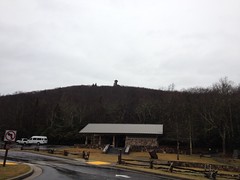
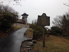
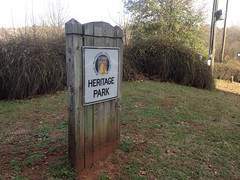
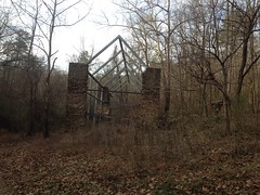
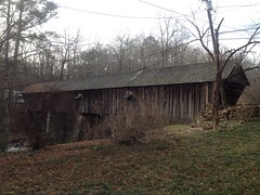
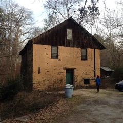
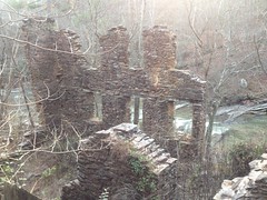
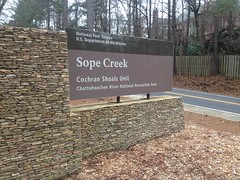
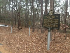
The Paper Mill Road Lot itself held no shortage of interest to the curious explorer. There were at least 3 historical markers, possibly more.

Historical Markers at Paper Mill Road Lot

And just down the main trail there was a beautiful, still pond.

Sibley Pond

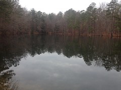
Can you fish there? I didn't see any signs one way or the other. I'll have to find out though. If you can, I'll be back this Spring.

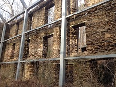
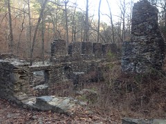
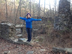
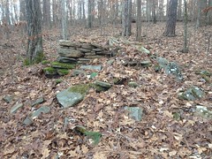
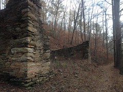
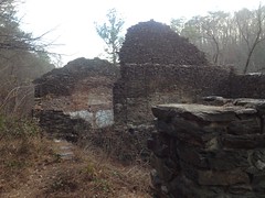
Another historical landmark lay just down the trail.

Paper Mill Road Area Chimney

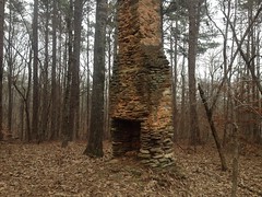
I'm actually looking forward to getting out there without a bike just to look around. I'll bet there's a lot of cool stuff out there.

As I understand it, the trails at Sope Creek used to be open to anyone but they weren't designed for bikes, hooves or feet for that matter, they were just there. And, from what I hear, they kind-of went the way of the old Yellow River trails. Shortcuts, re-routes, extensions, a maze, a spider-web, nothing marked... Eroded, patched, shredded, patched, patched again... Fun? Presumably. But not really built-to-last. So I hear. These days, things are a lot different.

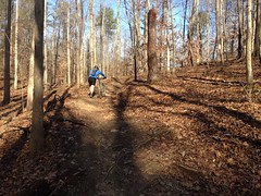
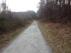
The doubletrack I rode out of the lot on was sweet and well-marked.

There were well-signed foot-trails to the left and right. "I must've missed the sign that said this was a hiking trail" probably won't get you out of trouble here.

No Bikes

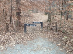
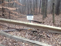
Nor will "I didn't realize the trail was closed."

Stay Out

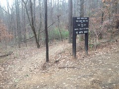
I did have to think about what day it was though, and I almost went the wrong way.

Directions

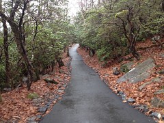
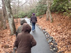
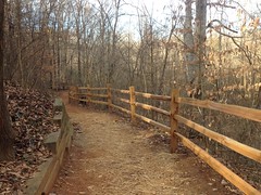
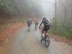
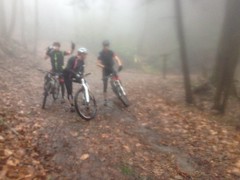
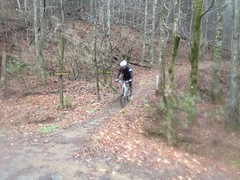
The trail was great. Where it wasn't clean doubletrack, it looked like dingo-cut singletrack and it meandered deliciously. It's been a year though, and I had roadie legs and a roadie brain. I felt like I was getting back on the skateboard after recovering from a broken ankle. I could feel in my head what I was supposed to do but my body didn't automatically do it.

Two riders passed me. I slid out on a wet root. The outslope of the trail felt steep.

It's going to be a long road back.

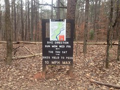
The signage was prolific but some of it was confusing. For example, this sign.

Confusing Signage

It says go left or right, but what it means by "go left" is "go left for three feet, then turn right and descend". If you actually go left without turning, you end up at some apartments.

The trail was laid out like three lassos. Ie. an out-and-back with a loop at the end, and halfway around that loop, there's another out-and-back with a loop at the end of it too. That second loop intersects the loop of yet a third lasso. The first two are what you'd think of as bike trails, but the third is more like an exercise trail.

Sope Creek Doubletrack

Oddly enough, I'd ridden it once before when I rode from Cumming to Atlanta and back on my road bike.

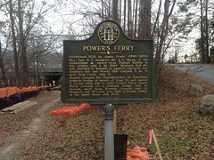
The exercise trail area is accessible from the Powers Ferry Lot on one end and Columns Drive Lot on the other. There was more cool stuff to read at the Powers Ferry Lot.

Powers Ferry Historical Marker

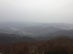
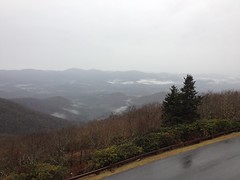
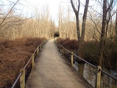
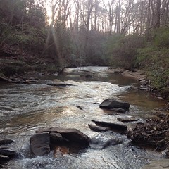
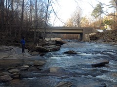
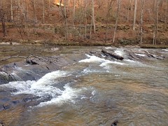
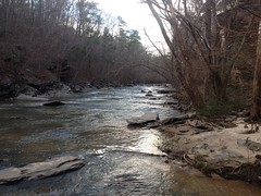
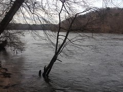
The trail runs right along the Chattahoochee too and offered some great views. The river was a little high and the water was really moving.

Chattahoochee River

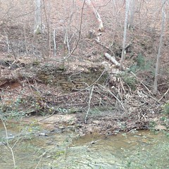
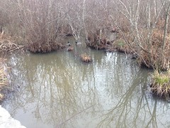
On the non-river side, it was really swampy and there was a beaver dam...

Sope Creek Area Beaver Dam

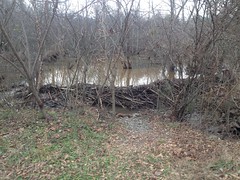
...and ducks everywhere.

Ducks

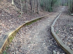
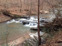
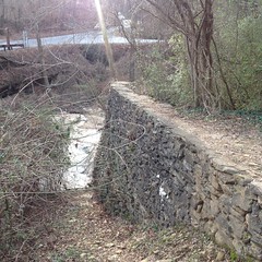
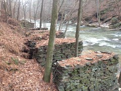
The trail back toward the Paper Mill Lot ran right up along Sope Creek itself.

Sope Creek

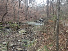
There was one pretty muddy spot where I had to walk on rocks for like 100 yards, but aside from that, it was more of the same flowy single and doubletrack.

I almost wish I'd ridden out there once or twice in the past 13 years just to have some basis for comparison. Some people say that it's terrible now, nothing like it used to be. Perhaps. What I rode was great. Twisty, fun trail with a decent amount of climbing, kind of like Rope Mill. The closed side trails I passed looked less inviting than the trail I was on. Who am I to say though? I don't know what I'm missing.

When I got back to the car it was right at 5:00 and traffic in every direction was moving 2 miles an hour. It took over an hour to get home less than 10 miles away. I think next time I'll go earlier in the day, or maybe just ride over.