Sunday, July 3, 2016

Cochran Mill

Backlog number 4 (of 4)...

Ha, ha! This one I actually did today! Or technically yesterday, as it is presently past midnight.

All last week I felt good. Not 100%, but maybe 95%. I'm still coughing, but I can work hard all day and I don't get more sick. I tried to sleep well too, but that was hard, given all the work catch-up I needed to do. Every day, I felt like putting in some road miles, but I fought the urge, figuring I needed rest more than miles.

Friday though, it seemed like a good idea and I spun out 30 or so between here and Powder Springs. I ran into a guy I knew too, who was "taking it easy" because he'd hit it hard the day before and wanted to hit it hard again the next day. I passed him at first, but then about 5 minutes later he dropped me so hard that it was upsetting.

So, I've got some work to do, it would seem.

Some of that work, I did today though. I met the frere in the vicinity of Cochran Mill and we put in about 25 miles in and around the park.

The Frere

Man, there are some nice trails out there.

The woods is beautiful this time of year too.

Cochran Mill Woods

And there are several water falls on Bear Creek.

Bear Creek Falls The Frere at Bear Creek Falls Bear Creek

One on the lower creek and one further up where the mill itself used to be.

The requisite mill ruins litter the woods nearby too.

Cochran Mill Ruins

And part of the mill dam still stands

Cochran Mill Dam Ruins

We did 2 lollipops. One on the southwest side of the property and one on the northwest side. The trails on the southwest side were either beautifully manicured dingo trail, or perfectly worn-in hand-cut bench. There's a big, rocky hill on that side at the end of the "stick" of the lollipop that we rode in both directions, first one, then the other. In one direction there's along gradual climb, and in the other there's a fairly steep climb with a long descent. Tons of fun in either direction.

I started wearing down on the way out though. At the time I couldn't tell why, but it seemed to be related to hydration. I'd been drinking like mad, but it wasn't working. At home later, I would pee the darkest pee I've ever peed. Pee which burned my eyes so badly I worried I might miss the toilet.

I kind-of held it together for the rest of that lollipop.

On the way out we passed 4 riders on horseback on their way in, several hikers, several other cyclists, and a guy running. All of the trails in the park are multi-use: bike, hike, and horse. In the lot there were like 8 trailers that hadn't been there when we arrived and umpteen cars with bike racks.

John apparently knows the guy who built the trails, or maybe Glen does. Some guy named Paul. Paul gets several high fives if I ever meet him. Me and John have talked about this before, re. the trails he built at Clinton... It's one thing to build some trails that you and your buddies ride. You intend to improve the situation for those guys, and it's great when that happens, because you meant for it to, and it worked out. But it's this whole other level when it turns out to have an unexpectedly positive impact on other communities, like the local cross-country running teams, or day hikers, or geocachers, or the local equestrian community. Judging from today's turnout, the trails are clearly great horse trails too. And they're not just riding the old trails that were there from before. There are probably 30 or more miles of trail now, and it appears to be a destination trail system, for all users.

The second lollipop had a bit more of an I-build-this-trail-recently feel to it. It still had those high frequency bumps that wear in eventually, but can really take a while. It was a stand up and crank trail, rather than sit down and spin. At that point, I had very little stand-up-and-crank in me and I cratered pretty badly.

Oof.

I tried to make the best of it, and push where I could, but it was really, really bad.

At the back corner, there's a spur-lollipop off of the main trail that leads to the other side of the falls we were at earlier. We went that way and ran into some buddies of John's. They were out on a TNGA training ride - partial Dirty Sheets loop + some number of miles around the park, and back. I think they were doing 70 or more, total. They'd been at it since we started, but had really just arrived at the park. They hadn't done the south loop yet.

We rode back out with them, and at one little stream crossing, ran into this Eastern King Snake stretched out at the edge of the water.

Eastern King Snake

Damn phone! Come on. Focus!

I swear I'll never figure out how to get it to focus correctly. The little yellow square was on the snake. What else do I have to do?

He was totally happy lying there and had no interest in moving. I didn't want him to get hit though, so I pinched his tail a bit to get him to scrunch up, which he did, and eventually slithered a bit forward, into the water and presumably out of danger.

I held on through the rest of that loop, but John described me as having the Death Stare, which sounded accurate.

We crossed the road and hit some trails on the Mill side with some good technical kicks in them. It felt like climbing in Pisgah. All I could do was sit back and crank. I couldn't carry any good speed. I certainly didn't climb with any authority. Around the Mill itself, when I took those photos, I was lightheaded and dizzy. I worried for a second I'd fall off of that mill dam.

No falling though. We eventually climbed out, ended up at the back of the Nature Center, and took the gravel roads back out.

Goodnesss!

25 miles, but it felt like a tough 40. Actually, I knew it would be bad too, because it was 70 degrees when we started and I felt comfortable. Last year I was so acclimated to the heat, when it first dropped to 72 I was cold.

Work! I need to put in work! 120 miles this week - 40 each Monday, Wednesday and Friday. And, an epic next weekend. That's what I need.

That's what I need!

Mountaintown Connector

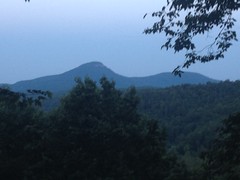
Backlog number 3... This was last weekend as well.

Sunday, Sunday, Sunday!

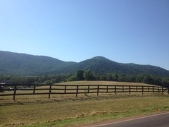
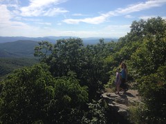
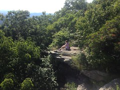
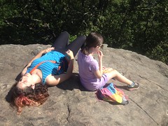
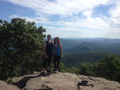
I couldn't make it to Ginni's birthday the day before, but Sunday there was no big get-together. It was just another day. Staff would be running around working and guests would be out riding or eating lunch. Perfect!

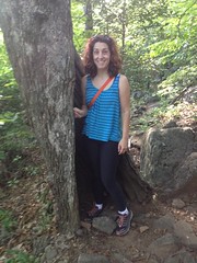
So, I showed up at MGap at about 11:00 to wish her a belated birthday and we ended up hanging out on the couch for a couple of hours, just talking and talking about everything in the world. She told me a bunch of stories that I hadn't heard before. Oh, man it was great! Diane and Kate and Andrew were there too, so I got to see all of them. Eddie even showed up unexpectedly, with his classy, well manicured beard. I ate some authentic Mexican leftovers from the day before.

Ideal!

Happy Birthday again, Ginni! What are you now, 35, 36? Heh, heh.

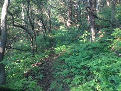
That was my main objective for the day, but I did have some minor-Adventure plans as well. As one might imagine, the Mountaintown Connector trail connects the Mountaintown Creek Trail to the Bear Creek Trail. It's the one trail in the area that's not open to bikes. Well, to ride at least, you can push or carry if you like, but hardly anyone does that. And, as such, since I'm almost always there with my bike, it's the one official trail in the area that I've never been on.

No longer!

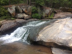
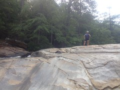
I would hike it, and if the powers align properly, continue on to Heddy Creek and see if the old USGS topo quads that show a trail leading up along it are accurate or not. Indeed, if I found a water feature of some kind, I would play in said feature. A grown man, alone in the woods, wading, swimming, leaping from rocks... Whatever play this feature permitted. Describing these plans to the assembled crew, Kate said it sounded like I planned to "frolic" in the woods. Yes. That was accurate. Frolic. In fact, that's how I should describe it going forward.

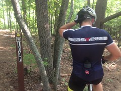
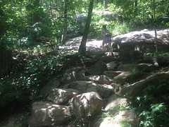
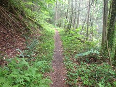
I parked at the foot of the Bear Creek Trail proper and proceeded north.

Bear Creek Trail

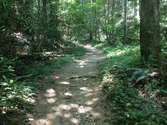
Funny... Given the dozens, perhaps even one hundred times I'd been on that trail, I'd only walked it once. Moving so comparatively slowly gave me a sense of urgency that took a while to shake.

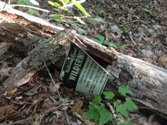
I noticed something though, that one wouldn't likely notice on the bike. Beech graffiti, from 1982!

Tree Graffiti from 82

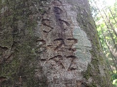
There was more graffiti on that tree, but the rest of it wasn't dated. I always look for dates when I run into that kind of stuff. There's graffiti on Stone Mountain dated to the 1800's.

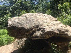
At the Gennett Poplar, I figured I'd take the obligatory photo.

Gennett Poplar With Snake Climbing It

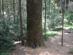
...but then, as I looked through the screen to take the photo, I noticed a weird, zaggity black line on the upper right side of the tree. The heck? I didn't remember seeing that before.
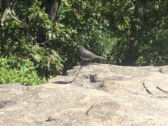
It was a snake!

Snake Climbing the Gennett Poplar

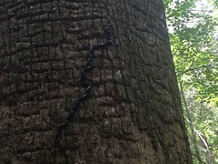
A black rat snake to be precise, climbing the bark of the tree. Goodness! First, I had no idea rat snakes climbed trees. Second, did it have any idea how high it would have to climb? It has to be 60 feet up to the nearest branch. Third, did it have a plan for getting back down?

I watched it for a while. It looked like it was climbing through a maze. It would stretch out the first 6 or 8 inches of its body and find some new set of ledges in the bark, then pull the entire rest of its body through the angles it had already twisted into. It was fascinating. I wanted to see how it ended. Would it climb the entire tree? What would it do when it got to the top? Would it fall? If it fell that far, would it die?

I had things to do, though, and while the urge to stay and watch was strong, the snake moved so slowly that I felt like I'd be watching all day and night if I tried.

Onward.

I was on the Bear Creek "Trail" and I needed to be on the Bear Creek "Loop" to get over to Mountaintown. There's a little cut-through though, that I had always assumed was closed to bikes. It didn't matter because I'd never needed to ride it, but as it turns out, it's not closed at all.

Bikes Ok on Bear Creek Cut Thru

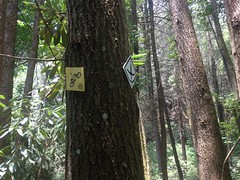
Ha! What do you know? When I got home, I immediately updated my trails site with that little tidbit.

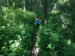
The Mountaintown Connector though, is decidedly not open to bikes.

No Bikes on Bear Creek-Mountaintown Connector

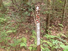
That may eventually change, as it's the only piece of the entire Pinhoti that isn't, but according to the CoTrails Asssessment, the lower half of the trail needs some serious rerouting before it could even be considered.

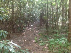
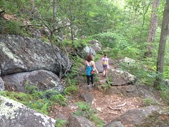
The upper half looked really nice though. Purpose-built, bench cut, rolling dips, grade reversals, half-backslope... The works. As I admired the construction, I saw a guy walking toward me, pushing a bike.

As I mentioned before, this is highly unusual. I've only even heard of people doing it who are intent on doing a Pinhoti thru-ride without skipping any sections. Everyone else rides out on Mountaintown before climbing back up the FS road and climbing a little bit of Bear Creek. I made a joke about him "cheating" by pushing over the ridge, rather than riding that aforementioned route, but it turned out he and his buddy behind him were staying at MGap and intent on following the Pinhoti, hike-a-bike and all.

They had another reason to be pushing too though. They were both from Tampa and not all that used to the local brand of rock garden. Consequently, by the time they were 2/3rds of the way down Mountaintown, they'd triple-flatted and had been walking ever since.

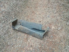
As fate would have it, I carry a little first-aid kit with me, most of the time. It's a bunch of stuff packed into a little snack bag. I throw it in my jersey pocket when I'm on the bike and I put it in one of the zip-pockets on my camelback when I'm hiking, or when I'm doing a long-distance ride. Since I use it on the bike too, it not only contains first-aid supplies for fixing people, but first-aid supplies for fixing bikes as well: glueless patches, tire boots, power-links, duct tape...

Mountaintown is remote. Except during organized rides, the likelyhood of running into another soul on that trail is low. Really, really low. The likelyhood of a hiker running into a cyclist pushing on the connector is even lower. The likelyhood of a cyclist running into a hiker, who just happens to be carrying supplies to fix a bike... I say this all the time: What are the odds? And I'm consistently surprised by how good they actually seem to be!

It took us several tries to fix the flat.

Fix-a-Flat

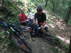
He had 3 holes in 1 tube and 2 in the others. We didn't notice the 3rd hole though until we'd already patched 2. I actually ran out of patches before we got it. Duct tape to the rescue? Not at first. Turns out you can't just slap a big piece of duct tape on a tube to patch it. No, you have to wrap it around a few times. It helps to wrap all of that with electrical tape too, which they had on them. That holds!

The tire was a little floppy where the tube wouldn't fully inflate because of all the tape, but it worked! They had originally planned on riding the Pinhoti back to MGap, but with the crippled bike, they updated their plans, substituting in various roads.

Did I mention that one of the guys was originally from New Orleans? He was. He was like: "When I saw you were from New Orleans too, I knew it was going to work out." How in God's name did he know I had lived in New Orleans? I puzzled over this for a few seconds, before finally asking him, almost those same words. He pointed to his forehead. Ha! My hat! Yes. That explained it. I forgot I was even wearing it. Working on bikes, it actually seemed to me I was wearing my helmet. Woohoo!

Anyway, when everything was fixed, I wished them luck, and they were off.

I was off too, in the opposite direction.

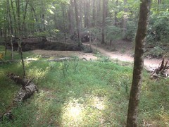
The lower Connector is a bit of a mess. It looks like someone wore in trail to connect a set of old skids. There was at least one spot where the old skid diverted the creek. It's not super, super bad, but it's definitely not good. You definitely wouldn't choose to put a trail there if you intended for it to last any length of time.

The Connector was fairly long too, longer than I expected it to be, but it did deposit me on Mountaintown proper, and I recognized the intersection.

Mountaintown Creek Trail

As I headed north toward Heddy Creek it started to rain. Then storm, then really storm, with thunder and lightning and a visibility-obscuring downpour.

It's amazing how the camera in my phone cuts through fog and rain.

Heddy Creek in the Rain

I swear I couldn't see 50 feet in real life.

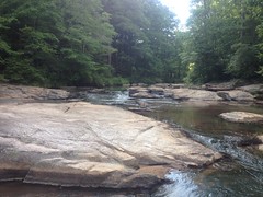
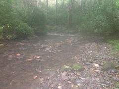
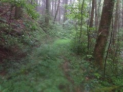
I found Heddy Creek and the old roadbed was easy to find too. It did exist. However, it alternated between wide open and clear...

Heddy Creek Trail

...and so dense that you might think it had ended.

Overgrown Heddy Creek Trail

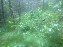
But, the overgrowth was always little sprigs of poplar, sweet gum, pine, or hemlock. Not magnolia. Not rhododendron. Never all that difficult to just walk right through. Except for the rain. The pounding, pounding rain. The walking shower.

I grew weary of the walking shower pretty quickly and resolved to return in late fall or early spring. I usually don't mind pushing through brush, but time of year makes such a difference, and given how far I'd already walked, and how much further I'd have to push. It seemed like a better idea to do it when it wasn't so difficult. Heck, at least come back when it wasn't raining.

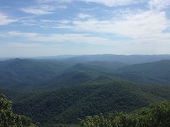
The trail was interesting too. Clearly an old road. Surprisingly wide. Conventional wisdom would say that Nat and Andrew had it built it to pull out timber, but I wonder. It was built just up the backslope, leaving wide, flat land between it and the creek. And the creek there was wide and set down deep into the ground. It would take quite a rain for it to overflow its banks. I've seen communities laid out like that before, with the road running up a valley and houses and fields between the road and the creek. It's like that along Gates Chapel Road, for example, and Conasauga Road. Both of which lie nearby. I've wondered about Mountaintown proper too. It's also alleged to be an old logging road, built in the '30's, but it doesn't have the network of little spurs I'd expect for that. No doubt it was used for logging at some point, but I wonder if it started off life that way. It goes all the way up over the ridge at Buddy Cove Gap, and the other trails in the area connect over to communities that still exist today, to East Mountaintown, and Bethlehem. Bethlehem has been around since the early 1800's, since before any large scale logging. Trails ultimately lead from Mountaintown over to Jack's River too, which was inhabited all the way up Flat Top Mountain from the early 1800's, well into the 1900's - from before, through, and until after all of the logging. I don't know... Sure, logging, at some point, but I really wonder if that was their original purpose.

I pondered all of this as I walked back, in the rain. The pouring rain. As I approached the Bear Creek Trail, the rain let up, and it stopped altogether well before I got back to the truck.

The snake was gone from the giant poplar. I wondered if it had made it up to the top or fallen. I didn't see it lying nearby, so it may not have fallen, to its death at least.

My kit had even mostly dried by the time I got back to the truck, but... ha, ha! I had remembered to pack my little camp towel, so I was able to get completely, thoroughly dry before changing back into street clothes. High five to me for thinking ahead.

On the way out, I ran by Mulberry again to see if my Florida guys made it back ok. They had. They hadn't gotten lost on the way back. They were fine, and it was good to hear. I thought about hanging out for a while, but I actually had work to do when I got home, so I took off while it was still semi-early.

Goodness, what did I do for dinner? Teriyaki chicken strips at Shane's Rib Shack, I think. Yeah, that sounds right. I call it dinner, but I had it around 4. I remember being super, super, super hungry. I also remember feeling really sleepy later and pulling off more than once to get snacks, and more than anything, just to walk around. Mountain Dew and chocolate took good care of me though, and in the end, I made it home without incident.

Saturday, July 2, 2016

Orange Blaze Trail

Ok, number 2 in the backlog. Lets see... This was just last weekend.

Ah, yes. Last Saturday was Ginni's birthday and I even bought a ticket to the birthday bash they were having at Mulberry Gap, but rules are rules, and try as I might, there was just nothing I could do to make it work out. As much as I wanted to spend the day at MG, I was forced to make other plans. Dangit!

On the upside, I'd felt reasonably good all week. The previous Monday went by just fine. I was able to ramp my work schedule back up without any noticeable effect. I did have a persistent cough all week. It wasn't terrible, I just couldn't kick it. I had energy again, or at least more energy than I'd had, so I figured I'd better spend it doing something useful.

"Something useful" is relative, of course, and to me, it meant exploring "the Orange Blaze Trail" that I'd discovered on upper Dover Creek a month or two back.

The heat was formidable. It had hit 103 the previous Thursday, but it crept up a bit more that day.

104

Fortunately, as I drove north and climbed, it dropped a bit. It was still in the high 90's when the Horserange came into view.

Horserange

But it had dropped to about 93 when I parked at the intersection with upper Dover Creek. Balmy, in comparison.

Upper Dover Creek? Where is that? Well... Drive up the forest road past the Raven Cliffs parking lot and you'll eventually cross it. It's nondescript though, you'll need a topo map with names on it to figure out which creek is Dover, unless you know the area, in which case, you wouldn't ask "Where is that?" to begin with...

Anyway, there was once a railbed running along the creek and on the north side of whatever that FS road is, the old railbed appears to have been converted into a road, then eventually abandoned entirely, most likely when the Raven Cliffs Wilderness was defined.

A few months ago the trail was wide open and clear. A week ago it was much less so. Kathryn would have hated it. I could easily make out where to go, but I had to push dangly brush out of the way pretty much constantly. There were a few really clear spots though, and several rhododendron tunnels.

Orange Blaze Trail (Chattahoochee Side)

So, it wasn't all terrible.

Last time, I wondered who used the trail. From the height of the canopy, I'd guessed riders on horseback, but I wasn't sure. That day, I saw some hoof prints on the road that looked like they'd come from the trail, turned right, and headed up toward White Oak Gap. So, I presumed that riders living in Kellum Valley made a loop out of it. Further up the trail, I saw more prints, and other signs of horse traffic too.

Horse Sign

Ah ha. Mystery solved.

I saw signs of bear traffic too.

Bear Hair

Or, so it seemed. Unless that wiry mess of hair also came from a horse, but I'm pretty sure it didn't.

I made quick work of the old railbed, and slightly less quick work of the old roadbed, or skid, or whatever it is, to Carr Gap. I'll tell you, when you start getting close to the gap, this time of year, unless you are just confident that the trail is there, you might decide that it wasn't. The weeds are so tall and dense, they completely crowd out the trail. The weeds on the backslope just blend right in to the weeds on the trail There's no indication of a bench. Nothing. You'd need X-ray vision to see it. It was pretty amazing, as just a few months back, it couldn't have been more obvious. Behold, the power of weeds!

On the west side of the gap, the trail is really easy to see and follow, at least for a while. it runs along the side of whatever that mountain is. Pine Mountain? Maybe. Whatever mountain it is, there's a ridge leading due west from it, and the trail turns and follows that ridge.

The ridge defines the Wilderness boundary, and either does, or once did define the Chestatee WMA boundary as well. There are signs all over the place. A good many of them have fallen down though. In some cases the entire tree they were posted to has fallen.

Downed Wilderness Boundary Sign

In other cases, the signs just lay on the ground as if the nails that held them up fell out of the tree they were nailed to. Must have been a dozen or more of them in that state. But, many others were still firmly posted, so it didn't look like someone went out there and removed them maliciously.

After a while, the old roadbed started getting further and further below grade, more and more full of leaves and deadfall, and more and more difficult to follow directly. It looked like whoever rode up there didn't follow it directly either. The woods to either side was pretty wide open, and the experienced eye could see where people usually go. The experienced feet could tell too, as the ground was a little harder there. In fact, a few times I could tell more easily by how the ground felt than by how the woods ahead looked.

It made me wonder about the road too. The trees didn't look like old growth, but the space between them did. Come to think of it though, I'm not sure what old growth looks like way up high. It might look just like that. I know that Dukes Creek, Dodd Creek, Dover Creek were all logged by either Byrd-Matthews or the Morse Brothers, but I'm not sure whether they made it over Carr Gap into the Kellum Valley. My copy of "Logging Railroads of the Blue Ridge and Smoky Mountains" doesn't mention Kellum Valley ever being logged, and given that it does mention the valleys to either side of it, it seems unlikely. There is evidence that there were homes in the Raven Cliffs Wilderness, and I've had a reasonably easy time making out what parts of it the logging rails ran up into. It's easy to chalk any old road up to logging, but this one runs high along the ridge, with no spurs. That just isn't how it was done. Old logging roads were placed along creeks so logs could be skidded down to them, then down along the creek to a mainline or a rail. This road may have served to connect communities.

Thinking about that made me question how far up Dover Creek the old rail actually ran.

Anyway, I pushed west along the old road and found this piece of tornado-flung roofing lying up there somewhere.

Tornado-Flung Roofing

As I approached the far western end, I checked the GPS pretty regularly. My map shows the NF boundary just east of Kellum Valley Road. I.e. at some point the trail I was on crossed out of the NF. Whether on to city, county, or private land beyond was anyone's guess, but I didn't want to walk onto it by accident. After all, who but locals would be coming from the direction I was? It wouldn't likely be signed. I'd put a few waypoints in the GPS to mark the boundary and I was vigilent in checking them.

And, then, right where I expected, I saw a bearing tree with a big red stripe on it, marking the edge of the Forest. The old road turned to the south there and I could even see a house in the distance. I know of a little side road leading up from Kellum Valley Road to a pair of houses. My guess, at the time, was that the old road I was on would just become that road, past the second house, and I'd probably be on someone's property if I kept going. Turned out though, when I got home, and looked more carefully at the lidar data of the area, the old road may actually parallel the new road and tee in below both of the houses. I'll have to check the property boundaries though. The road may or may not lie on someone's property, but in any case, it looks like if I follow it, I won't end up in someone's backyard. Might be something to look into in the future.

I didn't that day though. Instead, I just turned around and backtracked, all the way back to the car.

The Orange Blazes were a lot easier to follow in that direction too. It seemed that east was the preferred direction on that trail.

Still, it was slow going and rough until I started sidehilling below Pine Mountain.

Ahh, glorious sidehill.

Orange Blaze Trail (Chestatee Side)

On the way back down to the highway, I noticed a big chunk of someone's truck sitting in the road.

The Missing Piece

There's a hump in the road with a big dip on the other side, and it's easy to slap the nose of your truck on the far side of the dip if you hit it with too much speed. I'd done exactly that on the way up. It appeared that someone else had too, with much more disastrous results. Though, apparently not so disastrous that they noticed.

Pondering that gave me a sinking feeling. Maybe it was a chunk of MY truck. Maybe I'd knocked it loose earlier and I was Mr. Oblivious.

Aaahh!

So, I stopped and gave my truck a good once-over. Nope. Not me. I had all my parts.

Whew!

Coming back down the mountain I had to stop in a little turnout for something that escapes me now, but I happened to look to the right as I pulled away and noticed a little pile of dirt and gravel I hadn't seen before. Beside it lay several cut tree trunks, and as all this caught my attention, I noticed Mt. Yonah in the distance.

Yonah from Richard B Russell

Whoa!

That's new. Or at least, new to me. Someone had turned the little turnout into a scenic overlook. I'm not sure what the dirt and gravel were for, but the tree trunks were what was left of what had been blocking the view. It's funny how you can go some place dozens of times and miss something so spectacular, every time. That is, of course, unless it's new. I guess it could be. Either way I was pleased to have seen it that day.

Dinner? I'm pretty sure that was the trip where I pulled into Rooster's Cafe in Dahlonega 12 minutes before closing time, and not only did they serve me, but they must have given me all the fries they had left. Woohoo! Score!

So, yeah, Rooster's. Good people.

Eat there.

Blood Mountain

Goodness, the backlog grows, yet again.

Let's see... 3 weeks ago, feeling well, we all went to Duke's Creek Falls. Of course, Monday evening I was full on sick again, but it only lasted 2 days. Again, by Friday night I felt fine. But! Just to be sure, I laid about all Saturday. Sunday morning I was about the same. Ok. Adventure!

Blood Mountain, this time.

The approach to Neels Gap from the south is twisty and windy, and Kathryn hates twisty and windy, so we approached from the north. This required making this huge arc though Ellijay, Blue Ridge, and Blairsville, rather than going straight up through Dahlonega. 3 hours later we were climbing Blood Mountain from the north. It is substantially less twisty that way, but my goodness, the cost.

We parked at the Byron Herbert Reece trailhead, but not before first making a run up to Mountain Crossing at Neels Gap proper for a bathroom break, and also just so Sophie and Kathryn could see the building and the view, such as it was. The main bathroom was closed, but there was a row of the cleanest, most well-stocked port-a-john's I've ever encountered nearby, and we availed ourselves of these facilities.

Back at the trailhead, Sophie decided she needed a hiking stick, and went looking around for one.

Sophie!

She found two candidates but eventually decided that neither was actually suitable and abandoned them one at a time.

Oh yeah... It was just me and Kathryn and Sophie. Iz was hanging out with her boyfriend, if memory serves.

Anyway, we made quick work of the BHR and took a little break at the AT/Freeman Trail intersection.

Sophie and Kathryn at BHR-AT-Freeman Intersection

Wild Azaleas were blooming everywhere up there.

Orangeish Wild Azaleas

Man, I mean everywhere, and in great variety. They usually look orange with a hint of red or maybe salmon, but these were super orange, and later I saw some more that were super red.

Sophie really loves climbing on rocks, and that factored significantly into my choice of trail. It's almost nothing but climbing-on-rocks, all the way up to the top.

Sophie Climbing Blood Mountain

Kathryn was having trouble for the first quarter of the climb, but then she seemed to get warmed up and after that she seemed totally fine.

Somewhere up there, there's a little outcropping that faces kind of over toward Helen, with several big rock-chunks perched on it. One of them looks a bit like a sea turtle.

Sea Turtle Rock

...from the right angle, if you use your imagination. Ok, it's a lot more obvious in real life.

About 2/3rds of the way up we passed a family with two really young kids, one two and one three. When I was scouting the TNGA route, my girls and I explored all over North Georgia, but I want to say they were 3 and 5 when we first started doing all that, but it was mostly short little hikes to check out things we couldn't drive. We didn't tackle Blood Mountain until they were 7 and 9, I think. Even more amazing though, the mom was carrying a teeny tiny one in a sling across her chest. Kathryn asked how old he was. 2 months! As in, mom was well enough recovered to hike Blood Mountain only two months after bearing the child! Niiice.

We also met some Russian guys coming back down. Or, at least they sounded Russian. I guess they could have come from any of the former Soviet Republics.

And, before we knew it, we were at the top.

Sophie at Blood Mountain Shelter

A few years back Gary Monk and some other AT Conservancy guys made some major repairs to the shelter. I think it needed a new roof, and some of the roof beams even needed to be replaced. There was just no easy way to get the beams up there though. The closest thing to a road leads over to Slaughter Mountain, and most if it has become the Coosa Backcountry Trail. But it doesn't matter anyway, it's all Wilderness, in every direction. At the time, if not still, Gary was part of the CoTrails group, as were several members of the Backcountry Horsemen of North Georgia. They all got together, hatched a plan to haul the beams up on mules, and BAM! Done! The beams were carried up, and the up shelter was restored to its former glory. Man, you should have seen the photos. They attached a beam to either side of a pair of mules, and led them up from the Lake Winfield Scott side. Gary had always been frightened of horses, but by the end of the job, he'd actually ridden a mule up and back down. At the next meeting, he introduced himself as "Gary Monk... Equestrian!" Then he showed us all the photos. The work still looks good today, and I imagine it will for most of my lifetime.

There are some huge rocks up there, that dwarf the shelter, and we climbed all over them.

The view is spectacular.

View From Blood Mountain

Kathryn and Sophie climbed on some rocks next door too.

Kathryn and Sophie on Blood Mountain Sophie on Blood Mountain Again

Kathryn, though, apparently! didn't realize that it's not a good idea to walk up behind a kid who's standing as close to a ledge as they feel safe standing, and put her arm around them from behind. She did this and startled Sophie, who felt like Kathryn was pushing her forward, toward the ledge, that she didn't want to be any closer to! Sophie's reaction was to try to step back, but she couldn't because Kathryn was pressed up behind her. This put her off balance, she got scared, and told Kathryn to back up, but Kathryn kind-of argued with her rather than moving back... This made Sophie even more scared. Sophie tends to act when she's scared, rather than freeze, which Kathryn also, apparently! didn't know. Kathryn's keep-my-kid safe instinct was to grab her more tightly, but that just made Sophie feel even less in-control and gerch around even more, which put her even more off balance... Good. God. Imagine the fear and frustration that the other parent, who has plenty of experience with how Sophie is likely to react in such situations, would feel, watching all of this happen, from too far away to do anything about it. Imagine the urge to shout, and then imagine the presence of mind, and restraint it would take not to.

Just, imagine that.

On the upside, Kathryn has formidable crisis-handling skills. Little red flags started going up, and after two, escalating, iterations, she override her own instincts, let Sophie go and backed up. Then, a few seconds later, she WAS able to put her arm around Sophie, after _Telling Her_: "Hey Sophie, I'm going to put my arm around you, OK?" and then _Getting From Sophie_: "OK."

Coordinating access to personal space in potentially dangerous situations. What a concept!

The girls have pretty good instincts for what to do and what not to do in the woods, and Kathryn's picking it up quickly too, but we do have a few things we go over at the start of every hike. Just things that, over the years, we determined needed that extra bit of reinforcing: What's the first rule? Stay together as a group. What's the next rule? Leave nature where you found it. What do you do if you see a bear? Put your arms up. Do you run? No.

We used to talk about snake safety, but everyone's got that down now.

We may need to add some language about safety around precarious features though.

Where was I?

After climbing all over the rocks, we sat on them and enjoyed the view, for quite a while. Then we rested and we all had a bite to eat.

Rest and Food

Sophie took some pictures of us.

Kathryn and I on Blood Mountain

There was a family up there for a while speaking in what seemed to be a collection of languages. I definitely heard English, French, and what was either Spanish or Portuguese (the words they said were too similar in both to tell). But, they didn't speak one language consistently. They alternated randomly between them. Someone would say something in one language and someone else would answer in another. I felt bad eavesdropping, but it was fascinating.

Before long they left though, and this little bird flew in and hopped around in front of us, persistently.

Bird

Sophie threw it a goldfish. I figured it would peck at it, eat it, and beg for more. Nope. It grabbed it, spun around, and bombed down into the woods.

Well... Bye.

When we were sufficiently well rested, we pushed on. There's a set of switchbacks on the north/west side of Blood Mountain. Somewhere in there is a connector over to the Coosa Backcountry Trail. I know it exists, I've hiked it before, but it was well hidden. I was specifically looking for it and I never saw it.

When we hit the Freeman Trail, we took it back around to the BHR.

The last time I was on that trail, it was late fall and the trail felt like it was nothing but rocks and sticks.

Not so though, in early summer.

Overgrown Freeman Trail

We were constantly pushing through brush. "Things were touching us" and Kathryn is, understandably, not a big fan of "things touching her" when she's in the woods. Fortunately she was wearing her awesome new full length tights and though she didn't get to feel the breeze on her legs, she also didn't get to feel most of the brush, at least not directly. Most importantly, she was reasonably well protected from thorns and poison ivy.

The trail was super rocky too. Just constantly up and down and odd angles.

Rocky Freeman Trail

If you're not accustomed to it, it'll wear out your calves. Sophie's and Kathryn's were sore the next day. Mine were, admittedly, a bit more tired than usual too.

We ran into some really, really red Wild Azaleas somewhere on that trail.

Reddish Wild Azaleas

And Kathryn half climbed inside this hollow tree trunk.

Kathryn and a Hollow Trunk

She really liked that tree trunk.

They were both really happy when we hit the BHR. We were all tired of rocks and grass and weeds, it was downhill all the way back to the car, and the trail was sufficiently well traveled to keep the brush back.

The only drag was that Sophie kept trying to push past Kathryn all the way down, and they kept bumping into one another. Well, she wasn't exactly trying to push past. I guess she was doing the hiking equivalent of half-wheeling someone on a bike ride. In fact, I kept telling her to "stop half-wheeling Mom." It never seemed to take though. She'd stop and then she'd be doing it again a minute later.

Arhhh, Sophie! Personal space!

But, there was no crashing, and we made it out with plenty of light, despite Kathryn's joking insistence that the sun was "already down" because we couldn't see it behind the mountain.

None of us wanted to spend 3 more hours driving home through Blairsville, when it would take about an hour and a half through Dahlonega, so Kathryn braved the twisty descent down the north side of the mountain. This turned out to be totally fine until the last few turns when I had to speed up to keep a guy from tailgating me.

We had dinner at Johnny's Pizza in Dawsonville. Sophie had some really good ravioli. Kathryn had a sandwich, I think. I had some actual pizza, but I forgot that I really only like the 4-cheese pizza at Johnny's, so it was OK, but not great.

Well, you win some and you lose some. I lost at dinner, but we all won on the Adventure!

Blood Mountain!

Highly recommended.