Sunday, May 10, 2015

The Paved Trails of Cobb County

The road bike lives again!

My Dad and/or Mom come to town every few months, and one such instance of this occurred last week. My Dad and I actually rode with Billy at Allatoona Creek last Sunday, but sadly I failed to take comprehensible photos, and failed to write about it, unless you count this sentence as writing about it. It was an excellent ride though, and an excellent visit all around, but I think that I'm beginning to digress...

My Dad has been in possession of my brother John's old Cannondale for several years. When John got his most recent road bike, he bequeathed the old Cannondale to my Dad, who rode it like 4 times, decided he'd rather stick to the mountain bike, and parked it in his garage. A few months back, I needed wheels, so my Mom brought me the wheels off of that bike. More recently my shifter crapped out and my Dad just went ahead and brought the entire hulk with him on this visit, from which I stole the shifter.

So came to pass the resurrection of the road bike.

Figuring I ought to actually ride it this weekend, I got up moderately early Saturday morning and headed west on the Silver Comet. The "paved trails" of the greater Metro Atlanta area are on The List, I hadn't ridden most of them, and I'd be damned if that was going to continue.

First up... Out past Powder Springs, there's this boardwalk-looking thing perpendicular to the Comet. The heck is it? I would know.

Turns out, it's the Lucille Trail.

Lucille Trail Lucille Trail Boardwalk

It leads from Powder Springs up to Shipp Road, and ends abruptly there.

Lucille Trail Lot

They basically paved the right-of-way for the sewer/drainage system and called it a trail. I love those. The county wins because now they have paved access to the system. The people win because there's this scenic place to run/walk/ride, usually up along some creek. Nature wins because the corridor is rendered sustainable after years of expanding mud holes, questionably legal user created trails and ad-hock fords. The contractors win because they get to build something and get paid for it. Wins all around.

The trail was well built and scenic. Sadly it was also short. Maybe they'll extend it north someday. It looks like there's plenty more right-of-way up there.

Ok, so now I know where that goes.

Next, I backtracked a bit and headed north on Old Mountain Road. I've noticed a trail along Dallas Highway, for years, but I never noticed where it started or ended. After a few miles on the road though, I found the start, or at least the west end of it.

The trail followed the south side of Dallas Highway for a few miles. I call it a trail, but it's really just kind of a wide sidewalk. There were several other people out jogging and riding on it though, and it does keep you out of traffic, but it's cement, the expansion joints get tiring after a while, you still have to stop for every stoplight, and I'd honestly rather just ride on the shoulder of the road.

It ended abruptly at Cheatham Road. It seemed like I'd seen another section of it to the east, but I had another trail in mind and I gave it up there.

Next.

I'd also long seen something looking like a trail running up along Barrett Parkway, so I spun back and headed north along said Parkway until I found it.

It starts randomly. The sidewalk just quadruples in width, and bam: bike trail.

Turns out that it's the West Cobb Trail. It doesn't do much, other than parallel Barrett Parkway, but it is blacktop, and if you're heading north, it's better than riding on the shoulder of the road.

Somewhere up by Kennesaw Mountain it crosses the road and becomes the Noonday Creek Trail.

West Cobb Trail

Now, this trail is interesting. It has like 12 different personalities.

I followed it northeast as far as I could, and every mile or so it transformed into something completely different.

There was blacktop along the highway, followed by several little jaunts through the woods, ...

Noonday Creek Trail

..., and then it appeared in a few spots like they just declared the sidewalk to be a trail. Then there was some boardwalk, and several really nice bridges. One crossed Noonday Creek itself and afforded views of this beaver pond.

Beaver Pond on Noonday Creek

I guess that's a beaver pond.

It's funny though, right there, they were doing construction on the trail and there were "Trail Closed" signs all over the place. They meant to close about 100 feet of it, but the signs said "Trail Closed" on both sides, and the one placed after the construction made it look like the trail beyond the construction was also closed. This seemed unlikely, but I didn't understand until I realized that the sign said the same thing on both sides. I actually stood there for like 15 seconds working all of this out. If this description sounds confusing, then good. That means I have successfully communicated the state of mind I had at the time.

The trail wound around on the north side of the creek for a while, then ended abruptly at Bells Ferry Road.

Noonday Creek Trail Lot

Aw, man. I was kind-of hoping it went all the way to Woodstock or something, but no such luck.

With not much else to do but backtrack, I backtracked.

Near Kennesaw Mountain, I was out of water. Though it wasn't hot in the absolute sense, it was definitely a much hotter day than it'd been, and I felt like a little Gatorade might do some good. The Kangaroo convenience store on the corner hooked me up, but "strange things were afoot at the" Kangaroo.

The first was this guy walking toward me as I rolled up to the door wearing jeans and a long sleeve flannel hoodie, with the hood pulled up over his head and his hands in the front pocket. My first thought was "This guy's going to rob the place" but then he pulled his hands out and pulled the hood off as he approached the door. Maybe it had occurred to him that he looked like he was going to rob the place too. My next thought was something like "What equatorial country is this guy from?" I was sweating so profusely that I couldn't effectively wipe it off, I'd drained two water bottles, and felt like I needed to replenish some electrolytes. In the same conditions, this guy couldn't stay warm enough!

I noticed the other strange thing as I left the store. There was a convertible in the parking lot with the top down and the windows down, radio on, and two kids alone in the car singing along with the level of enthusiasm that can only be felt when insufficiently supervised: "Don't start no sh*t, won't be no sh*t!" Ha! Time to go.

But instead of taking Barrett Parkway, I hauled up over Kennesaw Mountain.

Turns out that's where the Noonday Creek Trail starts. Right there at Stilesboro Road. The trail heading down the other side of the mountain is the Mountain to River Trail, though it's actually signed as the "Mountain River Trail" without the "to".

That ended unceremoniously off Tower Road up by the hospital.

I weaved around until I found the square and eventually took Atlanta Road south.

There's another chunk of trail on Atlanta Road, so I rode that too. It's actually a nice bit of trail. It runs along the railroad tracks, it's paved with blacktop, lined with various decorative trees...

I had to cross Atlanta Road near Windy Hill though, and at the stoplight I saw one of the more unusual sights that I've seen in a while.

People leave all kinds of strange things on their back bumpers, and remarkably these things don't fall off. I've mostly seen soda cans and paper cups from Burger Kind or something, but I've also seen wrenches and other odd things. A few months back, my nephew actually left his cell phone on his grandma's bumper. She drove like 10 miles all over town and it was still there when she got back home.

This is one of the more unusual things that I've seen though:

Knife on the Back Bumper

A steak knife.

I considered notifying the occupants of the vehicle, but I wasn't confident that they spoke English. I struggled with how to say it in Spanish, and realized that I had no idea. I realized that even in Portuguese, the best I could do is "There's a knife behind your car." Can you imagine some random guy knocking on your window and telling you that?

Turned out that even if I had the words, I wouldn't have had time to communicate them. The light turned green and they sped off, with the knife still clinging to the bumper.

I took the Comet back toward the house and had to wait a few minutes for the train at Nickajack.

Train at Nickajack Road

Whew!

Good ride. I was good and tired, but I'd taken it easy and it'd been a nice, relaxing day.

I'd brought my GPS with me though, and when I pulled the data off of it, it turned out that I'd ridden almost 70 miles. Wow, I had gotten back home later than I expected. I guess that explains why.

This used to happen to me on the mountain bike all the time. I'd get to wandering around and "where does this go" would turn into "man, it's getting dark" and "ohh, the only way back to the car is up Winding Stair".

Nice to get a little bit of that back in my life.

Saturday, May 2, 2015

Blue Ridge WMA

Has it been a week? I think it nearly has. Yeah, last Sunday me and the frere drove up to Jake Mountain to put in some of the really good miles that one can put in up that way. I mean, the _really_ good miles. Every kind of good miles.

As we got closer, it looked like it might have rained the night before. Funny, it had been bone dry in the metro Atlanta area, but up north of Cumming you could tell that it had rained. Not a lot, but some, at least. We hoped good things about the trails though. I hoped all that work for all those years had paid off.

On the way in we were passed by a group of riders on Nimblewill Church Road.

Heese

Anywhere else that might seem odd, but not on that road.

We parked at the Jake Lot. There were one or two other cars in the lot too. We'd gotten a bit of a late start, but not too late. I guess I should just say that we didn't get too early of a start. A comfortable start. It was somewhere between 9 and 10 when we arrived and we got on the trail quickly.

But, before we left, I noticed something in the lot. It looked like the CTHA (hopefully in conjunction with SORBA) had something going on. That gravel pile was a lot smaller the last time I was up there working, and it certainly wasn't bagged up like that.

Bagged Up Gravel

Last I talked to her, Debbie Crowe mentioned putting in some turnpikes down at Jones Creek. Maybe that's what it was all about.

The trail was great. Totally dry. No problem.

It's funny though. I had a hard time just enjoying it. The girls and I walked every inch of that trail, hacked at most of it with a Pulaski, or a McCleod, or at least a fire rake, and I can't ride it without scanning it for clues to how it's holding up. It's been about two years since I was last out there. Two summers ago was one of the wettest on record. I was a little apprehensive, but it turned out that I shouldn't have been. The trail looked great.

Debbie had mentioned some low spots on the switchbacks that liked to hold water. Yeah, mainly where they cross the old fire road. That's about it though. The bench cut sections looked perfect. Or, if not perfect, at very least: "most popular horse trail in North Georgia" wouldn't have come to mind looking at it.

And, hey! There's one of the turnpikes Debbie was talking about.

Turnpike Near Jones Creek

I guess that's what they were up to after all

No more 10 foot diameter mud hole. Looking good.

We'd barely pedaled since we left the parking lot and I still felt really fresh. Our first obstacle lay ahead of us though - crossing Jones Creek. It was a little high, with all of the rain. But shoes off, socks off, barefoot, mid-thigh deep...

Crossing Jones Creek

That's what you do to start a ride. That right there.

We took Jake north to the Beaver Pond and cut over to Black Branch. But, I forgot how everything was laid out up there and we ended up riding Black Branch backwards.

Rusty, rusty. I hoped that would be the last of the navigation errors, but I wasn't super confident that it would be.

Rather than taking the connector again, we popped out on 28-1 and took it up past Montgomery Creek, up past Washega, up past Merrill.

There was this weird sign just past Washega with what looked like a foot pressing a gas pedal at first. On closer inspection though, it was a foot, but the gas pedal was a cell phone, hanging off of the big toe, like a toe tag. "Don't Text and Drive" was the message. Seemed like an odd place to put such a message, but thinking through it a bit, it made more sense. If you've been holed up in the woods for a while, as you have signal you're going to feel like finding out what's been happening in the world. There'll be all those new new texts and emails, Facebook and Instagram posts... It might be a good idea to hit people with that message on the way out of the woods.

We, however, were just going further into it.

We climbed Cooper Gap.

Climbing Cooper Gap Road

Man, it felt like home. Sadly though, I felt overgeared. Going to have to put in some work these next few weeks, I think.

The vacant property off to the left was looking more overgrown than ever. The road leading up to it looked impassible, especially right down at the intersection. Up around the bend a bit though, it appeared that someone had bought the property right up above the house and was just starting to develop it. There were a couple of little roads cut into the backslope and a trailer or something parked on one of them.

A couple of guys on motorcycles passed us on that final kick. At the gap there were 2 groups of AT hikers taking a break. A different set of guys on motorcycles were also up there, consulting a map. Of course, we rode through too. It seemed like the place to be. On such a nice day, I guess it was.

The quarry had a bit more graffiti than I remember. The rollers along the ridge were a little tougher than I remember too.

We stopped for a minute at Mauldin Gap for a snack.

Snack at Mauldin Gap

The wind was blasting through the gap there and it was a good bit cooler than it had been at the lot. I actually had to zip up.

We bombed down to Hightower and the descent felt really sketchy. John just rolled away from me. Part of it is just that I really need new tires. Part of it though, is just that I really need to get a few hundred more miles in, off road, this spring.

We passed a pair of hikers at Hightower and stopped a few turns down to tank up at the pipe.

Water Below Hightower Gap

I was one bottle down already. I had no memory as to whether that was good or bad for the number of miles or hours, but John was also one bottle down, so I figured it must be about right.

We tore down past Rock Creek Lake, past the Hatchery, past the Shady Grove Church...

Shady Grove

People were fishing on the lake and fishing in the creek. We waved and they waved back.

It seemed like a long way to FS333. Longer than I remembered it being. All of the landmarks were there, all in the right places, but it seemed like a long haul.

Jones Creek had been high and Rock Creek was high, but for some reason, the little creek we had to cross on 333 was low and easy. I even managed to keep my feet dry.

We ended up catching up to some Jeeps about halfway down the road. We'd catch them on the downhills and they'd pull away on the climbs.

FS333

And that's how it was for that leg of the route.

Fortunately, they somehow managed to miss running over this rat snake, despite it being all out in the road.

Black Rat Snake

I ended up scaring it taking that picture though and it spun back the way it had come.

Somewhere in there my legs started feeling pretty well used. It was that long burn, the kind you can't just shake off with a little rest. I hadn't felt that in a really long time. It seems like you can't get it on the road in Cobb County, there just isn't enough climbing. I was feeling it then though. It made me smile a little.

When we reached the last little bit of the road, we let the Jeeps go first.

Disgustingness

That section is usually sloppy and disgusting, but maybe somebody had run the grader down it recently because it wasn't nearly as bad as usual.

And then we picked it up a bit.

Past farms and fields, under that windy sky...

Fields and Sky

Past rows of mailboxes...

Mailboxes

Past the Double Deuce, and the old green schoolbus, and the short section of gravel by Peter Knob, and past that lake with the stacked rocks in the spillways.

We were rolling good and John almost missed the turn onto FS58.

Admittedly though, I was keeping a bit in reserve and I could tell that he was too. I guess it'd just been a while since either of us had done any serious climbing and we had about 8 miles of it just ahead.

We stopped for a second at the first little rise and right at my foot there was this little hemlock sprout.

Hemlock Buds

I picked about half of the light green buds and snacked on them. I had plenty of Clif Blocks, but come on... Wild Edibles. They were pretty good too. They can be really strong sometimes, but those were just right. It was time to eat though, and I did eat some Clif Blocks too.

We got right into the climb after that. Eight miles, right up along the creek. Fortunately it's a comfortable climb, for the most part. Mostly big ring, if you have such a thing any more.

This signage was a bit confusing though. I'd long ago heard that the DNR had given up the Blue Ridge WMA and it was now just an undesignated part of the rest of the National Forest. The game check station down by Bull and Jake had been torn down right around then too. And yet, this sign, this exact sign went up not a week later, erected in place of an older, more run down sign.

Blue Ridge WMA

And then a week later another one just like it appeared at Winding Stair Gap. It seemed that if the DNR had given up the land that they wouldn't have then immediately re-signed it. Who knows though, the way government budgets work, maybe they needed to spend the money that year so they'd get the same budget again the next... Still, I expected the signs to be taken down eventually. But it's been years and years, and there they still are.

We climbed and climbed.

We also got into this conversation about if we had to choose our top five hard rock vocalists, who would they be? I kept remembering additional vocalists and amending my list, until eventually I had to admit that it was getting difficult to concentrate on much other than the climb.

At the AT crossing, I'm not sure I've ever seen as many cars parked there as I did on that day. Ever. There must have been 50, all up and down the road.

At Hickory Flatts, I struggled to remember if there were 2 or 4 more miles to go.

Up near the top I couldn't remember if there were 2, 3 or 4 kicks.

I did remember that when you see the old torn up road off to the right, that you're nearly there.

I couldn't hold it together though, and John rode away from me at the end.

Climbing Upper Noontootla

My legs kind-of wanted to cramp. Not bad, just that little bit where you can back off and it goes away. The only cure is more climbing though. More climbing. Gotta do it.

At the gap, I wasn't feeling so bad.

Winding Stair Gap

Which just means that I wasn't working hard enough. I have an awesome picture from when me and Tim rode there way back. I appeared to have aged 15 years in 8 miles. Actually, I think the last time I'd ridden up there was that ride. Man... Times change.

There were two other cyclists at the gap, and a few more guys on motorcycles. The cyclists were a little disoriented. They'd ridden Jake and Moss Branch and then climbed Winding Stair. I believe that they had intended to climb Cooper Gap though. Maybe next time. They took off down Winding Stair and we followed a little bit later. Again, John just rolled away from me. That road is always rough. That day though, it was just coming at me too fast. I couldn't react fast enough. It didn't seem familiar. I had trouble in the turns. I remembered to get back and low, I remembered to counter steer, that was all intuitive, but my tires were just dying to slip, or so it seemed.

Roadie brain. Roadie legs. Roadie skills. I'm a pale shadow of that guy that wrote about all that stuff that he did in these same pages, years back. A pale, sad shadow. It's honestly pretty discouraging.

Or, I guess it is now. At the time, it was hard to feel discouraged, tear-assing down Winding Stair at the fastest speed I felt safe at. All I felt then was something like "Yeaaaaaahhhhhh!!!!!".

We swung left onto Turner Creek and ran into those same guys from up at the gap about 2/3rds of the way around. They'd missed the first turn, taken the second, still thought they were heading south though... Poor guys. If I hadn't gotten equally lost out there myself, I might have felt less sorry for them.

And then we were backtracking... Beaver Pond... Jake Mountain. We didn't bother taking our shoes off to cross Jones Creek a second time. It was like 2 miles or less to the car from there. But, two miles, almost all uphill, after god knows how many miles on that big loop.

We'd come upon some equestrians on Beaver Pond and it had taken me a second to notice them. We stopped about 40 feet away, but their horses were young and skittish and it wasn't as clean of a meeting as it could have been. Rusty, rusty. Next, we ran into a lady hiking with a dog. Saw her, did better. I forget though, aside from there not being much to see, the Jake trails are pretty good for hiking now too.

Climbing up off of Jones Creek I made an effort to keep an eye out, but still didn't see another pair on horseback until after John called them out, from behind me. That pass was better still, but man, I was surprised by how hard a time I was having spotting other people on the trail. I guess that's a skill too.

And then we were done.

The lot was completely full. People were packing up, or sitting on their tailgates, done with their rides. Those same guys that we'd seen a few times already showed up about 10 minutes after us.

I was tired. My legs were tired. My mind was tired. But I didn't have that good, even, whole-body-tired going. I remembered how it felt. I was reminded of it, but I didn't have it. It might take a few rides to get back into that. Maybe. I hope only a few.

The trip back was funny. I wasn't really totally straight, mentally, until I had a coke from Zaxby's. Might have been missing on one cylinder. The coke fixed my mind though. The Zax Snack fixed my body, more-or-less.

When I got home, I didn't even take my bike out of the car. Just left it in there, along with my clothes and shoes and stuff. Too much effort to do anything else. The next day I did get the clothes out though, as they'd already begun to smell bad.

Oh man, oh man. What a day. I need many, many, many more days like that, all over North Georgia.

There's plenty up there to ride. Just gotta get to it.

Get to it Dave.

Saturday, April 25, 2015

Allatoona Creek

Yeah! Mountain bike's fixed, more-or-less, and it was supposed to rain hardcore all day today, so I skipped out yesterday evening for some shred up at Allatoona Creek.

I haven't been there in years - my Dad and I rode there just after it had first opened. I remembered glorious bench cut IMBA flow though, and I've been craving that for a while now. Plus, it's probably the closest trail to my house now, it's on The List, I need to put some miles in on the new brakes... Lets go!

I had a little trouble getting there. Traffic was really, really bad, and there are multiple segments of Old Stilesboro Road. Finding the one that the trail was actually on was also a bit difficult. Maybe I should have used a map. But I was like "I know where Old Stilesboro Road is..." It's been a while since I could say this, but I can again! Don't trust me to get you anywhere.

I did get there though, suited up and got right on the trail.

There are all these fields that you ride through at first.

Allatoona Creek Fields

And I remembered part of what I'd liked last time. Diversity. I give a trail more points for diversity of terrain and scenery than for miles of singletrack. I may be alone in that, but I love trails where you ride through fields, under bridges, along creeks, out in the open, through the woods, on tight singletrack, and on open doubletrack... Not that 20 miles of singletrack isn't any good, but it gets pretty anonymous after a while.

Not so at Allatoona Creek! Diversity!

I rolled through the fields and onto the Rusty Bucket, but in my haste, I'd forgotten to fill my water bottle. It had like 2 sips left in it and I realized this about half way around. Ok, back to the bathroom. Filled it up. Let's try again.

Reset.

The fields appeared to have roads cut through them. Having done a little shred already, I felt like doing a little exploring, so I rode around a bit, seeing where things went.

Right away I found some craziness.

Deep Allatoona Creek

"Still water is deep water." as my brother has said. I decided against crossing that particular creek. Maybe next time.

Following the main trail out to the very end, I found a bunch of flooded trails and flooded woods, and eventually the confluence of Allatoona and Little Allatoona Creeks. But it looked like I was getting farther and farther away from anything that would be fun to ride, so I headed back.

Back to the bathrooms again, actually. Or more precisely, to the map near the bathrooms.

There appeared to be multiple new sections of trail out there - Mumbo Jumbo, Voodoo, a new chunk hanging off of Masons Bridge.

Yes! I would ride them.

And I did. And it was spectacular.

Mumbo was basically more of the same twisty singletrack found on Rusty Bucket, but with some amount of climbing involved. The woods was particularly beautiful at the time.

The Woods

Ahh, yeah. Spring in Georgia. The trees are still leafing. It's just beautiful.

I forgot about Voodoo entirely, and when I hit the turn-off to it, I thought that I'd ridden all of Mumbo. There were two trail runners right there though, pondering what to do.

"How many miles is it back to the parking lot in the direction you just came?"

I was bewildered. The sign right there said that it was a 2 mile loop. If we were at the entrance/exit of Mumbo, it would be 2 miles. Or they could just turn around and go directly back to the parking lot, and it would be zero miles. I wasn't sure how to answer them.

"Aren't you coming from the parking lot now?"

"No, that's Voodoo."

"Ahh, I'm not where I think I am!"

And we laughed. I definitely need to shake more of the rust off of my Adventure skills. That was pretty bad.

"Have you ever ridden Voodoo?."

"No, not yet."

"Well, good luck to you!"

And we laughed again. They didn't spoil it for me though, and tell me what lay ahead.

It started out with a cool little set of puncheons that led around some trees, with a green "Keep Right" sign on either end. Then there was this craziness.

Voodoo

Rocks and logs and benches on either side.

Ohhhh Kaaay...

The rest of the trail was even gnarlier. Basically every few hundred yards there was some kind of obstacle. Rock pile, log ride, skinny bridge... Something. I didn't just ride into the first one though, and that it turned out to have been a good idea. The first obstacle was this series of rocks, but you had to keep speed and drop off of the last one. The speed I had wouldn't have been sufficient.

I didn't ride into the next few either, but they would have been fine to have, so I started riding into them, and the rest of them were fine.

Somewhere in there, there was this gigantic root ball.

Root Ball

And this log ride looked fine but the other end of it was really steep and sketchy.

Log Ride

And I had too much fun on the rest of the trail to stop and take photos. There were some fall-line climbs out there though, or at least some climbs that didn't seem to follow the half-backslope rule. And a set of lazy switchbacks with the same issue. Maybe they did that on purpose though, so they would erode a bit. I don't know. Give how IMBA the rest of the trail is, it was surprising to see.

But man, those obstacles were fun.

Toward the end of the trail, it had that whole "I just built this" kind of feel: fresh dingo tracks, components of future obstacles scattered hither and tither... There might be even more fun in store, in the future. I'll keep an eye out.

The map made it look like there was another loop out past Mason's Bridge, so I headed over there next.

In fact, there was a new (to me at least) section of the connector too. You used to just run down along the creek. Now, on the way out, you hit some singletrack up in the woods, and run along the creek on the way back.

Under the bridge, I stopped to get a photo of the artwork on the far side.

Masons Bridge

And of the creek itself.

Shallow Allatoona Creek

Which I half-wanted to climb down and play in.

But there was an odd, acrylic smell in the air, and turning around I noticed several young men milling about up right up under the roadway. One appeared to be trying to light something. They either didn't notice me, or ignored me. I didn't want to hang around though.

I'd ridden the Mason's Bridge trail before, but I didn't remember it. It was just more of the same fast, semi-twisty bench cut IMBA glory. Not too much climbing, just pure shred.

Somewhere out there, I ran into this Biceratops.

Biceratops

I call it a "Bi"ceratops because the nose horn was missing.

At the half-way point I merged onto Mason's Bluff, though at that intersection it was only marked as "Loop 2". It seemed to have slightly more climbing, but it's possible that I just imagined that. About two thirds of the way around, I saw a sign, thought that I was done, merged left and found myself out in the middle of a field with a guy walking his dog to my left and a lake ahead of me.

Bobe Lake

Hmm...

Turns out that's Bobe Lake. Also, I was pretty sure I'd made a wrong turn. In either direction, the trail appeared to just lead out to the neighborhood.

I spun back and that's when I saw the sign labeling the trail "Mason's Bluff". So, I guess that's the name of that loop: Mason's Bluff.

It was right about then that I started realizing just how dark it was getting. I was almost as far as I could be from the car, at that particular trail system, and it was starting to get difficult to see.

I put it down a little harder on the way back, but it's been a while and my bike handling skills seemed a little deficient. It's funny how riding a bike comes right back, but riding it well takes a while. I had plenty of energy, but I didn't have the skills to bring it to bear.

I did make it out in time though. The sun was down, but I didn't have too much trouble seeing the trail. The guys under the bridge were still there when I rode back through. One of them was lying down on a bench. I thought they were homeless at first, but they seemed to have a car parked up at the road. Maybe they weren't sleeping down there. Maybe they were just planning on decorating the bridge a little more. I guess I'll find out next time I'm down under there.

When I got back to the lot, there were still 2 more cars. Some guy was lying in the grass stretching too. Maybe he'd been out for a run.

It only took 45 minutes to get home, and I don't think I took the most expeditious route. Not bad though, compared to the hour and a half it took to get there, during rush hour, and after getting lost a few times.

Allatoona Creek! After crunching the data, it looks like there are almost 20 miles of trail out there, and there are two loops south of Old Stilesboro that I haven't even ridden yet. And there appear to be at least 10 miles of proposed trail that haven't yet been built. Woohooo!

I think I might have found my new favorite in-town trail.

Tuesday, April 14, 2015

Naked Mountain

Adventure!

It's not exactly imminent these days, but it is at least now possible.

Adventure possible!

This past winter was horrible. Rainy days and long nights aren't conducive to improving one's fitness. Heck, even maintaining it. I'm probably not at an all-time low right now, but it sure does feel like it. I remember riding across the states of Georgia and Florida. I remember deathmarching the Canyon. Did I really do those things? Really? I sit here now, questioning whether a person can do things that I have actual memories of doing. I even have pictures.

Maybe I did. Maybe those memories are real. Maybe if I put in a little work they'll even seem real again.

Two problems though...

First, my road bike is busted. The return spring is broken in the right shifter. No new replacement shifter exists. Compatible shifters are 90 bucks on Ebay and they look as old and more busted than mine. My dad has a compatible shifter he's not using on my brother's old road bike though. Should have that in a week or so.

Second, my mountain bike is busted. I put new brakes on it and there's just nothing I can do to keep the front brake from dragging. Glen's got it right now. I ought to be able to pick it up later this week.

Two problems, one solution: hiking. I ought to call it "hiking" though, with the quotes, because I've asked real hikers to join me on my idea of a hike and they have declined to do so a second time. But fortunately there is a solution to that too. His name is Clark Neal. We seem to have the same sense of Adventure. Or, at least compatible senses of Adventure.

That's right, I capitalized that A. Got to pay it proper respect.

It was late Sunday morning when I showed up at Clark's place outside of Helen. I was running late because I had to find my compass and my shoes. They were both buried in this gigantic duffel bag in my closet. When I unzipped it, it smelled unused. I felt like that guy that neglects his dog. Walk your dog, jerk. It was awful.

I pushed through the guilt though, through the shame, got my gear together, and picked up Clark.

We made a quick stop at a gas station in Robertstown for some calories and I also ran to the bathroom. I only mention this because the bathroom door was exceptionally light and didn't have a spring on it. When I opened it to get out, it got away from me and whacked the toilet paper thingie. "Oops!" And the lady behind the counter joked: "Are you breaking stuff?"

Ha! I'd all but forgotten about gas stations small enough that the clerk can joke around with the one customer in the store. Oh man, it's the little things. It was going to be a good day.

From there, we headed off into the Wilderness. Literally, the Wilderness. I think it's the Mark Trail Wilderness. On the way in we passed several Jeeps. There'd been a Jeep festival of some kind in Helen the day before. A turkey flew across the road in front of us too, and a chipmunk ran across. It'd been a while since either of us had seen a chipmunk.

We put in at the day use lot of the Upper Chattahoochee Campground and got right to it. I wasn't exactly sure where the woods becomes the Wilderness but I was sure that in the direction we were heading, it wasn't going to be marked.

We bushwhacked along Henson Creek for a while, diverged a bit, picked up an old roadbed, and eventually crossed over the creek. The last time Clark and Suzy and I'd gone exploring, we'd ended our day right there at that crossing. On that day, it had gotten late and cold and we figured we'd pick it up a few weeks later or something. It's funny how quickly things can change though. That was over a year ago.

But now we were back at it. Lets go!

The trail was easy to follow. It looked like it wasn't too big of a secret either. Somebody had clearly been up that way recently. I had my GPS going, and as I do with all my little Adventures, I'd planned on putting the data on my trails site, but I kept waffling about whether to declare the trail an "adventure" trail or just "reclaimed". Usually if I declare something reclaimed, it's because it's pretty overgrown and you have to push through brush. This trail had very little of that, but a lot of deadfall. A lot. Seriously. A lot.

Sometimes the trail was a nice little bench cut. Other times it dropped down and crossed and re-crossed the creek over and over. Clark was all: "Man, who was it that thought it was a good idea to put a road here!?" No doubt. It was difficult to follow. In retrospect though, the terrain on either side was shot full of little draws and dry prongs. I guess they were taking the path of least resistance.

Some of the prongs weren't so dry though, and here and there remnants of old bridges still remained.

Old Bridge on Henson Branch

In some places the trail seemed to merge into the creek and disappear.

Henson Branch Crail

But, really, it had just diverted the creek, and with a little creative thinking we were able to figure out which of the many braided rivulets had once been the road.

And we kept seeing signs of former passage. Disturbed leaves, partial footprints, fire rings... And then there was this impressive structure:

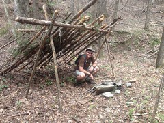
Lean-to on Henson Branch

Ha!

I love finding weird stuff way back up in the woods.

The coals were still fresh. That fire might have been burning yesterday.

I'd failed to top off my camelback at Clark's place, so I filled it from the creek. There was a little pool there, right in front of the campsite. It looked too small to fish but big enough to lay back and relax in. The water was pretty cold though. Maybe later in the year...

We came to what we imagined to be a fork, with the left branch running up a little ridge. We'd been climbing steadily though, and the main trail seemed to keep going to the right, but downhill. Hmmm... The correct direction to go is usually up, but the well defined trail led down. Eventually we decided that we'd head off to the right, and if it peters out, we'd go back up.

It didn't exactly peter out though. About 100 yards up it took a hard right across the creek and up the ridge on the other side. Why? Because, from that point, there was no other way to get over this:

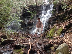
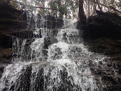
Clark at Henson Branch Falls Lower Cascade

Woohoo! Waterfall!

Henson Branch Falls Lower Cascade Up Close

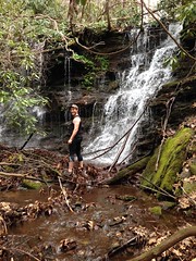
Clark got a photo of me by the falls too.

Me at Henson Branch Falls Lower Cascade

Kathryn says that I should have sucked in my cheeseburgers for the photo. Heh.

The old road managed to skirt that cascade, but then it led directly to this one:

Henson Branch Falls Upper Cascade

And there was just no getting up over it.

My guess is whoever built that road didn't do a lot of planning, they just headed upstream by whatever means necessary and backtracked when they got totally stuck. That's determination for you.

We whacked up over the falls and found the trail again. Apparently that had been it off to the left at that fork. We followed it up and around and up again.

It appeared to be going where it should though. Where should it go? If you look at the old USGS Quads, I think at 1:100K scale, they show this road following Henson Branch, then following Naked Mountain Branch, then curving south and eventually teeing into FS44F. Allegedly. The newer-but-still-pretty-old, higher resolution, 1:20K maps don't show it at all. The 20K maps aren't super reliable, and the 100K maps are even less reliable, but sometimes they tell the truth, and so far, so good.

It didn't look much like spring at the higher altitudes.

The Woods

With the overcast sky and complete absence of leaves, it looked as bleak as any cold winter day.

The only signs of spring up there were little stalks poking up through the leaves.

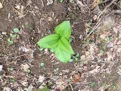
Is this a Hosta?

Is This a Hosta

It looked like one. Kind-of. If it is, I'd never seen them in the wild before. Neither had Clark. Actually, I guess, we'd never seen whatever it is in the wild before, independent of whether it's a Hosta or not. They were everywhere. Every 10 feet, covering the entire hillside.

The old road ended abrubptly at a steep creek in a deep draw. This was perplexing. It should connect up with FS44F. We could see Cut Locust Gap above us, and 44F was up there somewhere, but we had a ways to go to get to it.

Across the draw though, there was another trail. But it sat at a funny angle, and it was much steeper than the one we were on. There was no obvious way to connect the two. A bridge between them would have required at least one 90 degree turn and/or would have sat at a steep angle downhill. It didn't make any sense. I've seen that before though - two trails that seem like they ought to have been connected at some point, but without any obvious means of having been. So weird.

Our best theory was that the steep trail was a skid. Trees were skidded down it, piled up in the draw and then taken out on the good road. If that were true though, it would have to have been built down from the top. Maybe we'd find an old skid network up there.

We crossed over and began to climb. Man, it was steep. Super, super steep. It teed into another trail and that teed into another, even steeper trail. We verified our position a few different ways and it looked like we were exactly where we were supposed to be, we just needed to keep climbing. So, we took the even more steep trail uphill until it blended into the backslope close to some unnamed gap west of Cut Locust.

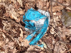
Somewhere up there we found the obligatory mylar balloon.

Mylar Balloon

We'd experienced all manner of Adversity and made various interesting discoveries. The balloon was the last item on the Adventure checklist, and now we could check it off.

FS44F had to be up there, so we pushed uphill towards the gap.

Much Steeper Than it Looks

It was a lot steeper than it looks. Like walk 20 feet, recover, walk 20 more feet, recover... That kind of steep.

Lo and behold though, when we got to the gap, FS44F was right there, right where it ought to have been.

There was a breeze blowing from the south, and there were ridges with ridges beyond them and more ridges beyond those.

The Mountains

I think that's sort of to the south-west. If so, that's probably Hickory Nut Ridge in the way back.

We sat down there for a while on a couple of logs, ate a bit, and enjoyed not climbing. 44F was almost dead flat in both directions and in comparison to what we'd been doing, it looked like a lot of fun.

I keep calling it 44F, but I guess it ought to be called "Old 44F" as it has decidedly been demoted to the rank of trail. I'm not exactly sure where the Wilderness boundary is, but I'm pretty sure that the road is now inside of it. At the southern end, it's still marked 44F on a Carsonite post, but the pipe gate is long gone and there are big Kelly humps down there. I think the Mark Trail was actually designated Wilderness in the 90's, so it's been not-a-road for a long time now.

I waited until Clark had recovered a bit before bringing up what to do next. The car was to the west but to the east, 44F allegedly ties into the AT, and since I've never been down to the end of it before, and we were there, it didn't seem responsible to waste the opportunity, it would only add a mile and a half or so...

It was good that I'd waited because I'm not sure Clark would have agreed with making the hike any longer if I'd brought it up right after climbing up out of that ravine.

We got going again before giving our bodies a chance to get used to not going, and with no deadfall to climb over, brush to push through, or anything resembling elevation change, we made very good time to the AT.

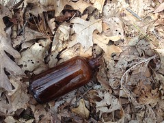
We did get a little distracted though. There was a little pit full of old glass bottles off to the left.

Medicine Bottle

There was a nice looking mason jar in it that Suzy might have liked, but closer inspection revealed a jagged wound to the rim and we left it behind.

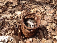
There was also this weird thing:

Old Motor

Clark thought it might be an old motor. Might be. It did have a bunch of copper wire wound up inside of it. It was a better theory than anything I could come up with.

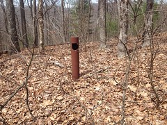
Just past that was an old pipe gate. Right where the map said it should be.

Old Pipe Gate on FS44F

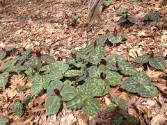
And there were Trilliums everywhere.

Trilliums Galore

Everywhere! They even outnumbered those Hosta-things we'd seen earlier.

We reached the AT quickly, stood there for a minute, then headed back. There was a campsite right there at the end of the road, and there were a few odd artifacts lying about.

Nicoderm

The German keychain wasn't all that odd. The blister pack of Nicoderm gum though, definitely fits in the odd category.

Clark: "Imagine trying to hike the AT and give up smoking at the same time. Seems like one challenge at a time might be enough."

Me: "Maybe you should chew it. Then later you'll be craving a cigarette despite never having smoked one."

Clark: "Wouldn't that be crazy - getting hooked on cigarettes by chewing the gum that's supposed to help you quit?"

He packed it out. Probably didn't chew it.

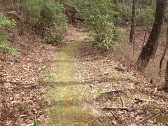
Near the southern end of 44F, someone had rolled out a glorious green carpet for us on the ridge between the old tire tracks.

Old FS44F

The photo doesn't do it justice. It was super, super lush and fluffy in real life. Unnaturally so.
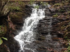
The Disney princesses were out there enjoying the woods too.

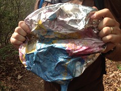
Disney Princess Mylar Balloon

My pack was actually starting to get full. I'd accumulated a rain poncho, a bottle, and now two balloons.

We reached FS44 in good time, and trucked it back towards the car.

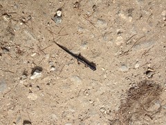
There was a little black salamander on the road somewhere in there.
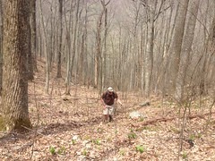
Little Black Salamander

I'm not sure I've ever seen one that was totally black before.
The car grew ever nearer, but the map I'd printed out had several little dotted green lines on it. Dotted green lines mean: "I've seen what appears to be a navigable trail leading off in this direction." There was one such dotted line leading north along Wilks Creek.

Yes, I was tired, and my feet were tired and kind-of hurt, and the car was like a mile away, but we were right there, and it would be irresponsible... I'm pretty sure Clark didn't want to add any more distance to the day, but he followed me up that trail anyway. Thanks man.

The trail was well traveled. This made sense, there was an established campsite at the bottom of it. A ways up there was a little sliding falls with no good vantage for a photo.

Upper Wilks Creek Falls

And further up a spring had apparently popped up above the trail and turned a long section of it into a creekbed.

Upper Wilks Creek Crail

And above that, there was more trail. I must admit that I was disappointed to find more trail. I honestly didn't feel like following it. Clark didn't either. He was like 100 yards back, making less-than-deliberate progress toward me.

"The trail keeps going up there, but honestly, I don't feel like following it."

"Yeah, my wanderlust has been sated."

Mine had too.

Fortunately it was all downhill from there, and our jibber-jabber made the mile or so back to the car fly by.

I was a little disappointed not to have seen much wildlife except out on the main road. That's bear country up there and dangit there ought to be bears somewhere. It's possible that our persistent clever-banter scared them away. Maybe that's good though. You know, save something for next time.

My Adventure skills were a little rusty all day too, and that kind of sucked. My legs are a little more scraped and shredded than was once typical for the same kind of hike. I poked my hand on something. Got my camelback hung up once... Get it together Dave, get it together.

Back in Helen we grabbed some dinner at La Cabana. Suzy had been hiking with her sister at Arabia Mountain all day, but she'd made it back to town and she met us at the restaurant. We had a great time. Man! It's been a while. Too long, too long!

That was yesterday. Today was decidedly less adventurous but about equally strenuous. My father-in-law and I'd begin some driveway repair on Saturday and I spent the day today pulling off the forms and backfilling behind the patched sections with gravel/dirt/rock/cement and spreading the remainder of the gravel to cover a parking area near the top of the driveway... in the rain, no less. Three days of good, solid labor. My back is tired. My legs are tired. It's supposed to rain all week, and that's fine with me. I'm looking forward to getting some nerd work done. I hope it's sunny in a week though. I ought to be ready to get back at it then.