Saturday, April 26, 2014

Hiram, Rockmart, Cartersville, Dallas...

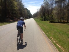
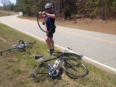
I met my brother in Hiram today for a big road loop out that way.

Last weekend I'd had an easy time of a loop of similar terrain and distance, and I'd originally come up with an even bigger loop than the one we ended up doing, but he had a little bit of time pressure, so I trimmed it down a bit.

We started in Hiram and immediately had to wait like 10 minutes just to pull out onto Hwy 92, which we were only going to ride for like 2 blocks. No idea why the traffic was so bad. Last weekend I'd had no trouble at all. It was weird. We eventually did find a hole in traffic but seriously, it took like 10 minutes.

On Hiram-Sudie road it was the Oppossum Apocalypse. I guess with the weather being pretty nice these days, they're out and about, running the roads, and unfortunately getting run down on the roads as well.

Hiram-Sudie is pretty nice. Lots of rollers, fun to keep speed on. We eventually turned on to Buchannan Highway though, and expected more of the same. In fact, there was a nice little roller right ahead of us, so we kept the pace up.

Ha!

Turned out it was a never ending series of step-ups. I'll bet we climbed 8 or 9 hundred feet over the next few miles. It just never ended. I'll have to remember that road and ride into it a bit more conservatively next time.

Probably at the top of all of that climbing, we hung a right and wound our way up and over Vinson Mountain. I expected more climbing, but we'd apparently done all of that earlier. Vinson Mountain was mostly flat, followed by a screaming downhill. We both hit 50 just tucked and coasting. I've never hit 50 before except coming down off of Hogpen.

Woohoo!

After a while we rolled into Rockmart, missed our turn, went back and found it and proceeded north towards Cartersville.

Plant Bowen

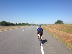
Plant Bowen loomed in the background for part of the ride. I assumed it was nuclear because of the huge cooling towers, but apparently it's a coal plant, a huge one though, the highest producing in North America.

I could have used some of that power right about then.

I was struggling and we were both running out of water. There was a gas station on the left, but John spotted a Dollar General ahead on the right and deemed it a superior choice. Apparently there's a Dollar General near his place that he stops at regularly for water, snacks, Gatorade, etc. and they are reliably less expensive than gas stations. He may have been right. I think my 20oz Gatorade was $1.50. I'll have to do a little comparison shopping next time I'm at a QuickTrip.

I hoped the quick stop and refuel would help me out a bit, but I just continued to struggle, worse and worse over the next few hours. We turned east and eventually south, toward Dallas, on Hwy 61, which was 2-lane and busy.

The ride back in consisted of me sitting on, falling back over and over, and John waiting. I haven't been more uncomfortable on the bike in as long as I can remember.

I blame ham. Or I guess I should say, I blame my own misapplication of ham. I'd gotten up late, eaten nothing all morning, put a route together, called John, put a second route together and grabbed a ham sandwich, 2 extra slices of bread, and an apple on the way out the door. I remember thinking as I ate the sandwich that the ham might sit in my stomach for a while. I should have listened to my own brain I guess. I felt full the whole ride. I kept re-tasting the ham. The whole ride. I'd pound water, but it felt like I was just forcing it into my already full stomach. I couldn't eat anything but I doubt I got many calories out of that lunch. Ugh. Terrible. Terrible! I should know better. I do know better! Terrible.

At any rate, we finished in good enough time, and I guess it's good to struggle sometimes, for perspective, if nothing else.

All in all... Hwy 113 towards Cartersville is scenic, but not all that much fun. I could do without 61 back into Dallas. The southern parts of the route were great though. I'll have to come up with something that goes south from Rockmart.

Monday, April 21, 2014

Paulding County

Oh, the road. It never ends.

I was back out on the road earlier today. I don't love exploring on the road as much as exploring in the woods, especially in the Metro ATL, but one thing I really do like is riding back roads from little town to little town, getting a good look at their old main streets and moving on.

I've hit most of the towns close by already, but today I figured I'd head west into Paulding County. It's been a while since I've been out that way, don't really remember what it looks like, and hey, it's right next door.

My brother had planned on joining me but he got buried in family obligations and had to bail. It was probably just as well. I've been putting in long days all week and my pace was decidedly slow.

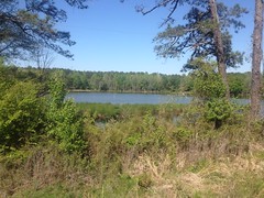
I headed out through old Mableton and Powder Springs like I often do, forgetting to take pictures, as they seemed so familiar. But instead of turning north, I followed the tracks out of town, off into the unknown, or at least unknown to me. It was a little more woodsy out that way than I expected, and I passed a surprisingly scenic little lake next to a raging creek.

Some Lake

It reminded me of the lakes I'd passed in Florida during CFiTT's and Huracans, back when I was doing CFiTT's and Huracans, and I felt compelled to take a photo.

Somewhere out that way I hung a left on Angam road. It got a little hillier than it had been and before long I'd crossed the borders of the Shire and stepped into the wilderness beyond.

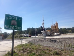
PACO

After a few miles of comfortable rollers I made it to the little town of Hiram where I had to stop for a train.

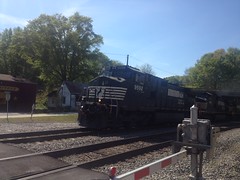
Train

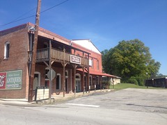
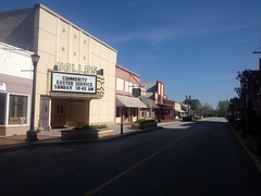
A five-locomotive train, no less. Fortunately there was a bridge over the tracks to the right, and I got a good look at their restored little main street.

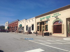
Hiram Main Street 1 Hiram Main Street 2

Italian restaurant, eh? I'll have to keep that in mind.

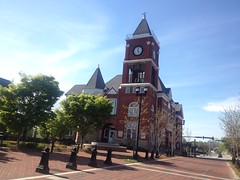
A few more twists and turns took me up over Cochrans Ridge, which featured a better downhill than I'd felt like I'd paid for, up over the Silver Comet and into Dallas.

Old Dallas New Dallas

Georgia that is. Dallas Georgia.

I tanked up at the local Racetrack but I wasn't hungry yet. I'd actually porked up a bit all week and started feeling like working some of it off, so even if I'd been hungry, I might have abstained.

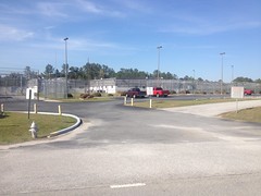
On my way out of town to the north, a quick side loop took me past a bunch of facilities in odd proximity to one another. First there was the Pauding County Senior Center. Then I passed the Juvenile Detention Center, which was directly across the street from a ball field. Imagine being on a local youth baseball team and seeing Juvi looming there across the street every day at practice. Maybe that's the idea though. "Baseball good. Crime bad." Just down the road was some kind of massive gravel and concrete distribution facility. Next door to that, the infamous Paulding Probation Detention Center.

PPDC

Sir, by your leave, sir?

Carry on.

I took Memorial Drive north and Due West Road almost due east. The community of Due West wasn't especially photogenic, and after that I forgot I even had a camera on me. Somewhere in there I started feeling the hunger. Actually not the hunger. The weakness. The antecedent of hunger. The hunger before you know you're hungry.

I didn't stop though. I had plenty of porkulence to replenish my dwindling power supply. I did slow down a bit. I think I need to adjust my seat too. It's not as comfortable as it once was when I roll my hips forward. It might just be wearing out and I might just be sinking into it more these days, but maybe if I tip the front down ever so slightly...

At length I reached Kennesaw and passed the Thai place.

Mmmm. Pad Kee Mao.

No, no. There's Pad Kee Mao down the street from my place. Move along, move along...

And I did, up over the shoulder of Kennesaw Mountain, down into Marietta, through the nearly deserted square. None of the shops were open. Thus no one to shop at them. That's right, it's Easter. It took a second to put that together.

Phase 1 - The weakness.

Phase 2 - The feeble mind.

Phase 3 - The Hunger.

It was nearly upon me.

I kept moving south. The last leg of my journey. Along Atlanta Road, through Smyrna, down King Springs, up over that one punishing hill, and at East-West Connector, not a mile from home, I felt like I couldn't possibly climb that last climb without addressing The Hunger, with which I was now wracked.

To the left lay several delicious options - Pizza, Thai, more Thai, and more Pizza. I opted for More Thai, at my favorite local Thai place - Curry Curry.

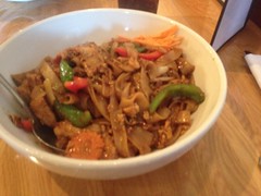
Their Pad Kee Mao hits the spot. Reliably.

Pad Kee Mao

It is apparently shiny and out of focus too. Hmmm. I wonder why.

Ever ridden home with a to-go box of Pad Kee Mao on your road bike? I have. Now.

And so it was. I plugged the route into Google Maps when I got home and it was a disappointing 60-odd miles. It seemed like it had been more in the 75 mile range, but I guess that's another side effect of The Hunger.

There are a bunch more little towns out that way too. Now that I have a sense of how far out it is, I'll have to come up with a loop that takes me through more of them.

Until then...

Saturday, April 5, 2014

Silk Sheets

They say... It's better to burn out than fade away. It's safe to say I've been doing a bit of the latter lately. It might even be safe to say that for the forseeable future, I'll be doing even more.

It's sad what passes for adventure these days. So sad that I dare not even capitalize the A. Not that I haven't been having a decent time, but you can hardly call it adventure. I've been on the road a lot lately and it looks like I'll be on the road a lot more.

Today me and John rode about 65 on the Silk Sheets.

Silk Sheets

Not too much to talk about really. It was a great ride. Endless country roads with very little traffic. I had bad sleep all week but I still felt pretty strong and so did my bro. I struggled a little here and there and so did he. Not much though.

We had one mechanical.

Fixin Stuff

John really put it down about 3 or 4 miles from the end. I wasn't sure how much we had left so I was reticent to do much but sit on. Maybe I'll challenge him a bit next time though, now that I have some idea of the route.

I did get an unexpected sunburn. Ha! I guess it's that time of year again. Time to break out the Coppertone, bake to a golden brown, and imagine Phil Liggett making unintentionally homoerotic comments about my powerful bronze legs.

Definitely time for the first two at least.

Sunday, March 2, 2014

Serenbe

Baldwin called me up mid-last-week to coordinate borrowing my tracker for the impending Huracan and, while he was at it, invited me on a road ride with him and Eddie and whoever else was interested in attending. He called the ride "Serenbe", but that word had no meaning to me. It was a road ride though, heading south out of Atlanta, so I had a good idea what to expect. How long? 70 miles. I'm in!

I met him at his place at 9:30 Sunday morning. His girlfriend was coming back from a jog and really burning it down to get back in time for us to leave and we were worried we'd miss the start but everything worked out and we made it over on time, no problem.

The start was apparently in the haircut district. There were barber shops and salons all down either side. Somebody was set to film a movie over the next few days too.

Filming Something

There were orange cones set up everywhere and trucks full of equipment were coming and going. The security guard told us they'd start filming on Monday. Now, watch, for the next year or two, every movie I see, I'm going to be scrutinizing to see if it looks familiar.

Eddie sent Mark a text... "Give me 10 minutes..." I could see Mark's mind groan as he read the text. Heh, heh. Mark is punctual and values punctuality. I like to BE punctual but I think I value it less than Mark does.

TWENTY minutes later Eddie appeared with two Faster Mustache riders in tow and we headed south.

This was the one opportunity I had to take a photo before the paced ramped up prohibitively.

Roll Out

We followed the Airport ride route for a while, then turned right off of it into who-knows-where. I know it was somewhere in South Fulton County because there was a sign proclaiming South Fulton to be the home of Cam Newton. I had no idea he was from around here. I guess you learn something new every day. I remember passing a dirt road named Newton Drive right after the sign too, which seemed appropriate.

Dirt ended up being the theme of the day. We wound around down by some river, probably the Chattahoochee, given how wide it was and followed dirt roads along it for miles and miles. I struggled more than I expected to and fell back a few times. Ugh. When we got off the dirt we passed a gas station with a church on the right and hung the next right after that. It all looked very familiar.

Me: "This reminds me a lot of the Silk Sheets."

Eddie: "It should, that's where we are!"

The gas station we passed was Charlies and the church was where we usually parked when we'd ride out there. Ha! Small world.

The sheets weren't so silky though. The road was cracked and rough and gravelly. Or maybe it was just me. I was not in the best of shape. Bad sleep for the past two weeks, the last time I rode was 4 days earlier, but the worst of all... cherry pollen. This time of year always kills me. The cherry trees bloom and they're so beautiful, and then the pear trees follow them and they're even more beautiful, but my lungs hate them and would burn them all down if they could. It's not so bad that I really notice unless I'm trying to do something that requires a little heavier breathing, and then I wheeze and hack and it's like those trees are reaching out and strangling me.

Excuses, excuses...

We eventually rolled into the community of Serenbe, which is kind of a walking community like Vickery Village up in Cumming. It's a little more spread out though, and a bit more scenic. Someday they plan on building about 30 miles of hike, bike and horse trails out there. Man, that would be nice. I meant to take a photo of the Serenbe sign but I was barely recovered enough from the last little hill to pull out the camera. This photo of the street will have to do.

Serenbe

On the way in there was a guy in a Prius who kept slowing down suddenly and then would creep along so slowly that it was difficult to stay up riding behind him. One of the guys suggested that we pass him and the other was like "No, he's driving a Prius, can't pass a Prius." I was too tired to say much at the time, but what came to mind is "Of course you can pass him. The only thing more pretentious than driving a Prius is riding a bicycle." Duh :)

We stopped at the Blue Eyed Daisy for coffee and a snack.

Blue Eyed Daisy

It was packed and half of the people there looked like they'd been out riding. Most of the cars parked on the street had bikes hanging off of them.

While parking my bike, I noticed that I'd lost one of my water bottles earlier on the dirt. Dangit. I didn't really need anything to eat. I'd brought two packs of little chocolate donuts along with me, but they had Zapps potato chips and I figured maybe I could use the salt, so I did order a plate of those. I forgot though, Zapps plain potato chips have notably little salt on them. They were still good but I was a little disappointed.

There was literally nowhere to sit inside, so we sat outside at a picnic table. It was in the 40's and windy and while it's comfortable while you're moving, sitting around in it isn't all that great and we all started shivering pretty quickly. I have this great little wind shell though, and I was glad that I'd brought it because it made all the difference in the world.

Funny side story there... That morning I'd woken up several times before my alarm went off, only to go back to sleep and have a quick dream about getting up and scrambling frantically to get ready for the ride, always having misplaced something or forgotten some important thing that I had to go back for. I guess my subconscious mind knew something though because when I finally did get up and get dressed for real, I was missing one knee warmer. I had everything else, but I was missing just that one. In the end, after tearing the house apart in vain, I reluctantly ended up wearing my fleece-lined running tights instead. I was worried they'd be too warm, and they were pretty warm on the road, but sitting there at that picnic table, I was glad I had them.

So, after a few chocolate donuts, some good chips, and just the right amount of bone-chilling weather, we hit the road again, back toward Atlanta. The ride out was circuitous but it was pretty much a straight run back into town along highway 29.

Eddie is like 2 or 3 levels of rider stronger than me, maybe 4. I could sit on his wheel, but even that took some doing. Mark saw that he was pushing it a little, and bridged up right away. The other two guys fell off and only caught back up when we hit some stop lights. Eventually we started taking turns and I took my turn when it came up, but it was really tough. Eventually I found myself staving off cramps and it was all over. Mark had to drop back and pull me back up a few times.

I'm not sure what was going on, really. I was drinking plenty but I was also super full feeling, like nothing was making its way through my stomach. That happens when I eat bacon or some other fatty meat in the morning before the ride, or even the night before, but I hadn't. Weird. Anyway, it was a struggle and a half. One would think from all of this complaining that in retrospect I wouldn't think of it too fondly, but for some reason, no, I remember it fondly already.

When I got home I napped for hours. It was that wonderful, body feels heavier than it is kind of nap. Oh man, so good. Sooo goooood.

Today I feel good too. I might even go spin the legs out for an hour or two later on.

Sunday, February 16, 2014

Piedmont National Wildlife Refuge

Mark Baldwin called me Friday afternoon, inviting me on 50-odd mile expedition into the Piedmont National Wildlife Refuge with him, Hirsch, Namrita and The E. The last time I did a long ride down that way was one of the best rides in recent memory. In fact, I think my exact words when contemplating another such ride were "I'm in if you do it again." Those words were directed at Chris Tavel but they might as well have been directed at Mark because he's the one that actually invited me on that ride. Friday, he was inviting me on another, and true to my word, I was in.

Saturday morning, we met at Hirsch's place, or out front of it at least, and carpooled south to the land of giant peanuts...

Peanut

...and fried green tomatoes.

Juliette GA, made famous by the movie Fried Green Tomatoes which was shot there. The producers turned a local hardware store into "The Whistle Stop Cafe" from the book and it's still there today, fully operational, serving the same fried green tomatoes that they served in the story. I saw the movie when I was a kid and I remember thinking that it was generally awesome. I don't really remember why except for some part about an abusive husband that either disappears or was made to disappear under suspicious circumstances. Maybe I should watch it again. I bet it's on Netflix.

At any rate, that's where the ride started, Juliette, GA.

We parked at the Monroe County Recreational Park, from which you can see the old Mill and part of the mill dam machinery...

Juliette Mill

...but unfortunately cannot see the dam itself, which stretches across the width of the Ocmulgee river. From the side we were on it just looked like the edge of the world. I caught a brief glimpse of the other side later, but only a brief glimpse. It was massive and stunning though, so I may have to go back and get a better view some day.

Eddie and Nam brought their dogs along with them. They've had two dogs for as long as I've known them - Jackson and Porter, both German Shorthaired Pointers. Porter was always calm and reasonably well behaved. Jackson was always excited and tied himself up in his own leash every few minutes. Last year Jackson died of cancer and even I, who only saw him randomly, found myself sadder than I expected to be in the days after hearing about it. Really, I guess I was mostly sad for Nam though. They were her dogs from way back and you couldn't spend any amount of time around them without being able to tell how much she loves them. There's a big hole there now, I think. Porter was with them on Saturday, as expected, but they had a new dog too, named Bailey. Bailey is another German Shorthaired Pointer rescue and I think they're fostering her for now, or something. This time, Bailey was the well behaved one and Porter took off after his nose as soon as the car door was open.

Oh man! Dogs. Dogs! Kathryn's allergic and I don't get enough time with dogs.

The dogs were fun to watch but we were actually there to ride mountain bikes, so we did get down to that eventually.

The route we planned to follow was called The Fried Green 50. Somebody organized a ride along the route years ago but there was some conflict with something else on the same day so I put it off, and then there was a conflict the next year too, so I put it off again, and I don't even remember what else has kept me from doing it since then, but it's apparently fairly well established now. There was a flyer for the 2014 ride tacked to the pavillion at the park.

We started off across the Ocmulgee, hung a right and passed some pretty impressive old waterworks ruins. There were some old houses along the road there too. Some still maintained, others less so.

Chimney

Hirsch had some problem with one of his cables rubbing on his tire but he fixed it somehow and caught right back up.

Hirsch

Before long we were on dirt, riding into the refuge.

Gravel

The terrain was a lot like the Oconee had been. In fact, we were only a few miles south of it. We were even set to cross some of the same creeks that we'd crossed last time, just further downstream. Between the Oconee and the Piedmont, I'd bet you could put together a 100 mile dirt route pretty easily. Hmm...

(Update: I guess I'm more geographically challenged than I thought. The Oconee that's a few miles north of Piedmont is a totally different section of the Oconee than the one we rode a few weeks ago, and the creeks, while bearing the same names as the ones in the other Oconee, are, in fact, different creeks. Woohoo!)

We passed a guy out hunting turkey or grouse or something. His dogs were running around, having a great time. He was all waves and smiles too, so I guess we were all having a good time.

The idea of being able to hunt in a "Wildlife Refuge" struck me as a contradiction in terms and I joked about it a bit. I guess the idea is to provide a refuge from the impact of land development though, as opposed to hunting, fishing or recreation, and we'd passed a sign earlier about needing a permit to hunt. It made sense, but it was still a little funny.

So, like I said, we were all just riding along, looking around, having a good time... And then...

It Could Flood

Ha ha ha!!!!

And they weren't kidding.

It was Falling Creek, the same one we'd crossed on the granite with the picturesque little waterfall off to the right in the Oconee. This time it was deep and raging. Go ahead and try to ride across, it'll sweep your wheels out from under you.

It was sunny but still in the mid-30's. We'd decided to stay on the forest roads and ride south of Atlanta to avoid the melting snow and ice; in effect, to stay warm and dry.

The irony!

Only one way that I know of to cross. I've done it before, many times, in worse conditions, and I was kind of looking forward to it, as it would neatly place this ride in the Adventure column. It didn't seem like a good idea to anyone else though. Not a good idea at all. I figured I'd better just go for it, once I was committed, they'd have to follow.

Nam took my camera, presumably to document my stupidity.

Here goes nothing.

Cold Toes Starting To Cross Falling Creek

It got deeper that this even, I wished I'd rolled my knee warmers up a little higher.

Making it Across Falling Creek

Ha!

I made it! No problem. I even had a little camp towel to dry off with. That meant that everyone else had to cross too.

Hirsch Crossing Falling Creek

Eddie thought hard about crossing on this tree...

Potential Bridge

...but, wisely I think, decided against it.

Eddie Deciding Against Crossing the Tree Eddie Crossing Falling Creek

Baldwin got the award for hiking his shorts up the highest.

Baldwin Crossing Falling Creek

He might have had the right idea though, the rest of us ended up getting a little bit of either shorts or knee warmers wet.

Nam was the last to cross and later admitted that she did so only after waiting to see if someone else would volunteer to carry her or at least her bike across. Ha! Yeah, fat chance of that. She did get the award for best looking toenails though.

Nam Reluctantly Preparing to Cross Falling Creek

Between the rocks and the cold, it does kind of hurt your feet to cross like that barefoot. Marc was mentioning that when he was a kid, he was always jealous of friends of his who had what they called "Indian Feet", to which Eddie replied "Nam has Indian Feet." Ha ha! Yeah, I guess so! The whole day we were making odd little jokes like that. We laughed a lot. All of us. It's one of the things I love about riding with those guys.

So... Traumatic events behind us, we pushed on, deeper into the Piedmont. There were dozens of gated roads to either side but every one of them was marked "Foot Traffic Only". I might have seen one or two trails but they were marked the same way. The Piedmont isn't part of the National Forest, and the rules are a lot more restrictive. You can't be in there at night at all, you can only ride bikes on the roads and you have to have special permits to do just about anything else other than hike. I'm not sure you can even hike cross-country without a permit.

No problem though, it was exactly what we were looking for. Several of our crew were training for the Huracan. Mark and Eddie were carrying various gear bags. I'd decided against bringing my Huracan rig this time. I didn't need to do any gear tests. I know my rig pretty well and I'm not going to be able to ride the Huracan this year anyway. More than that though, I'd only managed a few hours of sleep the night before and I wasn't sure how good I was going to feel. Lighter seemed like it would be better.

In addition to his bikepacking gear, Mark also brought some blinding white shoe covers.

Blinding White Shoe Covers

If you were behind him, between them and the white stripes on his seat stays, if the sun was behind you too, you couldn't even look down or it'd mess with your eyes.

Aside from Mark's blinding whiteness though, everything was going well. The roads rolled gently. They were soft sometimes too. Not sandy, but you had to work to keep moving. All-in-all, not a bad approximation of Florida. Maybe a little more climbing, but pretty good. We were moving, everyone was happy again, just riding along, looking around, and then we hit Allison Creek. Ha ha ha! Yes! Let's do it again. "You know the routine." It probably took 15 minutes to get everyone across the creek but we were getting better at it, more confident, and faster. This time there wasn't a big rock on the other side to sit down on though and my chamois sponged up an uncomfortable amount of sand and water from the roadbed. It was funny, the part of the process that got me most wet wasn't wading through the raging water, but rather sitting down afterward to get dried off.

Onward!

At some point the GPS track looked like we needed to go right on a paved road, but really we had to jog left into the Little Rock Wildlife Drive and then hang a left that paralleled the road. The Wildlife drive had a bunch of interpretive signs and stuff to either side and it wound back on itself over and over, around and through a really scenic little corner of the refuge, across ponds and creeks and in and out of little hollows.

Pond 21

The hills in there were the steepest of the whole route and I struggled pretty hard. I was really feeling the lack of sleep and I couldn't get recovered well enough between the hills. A few times I had to fall back and then punch it to catch back up and it made me a little worried because we were well under half way through the ride.

The next section was a few miles of pavement though. I ate a little, sat on, and did manage to get fully recovered.

Movin'

From then on, I felt great.

We passed traces of former occupation. Here and there a giant oak stood next to the road with trees cleared around it and a little bit of grass trying to grow. Sometimes you'd see a lone chimney set back off of the road a ways. Near Caney Creek though, there were some much more impressive ruins.

An actual log cabin.

Ruins Near Caney Creek 1

And a slightly more modern house.

Ruins Near Caney Creek 2

And some other collapsed old building across the road.

Ruins Near Caney Creek 3

Kathryn would have loved it, but I don't think she could have resisted trying to go inside.

The ride moved on. The hills didn't seem so steep or so close together any more. I was doing alright. We hit some pavement again, briefly near the community of Round Oak. Aside from a church and this old rail depot, or whatever it was, there wasn't much there.

Round Oak

Back in the woods, we passed this strange thing.

533

What is it?

It kind of looked like a tomb, maybe, but it was very plain for a tomb. In the end, all we could say for sure was that it was an unusually ornate box, out next to the road, in the middle of nowhere. The USGS maps call it "533", though I think they're referring to the concrete post next to it. Weird.

Eddie had remarked at various times about the lack of downed trees. Given the ice storm we'd had earlier in the week, he'd expected at least a few. We hadn't hit any yet but soon after passing that weird box we got into them. They were all spindly little pine trees though. I think there was one I had to dismount to get over. There was one that was really low but clear underneath and it looked like if you got over on one pedal and ducked down really low and were really careful you could limbo under it. Baldwin tried and ended up getting jammed in and falling over right underneath it. So close! Oh, man it was fun to watch though. I was actually kind of hoping he wouldn't make it because I was right behind him. I'd have had to try if he made it and I wasn't sure I could get under.

We rode by fields and more ponds, through forests of pine and hardwood. We hopped downed trees. We climbed, we descended. All in all, we were making very good time. Our pace was a lot higher than the ride in the Oconee. It was difficult to take pictures.

Eventually we hit Falling Creek again.

Falling Creek Again

I think "Aw man, do we have to?" was the predominant sentiment.

It looked shallow but waves clearly evidenced large rocks in the ford. Eddie wasn't hearing any of that large rocks crap though, and just rode on in. He had to ratchet but he made it most of the way across. It looked like the force of the current drug his back wheel over and he got hung up on something. Whatever it was, he got soaked and had to walk the rest of it.

The rest of us forded as we had before.

Hirsch Crossing Falling Creek Again Nam Crossing Falling Creek Again

The water was a lot warmer than it had been those previous times, at least.

A few miles later we had to cross another creek. I don't remember which one. I was even tired of it by then. Then a few miles later we hit yet another one, but it was low and ridable. Nam blew through it really fast though and got more soaked from the spray than she'd gotten in any of the previous crossings.

There was a short section of road we had to backtrack on and then we had to do a loop off of it that should put us back really close to the cars. We passed a nice waterfall just upstream of a bridge before turning onto the loop but nobody seemed into slowing down to take photos. One day I'm going back just to take pictures of stuff, damnit.

The loop was anticlimactic. The GPX track showed it going straight ahead but the road ahead was closed to bikes. It looked like we could walk about a mile and then hang a hard left onto some other road, but we couldn't be sure that the other road wouldn't be closed too. Without knowing the route, we could be walking for 5 or 6 miles even. Plus, who knows, it could be like the Wilderness where you can't even possess mechanical transportation. What did they do during the group ride? Poach the trail? Was it open to bikes at some point in the past? Do they get special permission? Grrrr. The other option was to hang a left and see where the road that we could ride went. That's what we did. It just looped back to the main road and cut a few miles off of the route.

Woohoo! Fried Green 50, or Fried Green 47.5 I think was our final distance. When we got back to the cars, they let the dogs out and we had to corral Porter to get him back in. Eddie would tell him to go back to the car and you could tell watching him that he meant to, but it was far enough back that he'd get distracted on the way and go off in some other direction.

We topped the afternoon off with a visit to the Whistle Stop Cafe.

The Whistle Stop Cafe

The waitress remembered Nam and Eddie from the last time they were there. The food was exactly as good as I'd hoped it would be. I stuffed myself and cleaned my plate. I did pass on the fried green tomatoes but everybody else seemed to like them.

Oh man, oh man! What a ride. I took a nap for like 3 hours when I got home. You know it's a good ride when you have to take a nap afterwards. I only woke up when my brother called me. It was fortunate too because I had some work to do and I'd have been up pretty late doing it otherwise.

Today I've been working all day. It's just as well though. I've got that relaxing whole-body-tired that makes a desk job feel good. Plus, I'd have compared anything I might have done today with yesterday and it might have paled. Work, work, work instead. Hmm. Speaking of work, I'd probably better get back to it. These bills aren't going to pay themselves.
Wednesday, February 12, 2014

Smyrna

It's been sleeting all night and day, and that's so unusual around the ATL that people are coming up with all kinds of clever names for it. The best one I've heard so far was Atlantarctica.

Honestly though, it's not so bad. It's definitely a little icy on fences, bushes and benches...

A Little Icy

...but the roads are just slushy. There's very little of that smooth, slippery ice that us Southerners can't drive on like we had the last time. I'm sure all of this slush will freeze up tonight though. Oh, I can't wait.

At any rate, the frustration of slow progress on the code I'm working on, the novelty of the conditions, and I must admit, a little bit of Rule #9 drew me out into the weather. I wore nearly every stitch of warm clothing I own and it was just about right.

The mountain bike seemed like the right tool for the job.

The Right Tool

It was.

The roads were slush and it was a slog. Road tires would have been useless.

I did have an objective. "Riddick" just came out at the RedBox and surprisingly, Publix was open.

It's a cold day in Atlanta when you can ride directly down the middle of the lane on East-West Connector. A cold day like today. I think I got passed by 2 cars in however many miles it is from here to Publix.

The weather wasn't all that bad, really. The sleet was fine and more or less just bounced off. The wind wasn't significant compared to the slush. I was warm enough too, so I figured I'd spin my legs out a bit and jumped up on the Silver Comet Trail.

I had it all to myself.

Silver Comet

For a while at least. I did eventually pass a few people out for a walk but nobody else on a bike.

They're resurfacing and otherwise upgrading most of the bridges on the Comet these days, so long sections of it are closed. I rode west as far as I could then took the roads back home. Roads I'd avoid on the road bike were nearly devoid of traffic and it was more than a little exciting to get to ride them.

I even rode through the old covered bridge on Concord Road and had a challenging time getting up the next hill. A guy stopped me to ask if the bridge was passable on foot and I had a tough time getting going again.

The bike suffered from a little ice buildup too.

Buildup

The worst was in the rear cassette. The smallest gears had little bits of ice packed between them and it was hopeless to try to use them. The derailleur itself kept growing little chunks large enough to rub against the spokes and I'd have to kick them off every now and then. Ha! How often does that happen? I love it!

I was out for 2 hours and I probably only rode 15 miles, but it was a fun 15 miles.

In-town Adventure, Woohoo!

Monday, February 10, 2014

Upper Chattahoochee

A few weeks back, Me and Clark and Suzy planned on doing some exploring of the general Upper Chattahoochee area. Fate intervened though, the night before they got sick, and our plans fell through. Turns out they didn't miss much, but there's plenty more up there to explore, so a few days ago we made new plans, this time nobody got sick, and today we met up for some world-class bushwhacking.

We'd actually planned on riding a loop of FS44 and stashing the bikes here and there to run off and explore side trails. To that end, I'd even brought my bike up with me. But.... Clark had recently traded in his truck and only the night before realized that his old roof rack clamps wouldn't work on the new roof rail design. For the first time in as long as he could remember, he had no reasonable means of transporting bikes, or at least, no reasonable means of transporting 3 bikes and 3 people. Nor did I, for that matter.

It's funny what curveballs life can throw at you. None of us saw that one coming.

No matter though, I'd brought an extensive pile of gear and aside from having to borrow a bladder for my camelback, I was set.

Let it begin!

It began where it usually does, at the no-camping-here campground off of FS44. Apparently, since the last time I'd been up there, a landslide had wrecked part of the road though, and the gate just north of the parking area was closed.

Wild!

I'd never even noticed a gate there before, let alone seen it closed.

Road Closed

No matter again! We walk!

Our first objective was a waterfall that I'd caught a passing glimpse of last time. I've ridden by it dozens of times, but usually in warmer weather with more leaves and less water, and as such, never seen it until a few weeks ago. Makes me wonder what else I've missed over the years.

Walking on the road always seems to take longer that it does. It seemed to take forever, but we actually arrived at our destination in good time. Our destination was the oddly named "Double Culvert Branch". I guess because of the double-culverts used to divert it under the road?

Double Culvert

If so, Clark gives them an F for creativity.

My iPhone died immediately after taking that photo. I can only remember one other time that happened. I guess I should have plugged it in last night. It said it was half-charged this morning. I guess half a charge gets used up quickly in cold weather.

Clark and Suzy both still had functional picture-taking devices though, so the remaining photos are courtesy of them.

A more-or-less discernible trail led up along the south side of the creek and we followed it.

After a sketchier-than-it-looked creek crossing, we found the lower cascade...

Double Culvert Branch Falls - Lower Cascade

...but the upper cascade raged on above us and we had a little more work to do to get to it.

This work included a challenging boulder scramble, slippery rocks, and with all the rain and snow lately, soft soil barely covering slippery rocks.

Sketchy Rock

We eventually made it to the main cascade, which was massive and unlike most north Georgia waterfalls, actually fell over rather than slid down the rocks.

Double Culvert Branch Falls Clark at Double Culvert Branch Falls Me at Double Culvert Branch Falls

For a no-name, unmapped, unsung falls, Double-Culvert is impressive and worth the effort to see. I wonder though, in the summer, if it's more than a trickle. I guess I'll have to come back and find out.

Milling around at the base of the main cascade, I noticed something unnatural-looking across the way. It looked like an old piece of wood with an iron spike sticking out of it.

Iron Spike

No way.

Upon closer examination though, yes way. It was exactly that, right there at the base of the falls, tucked up under a little rock overhang. Looked like it'd been there a while.

The Byrd-Matthews lumber company inundated the forest with trestles and locomotives in the early 1900's to get trains in and logs out. When the timber was cut, they'd tear up the tracks and reuse them somewhere else. Could this be a forgotten artifact of those days? Was there a trestle here, or did that board wash down from higher up the mountain?

Questions, questions... Frustratingly few answers sometimes.

The descent back to the road was even sketchier than the climb up and Suzy didn't take any chances.

Suzy Climbing Back Down

The walk back didn't seem to take as long as the walk out. We saw a lone bike tire track on the road, but never ran into the owner. We did see two trail runners come out right after we did though.

Not being on bikes ourselves, we actually had a few more options than we'd otherwise have had. Clark and Suzy had recently been up to another obscure waterfall off of the Andrews Cove Trail. Including it in our original plans would have made for a long ride, but it wasn't a big deal at all to drive there.

Objective 2: obscure waterfall off of random feeder creek of Andrews Creek.

And there it is.

Me at Falls on Feeder of Andrews Creek Falls on Feeder of Andrews Creek

How anyone knew it was there is beyond me. One of their friends knew it was there because someone told him. Who knows how long that knowledge has been passed down.

There was an old, overgrown roadbed leading right to the falls, but we didn't notice it until we'd already gotten there cross-country. We followed the old road out, but it just curved around weirdly and didn't appear to cross Andrews Creek. It was a road from nowhere, to nowhere. Obviously that doesn't make sense though. There were remnants of old roads across the creek, so it must have somehow hooked up with them, but it wasn't clear how. Perhaps there was a massive bridge there once. Point is... if you didn't know it was there, you'd likely only find it if you made a point of decoding the old overgrown system of roads, which were so overgrown, even I'd have given up on them before I found the falls.

The only other likely way you'd find it is by looking at a topo map and deducing that there might be a falls there from how steep the terrain is. The other feeder creeks lie on equally steep terrain too. Maybe we should go check them out too.

Hmm, actually, now that I think about it, I guess another way a person might find it is if they were wandering around over that way hunting or scouting. I guess there are quite a few ways people might discover and rediscover that waterfall. That last one actually sounds fairly likely now that I think about it.

So maybe not such a mystery after all.

Next!

Like two or three years ago, we'd followed Old FS44C out to a food plot and found that the old road hooked hard leff off into the Mark Trail Wilderness. It was too dark to check it out, and it was snowing too, so we filed it away for future exploration. Today was the future. The future! And Old 44C was our next objective.

FS44 was closed just past the Upper Chattahoochee Campground though, and once again, we were walking.

Me and Clark on FS44

We did get to see the landslide though. It's funny. There'd been a landslide a few years back, that had been repaired with a concrete retaining wall and some new culverts. This time, two separate landslides had occurred to either side of the old one. The repair was less elaborate this time though. It looked like they just realigned the road, laid down some gravel, spread hay on the displaced earth, and positioned a few pretty large boulders on the edge of the road. The repair appeared complete, but the road wasn't open yet. Maybe they're waiting to make sure it's stable. Probably a good idea.

Our objective lay in the next curve after the landslide. We followed the old road as far as it went. It was punctuated. Well maintained to the food plot and abandoned beyond, but had clearly been maintained not too-too long ago. Eventually there were Kelly Humps, the old road narrowed, and became quite overgrown. Near the top of a little knob, it just blended into the background.

The top of the knob was choked with knee-high little sprigs of god-knows-what. If it'd been summer, we'd have been challenged to even see the ground through the leaves. As it was though, in winter, with no leaves, it looked easily passable until you tried to push through it. My ankles are now, officially, shredded.

It didn't occur to me until a few minutes ago that the top of that knob may once have been another food plot, and that the road might actually continue on the other side even though it appeared to end there. That said, even if it had, I'm not sure I'd have wanted to follow it.

On the way back down, I ended up tripping over something, I don't even remember what now, and very slowly falling all the way to the ground. I ended up on my back, with my head aimed downhill, wrapped up in whatever I'd tripped over, and it happened slowly enough that I was able to continue whatever conversation we were having as I fell. It was funny, I kept thinking somehow I'd save it, either by extricating my foot, or by putting my hand down and regaining my balance. I didn't get my foot loose though, and my hand just slipped slowly as I fell. Clark joked that I'd crashed, like on a bike, but on foot. It felt like that. It was definitely one of the strangest crashes I've ever had.

Also, I can't remember if it was on the way out or back, but we saw like 20 or more turkeys hanging out on the road. At first they looked like pigs. Clark thought they were until they started moving. It's good that they weren't. I'm not a big fan of pigs, live ones at least.

There was one last objective on our list, or at least on my list. Naked Mountain Branch. Or Hanson Branch which then becomes Naked Mountain Branch, or something like that at least. Low-resolution USGS topo maps show a trail leading up along those creeks and tying into FS44F. Did it exist? I wanted to know.

Yes! It did, and it was scenic, and easy to follow until we got to a creek crossing where you had to drop down about 4 feet, walk through torrential foot-deep water, and then somehow climb back out on the other side. The alternative was to clamber up onto a downed tree suspended several more feet up above all of this, balance-beam across it and leap onto the other bank from several feet out. I did that, and it was so sketchy that I couldn't, in good conscience, recommend it. On the other side, the trail was clear, and begged to be followed, but the day was wearing on, we'd already walked 10 or 11 miles, and Clark and Suzy's small herd of dogs were undoubtedly spinning in circles, anticipating the opportunity to use the facilities. "Any minute now, any minute now, any minute now!"

It seemed like a good idea to pack it in and just add that one to the todo list.

The dogs were very happy to be let out and fed. We were eager to be fed too, and topped the day off with chicken parm sandwiches at the Nacoochee Tavern, where a "half-sandwich" is a foot long. We all three ate chicken parm sandwiches that we'd all three decided to get independently. Great minds think alike, I guess. Heh, heh.

Oh man! What a day! Infinitely more satisfying than the last time I was up there. Infinitely! I'm eager to reprise but I'm not so sure when that opportunity will present itself. Money's tight. The gas alone, and hell, even the opportunity cost are significant these days. At least, when I get the chance, there'll be plenty to do.

Until then...