Wednesday, December 12, 2012

Flat Top Mountain

Ok, let's try this again...

Last week I completely wrecked my legs during an embarrassingly short hike. So badly, in fact, that I was laid up all weekend. Theory number one was that I had gotten old all of a sudden. Theory number two was that I'd taken too many weeks off and tried to get back into it too quickly. Theory two seemed more likely on paper but felt less likely in my head.

Today I felt recovered and I was determined to find out.
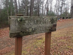
Back to South Fork.

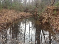
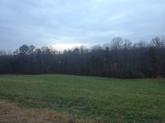
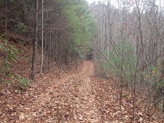
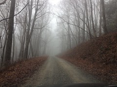
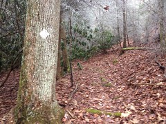
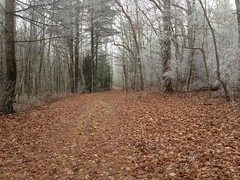
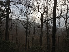
It was cold and misty between Watson and Dyer Gaps. The forest looked lonely and haunted.

 Spooky Forest

Actually it didn't look too lonely. There was a group of more hikers than looked like they could fit in one car, getting out of one car, at Watson Gap. We exchanged waves and smiles. Presumably they were hiking the Benton MacKaye.

I'd hit the BMT later but I had a more obscure destination in mind at first - Jack's River Road.

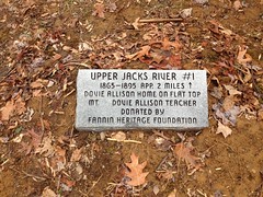
I've heard a lot of stories about Jack's River Road over the years. Apparently it was the main drag around those parts way back. There was apparently a community all up and down the river and up on Flat Top Mountain next door.

A while back I ended up on the road, pretty much by accident and found some monuments marking the location of an old church and an old school. There would have to have been houses within walking distance. Maybe I could find one of them.

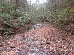
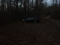
I parked at the end of the road and started walking south, upriver.

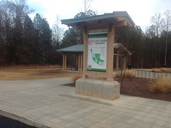
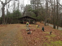
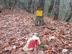
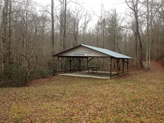
Past the aforementioned monuments...

 Jacks River Road Monuments

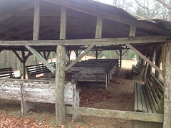
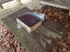
...and the church pavillion.

 Mt Gilead Church Pavillion

It was kind of cold, 34 degrees or so. I had fleece tights and a cycling jacket but I was a little worried about the barefoot shoes, especially if they got wet. Turns out they were fine, even in the low 30's. Totally warm, all day. They got soaked too, but being all vented, they actually dried out quickly. Exactly the opposite of what I expected. Very strange, but awesome.

There was a nearly overgrown spur to the left and I began to explore.

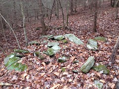
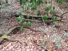
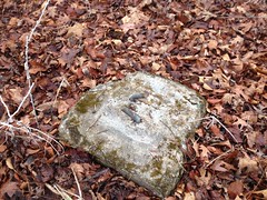
I found a flat spot along a creek that appeared to once have been cleared, but there was no evidence of a house or anything. Further up though, I found another such spot with what might have been an old, collapsed chimney.

 Upper Jacks River Homestead Ruins 1?

Yeah, doesn't look like much in the photo, but... It was right off of the road, right next to a creek, in a large, flat spot that appears to have been cleared at one point. Most significantly though, the stones were different from others in the area. The creek had plenty of rocks in it but they were all little and round and some different type of rock. I don't know rocks. I should probably learn rocks. Point is, the pile didn't look like it could have occurred there naturally.

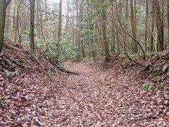
The road eventually just blended into the mountain so I headed back and continued upriver.

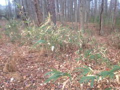
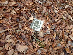
There was a little clearing just past the old school site and some clover growing in it, right along the trail. It was my lucky day.
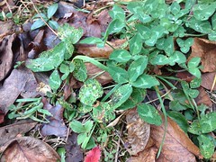
 My Lucky Day

What are the odds?

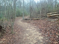
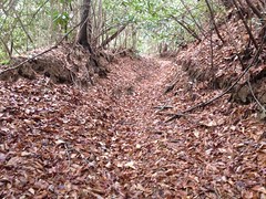
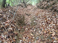
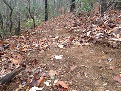
The road narrowed. Reroutes around old mud holes and downed trees increased in frequency. I saw indications of equestrian traffic at first, but eventually the canopy closed in. I'm not saying you couldn't conceivably get a horse up the trail, but I don't imagine it would be any fun.
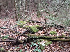
Hey...

 Upper Jacks River Homestead Ruins 2?  Chimney

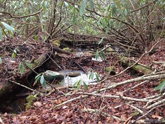
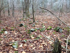
Another crumbled chimney?

Again, it doesn't look like much in the photo but there were also little piles that could have been footings in spots that would have made sense.

 Upper Jacks River Homestead Ruins 2?  Footings

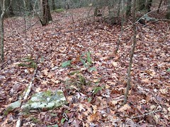
Of course those look even less like anything in the photo.

Just upstream there was an impressive boulder field.

 Boulder Field

Then the "road" crossed the creek and became a lot steeper and a little harder to follow.

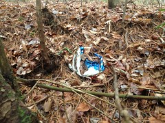
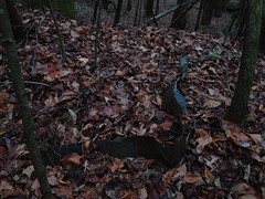
And there was a shoe.

 Shoe

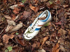
What the heck? Why one shoe? How does someone lose one shoe waaay back in the woods? This isn't the first time I've found a lone shoe either. This happens regularly.

So weird.

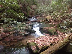
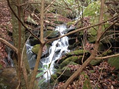
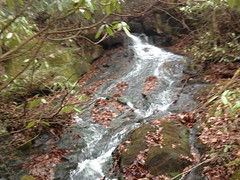
Just upstream from the shoe there was this little waterfally thing. Not much of one, but I figured I'd take a look.

 Upper Jacks River Falls - First Cascade

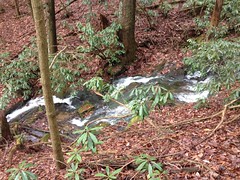
Then the trail got super steep. It just paralleled the creek, like 30 feet away, right up next to it. Super steep.

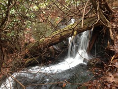
Then there was another cascade.

 Upper Jacks River Falls - Another Cascade

...and another one.

 Upper Jacks River Falls - Yet Another Cascade

...and then, abruptly, the trail got totally overgrown with rhododendron. One minute it was totally clear. Crazy steep, but totally passable. The next minute, totally overgrown and steep.

I crossed the creek and noticed that I was walking in the ruins of an old bridge.

 Bridge Ruins

The main beams were still in place, and one of the cross members lay in the creek. Wild.

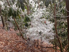
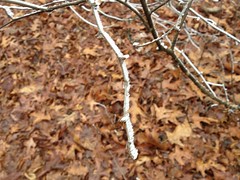
The higher I got, the colder it got, and a cloud had been sitting on top of the mountain earlier, covering everything with frost.

The most interesting things with frost on them were the spiderwebs.
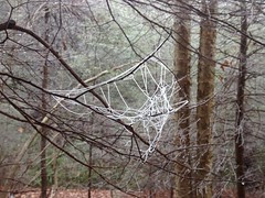
 Frosty Web

"Frosty Webs"

There were several more little cascades. All very hard to get a decent look at, much less a photo.

The uppermost was easier but somehow I managed to get it out of focus.

 Upper Jacks River Falls - Final Cascade

The trail leveled out a bit but just got harder and harder to follow. I ended up having to parallel it in the comparatively open woods.

Eventually it crossed the creek again at another old ruined bridge.

 Old Bridge Ruins

The next hundred yards must have taken 5 minutes or more to push through, but then... Ahhhhh...

The Benton MacKaye.

 BMT

It swooped in from the south and followed the route of the old road for a quarter mile or more. Ahhhhh.

I never really understood flocked Christmas trees. Why would you cake it all up in white... Ohhhh...

 Flocked

Not sure why, but it had not occurred to me before seeing that particular tree. Then it all made sense.

When I reached the top of the mountain, everything up there was flocked.

The BMT diverged from the old road so I diverged from the BMT.

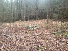
I could see a clearing ahead and it looked like the area I was standing in had once been part of it. The road kind of blended into the woods as they tend to do in a spot that had formerly been cleared.

It looked like there might have been a house there at some point too.

 Flat Top Mountain Homestead Ruins?

The ground looked like it had been leveled and a big pile of rocks lay to one side of middle of the leveled area. Hard to say though. Those same rocks are prevalent up there and a pile like that could form naturally. Dug Gap mountain, for example, is covered with such piles. Hmmm.

I divined my way over to the field, possibly following the route of the old road, possibly not.

Right where I emerged, there was this weird old rebar and chicken wire cage thing, laying up against a tree.

 Rebar and Chicken Wire Cage

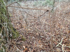
I'm sure there's an explanation for this. No idea what it is though. Weirder and weirder.

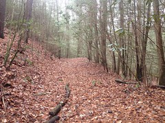
The road picked up on the other side of the field and eventually teed into Double Hogpen Road.

 Lonely Road

That's what I call it. I'm not sure what its real name is, or if it has one. The USFS probably calls it a food plot connector or something. It's the road that FS64A becomes after the gate, that leads to several food plots all over the top of Flat Top. Ordinarily roads like that are a few hundred feet long. This one is miles, probably longer than FS64A itself.

It was a long and lonely road.

The wind was blowing too and I had to pull my hands inside my jacket. That's something in need. Gloves. Seems that every winter I say that but every winter I end up not having bought any.

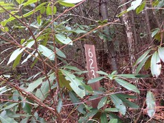
There was a little side trail to the right that I'd seen before, while scouting the TNGA route, years earlier. I took it, expecting it to lead to a campsite or something. Instead, it meandered around and then just paralleled the main road. What the heck? What's the point of this trail? Ohh...

 WMA Boundary

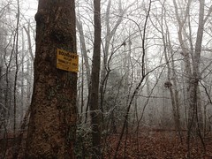
WMA boundary. Got it.

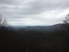
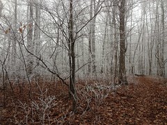
Flat Top isn't totally flat, and as I headed north it became more and more north-faceish - colder, windier. Everything was covered in frost feathers.

 Frost Feathers

The trail led right to the end of FS64A and kind of teed into it a 90 degree angle. Directly across was another trail that I wanted to check out. Old topo maps show it leading up to an old fire tower.

Indeed, it led to the remnants of one, at least.

There were 4 footings, and a fifth one in the center without any bolts in it.

 Flat Top Tower Ruins - Footing

Nearby there was this old slab too.

 Flat Top Tower Ruins - Slab

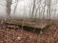
I guess there was an office up there or something. It seemed like an odd place for a game check station, but the only time I've seen an office by a fire tower is when it's been converted into an antenna and it needs a little radio shack. I wonder what the story is there.

The Benton MacKaye crossed right there, so I took it north.

It was even colder and lonelier than the road.

 Lonely Trail

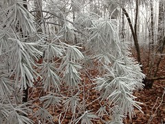
Everything was flocked and frosted there too.

 Frosty Pine

It was also very rocky and the wet leaves were sometimes half-frozen wet leaves, the kind that slip immediately because they're covering wet, half frozen slabs of rock. I tried to break my legs over and over and my shins took quite a beating.

Right before the BMT teed into FS64A I started seeing flags.

 BMT Reroute Flagging

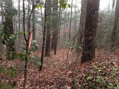
Driving in, I'd seen some flags too, and guessed that they might be for a future reroute. It appeared that I might be correct.

I didn't follow the flags exactly, but at the intersection with 64A, I noticed an old roadbed leading on and followed that. It turned out that the reroute planned to use that old roadbed too though and before long I was following the flags.

The new route should offer a decent view of Flat Top.

 Flat Top

In winter, at least.

There was a little overgrown spur to the right that didn't go anywhere and eventually the BMT reroute diverged from the old roadbed.

They'd cut new trail right up to that spot, actually.

 BMT Reroute Progress

The old road hit a ridge and eventually dove down off of it, became a series of humps and eventually blended into the hillside.

There was a fairly large deer ahead of me. I kept seeing its prints and hearing it rustle around. I even saw it a few times but it kept moving just out of range of a decent photo. I'd sneak up on it and it would let me get within 20 yards before bounding away again. Dangit!

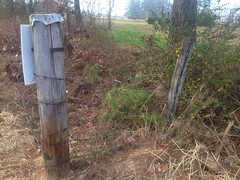
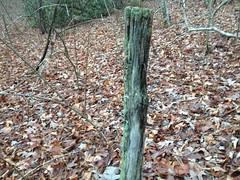
I made my way at last back to Jacks River Road and to my car. There was a short little spur right where I parked that led to what looked like a good spot for another homestead. I didn't find a chimney but I found a spot that might have once been a ford, and also this gnarly old fence post.

 Fence Post

Man! It was my lucky day. That clover was right. I found all kinds of cool stuff. The woods was totally full of it, everywhere I went!

I walked for 3 hours and 45 minutes, only 15 minutes short of my previous effort, but didn't suffer the slightest hint of discomfort later. Theory number one about getting old all of a sudden is apparently busted. Maybe I just got back into it too quickly but it doesn't seem like I'd be able to just wait a few days and be fine if that were the case. Stranger and stranger.

Well, whatever the deal is, I'm good now and it's comforting to know that I can still go running around in the woods without injuring myself from the effort.

I enjoyed my little adventure, but South Fork still holds many secrets, and if all goes well, I'll be back again soon.

Sunday, December 9, 2012

Caney Creek Preserve

Jeez, I think I've grown old all at once. That little excursion around Postelle Creek the other day trashed my legs completely. It's as if I've never walked a mile in my life. My calves are so shredded, I can't even do the shop ride tomorrow. God, you take a couple of weeks off and that's what happens? That just can't be right.

I could barely walk around my house yesterday, but today I ventured out in search of whatever recovery I could get.

I had a place in mind... Caney Creek Preserve. It's a new park, over by where I used to work. I used to drive by the property twice a week or so, whenever we'd go eat at Taco Mac or Shane's Rib Shack. Then a few weeks back I was out for a road ride, and "whoa!" the old farm had become a park.

 Caney Creek Preserve West Trailhead

I guess I should put "park" in quotes, really. It's not a traditional park, with ball fields and tennis courts, but a more of a greenspace with a parking lot. Kind of like Haw Creek or Al Burruss.

There was a playground though.

 Caney Creek Preserve Playground

Again, not your typical playground. Just a bunch of stuff to climb on.

There was a trail too, and thus, I was compelled to explore.

On that day I discovered the place, I was on my road bike and though I'm not afraid to get it dirty, the signs were ambiguous about whether the trail was open to bikes and I left it alone.

Today I needed a place to take a little walk and it seemed like as good a place as any.

The trail started off paved and basically went from the lot over to a dog park. There were little remnants here and there of the former purpose of the property.

 Old Fence

An old fence, an overgrown road, old ruts leading across a field.

The trail followed one set of old ruts and ended abruptly just as it crossed the main driveway. I double-checked the map, which showed it continuing on. Hmmm. I guess the map is a little ahead of reality.

I used my imagination though and followed the route that the trail will likely take, right around an old homestead.

 Caney Creek Preserve Historical Site

I've driven past that old house a gazillion times. I always wanted to stop and look inside. It used to be surrounded by abandoned trailers. The county removed the trailers a few years back, but left the old house behind. I used to work with a guy who alleges that a friend of his was involved in the fight to preserve it as a historical site. I wonder if they'll put up an interpretive sign one day. I'd like to know the history behind it.

The future path of the trail looped around the old house and doubled back on itself, then eventually led back past the lot and into the woods near Caney Creek proper.

The creek was kind of hard to see from the trail, but I noticed an old ford leading down and across it and got a better view from there.

 Creek

The creek looked remarkably healthy for being hemmed in by neighborhoods. There were little fish darting around in the pools.

There was plenty of cane on the other side too.

 Cane

I guess that's where it gets its name from.

The trail wound around through the woods, through some fields, and eventually across the creek in a more formal fashion.

 Caney Creek Preserve Trail

So, is the trail open to bikes? Clearly you can walk and walk your dog, and clearly you cannot drive your truck or ride your horse on it, but what about your bike? I think I'll call the parks office, it would definitely make a nice little addition to one of my road loops, if its legal.

The singletrack on the other side was pretty sweet...

 Caney Creek Preserve Trail Singletrack

...and it meandered around I the woods for a while before popping out at another trailhead much like the first.

I looped up around a little hill. The sun was going down somewhere ahead of me but it was too overcast to make out exactly where.

 Hilltop

The air was cool, it was getting dark, lights were glowing softly along the road. I could hear my favorite sound... distant traffic.

I wanted to just stand there for an hour but I really needed to get back and eat dinner with my family.

I'd forgotten entirely about my aching legs but when I got out if the car and tried to walk into my house, it all came back to mind. Man, this is horrible.

I guess I'm too old to take too many weeks off anymore. I'd guess I'd better get back on the wagon.

Thursday, December 6, 2012

Postelle Creek

"You have to make hay while the sun is shining."

Something like that. That's what I've been doing. I have a few opportunities right now, so it's been work, work, work, for 5 weeks now, I think. Wake. Work. Sleep. Maybe take the kids to gym and dance. Maybe eat. I took the weekend off for the CFiTT and did one road ride last week, which kind of sucked, but that's been about it. I really like the work I'm doing, so at least I've got that, but it's been hard.

Things eased up a bit this week though and I found myself, unexpectedly available for Adventure.

Adventure. I could barely remember the word, and it felt awkward and strange kitting up and driving north.

 Overlook from FS64

I parked at Dyer Gap. Months ago I'd gone running around up that way, found the network of old roads that used to connect the old Jacks River community with the old Mountain Town community and gotten interested in exploring more of the area. Today I figured I'd do that.

Right away I saw something new.

 Upper Jacks River #1 Marker

Interesting. It was right across the street from the lot. I swear it wasn't there before. I wonder if there's another one up on Flat Top.

I wasn't going that way though.

There's an elaborate cemetery just North of Dyer Gap, and as many times as I've driven, ridden and walked by it, I've never checked it out or taken a single picture.

 Dyer Mountain Cemetery Sign

Today I took plenty.

 Dyer Mountain Cemetery

The graves all had newish flowers on them. The monuments all looked like they'd been updated at some point. They were all granite. In many cases, the original stone was still there, in addition to the new one. Lots of the new ones just had the letter D on them. Others had just Father, Mother or Infant and then the last name. There were more infants than I expected, and stillbirths too. Life was a lot harder way back.

The chapel was interesting.

 Dyer Mountain Cemetery Chapel

But the most interesting thing was this:

 Dyer Mountain Cemetery Bible

A Bible in a Ziplock, right there on the pulpit, just sitting there. I guess they figure: "Who'd steal a Bible." Nobody, it would seem.

They had a port-a-potty too, converted into a pit toilet.

 Dyer Mountain Cemetery Bathroom

Bring your own paper though. There's no paper. There's is a lot of rhododendron nearby, but no paper.

Ok, enough sightseeing, time to explore.

For years and years now, I've seen a trail heading downhill from Dyer Gap that looked like it might get some traffic. The USGS maps show it running down along Postelle Creek. An adventure racing friend of mine told me if I ever went that way, I'd get my feet wet. Interesting.

I was a little curious about my feet, actually. I bought those barefoot running shoes a few months back and they were great all summer when it was a million degrees out, but would they keep me warm enough when it's in the high 40's? I wondered. Ditto for those running tights, or ballet outfit as Sophie calls it. Would they keep me warm? I would find out.

Long story short, yes, they kept me plenty warm. They felt great actually.

On with the adventure.

I began my descent.

The trail appeared to get enough traffic to keep it clear. From the hoof prints and other "evidence", it mainly looked like equestrian traffic.

Right away I made my first discovery.

 JD Marker

JD.

A memorial maybe?

I wonder if the Fannin Historical Society knows anything about it.

The initial descent from the gap was total gnar.

 Upper Postelle Gnar

And then it got even gnar-er.

 Upper Postelle Gnarer

With the leaves, it was tough to even find a safe place to step half the time.

The old roadbed was feet below grade, but turnouts had been cut through the berm every few hundred feet, so apparently it was like that even back when it was still being maintained as a road. Can't blame the horses for that, except the ones pulling the wagons way back, or whatever else they were pulling.

Where it was steep though, there was a new trench right down the middle.

Probably can blame them for that.

Yeah, the trail was a mess.

After the initial descent it improved slightly, in that it was still very old and busted, but whoever's riding it these days doesn't appear to be doing any new damage.

 Lower Postelle

I crossed several creeks but managed to keep my feet dry.

Then there was this...

 Lower Postelle Creek Diversion

...where the creek had been diverted from its original course and ran directly down the old roadbed for a few hundred yards. No way to keep my feet dry there.

At least I know what that's all about now.

Again, this didn't look like a recent development.

Way down, the trail was all beautiful and except for the blown out culverts and occasional downed tree, I could have driven my wife's Honda up it.

 Lower Postelle Niceness

Actually, if it weren't for those things, and the humps at the very top, I could probably have gotten my old Outback all the way up it.

Mylar balloon.

 Mylar Balloon

Imagine finding one of those, eh?

Way down near the bottom, a downed tree hadn't been cleared and the NF boundary wasn't too much further on. There weren't any No Trespassing signs or anything, but I'm always nervous outside the NF. North Georgians can be either really territorial or really friendly, you just never know. Sometimes they're really drunk too, but that can go either way.

I proceeded cautiously. It wasn't until I could see the main road that it teed into before I saw the back side of a Posted sign. I guess most people come from that side.

There were a half dozen side trails back uphill though, so I headed back up and took the first one past the NF boundary to the right.

It eventually led to a road. A real road, which turned out to be FS623.

 FS 623 Sign

Never heard of it. In fact, it's not even in the USFS's GIS data, or at least not the data from 2009 when I dumped it into my trail site.

It's a weird road. It tees into Devils Den road but they redid the gutters or whatever gutters are called on a dirt road, they just cut across the intersection. Also for the first hundred yards, it's all rutted out, so it kind of doesn't look like a real road, but then the whole rest of the road is a model of perfectness.

 FS 623

I walked all the way up and down that freakin' long ass road. It had this spur off of it too that was equally perfect until it got up on a ridge and ate way down into it.

I eventually found another NF boundary up there, the most complex I've ever seen.

 NF Boundary

Multiple bearing trees, gallons of red paint, lots of yellow tags, a benchmark and a sign explaining it.

I didn't investigate any further. I figured I'll come back later and try it from the other end. I have a good idea where it must go.

The sun was starting to drop any my right knee was starting to bother me and none of the trails connected up anywhere interesting so I just executed a direct abort. Back the way you came, boy.

On the way back, I stopped to check out this little waterfallish thing that I'd seen on the way down...

 Postelle Creek Falls

...and this campsite that might well have once been an old homestead.

 Postelle Creek Homesite?

The land was cleared and leveled, and the fire ring was made out of big, chunky chimney-style rocks.

Maybe.

Further up there was this chunk of metal roofing, or something too.

 Metal Roofing?

Maybe there were a couple of homesteads back up in there once. I didn't see any definitive evidence though.

As I climbed out, my right knee hurt more and more.

I'm officially getting old. If I don't ride or hike for a few hours, every couple of days, I can really feel it in my joints when I do anything significant. The colder weather doesn't help either, or the cloudy weather. "Ooh, it's gonna rain, I can feel it in my bad knee."

Seriously though, my knee was killing me when I got back to the lot. I can see that there will be some stretching in my future.

It was nearly dark when I got back.

 Dyer Gap Lot

I was hungry but I had half a Dutch Monkey Chocolate Chip Twist, a Tabasco Slim Jim and a Mr. Pibb waiting for me in the car. Oh yeah.

By the time I got home, my knee hurt less but it was super stiff. Advil to the rescue.

Ahh, minor Adventure, how I have missed you. Maybe if my knee gets better I'll get to do something this weekend too.