Tuesday, December 22, 2015

Eastern Continental Divide Route

I've heard that with the advent of the Trans North GeorgiA, the Pisgah Traverse, The Allegheny Mountains Loop, and whatever Karlos is calling his route from Key West to South Georgia, people have been working on stringing bits of those and other routes together into some kind of Eastern Contintenal Divide Route.

I'd love to say that I rode that last weekend, but no, not even close!

Long before that thing I referred to above was even remotely considered possible, Jim Parham wrote of an Eastern Continental Divide Route in his volume of "Off The Beaten Track." Actually I'm not sure he had "Eastern" in the name, and I'm too lazy to go check the book. Anyway, this route was named so because it takes you up over the Blue Ridge at Unicoi Gap, and then back over it at Indian Grave Gap. To the north of that ridge, all rivers eventually flow into the Gulf, and to the south, all rivers flow out to the Atlantic seaboard. Or something like that. When you're riding it, you can't tell, but the route needed a name and I guess that name seemed like a good one at the time.

I rode THAT Eastern Continental Divide Route this past weekend.

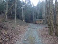
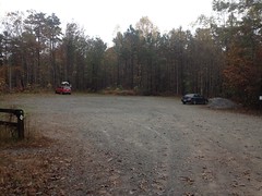
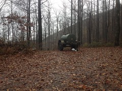
I parked north at Helen at the no-camping here campground where Martin Branch tees into the Chattahoochee and immediately faced the first challenge of the day.

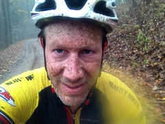
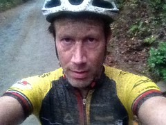
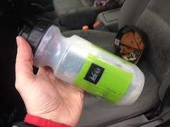
I'd brought with me: a base layer, wind shell, bib, arm and knee warmers, gloves, socks, shoes, shoe covers, glasses, and a helmet. I had forgotten, somehow, of all things, a jersey. This has never happened to me before. I have forgotten just about everything else, but never a jersey. The temperature wasn't an issue. I knew the base layer and wind shell would suffice. The lack of pockets though, that was an obstacle. Thinking back, it seemed like I'd raced 6-hours in the base layer before, and ridden the entire TNGA in it... But I'd had shorts with a pocket back then, and during the TNGA I had a backpack. Hmmm....

The solution did occur to me though...

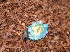
I stuffed everything I could in one of my water bottles:

Makeshift Pocket

And taped the spare tube to my stem.
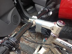
Another Makeshift Pocket

That should do it.

I'd have to stop if I wanted to eat something, but I could live with that. I didn't need my arm warmers yet, but they fit comfortably, folded up, under the legs of my pants. If I wanted to stash the jacket, I'd could stuff it into the back of my bib. I know just about every water source in the area and what's uphill from it, so I ought to be alright if I needed to tank up later. I couldn't effectively bring my iPhone with me, so I wouldn't be able to take more photos, but that was really the most significant cost of the solution. All right. Crisis averted.

Onward!

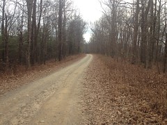
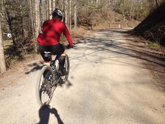
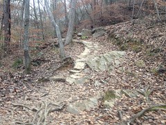
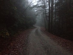
I climbed FS44 up past the first couple of turns, feeling pretty good. Better than I had for weeks, in fact.

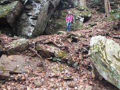
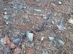
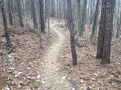
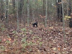
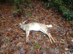
When I got to Jasus Creek I felt good enough to give it a try too. There were a lot of trees down, but it turned out that I could hop most of them. There is so much wildlife back up in there, but I found myself hoping that I didn't see anything interesting, for lack of a camera. The way my luck usually goes though, I figured I'd see a sasquatch petting a mountain lion, both posing for a photo. Fortunately though, there were no sasquatch, no mountain lions, no deer, bear, pigs, or anything at all. I saw a single turkey print, and nothing else.

Or, at least nothing else on Jasus Creek. I did see a little mole hanging out at the edge of the road at some point after getting back on FS44. I kind-of wished I had the camera for that, as I've never seen a mole outside of my backyard before, but all things considered, it wasn't that big of a missed opportunity.

I didn't struggle much, but it wasn't an easy climb. I didn't feel strong and fast, like I was making good time. My heart rate was low. My legs felt like they'd give out if I picked up the pace enough to keep my heart working hard. My equilibrium was off. Still is, I guess. More climbing! That's what I need.

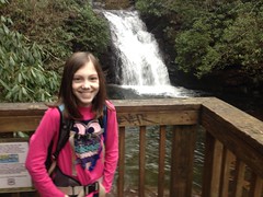
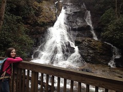
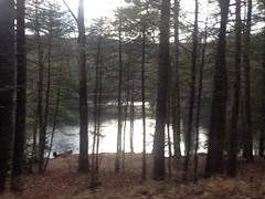
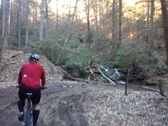
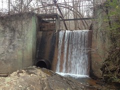
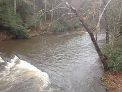
On Wilks Creek I got a really good view of the waterfall there. It's super hard to see in the summer. I was surprised how clear it was the other day.

I could also see more of what appeared to be old rails or skids on the other side of the creek. They were also difficult to discern in the summer, but super easy to see now that the leaves are gone. I'll have to do a little more exploring up that way soon.

But first things first. Back to the climbing!

The switchbacks weren't too bad. I didn't have trouble with them, but I found myself wishing that I was breathing harder.

There were some kind of weird semi-permeable drawstring bags tied around the ends of some of the hemlocks up there. The heck? At the time, it seemed like I'd seen that before, somewhere, but I couldn't put my finger on when or where. Maybe there, actually. Who knows?

Near Unicoi Gap there's a small sliding falls at the edge of the road, with a concrete settling tank built into it. The pipe was pretty badly clogged though. Water barely trickled out. I wondered how long ago the tank was built. It was a good source though, so I topped off my bottle, just in case.

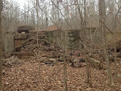
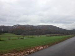
With all of the leaves gone, I could see the old campground below too. I'd looked for it several times during the summer and couldn't find either it or the road leading to it. The campground sits further down the hill than I thought, and it turns out the road to it leads down from the intersection of FS44 and the highway. I'll have to go check that out sometime as well.

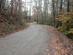
At Unicoi Gap I crossed the Divide and tore downhill on the road. It was a much longer descent than I remembered. Ones neck becomes quite tired during such a long descent. I had not remembered that either.

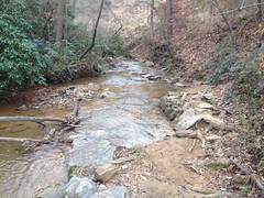
Near the bottom, I turned on to Indian Grave Gap Road and crossed the creek. I managed to get my right foot a little wet, but the shoe cover seemed to keep the water out of my shoe, somehow. Or, at least, if any leaked in, I didn't feel it.

That climb was a grind and a half, at least up to the little gap by High Shoals Falls. From there on it wasn't as bad, but I wouldn't call it good. My legs were getting tired and my toes were getting cold.

The potholes were all frozen. Enormous icicles hung from the rock on the left hand side of the road. I'd have liked to get a photo of that, but I have dozens just like it. No big loss.

At Tray Gap (or near it, at least) I had the option of hanging a right and descending back to the car, or hanging a left and descending a much longer route back to the car. It was officially dark at that point, and though I was prepared with lights, I didn't feel like being out any longer. More than anything, my toes didn't feel like being out any longer.

Right it was.

I forget how long Tray Mountain Road is, but it's really long, and it's also really steep. It was a blast tearing down it with just the headlamp. I think it might have been the fastest I've ever gone in the dark. It was definitely the longest downhill I've ever ridden in the dark.

I recommend it.

The road back to the car seemed longer than I remembered it being, but I got there and it felt good to have some legs at the end, unlike the last couple of rides where I'd ended up crawling back.

The barbecue place was closed so I grabbed some of that Chili Colorado at La Cabana, as I am wont to do, and it was delicious. At a gas station in Dahlonega, some guy was trying to return $60 worth of smoking accessories without a receipt. The cashier couldn't do it without the owner's approval and had apparently had it with the customer. I walked in on: "I can't take them back! You'll have to talk to him directly! What part of I can't take them back, you'll have to talk to him directly, don't you understand?!"

Entertainment!

So, I accomplished my goal of "more climbing in the mountains" and overcame the Adversity of the Missing Jersey. I also got pretty cold and thus had the opportunity to really enjoy my little truck's heater. All-in-all, a pretty good day. Feels a bit like old times actually. If I can, I'll have to get a little more of that next weekend too.

High Shoals Falls

I'd ridden all over Saturday-before-last, so the following Sunday, I figured it'd be a good idea to do a little hiking. Sophie is the only other member of my family who can be convinced to go hiking, so I brought her along.

Our first stop was the High Shoals Falls Trail.

Here is Sophie, on that trail.

Sophie on High Shoals Falls Trail

And here is a bridge on that trail, as well.

Bridge on High Shoals Falls Trail

Like so many other trails in its vicinity, the High Shoals Falls partly follows and old rail bed, as is clearly indicated in this shot:

High Shoals Falls Trail - Old Railbed

...and we explored a little off trail to the north to see how clear the old rail is where it hasn't been converted into a trail. Not that clear, actually. Not impossible to follow, but it doesn't look like anyone does.

As we approached the first cascade, I saw what looked like something colorful down by the creek, but with all the magnolia and rhododendron, I couldn't make it out. Then about ten seconds later we heard a loud slap and presumed that someone had jumped off of the falls. It wasn't super cold out, so it wasn't out of the question, but it seemed a little unlikely.

What had happened, was even more unlikely though...

As we approached the deck, we were met by a guy pulling a kayak out of the water. He'd hiked it in, put in above the falls, and then shot the falls. We missed it by less than a minute. His girlfriend was there with him and had apparently looked away right as he'd done it too, so she didn't see it either.

I can understand us missing it. We had no idea they were even there. But the girlfriend? They had planned this feat of epic bravery together, and engineered the production involved in accomplishing it. They'd packed, driven up, and portaged a kayak 2 miles into the woods, together. She knew exactly what he was going to do, and exactly when he was going to do it, and still, somehow, managed to look away at that exact moment! Her response: "I missed it, do it again."

He was not doing it again.

They were headed out as we were headed in though, so we didn't see them for long.

We did hang out at the falls for a while though.

Sophie at High Shoals Falls - First Cascade

It hadn't been raining really, but the water was raging like it had.

The second cascade was equally impressive and we stayed there even longer.

Sophie at High Shoals Falls - Second Cascade

On the way out we caught up to kayak guy, carrying his boat on his back, Himalayan Sherpa style with more weight and strain on his neck and head than I might have gone for, and ended up leapfrogging him a few times because Sophie likes climbing on rocks and just couldn't help herself.

Mountain Goat

The way out is a lot steeper than the way in, and Sophie really struggled for some of it. This seemed odd to me because she has classically been pretty strong. She didn't seem like she was out of fuel, but after stumbling a bit, pushing hard for a minute or two, and then complaining about her ears ringing, I figured it was time for a break before everything went black.

Fortunately everything didn't go black.

Her heart rate wasn't super high or low. She didn't seem dehydrated. She'd been eating. The weather was good.

I'm honestly not sure what happened. She recovered though, and didn't have any trouble later. It was weird.

Our original plan was to hike the High Shoals Falls Trail, then head south and do the Rocky Mountain loop. It was getting pretty late though, and it had taken us much longer to do the first leg than I had planned, so we decided to drive to Indian Grave Gap and just hike the AT out and back to an overlook that I'd been to once.

That was the plan.

We didn't make super good time though, and it started getting dark more quickly than we expected. Overlooks aren't so good in the dark, and though I love hiking at night, Sophie wasn't as in to it as I was. I think we made it about half way before turning back.

We got back in good time though and didn't even need the lights we'd brought with us.

Good enough.

On the way through Helen we debated: Pizza or Mexican... But then right as we settled on pizza, I remembered that there's also really good barbecue, and we opted for that instead. North Georgia Barbecue Co. We got lucky too, it was getting close to closing time and we just made it. The good thing about hitting a restaurant close to closing time though, is that they'll sometimes give you a little extra to avoid wasting it. Such was the case, and we got a few extra ribs on our rib plate.

Woohoo!

The North Georgia Barbecue Co. is incredibly good. I'm not arguing that ...insert your favorite barbecue joint here... isn't ALSO incredibly good. I'm just saying The North Georgia Barbecue Co. is incredibly good.

I guess that was about it for that little adventure. Reasonably satisfying, all around. I might have liked to have seen Mt. Yonah from the overlook, but I guess that just leaves something for next time.

Modified Noontootla Loop

Dangit, I'm developing a backlog again...

This was what? A week and a half ago? I guess that's not terribly long ago.

In keeping with the spirit of the past few weekends, I got myself up to "the mountains" weekend before last to "do some climbing in the mountains" again. This time it was the general Noontootla area, though actually, I never set foot or tire on Noontootla proper.

No, I started on FS42 instead, on Springer Mountain, just above Doublehead Gap.

FS42 on Springer Mountain

The weather was really nice. A little overcast, temps in the 60's, maybe a little breezy...

You wouldn't know it from the temperature, but it's full-on winter up there these days. No deciduous tree held a single leaf to the breeze. They were all on the ground, somewhere. You could see for miles into the woods and even further through them.

Burnt Mountain, I Think

I wish there was a "mountains in the distance" app that lets you take a short video, then turns it into a photo, cropping out trees in the foreground. I swear The Brain does that for me because whenever I take a photo of what seems like a beautiful ridgeline, the photo is nothing but trees.

I climbed Springer Mountain, and I felt it a few times. My fitness isn't total garbage, but it's a pale shadow of its former self. I didn't feel as bad as I had in Ellijay though, so maybe that's progress.

I ran into another guy on a bike about 1/3rd of the way up. He was coming back down. I didn't recognize him, or his kit. I was wearing my old long sleeve Reality Bikes jersey. Little chance that would be recognized these days either.

I felt good at Winding Stair, but I had to sit back and climb most of the rollers along the ridge.

At Puncheon Gap the brush was dead to either side and I cold actually make out the path of old FS141A below, where it climbed up to the gap. I'd never actually noticed that bit of it before and I assumed it had been destroyed when 42 was cut. Apparently not though, unless what I saw was something new.

I took a detour there, up to the top of Hawk Mountain. Some guys were camping across from the food plot but I didn't see any Rangers in the vicinity.

I did see the aerial marker again, and for the first time, noticed that it read G23 rather than 623.

G23

"G" eh? Ha! I've had that wrong for years.

I also noticed the footings for the fire tower.

Hawk Mountain Fire Tower Footing

I can't actually remember if I'd seen them before. I knew there was a fire tower there at one point, but I'm not sure I'd ever looked for its footings.

I did notice that the singletrackish trail that leads back down from the loop up on top has become a full on jeep trail. I'd swear it wasn't as wide in previous years, but it's not impossible that my memory is off on that one. It was as rough as I remember though.

I'd forgotten what it was like to be able to see for miles into the woods and I kept getting distracted looking over the edge of the road. I didn't see any animals though, or anything that I hadn't noticed before. I kept looking though. I guess it had just been a long time since I could.

At Rock Creek Lake, I wished again for that "remove the foreground" app.

Rock Creek Lake

I almost went down to the shore, but I had that "keep moving" feeling and I kept moving.

The fish hatchery was as vacant as I've ever seen it.

Chattahoochee Fish Hatchery

Just winter, I guess.

There does appear to be a newish road leading north from the property though, off into the woods. I checked my map when I got home and it's not on there. I wonder where it goes, and whether it's open to the public.

I imagine that Rock Creek Road must have looked much like Doublehead Gap Road before it became part of the Forest. If you use your imagination, there are indications that it was once settled everywhere you look. One such indication is a loop now known only as FS69C. It's about 6 miles long, and though I'd driven it in my truck a really long time ago, I'd never ridden it.

It seemed overdue, so I rode it.

It involved a great deal more climbing than I expected, but was otherwise unremarkable.

Well, I say that...

I did almost run over a little Ring Neck Snake.

Ring Neck Snake

Thinking maybe I had, I spun back to see how it was doing. When I poked it though, it was kind of stiff, and I thought for a second that it had already died. But no, it was all pfft, pfft, 3 or 4 times, with its little snake tongue and it stretched out a bit too. Not dead, apparently, just chilly.

I also saw what I presume is a decent sized Shagbark Hickory.

Gnarly Old Shagbark Hickory Shagbark Hickory, I Think

It was a little too far off the road to get the "fingers in the bark" photo, but the bark was deep and shaggy. If that's not Shagbark, I'm not sure what it is.

I saw a bunch of side trails too. I'll have to go run around back in there some day. Though, I think it would be better if that some day were after the end of deer and bear season.

FS69C spat me out across from the old church...

Pleasant Grove Church

...and I hung a right.

This time I followed Old Rock Creek Road instead of riding all the way out to the highway, and it worked out well. The weather had been decent all week and it wasn't wet or muddy.

On Doublehead Gap Road, I noticed a memorial that I hadn't seen before.

Bunker Hill School Memorial

It seemed that the Fannin County Historical Society had been at it again. That's at least two markers on the same road. I wonder if there are any more.

Apparently there was a little school house there until the 50's.

This little building sits on the property now.

House at Site of Former Bunker Hill School

I wonder if it's the same building, or if the school house was torn down.

The light was fading fast as I headed west.

Doublehead Gap Road

Fortunately I'd planned accordingly. Or, I'd tried to, at least. I had a set of commuter lights on the bike and my helmet-mount light as well. Though... I'd destroyed the red blinky tail light on a Silver Comet ride with Billy some months prior. Basically it had gotten so inundated with fine, wet grit, that the switch had gotten shorted, in the on position. It was impossible to turn off, and had drained the battery. I'd taken it all apart and cleaned it super well, but it was still stuck on. When I tried to take apart the switch itself, I fumbled a bit, and unleashed its spring loaded innards into every corner of my office. Actually, had the little parts flown into the corners, I'd have found them. As it was, I searched for like 20 minutes before realizing how hopeless it was and giving up. I'd actually tried that morning to purchase a replacement at the local shop. They had like 6 or 7 different lights, the smallest of which was about 5 times larger than my old one, and looked like a good candidate for getting bashed to pieces by my legs if I mounted it on the seat post, or kicked into my tire if I mounted it on one of the seat stays. So, this left me on Doublehead Gap Road, in the dark, realizing that I'd brought a working bar light, and a helmet light, but no tail light. After getting passed by one car, I figured it'd be better to have a white light flashing behind me than no light at all, and I put the bar light on my seat post. The next car gave me more space and I declared myself wise.

As I approached the gap, I also approached the Gilmer county line, where I was met with this friendly little sign:

Mountain Bike Capital of Georgia

Mountain Bike Capital of Georgia.

All right then. I guess I was in the right place.

The crawl up 42 to the car was rough. I hadn't really bonked proper, but I'd definitely done something similar.

But, hey, that's part of it. Climbing in the mountains requires strong legs, a strong heart, working lungs, and a well tuned system of digestive organs. Tune yourselves for this, digestive organs! I'm counting on you too!

Yes.

And that was the end of that particular Adventure. I didn't have that good whole-body tired, but I was pretty tired all the same. I can feel it coming though. Maybe in a ride or two.

Maybe three.

Sunday, December 6, 2015

Bear Creek/Pinhoti

So, last week I decided I needed to climb in the mountains, all day, until my fitness returns. To that end, the frere and I got all over some Bear Creek/Pinhoti today.

He was busy all morning, so we met at the Starbucks on Atlanta Road around noon and grabbed some Five-Guys on the way out of town. I had discovered that I only had 1 pack of Cliff Blocks in my car too, so I ran next door to some health-food place to grab some more. On the way out, I saw a confusing sign. Literally everything about it was confusing. There was a lady in a lotus position, with a young boy lying next to her. The boy had a pleasant smile on his face and a lit candle sticking out of his ear. The candle had a cone on it, presumably to keep wax from burning holes in his face. What?! I don't remember exactly what the sign said, but apparently this is a thing: ear candling. Never heard of it. Can't imagine what it would do. If you google it, you get people claiming it cures everything and doctors telling you it should never be done. The final bit of confusion came from the words of the sign that I can remember. They read: "...providing alternatives to a healthy lifestyle." WHAT?! Ohhh... they must mean "providing alternatives FOR a healthy lifestyle." Took me a few seconds to figure it out though. I almost took a photo of the sign but it was right there at the cash register, and it seemed like that would be awkward.

On the road, I took three bites of my burger and realized it had ketchup on it. I have only one pet peeve that I know of: I can't stand when food is wrong. Turned out it was John's burger though, and they'd just mislabeled it. A correct burger existed. Peeve averted. I consumed the burger cautiously though, eating only about half of it, as climbing in the Cohuttas while digesting meat is not recommended.

We parked at Mulberry Gap.

Mulberry Gap

I looked around for signs of life at the dining hall, but it was totally dark. In fact, the place was more vacant than I've ever seen it. I guess I've really never been there except for some organized ride or other event though, so I guess that kind of made sense. While we were getting ready, some guys with matching kits rode up the hill behind us. Turned out they were in town from Alabama for the weekend. They'd ridden Bear Creek, P1 and P2.

We had a more ambitious plan. Our plan involved climbing FS68, dropping in on Bear Creek, then hitting P1, P2 and P3, taking the road down off of and around the back of Fort Mountain, and CCC camp road back to Mulberry Gap.

That was the plan.

We even brought lights, in case it got dark.

All went well at first.

We spun a lap around the trail on the Mulberry Gap property, and then had a fairly easy time of FS68.

FS68

Some guys stopped and asked us for directions to the game check station and we tried to direct them to it. Unfortunately, I was a bit confused about where we were. I remembered it being past all the houses, on the right, but I thought we'd already passed all the houses. They knew that it was on Old CCC Camp Road but didn't know where that was, exactly. After misdirecting them once, I realized that the road we were on was actually part of Old CCC Camp Road, and that we hadn't passed all of the houses yet. So, I flagging them down and redirected them. They ended up pulling into the game check station right as we passed it. Everybody cheered and we were glad not to have sent them on a wilder goose chase than we already had.

We turned onto Bear Creek below the overlook, and the gate was actually open. I guess it's open during organized hunts. You could actually drive down upper bear creek right now if you so chose.

Bear Creek

And that was it for the photos. For the rest of the day we were either moving too fast or I was struggling too hard to take any more.

Tearing down Bear Creek was as fun as I remembered. Since breaking all those ribs though, my mind had built up this idea that water bars are 4 times taller than they actually are. They seemed like they ought to be the same size as the whoops that I'd crashed on. Of course, they are not. They're like 6 or 8 inches tall. A foot, max. After rolling tentatively over the first few, I was relieved, and I rode the rest as I always have.

I did drop one of my water bottles three times though. I have this shitty plastic cage up front, and I really need to replace it. I even have a cage to replace it with, I just keep forgetting about it until I drop a bottle out of it.

We passed a few hikers, and a dog.

The creeks were all high and John remarked that the poplar seemed like it had gotten noticeably bigger than when we first saw it. I guess technically it had gotten bigger. 15 growth rings bigger, to be precise. I wonder what that translates to in inches. Two, three, maybe? I doubt we'd notice that though.

I felt good on Pinhoti 1, but reaching into my pocket for Cliff Blocks, I realized that I'd left the ones I'd bought earlier in the car. It was an awful, sinking feeling. I had more than enough to get back to the car though, and it was only about 1/4 mile out of the way, so maybe we could make a slight detour...

At the end of P1, we ran into a hunter heading back to his truck. He hadn't seen a thing all day. We hadn't either. It's like the deer know when deer season is. I see every kind of wild animal during the rest of the year. I see deer every time I ride in places they can't be hunted too. They know. I'm telling you.

I felt like garbage climbing P2. The downhill was fun, but I had no legs. The tail end, after the last little climb just beat me to pieces too. I swear I must have been bottoming out my fork, but it wasn't just that, my feet were getting hammered too. Good, god. I wasn't alone either, John mentioned the same thing. I'm not sure why it seemed so rough, but it was really, really rough.

My pathetic legs began cramping as we rode toward P3. I don't think we'd ridden even 20 miles yet. Pathetic!

John wasn't feeling well either, it seemed, and his fork was giving him all kinds of trouble, so we called it a day. My 38 year old former self was rolling in its grave.

But, it is what it is. I didn't have another 20 miles in me. I had to back off to keep from cramping on the way up to Mulberry Gap proper.

So that was it. 20 miles or so. I guess it's a start. I just need to do more and more and more of that until I'm strong again.

Backing out of our parking spot, I managed to hit the roots of a tree with my tailpipe and cut enough of it off to completely clog the pipe. Me and John had to dig the debris out with a stick.

I ran by the barn too, to see who was around. The guys from Alabama were kicking back and watching Alabama vs. Florida. It was already the second quarter, but the score was like 0 to 2 or 0 to 3. Really low score for being that late in the game, against Alabama. I'm not sure how it turned out, but so far it looked pretty good for Florida.

Ginny was working in the kitchen and we talked for a long time. It was so good to see her. It's been a while since I've been up there, and a lot has changed. The barn is closed in and it has a floor now. The kitchen is bigger. The old dining hall has been converted into a large cabin (which was why nobody was around earlier) and they just do all the meals and get-togethers in the barn now. Weddings too, apparently. They'd gotten to where they were going through so many chickens that they couldn't keep them on the property any more, but there are as many dogs as ever, and a few cats now too, one of which thinks it's a dog. Diane was out of town, so were Andrew and Kate, so I didn't see any of them, but hopefully I'll catch them next time we're up that way.

I hope that's soon. I need the miles, badly. So badly.

Right now I need rest though. Not as badly, but still, badly enough.

Saturday, December 5, 2015

Chicopee Woods

Last Sunday I got on the bike again. What had it been? Two weeks? One of those weeks we spent in Louisiana eating and eating and eating. I also spent part of that week, and the one before it, lying on the couch coughing up both lungs. I swear, I've been sick every other week since I broke all of those ribs.

Garbage!

But I wasn't terribly ill last Sunday, so I got in a bit of a ride at Chicopee. I can't even remember the last time I was there. I'd probably have to look back through this journal to figure that out.

Chicopee is Singletrack. They ought to just rename the place "Singletrack Woods".

Singletrack

Glorious, flowing, unending singletrack. There must be 20 miles of it out there.

Sadly, I was in poor shape to enjoy it. Every hill felt three times as steep as it was, and I really struggled most of the day.

Still, I got to see some interesting sights. There's a new-to-me trail out there now, the Village Trail, which winds around off the back of Tortoise. And me without my GPS... I guess I'll have to get back out there and ride it again. Oh, darn.

Near the end of it, there was a pile of ruins off to the left.

Ruins

I'd seen it from the other side a dozen times, but not from the back. From the front it just looks like an old slab. It would seem that there's more to it than that though.

Some guy drove up right as I rode by, and started messing with an erosion barrier to one side of the slab. I waved at him, and he waved back, but it wasn't at all clear what he was up to. It was odd to see someone driving around back there. There are roads, but I've never seen anyone on them.

Chicopee Roads

The Red Trail wasn't as difficult as I remember, though that may have had a lot to do with my choice of gears than fitness.

There was a bit of a maze of new-to-me trails on White Tail too.

White Tail Trail

I double-checked when I got home too. I didn't have them on any of my maps. They looked like reroutes though, as opposed to just additional trail... One more thing to explore some day.

Somewhere toward the end of Copperhead Gap I ran into this buck with one antler.

Buck With One Antler

It was standing in the trail at first, then lazily walked uphill as I approached. After about 20 feet it stopped and started gnawing on it's butt. This was funny, so I stopped and watched it for a while. I'd hoped to get a photo of this weirdness, but it looked up right as I tried.

There was a balloon too, as usual.

Balloon in the Woods

A lot of the trails at Chicopee are modern reroutes of older trails but the layout is not as modern. It's more of a maze than stacked loops.

There is, for example, a location called Confusion Corner.

Confusion Corner

Indeed.

Fortunately I had a map, but as I reached into my pocket to consult the map, I realized that I did not, in fact, have a map. It had apparently escaped, and no doubt now decorates some part of the trail. Dangit. Sorry Chicopee. Hopefully someone will be kind enough to pick it up and pack it out.

I did figure out which way to go though. My fuzzy memories proved adequate.

I managed to dunk both feet trying to cross the creek at the end of the Outer Loop.

Creek Crossing

Seems like it used to be easier, and shallower.

The dam was right there, I couldn't remember if I'd ever taken a photo of it, so I walked over and got one.

Chicopee Dam

Seems like water doesn't usually rush so hard over it. That could explain the creek being higher than I remember too. The rocks near the dam were surprisingly sketchy to walk on in bike shoes, and I slipped a few times. I thought it would be funny if I survived riding the trail only to eat it walking, so I exercised extra caution, you know, to avoid embarrassment.

The little climb up off the creek has always been sketchy, but it was armored a few years back and by rights ought to be rideable.

Harder Than it Looks

It was not. Or at least, I sketched trying.

By the time I got to the top of the Granny Climb I'd had enough and just rode out. I didn't even bother with Coyote.

Awful!

I don't mean that the trails were awful, just that I was. It was one of my worst days in a long time. I blame illness, injury, atrophy, late nights, sugar, and pizza. Or, more precisely, not avoiding those things. So maybe it would be more appropriate to say that I blame complacence. Yeah, that rings a little more true.

Can I even come back from this though? There was a time, not that long ago, that I could do things, fairly easily, that now seem absurdly difficult. What will it take to get there again? Can it even be done? Man, I hope so. I want to enjoy the woods, not just endure it.

In the past, the solution has been climbing, in the mountains. Lots and lots of climbing. I'll have to give that a try. It seems like a good idea, at least. We'll see.

Sunday, November 8, 2015

Noontootla-Winding Stair

It's been raining for over a week now. All day. Every single day. Actually, I think there was one day that it didn't rain the whole day, but I barely remember that day. I've been dying to get back on the mountain bike, and yesterday seemed as good an opportunity as I was going to get. The forecast called for rain, but it looked like it would be more of a sprinkle/drizzle than proper rain.

Good enough.

I parked at the Jake lot.

Jake Lot

It seemed I was all but alone in my interest in the woods that day. There was one other car in the lot, from Missouri, no less. I imagined them having come down, hoping to get in some great riding, or hiking, or hunting, only to end up dealing with steady rain all week. Sorry guys. Welcome to Georgia.

It was actively raining when I left the lot, and I don't think it ever stopped altogether at any point. It did let up a good but at times, but when I left the lot, it had decidedly not let up. I even debated shoving off into it, but eventually decided that... a) I'd driven all the way up there. And... b) Getting wet is uncomfortable, but it's just the transition that's no fun, once you're all-the-way wet it's no big deal.

I headed up to the road, hung a right, and then hung another right on FS28-1.

FS28-1

It was a slog. No other words effectively describe it, only slog.

The ground was soft and wet. Every foot took two feet of effort. It reminded me of riding through melting snow.

But, just like rain, you get acclimated, and after a few minutes it doesn't seem wrong any more.

There were a bunch of slight differences since the last time I was up there. The Rangers had posted new yellow signs marking their routes. One set of signs counted up from 8 to 12, ending at Camp Merrill. I'm not sure what route it intended to mark though, as I'd only seen that chunk of it.

On some random this-used-to-be-a-road berm, off to the right, someone had planted a halloween ornament.

Halloween Ornament

It wasn't especially conspicuous though, and I don't remember it being near anything in particular, just randomly out there along the road.

At Camp Merrill, the sewage treatment pond had been filled in completely, and replaced by a gigantic blue tank. There were also yellow signs marking Cooper Gap and Black Farms routes.

I ended up following the Cooper Gap route and it looked like the Forest Service had been out there recently, re-marking boundaries. There were new bearing trees, benchmarks, and red paint all along the left hand side of the road, until a half-mile or so up, where they crossed the road.

It looked like somebody had done a bit more development on Sassafras Mountain too. The last time I was up there, a new road had been cut and somebody had parked a tool trailer at the end of it. That trailer was still there. The road had been extended though, or another road had been cut leading almost all the way to the first turn too. There are several little roads up there now, but no new constructions yet. I wonder what they have planned.

Climbing Cooper Gap was less of a slog than 28-1 had been. The ground wasn't as soft, and it was a lot rockier. It wasn't easy though. I'd been off the mountain bike for a long time, and been out of the mountains for even longer.

At Cooper Gap, the Rangers had left one of their water tanks.

Water Tank at Cooper Gap

I'd seen that before, when they're out there, running around in the woods on some exercise. They were nowhere to be seen or heard from, but I hoped I run into them later.

There was one guy camping under a tarp on the east side of the gap, to the right of the water tank. He looked really cozy in there with a dry bag and the warm glow of a lamp. Mmmm... warm and dry.

Up high, on the north side of the ridge, it was a little bit colder, and a lot muddier.

A Little Muddy on FS42

On every little downhill, I got sprayed relentlessly. It felt like water, but it was that fine, muddy mist that builds up, little by little, caking everything, especially one's legs, but most noticeably, one's glasses.

Ha! Adventure!

At Hightower Gap, I had the option of hanging a right and going for the long loop or staying straight and cutting it really short. I'd had such a difficult time already that I'd been mulling the options over in my mind. At the gap, I had to kind-of trick myself to keep going... "If I turn right, without stopping, then I'm committed to the long loop..." Something like that. So, I did, and tried not to think about it until I'd gone downhill long enough that the idea of turning around wasn't appealing.

I remember the first time John and I rode up there, that road was wet and soft, and we had to pedal constantly, while descending, to keep speed. It was much like that again yesterday.

The rain let up for a while though. You could tell it was raining if you were moving, but if you stood still, you'd have to wait a few seconds to be sure.

Rock Creek Lake smelled funny as I approached it. It smelled like wood. Like it smells near a wood chipper. I couldn't immediately determine why though. The only thing I could come up with was that the headwaters were flooded, and somehow that smells like wood. It was weird.

I passed the fish hatchery.

Fish Hatchery

Didn't look like much was going on there. Frank Gross was deserted. Almost every campsite was deserted along the road. There were a few people out fishing though, and a few more out driving around. Seemed I wasn't the only one.

Rather than even attempt FS308 up at the north end, I kept going out to Hwy 60.

There's a road there called Totem Pole Road. It also has some FS designation, but I forget it now. Maybe 656?

At any rate, I'd driven down it eons ago and there was, at that time, an intact logging truck from a bygone era, abandoned on the side of the road, complete with the load of logs it was carrying at the time. It looked similar in vintage to the truck up on Bull Mountain, but in infinitely better condition. For some reason, I hadn't taken a picture when I first saw it, and it occurred to me that in 10 years I'd hadn't been near enough to that location to do so. As fate would have it though, I was right there, the road isn't too long, and it seemed like the perfect opportunity.

The road was short and shallow, as I'd remembered it, but as I approached the houses at the end, almost within sight of the truck...

Totem Pole Road

Private property. No trespassing.

Dangit! I mean, I was within maybe 100 yards of the old truck, but I couldn't see it, it was around that corner somewhere, assuming it's still there. That sign hadn't been there ten years ago, and I guess the residents got tired of people (like me) driving around back there and turning around in their driveways.

Dangit again!

Hey, extra miles though, right?

Got to look on the bright side.

Back on the road, I crossed the Toccoa...

Toccoa River

...which also smelled like wood, as Rock Creek Lake had.

Weird.

On Hwy 60 I passed the "community" of Margret - 2 people, 1 dog. I also had to climb over Tooni Gap too, which is the one down side to that route option. It's not terrible, but it's there, and I'd forgotten about it. There were a half dozen cars parked at the gap. No doubt Benton MacKaye hikers. I hoped the rain hadn't ruined their day.

Come to think of it, the last time I hiked the Benton MacKaye on Tooni it was raining too. And, I remember telling the folks at work about it later and one of them was super incredulous. Like she didn't believe that I'd done it, much less enjoyed it. Everything about it sounded either terrible or impossible to her. I had photos to prove that I'd done it though, and GPS data, and I did have a good time, as crazy as that sounds.

On Doublehead Gap Road the rain set in again.

The trees aren't sure whether it means to be summer, fall, or winter though. Leaves were green, yellow, red, brown and gone. All at the same time.

Doublehead Gap Road

Further on, the fog on top of the mountains looked ominous. I didn't have to climb those exact mountains, but the clouds looked big enough to cover the ones I did have to climb.

I crossed the Toccoa again, and passed my favoritely-named road "Nellie's Big Fish Drive".

Up the road a bit, there were two guys out collecting a big chunk of quartz or marble or something.

Collecting Rock

The guy in the excavator had picked it up off of the side of the road and was busy positioning on the flatbed truck when I rode up. The rock was so huge and heavy that it didn't slide easily, and nudging it to the side a made the whole truck twist like it was going to slide on the pavement before the rock finally gave, and then it was in danger of moving too far. The guy running the excavator really seemed to know what he was doing with that though. As soon as the rock started to move, he'd back off and then nudge it again. It seemed like an impossibly delicate operation to pull off with such huge and presumably imprecise equipment, but they really had it down.

I think of FS58 as "the climb" on the Noontootla loop, but Doublehead Gap Road is a net climb too. It ascends along Laurel Creek to some little gap near Peter Knob and then after a short drop, ascends again to Doublehead Gap. I don't usually notice it, but I did yesterday.

I passed a small group of deer, 5 or 6, taking advantage of someone's not-so-well-mown field. And somewhere in there, there was a line of decorative cedar trees and about 20 turkeys on the other side. I stopped to try to take a photo, but they kept running away and I didn't get anything clear. With the trees, they didn't seem too scared of me, so they never flew away but they just kept running back and forth like mad and eventually I had to give up.

A lot of the properties along that road have changed over the years too. Several old log cabin-looking structures are completely gone now. Others have collapsed. One or two newer properties appear to have been abandoned. The one with the lake and the spillways with the cairns is up for sale. I want to say cheap too, like $240,000. Though my foggy mind may have missed a decimal place or two in that figure.

At the foot of FS58, there was a memorial stone that I'm not sure whether I'd seen before or not.

Memorial

What, exactly are they memorializing? Was there a school there at some point?

For a while, the climb up along Noontootla seemed less difficult than the climb along Doublehead Gap Road.

Somebody had chucked a deer off to one side near the bottom.

Deer

Ewww.

It started getting foggy before long, and then it started getting noticeably darker.

Ohhhh... That's right. I'd forgotten entirely about the time change, once again.

My original plan had been to get back to the car around 5:30, get home by 7 and get to my brother's house in time to catch the LSU-Alabama game at 8. I'd been keeping an eye on the time and I wasn't running terribly far behind schedule, maybe half an hour, but I'd completely forgotten that it would be full-on dark at 6, dark in the woods by 5:30, and probably even functionally dark earlier than that, given the weather.

Dangit, a third time!

I did not have the strength to push much harder. I had plenty of cardio but very little in the legs. As I have said: no amount of not climbing in the mountains gets you in shape for climbing in the mountains. That adage reasserted itself as, after what seemed a very long time, I passed three forks, the halfway point of the climb.

It wasn't dark yet though, just getting dark, and really foggy. Ahead of me in the fog, I spotted a huge buck. I mean, huge. Not just Georgia-huge, but Mississippi-huge, or Florida-huge. It looked toward me, but didn't seem to have as good an idea of what I was as I did of it, so it just stood there gawking at me. I stopped and very carefully pulled out my camera, but it took off as soon as I held it up to my face.

Come on!

I tried to take a photo of the road to demonstrate the fogginess, but this was all I got.

FS58

The heck? Why is fog so hard to capture? Kathryn and I discussed this later. Do iPhones have a polarizing lens or something? Would that decrease the fogginess in a photo? If so, why don't I have such lenses on my glassses? Seems like that would be really handy.

All day I'd been pelted and sprayed and it seemed I might be a little dirtier than earlier, so I took a photo for comparison.

A Little Muddy on FS58

Yes, a little dirtier to be sure.

At Winding Stair Gap I saw the water tank again.

Water Tank at Winding Stair Gap

They'd either moved it, or they have more than one of them.

I hadn't seen or heard the Rangers all day, but that's not that unusual. It's more unusual to have seen them, even when they're nearby.

The descent down Winding Stair was Adventure at its finest.

I needed the glasses to keep the water out of my eyes, but they were certain to become opaque within seconds. I ended up putting them on, pulling them way down my nose, angling them down a bit, and looking over the top of them. This worked really well, as they got hammered steadily, but kept about 90% of the water out of my eyes. The limited visibility was still a challenge though. My instinct was to try to look through the lenses and it was hard to override. After the very first little drop off of the ridge, it was a lot darker too, and just generally difficult to see.

I made it down though, without incident.

About halfway down I saw two little glow-sticks hanging on a tree, and a humvee parked just down the road. The driver was running up to collect them and didn't seem to have time to return my salutations. Or, maybe he just didn't see me until I was right on him.

About 3/4ths of the way down I heard barrage after barrage of automatic weapons fire off to the west, in the general direction of Jones Creek and the PR Gap Trail. So that's where they are...

At FS877 it was super, super dark. I couldn't make out any detail in the woods and the road was just a whiteish field in front of me with only subtle variations to distinguish ruts, potholes, and mud. It was still raining too, harder than it had all day even.

As I was heading out, several cars passed me, all heading into the woods. One was a truck, with a hitch rack, no less, but no bikes on it. The others were all nice cars. One was a BMW. They didn't seem like ideal vehicles for rough, muddy roads, in the dark, and in the rain. I wonder what they thought of me.

At the Jake lot, someone was pulling out right as I turned in. Could have been the Missiorians. The lights were so bright and the rain made such glare that I couldn't make out what they were driving.

I was beat. It was 6:30. I spent 7 minutes changing and putting up my bike. The drive back took an hour and 45 minutes. I met my family at Siracusa's, the local pizza place, where we watched the first half of the game. I showed up even dirtier than in that picture above. Kathryn, Sophie, and Dave, the owner, were shocked by just how dirty I was. It was bad. I had to wash up in the bathroom, which took like 10 minutes.

At halftime we drove over to my brother's place to watch the rest of the game. His mother and father in-law were both in town, and Carrie had made some really good gumbo. I mean it was really, really good. It might be the best gumbo I've ever had. John had mentioned it earlier, I saved some room for it, and man was I glad that I had. It almost made up for the devastating punishment Alabama crushed us with.

Not quite, but almost.