Saturday, December 31, 2016

Olde Rope Mill

I was napping hard yesterday when the phone woke me up with it's you've-got-a-text noise. I had 2 texts, actually, both from John. The lower one read something like "Meeting Baldwin at Rope Mill tomorrow. 10AM start." I presumed this meant that Mark Baldwin would be in town, down from his new crib in Ellijay, and wanted to ride Rope Mill at 10. I was pretty sleepy though, so I didn't answer. I glanced at the previous text and it said something about playing SRV's Little Wing for Lauren and then I got another one immediately asking if the Rope Mill lot was gravel. Or so I thought. Later when I woke up I could distinctly remember the Rope Mill invite, but I couldn't distinctly remember if I'd actually read those other 2 or just dreamed them. They seemed so odd.

I forgot about it quickly and never checked the phone, but later that same day I actually rode with the frere at Cochran Mill and he confirmed that he had send those other two. I hadn't dreamed it.

Ha!

We ripped most of Cochran Mill and I felt pretty good doing it. We had to abandon the loop at the back of the Yellow trail to avoid getting caught out in the dark, but hit all of the red, orange, and green loops. I definitely felt up to riding with Mark, which is kind of new because I've grown old this year and though my fitness isn't at an all time low, it is definitely unsatisfyingly low.

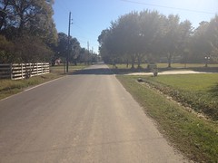
The next morning my brother met me at the parking lot next to the Starbucks off Atlanta Road and we rolled up to Woodstock to get in on the festivities.
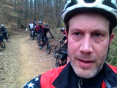
We were early.

John and My Bikes

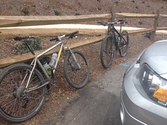
Mark was on time, as he is prone to be.

John and Baldwin

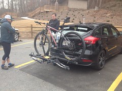
Marc Hirsch showed up almost immediately afterwards. There were a dozen and a half more riders meeting us though. It was apparently a birthday ride for a guy named Aaron that they all know. I didn't actually recognize his name, but when I saw him, I recognized him. I must have ridden with him before somewhere.

The rest of the crew trickled in over the next half hour and we got moving around 10:30.

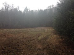
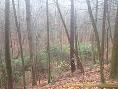
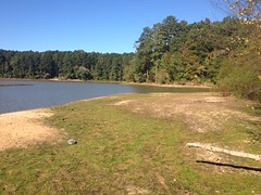
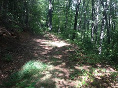
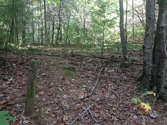
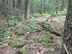
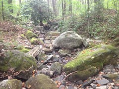
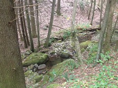
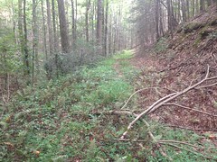
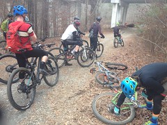
We hit the Explorer Trails first, which are really my favorite trails in the system. The Mill trails are faster and they have lots of jumps and berms, but the Explorer trails are more what I think of when I think of mountain biking. They wind around and expose you to the terrain. You experience the land when you ride them. They're not just a contrived means to an end.

So, we rode those and it was a lot of fun. I haven't followed a train of riders in a long time. I had forgotten a lot of the dynamics and it was great to get back in touch with them.

Aside from having to pump up my front brake constantly (my bulletproof 2014 XT disc brake which no one I have ever heard of has ever had any problems with, except me, that my brother got me because I had constant problems with my Magura Martas, which no one I have ever heard of has ever had any problems with, except me!) it was a great couple of miles.

Whoo! Done with the Explorer Trails.

Done With the Explorer Trails

After that we kind of milled around for the next 15 minutes. It wasn't clear why. It didn't seem like anyone needed to fix anything. It had been in the high 30's when we started and it felt like it was getting up into the mid 40's, so I shed my arm warmers, and I saw a few other riders shed theirs as well, but that took all of 10 seconds, collectively.

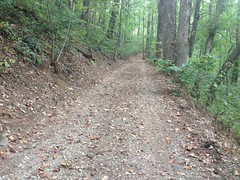
Eventually we were like "Ok, lets just get going", and most of us went over and rode The Mill.

I think of The Mill is a contrived means to an end. However, since that end is incredible fun, I'll take it! The Mill trails are just super, super fun. Jumps and berms and switchbacks and log-rides and rock gardens...

I love it!

I did not love that I dropped my chain in the first 100 yards of Turbine though. One thing that sucks about a 1x9, if you drop the chain, you must stop and put it back on by hand. There is no hope of just pedaling it back on. I'd left a few links in it because I wasn't sure if I'd like the 30 tooth front ring or if I'd want a 32 or even a 34. Between that and my freewheel not freewheeling super well, there's a lot of slack in the chain and that was the end result. Also, I need to learn how to adjust the derailleur clutch properly.

No good!

I struggled to catch and once I did it was tough to stay in contact with the rest of the riders. I managed, but it was a bit of work.

At a point, one of the guys ahead of me crashed and tacoed his front wheel in the process. I think he overjumped one of the jumps and came down nose heavy. That's exactly how I broke all those ribs in 2015, so I was a little worried until I saw him walking around and laughing it off.

Whew!

It's funny. I just had to look up the date of that crash. Apparently it was September of 2015. Man, time flies. Even though I know the date now, it still seems like it happened earlier this year. Man, more than a year later, I still don't feel fully recovered.

Done With Lap 1 of The Mill

All right, done with The Mill... Wait, nope, one more lap!

As soon as everyone caught, Aaron wanted to spin another lap. No argument from me. And, no crashes that lap.

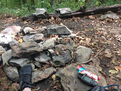
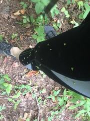
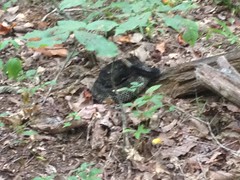
Back at the lot there was an effort to decide whether to spin another lap of the Explorer trails or hit the Avalanche. I had a new problem though. Just standing there my rear tire went flat, rather suddenly. It had been feeling a little soft for a while, but I thought it was just my imagination. It didn't feel right cornering, but then if I rode over something it seemed ok. I haven't done a forensic analysis of the hole yet, but I suspect that either I picked up a thorn yesterday and it leaked down a bit, causing it to half-pinch-flat today, or that the valve stem steadily detached from the tube. The latter is actually more likely. I've had a rash of that lately. For a while I had a pump that you had to shove on to the valve stem and it would push it way up into the rim, and the tube, forcing the valve stem away from the surface of the tube, in the one direction that it's probably the least strong. I finally replaced the pump, but I was reticent to do so until I had to because Tim Winters gave it to me when my old one broke and I was so strapped for cash that I couldn't even afford to replace it.

Either way I had to fix it if I wanted to ride, and I just couldn't get the tire off of the freakin' rim. I guess the beads are tighter these days because everyone likes to put together tubeless set-ups with regular tires and Stans. Or maybe rims are a little taller for the same reason, or both. Whatever the deal, the tire was not coming off on its own, and I had to borrow Marc's pink tire tool. Come to think of it, I had to borrow the same tool once up on Bull Mountain a year or two back, for a similar reason...

Airing it back up was equally frustrating. The CO2 got stuck on the valve stem and required equal parts force and finesse to remove it.

And, though I spent an entire 16oz CO2, it didn't fully inflate the tire!

My tire and front brake are just metaphors for my life these days. Things like that happen a lot. I misjudge something and I pay for it. I had a seemingly good basis for the judgment, but some set of things changed slowly and covertly out from under me, and the accumulated changes finally created problems. What I could reasonably have expected last time I checked, I can suddenly no longer reasonably expect, and I pay for it. And then, some things just fail outright, for no obvious reason. What I should reasonably be able to expect, by any objective measure, I simply don't get, and I pay for that too. All that paying-for-it taxes my resources and makes it that much less likely that I'll be able to keep up in the future.

"My God, are you serious? Come the f*** on!"

I find myself saying that a bit lately. I hate the words. I hate that they come to mind. Years ago I might have been awarded a merit badge for Tolerance to Adversity. But I guess tolerance is only sustainable for as long as you have the resources to spend on it. Whether it's bikes, computers, vehicles, companies, or individuals, one or more of those, pretty regularly these days, need to just come the f*** on!

Of course, if I had the resources I'd buy a new bike, or a new car, or have free time to troubleshoot computers, or to break ties with difficult clients, or spend more time on less difficult clients, or buy stuff for people who like to have stuff, or pay to do things with people who like to do things... But it's a cycle. When you get behind, you have to burn through your resources to catch up. You may never have enough to get ahead. If your luck is bad enough, eventually you won't even have enough to catch up.

All that came to mind as I realized I didn't have enough pressure in the tire to jump on, which I would have had to have done at that moment. I had a second CO2 in my pocket (always prepared!) but no time to use it. There was certainly no time to go back to the truck, dig out the pump, and get it right.

Dangit!!!!

But, the "dangit" was short lived. It started raining at almost that moment. John and I got dry and warm and as we were pulling away everybody else showed back up at the lot. They'd turned around after the first section, hoping to avoid the weather.

So, in the end I didn't miss much. Also, I spent a disproportionate number of words complaining there. The ride and the company were great. Pretend that there are a lot more words saying that.

Me and John grabbed a burger at Canyon Burger in Woodstock, which was good except that I ordered it with no cheese and they had clearly put cheese on it, and taken it back off after a noticeable amount of it had melted into the patty. Seriously? Figures. Christ, that's the kind of stuff I'm talking about. I was too hungry to send it back though, and though I could taste it, it wasn't awful. It just wasn't what I wanted, or what I paid for, or what I should reasonably be able to expect. I don't mean to knock them too much though. That's never happened before, and I don't expect that it will again.

I'll be back.

Thursday, December 29, 2016

Chestnut Flats

Christmas fell on a Sunday this year, so everybody had Monday off.

Billy and I had spent the previous Wednesday evening burning brush from his backyard in a 55-gallon drum "Detroit-homeless style", and had such a good time of it that we I decided to get together and do something even more fun on that Monday. Some manner of Adventure.

We were all excited, but then Sunday night it rained, and was still raining Monday morning. At least, it was in our county. This seemed like a drag at first, but the forecast called for only a 15% chance for the rest of the day, and according to the weather radar, all of North Georgia was clear.

All right!

So, we drove up to the Chestatee WMA, and it rained on us the entire time. We drove back up in there, past Dick's Creek Falls, and parked just up the road from the Crow Mountain Cliffs. There was no one at the falls. Maybe because it was in the 50's outside, and also maybe because it was still fricken raining. We did pass two horse trailers parked in the lot, but that was it. Normal people had stayed home that day.

We climbed up the road a bit and then up the Old Blood Mountain Creek Road, which I'd never climbed before. I'd only ever divined my way over to it from above the last waterfall on Blood Mountain Creek, and taken it back down. Turns out it goes a little further, and tees in to FS34. There are about 100 yards or so though, that are really flat, were probably once part of the nearby clearing, and would probably have been overgrown if it hadn't been winter. In fact, I'd come from the other direction once, with my family, and tried to find the intersection, unsuccessfully. Funny how much easier it is in winter, and from the other direction.

We hung a left on 34 and it was a short walk up the road to the clearing at Chestnut Flats.

Chestnut Flats

Note that it is still raining in that photo. 15% chance or not, it never stopped raining for the entire rest of the day.

Chestnut Flats is what the old USGS topo quads call an area along the border of the Blood Mountain Wilderness kind of above Crow Mountain. There is a much larger area up there that is flat or flat-ish than the area specifically designated on the map, so I wonder if the whole area wasn't once called "the flats" rather than just that one little corner, but who's to say?

The quad alleges an old road or trail of some sort leading northish out of the clearing up along some unnamed creek, deep into the Wilderness.

We searched for this road along the edge of the clearing, and thought we'd found it in the northeast corner. I still don't understand what it is we found though. It was sunken into the backslope, like a road that had been worn in below grade, but it only went for 100 yards or so before petering out into nothing. There was a little ridge to the left that appeared to get plenty of traffic, and it even appeared to have been rock-armored at one point. It had little berms every few hundred feet though, like a firebreak, and quickly became pretty overgrown. It didn't look like what I'd expected to find either.

Looking around a little harder though, we spotted this little treasure.

Chestnut Flats Homestead

I guess someone lived back there at some point.

In the past, I'd found what appeared to be other homestead ruins, and there are lots of spots that looked like they'd been artificially leveled. It seemed likely that there might have been a community back in there at some point. It was nice to find some less controvertible evidence.

Mmm, hmm, that imaginary fire is nice and warm.

Billy Warming His Hands Over the Nonexistent Fire

It looked like we weren't the first ones to make that particular discovery though. It looked like it had been a stop on some old Poker Run.

Poker Run

I guess someone had forgotten to collect that particular card.

It reminded me of a time once when I found a checkpoint from an adventure race on the south face of Frozen Knob. The race had been held weeks prior and someone had just forgotten to pick up that particular checkpoint. At the time, I even knew who to contact about it, and when I did, he was like "Yep, that's mine. Must have missed that one."

Those were the days.

We never found the road we were looking for, though in retrospect, I have a new idea about where to look for it so I'll probably go back up and do that sometime soon.

I had several more dotted lines on my map from previous outings in the same area, so we hit some of those. None of them really went where I expected though. In fact, each of them just went a little ways up into the woods before looping back to intersect themselves or the main road.

And it continued to rain.

General Blood Mountain Wilderness

I realize now that I keep "complaining" about the rain, but I don't mean to. I really just mean to point out the irony of the 15% chance. I was having a great time. I remember mentioning when I took that photo that it might look dreary and miserable, and that looking at it in the future, it might be difficult to imagine how appealing the experience actually was at the time. On paper, it should have been terrible. It was cold enough to see my breath. I was soaked head to toe. My feet were wet. Water was falling from the sky constantly. Pushing through brush was the walking shower. I was a little cold. But none of that really matters except when you first make the transition from dry and warm to wet and cold. Once you're wet and cold, it seems normal, as long as its sustainable. I.e. as long as your body's natural functions can keep you warm, and as long as the clothes you're wearing don't chafe.

Speaking of which, I was wearing running tights, a base layer, an orange hunting vest (still big game season until Jan 8), barefoot shoes, and a camelback. Billy was wearing more traditional clothing: jeans, layered shirts, hiking shoes with socks, and an orange jacket. Super comfortable when it's dry. Not so great when it rains.

I once read in National Geographic that cold weather is only miserable for those who don't know how to dress. I might say the same about wet weather. How you dress makes all of the difference. Tight and stretchy. That's the way to go. Bib and bike jersey or base layer and running tights. To stay warm, opt for the fleece-lined versions of those, or add layers on top of them.

Mmm, hmm.

We eventually ended up back on FS34 and just walked down it back to the car. We passed some old boys a tear-assin' up and down the road in an old truck. Yee haw!!! But they were friendly to us. We also passed a guy who, from the neck and forearm tattoos, looked like he'd spent his fair share of time in the pen. He wondered if we'd seen any deer or bear. He and his girlfriend seemed to be out driving around, hoping to spot some wildlife. I realized that we hadn't seen any wildlife at all, the entire day. I couldn't remember a single squirrel even.

Just as we arrived back at the car, two ladies on horseback came down the road from the direction we'd come from. We talked to them for a second or two. I'd seen their tracks all day, and hoped we'd run into them. Funny that we didn't until right as we were both finishing up.

I had plenty of warm and dry clothes to put on. Billy had to sit around in his wet and cold clothes. I felt kind of bad for him. I hope he wasn't too miserable.

We ate at Big D's Barbecue in Dawsonville. They are so generous with their portions... One of their "plates" is easily enough for two grown men. Also, we ordered Mac and Cheese but they didn't have any ready, so they gave us extra fries, and 2 slices of key-lime pie to make up for it.

Ha Ha! Yeah! Score.

Friday, December 23, 2016

South Louisiana

This past Thanksgiving, my family and I visited relatives in South Louisiana.

It was a pretty good trip, all things considered.

South Louisiana is home to some of the best food I've ever eaten, and whenever I manage to get down there, I plan on consuming mass quantities of things like red beans and rice, jambalaya, fried shrimp and catfish, gumbo, blackened alligator, and so on. And, since it was Thanksgiving, I also planned on consuming mass quantities of things like deep fried turkey, plain old baked turkey, pork loin, homemade mac and cheese, bread stuffing, pumpkin pie, and similar.

With plans to consume so many calories, I also needed a plan to burn them. The road bike was the plan, or at least operative in it. 50+ mile days, every day, might do the trick.

I managed to do just that. Well, I did miss one day, I think, because of a wedding, but I'll get to that later.

The first ride took me out of the neighborhood, along the initially quiet streets of Gonzales...

Bishop Woods

...out onto the incredibly busy streets of Gonzales. My goodness, the traffic. You'd think it was Black Friday already. After a few miles I managed to find some roads with more than an inch or two of shoulder, and the traffic wasn't a problem any more, but it sure had been for the first bit there.

I don't remember the highway numbers, but I basically headed east for a while, then turned north and crossed the Amite River...

Amite River

...near Port Vincent.

South Louisiana had recently been victim to a 1000 year flood. I.e. a flood so bad that such a thing only occurs once every 1000 years or so. It rained for weeks, and the storm was all hemmed in by various atmospheric pressure zones. The Amite, Comite, and Tickfaw Rivers overflowed and you were incredibly lucky if you didn't get at least 3 feet of water in your house.

We had lots of family, directly in the path of the flood, and by the most inconceivable stroke of luck, by and large, they managed to stay dry.

The residents of Port Vincent were not so lucky.

Flood Damage

Every yard had a pile of debris in it, or a spot where it was clear that there had recently been a pile of debris. I felt bad. Like I was a disaster-tourist or something. Everywhere you looked there were gutted homes. A few had even burned. The irony.

I saw dozens of signs like this one.

Professional Gutting

Professional gutting.

Yep, that's a thing.

Actually, my father-in-law was doing that every day. Either gutting or rebuilding. He'd been hanging sheet rock all week. His church coordinated a relief effort and they had a bunch of volunteers, he among them, doing whatever needed to be done. Thinking about that made me feel even worse. I was riding around, gawking at the disaster, burning all kinds of energy but not lifting a finger to help.

Terrible!

Up north of Port Vincent lay Colyell Bay.

Colyell Bay

Unfortunately I don't have a really good concept of how all the waterways intersect up there. I think there's a creek that flows into the Amite and that little bay is part of it, but I'm really not too sure. I should study all that someday, I guess.

At the north end of my route I found the unmarked Satsuma Road, which led to the also-unmarked Hood Road.

Hood Road

And there was remarkably little traffic from that point on, until I looped back around to the Amite.

I passed a really cool building on Highway 16 heading back toward Port Vincent. It was a roadside bar named "The Beer Box" (I think) and I can't believe I didn't take a photo. The whole thing was painted red. Just imagine a ramshackle roadside bar in South Louisiana, and you're probably imagining it correctly. There was an old abandoned prison bus across the road from it too. Why Dave? Why, no photos?

On another ride, I figured I'd head out along Manchac Bayou to the River Road and wander around down there for a while. So, I took a different route out of town, and passed a cemetery in Prairieville with some of the most perfectly iconic Great Southern Live Oaks I'd ever seen.

Massive Live Oak

That's the tree I really think of when I think of South Louisiana. There are some massive Magnolias down there too, but Live Oak is what really comes to mind. They line every boulevard. They dot every park, playground, and campus. They're everywhere.

Apparently, Manchac Bayou Road is also called Alligator Bayou Road. I knew of both names, but I hadn't realized that they referred to the same road until I rode past it and eventually realized I needed to turn around.

And then I had to turn around again because it was decidedly closed.

Alligator Bayou Road

Not just one, but two layers of barricades. The second more formidable than the first. I guess the recent flooding tore up the road a bit. I'd have to come up with another idea if I wanted to keep to my plan.

Looking at the map, as the crow flies, it wasn't terribly far from my in-laws place to the neighborhood I grew up in, and before coming up with the Bayou Manchac plan, I'd originally considered taking a spin out that way.

So, that was my Plan B. I backtracked to Hwy 73 (Old Jefferson) and took it north to Baton Rouge.

BTW, there is no longer any discernible border between Gonzales, Prairieville, and south Baton Rouge. It's just a consistent density of neighborhoods and farms from one to the next. There is a unique bridge over the Amite that I swear was wood-planked when I was a kid, but other than that, no discernible border.

Tiger Bend Road is a 4 lane highway now, and Jones Creek Road was presently being widened into a 4 lane highway.

I passed some familiar sights.

Shenandoah

J's neighborhood. The strip mall that used to house The Bicycle Source. The first gap I ever ollied. The church where I slid my first handrail. The curb I learned to do blunt-slides on.

My old house.

13639 Windy Ridge

Hickory Ridge Boulevard.

Hickory Ridge Boulevard

Man, it really looks like a boulevard now, with sprawling oaks that shade the grass to death and the street has been paved over so many times that the curbs are getting short.

I had to kind of burn it down to get home before dark that day. I remember it getting dusky on me before I even rode out of my old neighborhood. I had commuter lights on the bike though - red flashy in the back and a solid white up front - and I made it home safely, despite the traffic.

I did a couple of rides through Geismar to the River Road and around and around down those parts.

There are a bunch of robot cities down there.

Robot Cities

They inhabit a myriad of enigmatic vessels such as this one.

Vessel of Some Kind

And the robots live in placid solitude. The surrounding roads are quiet as can be. I guess most humans prefer to avoid contact with them.

River Road

On one of the rides I made it to Carville.

Carville

I remember Carville as being where I'd turn around when I rode south out of Baton Rouge in years past. It seemed funny that it was also where I had to turn around when heading north out of Geismar on that ride.

On that same ride I passed Ashland plantation too.

Ashland

I've passed it so many times, but I've never been inside. Do they even give tours? It seems like they do. I think my kids got to go once. Maybe someday.

So, I did all those rides leading up to Thanksgiving, and one on Thanksgiving day proper, and I still don't think I managed to burn as many calories as I consumed. It didn't help that we had Thanksgiving day at my in-laws, and then another feast at my aunt and uncle's place in Covington the next day, and then also feasted at my cousin's daughter's wedding the day after that!

Fall and winter are always tough from a fitness perspective. Halloween, Thanksgiving, and Christmas. All feasting holidays. Christmas is coming up. It's only like 2 days away. Fortunately I'm broke, so I probably won't be doing all that much feasting this year.

Ahh yes, what happy fortune.

Wildfires

Yep, wildfires.

We had wildfires. An unprecedented number of them, I believe. Some in Georgia, some in Tennessee. The ones in Tennessee turned out to be arson. Stared by kids, no less. Darn(ed) kids. The ones in Georgia were started by lightning, I think. I'm not sure how though, we hadn't had any rain in as long as anyone could remember. Thus the extent to which the fires could burn.

There were a few fires in Rome, and some up on Rough Ridge in the Cohutta Wilderness.

We got a ton of smoke from them in Atlanta, which made for some interesting sunsets.

Smoke from Wildfires in Atlanta

Eventually it did rain, and not a moment too soon. Then it rained for like 2 weeks straight and foiled every plan I had to get outside.

All that, and we're still in a drought! A level 2 drought or something.

I guess we need more rain.

Come on rain.

Jake Mountain

Goodness, this was almost 2 months ago. Where does the time go?

On November 5, I finally made it to the first work party I've been to in 4 years, I think. Or nearly 4 years. It's been a tough 4 years and trail work has unfortunately been pretty low on my list of priorities. Sadly, so has Adventure and writing about Adventure. Work and Money have been near the top and have been occupying all my time. Like 14+ hours a day, most days.

But, on November 5th I managed to steal away for a few hours and get some work done up at Jake Mountain.

Man, it was good to see Debbie again. And Nancy, and Kathleen, and I even saw Cindy for a few seconds before I left.

It was also good to see Raven the dog, and Debbie (or Nancy, I forget)'s new dog Buddy. Here they are, a-wrastlin, as dogs are prone to do.

Raven and Buddy

It's funny because I called Buddy "Buddy" when I first saw him, like "hey there Buddy", and that turned out to be his name. I think that's why they named him that, actually, because it's what people tend to call foreign dogs.

There were like 20 riders getting ready to ride when I got there. Among them was Lisa Randall whom Kathleen noticed. I got to say hi to her too. It was just like "old times" - where every time I'd go somewhere in the mountains, I'd randomly run into someone I knew.

After a tricky coordination process, made inordinately complex by the navigation of some unusual circumstances, I managed to join Debbie and Kathleen's group that was heading out to do some work on the Bull-Jake Connector.

The work itself was standard fare - cleaning out and restoring turn-outs and rolling dips. Nicking. De-berming. etc. As I began the work, I recalled fond memories of swinging the tools full-force, indefatigably, for as long as they needed to be swung. It's a hell of a thing to remember how to do something in your mind, but then not be able to make your body do it. It's like when it's been too long since the last time you played guitar, or like trying to kickflip a skateboard. I grew tired quickly, and had to rest before I could get back at it again. I can't remember that ever happening before doing trail work.

It's like I've grown old these past few years.

On the upside though, all the concepts came back immediately. It was always clear what to do. I guess it takes longer to lose that. We really did get a lot of work done too, and it was all soccer-ball approved, no less.

And, man did I get dirty.

Dirt

Dir-tay.

I had to take off as soon as we got back, so I didn't get to hang out and chat, but maybe I will next time.

I think I grabbed some Zaxby's in Dawsonville on the way back, but I don't really remember.

I do remember that there's a new gas station on the corner of 136 and Highway 9. It was so new that it wasn't even done yet.

New Gas Station

Man, how many hundreds of times have I been through that intersection over the last 15 years? The sudden appearance of the gas station might as well have been the sudden appearance of an alien spacecraft, it seemed to oddly out of place.

It'll be nice though - a good place to grab some drinks or snacks on the way in and gas on the way out, without having to get on and off of the highway in Dawsonville and contend with red-lights.

Progress!

Wednesday, November 2, 2016

Ford Escape

I've been kicking around in an '03 Saturn Vue for the past year or so, and on the way back from Noontootla it finally kicked it itself.

Basically the right side transmission seal blew catastrophically, relieving itself of a large volume of fluid in short order, and causing something to burn up. My dad and I thought maybe it was just super low on fluid, drained it, found it to be 2 quarts low (after having already added 2 quarts earlier, trying to get it going again), replaced the seal, filled it back up, and found it to still be shot. I skipped the part about driving all over town to buy the rare and expensive fluid and additive. That was involved too.

Dangit.

Well, I wasn't looking to purchase a new vehicle, but all of that work that's been keeping me inside does have an upside. Income.

Voila.

New Ford Escape

It needed a front seal, and a headrest, a pair of tires, and at some point I need to fix the CD changer. But, it's in otherwise excellent condition. With a couple of new towers, I was even able to fit my rack on the roof, with all 4 trays!

Kars 4 Kids picked up the Saturn today. Made me sad to see it go, but it's for a good cause.

Escape! Wish me luck with it.

Noontootla

It's mid October in North Georgia, and that's generally a really good time to be in North Georgia, if you like the outdoors. It's cool but not cold yet. The leaves are changing, and there are hundreds of miles of gravel roads to suffer climbing, if you're in to that sort of thing.

FS42

I'm in to that sort of thing, and to prove it (mainly to myself, because looking at the riding I've been doing lately, it's not so obvious, even to me) I got myself up to the general Noontootla area a few weeks back.

I got a late start, but that was kind-of on purpose. I'd recently acquired a new set of those little Spok lights and I wanted to do a little night riding with them.

I parked just above Doublehead Gap, in the first turnout off of FS42, kitted up and started climbing.

I didn't see much of anyone on the road. There were a couple of folks camping, but nothing like I expected. I thought it was the opening weekend of firearms season, and I expected every campsite to be jam packed, but I could literally hear crickets everywhere I went.

Turned out opening weekend was on the 21st.

Shows what I know.

Near the top I passed some Rangers out having fun too.

Ranger Humvee

Further up I passed a few more, and then a few more after them.

It's been so long since I was up there, I'd forgotten about seeing Rangers all the time when I was more of a local.

I felt good after the climb. Good enough to push across the top, and push down off of Hightower Gap. My 1x11 is a bit limiting though. After a steep descent, I can't start pedaling again for a while. The jury is still out on whether that's better because you get rest, or whether is just sucks because you lose time. I guess I need to do some long rides in the mountains with other people to find out.

The lake was deserted. The fish hatchery, also deserted.

Fish Hatchery

I saw a small water snake ahead of me on the road and stopped to see if I could figure out what kind it was.

Water Snake of Some Kind

Dead. It was the dead kind. That's how Billy classifies snakes. Alive or dead. Those are the two kinds of snakes. He prefers dead.

Either a Banded Water Snake or a Midland Water Snake. I guess technically it could be a Northern Water Snake, but I can't tell them from Midland. Nor, it seems can I tell them from Banded. I think of Midland/Northern as having offset stripes further back on their bodies. Which this one has, but there appears to be a lot of variation in Banded Water Snakes, so I can't be sure.

I pushed kind-of hard around the north end of the route, and got a little tired. The 1x11 was definitely sufficient back in there.

Emerging back into the civilized world, I noticed new construction along Rock Creek Road. I also noticed the nearby pasture was full of cows.

Cows

As many times as I'd ridden through, I don't think I'd ever seen cows before.

Of course, that photo is so bad, I guess it would be hard to prove that I saw them that time too.

Riding back along Doublehead Gap Road, it started to get dark, and I noticed the urge to hurry up and try to beat it.

DH Gap Road

Silly though. I meant to be out in the dark. That was one of my objectives. Just knowing that doesn't quell the urge though. Funny how that works.

Oh yeah, there was no beating it. It was really getting dark.

Really Getting Dark Now

It was black before I reached the church at the bottom of Noontootla Creek Road. Headlights blinded me, but it didn't seem anyone had any trouble spotting me. Yay blinky lights.

It's only a few miles from the church up to the gap and back to the car, so I probably spent less than 10% of my ride in the dark. I guess it's a good start though. Hopefully I'll get the chance to do more of the same over the next few months.

Allatoona Creek

A spin around Allatoona Creek isn't generally worth writing about, but the spin I took a few weeks back actually was.

There's some new trail out there. I'd noticed id a few trips prior to the one I'm writing about now. According to the map on the Kiosk, the trail's called Driftwood. It was rideable, but mostly unsigned. I say mostly because there was one little hand-written sign with the word "Trailhead" on it, and an arrow pointing in the general direction of the new trail. That sign was accompanied by some yellow tape blocking one of the ways you might go if you were so inclined, but there was no tape blocking the trailhead itself. I took that to mean that I was welcome to ride, and judging from the starting-to-get-worn-in'ness of the trail, it seemed plenty of others had too.

Feeling invited to do so, I took a little spin around the loop, and encountered a gentleman on the way out asking if "this is the way to the lake?" Well, I knew the trail I'd just ridden didn't go anywhere near the lake. Nor, for that matter, did any other trail I'd ever ridden out there. They all sort of petered out along the creek. I'd never run into anything I'd call "the lake." I knew the lake was to the north, and I knew the trail he was on (the one that Driftwood lay off of) went north, but that's all I knew. I explained all of this to him, and we parted company.

That all happened a few weeks prior to the visit that I mean to write about. Though, I realize now, that I've written quite a bit about that visit as well.

Anyway, I wondered if he sort-of knew what he was talking about. Was it possible to get to "the lake" if I kept heading north?

Well, as it turns out, yes!

Lake Allatoona 1 Lake Allatoona 2

From the abundant tracks in the vicinity, it appeared to be a popular destination for the equestrian crowd, as well as locals on foot. I saw one bike track. Another explorer like myself, I guess.

To the east, I heard a ruckus a brewin' and it seemed worth investigating...

Some guys had piloted their small craft a bit too far into the shallows and gotten hung up on the bottom.

Stuck Boaters

I'd never seen anyone trying to push a boat before.

I felt kind of bad too. Helpless. I'd have lended a hand if at all possible, but there were hundreds of yards of water between us and it clearly got deep between them and me.

Poor guys. I hope they got out cause I hear the lake is much lower these days than it was that day.

There were actually several little inlets back there. One looked like it might even be a decent fishing spot. I may find my way back up in there again if it doesn't get too cold, and if we get enough rain to raise the water level a bit.

On the way out there were wildflowers blooming to my left and some of the trees in the distance were just barely starting to look less green.

Starting to be Fall

It was staring to be fall.

Fall in Georgia is something to see. Unfortunately the same work that's been keeping me from writing has been keeping me inside.

Fall is coming. I hope I don't miss it.

Sunday, October 30, 2016

Blood Mountain Wilderness

Until recently, I haven't spent much time in the Chestatee WMA. I'd been to Dick's Creek Falls before, and up the road a bit, but there's not much back up in there in the way of developed recreation opportunities. You can visit the falls, camp along the road, and fish in the creek, but there aren't any system trails and the road is just a short out-and-back. At first glance, it doesn't seem like there's that much to do.

If you take a closer look though, you might find a few things. I'd been taking that closer look for a while, and at the end of every day, I wished I'd had more time or more stamina. It kept me coming back. Such was the case a few weeks ago.

I parked at the end of the main road (FS34) and proceeded up what I call Old Burnett Field Mountain Road. Who knows what its real name is. If someone does, please tell me.

Old Burnett Field Mountain Road

It was just starting to try to be fall up there. No color in the leaves yet, but everything was starting to thin out.

Chestatee Woods

The ground was covered in acorns.

Chestnut Oak Acorns

Big, Chestnut Oak acorns. In fact, they rained down left and right. I was worried I'd get hit in the head, but I was lucky enough not to. We used to have Chestnut Oak in our yard in Cumming. The acorns are no joke. They're so heavy that they'll dent your car. My insurance had to cover "hail damage" on a rental once, because I left it parked in the driveway at the beginning of fall.

I'd walked down the road I was on a few weeks earlier, but I hadn't yet climbed it. I was hoping to investigate some side trails on this trip, but I kept noticing other interesting things too...

This is a makeshift water bar.

Makeshift Water Bar

There are dozens of these out there. The trail was once a road, with rolling dips every so often. People pile up sticks at the peaks of the old dips and anchor them with rocks. Sometimes there are rocks lining the lower side of the dip too. It's not clear how this is intended to help though. Without being dredged from time to time, the dip itself will get backfilled. Water bars themselves have to be dredged from time to time too. There didn't appear to be any of that going on. And, all of these constructions were at the peak of existing dips. The existing dip might channel away water, but the rock wouldn't do anything until the dip was completely backfilled, which could take decades. The rockiness might encourage horses to step over them though, and not wear down the peak of the dip. Now that I think about it, that might be the specific intent. Hmmm...

There were 2 old clearings up there too, the first of which was barely discernible as a clearing, but had been marked by a post at some point.

Old Clearing

A littie further up, the ruins of an old bridge still spanned a creek.

Old Bridge

Right after the old bridge, I met a man coming the other way.

We were both equally surprised to see each other. He was up from Sweetwater Florida, exploring the mountains, as he does a few times a year. We talked about where we'd each been and where we were going. He had surprisingly good knowledge of the area. Though, thinking about it, even though I'm local, he probably gets more exploring done than I do because he's able to camp there for a week at a time and spend all day trekking around.

He'd basically done the same hike that I'd done last time I was up there, but upon finding the waterfall on Dick's Creek, he scrambled up it and bushwhacked to the old road that we ran into each other on.

He had concluded, as I had, that whoever marked the trails on the USGS quad must have been trying to recall them from some vague memory of the area.

We spoke for a while, but we both had things to do, so we eventually parted ways and got back to our respective exploring.

I hit the side trails I'd wanted to check out. One was just a short dead end. There could have been a house down there at some point, or not. Who knows?

The second had some old shot-up orange buckets lying in the middle of the trail.

Orange Buckets

Further up the old road itself became suddenly very overgrown, but the surrounding woods was surprisingly open and easy to walk around in, but it was a maze of game trails, old segments of road, braided creekbeds, and what appeared to be hand-cut channels.

I found 2 chimney ruins.

Chimney Ruins Along Upper Dicks Creek 1 Chimney Ruins Along Upper Dicks Creek 2

Though they don't look like much in the photos.

And there was a wooden plank lying in a stream nearby.

Plank In Upper Dicks Creek

Somebody used to do something up there. Goodness only know what though, or when.

The whole area lay a bit downhill of an inholding, and I was a little apprehensive about walking around too far from the old road that I'd taken in. With my luck, the bottom end of the property wouldn't be fenced or marked, and I'd wander on to it. I mean, why fence it, who'd come in from that side? Me. I would. I've done my share of that, and I wasn't looking to do it again.

So, I made note of what I'd seen and planned to come back later with a more accurate map and more time on my hands.

I took Jarrard Gap Road up to Jarrard Gap proper.

Jarrard Gap Road

There I kicked back at an AT campsite for a while and ate some lunch.

Kicking Back

I think lunch involved Skittles, but I don't remember what else.

I'd seen a trail leading east-southeast from there last time, so I took that trail.

It should be named The Begger Lice Trail, because that seemed to be the only thing that grew along it.

Begger Lice

Oh, there was also this really angry timber rattler.

Angry Timber Rattler Below Jarrard Gap

It's funny. I can't count the number of rattlesnakes I've encountered on the trail. Except for this one, and one on Tibbs, they have been universally ambivalent to my presence. This one was decidedly NOT ambivalent.

I should email the link to Billy. Heh.

At great length I ended up at Blood Mountain Creek.

Upper Blood Mountain Creek

Near there, the trail teed into a trail that Billy and I had explored the last time. We'd walked right by the intersection though, and not seen it, despite looking for it. That day, I couldn't see how we could have missed it, or why we thought the trail kept going uphill. The trail does keep going uphill, but for the life of me, I couldn't discern it. In fact, I assumed that I wasn't on the same trail that Billy and I had been on the last time, but rather on a trail that paralleled it, or something, until I started recognizing features.

This old post, for example:

Old Post

And further down there was an old drum.

Weird.

Much further down, I followed a route I hadn't been on before. It's hard to describe it, but it was The Right Way to go, and the last time, we'd taken The Wrong Way.

The Right Way offered nice views of the creek.

Blood Mountain Creek

..and I ran into the requisite mylar ballon.

Mylar Balloon - Still Inflated a Bit

Though, this one was still partially inflated, and hung a few feet above the ground. I'd never seen that before.

There was a bit of a chasm across the old road too.

The Chasm on Old Upper Blood Mountain Cove Road

I guess an old culvert caved in and got washed away. That or someone dug it out on purpose.

Further down there was this gall, made by a gall wasp.

Gall

And then the road got more and more overgrown.

Old Upper Blood Mountain Cove Road

Eventually I ended up at a pile of downed trees that no one had ever made any effort to clear a path through.

This made no sense to me. Further up, the trail was well traveled. The tangle of trees was near the bottom, seemingly close to FS34. I walked back and forth a bit, before finally discovering a little connector that led down to The Wrong Way that Billy and I had taken last time. Ok, ok, it did make sense, I just didn't see it. It's really funny how well hidden trails can be sometimes. Trails that get a lot of use even. Never fails to amaze me.

After that, I stumbled back to the car and headed out. I recognized the guy that I'd seen in the woods earlier, camping a bit down the road, so I stopped and talked with him a bit more. He was thinking about moving to Georgia, and we talked about various places that might be nice to move to.

I ate dinner at The Roadkill Cafe on Hwy 129. I'd wanted to eat there the last time I was up with my family, but Sophie refused to eat anywhere with the name Roadkill in the name. Her loss though. It was delicious.