Tuesday, May 31, 2011

Mount Yonah and TNGA Recon

The girls and I had a big day planned today, so we got an early start. At 7AM, we were up and about. Score one for antibiotics too, I felt even better than yesterday, even with the long ride.

We pounded some calories; eggs and dry toast.

 Waffle House

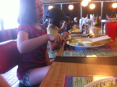
Does that count as healthy? I mean, it's eggs and dry toast, but also, it's Waffle House.

When the girls were too young to go running around in the woods, we drove all over North Georgia in my truck. Inevitably this took us past Mount Yonah and I'd tell Isabel: "One day, we're going to climb that mountain."

 Yonah

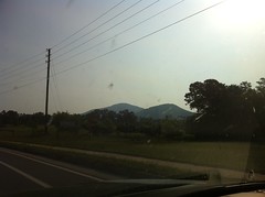
She always thought I was crazy, but I showed her. Today was the day! Mount Yonah day.

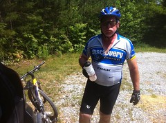
We met Clark's place, and immersed ourselves in his happy dogs.

 Dog Herd

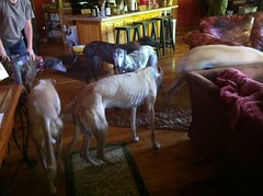
Clark and Suzy tend to a herd of rescued greyhounds. They're very friendly and hypoallergenic as well. Kathryn's deathly allergic but the last time she was up there, she barely got any symptoms.

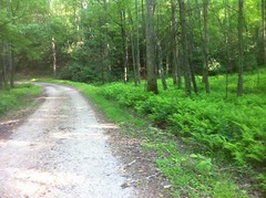
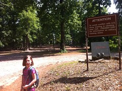
We did some a'settin down for a spell, and then headed out to the trail.

 Mount Yonah Signage

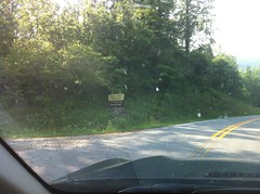
It was about 9:30 or so when we got there, and it was just starting to get warm.

We climbed...

 Clark and the Kids on the Trail

and climbed...

 Clark and the Kids on the Stone Steps

and climbed some more...

 Kids in the Boulder Field

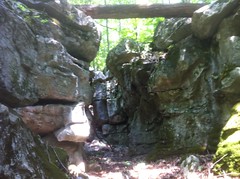
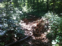
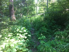
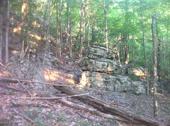
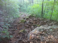
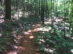
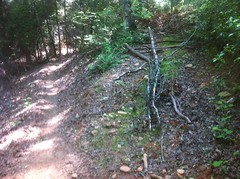
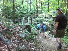
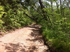
It's a steep hike up Yonah. The first section was all singletrack. There were a couple of little spurs off to either side here and there, leading to the various climbing walls.

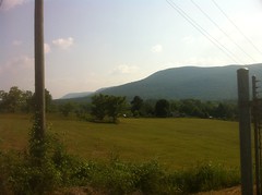
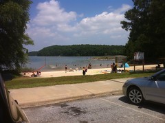
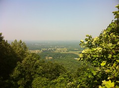
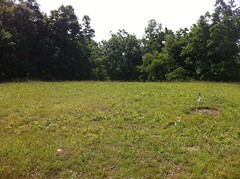
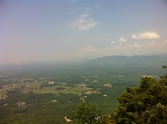
About a mile in, we ended up at a clearing with a great lookout rock.

 Iz at the Lookout Rock

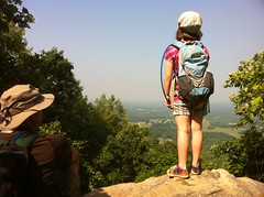
It was hazy out, but we still got a great view of the sprawling piedmont to the south.

 South Valley from Yonah

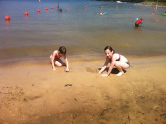
We sat on the rock and snacked.

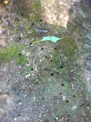
There were a billion ants running around. One of them, for some reason, was dragging the dead carcass of another ant up the rock. "You're going the wrong way, there's nothing up here."

The girls were a little more fidgety and pushy than seemed like a good idea to be. They were jostling for space on top of the rock like it wouldn't kill them if they fell. It made me worry whether they were responsible enough to be up there. We talked about it a little. They are usually very good about that kind of thing.

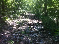
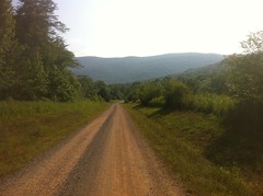
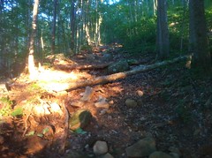
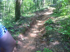
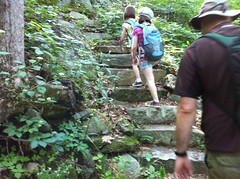
The next leg was a much steeper climb up an old, deteriorated roadbed. Clark said he'd seen marks from tractor tires on it recently. Maybe they run the tractor down and mow the clearing every now and then. I'd like to see that. Except for the very last little bit, it looked really rough.

That led to a forest road, and we followed it up to a campground. Apparently the road leads down to a neighborhood with a private drive and isn't generally accessible.

 Mount Yonah Campground

The Rangers out of Camp Merrill have a key though, and they train on Yonah all the time. I've seen video of it on TV even. That'd be cool to see in real life too.

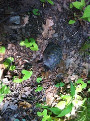
We tried looking out of the back of the campground towards Clark's house. He says in the winter, you can make out his roof, but there was way too much brush in the way today, and it was hazy.

We did find a turtle though.

 Turtle

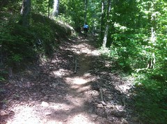
The slog up to the top was steep and gravelly. Sophie was dragging her feet and acting really tired. Both girls had been up 'till 11 cleaning and decorating their rooms. Eight hours of sleep is a long night for me, but it might be short for a growing girl.

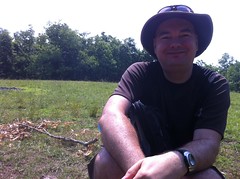
Eventually though, we made it to the top.

 Mount Yonah Peak

There wasn't much to see up there. No view, just a clearing and a ring of trees.

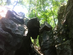
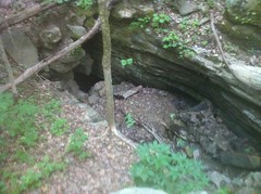
Well, there was also this little oddity. Me and Clark puzzled over it for a while.

 Mount Yonah Lookout Tower Pylon Remnant

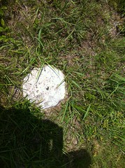
Clark had initially thought it might be a benchmark, or what's left of one. That's possible. It might also be what's left of one of the footings of the lookout tower that used to be up there, but it was in an odd spot for that. A mystery. Somebody knows.

Successful in our summit attempt, we took a break.

 Kids Taking a Break

 Clark Taking a Break

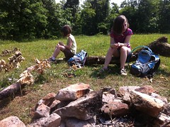
According to Iz, there's "nothing better than sitting around a campfire that's not burning on a hot day." I'm not sure that there's nothing better, but we did enjoy the break. Granola bars and leftover Starburst from yesterday. Apparently neither of my kids like lemon Starburst. They are crazy though, all Starburst flavors are good.

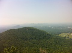
The top of the big rock face that makes Yonah so recognizable was just downhill to the southwest. The views were even better there than the view from below.

 View to West-Northwest from Yonah

 Pink Mountain

Clark pointed out some pitons that had been placed up there for rappelling.

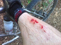
As below, the girls were using slightly little less self control than I'd have liked. Iz slipped on some lichen. Sophie screamed and jumped and stamped around uncontrollably when she noticed some ants. Not the kinds of things you'd want to be doing if a fall could kill you. When they were younger, they were more careful. Now, they're confident enough not to be nervous but not yet wise enough to be generally careful. I remember that from being a kid too, but I wasn't often in such a dangerous situation. We're going to have to work on that, I think. I made sure to stay a little further downhill than either of them, just in case. He didn't say anything, but it looked like Clark was doing the same thing.

The views were great and it was much cooler up there than back at the car, but we had a lot more to do, so we headed back down.

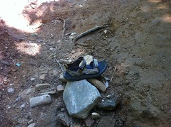
On the way, we passed "The Shoe" and Iz required a photo.

The Shoe:

 The Shoe

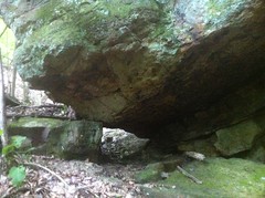
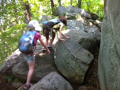
We took a slightly different route down and found a bunch of side trails leading to even more climbing routes.

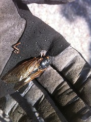
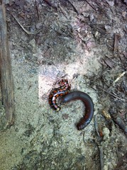
We also watched this crazy looking centipede eat a dead millipede.

 Centipede vs. Millipede

There was also a dead juvenile copperhead getting eaten by a bunch of bugs. I should have taken a picture of that.

About a half mile from the bottom, we passed a group, heading up. "How far is it to the top?" "You've got about another mile and a half." "And you have to walk back down?" "...Yes" It made me wonder. Stone mountain has a gondola that can bring you down if you walk up, but then you'd still have to walk back around. I wonder if there's anywhere that you can climb up and get some kind of a ride straight back down to your car.

Haha! Done. I finally followed up on a commitment from like 5 years ago. We climbed Mount Yonah.

Our victory celebration included pizza and popcorn from the Nacoochee Tavern and it was excellent.

We dropped Clark back off at his crib and played with their dogs for a little while, two of which simply walked outside and collapsed in the grass, with zero interest in the ball. This amused Sophie, substantially.

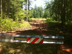
Next up, we had some TNGA recon to do. Tornados had tracked directly across Tray Mountain during the storms last month and who knows what roads were still passable. I know some folks that were planning on doing the TNGA as an ITT this summer, so I figured I'd get up there and take a look. It would also give me an opportunity to see how the Outback handled on some fairly rough terrain.

I had no trouble at all getting up FS79. It handled as well as the Durango had through mud holes and humps. I did slap the nose on the ground once, but I'd done that in the Durango too. The really chunky section of FS79 was fine too. In fact, I got way less body roll in the Outback and I was able to take some lines that I might not have considered in the Durango.

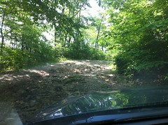
This doesn't look bad in the photo, but I wasn't sure whether I'd make it or not. It turned out to be a piece of cake.

 FS79 Chunkiness

There was one spot where I could feel it shifting power away from wheels that wanted to slip. It made this odd noise that I didn't expect, but I never lost traction. Woohoo!

The tornado apparently came right over 79 because there were trees down across the road for about a quarter mile. Somebody had come in and cut out the limbs that were hanging down, but the trunks were still up.

 Trees Across FS79

I'd caught up to a guy in a Jeep that was too tall to get under one of them. We thought I might be able to, but the bike rack stuck up a few inches too far. Darnit. We had to turn around.

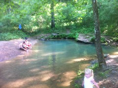
I wanted to check out Corbin Creek and Charlie's Creek too. I'd meant to descend Corbin, but that was out of the question now. We headed back down and around to Charlie's.

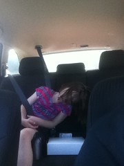
The kids were both knocked out for most of that trip.

 Sleepy Kids

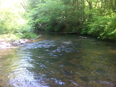
I woke them up as we forded the Tallulah River. It was down. That's something I'm still not too sure of. I'd dunk the Durango up to the hood sometimes, but how deep can the Outback go? We didn't find that out today.

If you check out the novelty maps of North Georgia that hang by the bathrooms in some gas stations, the comment next to Charlie's Creek road is "4 Wheel Drive or a Horse." It appears to be completely unmaintained.

I had a little trouble with this hole.

 4WD or a Horse

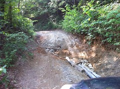
It took 3 tries and a get-out-and-look down from the top to figure it out. I got it though, with no spinning. I wonder if I can get it up Hawk Mountain.

There were no trees down on Charlie's Creek. It didn't look like the storms had gone up that way at all. We circled back around to Corbin Creek but right at the bottom we ran into some folks who'd just driven up to Trey and back with no trouble. It was open all the way. All right!

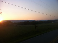
We took their word for it and headed home. It was still light outside when we grabbed some Moe's in Dawsonville and the girls were in bed by 9:30.

Ahh. It was a long day, but a long, productive day. We can cross Yonah off the list. It's also nice to know that some of the roads I was worried about are passable. I still need to check out the Hickory Nut though. It wasn't directly in the path, but you never know. Maybe I can do that this weekend. I think we've got a work party at Bull this weekend too.

Busy, busy, busy.

Pigeon Mountain

This past Saturday I was feeling about 70%. Well, maybe 60%. I was feeling substantially less infected. My nose was less sore, but was still on antibiotics and still generally weak. I wanted to take it as easy, but still do a ton of riding. There was an obvious destination. I left it half explored a few weeks ago and I've been itching to get back: Pigeon Mountain.

Pigeon Mountain is a long way away so this time I got up reasonably early and didn't feel rushed to get there. I passed some houses along Hwy 136 that, though not destroyed by the tornadoes, had clearly been damaged. There were no cars in driveways, and tall piles of belongings lay stacked in driveways and under front porches. I can only imagine what they're going through.

I rolled through Villanow and LaFayette, grabbed a soda at Uncle Jed's and parked on the north side of Dug Gap.

The cicadas were screaming. Has it been 7 years? I guess it has. Apparently they make two noises. One I was familiar with. I heard it all night, every night in Louisiana. That deep, oscillating, perpetual chirp thing. The other I'd never heard before, or at least never noticed. At first, I thought it was a distant tornado siren, then maybe that it was frogs, but then a cicada flew by and I heard it close up. I guess when ten billion of them fly around, it makes that droning siren noise. Wild.

They were flying around everywhere, and their corpses littered the ground. You couldn't look anywhere that you didn't see at least one.

 Cicada

It was the great cicada plague.

But I hadn't driven all morning for ten billion bugs to get in the way. Time to ride. I followed the fire road up and around to the West Brow Trail (Cane Section) and out to the campsite at the end of the road there. While attending to the call of nature, I noticed two different species of Trillium.

 Trillium 1

 Trillium 2

I'm pretty sure that top one is a trillium. If it's not, somebody tell me what it is. It looks trilliumish.

From there, the trail became singletrack. It was very technical, and there were quite a few trees down, but it was ridable and relatively fun for a while. I was crawling though, taking it really easy, picking my way through rock garden after rock garden.

At Walker Branch, I noticed a neat little canyon looking thing upstream, just off trail.

 Walker Branch Mini Canyon

When it's wet, water must flow between the rocks. It was totally dry for me though. Up in there a bit, there was a scary chunk of rock balanced above my head.

 Walker Branch Mini Canyon Balancing Rock

The trail eventually became a very long series of extremely rocky, chunky climbs...

 West Brow Trail Cane Section Rockiness

...and extremely chewed up and rutted out climbs.

 West Brow Trail Cane Section Ruts

It was like 95 degrees outside and every creek was dry, but somehow the trail itself was damp and soft. I walked, pushed and carried for at least half of the distance and at least 2/3rds of the time. It was all uphill, very rocky and very steep. I think it would have been more fun in the other direction.

At great length, I got to a 4 way intersection and took what I figured must be McKutcheon Springs road to the southwest. I have to admit that I was glad to be off the singletrack. I hoped that the Chamberlain trail would be more fun. I'd ridden it once before, 4 or 5 years ago, when it first opened. It was a blast back then.

It turned out to be more fun than West Brow, but not fun in the absolute sense. It was definitely interesting. The first quarter mile was fast and flowing with a couple of downed trees. Then there was this crazy (dry) creek crossing.

 Chamberlain Trail Dry Creek Crossing

I remembered it from the last time and I'd half hoped that since then I'd have picked up some new skills and it would look ridable, but alas, I could see a line but I wasn't confident enough to try it.

Almost immediately, the trail became overgrown and strewn with rock. It reminded me of the Hickory Nut, though even the Hickory Nut is generally clearer than this.

 Chamberlain Trail Overgrowth

The overgrowth ended as abruptly as it began. I crossed several dry streams that tested my rock crawling skills. And, of course, I found a mylar balloon.

 Mylar Baloon

(I packed it out)

Near the end, I passed through a clear cut and at the absolute very end, a ton of thorn bushes that shredded my left arm, and for some reason, only my left arm.

There was a horse trailer in the Chamberlain Lot, but they must have been way up on the mountain somewhere. I hadn't seen them or anyone else all day.

It seems like I always forget something when I leave the car, and this time it was water. I mean, I had water, but I hadn't filled up my camelback and I just had whatever was left in there from last weekend, so I rolled up on Uncle Jed's and tanked up from their hose out back. I also ate a couple of chocolate donuts and starburst. High quality calories there.

I had an idea where to go next. I've seen it on the map a bunch of times, but never been there: The Blue Hole.

The ride over offered a good view of Pigeon. I was up on top of that earlier.

 Pigeon Mountain

The Blue Hole road was long and dusty.

 Blue Hole Road

Cars drove past me in both directions. It must be a popular place.

When I got there, it wasn't quite what I expected. The Blue Hole, in all it's glory:

 The Blue Hole

It was definitely blue, but also really small. I guess knowing there's a quarry nearby, I expected it to be an old quary that had hit a spring and filled in with water. I'm not exactly sure why. Maybe because I've seen it shown as a little blue circle on some maps and expected the circle to be to scale.

Still, it was a cute little swimming hole. There were a dozen kids and their parents hanging out along the edge. Nobody really wanted to get in the water though. I discovered why a minute or two later. The water had to be around 45 degrees.

Given how hot I was, it felt great, but I don't imagine it would have been all that great if you left an air conditioned house and rode over in an air conditioned car.

I stripped down to my bib and walked all around in the water. There are two distinct holes where the water comes up out of the ground. One of them was deep enough to get completely submerged.

Climbing back out, I managed to drag my shin across some little rocky ledge. My skin was numb though, and I didn't even feel it cut me.

 Shin Dank

I only noticed later when I started to warm back up and felt the blood running down around my toes. It's amazing. I managed to get a classic bike wound, in the middle of a bike ride, but not from riding my bike.

I didn't see or hear any cicadas on that side of the mountain, but the holes they'd crawled out of were everywhere.

 Cicada Holes

...and I do I mean EVERYWHERE. In a year or two, I should be able to randomly dig up a shovel-full of dirt from anywhere in North Georgia and find ten or twenty of them.

Refreshed from my swim, I had a point of confusion to resolve. The map showed a trail leading back up to the top of the mountain from the Blue Hole area. There were two, unmarked trails leading away from the Blue Hole itself. Neither looked especially bike friendly. I talked to a group of cavers about it. They hadn't been down either trail, but they were pretty sure that one of them went up to a cave with a deep rappel.

I gave the shallower trail a try, but after a few hundred yards, it was pretty clearly leading in the wrong direction.

I'd seen a nondescript, overgrown-looking fire road heading off to the right on the way in. Maybe that was it. Yep, that was it. It was overgrown for 50 yards or so, then opened up and except for a few downed trees and some extreme steepness, was a much nicer trail than I'd ridden yet that day. There were only a few sections that I had to walk and never for very long. It was about like Tibbs, if Tibbs had never been opened to ATV's.

Near the very top, I noticed the mouth of a cave. Ellison Cave, I later determined.

 Ellison Cave

I think that's the name of the cave the guys had told me about earlier. I wonder if the trail leading away from the Blue Hole leads more directly to it.

Nearby there was also this crazy balancing rock where a stream flows through the gap between the big rock and the one it's sitting on.

 Balancing Rock

All that was right up at the top of the trail and before long I was back at the same 4 way intersection I'd been to at the beginning of the day. It was about 7:00 then. I had about an hour and a half of daylight left. I figured I'd descend the Pocket Loop and take the Estelle Mine trail back to the car.

The Pocket Loop looks like a long descent on the map, but there turned out to be a bit of climbing at the start. On the Pocket Loop, the 3 R's are emphasized: roots, rocks and ruts. The short little climb was demanding and the ensuing descent was even more demanding. There were sections that were a lot of fun, but I could never roll for very long without having to dismount and heave my bike over a downed tree.

There was a cool rock wall running along the left hand side of the trail and every now and then there'd be a big block of oddly shaped rock separated from the wall, sitting near the trail.

 Rocky Wall and Block

The entire hillside, in fact, appeared to be terraced with a long series of rock walls and flat ground between them. The rock was very geometric. It looked like the "lego cliffs" I'd seen up near Keown Falls a while back. I'd read once that the whole area is either currently owned, or was once owned by the Estelle Mining Company. It made me wonder if that hill had been quarried, top to bottom and I was just seeing what was left some decades later.

I arm-wrestled the trail for a couple of miles, then it turned even more downhill and became a full-on WWE Smackdown. It was by far, the most heavily deteriorated, marked trail that I've ever seen. For half a mile, I'm not sure I rode more than 50 feet at a time. In fact, "ride" would be a liberal description of what I did. Basically I alternated between yanking over one obstacle and then balancing while gravity gently pulled me over the next.

Looking down the trail...

 The Pocket Trail Looking Down

Looking back up...

 The Pocket Trail Looking Up

And these photos really don't capture it.

There were water bars scattered here and there, some suspended in mid air, only distinguishable from deadfall by the long, bent-over nails at either end. Others still sat on narrow pillars of soil, totally eaten out on either side. It was a rough trail for sure. I think it might be the roughest I've ever ridden.

As it flattened out, the character changed abruptly and the trail transitioned into a gravel road. I saw signs for the Estelle Mine Trail but it was already getting pretty late and I opted for pavement instead. The mine trail will have to wait.

The sun had already dropped below Lookout Mountain.

 Lookout Mountain

I made it back to my car right at 8:30.

Wow. After crunching the numbers, it turns out that I climbed over 5000 feet, in 30 miles, 10 of which were dead flat road, so actually 5000 feet in 20 miles. I averaged under 5 miles an hour, including those road miles. That was a crawl.

I really wouldn't recommend anything I rode to anyone that isn't in the mood for anything other than pure exploration. West Brow might have been fun as a downhill, except for all of the downed trees. Ditto for Chamberlain. Actually the fire road leading to the Blue Hole was pretty good, so I might recommend that. If there had been fewer downed trees, long sections of the Pocket Trail might have been fun, but that last section was nuts.

The traffic up there appears to be mostly equestrian and the trails are mostly fall-line and steep enough to get chewed up. By hiking or mountain bike standards, they're highly deteriorated, but judging by the number of hoofprints I saw, they don't seem to be a problem for the equestrian community, they're just challenging trails. The environmental impact is hard for a layman like me to judge. With a few notable exceptions, the trails are mostly way up the mountain and the streams mostly cross them at right angles, and I imagine those streams are dry for half the year. I'd also bet that what water does flow out is impacted more by the farms and industry at the bottom than the trails. There might be some specific bug or fish or something that's suffering though, it's hard for me to say.

So, was it fun? Kind-of. I love exploring, I really got to test my rock crawling skills, I saw and did some interesting things, met some interesting people and didn't break myself off. I'm not so sure about fun, but I'll put it in the "worth having done" column. There are still a few trails up there that I haven't ridden yet too, so I imagine I'll be back. You never know, they might be awesome.

Saturday, May 28, 2011

Keith Bridge Park

I'm still trying to kick this plague, so the kids and I took it easy today. Again.

Sophie had a great idea. Let's go swimming.

Mary Alice Park and Lanier Beach are pretty close, but they cost $4. Darn that $4. The internet didn't mention a day use fee for Keith Bridge Park, so we went there, after grabbing some lunch at Fat Phil's Grill. It turns out Keith Bridge costs $4 too. Yay internet.

No matter.

Iz was all "It's so tiny!"

 Beach at Keith Bridge Park

It's not that tiny. It's like 50 times the size of a pool and when we got down on the beach, it seemed about the same size as Mary Alice or Lanier. I guess framed out by trees, it looks smaller from far away.

Tiny or not, we had huge fun. We waded and swam. I just grabbed Sophie and threw her as far as I could about 10 times. Iz wasn't having any of that. There were other kids there too that played with us.

Fish bit my ankles. The large, flaky silt in the water made it look like we were swimming in gold glitter. Later, Kathryn even asked Iz why she had glitter in her hair.

When Sophie's lips turned blue and she couldn't stop shivering, we got out and the girls dug in the sand.

 Playing in the Sand

I did feel a little out of place without neck tattoos and a pack of smokes but it didn't seem like anyone noticed.

On the way out, we passed the Park Ranger who was writing tickets to everybody who didn't pay their $4. He had written quite a few, but when he saw my tag he smiled and waved all extra friendly. Hah!

Great day at the beach. Now that it's warm enough, we'll have to do more of that.

Tuesday, May 24, 2011

Jake Mountain

Sunday morning I felt less sick than Saturday. I wouldn't call it well, but definitely better. My parents are in town and my Dad wanted to go ride at Chicopee with me and my brother, but my brother couldn't make it and I needed to do some Jake Mountain recon, so we headed up there instead. He met me at Holcomb Bridge and we carpooled up to Jake.

Great photo here:

 The Padre

"It's warm out today. It was warm yesterday.... Warmer today." 95 degrees. Georgia springtime. It'll be 50 degrees next week, just watch.

There was a dual sport bike event or something going on nearby. We'd seen a Sprinter van parked by Nimblewill Church and a rider heading down into the Jake Campground. He had put his blinker on when turning off the main road, and when we saw him headed back out he'd forgotten to turn it off. Later on we saw some more riders, with matching tee shirts. I wonder if they were doing a poker run or something.

Right as we parked, I got a voicemail from Russell. He'd apparently just left after riding all the trails that we were planning to ride. We must have passed each other on the road without realizing it. Darn!

We screwed around with our gear for half an hour, and eventually got down to business. I'd heard that there was a new trail connecting Jake Mountain to the the Bull/Jake Connector, so we headed over to Jake to check it out. I had been mistaken though. Jake was closed.

 Old Jake

Ohhh! There might be an entirely new Jake trail! Maybe that's what's going on. Oh, man!

There were 2 reasons I wanted to ride at Jake.

First, I just wanted to get GPS data for the new trails. The Fool's Gold is coming up and if the trails we use have been shortened significantly, I'd need to do some re-figuring of the route. I'd heard that Black Branch in particular had become a good bit shorter.

Another objective was to examine the new construction. As I understand it, and have observed, bikes and horses tend to ride directly down the center of the trail. Hikers tend to walk on the very outside edge. Nobody knows why, or at least I've never heard that anyone knows why, but that's what apparently happens. When a trail is fresh-cut, the soil is soft and as it gets worn in, on a bike/horse trail, the center gets packed down. On a hiking trail, the outside edge tends to get packed down. The inside edge tends to get filled in by slump and deposition from the backslope. The outside edge tends to slough off. These forces fight each other, but you often get berming on a bike/horse trail and creep on a hiking trail. Not long after the initial cut, you usually need to go back and deberm the trail, nick the turns, clear the turnouts, and so on. There is probably a formal process that trailbuilders go through. I need to get a little education on that actually.

I expected to see some berming and there was some.

 Berming

Some folks on the Sorba forum had reported as much earlier in the week.

It was present along most of the trail, though I noticed something I haven't noticed before. The steeper the downslope, the more sloughing off of the outside edge had occurred and the less berming had occurred. It was consistent along the length of the trail, and later I noticed it on other trails later too.

The upslope was filling in, as expected. There's work to be done, but so far, it looked pretty good. The initial cut looked like it might have been 3 feet wide, but it'll be 10 inch wide singletrack before long.

I expected a couple of reroutes here and there, but Jake was an almost entirely new trail. Most of it was IMBA-looking singletrack; bench-cut with grade reversals.

 Sidehill With Grade Reversals

The grade reversals were a little shallow though, not the deep kind I've seen at FATS or Jackrabbit. Will they hold up? I'm a little concerned about that, but we'll see. One section of the new trail criscrosses the old trail all the way down a long hill. The trail there is much less sidehilly an there are short runs of fall line trail. I'm curious how those will hold up too. They are short runs though. We'll see.

The new Jake has been open for a while and appears to have gotten a lot of equestrian traffic since it opened. Despite the heat, we even ran into 2 riders on horseback a mile or so out from the campground. There were hoof prints everywhere, but they were little shallow footprints and barely even made the trail bumpy. It looks like they got the grade right. The wear appeared to be entirely compressive. I didn't see any shearing (chewing up) at all, just packed down trail. It was extremely fun to ride and I imagine it's just going to get better over the next few months.

I did see this and thought "Oh, man, what a disaster, the rest of the trail was so nice..."

 Old Trail Below Grade

But it turned out that's right where they tied into the old trail to cross Jones Creek and that was the one bad spot that I saw all day.

We walked across Jones, it was mid-thigh deep, and the cool water was delicious.

 Jones Creek

Both sides of the crossing had been armored with gravel and rock and looked like they'd held up well over the past few months.

The ruts on the unclimable climb on the other side had been filled in a few months ago and a bunch of rock had been littered around on the lower section. The Padre climbed it easily.

 Unclimable Hill

That section used to have a trench down the middle and will almost certainly, eventually get wrecked again. It's just too steep and the horses slip. Fortunately it's over a hundred yards away from the creek, and it took decades for it to get wrecked last time. Hopefully it will take another couple of decades to get wrecked again.

The new trail diverged again shortly after the climb and eventually teed into Moss Branch.

Somehow, my dad broke the visor on his helmetm right when we stopped at the intersection and had to fix it with some duct tape.

 Visor Maintenance

Moss Branch had received the same treatment as Jake, though the unclimbable hill past the creek crossing had been rerouted rather than patched up. That's it up to the right, with the new trail straight ahead.

 New Moss Branch

Actually it looks like they patched it up, then closed it after scarifying the soil and dropping trees left and right across the trail. There was new grass was growing up in between the trees.

Either side of the creek crossing had been armored with rock and gravel like Jones too.

From there to FS28-1, it was new cut, flowing singletrack.

On 28-1, we ran into a pair of riders, out for some base miles. It was blazing hot on the road. We followed them for a while, then pulled off toward Black Branch for a little more recon.

The new Black Branch trail was similar to Jake. IMBA-ish, but not quite perfect. If there's anything I'm worried about, it's the shallow grade reversals. I'm just not sure about them. I know water can't flow up hill, but I can imagine them getting flattened out. Black Branch hadn't been open for long and it was still insanely bumpy. There was very little berming yet, but I imagine that's coming. It's getting worn in quickly and it won't be long before it's as smooth as Jake, but it isn't yet and in the mean time, the hoofprints are tooth-rattling. Russell had ridden it on a rigid singlespeed earlier that day and it wore his arms out.

Somewhat in keeping with the character of the old trail, there's a long, fast descent on the way in, which tied into the old Vietnam trail right at the creek crossing, and then left it again almost immediately. The second half had been rerouted around the most rutted out climbs, but otherwise utilized the existing trail. My Dad's been riding in Dallas all year and was not amused with the rollers near the end.

The trailbuilders didn't screw around with the sections of the old trail that they didn't use. The parts that we could see from the new trail looked scarified and they'd dropped trees and ebris across them, left and right, for as far as we could see.

We ran into another guy on horseback where you pull off Black Branch over to 28-1. He passed us and headed off at a gallop. I'd never actually seen a horse galloping off down a trail before. It was almost like watching it in slow motion. The horse covered lots of distance with each bound, but didn't look like it was working very hard. It reminded me of watching the mountain lions run around in their pen up on Grandfather Mountain. It's amazing how quickly and effortlessly a large animal can cover a large distance.

We headed further north on 28-1, up past Wahsega, past Merrill. I never realized how long of a climb it is from there. It's just one long climb, all the way up and I was feeling it. I was able to sit back and take it easy, but I had to. Still, I was feeling a lot better than the day before, like being outside was doing me some good.

On 141, we took the Bee Trail to Montgomery Creek Falls, AKA False Black Falls, ditched the bikes and went for a swim.

 The Padre at False Black Falls

We played in the water. We swam in the pool. We sat on the rocks.

 Shoals Below False Black Falls

The water must have been 60 degrees, but with the air probably 85 degrees, it felt even more delicious than Jones Creek had earlier. We felt like we'd earned it too. There's nothing better than a refreshing swim on a long, hot day.

Woohoo!!!

 Me at False Black Falls

Cinnamon ferns encroached along the rest of the Bee Trail and they smelled awesome. That trail has healed well since last year's mess. I couldn't even immediately identify the sections that we'd had problems with.

On 141 there were signs about logging activity, but so far we had seen no logging, only more of the same lush fernery we'd seen earlier.

 FS141

Eventually we ran into the logging operation, but it was Sunday and everybody was off. We saw one clear cut, two or three strip cuts and a ton of select cuts. Select cuts? I think that's what they're called.

One funny thing... The signs called the area "Pin Cove" but I think they meant to call it "Pen Cove", which is short for Penitentiary Cove. There's a cove to the northwest called Penitentiary Cove because of how steep the surrounding slopes are. I've heard that there is old growth forest up in there because it was too steep to log. Maybe there's even some longleaf pine up in there. I've walked way back along the upper reaches of Montgomery Creek but I never ran into any old growth. I've always wanted to walk down from the top though. I'll have to put that on the list.

141 seemed like an endless grind, as did the connector trails over to Moss Branch. My Dad and I were joking about this thing a friend of mine, Ruth had said on Facebook last week. It was something like "I'm going for this long ride, meet me at such and such, bring an overstuffed camelback and a roll of duct tape... for your mouth, if you start to whine." We had some duct tape, so we made sure not to complain, lest we'd have been required to use it.

The Moss Branch Connector was also new and as rough as Black Branch. Moss Branch proper had apparently been opened sometime between Jake and Black Branch. It was about halfway between them in roughness. A good bit of the northern end Moss Branch just reused the old trail, but there was a long section of new trail as well.

At the intersection with Jake, we headed back to the car, our missions accomplished. At Jones creek, we took extra time wading across. It was hard not to just stand in the water for 20 minutes.

Kathryn called my phone, which for some reason had service. Since I was climbing a long climb, slowly, I answered and talked to her, but it took her forever to explain what she wanted and I kept worrying I'd get done with the climb before she got to the point.

On that same switchback climb, my Dad became officially worn out. He started cramping and had to stop and rest. Afterward, the cramps didn't return, but he still struggled. We were only two miles from the car, but he said if it had been three, he'd have had to stop again.

Done.

Now that I've had a chance to analyze the GPS data and crunch the numbers, here's how the distance stacks up. I'd heard reports of Black Branch being cut in half and so forth, but it didn't feel that way riding it. The numbers don't lie though.

Old:
Jake Mountain - 2.12
Moss Branch Connector (Old) - 0.87
Moss Branch - 1.88
FS28A cutovers - 0.45
Black Branch - 3.25
------
Total - 8.57 miles


New:
Jake Mountain - 3.03
Moss Branch - 3.6
Moss Branch Connector (New - replaces FS28A cutover) - 0.49
Black Branch - 2.34
------
Total - 9.46 miles

Black Branch is about 2/3rds of it's former length, but there's about one net mile more of total trails. Some of the designations have changed too.

Heat, illness and struggle notwithstanding, I had a great time. It wasn't a major adventure, but it was exactly what I wanted to do. My Dad alleges that he had a good time too and says he's not even sore today. Excellent.

This morning I felt great, but by mid afternoon I started feeling sick again, and got a series of nosebleeds. When I got home I had a fever and all but collapsed on the couch. I'm only up now because I was waiting for a report process to finish for work. It's done now though, so I'm about to sack out. I'm going to the doctor tomorrow. I don't know what I've got, but it's killing me. I need to kick this thing and get back to knocking some of those real adventures off my list.

Update: Current map and GPS data is available here: Bull/Jake Mountain