Sunday, May 31, 2015

Upper Chattahoochee

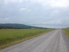
Yep, still exploring the Upper Chattahoochee. My map had a half dozen little dotted lines running from FS44 off into the woods, and this past Saturday seemed like a good day to find out where they go.

Sadly, few of them went anywhere interesting, but there is still a bit of a story to tell...

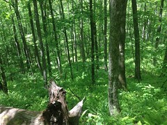
I drove up to Unicoi Gap and descended 44. I'd park at each little side trail, go walking off down it, come back, and repeat, over and over, all day.

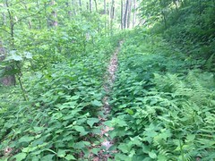
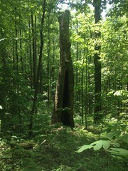
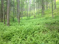
The first trail I hit was some little trail along some little unnamed feeder of Wilks Creek, not even a blue line on the map. It was overgrown from the start and based on the trash, it appeared that people camped across the street like to use it as a bathroom. The trail started as a little bench cut, but after crossing the creek, there's a bunch of deadfall, and after that it's clear that nobody goes that way any more.

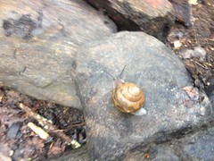
There was a bunch of this weird fungus growing all over up there...

Weird Fungus

...but other than that, nothing else all that interesting up that way.

The next little side trail wasn't any more interesting. It started off wide open, but I think people still just camp there regularly. A trail continued, but it was choked with deadfall. According to the old topo quads, there was a food plot back up in there at some point, but it's long, long gone today.

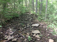
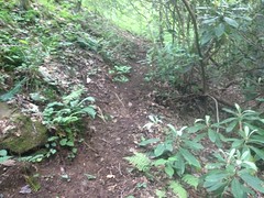
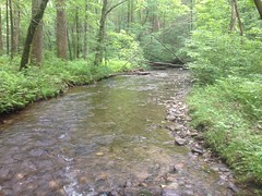
The third trail was, finally, somewhat interesting. It dove down to the Chattahoochee, crossed it, crossed Wilks Creek, and ascended in the general direction of FS178.

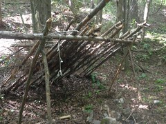
Down by the river it looked like people still camp sometimes. There was some modern-ish looking trash down there, but it seemed like most of the traffic that campsite gets was pretty old. There was a corroded old 55 gallon drum nearby with what looked like garbage spanning 20 years or more spilling out of it.

The most interesting thing though... Somebody had lugged this big chunk of metal down there, I guess to grill with.

Grill

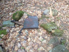
I couldn't identify it. What's that from?

I guess it makes a good grill.

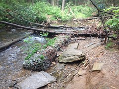
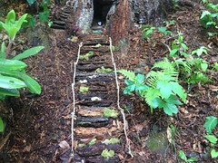
Further down the trail, at the next creek crossing, there were remnants of an old bridge.

Old Bridge Remnants

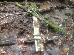
Boards and boards, some still nailed together. Big square nails.

Gnarly.

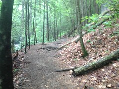
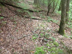
The trail was punctuated. After each tangle of deadfall, it was noticeably more overgrown. I guess people just got less and less motivated to keep following it over the years.

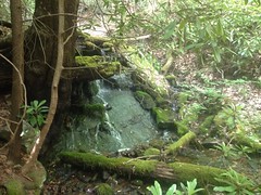
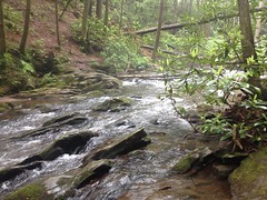
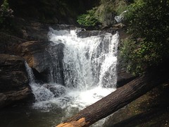
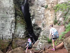
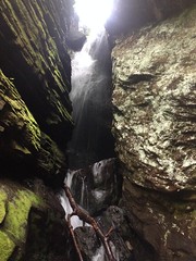
For a while, I could hear loud cascading falls to the right, but the woods was so dense, there was no way to see anything. The trail finally crossed the creek up near this tiny little 4 foot cascade.

Tiny Waterfall

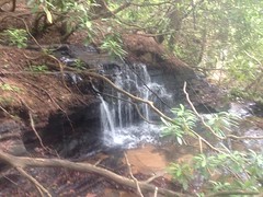
But that was the best view I could get of what sounded like it must be an impressive falls.

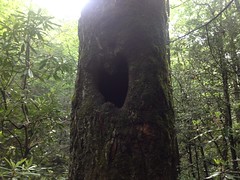
I followed the trail as far as I could. It eventually appeared to dead-end into another one. I wasn't 100% sure where I was though. The terrain was fairly complex, the woods was dense, and I couldn't see any landmarks. Turned out later, when I got home, and looked at my GPS data on a map, that I was where I thought I was, but I wasn't certain at the time. It also turned out, that the trail I was on is actually shown on this old map from 1980 (or is that 1960? I can barely read it) and if I'd kept going, it would have teed into 178 near Horse Bone Gap. Dangit. Guess I'll have to get back up there and connect the dots someday.

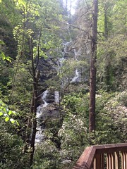
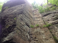
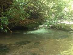
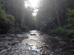
On the way back, I did some rock hopping along the Chattahoochee itself to try and find where that creek with all the cascades tees in to it. I found it, but from the bottom it looked almost exactly like it had up at the top. The backslope was basically a cliff too. There was no easy way up. If there's a decent falls back up in there, it's possible that nobody has ever seen it.

The river itself was pretty interesting at the confluence there, though. There was a natural pool that turned out to be about waist deep. The water was cold though, and the air down there couldn't have even been 80 degrees. Rivers are great when it's super hot. Not so nice when it's cool.

Pool

Next stop, Jasus Creek. For years and years, I'd seen a gated road that appeared to parallel the creek. Old maps show it too. Turns out, it goes right where the maps say. Right up to a food plot.

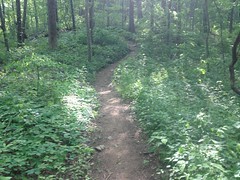
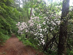
The road is beautiful. I'm sure it's less spectacular in winter, but it was beautiful yesterday.

Jasus Creek Food Plot Trail 1

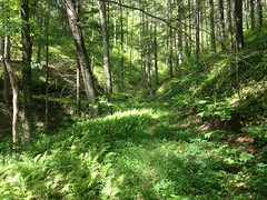
Seems wrong to call it a road, even. It's singletrack on a roadbed. Doesn't look like it gets much traffic.

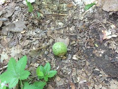
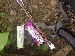
Of course, I found a balloon.

Mylar Balloon

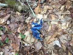
Or what was left of one, at least.

Above the food plot, the road became braided and overgrown and crossed the creek over and over. If it emerges from the creek somewhere, it's not clear where, and at the time, I wasn't sufficiently motivated to keep pushing through the rhododendron.

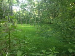
Instead, I just got up on the backslope and headed back downstream. The cove itself was as scenic as the road had been earlier.

Jasus Creek Cove

As was the creek itself.

Jasus Creek

It's easy to see why it's such a popular place to camp.

There were fishing trails up and down the creek too. One approached the same food plot that the road had led to, but didn't seem to go any further.

Hmmm... It seemed that I'd explored the area sufficiently well.

I moved on.

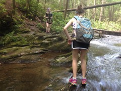
My last stop was down at the intersection of 174 and 44. There was a scramble along the east side of the river and two old logging roads. The scramble was kind-of fun, actually. The roads, less so.

The first just paralleled the river. It seemed to get a bit of traffic too, as it was pretty wide open for a while, and most of it was carpeted with mountain laurel.

Laurel Carpet

Eventually though, after crossing a little feeder, I encountered the tallest tangle of downed trees I've ever tried to climb over, in my life. At the highest point, I was probably 8 feet off of the ground. After climbing down from the highest trunk to the next highest, I took one step and bam! Ate it. It would seem that my that-looks-slippery skills are not yet back up to par. Fortunately, several amazing things happened. I landed on my back, on the same log that I'd slipped on, and somehow, managed to remain on that log, and not fall any further into the tangle below. I also managed to keep from hitting my head. And, most amazingly, at the time, I had my iPhone, GPS, and map, all three, in my right hand, and didn't drop any of them. That is important to note for later.

Ok. So, shaking that off, I much more carefully climbed down off of the pile and pushed on. It seemed that I was alone in pushing on though. Nobody had come that way in a very long time and before long I gave up even trying to keep going.

On the way back, I opted for the under-rather-than-over route through the tangle, and it worked out a lot better.

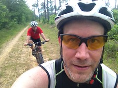
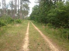
The last trail of the day ascended up to Hargret Ridge and ran along it for a little while. It's flat up there, and it's hard to follow an old road across flat terrain. There's no bench cut to look for, just old tracks. I'd go for a while without seeing anything, and right when I'd figure I was just following a game trail, I'd find two clear, linear impressions again, usually leading directly into another laurel thicket.

It was getting late. I was thinking about calling it a day, and at that point, I realized that my iPhone wasn't in my hand. Oooh. I'd thought it was. I checked my pack. Nope. Checked again. Nope again. Maybe I'd left it in my truck. This has only happened once before, and that time I had left it in my truck. I hoped I had again. For all I know, I'd dropped it randomly pushing through some bit of brush though. On the way back, I looked hard. And, as it turned out, I had one thing going for me in my search. I keep the phone in a Lifeproof case, and I'd recently replaced my old worn out black case with a new purple one. The purple one was gaudy and thus cheap, but being purple, it was also a different color than anything else in the woods. A black phone might go unnoticed, but a purple one was much less likely to.

No luck on the trail though. I checked the truck too. No luck there either. I could imagine my phone, lying there in the woods like all those balloons and beer cans I've found, but safe in it's case, good as new, until some explorer from the distant future randomly runs across it.

About that time, it occurred to me that I might have dropped it when I fell earlier, and just not noticed that it was missing while I was shaking off the hit. That seemed to be the most likely scenario. I still had time to get back to that location before dark too, so I took off up the trail. Not 100 yards later, I found it, lying in the middle of the most wide open section of the whole trail. Nothing challenging there. No idea how I managed to drop it there, nor how I managed to not notice that I had.

Ahh, the relief though! The relief!

Time to call it a day.

Middle of the Chattahochee

I grabbed a chicken parm sandwich at the Nacoochee Tavern. Some guys were ziplining by as I returned to my car. The drive home was definitively peaceful. This time of year, there's this blue haze everywhere right after the sun goes down. Every window is a dim yellow glow. Sometimes the fields are foggy and sometimes there are fireflies. I was tired and a little beaten up. My stomach was full. It was easy to relax...

The perfect way to end the day.

Monday, May 25, 2015

Upper Chattahoochee

"My wanderlust knows no satiety" is how I described my state of mind on Clark's voicemail. I'd hoped that his had grown a little dissatisfied as well, and perhaps it had, but he proved to be difficult to get a hold of as this past Sunday approached. We both have busy schedules and it's difficult to coordinate sometimes. He did end up calling me back, as it turned out, but I didn't get the message because I was in the middle of the woods at the time.

"The middle of the woods" being the Mark Trail Wilderness between FS44 and the Blue Ridge.

I drove up there Sunday afternoon and got on the trail around 1:30 or so. Just getting there was its own Adventure though. Being the Memorial Day weekend, cars were backed up for miles north and south of Helen. As I saw the line of cars, I spun back to a gas station to hit the restroom, grab some snacks, and fuel up, only to find that they were out of gas except for premium. Fortunately they weren't out of food, and their bathroom was in good shape. To get where I was going though, I had to take Asbestos road and Alt 75 around Helen, and to fuel up, I had to hit the gas station north of town in Robbinsville, which was as busy as I've ever seen it. But! Then, finally I was able to get on the trail.

"The trail" being the Upper Wilks Creek Trail. That's not an actual trail name. I named it that. Clark and I started exploring it the last time we were up that way, but gave up as it merged with a nearby creek and became this soggy mess.

Crail

I pushed through that this time though, only to eventually find the actual end of the trail, for real, not much further up. Turns out we weren't missing much by having turned back where we did.

When the trail petered out, I kept going uphill. Old FS44F was up there somewhere. Of that I was certain. The hillside did get pretty steep before I found it, but fortunately I've shed some of my winter pork and it wasn't like last time where I had to walk 20 feet, rest, walk 20 more, rest... I was able to keep moving the whole time, albeit slowly.

Up on 44F, the gall wasps appeared to have been having their way with the local foliage.

Gall Wasp Ball Another Gall Wasp Ball

There were other insects flying around up there too. I saw a pair of some weird bee-looking things (but not gall wasps) mating - hooked together, one flying backwards, like love bugs. I've never actually seen that, except with love bugs. Those were the only interesting insects. The rest of them just kept landing on me and crawling around.

The foliage itself was somewhat interesting too.

Lots of Chestnut...

Chestnut

...and Striped Maple...

Striped Maple

...and tickweed...

Tick Weed

(just what I all it, I'm sure it has a real name)

...and Wild Azaleas!...

Wild Azaleas

...and May Apple...

May Apple

...and the Trilliums that me and Clark saw last time are really getting big now.

Trilliums

The backslope was covered in ferns. Ferns forever. Nothing but ferns. As far as the eye could see.

Ferns

As interesting as all that was, I had another objective being up there. Last time we were up there, me and Clark had followed the Naked Mountain Branch Trail as far as it seemed to go. But then, later, when I compared the GPS data to the old low-res USGS quads, the route we'd taken didn't come close to matching the map, above the waterfalls. There'd been a spur that we hadn't taken, and I'd seen a spur leading down from 44F. I was curious if the two joined up.

The spur was tough to find though. It was super clear last time, but since then, everything has leafed out and the brush had grown up. I walked past it and back past it, 3 or 4 times before eventually just walking downhill until I found it and then backtracking to find where it hits 44F. If I hadn't known it was there, there's no way I'd have seen it.

But I did find it, and it was semi-easy to follow, and it sort-of went where I expected it to, and I made a few discoveries before it joined back up with the trail we'd been on before.

First, there was this gnarly old poplar shell.

Old Dead Poplar

All the limbs were gone, but the bark still looked kind-of alive. It was quite large. I could have climbed inside of the hollow. In retrospect, I should have taken a photo with the camelback in front, for scale, but that didn't occur to me at the time.

Further down, there was this big chunk of pyrite in the middle of the trail.

Big Chunk of Pyrite

It was like a foot and a half across. Again, should have put the camelback down there for scale.

And then there was this old cable.

Logging Cable

That's about the dozenth cable I've found way up in the woods. It might have been tied across the trail at some point, or maybe it was used to haul logs out at some point. Either way, it's been up there for a long time.

When I got down to Naked Mountain Branch, I wasn't 100% sure that I was on the right trail. It seemed like I was following the right creek, and it seemed that I was in the right general area, geographically, but I didn't recognize it at all with all the brush and leaves.

Passing the little shelter along the creek confirmed my location though.

Shelter

"Ok, good. I am where I think I am."

Always a good feeling.

Last time we were up there, we saw a trail leading up along Henson Creek, where it diverges from Naked Mountain Branch, but we left it alone at the time. It was clearly a much older trail, as the construction of the main trail had obliterated the intersection, leaving the old trail suspended 4 or 5 feet up the backslope.

I followed it though, and man was it difficult to follow. It was super overgrown, crossed the creek a dozen times, and the brush on the hills to either side was just as dense, so I couldn't just parallel the old trail. There was hog rooting all over the place too, and it looked like the pigs had worn in their own trail.

Pig Trail

There was a small trickle of a waterfall up there, but nothing spectacular.

Small Falls on Henson Creek

Eventually the trail joined the creek and never diverged again. The creek then dried up, and the woods opened up to either side. I just kept walking uphill. I figured I'd hit the ridge around Henson Gap and take the AT back east around to the car.

The whole area up there is bear country, and though I didn't see a bear, I did see this mark on a tree just above the creek.

Bear Territory

I've heard of bears marking their territory by tearing the bark off of trees. I've seen such things before, but not where I could definitively say that it wasn't likely done by humans, maybe looking for tinder. This mark was up above arms reach though, at least for a person. Plus it was seriously in the middle of nowhere. It seemed, at least, a good candidate for having been made by a bear.

And then there was this really large Poplar too.

Large Poplar Near Henson Creek Large Poplar Near Henson Creek Again

This time, it did occur to me to put my camelback down at the foot of it for scale.

Man, it was big! The lowest branches had to be 60 feet up. I had a hard time being sure that it was a Poplar even. It's not as healthy as the Gennett Poplar at Bear Creek, but it's bigger around for sure.

I proceeded uphill along one of the little spines of Spaniards Knob, hoping to hit the ridge west of Henson Gap. Somewhere up there, I found a long vein of chunky, exposed rock and climbed that rather than kicking my way through all the ferns and tickweed.

I ended up a little further west than I'd intended, but it worked out, and after a short descent, I made it to the AT at Henson Gap.

AT at Henson Gap

As luck would have it, there was a good log there, for a-setten down, and I had a little snack.

Snack

I also assessed the shape of my body. It's not unusual to get scratched up off trail, but there was something in the air today. Pollen, spores, or something. Maybe fern spores. Whatever it was, I was clearly allergic. All my scratches were swollen and puffy. The older ones were starting to calm down, but they were still a lot worse than usual. One on my neck was so puffy that I'd notice it when I'd turn my head. I'd already had two coughing fits and I'd been sneezing a lot too. Ugh.

The damage was mostly confined to my ankles and forearms though. The scratches were calming down. Sitting there at the gap, my sinuses cleared up too. Ok. I was good. No immediate danger at least.

Some hikers came through after a few minutes. They'd started at Arkaqua Gap, hiked that up to Brasstown, taken Jacks Gap to the AT, and were heading towards their car at Unicoi. Hmmm... Sounds like a good route, actually. Might need to try that one some day.

They were getting close to the end, so they kept moving. I finished my little meal and hit the trail myself. Compared to what I'd been on, the AT felt like a sidewalk, so I jogged it. I passed the group I'd seen at the gap near Blue Mountain. On Blue Mountain, I ran into the shelter steward and talked to him for a few minutes. Up on Blue Mountain, I passed 3 more hikers.

At FS44F, I hung a right and kept going. It was a little rough for jogging so I walked out on it. Near the end I saw a cigarette on the ground, and it reminded me of the Nicorette gum Clark'd found last time we were up there. Too bad Clark packed it out. The cigarette guy might have found it and chewed it instead.

At 44 I hung a right and made tracks back to the car.

I did take one short detour into the old food plot right there next to Old 44F though. Most of it was overgrown, but this flowing little meadow did still remain. It was barely visible from the road. I'm not sure I'd have seen it if I wasn't on foot.

Meadow Near Old FS44F

I grabbed some dinner in Cleveland, at the Cancun Grill. I think that's the name. Something like that. When the waitress brought me my ticket, I asked "Pay here, or up front?" but from the shocked and concerned look that instantly shot across her face, she must have thought that I said something entirely different. So I rephrased it: "Should I pay you here, or go over to the register to pay?" "Ohhhhh!" (relieved) "Whichever you like." I racked my brain trying to figure out what she thought I'd said, but I couldn't come up with anything. Felt a little bad for the misunderstanding though.

So, re-reading this now, it seems like I had a pretty good time. But, I guess I'm leaving some details out. It was extremely difficult. More difficult than it was rewarding. The undergrowth shredded me and the deadfall beat me to pieces. It involved extended climbs, off trail, directly up the side of the mountain, twice. Whatever it was that I was allergic to gave me the business. The only wildlife that I saw was that one pair of bugs. All-in-all, if you had to pick a hike to miss, that would have been a good one. I mean, it wasn't terrible, and I did find some really interesting stuff, but it's definitely more fun to read about than it was to do.

And yet, I'll probably be back up there in a few weeks, right back at it again.

Raven Cliffs Falls

More backlog...

The girls and I hiked up at Raven Cliffs last weekend. I remember it being great, but it was too long ago to remember exactly what made it great. Maybe it'll all come back to me.

We intended to see the Dukes/Davis Creek Falls first, then continue on to Raven Cliffs, but as has happened several times before, I forgot that it costs $4 to park in the Dukes Creek lot. It turned out that I had about $2 in change in the car. No amount of scrounging could produce the $4 that we needed, so we spun around and figured we'd park on the forest road near the Raven Cliffs lot. Turned out though, that the Raven Cliffs lot had no fee. I guess that I'd forgotten about that too. Score!

Getting to Dukes from the Raven Cliffs lot required a little jaunt down the forest road and the crossing of Dukes Creek itself. The last time we were there it was a gentle little current an inch or two deep and the girls played in it for about an hour. That was probably 4 years ago though, and since then storms have really had their way with that crossing.

Storm Damage

Way back, the forest service fortified the southern side of the creek with all those rocks tied up in chicken wire. They held for a while, but it looks like trees got piled up behind them, water poured over, and that was that. Nature always wins, eventually.

It was feet deep where it was once inches, and the tangle of trees looked dangerous.

We crossed here instead.

Dukes Creek

This is actually crossing back, but you get the idea.

Crossing Dukes Creek

I tried to leap from rock to rock, but I ended up in the water. Turned out it was just as well though. The girls needed me in the water so they had an arm to hold on to when leaping from rock to rock themselves.

It took a while to get across, but once we did, things were a lot easier going. The trail to Dukes Creek Falls is really, really easy. So easy that both girls complained about how boring it was.

If boring, the trail was at least well decorated. There was a ton of Mountain Laurel blooming on either side. First time I'd seen it this year.

Mountain Laurel

I'd all but forgotten about its existence and seeing it was a nice surprise.

We made it to the falls quickly.

Dukes Creek Falls:

Dukes Creek Falls

And Davis Creek Falls:

Davis Creek Falls

Some guy was there taking pictures and he was all "They need to cut out some of these trees!" Sadly, most of the trees blocking his view were Hemlock, and riddled with adelgid. They'll be gone soon enough.

After enjoying the falls for a while, we headed back north. Having done it once, crossing the creek the other was faster and easier. Pretty soon we were on the Raven Cliffs Trail, heading toward that falls.

Crossing Dodd Creek

Right away on that trail though, there are a bunch of campsites, and the girls were already getting hungry, so we stopped for a quick break.

Taking a Break

There was a snail on the log that Iz sat on, so she moved it to one of the rocks that composed a nearby fire ring.

Billy the Snail

Then they found another snail and put it near that one. Since Sophie names all animals that she sees in the woods, she named them Billy and Mandy, from "The Grimm Tales of Billy and Mandy". They found another snail later and named it Grimm.

After the break we got going again. We passed the Heart Tree.

The Heart Tree

We clambered up over a bunch of roots and rocks. I'd forgotten how rocky the trail is. It kind-of follows an old rail bed, but the rail used to cross the creek over and over, and over the years, people wore in some reroutes. The rooty and rocky bits are mainly in those reroutes, but here and there, the old rail bed is a little bit rooty too.

Raven Cliffs Falls Trail

When the girls were little, Kathryn used to tell them that all the holes between rocks and in trees were fairie homes. Even when they got old enough to know better, they still liked to call them that. I figured that Kathryn had just made that up, but it seemed that somebody else had the same idea.

Fairie Home

Apparently somebody hauled all those little bits out there and spent time building that.

Art!

It's art.

After what the girls complained about being an interminable distance, we finally arrived at our destination.

Arriving at Our Destination

The Raven Cliffs Falls.

Raven Cliffs Falls

Which cut through the center of the Raven Cliffs.

Raven Cliffs

We sat there for a while and ate a bit. Sophie's batteries needed to recharge.

Taking Another Break

While we sat there, some guy and his girlfriend/wife showed up and climbed all over the rocks nearby. He had been drinking, as evidenced by his personal odor, and ended up stumbling and sliding down the face of one of the rocks he was climbing on. Not on purpose. He saved it, but man was it sketchy. They both had hula hoops too, and they didn't so much hike, as dance down the trail with the hoops. It reminded me of rhythmic gymnastics. I guess that's something people do? Not judging. Do your thing, it's not hurting anyone. They seemed to be having a good time.

When Sophie's batteries were back to good, we took off toward the car. She'd brought her iPod with her and she listened to Taylor Swift all the way back. She seemed to be motivated and moving with a purpose. Iz actually had to ask her to slow down a few times. Hmmm... Maybe I'll suggest that she bring her iPod next time too.

And then we were done. Woohoo, waterfalls!

We grabbed some dinner at the Troll Tavern. Fortunately we'd established earlier that I did have the $2 it takes to park in Helen. The food was good, but a lot more expensive than it used to be. I guess both girls graduated from the kids' menu since we were there last.

Re-reading all this, it doesn't strike me as being as good as I remember it. The words don't do the experience justice. Maybe the details just aren't fresh any more and I'm leaving stuff out. Maybe it's just how things always seem better when you think back on them. I don't know. I'll have to think about it, I guess.

Friday, May 22, 2015

Berry College

It seems that I'm starting to develop a backlog. Too much work to do much journaling these days. Lets see if I can knock this one out quickly though...

Billy and I got together last weekend for a bit of mountain biking up at Berry College. I'd long heard there were trails up there, somebody send me some data for some of them years back, but I'd never actually been there. Neither had Billy, it turned out, so we gave it a try.

On the way into town, we ended up behind someone getting a vehicular escort for about a mile.

Escort

I'd heard of European tour riders getting a chase car to follow them sometimes, and I know people do it during the RAAM, but I'd never seen it in person. Not sure who it was, or what they were up to. The RAAM's not going on right now. No idea.

We also passed south of Plant Bowen.

Plant Bowen

If memory serves, Plant Bowen produces more electricity from coal than any other North American plant. It has some record like that. I'd seen it from farther away before, on a ride with my brother, but up close it looked even more massive.

When we arrived at the college, I had to pee super bad, so we stopped at the welcome center, availed ourselves of their facilities, and picked up a much better map than the one I'd printed off of the web. Fifteen minutes later, we were on the trail.

"The trail" being the paved, multi-use Viking Trail, named after the Berry College mascot. Berry College has two campuses, the Main Campus, and the Mountain Campus. There's not much between them but woods and fields.

Piney Woods

The Viking Trail crosses said woods and fields and leads from one campus to the other.

It has two interesting features.

The first is this tiny little side-trail that runs along the entire length.

Viking Side Trail

Though tiny, it's gravelled, so it does appear to be there on purpose. Later on we saw someone running along it, rather than on the pavement. My guess is that it formed over the years, there's no good way to keep people off the grass, so they eventually gravelled it to keep it from getting braided.

The other interesting feature is a model of the solar system. Near the trailhead, there's a big yellow sun painted on the trail, with the word "SUN" written across it. Then further out there's this little spec with Mercury labelled above it. Then Venus, Earth, Mars, etc. Each to scale, in diameter, and distance from the sun. I never saw Pluto. Not sure if they left it out because of its dwarf-planet status, or whether it's just so far out that they ran out of trail.

Anyway, we rode out and back on the Viking Trail, just to have done it. I really wanted to ride some dirt, and there were allegedly multiple dirt roads that paralleled the Viking Trail and led to trails up on Lavender mountain. So, we spun back and tried to find O'Bryan Gap Road.

The map showed it crossing fields and roads, right through the main campus, but it did no such thing. There was an old log cabin next to a raised bit of land in the middle of one field, and what vaguely looked like a continuation of that same raised bit of land across the road to the east. Maybe, in the olden days, those little raised bits were part of the road, but further east and to the west of the first bit, construction of the campus seemed to have bulldozed it out of existence. The bits that remained also appeared to have been part of a disk golf course, so we gave up on O'Bryan Gap and looked for Old High School Road instead.

It was easy to find and led right where it was supposed to. For being an old road, it was really nice. Gated at both ends, it clearly gets very little vehicular traffic, and so it's basically just become doubletrack. The woods to either side are interesting too. There's a swamp back in there and the tree canopy is pretty dense, more-or-less shrouding the entire trail, at least in the summer. Out at the very end it turned back into pavement and there was a sign for the Frost Chapel to the left. It looked familiar, but I couldn't put my finger on why at the moment.

We didn't go checking out the Chapel though, we were looking for the Hurtin' Gator trail, which turned out to be back the other way just a bit.

It turned out to be more of the same closed-road doubletrack that we'd already ridden on. At first it just ran along the foot of the mountain, but then it hooked left and climbed straight up it. We brainstormed about the name of the trail. My theory was that someone from the University of Florida had come up to visit, gotten into a ride with some locals, and suffered immensely from all the climbing. If you're used to riding in Georgia though, it's not that bad.

Up on top we followed the map to The House o' Dreams. No idea what the objective of The House o' Dreams is, or who put it there, but it's basically a really nice house, up on top of the ridge, with a view to in the north-ish direction.

House o Dreams View

At the west end of the property there was this massive tower.

House o Dreams Tower

And there was also a "Bike Trail" sign leading south.

When I first started playing guitar, I got into Iron Maiden. At the time, the average Iron Maiden song was within my ability to play, except that in each song there was this short little bit that was ridiculously difficult. Listening to the song, the whole thing sounded equally difficult, so it was always unexpected to run into that difficult bit. That's how it was up on Lavender Mountain.

So far, the "trails" had basically just been either closed dirt roads or manicured gravel roads. They required a little climbing effort, but from a technical perspective, they were a non-issue. The "Bike Trail" though, was like the Pinhoti on Dug Gap Mountain. I rolled into it thinking it'd be more manicured smoothness, but I quickly found myself in the wrong gear, pinging off rocks, brushing trees and grabbing brakes... for all of 100 yards... and then BAM! I was back on manicured doubletrack. The heck!?

There was another equally short but chunky section a bit further on, but then it went right back to easy old roads again too. The whole rest of the day we didn't encounter another shred of technical trail, just those short, very technical bits up on top. Ha! I love it.

We took the Snow Loop down off of the west end of the mountain. It rained on us briefly, but it was short lived.

Then we took Old Redmond Gap Road back south toward campus, ...

Billy

...hung a left at the Possum Trot Church, ...

Possom Trot Church

...got a good view of the mountain from the road, ...

Possum Trot Road

...rode past dozens and dozens of horses, ...

Heese

...and apparently got so wrapped up in taking in the scenery that we missed our turn.

All of a sudden we were approaching the Mountain Campus again, but we were supposed to have taken a right back there somewhere.

Adventure!

We backtracked and found our turn off, right were it should have been.

Me and Billy

That old road was even less like a road than the other one. It looked like everyone rode on the left side too. The right side disappeared entirely in a few places.

Doubletrack

That trail was long and straight, and you could see forever down it. It reminded me a lot of crossing the Ocala in Florida, only the roads in the Ocala are wider and more open.

Oh yeah... We also passed a guy running the other direction, and I do mean running. Not jogging. Running. His pace actually made me feel lazy.

Back near campus we picked up the Viking Trail and took it back in. There were dozens of deer milling around in the fields. Billy counted 24, but then there were even more lying down further on. We passed a mother and fawn and I tried to get a photo of them, but they were a little too far away and the grass was too tall. Turned out that it didn't matter though, across the road, there was another mother and fawn in an open field with mowed grass, unconcerned about being photographed.

Doe and Fawn at Berry College

So many deer! I'd bet that if you went to school there, after the first week, you'd get bored of seeing them.

We'd gotten in some good miles, but I still wanted to resolve the mystery of O'Bryan Gap Road. Up by Hurtin' Gator, we'd seen the top end of it, so it must exist, but where does the bottom end come out? We headed up toward it again, but about halfway out, Billy'd had enough. I figured we'd just head back but he urged me to continue and meet him on the same trail after I'd figured out the other road. After some quick debate about the subject, I gave him the rest of my Clif Blocks and took off.

It was just as well though, Billy hates snakes, and I ran into this massive Grey Rat Snake out there.

Grey Rat Snake

Harmless of course, but try telling that to someone that doesn't like snakes.

Turns out O'Bryan Gap Road becomes a paved road and tees in to some other loop just about where the map says it should. I'm not sure how we'd missed it earlier.

I spun back out, met Billy and we headed back in.

In the lot, we tried fixing his windshield wipers. It was time, and he'd bought new ones, but one of them was missing parts. Two different parts, it turned out, and the instruction booklet. Come on! We passed an Advance Auto Parts on the drive back though, which is where he'd bought his, and we were able to get the guy to swap them out. Or, actually... They were sold out of the exact size that he needed, but the mounting clips are universal, so the guy just opened a package and gave us the mounting clips out of it. No doubt someone had done the same thing to the ones that Billy'd bought earlier, and that's why the clips were missing from his. Ha! I wonder now if someone else will buy the one that the guy pulled the parts out of and then have to do the same thing we did, and if the whole process will then repeat forever. I wonder.

So, Berry College... I give it an A for diversity of trail, and an A for scenery. We rode over 40 miles, so it also gets an A for distance too. I'd give it a C for fun though, there's not much in the way of singletrack (at least that we saw) except for that really short bit of very technical singletrack. But, it's easy enough that if they can handle the climbing, I could take my kids riding there, and there are some loops that they could do with almost no climbing involved.

Hmmm.... Definitely something to think about.