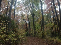
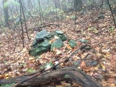
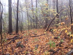
It's been raining for over a week now. All day. Every single day. Actually, I think there was one day that it didn't rain the whole day, but I barely remember that day. I've been dying to get back on the mountain bike, and yesterday seemed as good an opportunity as I was going to get. The forecast called for rain, but it looked like it would be more of a sprinkle/drizzle than proper rain.
Good enough.
I parked at the Jake lot.
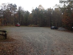
It seemed I was all but alone in my interest in the woods that day. There was one other car in the lot, from Missouri, no less. I imagined them having come down, hoping to get in some great riding, or hiking, or hunting, only to end up dealing with steady rain all week. Sorry guys. Welcome to Georgia.
It was actively raining when I left the lot, and I don't think it ever stopped altogether at any point. It did let up a good but at times, but when I left the lot, it had decidedly not let up. I even debated shoving off into it, but eventually decided that... a) I'd driven all the way up there. And... b) Getting wet is uncomfortable, but it's just the transition that's no fun, once you're all-the-way wet it's no big deal.
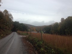
I headed up to the road, hung a right, and then hung another right on FS28-1.
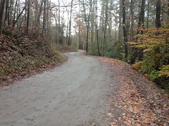
It was a slog. No other words effectively describe it, only slog.
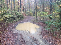
The ground was soft and wet. Every foot took two feet of effort. It reminded me of riding through melting snow.
But, just like rain, you get acclimated, and after a few minutes it doesn't seem wrong any more.
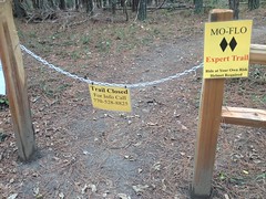
There were a bunch of slight differences since the last time I was up there. The Rangers had posted new yellow signs marking their routes. One set of signs counted up from 8 to 12, ending at Camp Merrill. I'm not sure what route it intended to mark though, as I'd only seen that chunk of it.
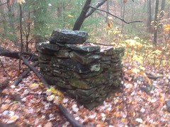
On some random this-used-to-be-a-road berm, off to the right, someone had planted a halloween ornament.
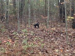
It wasn't especially conspicuous though, and I don't remember it being near anything in particular, just randomly out there along the road.
At Camp Merrill, the sewage treatment pond had been filled in completely, and replaced by a gigantic blue tank. There were also yellow signs marking Cooper Gap and Black Farms routes.
I ended up following the Cooper Gap route and it looked like the Forest Service had been out there recently, re-marking boundaries. There were new bearing trees, benchmarks, and red paint all along the left hand side of the road, until a half-mile or so up, where they crossed the road.
It looked like somebody had done a bit more development on Sassafras Mountain too. The last time I was up there, a new road had been cut and somebody had parked a tool trailer at the end of it. That trailer was still there. The road had been extended though, or another road had been cut leading almost all the way to the first turn too. There are several little roads up there now, but no new constructions yet. I wonder what they have planned.
Climbing Cooper Gap was less of a slog than 28-1 had been. The ground wasn't as soft, and it was a lot rockier. It wasn't easy though. I'd been off the mountain bike for a long time, and been out of the mountains for even longer.
At Cooper Gap, the Rangers had left one of their water tanks.
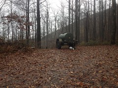
I'd seen that before, when they're out there, running around in the woods on some exercise. They were nowhere to be seen or heard from, but I hoped I run into them later.
There was one guy camping under a tarp on the east side of the gap, to the right of the water tank. He looked really cozy in there with a dry bag and the warm glow of a lamp. Mmmm... warm and dry.
Up high, on the north side of the ridge, it was a little bit colder, and a lot muddier.
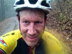
On every little downhill, I got sprayed relentlessly. It felt like water, but it was that fine, muddy mist that builds up, little by little, caking everything, especially one's legs, but most noticeably, one's glasses.
Ha! Adventure!
At Hightower Gap, I had the option of hanging a right and going for the long loop or staying straight and cutting it really short. I'd had such a difficult time already that I'd been mulling the options over in my mind. At the gap, I had to kind-of trick myself to keep going... "If I turn right, without stopping, then I'm committed to the long loop..." Something like that. So, I did, and tried not to think about it until I'd gone downhill long enough that the idea of turning around wasn't appealing.
I remember the first time John and I rode up there, that road was wet and soft, and we had to pedal constantly, while descending, to keep speed. It was much like that again yesterday.
The rain let up for a while though. You could tell it was raining if you were moving, but if you stood still, you'd have to wait a few seconds to be sure.
Rock Creek Lake smelled funny as I approached it. It smelled like wood. Like it smells near a wood chipper. I couldn't immediately determine why though. The only thing I could come up with was that the headwaters were flooded, and somehow that smells like wood. It was weird.
I passed the fish hatchery.
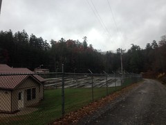
Didn't look like much was going on there. Frank Gross was deserted. Almost every campsite was deserted along the road. There were a few people out fishing though, and a few more out driving around. Seemed I wasn't the only one.
Rather than even attempt FS308 up at the north end, I kept going out to Hwy 60.
There's a road there called Totem Pole Road. It also has some FS designation, but I forget it now. Maybe 656?
At any rate, I'd driven down it eons ago and there was, at that time, an intact logging truck from a bygone era, abandoned on the side of the road, complete with the load of logs it was carrying at the time. It looked similar in vintage to the truck up on Bull Mountain, but in infinitely better condition. For some reason, I hadn't taken a picture when I first saw it, and it occurred to me that in 10 years I'd hadn't been near enough to that location to do so. As fate would have it though, I was right there, the road isn't too long, and it seemed like the perfect opportunity.
The road was short and shallow, as I'd remembered it, but as I approached the houses at the end, almost within sight of the truck...
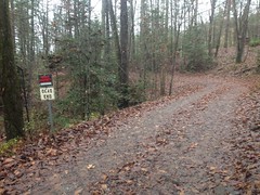
Private property. No trespassing.
Dangit! I mean, I was within maybe 100 yards of the old truck, but I couldn't see it, it was around that corner somewhere, assuming it's still there. That sign hadn't been there ten years ago, and I guess the residents got tired of people (like me) driving around back there and turning around in their driveways.
Dangit again!
Hey, extra miles though, right?
Got to look on the bright side.
Back on the road, I crossed the Toccoa...
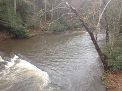
...which also smelled like wood, as Rock Creek Lake had.
Weird.
On Hwy 60 I passed the "community" of Margret - 2 people, 1 dog. I also had to climb over Tooni Gap too, which is the one down side to that route option. It's not terrible, but it's there, and I'd forgotten about it. There were a half dozen cars parked at the gap. No doubt Benton MacKaye hikers. I hoped the rain hadn't ruined their day.
Come to think of it, the last time I hiked the Benton MacKaye on Tooni it was raining too. And, I remember telling the folks at work about it later and one of them was super incredulous. Like she didn't believe that I'd done it, much less enjoyed it. Everything about it sounded either terrible or impossible to her. I had photos to prove that I'd done it though, and GPS data, and I did have a good time, as crazy as that sounds.
On Doublehead Gap Road the rain set in again.
The trees aren't sure whether it means to be summer, fall, or winter though. Leaves were green, yellow, red, brown and gone. All at the same time.
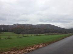
Further on, the fog on top of the mountains looked ominous. I didn't have to climb those exact mountains, but the clouds looked big enough to cover the ones I did have to climb.
I crossed the Toccoa again, and passed my favoritely-named road "Nellie's Big Fish Drive".
Up the road a bit, there were two guys out collecting a big chunk of quartz or marble or something.
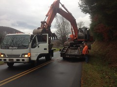
The guy in the excavator had picked it up off of the side of the road and was busy positioning on the flatbed truck when I rode up. The rock was so huge and heavy that it didn't slide easily, and nudging it to the side a made the whole truck twist like it was going to slide on the pavement before the rock finally gave, and then it was in danger of moving too far. The guy running the excavator really seemed to know what he was doing with that though. As soon as the rock started to move, he'd back off and then nudge it again. It seemed like an impossibly delicate operation to pull off with such huge and presumably imprecise equipment, but they really had it down.
I think of FS58 as "the climb" on the Noontootla loop, but Doublehead Gap Road is a net climb too. It ascends along Laurel Creek to some little gap near Peter Knob and then after a short drop, ascends again to Doublehead Gap. I don't usually notice it, but I did yesterday.
I passed a small group of deer, 5 or 6, taking advantage of someone's not-so-well-mown field. And somewhere in there, there was a line of decorative cedar trees and about 20 turkeys on the other side. I stopped to try to take a photo, but they kept running away and I didn't get anything clear. With the trees, they didn't seem too scared of me, so they never flew away but they just kept running back and forth like mad and eventually I had to give up.
A lot of the properties along that road have changed over the years too. Several old log cabin-looking structures are completely gone now. Others have collapsed. One or two newer properties appear to have been abandoned. The one with the lake and the spillways with the cairns is up for sale. I want to say cheap too, like $240,000. Though my foggy mind may have missed a decimal place or two in that figure.
At the foot of FS58, there was a memorial stone that I'm not sure whether I'd seen before or not.
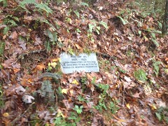
What, exactly are they memorializing? Was there a school there at some point?
For a while, the climb up along Noontootla seemed less difficult than the climb along Doublehead Gap Road.
Somebody had chucked a deer off to one side near the bottom.
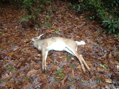
Ewww.
It started getting foggy before long, and then it started getting noticeably darker.
Ohhhh... That's right. I'd forgotten entirely about the time change, once again.
My original plan had been to get back to the car around 5:30, get home by 7 and get to my brother's house in time to catch the LSU-Alabama game at 8. I'd been keeping an eye on the time and I wasn't running terribly far behind schedule, maybe half an hour, but I'd completely forgotten that it would be full-on dark at 6, dark in the woods by 5:30, and probably even functionally dark earlier than that, given the weather.
Dangit, a third time!
I did not have the strength to push much harder. I had plenty of cardio but very little in the legs. As I have said: no amount of not climbing in the mountains gets you in shape for climbing in the mountains. That adage reasserted itself as, after what seemed a very long time, I passed three forks, the halfway point of the climb.
It wasn't dark yet though, just getting dark, and really foggy. Ahead of me in the fog, I spotted a huge buck. I mean, huge. Not just Georgia-huge, but Mississippi-huge, or Florida-huge. It looked toward me, but didn't seem to have as good an idea of what I was as I did of it, so it just stood there gawking at me. I stopped and very carefully pulled out my camera, but it took off as soon as I held it up to my face.
Come on!
I tried to take a photo of the road to demonstrate the fogginess, but this was all I got.
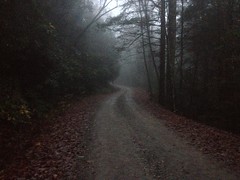
The heck? Why is fog so hard to capture? Kathryn and I discussed this later. Do iPhones have a polarizing lens or something? Would that decrease the fogginess in a photo? If so, why don't I have such lenses on my glassses? Seems like that would be really handy.
All day I'd been pelted and sprayed and it seemed I might be a little dirtier than earlier, so I took a photo for comparison.
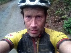
Yes, a little dirtier to be sure.
At Winding Stair Gap I saw the water tank again.
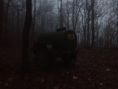
They'd either moved it, or they have more than one of them.
I hadn't seen or heard the Rangers all day, but that's not that unusual. It's more unusual to have seen them, even when they're nearby.
The descent down Winding Stair was Adventure at its finest.
I needed the glasses to keep the water out of my eyes, but they were certain to become opaque within seconds. I ended up putting them on, pulling them way down my nose, angling them down a bit, and looking over the top of them. This worked really well, as they got hammered steadily, but kept about 90% of the water out of my eyes. The limited visibility was still a challenge though. My instinct was to try to look through the lenses and it was hard to override. After the very first little drop off of the ridge, it was a lot darker too, and just generally difficult to see.
I made it down though, without incident.
About halfway down I saw two little glow-sticks hanging on a tree, and a humvee parked just down the road. The driver was running up to collect them and didn't seem to have time to return my salutations. Or, maybe he just didn't see me until I was right on him.
About 3/4ths of the way down I heard barrage after barrage of automatic weapons fire off to the west, in the general direction of Jones Creek and the PR Gap Trail. So that's where they are...
At FS877 it was super, super dark. I couldn't make out any detail in the woods and the road was just a whiteish field in front of me with only subtle variations to distinguish ruts, potholes, and mud. It was still raining too, harder than it had all day even.
As I was heading out, several cars passed me, all heading into the woods. One was a truck, with a hitch rack, no less, but no bikes on it. The others were all nice cars. One was a BMW. They didn't seem like ideal vehicles for rough, muddy roads, in the dark, and in the rain. I wonder what they thought of me.
At the Jake lot, someone was pulling out right as I turned in. Could have been the Missiorians. The lights were so bright and the rain made such glare that I couldn't make out what they were driving.
I was beat. It was 6:30. I spent 7 minutes changing and putting up my bike. The drive back took an hour and 45 minutes. I met my family at Siracusa's, the local pizza place, where we watched the first half of the game. I showed up even dirtier than in that picture above. Kathryn, Sophie, and Dave, the owner, were shocked by just how dirty I was. It was bad. I had to wash up in the bathroom, which took like 10 minutes.
At halftime we drove over to my brother's place to watch the rest of the game. His mother and father in-law were both in town, and Carrie had made some really good gumbo. I mean it was really, really good. It might be the best gumbo I've ever had. John had mentioned it earlier, I saved some room for it, and man was I glad that I had. It almost made up for the devastating punishment Alabama crushed us with.
Not quite, but almost.
