Thursday, July 27, 2017

Jake, Bull, and Black Mountains

On my trails site, the historical topo layer from 1898 shows most of the trails in the Bull/Jake Mountain system back when they were roads. One in particular caught my eye when I first got that layer working. Bull Mountain proper apparently used to diverge from its present loopish route and lead up to the gap on Black Mountain where the Black Mountain shelter sits these days.

I'd found the trail leading over to it from the other side like 10+ years ago, and seen that it keeps going in the direction of Bull Mountain, but I'd never gotten back up there to fully explore it.

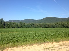
Well, having finally explored the heck out of Pinelog, I felt like getting back up to North Georgia this past weekend, and that particular road seemed like the right thing to check out.

I forgot they were replacing the bridge over the Etowah, so I had to turn around at Hwy 136 and backtrack through Dawsonville, but it didn't add too much time.

I was at the Jake lot and ready to ride by about 3.

Bike at Jake Lot

There was a guy next to me with a dog who was super tired and needed help getting into the bed of his truck. He struck me as a mountain biker, but I saw no bike. Apparently he had broken his tailbone a week or so back! Funny story actually... He rode all of Rope Mill, managed all of the technical trail on the north side, only to slip on the damp wood of the bridge coming back across it. What luck. Sounded like something that would happen to me. He was finally feeling good enough to get outdoors and had been hiking the Jake side all day, and apparently wearing his dog out.

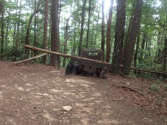
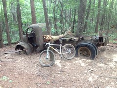
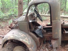
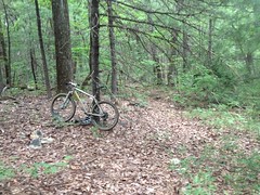
I took the Connector and the 83 Bypass over to Bull, climbed up to the Whoops, stayed left on Bull, and climbed up to the old truck.

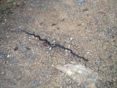
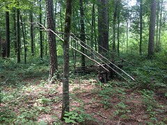
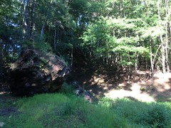
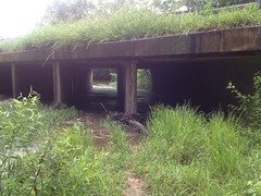
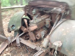
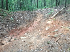
There's a chunk of it about halfway up to it that I finally remembered to get a photo of, though somehow managed to forget to mark the location in my GPS.

Truck Chunk

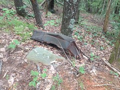
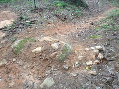
I guess that's a chunk of the truck. Looks like it.

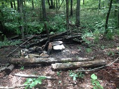
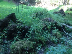
When I got up to the truck, I was super tired. It's been a tough couple of weeks. Not enough sleep. Not enough miles.

I made it though. Yay, truck!

Bull Mountain Truck from Behind Bike at Bull Mountain Truck Bull Mountain Truck Cab Bull Mountain Truck Motor

Just above the truck, the trail currently bends around to the right side of the ridge, but according to the map, the old route looked like it hung around the left side.

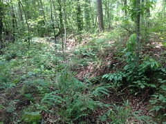
I'd never noticed anything like that in the past though, but the map made it look like it was a pretty major road, so it ought to be pretty obvious. It was, in fact, when you know where to look, and for the first hundred feet or so, it would have been rideable had I been interested in riding it, but deadfall and overgrowth cut it short there. So, I parked the bike against a tree, changed into my hiking shoes...

Hiking Shoe

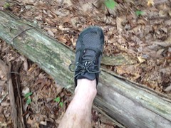
(which I had the foresight to bring)

...and pushed up the road.

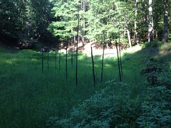
It basically crested the little hill, bent left, and dove down the ridge toward Nimblewill Creek.

A few hundred yards later it became a semi-decent trail.

Old FS28D

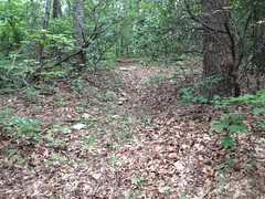
It was so nice that I followed it for a long way down the ridge, well past where I'd have turned off to head toward Black Mountain. It looked like it got a bit of foot traffic. I didn't seen any indications of other traffic though, and it looked like maybe people come up from the bottom and then head back down when it gets overgrown, only a few hundred yards short of the Bull Mountain Trail.

I was tempted to follow it all the way down, but it was heading in exactly the opposite direction from where I wanted to go, and I was already a bit pressed for time.

I'll have to get back to that one.

I'd seen the trail I needed to take earlier, so I headed back up and took it.

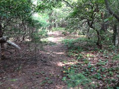
It was also fairly overgrown at first, and almost right away a bit of deadfall was placed so perfectly that if I hadn't known that the road kept going, I probably would have thought that it ended there.

A big circle revealed the bit leading on though, and before long it was wide open, and there were indications that someone had been that way recently.

Old FS77A

I followed the trail up the ridge for a while. Eventually it started to sidehill, just as the map said it should. Then it dove down to a creek crossing, just as the map said it should. Then it climbed back up, sidehilled some more, and finally dropped straight down the ridge towards the Bull Mountain Trail, in no way like the map said it should.

Hmm..

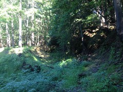
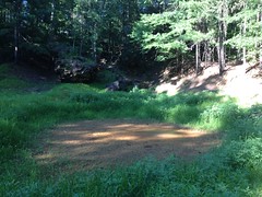
There were a couple of overgrown side trails in the area, and I followed a few of them, hoping to get back on track, but they turned out just to be stacked side loops and nothing discernible led uphill from anywhere.

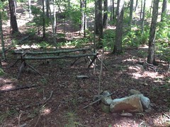
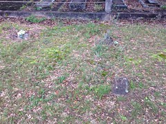
There was an unnatural flat spot off of one of the side loops that looked like something might have been there at some point, but no structure, debris, or anything remained.

Man!

I double and triple checked my route against the map. I even went so far as to look at the GPS route and compare it. It appeared to line up. I couldn't imagine that the map would make such a specific, but false, claim about the route. It didn't make any sense.

Eventually I gave up and headed back. I'd have to put my GPS track on the map and see what I did wrong.

Back at the bike...

Back at the Bike

...I changed my shoes and put my helmet back on.

I'd put my gloves in my helmet and put it on the ground under the bottom bracket before I left. Apparently my gloves were so dirty that they adequately simulated a corpse, and my helmet was full of all kinds of large bugs. Dozens of them. They poured out when I lifted it off the ground. I shook even more out of the gloves.

I'm not especially squeamish about such things, but it was a little unnerving, even to me.

I was even reticent to put my helmet on my head without thoroughly examining it first.

Later I even got Iz to check my hair for ticks.

I was in luck though. No ticks. Nothing bad at all.

On the way back, I hung a left down the Whoops to see how the rolling dips we restored in early June had faired. We'd had an ungodly amount of rain. I feared the worst.

Ehhh...

Rolling Dip 1 Rolling Dip 2 Rolling Dip 3

Well, it's a good thing they're 90% rock. If they'd been dirt, they'd have been gone.

The surface dirt was a mess, but they were still structurally solid. Ugly, but solid. Hopefully they'll firm up if it ever stops raining every day.

The turnouts below each of them were functioning really well though.

Rolling Dip 3 Turnout

Long term, we really need to do some road-trail-conversion stuff up there though, or reroute to the east.

I felt a lot better in the ride out than the ride in. I guess it takes 3 or 4 hours to warm up these days.

Nimblewill Church was packed when I drove out past it. It was Sunday, but I've been there at that time on so many Sundays and never seen it packed like that. Something was going on, but I couldn't tell what.

For the drive back, I took the route I should have taken in. It wasn't dark yet, but it was trying to get dark. The air was comparatively cool. Rolling through the mountains with the windows down, at that time of day, feeling tired and relaxed... It had been so long since I'd done it, I'd all but forgotten about that part of the experience.

Ahh, el luxurio.

I don't remember what I did for dinner. Must not have been all that great.

When I got home, I checked my route against the map. At some point, I'd noticed a trail diverging from the trail I was on, and leading up the ridge. I'd even marked it. That was the trail I should have taken. the route I took almost perfectly paralleled the route that I'd have taken if I'd followed that trail, so it looked like I was on track, but in fact I was several hundred yards down the mountain from where I needed to be.

Dangit!

Well, it would appear that I've been on the bike a bit too much lately. My explore-the-woods skills have gotten a little rusty.

I know what I'm doing this weekend.

Pinelog WMA

After working much of the weekend, I rode at Pinelog again last Monday. I honestly don't remember that much about the ride. I was just getting in miles and checking out the last few remaining little bits that I hadn't checked out yet, mostly on foot.

My bike shoes are really getting worn out. My shoe goo repair is starting to pull off. It's just a matter of time now before it fails completely, and the stitches are starting to pull out of the other shoe too, so it's heading down the same road.

Every last mile though. That's what I like to get out of my equipment.

I did see one really cool thing though.

Full Grey Rat Snake

I could be wrong, but I believe that's a Grey Rat Snake, as opposed to the black ones I see 99% of the time. That or it's just another black one with prominent markings.

The cool thing about this guy is the little bump in the middle of his body, which may not be super visible in this out-of-focus photo. He had apparently consumed a mouse or some other similarly sized meal recently, and was lying in the sun to help digest it.

He didn't move the slightest muscle the entire time I was next to him. I actually got a phone call right after taking that photo and stood there talking for a few minutes, within a few feet of him. I don't think Billy would have approved.

Yeah, that was the highlight of that particular ride/hike.

Good enough though.

Monday, July 17, 2017

Davis Branch

So, last weekend I was at Pinelog, ran into Curtis Glass, and he mentioned a trail along Davis Branch. I'd never even looked for one there before, though last winter, from the road, I'd seen a birdhouse on it.

Anyway, there are a small handful of trails up there that for one reason or other I hadn't yet explored, including that one, so I went up yesterday morning to knock them out.

It wasn't much of a ride. I just used the bike to get to places, and then walked. In retrospect, I could actually have driven to the head of each trail. That probably would have saved time, but I guess I got a little exercise using the bike.

The other trails turned out to be logging skids.

The upper section of the Davis Branch trail was more of a somebody-goes-this-way-sometimes than a proper trail. The experienced eye can discern the route, but there are several sections that are indistinct, and twice I thought I'd hit the end, and walked in a big circle until I found the trail again. Also, it seemed like someone was actively trying to obscure the trail by moving branches across it. I guess to some people it might look like they'd just fallen there, but to me it pointed out exactly where to look for the trail.

There was an elaborate campsite back in there.

Elaborate Campsite 1

I'd seen another such campsite along Stamp Creek above the second ford. Somebody's been watching too much Naked and Afraid.

At the very north/east end of the trail, it kind of petered out, but across a little clearing I could see a road that I'd found a while back. It gave me that "Hey! I know where I am!" feeling, which is always fun.

I followed the trail on the other side of the main road too, where it was marginally more distinct. Though, it had at least 1 complete break in it, and at the very southwest end, ends well before teeing into the trail along Stamp Creek.

There were 2 more elaborate campsites down there.

One had a teepee over the fire, presumably to hold a pot.

Elaborate Campsite 2

The other featured several fireside works...

Elaborate Campsite 3

...and the most elaborate shelter structure I've seen to date.

More of Elaborate Campsite 3

I'd once seen a similarly impressive campsite on the Upper Chattahoochee, and it struck me that maybe the same people were responsible for all of these. Later, I wondered if the Civil Air Patrol might have built them. They do training operations in Pinelog, and all over the NF.

Hmm...

There was also a long ditch out there. I'd actually encountered it before, along Stamp Creek, and thought it was a sunken roadbed. It's much more clearly a ditch where it runs along Davis Branch though.

Davis Branch Ditch

Of course, it looks like nothing in the photo, because... hole in the ground... in summer.

I have no idea what its purpose was. I'll have to get back up there at some point, and follow it end-to-end. Maybe that'll shed some light.

So, that was about it for that day. Long on discovery. Short on exercise. I need to get in some good miles. These days I pray that it doesn't rain.

Maybe I'll get lucky today.

Cripple Creek Ore Bank

I've gotten to where I don't even write about riding at Pinelog any more. Not much interesting has happened up there for a while. I did manage to get in a great many miles, and improve my fitness a bit, but for a while that's about all I could really say.

A few weeks back, it started raining every single day, and I picked up a new client in Canton, so I ended up off of the bike for a while. Actually, I brought my bike with me a few times, hoping to ride after work, only to get rained on. And, on a few different days, I began driving up, only to drive directly into massive storms, each time. Terrible!

You know how if you ride enough, you can crush the pedals for 6 hours, and then when your fitness falls off, and you try to get back on it, you can't imagine crushing the pedals up even 1 hill? That's how it was last weekend when I tried to get up there and reclaim some fitness.

I did do one interesting thing though.

I'd long ridden past the Cripple Creek Ore Bank, but I'd never gone down to check it out. It seemed like a good opportunity that day though, so I did that.

The bank appears to have once once been a little knob, but when it was discovered to be iron-rich, the knob was reduced and even inverted to a 20 or 30-foot deep pit. Indications of its former height ring the pit, and it's pretty amazing to think about as you walk down into it.

An overgrown old road lead down to the floor of the bank, along the north side.

In winter, the pit fills with water to a depth of a few feet, but in the summer, it's covered in grass.

Cripple Creek Ore Bank - Floor

Old cuts can be very clearly seen on the west and north sides.

Cripple Creek Ore Bank - West Side Cripple Creek Ore Bank - North Side

But, in the summer, the photos don't come out so good.

Large blocks of ore lie at the bottom of the pit.

Cripple Creek Ore Bank - Blocks of Ore

There are some weird sticks poking up out of it too.

Cripple Creek Ore Bank - Weird Sticks

I couldn't tell looking at time if they were dead trees or if someone had stuck them there. I pushed on one of them and it didn't seem too solid, but I still couldn't tell.

At the lowest point, there was still a little bit of water, even in this heat.

Cripple Creek Ore Bank - Pond in Summer

And that was about it. I was, once again, confronted with the difficulty of taking decent photos of holes in the ground, in the summer. Winter is much better for that, I guess.

On the ride out, I passed the vast meadow that used to be a lake.

Kinsey Meadow - Planted

Apparently it's planted in the summer. I didn't recognize the crop though.

Man, I was tired, pulling out of the north end. Whooo!

Normally I try to crush it all the way back around on the road, but there was no crushing it that day. I actually stopped at the Rydal Store, drank one bottle of Gatorade and filled up one of my bottles with another one. I then drank almost all of it on the way back to the car.

I guess it was just hot too. It didn't seem so at the time, but later I saw that it had hit 98 that day, and I didn't feel SO bad about having such a rough time.

Still, not good, but at least not SO bad.

Also... I'd run into a guy named Curtis Glass in the lot on the way in. He had a bike on his rack and was waiting for a friend. We chatted a bit, and he really seemed to know the area. I realized as I rode that I had more questions for him, and I hoped to run into him when I got back. As luck would have it, I did! He and his buddy were still in the lot, and I got to talking with both of them for like an hour. They gave me some good info about the system, surrounding properties, and even about some trials in the national forest. They were both general outdoor adventurers, much like myself, not afraid to venture off trail, or push through a little brush. They were both paddlers too, and the Curtis had long been a climber. So, actually, they were quite a bit more accomplished adventurers than I. It was great talking to them, and I gave the buddy the URL for my trails site, which has my email on it, so maybe I'll hear from them again.

So, it was a tough day, but ended well, all things considered. It was even worth writing about.

Cherokee County

Several of my recent explorations have been inspired by B&E Roberts. His Southeastern Explorations section well worth browsing, especially if you're from around these parts, and his photos are way better than mine. I scoured his site for places to explore, and I've got a bit of a backlog now, but in scouring his site, I also sort-of began to understand how he might decide what things to go looking for. Historical maps and bulletins from the early 1900's (available on Google Books) either describe or directly show the locations of all kinds of mills, factories, mines, and so forth. Then, there are also resources like the Etowah Valley Historical Society and Bartow Ancestors that do the same. Between them, the approximate locations of all kinds of old abandoned whatnot can be inferred. All that remains is to get out in the field and see if any part of said old abandoned whatnot remains.

So, in that spirit, I scoured some of the historical maps on my trails site, identified a few locations to check out, and hit the road.

The first was Marun's Mill. Old maps allege it to be (or have been) located in northern Cherokee County, on the south side of Salacoa Creek, on the north side of Garland Mountain. It looks like it's "behind" some private property though. It might be accessible from the Garland Mountain horse trails, but maps of that system don't show the trails going that far north. I wasn't too optimistic, but I checked it out anyway.

No luck. There was private property on the north side, or at least, the road got narrower and narrower, and though it wasn't marked private, it kind-of looked like it. At least it didn't look like something I should drive my truck down, in case it was private. Maybe the road bike. From the sorth, the Garland Mountain Sporting Clays club seemed to own the land between the end of the road and that part of the mountain. They're open to the public though. Maybe I could give them a call...

Next.

The same map alleges an unnamed mill, a bit east, on Little Creek, near where it joins Salacoa.

When I pulled up, I was optimistic. There was a bit of a parking area. The woods were clear, all the way down to the creek. It looked like a popular place.

There was a little dam across the creek, though I doubt it had anything to do with the mill

Dam on Little Creek

There were a couple of campfire rings, and some swings over the creek.

Swings Over Little Creek

But I looked all over, even under the bridge nearby...

Little Creek Bridge

...and there was no trace of any old mill. Dangit.

It's not impossible that there was something on the other side of the creek, obscured by overgrowth. In fact, there was a large amount of it, right where a structure ought to be, but it was raining, the creek was high, I wasn't wearing the right pants or shoes to cross it...

Hmm...

I would need to come back in the winter, properly dressed.

I'd seen several Such-and-Such Mill Roads on the map while looking at how to get to those two, so I went and checked them out too.

The first was Irwin Mill Road. At the west end, there was a small-scale lumber mill in present operation. There was a quarry just up the road, and the rest of the road wound around through some sketchy cliffs with multiple signs telling you to watch out for falling rock.

No ruins were visible along the length of the road though. But, again, the undergrowth was dense. I needed to come back in the winter.

The next was Riddle Mill Road. What a road! It's 1-vehicle wide, way below grade for most of its length, and, oddly enough, paved. It winds through all manner of old farms, but at the only spot that it crosses a creek, there's nothing visible. But, as before, I really couldn't see that far up or downstream, and I needed to look again in the winter.

Blah!

Winter. Winter is the friend of anyone looking for old structures in the woods. That was the lesson of the day.

I did run into the old Mahan cemetery while I was out and about though.

There were some very old, worn-away stones there.

Mahan Cemetery 1

And a section interring a family - mother, father, and at least 6 children, all of whom died at birth or within the first year.

Mahan Cemetery 2

Can you imagine? I'd seen a similar section of the Bynum Cemetery near Willis Knob. I'd learned in school how much was done in the 20'th century to combat infant mortality, but seeing evidence in cemeteries like these makes it seem a lot more real.

More older stones...

Mahan Cemetery 3

This gentleman was born in the 1700's!

Mahan Cemetery 4

It was the oldest stone I could find that wasn't worn away.

And that was it.

I did find some great roads that made me want to get up there on my road bike. But, I really struck out on the old-structures-in-the-woods front.

Winter! Maybe this winter.