It's definitely allergy season. Yesterday I could barely drag myself out of bed and two of my co-workers were sick too. The pear trees are blooming. I don't know if it's pear pollen or if they're just harbingers, but man, it's miserable.
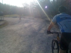
It was also 40 degrees this morning and I couldn't bear the thought of riding to work, so I didn't get my usual warm up before the group ride and frankly, I'm stunned that I didn't get dropped. It took me a few minutes longer than I expected to get home and another few more to get out of the house. I rolled up right as the group was leaving. One minute more and I'd have missed them. They were especially fast today, or maybe I was just especially slow. It felt fast. I took my turns but I didn't even try to bridge up to the breaks. We got split at a traffic light after the Elmo Road climb. Maybe 10 riders got out ahead. JMill put down the longest, hardest pull I've ever seen anyone do on that ride and got them back in sight. It was inspiring, but I was next and all I could do was hold the distance for a few hills. After that, we never saw them again.
At the end, I held it together over Sawnee Mountain and managed to get in good position for the sprint, even put in a test break, but this one guy had been pulling really hard since we came off of the mountain. He didn't look like he wanted to let up, so I faked like I was going to jump, then didn't and he held on for the win. It seemed like my little maneuver might have bought him the second he needed, but it's hard to say for sure.
On the ride home I felt allergied again. The little rollers in the neighborhood felt like climbing Sawnee. No good. I hope it's a little warmer tomorrow morning.
Wednesday, March 31, 2010
Monday, March 29, 2010
Brawley Mountain
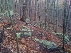
It was nice all week, but this morning, the rain was back. I slept through my alarm clock and missed church too. It was a gloomy start, but maybe I could make up for it with a long day of exploring. I've been running around Brawley Mountian lately, but I still haven't seen everything up there, and I had a hunch where I might find something good.
On the drive up, it was 50 degrees and the rain kept flipping back and forth between downpour and a drizzle. It was always coming down, but I could always see blue sky somewhere too. No way to know whether it would be wet or dry, hot or cold. I'd been concerned about that before I left and packed every stitch of clothing I owned, just in case.
I parked just up Old Dial Road from Sandy Bottom. I'd seen a trail there before and the topo maps showed kind of a lasso too.
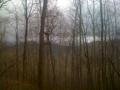
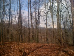
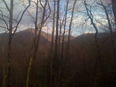
Part of the loop still existed, part had been rerouted, most of it was overgrown. There was a trail up through the middle of the loop too. It looked like people used it to get to the headwaters of the creek, but few ventured beyond that. On the south side, there was a pretty good view in the general direction of Blue Ridge.
Instead of finishing out the loop, I took a trail over towards Weeks Mountain and another one up the ridge. I figured I'd finish out the loop later on the return trip. Little did I know...
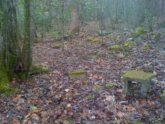
The Weeks Mountain Ridge Trail petered out quickly. On top, there were obvious signs that people walk around up there, but nothing I'd call a trail. There was an Ammo Box though.
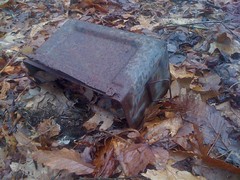
I've seen them all over near Camp Merrill. The Rangers use them as orienteering markers. Of course, they also use them to carry ammo. I wonder which this was. Geocachers use them as too, but this one looked like it's been sitting up here longer than geocaching has existed.
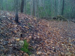
I followed the ridge toward Garland Mountain and picked up a trail down toward FS35. It looked like somebody had made a specific effort to reclaim the trail, but somebody else made a specific effort to keep a path hacked through it. Near the bottom, I spotted this enormous rock pile.
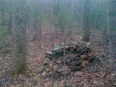
Too big to be a collapsed chimney, unless it was a really big chimney. Uphill, there were more of them.
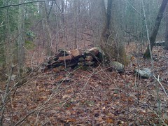
Some were sort of trying to dam a little trickle of a creek, others were just out on the hillside. They were clearly built, but why?
When I hit 35, I started jogging east. A guy in a red truck offered me a ride, but I was good. A few minutes later I passed his truck, parked off to the side. He wasn't dressed for hunting or fishing. I wonder what he was up to.
I wandered around on some side trails for a while but I didn't find anything all that interesting.
The rain had pretty much stopped and there was blue sky above me. For a while it was actually warm, but from time to time, out of nowhere, blam! and have to put my jacket back on, then as soon as I did that it would stop and it would get warm again.
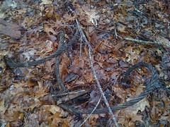
One trail looked like it might lead up to South Brawley Ridge. On the way up, I found this gnarly skull of a young buck.
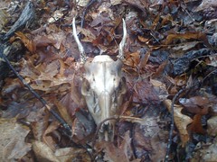
My wife sort of collects them. If I left this one here and she found out, she'd be pissed. I cut a chunk of cord, fed it through the eye sockets, wrapped it around a couple of times and tied it to various points on my camelback. In the midst of this operation, it began raining extremely hard, thundering, and sleeting. Huddled down though, as I was, with my jacket draped around me, I actually stayed pretty dry. It seemed like a good time for lunch and ate one of the bagels I'd brought with me.
The rain stopped and I got going again. The trail didn't quite lead up to the ridge, but somebody wanted it to and had marked a route with white and orange ribbons.
The view was nice.
I checked the time. It was getting late. I'd planned on heading down and taking a trail I'd seen before up to Ledford Gap. No time for that. Instead, I took a different trail, directly toward Ledford. When it ended, I aimed for a little gap to the west of there and sidehilled for a while.
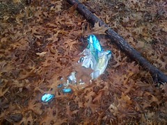
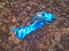
I have this theory that for every square mile of forest, there is at least one mylar balloon.
The woods got denser as I approached the gap, but I eventually picked up a trail that I'd been on before and took it out to FS45. The weather that had pounded me so hard before had moved on the east, leaving a rainbow behind, barely visible in this shot.
I jogged over to Ledford. I'm finally getting to where I can jog for a while without wearing out some odd little muscle. Not for miles at a time, but at least for miles a day. At Ledford, I looked around for an old roadbed. Some Low-res USGS maps show a road leading up from around Hurst, but the higher-res maps don't show it. Maybe it would be there, maybe it wouldn't. As luck would have it, it was, and right where the map said it would be. I didn't see any footprints, hoof prints or bike tire tracks, just the shallow impressions left by ATV's. I'm usually critical of ATV's, especially in a riparian zone, and they're certainly illegal in the National Forest, but they had tread lightly on this particular trail. There were a few short runs where it was below grade and there were a couple of reroutes, but nothing like Anderson Creek or some of the trails around Cashes Valley.
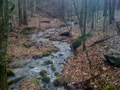
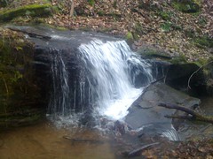
The scenery was beautiful.
Near the creek, it might even have been old growth. I'll have to come back in the summer when I can tell what kind of trees they are. There were plenty of flatts. I wonder if there were settlements up here way back.
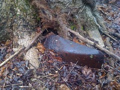
Down near the bottom, I ran across this old heap.
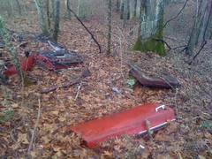
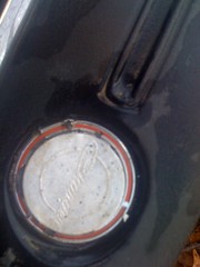
I wondered if I could identify it. This was a clue.

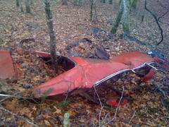
And this was a bigger clue. Probably a Dodge Charger, the only car I know of where the back glass is set into the body like that.
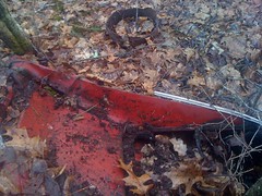
Yep, it's a Dodge Charger all right.
I love finding old junk in the woods. Not that I approve of dumping, but if somebody's already done it, it's neat to run across it 20 years later.
Another balloon.
The trail teed into FS82 right where I thought it would and I began climbing along Rocky Knob Ridge.
I'd seen a trail up there last time, heading toward Hickoryland. I'd hoped I could make my way on it, over to Persimmon Creek, up to the BMK and back down to the Sandy Bottom loop I was on at the beginning of the day.
Unfortunately, the trail ended just below a little gap on Hickoryland. I climbed up over the gap, set off on a course toward upper Persimmon Creek and immediately found another trail, which led to a vast, lichen-covered boulder field. This photo shows only a very small section of it. I've seen a lot of boulder fields, but this one, being green, was especially cool.
The trail led to a ridge and ended at an unimaginably overgrown logging road. It looked like it was pretty close to the trail I wanted to pick up on Persimmon Creek though, so I bushwhacked down through it, and voila, there it was. I needed to head southwest to get to the creek, but to verify that this was the correct trail, I needed to go northeast. I tried for a few hundred yards, but the trail was getting overgrown, the sky was getting dark and I really wanted to get to the creek while I could still see.
I turned out that I was on the trail I was looking for. It apparently heads upstream, bends around and tees back into itself. There are quite a few trails in the area that do that same thing. It's kind of weird. My first guess is that there were once farms here and these roads just led all around them. I guess they could just be logging roads, but they just don't have that kind of a feel to them. Maybe this was once a Horse or ATV trail system. Who knows?
At Persimmon Creek, it was officially dark. My original plan was out the window, but I had a new plan, and it should have been easy; find the feeder creek, follow it upstream to the Persimmon Creek trail, follow that out to FS119, 119 to Old Dial, Old Dial to the truck. I found the feeder. There was a big rock pile there, looked like a collapsed chimney, but it was too dark to get a photo of it. The map shows a trail right along the creek, and yeah, there is one, but it was choked with Rhododendron and in the dark, virtually impassible.
Nevertheless I pushed through it for what seemed like an eternity. It seemed like I should have gotten to the other trail by now. Did I pass it up somehow? If I just go uphill, I should hit the Persimmon Creek trail, but what if I pass it up too? What if I can't find my way back down to the creek? I felt like I did when I very first started learning to navigate off-trail. There are obvious answers to all of those questions, but none of them came to mind at the time. I have enough experience bumbling around in the daylight to be confident, but none of that confidence applied at night. Was it that easy to walk past the trail? Could I actually miss it? Had I gone far enough? Checking the map, I realized that all I needed to do was walk south and I'd eventually hit either the Persimmon Creek Trail or FS119. Duh. So, I did that. My brain kept wanting me to turn west, but I fought that urge, eventually got to the trail, and the jog back to the truck was uneventful. On the road, a truck passed me. I waved, they waved. It didn't seem odd to them that I was out on the road by myself in the dark :)
Looking at the GPS later, I just hadn't gone far enough upstream. I was about 100 yards from the intersection. If I'd been a little more persistent, I'd have gotten there. They say night-nav is hard. I could definitely use some practice.
On the drive up, it was 50 degrees and the rain kept flipping back and forth between downpour and a drizzle. It was always coming down, but I could always see blue sky somewhere too. No way to know whether it would be wet or dry, hot or cold. I'd been concerned about that before I left and packed every stitch of clothing I owned, just in case.
I parked just up Old Dial Road from Sandy Bottom. I'd seen a trail there before and the topo maps showed kind of a lasso too.
Part of the loop still existed, part had been rerouted, most of it was overgrown. There was a trail up through the middle of the loop too. It looked like people used it to get to the headwaters of the creek, but few ventured beyond that. On the south side, there was a pretty good view in the general direction of Blue Ridge.
Instead of finishing out the loop, I took a trail over towards Weeks Mountain and another one up the ridge. I figured I'd finish out the loop later on the return trip. Little did I know...
The Weeks Mountain Ridge Trail petered out quickly. On top, there were obvious signs that people walk around up there, but nothing I'd call a trail. There was an Ammo Box though.
I've seen them all over near Camp Merrill. The Rangers use them as orienteering markers. Of course, they also use them to carry ammo. I wonder which this was. Geocachers use them as too, but this one looked like it's been sitting up here longer than geocaching has existed.
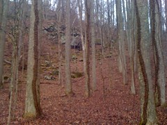
I followed the ridge toward Garland Mountain and picked up a trail down toward FS35. It looked like somebody had made a specific effort to reclaim the trail, but somebody else made a specific effort to keep a path hacked through it. Near the bottom, I spotted this enormous rock pile.
Too big to be a collapsed chimney, unless it was a really big chimney. Uphill, there were more of them.
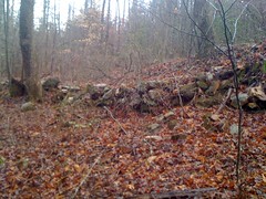
Some were sort of trying to dam a little trickle of a creek, others were just out on the hillside. They were clearly built, but why?
When I hit 35, I started jogging east. A guy in a red truck offered me a ride, but I was good. A few minutes later I passed his truck, parked off to the side. He wasn't dressed for hunting or fishing. I wonder what he was up to.
I wandered around on some side trails for a while but I didn't find anything all that interesting.
The rain had pretty much stopped and there was blue sky above me. For a while it was actually warm, but from time to time, out of nowhere, blam! and have to put my jacket back on, then as soon as I did that it would stop and it would get warm again.
One trail looked like it might lead up to South Brawley Ridge. On the way up, I found this gnarly skull of a young buck.
My wife sort of collects them. If I left this one here and she found out, she'd be pissed. I cut a chunk of cord, fed it through the eye sockets, wrapped it around a couple of times and tied it to various points on my camelback. In the midst of this operation, it began raining extremely hard, thundering, and sleeting. Huddled down though, as I was, with my jacket draped around me, I actually stayed pretty dry. It seemed like a good time for lunch and ate one of the bagels I'd brought with me.
The rain stopped and I got going again. The trail didn't quite lead up to the ridge, but somebody wanted it to and had marked a route with white and orange ribbons.
The view was nice.
I checked the time. It was getting late. I'd planned on heading down and taking a trail I'd seen before up to Ledford Gap. No time for that. Instead, I took a different trail, directly toward Ledford. When it ended, I aimed for a little gap to the west of there and sidehilled for a while.
I have this theory that for every square mile of forest, there is at least one mylar balloon.
The woods got denser as I approached the gap, but I eventually picked up a trail that I'd been on before and took it out to FS45. The weather that had pounded me so hard before had moved on the east, leaving a rainbow behind, barely visible in this shot.
I jogged over to Ledford. I'm finally getting to where I can jog for a while without wearing out some odd little muscle. Not for miles at a time, but at least for miles a day. At Ledford, I looked around for an old roadbed. Some Low-res USGS maps show a road leading up from around Hurst, but the higher-res maps don't show it. Maybe it would be there, maybe it wouldn't. As luck would have it, it was, and right where the map said it would be. I didn't see any footprints, hoof prints or bike tire tracks, just the shallow impressions left by ATV's. I'm usually critical of ATV's, especially in a riparian zone, and they're certainly illegal in the National Forest, but they had tread lightly on this particular trail. There were a few short runs where it was below grade and there were a couple of reroutes, but nothing like Anderson Creek or some of the trails around Cashes Valley.
The scenery was beautiful.
Near the creek, it might even have been old growth. I'll have to come back in the summer when I can tell what kind of trees they are. There were plenty of flatts. I wonder if there were settlements up here way back.
Down near the bottom, I ran across this old heap.
I wondered if I could identify it. This was a clue.
And this was a bigger clue. Probably a Dodge Charger, the only car I know of where the back glass is set into the body like that.
Yep, it's a Dodge Charger all right.
I love finding old junk in the woods. Not that I approve of dumping, but if somebody's already done it, it's neat to run across it 20 years later.
Another balloon.
The trail teed into FS82 right where I thought it would and I began climbing along Rocky Knob Ridge.
I'd seen a trail up there last time, heading toward Hickoryland. I'd hoped I could make my way on it, over to Persimmon Creek, up to the BMK and back down to the Sandy Bottom loop I was on at the beginning of the day.
Unfortunately, the trail ended just below a little gap on Hickoryland. I climbed up over the gap, set off on a course toward upper Persimmon Creek and immediately found another trail, which led to a vast, lichen-covered boulder field. This photo shows only a very small section of it. I've seen a lot of boulder fields, but this one, being green, was especially cool.
The trail led to a ridge and ended at an unimaginably overgrown logging road. It looked like it was pretty close to the trail I wanted to pick up on Persimmon Creek though, so I bushwhacked down through it, and voila, there it was. I needed to head southwest to get to the creek, but to verify that this was the correct trail, I needed to go northeast. I tried for a few hundred yards, but the trail was getting overgrown, the sky was getting dark and I really wanted to get to the creek while I could still see.
I turned out that I was on the trail I was looking for. It apparently heads upstream, bends around and tees back into itself. There are quite a few trails in the area that do that same thing. It's kind of weird. My first guess is that there were once farms here and these roads just led all around them. I guess they could just be logging roads, but they just don't have that kind of a feel to them. Maybe this was once a Horse or ATV trail system. Who knows?
At Persimmon Creek, it was officially dark. My original plan was out the window, but I had a new plan, and it should have been easy; find the feeder creek, follow it upstream to the Persimmon Creek trail, follow that out to FS119, 119 to Old Dial, Old Dial to the truck. I found the feeder. There was a big rock pile there, looked like a collapsed chimney, but it was too dark to get a photo of it. The map shows a trail right along the creek, and yeah, there is one, but it was choked with Rhododendron and in the dark, virtually impassible.
Nevertheless I pushed through it for what seemed like an eternity. It seemed like I should have gotten to the other trail by now. Did I pass it up somehow? If I just go uphill, I should hit the Persimmon Creek trail, but what if I pass it up too? What if I can't find my way back down to the creek? I felt like I did when I very first started learning to navigate off-trail. There are obvious answers to all of those questions, but none of them came to mind at the time. I have enough experience bumbling around in the daylight to be confident, but none of that confidence applied at night. Was it that easy to walk past the trail? Could I actually miss it? Had I gone far enough? Checking the map, I realized that all I needed to do was walk south and I'd eventually hit either the Persimmon Creek Trail or FS119. Duh. So, I did that. My brain kept wanting me to turn west, but I fought that urge, eventually got to the trail, and the jog back to the truck was uneventful. On the road, a truck passed me. I waved, they waved. It didn't seem odd to them that I was out on the road by myself in the dark :)
Looking at the GPS later, I just hadn't gone far enough upstream. I was about 100 yards from the intersection. If I'd been a little more persistent, I'd have gotten there. They say night-nav is hard. I could definitely use some practice.
Saturday, March 27, 2010
Clinton Farms
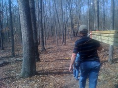
The rain this winter has really had it's way with some of the trails at Clinton Farms. A few months back, my brother and dad had to build a bridge across a creek that, once only inches below trail level had deepened by almost a foot.
Further downstream, an existing bridge needed repair. It was an 8 foot bridge, once spanning a 6 foot gap, but the rampaging deluge had widened the entire creek bed by over a foot and a half. The last time my dad had rolled through there, that bridge was barely hanging on, another bridge had been damaged by another washout, and one of the trails needed a reroute. This past Thursday, he mentioned he wanted to get out there and work on it this weekend. Sounded good to me.
Me and the kids packed up the tools, picked up my dad, rolled through Home Depot, put in a little 4WD down on Old Pool Road and humped our the gear to the creek.
Somebody had stacked up some impressive rock piles on both sides of the creek and placed the bridge on them. It was stable, but it sat a little low and another good rain would certainly carry it off again.
My dad's plan was to attach a 12 foot 2x6 to either side of the existing bridge, bury both ends a bit to hold it in place, add slats and shore up the banks with rip-rap to mitigate further erosion. We did exactly that. We also placed large rocks under each end and rock-armored the approach on either side.
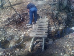
The rock piles were perfect rip-rap. We just left them there and added a few more.
All done.
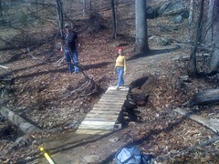
The girls were very helpful. Not just carrying equipment, but finding, carrying and placing rocks, backfilling holes and handing out screws. If they hadn't been there, everything would have taken longer. As it was, we knocked it out in just over an hour.
On to the next one.
The trail crosses a spring-fed trickle of a creek in three places. For the first two, the trail crosses, winds round for 50 yards or so and crosses back. We were in a drought when it was first laid out and the trickle was dry, but since then we've gotten plenty of rain. The two crossings have become wide, stinking mud pits, filled with broken, rotting sticks people have thrown in trying to make them easier to get across. Not super, super bad, but I've seen plenty of those before and they were just going to get worse. Somebody cut across the loop at the top of the hill, but it involved two really hard lefts and cut off about 200 yards of trail. The last time my dad was out there, he had put in a more gradually sweeping cutoff that didn't cross the creek, and only shortened the trail by about 20 yards. We cleaned it up a bit, covered up the old trail, covered up the short cutoff, removed the debris people had placed in the crossings, raked down the ruts and restored the original drainage path. Again, the kids were very helpful, and a lot of fun. Sophie stepped in the wrong place once, got one of her shoes sucked off and had to go back and dig it out. It was funny to us.
We talked about other options, but the only ones we could think of involved building puncheons or some other structures, and we would have had to haul in rocks from at least a quarter mile away. It looked like people were already using the cutoffs. They seemed like the right solution.
The third crossing wasn't an issue. There's a large granite deposit down there and the creek kind of goes into the ground and spreads out across it. There are sometimes muddy spots spread out along it's length, but they dry up periodically (they were dry today) and have remained stable in size.
The last project was a fill. The Nature Trail, one of the oldest trails in the park, dives directly down the fall line to a bridge, which sits about 6 inches up from the trail. When it rains hardcore, it comes rolling down the trail, hits the bridge and gets funnelled to the right. With all the rain we got recently, it washed away a tremendous amount of soil holding up the right corner of the bridge. The creek itself washed away even more soil on the back side. The bridge was sagging, but stable. The washout itself was dangerous. From the other direction, if you stayed to the far right you were safe, but even a foot over, you could fall into a pretty good little chasm. Some folks had laid deadfall across it, but it wasn't enough to support anyone if they got too far left.
We rolled a couple of big rocks down the hill, collected a couple of dozen more from the around the creek and filled in the hole, then re-placed the sticks and added a few more of our own. The rocks would allow water to flow in and drain to the creek but resist erosion, and they held up the sticks, which provided a more stable surface to walk or ride on. It wasn't perfect, but it was way better and the best we could do without new construction.

After all that, we all spun a couple of laps around the track and tried riding out past the lake and back.
The kids didn't have any much of a problem with the dirt. At first, Sophie had a little trouble braking gently and standing up when it got bumpy, but she figured it out. No trouble with the dirt itself, but they struggled with the hills. What seem like gentle rollers to me are unclimbable for them. Standing up with all of her weight on one pedal, Iz just didn't weigh enough to make it go anywhere. She could use some gears.
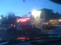
When it was getting dark, we headed over to my folks place, dropped off my dad's gear and grabbed some dinner at the Italian Oven. When I lived in Marietta, it was one of my favorite restaurants. But I haven't been there in so long, I'd nearly forgotten about it. It was like cleaning a bunch of old receipts out of my wallet and finding a twenty dollar bill.
Great day.
Further downstream, an existing bridge needed repair. It was an 8 foot bridge, once spanning a 6 foot gap, but the rampaging deluge had widened the entire creek bed by over a foot and a half. The last time my dad had rolled through there, that bridge was barely hanging on, another bridge had been damaged by another washout, and one of the trails needed a reroute. This past Thursday, he mentioned he wanted to get out there and work on it this weekend. Sounded good to me.
Me and the kids packed up the tools, picked up my dad, rolled through Home Depot, put in a little 4WD down on Old Pool Road and humped our the gear to the creek.
Somebody had stacked up some impressive rock piles on both sides of the creek and placed the bridge on them. It was stable, but it sat a little low and another good rain would certainly carry it off again.
My dad's plan was to attach a 12 foot 2x6 to either side of the existing bridge, bury both ends a bit to hold it in place, add slats and shore up the banks with rip-rap to mitigate further erosion. We did exactly that. We also placed large rocks under each end and rock-armored the approach on either side.
The rock piles were perfect rip-rap. We just left them there and added a few more.
All done.
The girls were very helpful. Not just carrying equipment, but finding, carrying and placing rocks, backfilling holes and handing out screws. If they hadn't been there, everything would have taken longer. As it was, we knocked it out in just over an hour.
On to the next one.
The trail crosses a spring-fed trickle of a creek in three places. For the first two, the trail crosses, winds round for 50 yards or so and crosses back. We were in a drought when it was first laid out and the trickle was dry, but since then we've gotten plenty of rain. The two crossings have become wide, stinking mud pits, filled with broken, rotting sticks people have thrown in trying to make them easier to get across. Not super, super bad, but I've seen plenty of those before and they were just going to get worse. Somebody cut across the loop at the top of the hill, but it involved two really hard lefts and cut off about 200 yards of trail. The last time my dad was out there, he had put in a more gradually sweeping cutoff that didn't cross the creek, and only shortened the trail by about 20 yards. We cleaned it up a bit, covered up the old trail, covered up the short cutoff, removed the debris people had placed in the crossings, raked down the ruts and restored the original drainage path. Again, the kids were very helpful, and a lot of fun. Sophie stepped in the wrong place once, got one of her shoes sucked off and had to go back and dig it out. It was funny to us.
We talked about other options, but the only ones we could think of involved building puncheons or some other structures, and we would have had to haul in rocks from at least a quarter mile away. It looked like people were already using the cutoffs. They seemed like the right solution.
The third crossing wasn't an issue. There's a large granite deposit down there and the creek kind of goes into the ground and spreads out across it. There are sometimes muddy spots spread out along it's length, but they dry up periodically (they were dry today) and have remained stable in size.
The last project was a fill. The Nature Trail, one of the oldest trails in the park, dives directly down the fall line to a bridge, which sits about 6 inches up from the trail. When it rains hardcore, it comes rolling down the trail, hits the bridge and gets funnelled to the right. With all the rain we got recently, it washed away a tremendous amount of soil holding up the right corner of the bridge. The creek itself washed away even more soil on the back side. The bridge was sagging, but stable. The washout itself was dangerous. From the other direction, if you stayed to the far right you were safe, but even a foot over, you could fall into a pretty good little chasm. Some folks had laid deadfall across it, but it wasn't enough to support anyone if they got too far left.
We rolled a couple of big rocks down the hill, collected a couple of dozen more from the around the creek and filled in the hole, then re-placed the sticks and added a few more of our own. The rocks would allow water to flow in and drain to the creek but resist erosion, and they held up the sticks, which provided a more stable surface to walk or ride on. It wasn't perfect, but it was way better and the best we could do without new construction.
After all that, we all spun a couple of laps around the track and tried riding out past the lake and back.
The kids didn't have any much of a problem with the dirt. At first, Sophie had a little trouble braking gently and standing up when it got bumpy, but she figured it out. No trouble with the dirt itself, but they struggled with the hills. What seem like gentle rollers to me are unclimbable for them. Standing up with all of her weight on one pedal, Iz just didn't weigh enough to make it go anywhere. She could use some gears.
When it was getting dark, we headed over to my folks place, dropped off my dad's gear and grabbed some dinner at the Italian Oven. When I lived in Marietta, it was one of my favorite restaurants. But I haven't been there in so long, I'd nearly forgotten about it. It was like cleaning a bunch of old receipts out of my wallet and finding a twenty dollar bill.
Great day.
Thursday, March 25, 2010
Weekly Beatdown
I rode to work Tuesday and Wednesday, and Wednesday afternoon I did the Reality group ride. "Smarter, not harder" was my motto and I and hung with the group until the final sprint, went for a break and just didn't have it. Hey, that's how it goes. I felt a lot better this week. Last week I had a hard time breathing, this week it was totally under control. I was even good for a couple of good pulls and bridges. I think I've just about cleared out the winter cobwebs. Still though, that little voice that screams when you bury yourself is louder than I remember it being last year. I've got a little more work to do on that.
On my commutes I usually bring my laptop, a shirt, Chamios Butt'r and odds and ends like tools, keys and my wallet. I have crocs and pants at the office. But yesterday I also brought real shoes and socks and brought my pants back home at the end of the day. I could feel the extra weight, but it didn't feel like I was riding any slower. At the shop, I picked up a pair of tires for my daughter's 20 inch and that put it right over the limit. I felt like a pack mule, struggling over the hills on the way back into my neighborhood. Should be good TNGA training though.
On my commutes I usually bring my laptop, a shirt, Chamios Butt'r and odds and ends like tools, keys and my wallet. I have crocs and pants at the office. But yesterday I also brought real shoes and socks and brought my pants back home at the end of the day. I could feel the extra weight, but it didn't feel like I was riding any slower. At the shop, I picked up a pair of tires for my daughter's 20 inch and that put it right over the limit. I felt like a pack mule, struggling over the hills on the way back into my neighborhood. Should be good TNGA training though.
Monday, March 22, 2010
Brawley Mountain
50 degrees is a funny temperature. If it's sunny, 50 degrees is warm. If it's overcast, it's "cool". If it's windy, especially if it's wet and/or actually raining, it's cold, possibly freezing. Today it was 50 degrees, raining, incredibly windy, and thus cold, possibly freezing.
I've been training and racing and crap like that for the past couple of weeks and ignoring the urge to just go out and explore the world. I also just washed last week's race off my mountain bike, and couldn't bring myself to even think of a road ride. It seemed like a good day to indulge.
Persimmon Creek runs down the north-ish side of Brawley Mountain. USGS maps show an odd, lasso-shaped trail looping off FS119, up around the creek and back. Was it really there? Today 119 was open for some reason so I drove out and parked right at the end of the trail.
It was there, and really clean and open for maybe a mile. At the first creek crossing, there was sort of a clearing off to the right. Maybe an old homesite? I looked all around, but a single cinder block, or at least part of one, was all that remained of whatever used to be there.
The trail went on and on, and then, abruptly, became the most solid wall of saplings I've ever tried to push through. Despite being seriously overgrown, it kind of went where the map said it would. But, just as the brush cleared, the trail ended. It looked like there might be something down along the creek itself, so I trudged down and ended up following another trail north of the creek toward Hickoryland Mountain. It was a little rough at first, then suddenly became totally clear, like I-could-drive-my-truck-on-it clear. A little further up there was another clearing, with what looked like an old rock wall cutting across it, and there was this old cable.
The rock wall looked more like a rock wall in real life.
And there was also this shovel, buried in the ground and a tree had grown up around it.
The road bent around behind the clearing and there was another, longer cable coiled up there.
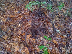
Something used to be there.
Hey, look, another mylar balloon.
The trail was extremely overgrown beyond the cable, then cleared up a little, but not so much that I'd call it "clear". How could it be overgrown on both ends and clear enough to drive on in the middle? There were a couple of side trails, but they all looked pretty bad. Maybe one of them wasn't as bad as it looked. Weird.
Eventually the trail turned north but I really wanted to go southeast, on up to Brawley. From a ridge nearby, I could see the peak and started navigating toward it. I sighted on the highest point along the ridge, but the closer I got, the more I realized I was really headed toward a little knob to the southwest of Brawley proper. That little knob looked like the tallest point though and I could see Garland Mountain too, right where it should be. I really don't understand what I did wrong.
As I climbed up the side of Brawley, I found another cable, in the middle of nowhere on the side of the mountain.

It was a good day for finding cables, if you're into that sort of thing.
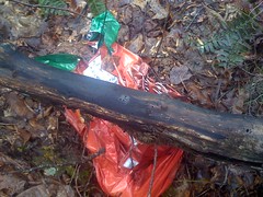
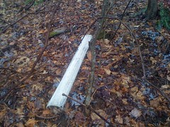
...and I recognized where I was. The last time I was here, there was corrugated plastic everywhere. This corrugated plastic:
I ended up on the landing at the end of Old FS119. Having been there before, I wasn't looking forward to being there again. Uphill, the brush was super dense and thorny and it took a lot of effort to get through it. There was one clear spot though, and looking behind me, I had a great view of the Rich Mountain area. I think that's Davenport on the right, Rocky in the middle and Cold Mountain on the left.

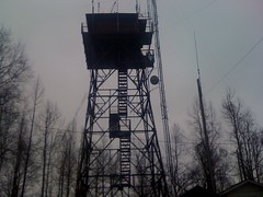
Eventually I made it to Rocky Knob Ridge Road and the Benton MacKaye, and the Brawley Mountain tower sprung, suddenly from the fog in front of me. My first thought was that it looked like one of those fighting machines from War of the Worlds. "Monstrous tripods, higher than the tallest steeple, striding over pine trees and smashing them."
A trail led southeast from Brawley. I followed it down to FS35 and ran across this nasty, half-scavanged deer carcass about a third of the way down.
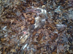
Maybe a pack of coyotes took it down, but more likely a hunter just shot it, took a quick photo and abandoned it there. I've seen so many abandoned deer carcases... I always figured they eventually get eaten. I guess they do. The intersection with FS35 was kind of weird. It didn't tee in at the same level, like 35 was built way later, or at least widened later. Or something. I wonder if it was the original road up to the tower. Who knows?
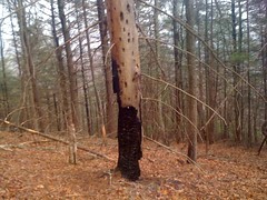
35 is pretty flat, so I jogged north to Brawley Creek and around to the base of a ridge that, at least at the top, had a trail on it. At the bottom there was no trail, but the ridge itself was easy to follow. Somebody had painted yellow stripes on like every 5th tree on the entire ridge. I imagine there will be some logging up there at some point. The stripes looked old though. Do they mark the trees and come back to harvest them when they're grown?
This one looked like it got struck by lightning, burned, died and then got attacked by woodpeckers, or birdpeckers as Sophie calls them :)
Not far up, an old roadbed turned in from the northeast and went straight up the ridge. I followed it to FS45 and took a series of old, overgrown trails over to Ledford Gap. The wind was screaming through the gap and as I pushed through the brush to get out to the road, some thorns whipped around my face from behind, leaving 3 cuts on my nose. I didn't notice at first, but a few minutes later, something just didn't look right, and I realized that they were bleeding, fairly profusely. Yay.
Back at the tower, there was a little three-walled shack housing a generator. I had a seat inside, out of the wind, and ate some lunch. It had been raining off and on all day, but up on the ridge, the wind was fierce and the rain was stinging. It was nice to be out of it. But, sitting still equals getting cold, so I didn't stay long.
The Benton MacKaye led west along a ridge to Garland Gap. Up on the ridge, the wind was relentless, and there was a bunch of horse sign along the trail. Naughty, naughty. On the back side of Brawley Mountain, the BMK bends around through a large, flat area with interesting rock formations. They look like caves, but the last time I was there I walked up close to them and it's just an illusion.
There are also rock piles all over the place, at odd angles to each other. Indian Graves?
At Garland Gap I went south. I'd seen an old roadbed there last time, but I couldn't tell if it went anywhere. Turns out it runs down along the creek to FS35. Near the end, there was a long rock wall, which looked as if it had been built to support the road.
Or maybe there was a house or something there and when it was gone, they built the road right through where it was. Either way, it was interesting. The last hundred feet or so, down to FS35 was overgrown, as if it has been scarified. There was a small tunnel through the brush beside it though and I was able to get through.
On the other side of Garland Creek there was another trail, leading back up toward the gap. It was a bit less passable than the one I'd come down, but I took it back up, took the BMK water trail down the other side, cut cross country to the Garland Gap Trail, and again to some other old roadbeds I'd been on last time, explored them a bit, and finally headed down to FS119 and jogged back to the truck.
I still can't jog very far, but I'm finally at the point where I don't feel like I'm going to wear out some little muscle in 5 minutes. I can't yet just pick a pace where I can jog all day, but I'm getting there. I'm also getting more comfortable navigating when I can't see more than 100 feet at a time, though I still have trouble judging how far I've gone without some kind of landmark to measure against.
All in time.
I'd totally forgotten about getting my face all cut up until I happened to catch a quick look in the mirror. The cuts were tiny, but they sure did bleed. My entire nose and most of both cheeks were covered. I guess the wind had blown it all around as it dried. It looked pretty awesome. I should have taken a picture. It's lucky that I even noticed though. I grabbed a bite to eat in Dawsonville and I can only imagine how crazy they would have thought I was if I hadn't.
I've been training and racing and crap like that for the past couple of weeks and ignoring the urge to just go out and explore the world. I also just washed last week's race off my mountain bike, and couldn't bring myself to even think of a road ride. It seemed like a good day to indulge.
Persimmon Creek runs down the north-ish side of Brawley Mountain. USGS maps show an odd, lasso-shaped trail looping off FS119, up around the creek and back. Was it really there? Today 119 was open for some reason so I drove out and parked right at the end of the trail.
It was there, and really clean and open for maybe a mile. At the first creek crossing, there was sort of a clearing off to the right. Maybe an old homesite? I looked all around, but a single cinder block, or at least part of one, was all that remained of whatever used to be there.
The trail went on and on, and then, abruptly, became the most solid wall of saplings I've ever tried to push through. Despite being seriously overgrown, it kind of went where the map said it would. But, just as the brush cleared, the trail ended. It looked like there might be something down along the creek itself, so I trudged down and ended up following another trail north of the creek toward Hickoryland Mountain. It was a little rough at first, then suddenly became totally clear, like I-could-drive-my-truck-on-it clear. A little further up there was another clearing, with what looked like an old rock wall cutting across it, and there was this old cable.
The rock wall looked more like a rock wall in real life.
And there was also this shovel, buried in the ground and a tree had grown up around it.
The road bent around behind the clearing and there was another, longer cable coiled up there.
Something used to be there.
Hey, look, another mylar balloon.
The trail was extremely overgrown beyond the cable, then cleared up a little, but not so much that I'd call it "clear". How could it be overgrown on both ends and clear enough to drive on in the middle? There were a couple of side trails, but they all looked pretty bad. Maybe one of them wasn't as bad as it looked. Weird.
Eventually the trail turned north but I really wanted to go southeast, on up to Brawley. From a ridge nearby, I could see the peak and started navigating toward it. I sighted on the highest point along the ridge, but the closer I got, the more I realized I was really headed toward a little knob to the southwest of Brawley proper. That little knob looked like the tallest point though and I could see Garland Mountain too, right where it should be. I really don't understand what I did wrong.
As I climbed up the side of Brawley, I found another cable, in the middle of nowhere on the side of the mountain.
It was a good day for finding cables, if you're into that sort of thing.
...and I recognized where I was. The last time I was here, there was corrugated plastic everywhere. This corrugated plastic:
I ended up on the landing at the end of Old FS119. Having been there before, I wasn't looking forward to being there again. Uphill, the brush was super dense and thorny and it took a lot of effort to get through it. There was one clear spot though, and looking behind me, I had a great view of the Rich Mountain area. I think that's Davenport on the right, Rocky in the middle and Cold Mountain on the left.
Eventually I made it to Rocky Knob Ridge Road and the Benton MacKaye, and the Brawley Mountain tower sprung, suddenly from the fog in front of me. My first thought was that it looked like one of those fighting machines from War of the Worlds. "Monstrous tripods, higher than the tallest steeple, striding over pine trees and smashing them."
A trail led southeast from Brawley. I followed it down to FS35 and ran across this nasty, half-scavanged deer carcass about a third of the way down.
Maybe a pack of coyotes took it down, but more likely a hunter just shot it, took a quick photo and abandoned it there. I've seen so many abandoned deer carcases... I always figured they eventually get eaten. I guess they do. The intersection with FS35 was kind of weird. It didn't tee in at the same level, like 35 was built way later, or at least widened later. Or something. I wonder if it was the original road up to the tower. Who knows?
35 is pretty flat, so I jogged north to Brawley Creek and around to the base of a ridge that, at least at the top, had a trail on it. At the bottom there was no trail, but the ridge itself was easy to follow. Somebody had painted yellow stripes on like every 5th tree on the entire ridge. I imagine there will be some logging up there at some point. The stripes looked old though. Do they mark the trees and come back to harvest them when they're grown?
This one looked like it got struck by lightning, burned, died and then got attacked by woodpeckers, or birdpeckers as Sophie calls them :)
Not far up, an old roadbed turned in from the northeast and went straight up the ridge. I followed it to FS45 and took a series of old, overgrown trails over to Ledford Gap. The wind was screaming through the gap and as I pushed through the brush to get out to the road, some thorns whipped around my face from behind, leaving 3 cuts on my nose. I didn't notice at first, but a few minutes later, something just didn't look right, and I realized that they were bleeding, fairly profusely. Yay.
Back at the tower, there was a little three-walled shack housing a generator. I had a seat inside, out of the wind, and ate some lunch. It had been raining off and on all day, but up on the ridge, the wind was fierce and the rain was stinging. It was nice to be out of it. But, sitting still equals getting cold, so I didn't stay long.
The Benton MacKaye led west along a ridge to Garland Gap. Up on the ridge, the wind was relentless, and there was a bunch of horse sign along the trail. Naughty, naughty. On the back side of Brawley Mountain, the BMK bends around through a large, flat area with interesting rock formations. They look like caves, but the last time I was there I walked up close to them and it's just an illusion.
There are also rock piles all over the place, at odd angles to each other. Indian Graves?
At Garland Gap I went south. I'd seen an old roadbed there last time, but I couldn't tell if it went anywhere. Turns out it runs down along the creek to FS35. Near the end, there was a long rock wall, which looked as if it had been built to support the road.
Or maybe there was a house or something there and when it was gone, they built the road right through where it was. Either way, it was interesting. The last hundred feet or so, down to FS35 was overgrown, as if it has been scarified. There was a small tunnel through the brush beside it though and I was able to get through.
On the other side of Garland Creek there was another trail, leading back up toward the gap. It was a bit less passable than the one I'd come down, but I took it back up, took the BMK water trail down the other side, cut cross country to the Garland Gap Trail, and again to some other old roadbeds I'd been on last time, explored them a bit, and finally headed down to FS119 and jogged back to the truck.
I still can't jog very far, but I'm finally at the point where I don't feel like I'm going to wear out some little muscle in 5 minutes. I can't yet just pick a pace where I can jog all day, but I'm getting there. I'm also getting more comfortable navigating when I can't see more than 100 feet at a time, though I still have trouble judging how far I've gone without some kind of landmark to measure against.
All in time.
I'd totally forgotten about getting my face all cut up until I happened to catch a quick look in the mirror. The cuts were tiny, but they sure did bleed. My entire nose and most of both cheeks were covered. I guess the wind had blown it all around as it dried. It looked pretty awesome. I should have taken a picture. It's lucky that I even noticed though. I grabbed a bite to eat in Dawsonville and I can only imagine how crazy they would have thought I was if I hadn't.
Sunday, March 21, 2010
Alpharetta Greenway
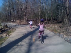
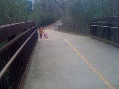
The girls and I went back to the Greenway yesterday. There was a section that we hadn't ridden yet and I wanted to see if they were good for a pretty long ride.
We started at Kimball Bridge Road and headed south. Sophie led, but Iz was staying like 20 feet back from her and kept drifting further back. Sophie wasn't going too fast, Iz was just nervous that she'd stop suddenly or swerve or something. It wasn't an unwarranted fear either. Sophie's riding a lot better, but she's still a little squirrelly. That said, she was climbing well and made a bunch of hills that I didn't expected her to make.
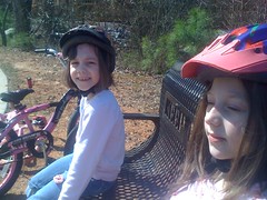
We rode south to the Big Creek trails, took a break...
...and headed back. Since her crash, Sophie really wants to ride in the middle of the trail, right up against the yellow line. She unconsciously drifts over to it. If I remind her, she moves over and ends up back at the middle 10 seconds later.
I think we rode for about 2 hours. Not sure how many miles. It seemed like 8 or 9, maybe more. Sophie was a little tired, but not too bad. I bet we could do the entire thing. We'll have to try that soon.
We started at Kimball Bridge Road and headed south. Sophie led, but Iz was staying like 20 feet back from her and kept drifting further back. Sophie wasn't going too fast, Iz was just nervous that she'd stop suddenly or swerve or something. It wasn't an unwarranted fear either. Sophie's riding a lot better, but she's still a little squirrelly. That said, she was climbing well and made a bunch of hills that I didn't expected her to make.
We rode south to the Big Creek trails, took a break...
...and headed back. Since her crash, Sophie really wants to ride in the middle of the trail, right up against the yellow line. She unconsciously drifts over to it. If I remind her, she moves over and ends up back at the middle 10 seconds later.
I think we rode for about 2 hours. Not sure how many miles. It seemed like 8 or 9, maybe more. Sophie was a little tired, but not too bad. I bet we could do the entire thing. We'll have to try that soon.
Wednesday, March 17, 2010
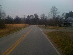
Sunday, March 14, 2010
Alpharetta Greenway
I got a little recovery ride in today. The best kind. Five miles on the Greenway with the girls. Or one of them at least, Iz was sick today, so she couldn't come. I missed her, but I don't get much one-on-one time with either of them, and when Isabel isn't around, Sophie talks and talks and talks.
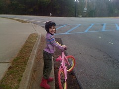
We just barely got across the parking lot when Sophie decided it was too cold. It was actually the same temperature as yesterday, but today it was overcast and breezy. My winter kit was in the trunk, but it was a little big on her.

Woohoo, Greenway! We had it almost all to ourselves and Sophie hit me with a steady barrage of unusual questions. Questions like "When we get older, do you think they'll discover a new color?" Iz loves to talk and when she's not around, Sophie takes full advantage of the opportunity. It makes me wonder how many strange questions she doesn't ask.
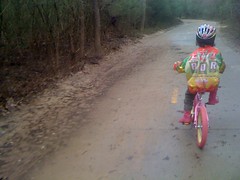
Big Creek.
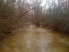
Some trails have problems with erosion. This one has more of a deposition problem.
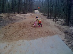
Sophie didn't like how dirty her tires were getting, and also kept calling them pedals instead of tires.
"My beautiful pedals! Look at my beautiful pedals!"
"You mean tires?"
"Look at my beautiful tires!"
I kept telling her not to swerve too hard in the dirt, but she did it anyway and washed out once. She didn't crash though, just bailed. I guess she learned a bit from last weekend. She did a lot better climbing today too, rode a lot faster and generally seemed more confident. It's funny how few hours it takes to go from just-learning to doing-well, but it's also funny how many weeks it takes to get in those hours when our neighborhood is too hilly for her to ride in.
She did have to push a few hills, especially the steep ones at the bridges.
We topped it off with dinner at Chipotle. Sophie likes burritos with rice and cheese and nothing else. Kind of weird, but hey, whatever makes her happy. Watching her eat is entertaining too. When she gets near the end, she doesn't know what to do and just makes it falls all apart.
A little chilly, but otherwise a great day. There are still a couple of miles we haven't ridden out there. I'm looking forward to the day that we can marathon the whole thing.
We just barely got across the parking lot when Sophie decided it was too cold. It was actually the same temperature as yesterday, but today it was overcast and breezy. My winter kit was in the trunk, but it was a little big on her.
Woohoo, Greenway! We had it almost all to ourselves and Sophie hit me with a steady barrage of unusual questions. Questions like "When we get older, do you think they'll discover a new color?" Iz loves to talk and when she's not around, Sophie takes full advantage of the opportunity. It makes me wonder how many strange questions she doesn't ask.
Big Creek.
Some trails have problems with erosion. This one has more of a deposition problem.
Sophie didn't like how dirty her tires were getting, and also kept calling them pedals instead of tires.
"My beautiful pedals! Look at my beautiful pedals!"
"You mean tires?"
"Look at my beautiful tires!"
I kept telling her not to swerve too hard in the dirt, but she did it anyway and washed out once. She didn't crash though, just bailed. I guess she learned a bit from last weekend. She did a lot better climbing today too, rode a lot faster and generally seemed more confident. It's funny how few hours it takes to go from just-learning to doing-well, but it's also funny how many weeks it takes to get in those hours when our neighborhood is too hilly for her to ride in.
She did have to push a few hills, especially the steep ones at the bridges.
We topped it off with dinner at Chipotle. Sophie likes burritos with rice and cheese and nothing else. Kind of weird, but hey, whatever makes her happy. Watching her eat is entertaining too. When she gets near the end, she doesn't know what to do and just makes it falls all apart.
A little chilly, but otherwise a great day. There are still a couple of miles we haven't ridden out there. I'm looking forward to the day that we can marathon the whole thing.
Saturday, March 13, 2010
Heritage 6 Hour
Man, man, man. Heritage. First race this season. Usually I jump in at Snake Creek Gap, but we all know how that went. So... Heritage.
To get to Heritage, you have to get up early.
I always go the wrong way, and I did again today. But I did get there, and so did some friends.
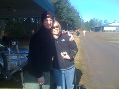
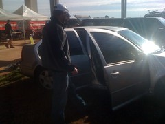
Travis and Michelle.
Sadie the dog.
Matt.
Great photo there, eh?
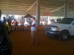
Last year, the whole 6/12 hour series was run by Dirty Spokes. This year, Dirty Spokes is doing one or two of them, but the rest are run by Chainbusters. Kenny, of Chainbusters:
Yeah, I know how to take a good picture.
All my warm weather BOR jerseys are worn out: stretched out, busted pockets, snagging zippers, holey and thread bare. Today I tried just wearing my base layer and shorts. It was in the low 50's but sunny and, as it turned out, plenty warm. It may have looked a little weird, but I figure if I can lose some weight, I can pull it off.
The parade lap was lazy and I got into the woods in good position. A few minutes in, I passed Travis, standing on the side of the trail with a busted chain. Yeah, I guess it is the Chainbusters series. I settled in behind Lisa Randall and came to a terrible realization. Last year at Tribble Mill, I passed a girl in a really bad spot and almost hit her. It was really bad, I think about it every time I pass someone now and I'm a lot less aggressive these days. I didn't realize it was Lisa though, until today. She was wearing the same kit and yeah, it was definitely her. It's weird, I've ridden with her since then. I didn't realize it was her and I don't think she realized it was me. Sorry Lisa. (Update. pfft. now that I look back at it, it couldn't have been her last year because she was having a baby and didn't even race the series. Well, whoever it was, same team, same kit, looked a lot like her. Sorry to whoever you are.)
After all that, I had no intention of passing her, but it didn't matter, I still had winter lungs and half a lap in, I started sliding back.
The course layout was way different than any other race there. Heritage is usually uphill both ways. The way they routed it today, it was only 7 miles and there were several long, rolling descents; a totally different feel. Still, it was a hand-slammer and every ten feet you had to put out some little burst of effort; yanking over something, bumping up or down some crazy staircase of roots, diving in and out of a gully, or who knows, some other nightmare. And... since it rained all week, the course was damp and every root wanted to yank my front wheel. Challenging doesn't come close to describing it.
Lap one was fun. On lap two I passed a bunch of riders. At the end of lap three I started getting twinges in my left leg. Come on! Plenty of energy and no legs to put it into. Lap four was cramp management. At the end of the lap, I asked for the time. 1:08. I'd really expected it to be later. 4 laps in 3 hours. I could potentially do 4 more, but I was already winding down and I couldn't imagine doing 4 more. 3 more, maybe. Lap five was more cramp management, which meant really throttling back the effort. I'd forgotten to lube my chain too, and it was making some crazy noises. Lap six I lubed my chain and reapplied the chamois butt'r. The cramps were gone, but so was my energy. Travis caught me about a mile from the end. I pulled in with 52 minutes remaining, but my last 2 laps were 58 and 60 minutes respectively. No more for me.
All said and done, I came in 5th out of, I think, 16 riders. That'll do.
I spent the next two hours coughing cobwebs out of my lungs. All day, I never felt great. Sometimes it feels like you've got iron legs, crushing the pedals all day. I never got that feeling. In fact I had a hard time even taking a deep breath. Better luck next time.
Right before the awards, we were treated to a rainbow.

Most everybody I know placed or came close. Travis managed 9th, even after having to go back to the car to fix his chain and losing almost 45 minutes on his first lap. I think it was 45. Something like that.
Me, Travis and Michelle bailed back to the ATL for some Grant Central Pizza and were again, treated to a rainbow.
I think Yargo is next. Not sure when exactly, but I should be able to get a little fitness upgrade from some group rides and commutes between now and then. Here's hoping.
To get to Heritage, you have to get up early.
I always go the wrong way, and I did again today. But I did get there, and so did some friends.
Travis and Michelle.
Sadie the dog.
Matt.
Great photo there, eh?
Last year, the whole 6/12 hour series was run by Dirty Spokes. This year, Dirty Spokes is doing one or two of them, but the rest are run by Chainbusters. Kenny, of Chainbusters:
Yeah, I know how to take a good picture.
All my warm weather BOR jerseys are worn out: stretched out, busted pockets, snagging zippers, holey and thread bare. Today I tried just wearing my base layer and shorts. It was in the low 50's but sunny and, as it turned out, plenty warm. It may have looked a little weird, but I figure if I can lose some weight, I can pull it off.
The parade lap was lazy and I got into the woods in good position. A few minutes in, I passed Travis, standing on the side of the trail with a busted chain. Yeah, I guess it is the Chainbusters series. I settled in behind Lisa Randall and came to a terrible realization. Last year at Tribble Mill, I passed a girl in a really bad spot and almost hit her. It was really bad, I think about it every time I pass someone now and I'm a lot less aggressive these days. I didn't realize it was Lisa though, until today. She was wearing the same kit and yeah, it was definitely her. It's weird, I've ridden with her since then. I didn't realize it was her and I don't think she realized it was me. Sorry Lisa. (Update. pfft. now that I look back at it, it couldn't have been her last year because she was having a baby and didn't even race the series. Well, whoever it was, same team, same kit, looked a lot like her. Sorry to whoever you are.)
After all that, I had no intention of passing her, but it didn't matter, I still had winter lungs and half a lap in, I started sliding back.
The course layout was way different than any other race there. Heritage is usually uphill both ways. The way they routed it today, it was only 7 miles and there were several long, rolling descents; a totally different feel. Still, it was a hand-slammer and every ten feet you had to put out some little burst of effort; yanking over something, bumping up or down some crazy staircase of roots, diving in and out of a gully, or who knows, some other nightmare. And... since it rained all week, the course was damp and every root wanted to yank my front wheel. Challenging doesn't come close to describing it.
Lap one was fun. On lap two I passed a bunch of riders. At the end of lap three I started getting twinges in my left leg. Come on! Plenty of energy and no legs to put it into. Lap four was cramp management. At the end of the lap, I asked for the time. 1:08. I'd really expected it to be later. 4 laps in 3 hours. I could potentially do 4 more, but I was already winding down and I couldn't imagine doing 4 more. 3 more, maybe. Lap five was more cramp management, which meant really throttling back the effort. I'd forgotten to lube my chain too, and it was making some crazy noises. Lap six I lubed my chain and reapplied the chamois butt'r. The cramps were gone, but so was my energy. Travis caught me about a mile from the end. I pulled in with 52 minutes remaining, but my last 2 laps were 58 and 60 minutes respectively. No more for me.
All said and done, I came in 5th out of, I think, 16 riders. That'll do.
I spent the next two hours coughing cobwebs out of my lungs. All day, I never felt great. Sometimes it feels like you've got iron legs, crushing the pedals all day. I never got that feeling. In fact I had a hard time even taking a deep breath. Better luck next time.
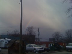
Right before the awards, we were treated to a rainbow.
Most everybody I know placed or came close. Travis managed 9th, even after having to go back to the car to fix his chain and losing almost 45 minutes on his first lap. I think it was 45. Something like that.
Me, Travis and Michelle bailed back to the ATL for some Grant Central Pizza and were again, treated to a rainbow.
I think Yargo is next. Not sure when exactly, but I should be able to get a little fitness upgrade from some group rides and commutes between now and then. Here's hoping.
Subscribe to:
Posts (Atom)


