Saturday, May 26, 2012

Allatoona Creek

I have no specific memory of when I first heard about Allatoona Creek.

I do remember a while back hearing that it was open though. And I also remember kicking myself that my Dad and I didn't go there instead of wherever we did go when he's been in town. Well as luck would have it, my Dad's in town again, last night we were talking about where to ride and for some reason Allatoona Creek finally came to mind. I looked it up, went to my trails site, tried to figure out how to get there from here and noticed that I already had a placeholder marking its location. Pitner Road Park I'd called it. "Construction of trails will begin in 2011" or something like that. I stretched my mind but I couldn't reach any memory of having typed in any of that. This is a milestone I think. My database has gotten so big that I'm starting to forget what's in it, despite having put all of the data in myself.

A nerd milestone.

I started the day off right, at the Dutch Monkey, as all days should be started.

 Chocolate Boston Cream

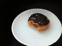
I can't believe that I'm saying this but it's possible that the Chocolate Boston Creme donut might actually have more chocolate in it than I'm down for in a single bite. The filling was chocolate, there were little chocolate chips on top, and the donut itself was, if I may quote The Simpsons, "Covered with chocolate so dark that light cannot escape its surface."

It was chocolate overload but I ate it because, I mean, come on, it's a chocolate donut, in my vicinity, that no one else has claim to. It's going to get eaten.

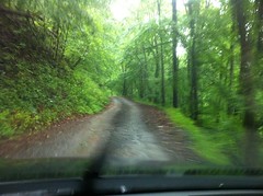
The drive over took way longer than I expected.

I managed to spill half of my Mexican Sugar Coke on the passenger seat. Don't trust my cupholders with your narrow bottles.

On Cobb Parkway I ended up next to or behind a dude with a black 80's Corvette Stingray convertable, just out cruising the drag.

 LS-1 Stingray

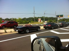
According to the stickers on the hood, he'd put an LS-1 motor in it.

While I can't see myself putting in the time and energy into such a project, I'm glad that someone did. I enjoyed following the guy for miles.

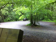
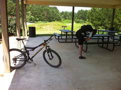
After seven eternities, I met o meu padre at the Pitner Dog Park. We'd both sort-of expected some indication that there was a trail nearby but there were no such indications. The trailhead is tucked semi-anonymously off in the front right corner of the dog park, by the playground. My dad had even made a cursory survey of the area before I arrived and failed to discover it.

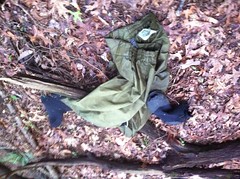
Discover it, we eventually did though, kitted up, stretched a bit...

 Stretch

...and commenced to shred.

 Shred

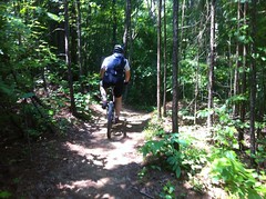
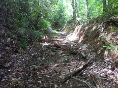
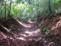
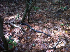
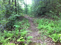
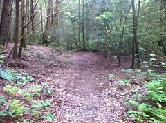
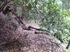
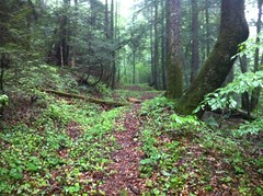
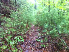
The trail nearest the lot is called Turtle Back and it's got an extension dangling off it's southernmost extremity. Together, they pretty much just wind around in the woods behind the dog park, but they are IMBA bench cut flowmasters and we twisted excitedly through their drops and turns.

Near the beginning there's a small bridge though, followed by a short steep natural drop and then another short bridge drop right after that. As innocuous as it looked, on our second lap neither of us saw fit to commit to it.

I think we're getting soft. A few years back I'd have spun back just to ride it.

There was a long, turny bridge later in the lap that I did ride but it didn't erase the shame of skipping that first set of drops.

The shame.

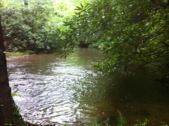
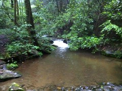
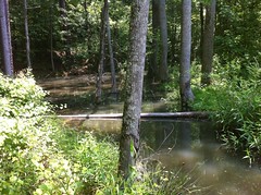
About 2/3rds of the way around we found a connector leading over to another section of the park and took it. Though singletrack, this connector had a very different character than the trail we'd ridden so far. It was much flatter, less twisty and ran through a wetland of sorts with a bridge even over the narrow spot between a pair of scenic little ponds.

 Allatoona Creek Wetland

Eventually we arrived at a road, which we later determined to be Old Stilesboro Road and had to wait on a dozen or more cars before crossing the street. Coincidentally, when I arrived home, somebody had just posted on the Sorba forum about trying to get a crosswalk painted and signed there. I think that would be nice to have, as well as a sign in the woods indicating that there's a road ahead. Not critical, but nice to have.

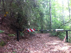
Across the road there was another parking lot and trailhead. The trails beyond appeared to be on Army Corps land and had a long list of dates when they were closed except for hunting. Today didn't appear to be on the list so we proceeded forth, beyond the gate.

The whole area reminded me of the Central Florida nature preserves that we rode during the Huracan, and that I believe, the Naked Indian himself is tackling in his own ITT at this very moment.

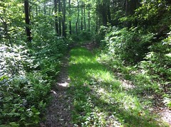
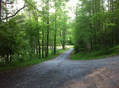
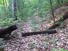
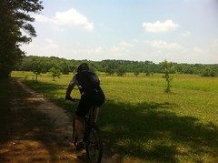
Basically it looked like old farmland where the old fields had been preserved, with little bits of forest between them and old farm roads, turned doubletrack, winding throughout.

 Fields

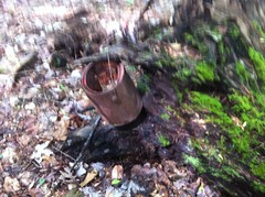
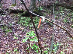
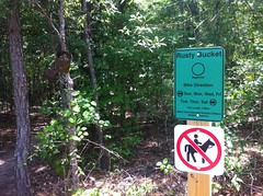
The map was a little unclear about which way we should go, as the trail we were on eventually blended into the lines marking the border of the property but I drew my finely tuned navigation skills against the problem... and followed the signs to the Rusty Bucket Trail.

 Rusty Bucket Signage

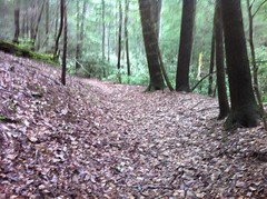
The Rusty Bucket was wider than the previous trails and much flatter, but also reasonably twisty. My girls could probably ride it and I would dig riding it with them. About halfway around a connector led south (I think), crossed a road (with no traffic this time) and followed a drainage line down the side of a creek and under a bridge. Mason's Bridge, I gathered, from the name of the trail.

Again, the character of the trail changed dramatically. So far we'd had 5 distinctly different trail experiences. The only thing that I love more than ripping twisty singletrack is ripping twisty singletrack through a mixed forest and then straight singletrack through a wetland and then wide open doubletrack through sunny fields and then wide singletrack through a pine forest and then open singletrack along a creek under a bridge...

In my ranking system, trail systems get substantially more points for variety of trail experience than for the number of miles of fun trail. Allatoona gets dozens upon dozens of points.

At the end of the connector there was another mile or two of twisty singletrack like we'd ridden at the beginning behind the dog park. Somewhere in there we got passed by another rider. My dad and I joked about having an easy Sunday ride but I was having exactly the kind of ride I wanted to be having and he was too. We were accomplishing our goals and there was no reason to push any harder today.

Eventually we'd reached the furthest extremity of the trail and started working our way back. We'd taken all rights on the way out and continued to take rights again on the way back to catch the other halves of the loop trails.

On the way back to the Stilesboro lot I noticed a bush full of blackberries and we ate until we were tired of eating blackberries.

 Blackberry Snack

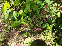
Sometimes blackberries are bitter. Sometimes they're sour though, without actually being bitter. That's how these were. The latter. Good lord they were good.

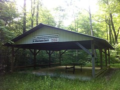
Back at the Stilesboro lot my dad ran in to use the facilities for a moment and I noticed an older lady trudging toward me from across the lot, carrying a small child. The sun was blazing and for whatever reason, though the weather has been relatively cool for the past few weeks, today it had been 97 when we arrived and seemed to have gotten even hotter since. At first I didn't think much of it, but as the lady got closer her steps became substantially more labored until eventually she was barely more than shuffling through the gravel.

I was about to say something when she reached the shade of the nearest stand of trees and recovered enough to begin to lift her feet again.

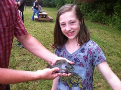
She was close enough now that I could identify the child as a beautiful little girl. She seemed immune to the heat and examined her world intently, in every direction, in the way that only a child, to whom very little is yet familiar, can do.

"How old is she?" I asked.

"10 months... I'm her grand-mother... No, her great-grandmother. Whoo! I'm not exactly physically inclined."

So we had a great-grandmother and great-granddaughter, alone in a parking lot, approaching collapse, without food or water. How did this happen? Certainly she couldn't be in such poor shape to be over exerted by simply walking across the lot from her car...

I realized then that I might have seen her earlier at the other lot, examining the trail map with the mountain biker that had passed my dad and I earlier, another lady and another man, but I hadn't noticed the little girl at that time.

"Some friendly bikers are taking my son back to get the car. He's coming back for me in a minute."

Ahh... She's set out on foot from the other lot with the child's parents (or at least one of them) and couldn't make it back under her own power. While stopped here, some bikers had come off the trail and were now relaying the son back to the dog park lot. They couldn't take the child with them, presumably because there was no car seat.

The probability that the parents had gone back for the car on foot had been forming in my mind, but it had not yet occurred to me why they'd have left the child behind. As a father of two formerly 10 month old girls, I can't imagine leaving either of them behind with my mother in such a state, unless I didn't believe I'd make it back either. If that were the case, I can only imagine the nerve it took to commit to the action they took. I would be all nerves and bitten nails until she was safe in my sights again.

I've seen it before too. It's so easy to get in over your head on what seems like it should be a short hike. It can happen just like that.

From the looks of it, everything turned out ok. Grandma and child made it to the bathroom where there was water and shade and the rider that passed us earlier stayed with them until the father returned. Crisis averted.

The padre and I rode back to the dog park and spun another lap around the front half of the trail system. We'd been talking about random stuff all day, but somehow the conversation for that lap turned to some work we might soon be engaged in and the explicit details of how a particular Flash program is getting authenticated to run and how it sends the results of a media-rich quiz that it presents the user to a database... Not the kind of conversation that you might generally engage in while shredding twisty singletrack. This occurred to both of us about halfway through the lap. Some would deem that conversation under those circumstances outright heresy, but apparently if you're equal parts computer nerd and mountain biker it comes quite naturally. If such nerdity is wrong, I don't wanna be right.

We probably could have done a-whole-nother big lap but we both kind-of needed to get home. We hit the Gondolier Pizza joint on the way out of town. I expected the same Gondolier that me and Travis and Russell ate at in Rome after the Up the Creek Without a Pedal ride way back, but this was a totally different, lower-budget Gondolier. Budget aside though, their pizza was delicious and the two-for one deal they had going on made it all that much better. I've got tomorrow's lunch in my fridge, right now.

I took a slightly different route home and it led me past that Marietta landmark of landmarks - the Big Chicken.

 Big Chicken

All hail the Big Chicken, with it's creepy rotating eye.

All hail.

Thursday, May 24, 2012

Weekly Beatdown

Starting over.

That's what this weeks beatdown felt like. Like I hadn't ridden a bike in years. Like I hadn't had to work a day in my life. I'm coming off of a stomach bug and I've been putting in a lot of late nights so I'll blame that for now. I hope that's all it is.

Ugh.

Pink Knob

It was forever ago that I did this. The memory has nearly faded. I hope I remember it correctly.

Life has been that way lately. Either I've got nothing to do or I've got more work than I can get done. Throw in bad weather and illness and it's enough to drive a person crazy.

I guess it was about two weekends ago that we got bad weather and I ran around lower Bear Creek and drove around in The Great Unknown to the east of there. The following Monday I didn't want to do anything but drive back up there and do it again. Monday, I had too much to do. On Tuesday though, I was blocked, waiting for input, and I did what any good nerd would do: a context switch - to the Pink Knob area.

I parked off of Zion Hill Road, way up at the top, at the gate of an old defunct FS road and started walking north.

The last time, I'd driven to the very end, where I was blocked by private property ahead. The old road continued left but it didn't look inviting in the rain.

Turns out I made the right call. Rain aside, I wouldn't have gotten far if I'd turned left.

 Old East Mountaintown Creek Road

I've seen roads that are further below grade than that, but not many.

Further up, the situation improved somewhat and there was even an old FS-looking pipe gate.

 Old East Mountaintown Creek Road Gate

The gate was flanked with comforting red stripes as well.

It's always nice to be assured that you're on public land. There had been signs and fences to my right and it seemed clear where it was ok to be, but you never know. Just because it's not fenced in or signed doesn't mean it's public land. Per Georgia law, it's not strictly illegal to cross private land unless you know you're not supposed to, but landowners seem to do what they feel justified in doing on their land and whether that falls in line with the law or not is more a matter of chance than choice.

The USGS map showed two roads, one leading around some now-defunct lakes and another leading further up into the unknown. In fact though, there was a bit of a maze back there. There was plenty of evidence that people frequented these parts...

 Campsite

...but it wasn't immediately clear which ways they usually went.

I'd hoped to take the road off into the unknown, and it could have been any of the half dozen overgrown spurs to the left but the route most travelled seemed to lead more northeast than that and I divined my way forward, following what seemed to be the way people tended to go.

Eventually I figured it all out.

Zion Hill Road (or Old East Mountaintown Creek Road) more or less followed the creek and there was a circle off of it to the west with several spurs off of that. People, it seemed, tended to follow the main road and occasionally camped off of the circle.

The main road ahead was wide, clear, not terribly well worn, recently at least, but worn in well enough to follow.

It alternated between perfect, bench cut sidehill...
 Nicer Trail

...and the ugliest ridge runs of all time.

 A Little Below Grade

It looked like they only cut sidehill when the ridge got too steep to follow directly though. That's old school.

Man, how old is this road?

It looked like a significant road. In several places it had gotten braided as old routes were abandoned and rerouted, several times. It was so below grade in some places that it had to have been bulldozed, over and over. The surrounding forest was wide open with huge trees and little brush. It might have been as easy to walk through the open woods as along the trail. I always wonder about old roads like this. Was it really just an old logging road or was it a turnpike connecting communities or regions? There was certainly a logging network lower down, but if the upper reaches had ever been logged, it was a very long time ago.

I've occasionally wondered what would happen if a road that had become too deeply trenched to navigate was just abandoned in place. Would it continue to erode forever? Would it ever heal? I've seen only short little examples of such abandoned roads before so I could never be sure that they were representative.

I had plenty of research opportunities that day though. The road had every problem I've ever seen, in bulk, and it had clearly been abandoned for a very long time.

So it looks like the road does keep eroding, but without traffic to clear the duff, leaves eventually build up and trap the sediment. This game of give and take must go on for years before it reaches an equilibrium. In some spots, bare rock is eventually exposed. In others, even the chunkiest ruts get filled in. In the end, all that's left is the a big, smooth, rounded U, easily mistaken for a dry prong by the casual observer. In fact, I'd bet that the process that obscures a dried up creekbed is very similar.

Trail science aside though, I saw several more interesting things.

A black racer:

 Black Racer

A can of red paint:

 Paint Can

I think this was the can of paint used to mark trees along the NF border. It looked like somebody realized they were running out of paint too and tried to use it all up because The marks got larger and closer together until, right before I found the can, literally every other tree was marked for several hundred yards.

There was also a fire newt;

 Fire Newt

It's been a while since I've seen one of those. They never look real to me.

I also saw several deer which acted weird, running away one at a time, with several seconds in between them rather than all at once.

Somewhere in there I was approaching an old culvert and a gigantic snake fled into it. I didn't recognize it at all. It was glossy, brownish grey and probably an inch and a half in diameter. I immediately thought of a worm snake but this would be the biggest worm snake of all time. Probably not a smooth earth snake for the same reason. It could have been a red bellied water snake, as it was in water, and in the right size range, but I couldn't see its head or belly and I wasn't brave enough to try to dig it out.

I think I saw more pileated woodpeckers than ever before in my life too. They were everywhere. It's the only bird I remember seeing and I saw them all day.

Up near the top there was a ton of Mountain Laurel:

 Mountain Laurel

I knew I was nearing the top, but I wasn't exactly sure what it was the top of, exactly? Surely the ridge of Pink Knob, but where along that ridge? Which gap? The likeliest candidate was Sassafrass as it was the only named gap up there and I hadn't seen any spurs, other than braiding, since I'd gotten up out of the habitated zone. Plus it sort-of seemed like that's where I'd been headed. I wanted to be sure though.

As I approached the actual top, it got very overgrown all of a sudden and I couldn't see anything. I knew I was in the right place though because someone had tied a small ribbon around a branch, marking the way.

The road continued downhill from there though and eventually I got to a spot where I could sort-of see Flat Top through the trees. It took a while to be sure but, yeah, I'd come through Sassafrass and I was headed somewhat northeast, probably down towards Jack's River.

There was another old road to the right but the one I was on continued straight and I followed it. Unfortunately I think the other was is the direction people usually go. The direction I went cleared occasionally but not to the extent that I wouldn't classify the trail, in general, as overgrown. It might be less so in the winter, but it was mostly hemlock and rhodo, so probably not all that much. As I got further down off the mountain a logging network materialized. Near the very bottom the road joined a creek and didn't diverge for another 100 yards. Not 100 yards after that though, it teed into a gloriously clean trail.

Could this be the fabled Jack's River Road?

 Jacks River Trail

I say fabled because I'd heard word of it from several equestrians and the USGS maps show a road leading up along Jack's River, but I'd never seen it myself.

It was certainly in the right place to be Jack's River Road. I followed it downstream and indeed, it soon became a road.

 Jacks River Road

The trail part was very interesting though, and it points out something that we've been talking about lately in the CoTrails group....

The National Forest is shot through with trails that aren't part of any authorized trail system, so many that they will eventually need to be mapped and assessed. A small few were intentionally created but the vast majority probably formed the same way the authorized trails did - people just continued to use old roadbeds on foot or horse (and later on bikes) long after they were decommissioned as roads. Why they were never integrated or formally closed has been lost to history.

With a few notable exceptions, the vast majority of the trails that I've found have fairly clear corridors and appear to get some amount of traffic, but don't appear to be causing an unacceptable level of environmental impact. I say "an unacceptable level" rather than "any" because all forest use has some impact. A bear walking through the woods has _some_ impact. The very existence of the trail might count as _some_ impact. Still though, the impact of most of these trails is really low.

However, for the most part, these trails are protected by their obscurity alone. Many lie in the least sustainable locations - along a ridge, up a fall line, on an old trenched out roadbed, etc. If they got materially more traffic they would degrade, but as they are, whatever traffic they're getting doesn't present a problem.

Such was the case with Jack's River Road. At first glance, it looked like a hiking trail, or maybe more like upper Mountaintown Creek Trail - open and travelled, but still pretty wild. Later though, in the one soft spot, I noticed hoof prints. So, this trail gets some amount of horse traffic. Given it's proximity to Jacks River Campground, and the fact that I heard about it from a couple of different equestrians, this didn't surprise me. But the condition, compared to what I'm used to seeing from a horse trail, was very surprising.

What should the USFS do about this trail? From an impact perspective, at least from what I saw, there's no reason to close it. There's no good punitive reason to close it either as it wasn't user-created per se, any more than any of the system trails were, and the people who use it aren't breaking any law except possibly trimming brush and deadfall, which I could understand would be an issue if one were attempting to establish a new trail, but not on an already established trail. If it were incorporated into the system though, it would need work to support the increased level of traffic it would get, possibly destroying the wild character of the trail. I could probably name dozens of trails in this same situation. I'd say that the majority of non-system trails are like that. What to do? What to do?

What to do?

So I'd heard about the road, but further up I discovered something I hadn't ever heard about.

 Mt. Gillead Church Pavillion

 Jacks River School Monument

 Jacks River School Cross

There was a school here!

That means there was a community here! With kids! Enough kids to need a school! The school had to be close enough for them to walk to.

Jeez, I'll bet the South Fork Trail was just part of Jacks River Road once and there was a community stretched out along the South Fork between the river and the road. I wonder if it stretched all the way to Bethlehem. Heck, it could have gone even further. I wonder if any old chimneys remain. Man, I wonder.

In all that excitement, I'd kind of lost track of time. I don't remember now what time it was, but I remember that when I checked, I knew that I had to make some decisions. I remember sitting down on a rock across from where Jacks River Road and FS64 meet and thinking about it.

I still wanted to find that old road that led from Zion Hill over Alaculsy Gap, down into the general Mountaintown Creek area. On the Zion Hill side, if it was one of the spurs I'd seen, it was really overgrown. Who knows what it would be like on the other side. The forest surrounding Mountaintown is fairly clear though, I remembered that.

An ambitious plan was coming together.

If it existed, I had a decent chance of finding the road on the Mountaintown side and it had a good chance of being somewhat clear. If I didn't find it, I'd descend to Dyer Creek and try to find the old road that should lead northeast from there. Worst case, I'd have an extended bushwhack over the ridge but it should put me back almost directly at my truck. Absolute worst case it would get dark but I'm not incompetent in the dark. Though this is bear country...

I remember thinking: "I'd better march."

And I did.

Past the inviting-looking Jack's River Campground where Norma and Johnny and I camped during the TNGA...
 Jacks River Campground

...past a pipe that I'd never noticed before (I'll have to tell the TNGA'ers about that one)...

 Water Source

...past a Ringneck Snake playing dead in the road.

 Ringneck Snake

It was lying on its back and after studying it a minute, I flipped it back over to see what it was. It looked unharmed, and it was moving! It slowly flipped itself back upside down. Ha! I'd heard that Hognose snakes do that but not ringnecks. Awesome!

"I am dead."

"No you're not, you're moving."

"Yes, but see, I'm upside down again, and therefore dead."

"Ahh, I see sir, I was mistaken, you are in fact dead. I guess I'll leave you alone then, for there is no value except in a living snake."

Such is the mental dialogue between this snake and something that might eat it. I don't know offhand what eats a snake. I know a Honey Badger eats a Cobra. What eats a ringneck? A Hawk? I don't know.

I was making really good time and I was about to cut off over a mile of walking. A side road led to a food plot which led to a trail running down the ridge on the east side of Buddy Cove which eventually led to what at first appeared to be nothing more than a game trail. I had to crouch to follow it but it was clearly a trail.

Eventually I discovered evidence that it had probably once been something more significant.

 Evidence

Every 20 yards or so a tree lay across the trail. The surrounding woods was extremely scrubby. Somebody had logged out the ridge and left these trees behind for some reason. Maybe they didn't totally clear cut it and dropped these trees to close this end of the old road. I could imagine them doing that, as the hillside had started to get precipitously steeper and steeper there. Then, suddenly the whole character of the forest changed. Small trees with dense scrub between them gave way to big, fat trees on wide centers with rocks and dirt and a whole lot of nothing between them. If that part of the woods had ever been logged, it was a lot longer ago than the part I'd just been through.

And then I saw it, lying right there ahead of me - the Mountaintown Creek Trail.

 Mountaintown Creek Trail

The most highly contested piece of National Forest real estate in Georgia. "Destroyed by mountain bikers!" "Completely blown out, top to bottom!" as clearly evidenced in this photo. Actually, there are a few bad sections but nothing _that_ bad.

The road at the bottom is private so you have to ride or hike it as an out-and-back, and it's a strenuous climb on a bike. The USFS has been trying to figure out what to do about it for years. Rumor was that Sorba asked folks not to ride the trail until the decision was made but that was back in 2009. I last rode it in 2008. The trail is great but I haven't been sufficiently motivated to climb it yet. I hope somebody makes a decision soon, I'm kind of antsy to ride it again now.

If I walked 100 feet down the trail it would have been a lot. I was looking for a side trail leading up the first cove on my left and I found one almost immediately.

It looked like I wasn't the only one who'd found it though.

 Pants and Shoes

Those are neoprene shoe covers and pants used for standing in freezing cold water all day whilst fly fishing.

I guess the guy was hiking out and they fell off his backpack or something. Man, can you imagine getting back and realizing you lost them? That would suck. I imagine that's what happened. They didn't look like they were in the kind of shape that they would have been abandoned on purpose, although something did appear to have gnawed on the neoprene after the fact.

It goes without saying that I found a mylar balloon.

 Blue Balloon

They are more common in the forest than deer.

The trail kind of more-or-less went the way I thought it should. Up, on the left of the creek, sort of east. But before long it didn't look right. I hadn't checked the map or the compass or the GPS in a while and I wasn't going the right way. Without any points of reference, the average person will end up walking in circles in the woods. Apparently I will too, even with plenty of points of reference and a map and a compass and a GPS. I ended up at Crenshaw Gap on FS64, right where I'd been a half hour earlier. I'd walked up Crenshaw Branch. I needed to be one more cove south of where I was. How'd I miss that? Well, at least I got to explore that trail too.

I was really behind schedule now though and I sure hoped the trail I was looking for existed.

The drop back to Mountaintown was quick. It always seems shorter the second time, especially when it's downhill. The trail I wanted actually should tie in at Crenshaw Branch, just south of it, not north, and it should bend around and lead up a different cove, to Brushy Gap. I looked carefully where I thought it should intersect but I didn't see anything. I mean, nothing even vaguely old-road-like. But then a little further south I saw the road, notched into the hillside, to my left. I backtracked again and used my imagination. If I wanted to get up on that road and there was no brush here, how would I do it, in a vehicle. Nothing. It didn't make any sense, but that was the road I needed to be on so I took it. It led both directions. To the north it appeared to bend around and lead up into Crenshaw Cove, without intersecting Mountaintown at all. What?

It also looked somewhat clear and travelled. Light traffic, but there was a clear trail on the old roadbed.

 Alaculsey Gap Trail

I headed south. A little while later I spied a chunky, rutted connector leading down to Mountaintown. So apparently back when they were roads, they used to connect to each other, but it was an afterthought. Neither spurred directly off of the other. Strange.

This strangeness baked my noodle. I wished I had time to see where it went to the north but I had no time for this. I marched south, with a purpose.

I watched the compass more carefully though and once again the trail appeared to diverge from the direction I expected it to take. Fortunately, this time it was still going where I hoped it would. I need to get the MyTopo layer working again on my trails site though because the Google terrain layer can be a little confusing. I arrived at Brushy Gap, thinking I was on a little spur thing north of it and briefly took a wrong turn before discovering my folly. I guess I can't be totally faulted though, as the line on the USGS maps is wrong and I wasn't sure exactly where I'd diverged from it.

Back on track, I crossed a couple of creeks, found another balloon...

 Silver Balloon

And again diverged, though less confusingly this time, from the USGS line. When I arrived at Alaculsy Gap I realized where I was and the trail ahead was as clear as ever.

In fact, it looked like a while ago, the trail had been maintained to some extent.

 Maintained for Foot Traffic
It looked like a long time ago though.

From Alaculsy Gap the road led straight down the ridge. It was largely below grade and had at least two reroutes but it followed the path exactly described on the USGS and there was a clear, well defined trail on the old road until the very bottom. Within 100 feet or so of the end, the trail became substantially more overgrown and it was weird because I only saw one side trail higher up and definitely didn't see a more well defined route leading off that way.

At the end, it teed into a somewhat complex set of side trails before dumping me out on the circle off of Old East Mountaintown Creek Road.

This made so little sense to me that I'm still wondering about it. This was as significant trail, over two miles long, with very few spurs, joining two significant valleys but at the bottom end it lay overgrown and anonymous, off of a spur of a spur of a circle of what used to be the main road up East Mountaintown Creek, and on the other, only a rough connector tied it in to the main road up Mountaintown Creek. It would be like if the only way to get on Hwy 400 from I-85 in Atlanta was to drive through the back of an old housing project.

Maybe I'm missing something, but it seemed a little unusual.

Haha! Success though. I made it out of the woods and back to my car with daylight to spare.

On the way down the mountain I passed a black bear mother and cub. I first mistook them for dogs. The property just south of where I parked is home to two gigantic rottweilers that chase you along their fenceline as you drive by. I thought maybe they'd gotten out, but no, it was bears. I really scored on the wildlife.
I can't even remember what I ate or the rest of the evening at all. All I remember is that between then and now I've had to work a punishing amount and contracted a not-terrible-but-still-not-enjoyable stomach virus, and between the two have barely slept for a week and a half.

It's no good. I hope next week will be better.

Monday, May 14, 2012

Lower Bear Creek

When deciding to have Fake Mother's day on Saturday, we should have looked at the weather forecast. Sunday, it poured, all day. In the morning it was so bad that I didn't even want to wake up. Rain makes me sleep in sometimes. Part of it is the cozy sound of it pattering on the house but this time I think part of it was also realizing that it was useless to go for a ride.

Then I had a dream that I'd driven north, past the rain and ridden all day in Chattanooga. When I woke up I realized that it might not be raining everywhere, checked the map on my phone and went back to sleep again because, yes, it was raining everywhere.

Eventually I got up though. The kids and I raced over to the Dutch Monkey, hoping to get there before they closed at 1, only to find that they now close at 4 on Sunday (and have for a while) and also that they were nearly sold out. We had to settle for chocolate cake donuts, which were still good, but just not what we were hoping for.

The rain wasn't coming down in sheets anymore and the more I thought about it, the more I wanted to go running around in the woods. I did a bunch of that last year, in the rain, and I had a lot of fun then. Maybe I'd have fun today too.

I even knew where I wanted to go, and I drove there as quickly as rainy Sunday traffic would allow.

 Bear Creek Camp Road

I wish the camera in my phone could really capture the green. It's so much greener here than it looks in these photos and the rain made it look all shiny and crazy. It was really dark and misty too. When it's warm, the woods usually looks so inviting, but it's a lot different when it's been raining. I guess the mist and the darkness are scary, and then the over abundance of bright, glossy green leaves seem unnatural in that setting. The woods is a fisherman with a shiny lure.

I parked at the Bear Creek Campground.

 Bear Creek Campground Lot

The girls and I had been there a month or two earlier and I'd noticed two trails leading away from the lot. One appeared to lead north toward the Bear Creek loop. I'd long seen remnants of a trail leading north along the east side of the creek and wondered if they were the same trail. The other led east. For all I knew, it might lead over to Mountaintown. If so, it could have Northwest Passage-level significance - I could descend Mountaintown and do a short hike-a bike to the bottom of Bear Creek, avoiding the private road altogether - that is, if the trail actually goes over that way. I would find out.

The first trail didn't go anywhere near where I expected. I soon found myself decoding an old logging network that apparently still gets some small amount of foot traffic. Several little spurs spun off of the main trail and with each downed tree got more and more overgrown as people got less and less interested in climbing over them, eventually becoming almost impassibly dense.

One spur was less overgrown, and from the looks of this marker, might be the right way to go.

 Must Be the Right Way

Actually, it petered out too but a not-quite overgrown spur led over to a very clear trail which turned out to be that other trail that I'd wanted to explore earlier.

There were, of course, side trails and eventually I unwound the maze.

Along the way, I encountered beautiful, clean trail...

 Trail

raging, rain-fed creeks...

 Mountaintown Creek

"Wildlife"...

 Slug

an empty, overturned nest...

 Nest

another balloon, though oddly, not mylar...

 Balloon

...and a walking shower.

 Walking Shower

Seriously, try to walk through a stand of small pine trees when it's been raining. Your clothes will become saturated in the first half second and then the water just pours down your body in sheets. You'd stay dryer in the middle of the road during a thunderstorm.

So that second trail never led over to Mountaintown, except to private property at the bottom and the first trail never led to the Bear Creek Loop Trail. Part of the network eventually led to FS304 but not to the trail down by the creek. So what of that trail that I'd seen there before? This was a mystery and I wasn't about to let it go unsolved.

Explore!

I made my way to the creek...

 Bear Creek

where somebody had recently gotten very artistic...

 Bear Creek Cairns

and nearly broke my leg trying to get a photo of those cairns. I guess I should remember that it can be slippery when it rains. That could be important to remember.

I followed the old road south along the creek. It was literally right along the creek. In fact, it appeared to have been the original route of the old roadbed that eventually became the Bear Creek Trail. It was overgrown for a while but cleared after a while and rejoined FS241. There was evidence that people drove trucks there occasionally. Oddly, there are signs saying No Camping but no signs marking it closed to vehicles.

It looked like the road may have been the original route up Bear Creek. At the top end, it looks like it used to join what is now the Bear Creek Trail. The union was obliterated when they built the parking lot but it doesn't take much imagination to see the two connected. I bet that if I looked, I'd find that diverges again from FS241 and follows the creek south too.

I always wonder about old roads like this. I've seen a lot of them - right up along the creek and eventually replaced with a better road higher up the hill. How old is that original road? Who built it and why? The obvious answer is logging, but surely some of these old roads existed before all that. Which ones?

The first part of my mission was more or less accomplished and I walked around the campground for a while. It turned out to be substantially larger than I thought, stretching probably a half-mile or more south along the creek.

I think something is wrong with the toilet though. Between the toilet and the bridge, basically downhill of the tank, it stunk horribly and later inspection revealed that the stank was getting carried around on soles of my shoes. I could be wrong but it seemed like maybe the tank was leaking into the ground and then coming back up through the parking lot, right there by the creek. In fact, as soon as I crossed the creek, the smell was gone. It was really, really nasty.

Ok, so now the first part of my mission was entirely accomplished and I was thoroughly soaked, to the bone, head to toe. It was bout 7:00 and I had about an hour and a half of light left. I really needed to dry out before getting something to eat and for the longest time I've been wanting to drive around and explore the great unknown between Gates Chapel and Boardtown roads.

I drove up Zion Hill Road, all the way up, as far as I could go. Eventually the road took a hard left and looked a bit more unmaintained than I was down for and I had to back up for quite a while to get out. According to the USGS maps, it keeps going up around a pair of old lakes which appear to have long since dried up and a spur leads off into the greater unknown. Maybe I'll have to go running around up there some day. I found Old FS56 too. The USFS GIS data shows it to be a road, but it's definitely not a road any more.

On the way back down I took Harpers Creek Road over to FS425 which turned out to be even less maintained than that road at the top of Zion Hill and taxed my weak 4WD skills. The Outback did way better than I expected though and being lighter than the Durango, had way less tendancy to slip down into ruts, even with the stock tires. Eventually I reached an obstacle that I wasn't confident I could cross.

 Mud Hole

Maybe if I had a shovel and a stick and a comealong or a buddy with another truck... Not by myself though. In the other direction, FS425 was substantially more sketchy than it had been on the way in, and I slipped and scraped the bottom a few times more than I was comfortable doing. That road actually might be fun to ride a bike on.

On the way back I drove up Whitecliff Road until a downed tree stopped me and I had to just back up for at least a quarter of a mile.

 Downed Tree

The USGS maps show that road becoming a trail that leads all the way up to the White Cliffs of Fowler Mountain. I wonder if it still does.

I spun a loop around Flat Branch and checked out FS245 from the other side too. It doesn't get any less gnarly on the other end either.

The rain had picked up and the fire department was really earning it clearing downed trees off of the road.

 Fire Dept Clearing the Road

I felt bad not being able to give them a hand but my thanks seemed to be enough for them. Thanks again guys.

All of my missions were accomplished, but ohhhh, it was late. 9:15 or so, on a Sunday. My clothes were remarkably dry but nobody is open for dinner past 9 on a Sunday except, as it turns out, Ruby Tuesdays by the Walmart, south of Ellijay. It would have to do.

I rarely eat out any more and when I eat in, I guess I serve myself smaller portions or at least less dense portions. It was virtually impossible for me to consume the entire burger and fries, and mashed potatoes, at least all at once. I guess it's good for my health but it is a little awkward. I got like half of it to go, which I guess was also good because they closed at 10 and I didn't keep them late. I ended up snacking on all of it later too, so maybe, now that I think about it, it was really a win all the way around.

Yay! Rainy day! Running around in the woods in the rain is great! Go run around in the woods in the rain! I think next time I do, I'll bring a change of clothes though and maybe a towel.

Buford Hatchery

Saturday was Fake Mother's Day. Real Mother's Day was on Sunday but via some complex logic that I can't remember now we decided it would be better to do stuff together as a family on Saturday. We did various things, but one of them was catch fish at our favorite little fishing hole.

Man, did we catch fish.

 Iz

Again, Kathryn and Iz caught so many that they eventually got bored. For the first time in her life, Isabel got brave enough to take the fish off of the hook too and took most of them off herself.

Kathryn managed to catch an angry turtle...

 Angry Turtle

...and what I guess is a Pumpkinseed.

 Pumpkinseed

I caught what seemed like a much bigger catfish at the time...

 Catfish

I guess that's how so many fish stories start.

Iz caught the biggest bluegill that we've yet caught in this pond.

 Biggest Bluegill Yet

It looked a lot bigger in real life too. It didn't look too healthy though, and she didn't want to hold it either way.

We had a good time.

The pond closes at 4:30 and we usually set an alarm and get going at about 4:20. Nobody else ever seems to be in such a hurry though and again Saturday, people were still arriving at 4:00 with tons of gear. I've seen this over and over. I wonder if they know something we don't know.