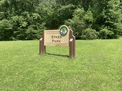
Pisgah.
I have nightmares about Pisgah. All those ORAMMs and Swanks. A burned up Chris King hub. Breaking my seat on Butter Gap. Farlow.
I guess not technically nightmares, but when I'm lying in bed, thinking about Pisgah, it feels dangerous. Somehow I've been up there a dozen or more times, though, and when I think about it sitting around during the day, it feels more fun than dangerous. That was all a long time ago though. Georgia trails have come so far over the past 15 years, that I've been less and less motivated to make the drive.
A few months ago though, my brother was like "Is there a long route you've been wanting to do?" The Pisgah Traverse came to mind, and we both realized that we haven't been up there in a long time. The Pisgah Traverse proper is difficult to do though, as it's a point-to-point, so you have to drive two cars up, and spend much of a day staging them and much of another day picking up the second car at the end. Plus, it's 190-odd miles, and I don't have proper data for part of it... But something in and around Pisgah would be great. It's been too long since we'd been up there.
We put a date on the calendar, started working on a route, got our gear sorted, and headed up there this past weekend.
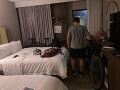
John has a million points with Hampton Inn, and can pretty much stay at one for free at will, so our starting point at the Hampton Inn in Brevard was a given.
Figuring out a route was somewhat tricky. West of Asheville, the trails get easier as you head east, but you have to ride most of them in loops. It's difficult to come up with a single loop that doesn't just put you on the road for 30 miles, or put you riding backwards up something that nobody ever climbs. I eventually came up with the following, admittedly complex route:
- Start in Brevard.
- Climb up to Farlow Gap, ride Farlow to Daniel Ridge, cut over to Cove Creek, come down that back to the main road.
- Climb up to Butter Gap, ride Butter back to the Fish Hatchery on the main road.
- Ride back down the main road to Pisgah Drive, climb that to Buckwheat Knob, take that over to Black Mountain, take that to Turkey Pen, take Turkey Pen to the parking area there.
- Take Bradley Creek over to Laurel Mountain, climb Laurel Mountain, descend Pilot Rock, take the road to South Mills River, take South Mills river back to the Turkey Pen parking area.
- Take Bradley Creek again for a bit, pick up roads, take roads over to Bent Creek, do a loop around Bent Creek.
- Catch Trace Ridge on the way back from Bent Creek, take roads over to Buckhorn Gap.
- Descend Black Mountain back to the main road.
- Take that back into Brevard.
It was about 150 miles, and super complicated. It works its way east, but you spend a lot of time heading west because of the looping nature of the route. No proper backtracking, but lots of reriding short chunks that you've ridden already. I send John the GPX file though, and a map of the route with arrows and numbers describing the whole thing, and got the thumbs up. John had gone up there last year and ridden for one day, but otherwise, neither of us had done anything serious up there in 12 years or more. So, neither of us knew the current condition any of the trails, but hey, that's part of the Adventure.
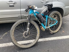
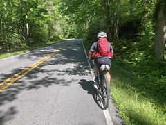
We planned to ride for 3 days and camp for 2 nights, with no resupply. I'd just spent a year figuring out how to carry my gear on my bike and not on my back. After playing around with it, it looked like I'd have all the stuff on my bike, AND have to carry a pack full of food, weighing the same as the gear I used to carry.
Adventure!
Thursday itself was a mad dash to get all kinds of important things done, both work and personal, but I got them done, and we drove up Thursday night. We did stop at the REI on the way out of Atlanta, to try to find some packets of Chamois Butt'r, to no avail. I did find some Squirrel's Nut Butter though, which I figured I'd give a try. We also stopped at the Ingles in Brevard because I kept forgetting to grab some tomato powder in Atlanta, and John forgot his earplugs. Turned out they had the earplugs, but no tomato powder. I grabbed a tube of tomato paste instead (who knew it came in a tube?) and we were set.
We crashed at the Hampton Inn Thursday night.
And after a quick breakfast of french toast sticks and muffins, we started climbing the next morining, bright and early.
And climbing.
I hadn't had the weight of a full pack on my back in a year, and it took a while to get used to it. I kept feeling like it wanted to rotate me backwards off the bike. Considering there would be no resupply, I'd been a bit more scientific about my food than just grabbing a couple of chicken sandwiches at the Waffle House and whatever clif blocks were handy. John recommended 1500 base calories plus 200 calories per hour on the bike, and assume we'd be riding 10 hours per day, so 3500 calories per day. I packed 3800 for good measure. It felt right, but it felt heavy. On the upside, it would just get lighter and lighter as the days wore on, and I was looking forward to that.
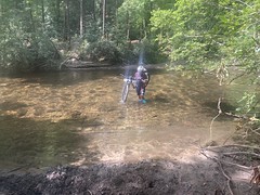
The gravel on the kick up to Farlow was that semi-loose, wrestling match gravel, where it doesn't help to stand up, because you can't really lean forward, or you'll slip.
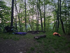
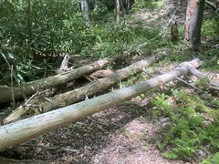
There were some junk bikes up against a tree up there.

Nice color on that one!
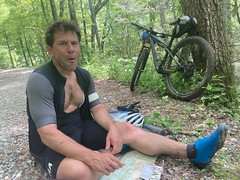
John pulled out the map to check where we were...
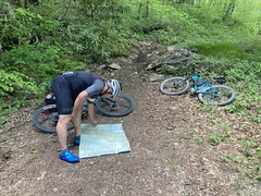
...but the map is actually wrong there. It doesn't show the trail that leads from the top of the forest road over to the top of Farlow proper. It just shows the Art Loeb trail, which was up above us, and which we'd crossed earlier. I had GPS data showing where to go, that I'd gotten years ago when we last rode it, and it was in both of our GPSes, so we eventually trusted that, but it was interesting that the map didn't show the trail.
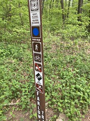
At Farlow Proper, it was requested that we be quiet, as there were golfers on the course. Also, no snowboarding, apparently.
I remembered Farlow being chunky, and I remembered long stretches that were pretty steep, but I also remembered being able to ride almost all of it (on a 26 XC rig, no less) except that there was some hike-a-bike around some creek crossings. I guess that's how it was 15 years ago. Last weekend, there were long sections that neither of us dared. And it wasn't like we're just old and wary now. Our tech skills are better now than they were back then, and our bikes are much more capable. Where rocks used to stick up out of the ground, there is simply no ground any more, only rocks. Long stretches of that. In bike shoes, it was tricky to even hike it.
I managed to slip, sit down on my right heel, twist my ankle, and stove my leg from the knee down in one section. I was worried that I'd sprained it, but it started functioning again after a few minutes, and working mostly properly after a few more.
"Lets focus."
Right.
Drops and rock gardens. Neither of us could figure out how to ride this.

It took a minute to figure out how to walk it.
Yeah, bring your enduro bike to Farlow. It's XC days are long gone.
Daniel Ridge was another story. It was mostly rideable. The data I had for it eventually led us down what appeared to have been a former route though. The trail was still well defined, but there was a lot of deadfall and encroaching vegetation. There had been a route to the left earlier, with fresh blazes that looked like the modern route, despite being stair-stepped directly up a fall line. It bent around and eventually joined the GPS track, but there was no sign of the older trail joining it. A washout maybe? It was the only thing I could think of.
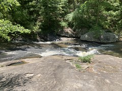
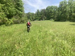
There was some beautiful flow leading from Daniel Ridge over towards Cove Creek.
My map showed it to be a forest road, and maybe it was 15 years ago, but these days it's fast, open singletrack. It did, eventually join a gravel road though.
Man, I need some whitening toothpaste. My teeth look fine in the mirror. I can't believe they look like that in photos.
We stopped for some lunch when we hit the gravel road above Cove Creek. J was eating these Pro Bars topped Almond Butter all day. It looked delicious.
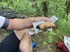
I ate Clif Blocks, Clif Bars, and Kind Bars. All well-tested nutrition, or so I felt at the time.
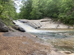
We bombed Cove Creek, which was also beautiful. I kept thinking it was called Caney Bottom, but that's the hiking trail that you hit about halfway down it. Speaking of hiking, we ran into a few hikers on upper Cove Creek, as well as a few other mountain bikers about half way down, the first of each that we'd run into. Way back, the bridges on Cove Creek used to be three logs side-by-side, leveled and cross-hatched. It wasn't completely impossible to ride them, but it was sketchy. These days there's one long one like that, but the rest have been replaced with wide, completely rideable bridges.
I got a little confused at the bottom. I remembered it running out into the back of a field, and there were some wooden turnpikes at the bottom to keep you out of some low-lying sogginess. I remember them being slippery, and Kip crashing on one of them. I never saw anything like that though. It wound around and sidehilled, and one spot where you could drop into the field was blocked off. We eventually ended up dropping onto a road. This actually matched my GPS data, but not my memory.
Fuzzy memory, I guess.
We climbed back up, hung a left, and took Butter Gap back down.
Butter Gap was also much chunkier than I remember, but it was still very rideable. I don't think we walked much of the downhill, if any of it. There was more climbing at the top than I remembered. I basically remembered just bombing down from the road. But, again, that was during the Swank, 15 years ago.
Butter Gap drops you out at the Fish Hatchery, which was closing up just as we got there. No dogs and cats allowed, apparently.

Heh.
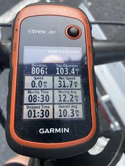
There were vending machines but we didn't have any bills or change. There was free water though, and we took full advantage of that. It was much later than we'd expected it to be for how many miles we'd covered, and we were both a lot more beat up than we'd expected. I want to say we'd been out for like 7 hours and ridden 30 miles.

Pisgah is hard.
It looked like the end of the day for everybody else. We kept seeing people riding in, loading up their cars, and heading out. We weren't sure where we wanted to camp, but definitely nowhere near there. It was hard to say where though. I didn't remember much about Black Mountain, except that the bit we needed to cover was a climb, and I had no memory of Turkey Pen at all. We discussed the details of the route ahead, and figured we'd head up the road toward the Buckhorn Gap Shelter and pick a spot that looked good between here and there.
It was easy miles back to Pisgah Drive, and fairly easy miles up to the Horse Stables.
"Right! We turn here!"
"Nah, we keep going up and pick up Black Mountain."
"Yeah, but this is Clawhammer. This goes to Buckhorn Gap."
"I know, but the route continues up this road until we hit Black Mountain, then we'll take it over to Buckhorn Gap."
"Whaat? Ok."
I was actually wrong about the trail names. Black Mountain doesn't go that far west, you have to take either Buckwheat or Club Gap over to Black Mountain, and the route actually put us up Buckwheat, but still, we weren't supposed to turn on Clawhammer.
As we passed the Buckhorn Gap Trail...
"Don't we turn here?"
"No, we keep going... Well, if we follow the route, then we keep going up an pick up Black Mountain..."
"Yeah, but this leads over to Buckhorn Gap."
"I know, but if we want to follow the route, then we continue up this road until we hit Black Mountain, then we'll take that over to Buckhorn Gap."
"Whaat? Ok..."
This made me raise an eyebrow. We'd just had that same conversation at the last intersection, and discussed the route ahead extensively while sitting at the fish hatchery. It reminded me of my dad at the tail end of the first leg of the Northeast Texas Trail. He had seemed fine, but said confusing things. It was like that. I felt like I was probably a lot more tired that John was though, and I felt like I was thinking straight, so it was odd. He seemed fine after that though. No idea.
We eventually passed 2 guys sitting on the side of the road, their bikes loaded up like ours. "Looks like you're doing the same thing we are!"
They were doing some specific loop that had a name, that I'd never heard of. Per their description, it sounded like it was up that road to the parkway, over on the parkway to some other gravel road, and back down. 40 miles, 20 per day. They ride up there all the time, but this was their first overnight. "Any tips?" I couldn't think of anything concrete other than to tell them that what works for one rider doesn't for another, so you pretty much have to figure out what works for you. Ride, figure out what worked and what didnt, do it again, think about it again, and so on. We talked for a bit, but we needed to get going, so we didn't talk for too long.
We had been looking for water, found a spring a few hundred yards up, and expected to see them ride by at any time, but didn't. Instead, several other groups of riders came by on gravel bikes and just regular mountain bikes. It seemed really late in the day for a day ride, but they seemed like they knew what they were doing.
We missed the turn onto Buckwheat, backtracked and picked it up.
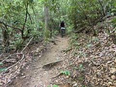
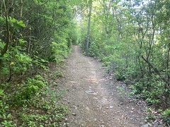
It was pure hike-a-bike for like a mile to the top. This photo shows probably the easiest section, that you could conceivably ride if you were fresh.
The rest was rock chunk stairs. I felt like I could ride down it though.
I'd struggled a bit on the gravel road climb. Like, I started feeling good, but it just drained me. I had a really tough time on Buckwheat. Just no energy. I didn't feel hungry though, and I didn't feel like I'd bonked. I just didn't have the energy I expected to have.
My shoes were also giving me fits. I'd never put the metal spikes in the toes, and the cleats had been worn off of the toes for months. It hadn't really been a problem though, and somehow, though in retrospect it seems ridiculous, I didn't imagine we'd be doing so much hike-a-bike. I just didn't remember there being so much. A bit on Farlow and some at the top of Laurel Mountain. That's all I remembered. Ha!
We joked that I'd brought road shoes to Pisgah. That was basically true. I had to step flat-footed so the cleats on the ball and the heel cleats would grab. I didn't slip much, but it wasn't efficient by any stretch. I couldn't use my calves to climb, at all.
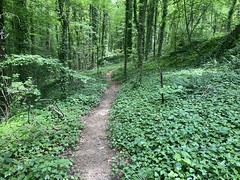
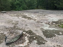
At the top, it flattened out, and the trail was really cool for a while.
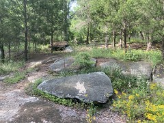
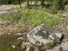
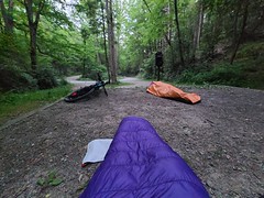
Eventually we came upon a pretty nice campsite and figured "yeah, this is a good spot."

I want to say we covered like 36 miles in like 10 hours. I shall reiterate... Pisgah is hard.
I cooked up two batches of tortellini, one with tomato paste, and the other with parmesan cheese and some spices, using the leftover water from the first batch to cook the second, and saving that water to cook breakfast the next morning. It worked out really well, but it took a while to cook. I basically just brought a cup and two of those fire-starter sticks. To boil water, I propped the cup up on some rocks with a chunk of the fire-starter under it. It works, but it takes a while, and the water barely boils. John had a gas stove and I want to say he had furiously boiling water in 20 to 30 seconds.
My knee had been giving me minor trouble all day. I'd twisted it and my ankle on Farlow. Somehow my ankle was fine. My knee had been fine riding, but when we'd stop for more than 5 minutes, it would hurt for the next 15 once we got going again. That kind of thing tends to work itself out as you ride though, so I didn't worry about it. It was giving me the business at the campsite though. My hip was too, actually, though way less. I'd slept on it funny in the hotel room the night before, and it had also bothered me early in the day.
Man, it sucks getting old.
My sleep system consisted of a relatively new Big Agnes AXL Air, some silk bag liner and a SOL bivvy cut down one side to make it into a blanket. I'd used this on the TNGA in 2019, and it worked great in the middle of the summer. I wasn't so sure about it in the spring, but wagered it would be ok.
I slept really well until some time in the middle of the night. I got up to pee, didn't feel all that cold standing around, but then couldn't get back to sleep without balling up to stay warm. Some time later, it warmed up a bit and I fell back asleep until morning. All in all, pretty good sleep. I'd have liked it a bit warmer, but I woke up refreshed and felt like riding when I got up. So, good enough, I guess.
John woke up before me, and got this shot while I was still asleep, right before the sun came up.
My knee and hip felt fine, so the sleep had done some good. I ate potatoes for breakfast, but didn't bother with the hot chocolate I'd brought. I had plenty of calories and honestly didn't want to use the water.
I ended up drinking the rest of it on the way over to the Buckhorn Gap shelter...
...where we took on plenty more from the spring behind it.
We'd ridden a decent amount from Buckwheat to the shelter, and the hike-a-bike had been mild and easy.
At Buckhorn Gap proper, there was various humor.
No inline skates on Black Mountain.
Black Mountain contains no cash.

From there to Turkey Pen was almost entirely walking. I mean, there were little spots here and there you could ride, but never more than 100 feet at a time, or so it seemed.
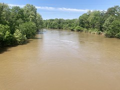
There were some spectacular overlooks.
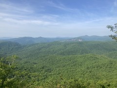
But, they didn't really make up for the trudge.
I almost rode past Turkey Pen, as it was tough to keep my eyes on the GPS, and it's just kind of suddenly there.
I had zero memory of Turkey Pen, and riding it didn't jog that memory at all. I was fairly confident I'd ridden it before. I have GPS data of it, that I must have collected myself. But, I didn't recognize any part of it at all.
The elevation profile doesn't look like much, and it's a net descent to the trialhead, but it follows the ridge, almost entirely. NO sidehill. And there are 3 kicks that are just punishing... arms fully extended over your head, hoping to hold your bike up on the edge of the trail, as you take 8 to 10 inch stair steps at a time from a 2 foot deep rut in the middle. Aside from the hike-a-bike though, the trail is pretty wild. Lots of fast, extended downhill, much of which is only mildly chunky, and a lot of it really overgrown. Definitely a maintenance level 2 trail. The final descent to the parking lot is impressively steep and rough. Drop after drop after drop. John felt like we got lucky on some of them. I actually felt confident, except for once. We met several groups of hikers that morning, and the last group was like 30 boy scouts and their leaders. When we first saw them, I had to stop between two drops and the weight of the pack shifting forward as I stopped made it a little sketchy.
We stopped for a minute at the Turkey Pen trailhead, ate a bit, then pressed on north on some trail that I don't know the name of. South Mills River came in from the left, across a bridge, and we stopped and talked about how we'd do a counter clockwise loop all day, then eventually come back in across that bridge.
I wondered if the trail hadn't been a railbed at some point. The grade was consistent, and there were some pretty deep cuts. I'd actually wondered the same about Pisgah Drive the day before, because if its very consistent grade. Hmmm...
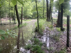
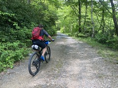
There were mud holes everywhere along the river, with deep hoof prints in them. We'd be making fast progress, then have to stop and pick through the mud, over and over. We also had to cross the river a few times too. On the Bradley Creek, we had to cross like a dozen times.
This just made the whole process slow and frustrating. I remembered crossing Bradley Creek over and over from the previous time we'd ridden it. I'm not sure how I remembered that, but blocked out all of Black Mountain and Turkey Pen.
There was a pretty nice meadow on Bradley.
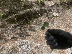
And John found a 5-leaf clover, just randomly looking down as he was about to get back on his bike.
Somewhere in there, if you're just looking at your GPS, zoomed in, it's confusing. It looks like you come to an intersection, then go both right and left. The intent was to go left, make a big loop, eventually end up back at that point, then go right. We'd discussed this in detail earlier at the South Mills River intersection, but the route was confusing, and a detail like that is difficult to recognize when you come upon it. You can't just follow a line on a GPS. You have to understand the bigger picture, which is difficult. It's actually an issue with every long route I've ever done up there. The Swank and ORAMM were both like that. If it weren't for course marshalls, you'd have a hell of a time. I've done the race, not realized I'd ridden part of the same road or trail twice, then struggled to understand what I did when I looked at a map later. This route was three days of that.
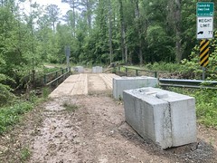
There's an old reservoir up there...
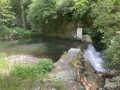
...and a tricky creek crossing right after it. It's difficult to tell where to go, and you can easily cross a side-stream before realizing you have to cross the main creek.
The trail on the other side was distinct, but there was so much deadfall.
You could jump on a pedal and coast for a bit, but never really get back on the bike. It was just deadfall though, the trail wasn't super overgrown. It was odd. I clearly remembered riding it way back. Maybe it was just a blowdown, and we just need to push through it. It looked like we had about 2 miles to go before the next road. If we turned back, we'd have to cross the creek a bunch of times just to get back to where we could go a different way. It was a sadistic decision, but we decided to press on. It never got better. Not materially. Fortunately, it was mostly shallow, running along a creek. You could see footprints sometimes, and occasionally a tire track or hoof print. People did still come this way, just not many. I wondered if they'd gone that way intentionally, or, like us, had just stuck to the route because it wasn't impossible to follow.
Whatever the case, we eventually made it up to whatever road that is that Laurel Mountain is off of, and took a break there.
John ate more of the Pro Bar + Almond Butter, and I ate a Clif Bar. Many, many riders came by. Like 10 or more, in multiple groups. All different kinds of bikes.
When we were done, we coasted over to Laurel Mountain. I had 1 full bottle, but figured I'd rather have 2. I could hear water running, but it took like 5 minutes to find the spring and fill it up. I ended up startling some hikers who were walking by on the road, as I pushed around in the brush.
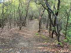
I want to say Laurel Mountain is the first trail I ever rode in Pisgah. It and Pilot Rock were my concept of the whole place for a long time. Fortunately, it was almost exactly how I remembered. A long, gradual, sidehill climb...

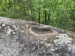
Little bits of tricky rock here and there. Some hike-a-bike, but not much. Rhodo tunnels. A cool little cave...

... sort-of. I joked that it reminded me of the Cohutta Pinhoti, but really, I ought to say that the Cohutta Pinhoti reminded me of it, as Laurel Mountain waaaay predates the Pinhoti.
It's mostly a shallow sidehill with occasional grade reversals, so it's well suited to last, but when you get to the top, it's punctuated by some murderous hike-a-bike sections. The most difficult so far. I had a very hard time with one bit. Much harder than I'd remembered. Fortunately, they were relatively short.
Unfortunately, they led directly to Pilot Rock.
I remembered Pilot Rock being extremely difficult and dangerous. It's pretty steep and super rocky. I'd only ridden it twice before. The first time on a 26er with v-brakes. I crept down it, and over and over I'd come around some bend, not see any line at all through the rocks ahead of me, and I'd have to walk. I probably walked about half of it. The second time, I could see lines through most of the rock gardens, but I was super careful and I felt like it was the absolute edge of my ability. This time, I felt pretty comfortable riding it. I had trouble with a few switchbacks, where I'd get into it and realize I should have taken a narrower line or something, but it wasn't scary. That's not to say that it wasn't brutal though. Just drop, drop, drop! At any reasonable speed, it's hand-slamming. About halfway down, I heard John say "...something something... no flow, just getting bucked around..." but I'm not sure if he meant that as a description of the trail, or of my riding. It could probably describe either.
We sat at the bottom for a bit and debated what to do next. The route had us looping back to the Turkey Pen trailhead via South Mills River, then pushing on towards Trace Ridge. But we'd only covered like 26 miles already that day and it seemed like a lot better idea to just bomb down to the Mills River Campground, camp somewhere in the vicinity of Trace Ridge and decide what else to do in the morning.
We did that.
I felt pretty good for most of it, but after bombing for like 5 miles, there's a bit of a push over some gap and I started feeling like I had toward the end of the day before. When we got to Mills River, I couldn't conceive of the 300 feet or whatever it was we had to climb to get up into the Trace Ridge area. I had to sit at a picnic table for like 30 minutes to recover from what really wasn't that big of an effort.
After a bit of rest, it was doable, and we quickly found a campsite.
I think we covered about the same distance as the day before, in about the same time. Maybe a little longer. Pisgah is hard.
I ate the same as the night before, and it was so satisfying. We were at much lower elevation too, so it was warmer, and we were right along a creek too, so we had plenty of water, but we also had plenty of bugs. I'd been trying out these weird little bracelets that are infused with citronella. They worked surprisingly well. After about 5 minutes of putting them on, I didn't notice a single bug on me, and they had been harassing me pretty well prior.
My knee and hip gave me some minimal amount of trouble that evening, but not like the day before. They seemed to be getting better.
I slept pretty well again that night, but again woke up cold at some point and had to manage it. It was a bit worse than the night before, but not miserable.
The next morning we were both kind of lazy and just sat around, and laid around for a while.
I ate potatoes again, and had the hot chocolate this time. So satisfying. I was joking with my bro about "comfort proteins". There was some commercial in the 80s or 90s with some little baby drinking milk then "comfort proteins" were floating up from it's belly. I was telling him that I felt like that.
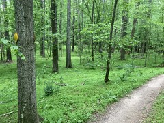
I have no idea what I'm pointing at here. Some tree maybe?
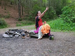
I do remember that I couldn't identify some of the trees around us. I thought they might be hornbeam, but I wasn't sure. Maybe that's what I was pointing at.
We eventually did get moving. My kit was wet and nasty when I put it on, but, as usual, I didn't even notice after a mile or two. The night before, we'd basically decided to bail on Bent Creek entirely, and just hit some of the local stuff and then decide how to get back to Brevard from there. Following that plan, we climbed up to the Trace Ridge Trailhead. For the first time, I noticed how much lighter my pack felt, having consumed so much of the food. It had been lighter by a good bit the day before, but I hadn't really notied.
Up near the trailhead, there's another reservoir - the Hendersonville Reservoir.
We kind-of rode along the edge of it to the intersection of a bunch of trails. John knew a specific one that he wanted to take up, so we did. But, first, I needed to heed the call of nature. I found a good spot, and dropped a brick so dense that it noticeably curved space-time in it's vicinity. Hmm... That's not generally good, and it reminded me of some bad decisions I'd made re. nutrition on previous trips. If I'm having trouble, it's almost always nutrition. Kind Bars are basically just a bunch of nuts glued together with honey and chocolate. They are delicious, but they're also just a bunch of nuts. I was eating two of them per day, towards the end of the day. I eat them all the time on rides, so I felt good about using them, but I guess I hadn't ever tested using them on long rides. Or, at least not on multi-day rides. I'm not so sure they were the best strategy. It hadn't occurred to me until right then though.
I'll have to try something else on the next long one.
We climbed Spencer Ridge (I think) and it was a pretty fun climb. Minimal hike-a-bike, if any. When we reached some road, we crossed it and climbed what, in retrospect, was probably intended to be a downhill run - Spencer Gap. Near the top, we ran into a guy coming the other way, and at the very top, two guys in full-face helmets on enduro rigs who took off down it.
I walked a good bit of that trail. Not because it was rutted or chunky, just because it was too steep for me to ride on day 3. John was able to ride most of it, which was pretty impressive.
We took a little break at the top, then took off down Trace Ridge.
It was moderately chunky, not flowy like what we'd climbed earlier, but easily rideable. It wasn't super steep, but I don't think I'd want to climb it. There was one flat spot.
But just one.
At the bottom, we took the road back to the Mills River Campground...

...and debated what to do next.
We could climb back up and over to Buckhorn Gap and come down something over there. Neither of us wanted to climb Black Mountain again, so it would have to be Clawhammer. Or, we could just take pavement back to Brevard, 15 or so miles away. I was well satisfied with the Pisgah experience at that point. More gravel would just be more gravel. More of what we'd already done. The road would be, at least, different, and we'd get home sooner.
Yeah, lets take the road.
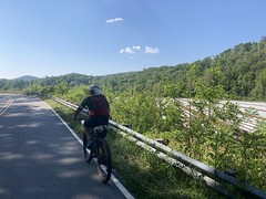
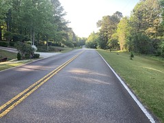
We made decent time back, but I struggled a bit on some of the longer climbs. I haven't done a good road ride in as long as I can remember. Man. I need to jump in on some group rides.
We saw various roadies on the way back, and I remember seeing the oldest still-standing house in North Carolina - since 1815, but I can't remember the name of it. There was also a Corvette Drive, which stood out because John had been singing Little Red Corvette at some point earlier.
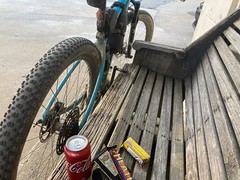
When we got back, the truck was still there.
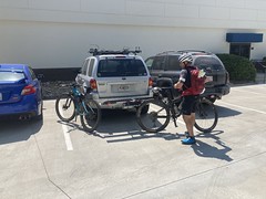
Always good.
Done!

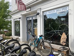
We got dressed in normal clothes and drove over to the Hub...

...where there were brisket tacos available from the taco truck. I also got a goofy Pisgah sticker and stuck it on my fairing.
On the drive back we stopped at some gas station and I heard all the hillbilly gossip I care to ever hear from the clerks. Some lady was upset because some other lady that works with her was lying about her. The lady she was complaining to sounded like she smoked 20 packs a day. Another lady that walked in agreed with the two of them. By all accounts it sounded like the first lady had a legitimate gripe. She was definitely angry about it. I'm confident that each sentence contained at least 2 curse words, and I'm pretty sure one sentence contained all of them.
The drive back was fairly uneventful. We talked about what worked and what didn't...
My shoes would have been fine if they weren't worn slap out. Don't bring worn out shoes to Pisgah. Make sure they have the metal cleats screwed into the toes. My bike worked well except for the seatpost, which is a constant pain. Where it clamps to the seat catches your pants. This is a known issue, but since I lock-tited the screws, it hasn't been a problem, so I figured maybe if the little grabbers are in the right place, they're just out of reach. Nope, still terrible. In fact, it grabbed at my pants so much that it frayed some threads, which then were just easier to catch, and made the edge of the chamois pull away from the fabric and irritate the inside of my leg. Otherwise the bike was great. Clustering gear toward the center to minimize the impact on handling was key. Of course, a trail or enduro bike would have been a better choice for some of the trails, but would not have been good loaded for multiple days out. My bike performed way better than my old bike had on the last TNGA. It specifically performed better in the specific ways that I wanted it to, so I'm calling that a win. The trisuit was great except for where the chamois pulled away. It's always the damn chamois. It worked well at managing the perpetual buckets of sweat that poured off me at all times though, and dried well after getting soaked up to my waist in the various river crossings. My cook set worked well, if slow. My sleep system was adequate, but not great. It's fine when it's in the 60's at night. Anything colder, and it just doesn't quite cut it. Solution to be determined. My food mostly worked well. If I just replace those Kind Bars with more Clif Bars, it'll be fine. My helmet lamp got caught on overhanging branches more ofthen than I'd like, but it's tough to do much about that. My body performed so-so. I'm adequately strong, but I'm a fatass these days and I'd be a lot better off it I were less of a fatass. The route didn't work. Too complicated. Too much looping back on yourself. If I just gave you the GPS track, you wouldn't know where to go.
We talked a bit about the trails too. So many of them are just so deteriorated... It was like riding Cedar Hill - novel to ride again, after all these years, but by and large, not a ton of fun. Farlow was sketchy and difficult. Butter Gap has gotten rough. Buckwheat, Black Mountain, and upper Laurel Mountain are pure hike-a-bike. Turkey Pen is fun, but you really pay for it. Bradley Creek is 2 miles of picking through deadfall on foot. Pilot Rock is just brutal and difficult. I mean, it's cool that we're still fit and tough enough to be able to ride them, I guess, but I didn't enjoy riding them like I enjoy North Georgia. I'm sure they'd be more fun on a more capable bike if I was just up doing day rides, but we used to really enjoy the same trails on far less capable bikes. Yeah... Those specific trails... novel, but not implicitly fun. Some time from now, I might ride some of them again, for the novelty, but not to have a great time. I would be interested in riding more of the Trace Ridge area, and Bent Creek though. Trace seemed really cool, and I just have no idea about Bent Creek.
I dropped J back at his place, and auto-piloted myself back to mine. I can't remember anything else about that day.
My knee and hip gave me trouble all week, but were eventually fine. They're fine now. I also dooked another neutron star that evening. Definitly going to ease up on the Kind Bars next time.
I got my second COVID vaccine the next day, didn't feel any ill effects, then Wednesday through Friday morning could barely stay awake. I actually spontaneously woke up on the couch twice on Wednesday, having apparently turned off the TV and lain down, not specifically remembering having done so. Delayed reaction to the vaccine, or delayed reaction to 3 hard days on the bike?
Hard to say.