Monday, September 11, 2017

Reinhardt University

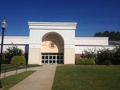
The first time I drove through Waleska, I noticed the Reinhardt University campus, which pretty much dominates the little downtown area. Each successive time through, I was like: "Oh, yeah, Reinhardt University." At some point I heard there was a trail there, and always meant to check it out, but a decade's worth of years went by and I was never sufficiently motivated to do so.

Its proximity to Pinelog brought it to mind recently, and now that I've almost thoroughly explored Pinelog, I figured it was finally time to get over to Reinhardt.

I drove up this past weekend and had a fairly easy time finding the lot. Reinhardt University Kiosk

I had a more difficult time finding anyone to talk to about riding.

On the website, there's a waiver you have to sign, and it says that the trails are open to the public but use is handled on a per-case basis, or something. I figured I'd sign the waiver, ask permission, and hit Pinelog if they wouldn't give it to me.

No luck though. There was no one around at the (hilariously named) Boring Sports Complex.

Boring Sports Complex Sign

And there were a few guys playing basketball or something at the wellness center next door.

Rollins Wellness Complex

But, they looked like students and all of the offices were dark. It kind of made sense, being Sunday.

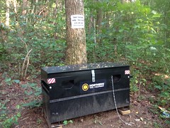
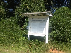
The kiosk didn't mention any restrictions on trail use, or the waiver. I figured I'd keep the waiver on me and show it if anyone asked. Worst case, they'd ask me to leave. Also, there was only one other car in the lot when I rode out. Not events going on or anything. I was pretty sure I wouldn't be bothering anyone.

First though, I rode a couple of roads in the area, for context.

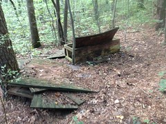
The road on the west side of the system (Grady Rd.) had this abandoned elementary-looking school off to one side.

Mountainbrook School (Abandoned)

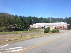
There was a Subway across the steet at the end of Grady. But those were the only things that stood out. The rest was just standard small-town houses and shops.

Ok, trail time. I rode the little paved trail down to the Boring Sports Complex, and milled around there until I got the layout. That was a little tricky, actually, because the trail map I got off the web showed it all under construction, and it showed trails running through parts that have been civil-engineered and built-out.

But it wasn't too tough to sort out.

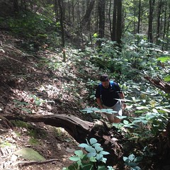
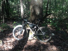
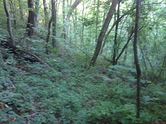
After that, I did loops and loops and loops until I'd ridden all of the dirt.

The beginner trail is just a big loop around the outside of the system.

Trail "1" it's called. It's mostly gravel road and some double track.

1

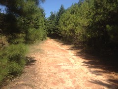
It appears to have originally been the access road for the local water treatment plant.

McClure Water Treatment Facility

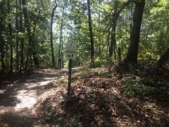
There are signs all over for the intersecting trails, which are also numbered, 1-8.

Signage

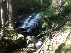
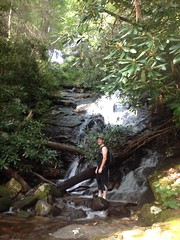
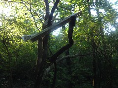
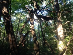
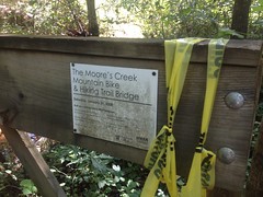
At one point, the main trail diverges from a gasline cut into the woods, and there's an old bridge over the creek there.

Moores Creek Bridge

It's seen much better days.

And was apparently built by Sorba a while back.

Moores Creek Bridge Signage

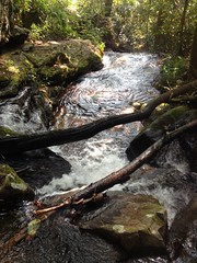
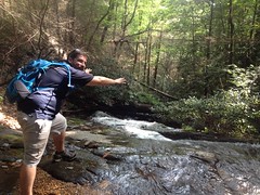
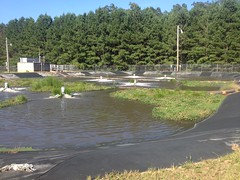
The trails running through the middle of the loop are intermediate/advanced trails. 5 is more doubletrack, and was apparently originally the access road for a pond and the dam that creates it.

Reinhardt University Pond

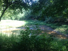
There was a duck on the "pond" seconds before I took the photo but I think he saw me.

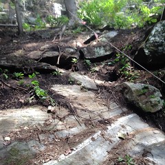
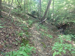
There's also a sign warning of Erosion on the way down to the dam, but the trail was actually extra nice there.

Erosion Warning

I guess they fixed it.

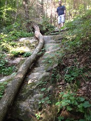
The other trails are more singletrackish, and actually pretty fun to ride. 6 is half old roadbed...

6 (Old Roadbed)

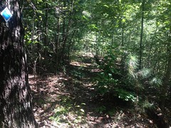
...half bench-cut singletrack, and probably the nicest of the lot.

6 (Singletrack)

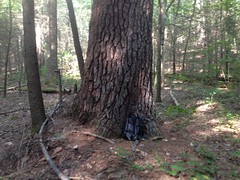
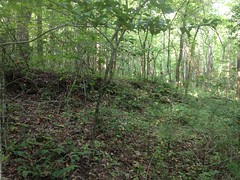
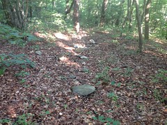
I found this old stone block on 4.

Stone Block

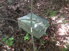
Weird circular holes appear to be drilled at one end. I guess it was dumped out there way back. It really stands out when you're riding by.

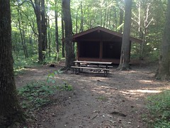
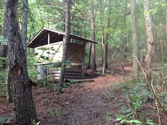
8 starts off as just an access trail for a little 2-pad campground...

Reinhardt University Campground

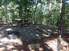
(which actually has bear activity warnings on its signage!)

...then rips downhill, jogs out to a gasline cut and continues ripping back to 1.

Plenty of fun.

I think the web site alleges 7 miles of trail, but I only found about 5. Maybe 5.5 if you generously account for GPS error. It seems unlikely that I missed 1.5 whole miles, but you never know.

Overall, it's an OK system. Not exactly modern, glowing bench cut trails, but old-school trails are fun to ride if they don't get a lot of traffic, which these don't appear to. Yeah. It was a good ride.

The uncertain ok-ness about riding there makes me dubious about coming back though, even if I could find a way to link it up with Pinelog for more miles.

Cochran's Falls

I worked on my rent house in Cumming for most of August. 12+ hours a day, two or three days a week, and usually both days on the weekend. Tenants can really, really beat up a house. I'd be amazed if I hadn't seen it all before.

Kathryn and the kids joined me as much as they could, and Billy was right there with me too, like 3 weekends in a row.

I said something like this at his wedding: Me and Billy have fun together. Bike rides, hiking, camping... And that's what most friends do, get together, and have a good time. But a REAL friend helps you move. A REAL friend helps you pull the engine out of your truck, and then pull it back out when you realized you put the oil pump in wrong. That's the kind of friend he's been to me. I guess I can add to that list that a REAL friend helps you tear up carpet, repaint, and turn your rent house too!

Doing work with friends is fun, or at least I like it, but at the end of the month, the work was done and we figured it was time to have a bit what normal people might consider fun. I'd last been to Cochran's Falls with the girls 10+ years prior, failed to reach the main cascade, failed to take photos of any kind, and failed to make it back since.

Long overdue!

We parked at the campsite on Cochran's Creek proper. Way back, I'd been able to ford the creek and continue driving until I hit a ridiculous mud puddle that looked like it would swallow my Durango. From there, the girls and I had walked a fairly short distance to the trail, and climbed as far as I felt safe taking them.

Since then, the road has been blocked, though people clearly take Jeeps and ATV's up the hill behind the blockage. After walking it, it looked navigable, but we were there to hike, not to drive illegal Jeep trails. Plus, like 500 yards down the road, it was blocked again, so it wouldn't have netted us much anyway.

It looked like the Forest Service rehabbed the road a bit before closing it. I couldn't easily locate the mud pits I'd wrestled with the last time. They'd clearly been bulldozed. Some of the long, deep holes had trees felled across them.

And, speaking of downed trees, the monster poplar at the end of the road now lies across it. Apparently it came down some time ago too.

At the end of the road, we made quick work of the trail up to the first cascade.

Me at Cochrans Falls (Lower Cascade)

The trail above that has several steep and sketchy kicks though.

Billy Climbing Steep Cochrans Falls Trail

I remember taking my girls on it, when they were like 6 and 8, being completely confident they could negotiate it, and then watching them validate my confidence. Looking at it the trail with fresh eyes, I'm not sure I'd take them on it today. Maybe, but I wouldn't be so confident.

There's one spot with a rock that bulges out into the trail, and you have to ease around it. It would be easy to think you have room, not have room, slip or fall backwards into the creek, and go tumbling downstream over this ledge.

Cochrans Creek

There's another section further up where you have to negotiate a slab of mossy, slanty rock with very small hand/foot holds. It's safer to cross the creek, and then cross it back. I remember taking the girls up past that rock.

Further up there was a rope-assisted scramble.

Rope-Assisted Scramble

We didn't take it though, because the trail led on. Also, Billy was like: "Remember the rope swing." Referring, of course, to the rope swing debacle on Stamp Creek the day we found the Pool Furnace and Jones Mill. Those were the days, but we didn't want a repeat.

It was a little steep and sketchy through there, and that's where I turned around with the girls. They were just too small to reach from hold to hold safely. Plus, they were a little overconfident, playing around, getting off-balance, and I was like: "ok, we're out of here."

Billy and I were grown though and made it to the base of the main cascade.

Me at Cochrans Falls (Primary Cascade)

Unfortunately, you can't get a decent look at it. The uppermost cascade is at the very top of the photo, but it doesn't look like much. Maybe in winter it would be better. I wonder how safe those bulgy and slanty rocks will be that time of year though.

Did I say we were grown?

Billy Screwing Around

Maybe not so grown :)

A steep, sketchy scramble continued from there, and I followed it a bit, but it went for a long way, and didn't look very well used. Billy didn't seem too confident, and I have a rule that you don't do anything in the woods that you aren't confident you can do. So, we headed back.

Steep, sketchy trail is trickier downhill, I generally find.

Steep Sketchy Trail

On the way in I tried to spot a giant pine tree that I'd seen the last time, but I couldn't find it. I did spot it on the way out though.

Large Pine Tree

10 years bigger now even than it was last time.

I also wanted to check out a side trail that I'd marked on my map way back and seen on the way in.

It became overgrown after a few hundred feet, but there were 2 distinct, though very old, rock-armored terraces on the north side.

Super Old Rock Wall

It looked like maybe the land had been leveled for a house or something.

Legend has it that the Cochran's Creek area was one of the first settled in North Georgia. There were lots of houses back in there at some point. It allegedly remained settled through the early 1900's, and as such, managed to avoid ever being logged. Very rare in North Georgia.

Driving back, we took Hwy 53 towards Tate and stopped at a gas station that I've been to a few times. There was a lady sitting at a table that you walk by if you're heading towards the drinks and food. I'd seen her sitting there every time I'd been in. I don't think she recognized me per-se, but as I walked by she was like: "Hi there... High-five!" and held out her hand for a high-five. I high-fived her on instinct, and it was really funny to both of us. I'm not sure if she does that a lot, but it kind-of made my day.

When I got home, I did a little research and it looks like we could have scrambled up that steep section and taken a cleaner trail all the way to the very upper cascade, which is visible from underneath a cool-looking overhang. Dangit!

Now I'll have to go back AGAIN. Hopefully I can get that done sometime sooner than 10 years from now.

Sunday, September 10, 2017

TNGA 2017 (Spectating)

The 2017 Trans North Georgia Adventure started this past September 19th.

If I can swing it, I like to do a little spectating at MGap, the start, and Woody's. As luck would have it, this year I was able to.

On the drive in, I saw a bunch of whatever these are, hanging out on the side of the road.

Pheasants, Again, Maybe

Pheasants?

Someone is laughing at that. I wish I knew birds better.

They were 100% ambivalent to my presence. I probably could have walked among them if I'd cared to.

Some guys are filming a documentary about this years TNGA.

2017 TNGA Documentary 1 2017 TNGA Documentary 2 2017 TNGA Documentary 3

They were walking around, talking to everybody.

I gave a rambling, interrupted bit on the origin of the route, and the goals I had for it. Ha! Goals. Yeah, some goals evolved as the route and event evolved, but it's a stretch to say I had any goals at the outset, other than to explore North Georgia to such an extent that a route across it would eventually become clear. I didn't have the original idea even. It was suggested on the Sorba Forum over and over, and ultimately, formally requisitioned by Robin Allen. The group rides, through-ride, and events were all organized in response to demand from the community. I did a lot of the legwork, to be sure, but I didn't even do that alone. I dragged my kids all over the woods, for years, trying to figure out what went where. It's absurd how many random roads and trails they've been down. ...and my Dad, and my old riding buddies. And the major legwork for the event has always been done by MGap, Sorba, GA Pinhoti Assn, Woody's, and so on. Koz and Honcho have done so much more with the event than I ever did. I maybe made a significant contribution, but the TNGA has always felt like a community effort, driven by the community. It's hard to say that I had a vision or goals for it other than to let that be.

So, it evolves, and as such, I regularly see things that amaze me.

There are 75 riders, every year, and a long waiting list.

These days, most of the riders finish!

Kate has a binder that says "TNGA Race" on the side.

There are TNGA stickers and t-shirts and stickers in the MGap shop.

Look at this:

2017 TNGA Bikes

Andrew actually built that, primarily for this purpose.

On the day of the event, there's a professionally printed sign at Top of Georgia that reads "TNGA Welcome" and they put out food and water for the riders.

There's basically a party at Woody's that night.

My TNGA experience was frosty-morning group rides with Travis and Russell and a through-ride with Johnny and Norma. My concept of the event is that jumble we managed to hold together from 2010-2012.

I love what it's become, but it strikes me as surreal. Probably always will.

But... back to Mulberry Gap.

Diane was up from Florida, and when I ran into her, we talked for like 20 minutes, mainly about Kathryn's recent props work and how Rachel is doing.

Diane

It was too bad the photo I got of her was out of focus. Damn iPhone. Seems impossible to get a well-focused shot these days.

I ran into Scott Thigpen too, and we talked for like 20 minutes about software development.

Me, Glen, and Justin talked about my brother John.

Me and Koz talked about trail work.

Seemed like I had something other than cycling to talk about with almost everyone.

Diane, Ginny, Eddie, and Scott

The riders were all camped out on the cool side of the barn for an hour or so, before they headed off to the start. They struck me as soldiers awaiting transport to the front.

2017 TNGA Riders

When they took off, I headed home, and drove over to the start the next morning, with the girls.

It was foggy in Clayton on the way in.

Fog in Clayton

Unlike 2016, we made it there in plenty of time. Norma and Johnny were there, as was Shey Lindner and John Hightower. Man it was good to see them. I ran into a guy that I'd met the year before too, who's son was riding, and we talked quite a bit prior to the start.

The girls went with Norma and Johnny across the bridge and hobnobbed with everyone over there for a while.

The riders assembled on time.

2017 TNGA Riders Assembling

And the start went off without a hitch.

We drove up to Sarah's Creek and got some photos and videos of the riders coming through there.

I didn't hang around as long as I did in 2016 though, and I missed Justin and Glen coming through. Dangit!

We grabbed some lunch at Fatz in Blairsville, which, honestly, wasn't as good as I've had it before. And then we headed back to MGap, slept on their couches for a few hours, walked all over the property, played foosball, chatted a bit with Ginny, Andrew, and some of the staff. I'd hoped to see Diane again, but she and Kate had headed back east not 20 minutes before we got there to rescue someone, or something.

Busy, busy, busy.

Toward the end of the day, we headed over to Woody's, by way of Helton/Hatchet Creek Road, and Hogpen Gap. Several of the leaders were climbing over as we descended. I tried to give them words of positive encouragement, but I fear I may have just startled the number 2 rider. So, for the rest of the riders, I just waved and kept my voice down.

It was just after dark when we got to Woody's proper and plenty of riders were taking a break at the various picnic tables. It's hard to describe the atmosphere there. It's a relaxed party, if that makes any sense. There are tents and light and lots of people, and food, but everybody's chill and the riders are usually pretty tired.

As necessary, it's all business too. Woody was busy repairing a difficult-to-seat rear tire as I walked up. Some of the riders interrogated me about what was next on the route.

I ran into Chris Ernst too, and continued my trend of mostly not talking about cycling with people, by mostly talking about GIS with him. In particular, getting the story behind how the Lidar data for White County ended up on the web, with him cited as the source. I also got the rundown on the recent work at Yonah Preserve, which I must check out ASAP.

Clark and Susy were in Asheville, getting some jelly work done, so they couldn't meet us for dinner. As such, we ended up at Wendy's, of all places. There are like 20 good restaurants in Helen, but the girls were tired of all of them, especially the Troll Tavern, which they've probably eaten at 30+ times in their lives already.

After dinner we spent another hour or so at Woody's again. I ran into Asa Marshall and actually talked to him about cycling, of all things, for quite some time. Jeff Williams (Mike Honcho) was there too, and we talked about anything and everything TNGA. Jeff's an NWGA Sorba guy, and the logical successor, so Koz is handing him the TNGA reigns, starting this year. Good luck Jeff! Thanks for keeping the junk show rolling Koz!

The film crew was filming, and the girls and I will no doubt end up in the background of a shot or two. Kris expressed interest in a sit-down interview about the roots of the route and the event. I'm kind of the Paul Di'Anno of the TNGA though, and he's mentioned in most Iron Maiden documentaries, but I've only seen him speak once, so we'll see how that goes :D

I watched the trackers over the next few days. Glen and Justin made it to Helen, but I haven't talked to them about how the ride went yet. Karlos and a couple of his buddies came up from Florida, but rode separately from the rest of the group and took like 6 days to ride the route. They were touring and having fun, but still beat my time, I think.

The route was a little different this year too. It follows the Pinhoti around Sims Mountain, down to Cave Springs, and eventually ends at the Alabama Line on the Silver Comet Trail. I think the new route adds 17 miles or so, and the end is very different. There are some trails in there that I've never ridden too, so I'll have to go check them out.

I love it!

Yeah, TNGA. Can't wait for next year.

Saturday, September 9, 2017

Jake, Bull, and Black Mountains again

Goodness, this was over a month ago.

I've had so much work to do lately, I can barely get it all done, even more barely find time to ride or hike, and even MORE barely find time to write about it. I guess it's a good problem to have, but it's still quite a problem.

Ok, so... let's see.

It appears I'd tried to discover the route from Bull Mountain up to the gap south of Black Mountain the previous weekend, and then succeeded the next weekend. That rings a bell at least.

I parked at Jake, rode over to Bull, climbed up to the truck, parked my bike...

Parked

...on the old road just uphill from it that leads over towards Black Mountain, changed shoes, and headed off in the general direction of Adventure.

The photo shows my helmet and shoes balanced on the bike rather than sitting on the ground because the previous weekend I'd returned to find both full of big, heavy-bodied ants. Figuring maybe ants don't like climbing around on bikes, that seemed like a good solution. (It worked, BTW)

I'd analyzed my GPS route after the previous Adventure, and seen where I'd diverged from the road I meant to take. I remembered even seeing it when I was out there, but it didn't look promising at the time. This time I took it, but it just headed up the ridge for a while, started sidehilling and then petered out into what seemed like nothing. Or maybe it bent left and headed up to the ridge again? Or maybe one of the braided sections below was the right one to take? I had an extremely difficult time finding anything that vaguely resembled the well-established road alleged on the old topo map.

In some cases, there was a vague indentation in the ground. In other cases, some rocks had been cleared to one side or another. In other cases, it was too rocky to one side or the other, so I presumed the old road must have gone up the middle. In other cases, more-exposed rock seemed to mark the route.

Is This the Trail

I really had to use my imagination, but I knew it had to be there, and if I kept at it, I'd reliably find some more solid indication further on.

I got WAY off a few times though, had to walk in a big circle until I picked the trail up again, and just hoped I'd find the right way to go coming back.

Of course, I found several of these out there:

Mylar Balloon

Goes without saying, really.

As I approached Black Mountain proper, I ended up on a former route, I guess, which eventually petered out completely, heading up the ridge towards the peak. It should have started sidehilling toward the gap, but I never saw anything like that. Eventually I started sidehilling myself, weaving up and down the mountain wildly, hoping to find something, but never actually finding it.

I heard voices at one point though, which meant the AT was nearby. I figured: screw it, maybe the AT follows the old roadbed, and I climbed until I was on it. Nope. No old roadbed, just beautiful, purpose-built singletrack.

Dangit!

I wasn't far from the Black Mountain Shelter though, and the shelter was at the gap I was hoping to have followed the old road to, so I followed the AT over to it, and milled around its vicinity for a while.

Black Mountain Shelter Black Mountain Shelter Privy Black Mountain Junk Pile Bear Resistant Food Storage

From the water trail below the gap I could see the old road to my left, and when I was done exploring the gap, I took it back.

The old road:

Old Black Mountain Road

Obvious, isn't it?

The route was much easier to follow in that direction, and I made a much more thorough effort to stay on it, or if I got off, to find it again, backtrack, link up, etc.

Along the way though, I found something much stranger than a mylar balloon, hanging in a tree.

Aircraft Debris Maybe Aircraft Debris Maybe (From Other Side)

Aluminum linkage, with some steel linkage bolted to it, painted olive drab.

Did it fall off of a military aircraft?

There was a plane crash to the south, near Nimblewill Gap, in 1969, which was removed in the 90's. But it was a private Cessna. A Cobra chopper crashed way to the northeast in the 80's. I can't find an account of another crash.

I guess it could have been flung up there by a tornado. I've seen plenty of chicken house roofing that must have been.

If someone can identify this, please do. I'm very curious.

The route back was relatively easy to follow for most of the way, but where it began to run down the ridge toward Bull Mountain, it faded into the hillside, and I had as difficult a time following it as I'd had earlier. I knew it was more distinct below too, I just had to figure out how the two sections linked up. I'm not 100% sure that I did, but I'd challenge anyone to do better.

It was getting late when I got back to the bike, I overcooked it a bit on the descent, trying to get out before dark, and flatted. Dangit! When it was fixed, it was dark, and all I had were little Spok head/tail lights, which are more so people can see you than so you can see. But, I'd ridden out Croom on them in the Huracan years back, so I figured I could probably get down off of Bull too.

I did, but it was slow going to be sure.

When I got back to the Jake lot it was decidedly night. I was surprised to see a second car in the lot, and even more surprised to see a guy moving around in the dark with a red light on his head.

As I got closer, I noticed a tarp on the ground, tables of equipment, and some contraption set up in the middle of it all.

The heck?

Turns out he was an amateur astronomer, photographing the Butterfly Nebula. Apparently that night, atmospheric conditions were perfect, and the Jake lot is a great place to set up. No light pollution, but it's right off of a main road.

Ha! Cool!

I don't remember much else about that particular Adventure, except that it was overall, very difficult. Rough country. Not sure where I was going half the time. Flat tire. Darkness. On paper, that sounds fun, but it wasn't. Not really. It was just hard. I did get where I was going, finally, so points for that, but man, what an effort.