Sunday, May 14, 2017

Pine Log (imagine that)

I may have to start naming these after the specific place at Pine Log that I went, just to break up the monotony.

I was back there yesterday after re-gluing my shoe. It is now, officially, more goo than shoe. I hoped it would hold up, but the only way to tell was to ride and walk on it, and I planned on doing plenty of both.

On the way in, I ran into some folks from the Civil Air Patrol. I'd seen them last time too, just getting out of their vehicles, but this time they were on foot, already a ways back into the system.

I checked out some trails that I'd seen before, but hadn't followed. I had imagined where they might go though, and it turned out they went exactly there, basically connecting up with some stuff I'd ridden years and years ago.

The woods was really scenic back in there.

Woods

And in one spot there were lots of boulders.

Boulders

And up on top, there were some gnarly rock formations.

Rocks

And someone put a trash can way up there, in the middle of nowhere. Not even in a campsite, just randomly among the rocks.

Trash Can

The strangest thing was that it actually had trash in it - several powerade bottles. They looked like they'd been in there a long time.

I found this piece of trash too, but not in the can.

Trash

A squirrel or chipmunk had stuffed it full of acorns. I guess it was a good spot for that.

Somewhere back in there I saw, a ways off to my left, down a trail that I knew, a red and white tarp fluttering in the breeze. At first it looked like someone had set up an elaborate campsite and strung it up over their tents in case of rain. Later It occurred to me that it might be more Civil Air Patrol folks. Like maybe the first group had to rendezvous with the second group, and that's where they were set up.

Whoever it was, they were highly visible.

The previous weekend, I lost my glasses out on the Main Road when I crashed. Figuring they might still be lying in the brush, I rode back up to see.

On the way, I encountered this nice-sized timber rattler, sunning himself on the road.

Timber Rattler

The last rattler I encountered coiled up and rattled at me furiously when I got within 15 feet of it. This one was completely ambivalent. It didn't move any part of its body, any perceptible amount.

Ha ha!

Glasses

My glasses were still there!

Consistently demonstrating: If you buy cheap glasses so that you don't mind if you lose them, then you'll never lose them.

Oh. Also, I saw 7 turkeys. Seven. Monday is either the last day of the season, or at least the last day to hunt them in that WMA. I'd seen a few up in the Cohuttas earlier this year, but none in Pine Log until yesterday. I was starting to wonder if there were any out there at all.

My shoe held up well. I guess it helps not to crash on it.

My body didn't hold up so well though. Earlier, I'd tried to sneak around the left end of a branch jutting out at me at thigh height, didn't make it, and ended up jabbing it really hard into my thigh. It wouldn't just cut me and slip past either, it just bent and bent, and when I moved enough to release it, it sprung back, directly into my groin. Come on! I'd basically used my leg to spring load it for a high-powered crotch attack. I couldn't have more precisely executed such a maneuver if I'd tried. Blood was already running down my thigh from some fairly jagged gashes and I feared my gentleman's materials might have sustained similar wounds. They hurt almost as badly, and I was a little scared to look. Thank god for bike shorts though, and the tiny little extra bit of protection they provide. It was just enough. I was completely uninjured. Downtown, at least. My leg was bleeding and bleeding, and looked bad at first, but it turned out it that those wounds were all superficial. All right!

Seems I can't get a ride in these days without some kind of calamity. I guess I'll have to make a specific effort to avoid it next time. I really need to break this streak.

Tuesday, May 9, 2017

Pine Log

My right bike shoe has been struggling for weeks now. The threads that hold the buckle to the side of the shoe have started to break, and tightening the buckle just makes more of them want to break. I shoe-gooed the heck out of it, and clamped it, this past Friday evening, and let it dry for a day and a half. It seemed pretty solid Sunday afternoon, so I figured I'd try it out at Pine Log.

When I got there, the parking lot was full, and there was a crane parked 90-degrees to the street, with a strap around a small house sitting on the back of a flatbed trailer. There were a few police parked nearby, with their lights on. It took me a second to figure out what the heck was going on.

Movie Shoot

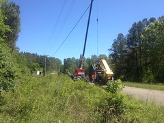
It was a movie shoot. I'd actually passed 2 signs for it near the highway, but I'd apparently taken a slightly different route to the trailhead than the crew, because I hadn't seen any more signs since those. If you zoom in, you can see the camera crew and the giant wind machine. They were about to start shooting as I was getting ready to ride out, but I didn't dally around to see how it would all go down. I had stuff to do, and also when I took that one photo, some lady told me to keep moving, so it didn't seem like they were too keen on spectators. As such, that was the best shot I could get of the goings on.

I passed some guys with bikes in the bed of their truck as I rode in. That would be only the second set of mountain bikers I'd ever seen there. Only the third set of riders of any kind, if you count the one lady on a horse I saw the last time. Not a super-popular place, I guess. This seemed funny to me at the time, given how much I'd been up there lately.

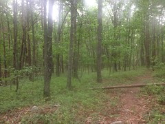
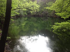
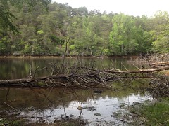
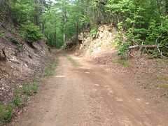
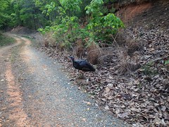
There was hardly anyone back in the woods either. No cars parked along the road. No one fishing by the Lewis Furnace. No one fishing by Grassy Meadow Road. No one hunting turkeys. My shoe hadn't fallen apart yet, on the ride in, so it seemed solid enough to ride on. I wondered if it would hold up to some hiking, so I took the opportunity to explore upper Stamp Creek. If the old mill was up that way, maybe I'd even find it.

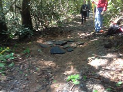
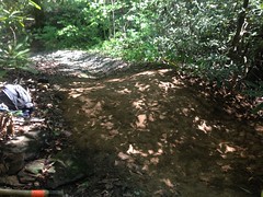
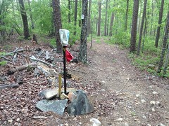
Turned out there was a trail back in there. It didn't seem to be a "fishing trail" either, as it purposefully wound around in the woods, well away from the creek. It eventually led to a 4-star campsite on the creek...

4-Star Campsite

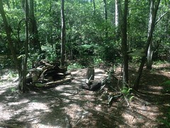
...and then petered out after a short run to the north.

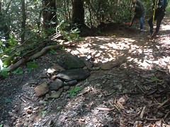
So, I backtracked, picked up the bike, and headed up the road to the next group of campsites, which I'd put off checking out on previous outings because it had always been full. Turned out there were several sites down there, not just one, and there were trails leading up and down Stamp Creek as well. The downstream trail eventually led to a spot directly across from the 4-star campsite. I couldn't see it from the other side, but apparently if I'd crossed the creek through some rocks, I could have picked it up.

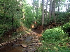
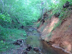
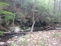
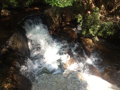
Upstream, the trail crossed a branch and eventually led to a terraced waterfall.

Stamp Creek Falls

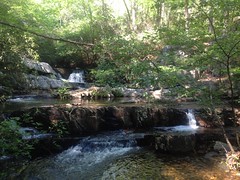
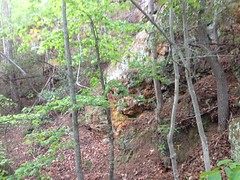
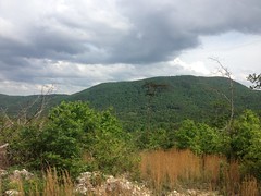
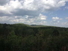
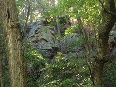
The whole area was ringed by cliffs. The cliffs to the west were fairly accessible.

Cliffs to West of Stamp Creek Falls

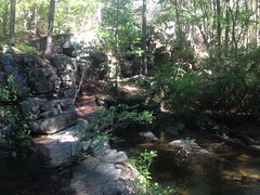
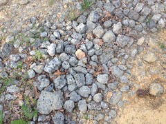
The rocks around the falls itself were like legos, and relatively easy to climb, even in bike shoes, so I got a good look at the upper cascade.

Stamp Creek Falls - Upper Cascade Detail

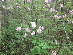
Above the falls, there were more cliffs to the east, but they were difficult to get a good look at this time of year.

Cliffs to North of Stamp Creek Falls

I'll have to come back in the fall or winter.

My shoe-fix was holding up well. One thing that can happen is, if you step next to a rock, then the buckle can catch on the rock and try to pry itself off of the side of the shoe. This happens, seemingly constantly. For some reason, it seems to happen more on my right shoe than left though. I'm not sure why, but it does. Though this continued to happen, the shoe-goo held up promisingly.

Yes, it seemed I had fixed my shoe. I was pleased.

I headed up to the top of the Main Road and followed some trails that I'd seen earlier for a while.

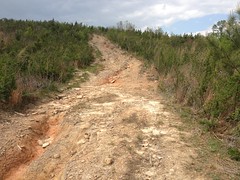
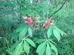
Coming down the Main Road is pretty tricky because it's super, super rutted. You kind of have to pick an island to ride and then deal with it somehow when you have to cross a rut. I was riding the island to the far right, and noticed a sprig of sumac hanging out over it.

Earlier, I had ridden into another such sprig of something else, which whacked the bridge of my nose unexpectedly hard before dragging across it. I didn't realize how badly it had cut me at the time, but it's pretty awesome now, and I suspect people have wondered who I got into a fight with at the various places I've been since then.

Seeing this sprig, I decided I'd rather not get whacked like I had earlier again, and right as I began to think about what I might do, my front wheel slid out from under me, into the rut to my left. I don't know if I touched the brakes, or if I got too close to it, or got too high up on the transition to my right, or what... Whatever it was, I was clearly paying too much attention to that branch and not enough to my line. I slammed on my right hip super hard, and it wracked my whole body.

Whooo.... Took me a second to shake it off. There was an upside though. I used to joke with Kathryn about this. When you crash, you subject your body to forces that you can't easily simulate without crashing, and I swear it does some good. I remember skateboarding, I'd slam dozens of times a day, and if I didn't skate for a week or two for some reason, my back, and neck, and ribs, and hips would get all sore and stiff, and after slamming a few times, I'd feel a lot looser and better. It was like some form of violent, inadvertent chiropractry.

Anyway, I'd had a crick in my neck for weeks, after lying about with that flu for so long, and post-crash it felt great.

Ha!

Upside.

I'm not sure it outweighs the downside though. I have a bruise the size of my hand just below my hip, and my right foot got jammed in between my bike and the side of the rut during the crash, grinding my shoe against it for a foot or two. This completely tore the shoe-goo'ed part of the buckle back off, and popped about 20% of the remaining threads. And, two days later I now see that I have a good bruise all the way across the top of that foot too. Fortunately it doesn't hurt when I walk, just if I press on it.

Oh! And! I lost my glasses. They were in my helmet, and I guess they just went flying. I didn't notice until like 20 minutes later. I must have jinxed it a few days earlier, because I was talking to Kathryn about how I only buy cheap glasses so it's no big loss if I lose them, which I used to do regularly, until I started buying cheap glasses. Now that I only buy cheap glasses, I don't seem to lose them very often. I guess I shouldn't have mentioned it.

Anyway, I shook it off and didn't have any trouble with the rest of the ruts. I did end up behind a guy with 2 kids in the back of his pickup, bouncing down the road like that's a safe thing to do. The kids didn't go flying out though, so I guess it was safe, actually. It's funny though. The only 2 times that I can remember seeing kids in the back of a pickup, since I was a kid myself, both happened recently, in that WMA.

My shoe seemed to be holding together, but it also seemed to have gotten some crap in it, so I stopped a bit later to fiddle with it. Turned out the sole had gotten partially detached and some pebbles had gotten between it and the body of the shoe.

Ha!

Rolling junk show.

Still though, it was good enough, so I climbed up over Pine Log Gap and checked out some side trails up there. With the buckle levered out to the side, my shoe was even more prone to catching rocks, but it held together, and I had duct tape in my pocket if it failed, so I wasn't too worried.

Actually, on the way up to the gap, I noticed an old mine cut across the road from some chunks of ore that I'd noticed during a prior trip. Seeing as Pine Log Gap Road didn't extend to the Sugar Hill area until well after it was shut down, but that it did lead right by the various furnaces to the south, I reasoned that this cut may have provided ore for those furnaces. There may well be more mine cuts on the south side of the WMA. Those furnaces ran for 20+ years. They must have gotten their ore from somewhere!

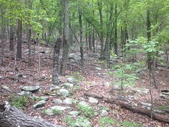
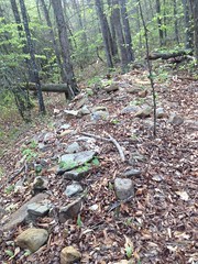
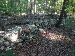
Closer to the gap, I checked out a side trail that I'd seen this past winter. Actually, I didn't see the trail, but rather saw a rock wall, which I presumed had been formed by the clearing of rock from the road.

If you hike the Dockery Lake Trail, or the Hightower Gap trail, or the really old route of Angel Drive in Alex Branch Cove, or probably a dozen other trails that don't immediately come to mind, you'll see that where they follow the fall-line, they are bordered on both sides by tons of chunky rock, which is sometimes dense enough to form little walls. Where they sidehill, they are sometimes bordered on the uphill side, or if they've managed to still get below grade, then sometimes on both sides. I presume that when the road was initially cut, any exposed rock was thrown to the side. To the uphill side, if there was one. To both sides if the road ran up the fall line. Then, as the road got eroded, and rocks got exposed enough to impede horses and/or wagons, people would dig them up and chuck them to the side. Being lazy, they didn't chuck them too far to the side. In either case, if the ground was sufficiently rocky, a nice little wall would form, from this discarded rock.

That is what I presumed was the case with this wall.

Down at the bottom end, it appeared to be so.

There was an old road, running up the fall line, bordered on both sides by rough piles of rock.

Rock Wall 1

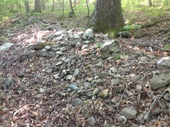
There were various breaks in the wall, and it looked generally haphazard.

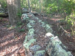
Where the road began to sidehill, the wall seemed to continue exclusively to the uphill/east side.

Rock Wall 2

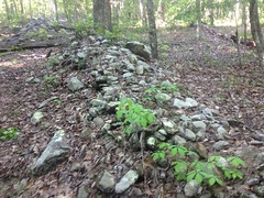
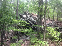
But then the wall got a lot more organized and looked a lot more square than it had further downhill.

Rock Wall 3

And then the old road bent away from the wall to the west, but the wall continued uphill, became rather bendy, and was composed of flatter rock, which was clearly stacked quite neatly.

Rock Wall 4

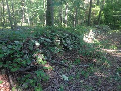
At its furthest extremity, the wall is very well organized, very square, and solid enough to walk on.

Rock Wall 5

It doesn't hold up the roadbed, and it doesn't retain earth to one side of the roadbed. At the northern end, it kind of blends into a boulder field to the west.

It may have bounded someone's property. To the east of the wall, away from the road, the ground looks somewhat disturbed. There are a few rock piles, which I guess may have been footings or maybe collapsed chimneys. There's a weird, smaller rock wall that juts out to the east, about halfway up the main wall.

Smaller Rock Wall

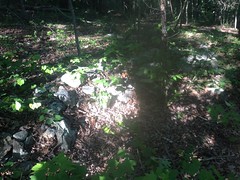
But it doesn't connect to the main wall.

I don't know. The whole thing is weird. There are several breaks in the walls, and it made me wonder if different walls had different purposes. Like the ones at the bottom end of the road were there for the reason I originally thought, and then the more organized wall further uphill bordered some property. I toyed with the idea that it was another mine of some kind, but I couldn't find any evidence of that.

No idea. It made me want to go back up later though, and explore the area more thoroughly.

After that, I headed up over the gap, and down into the Sugar Hill area again. There's a road leading up Little Log Creek that I'd been to the end of once, but that time, a guy had been parked down there, presumably hunting, so I didn't get a chance to see what was back there.

Turns out there are a couple of interesting things back there.

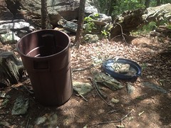
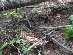
Someone had put together a makeshift blind.

Blind on Little Log Creek

Maybe that same guy I'd seen last time.

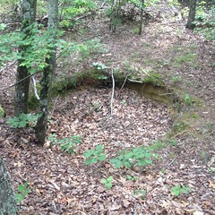
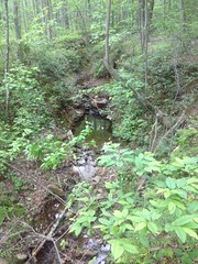
And then further back still, I found the ruins of a massive dam.

Tailings from the Cripple Creek Ore Bank line the west side of the road, and I wasn't sure at first that I wasn't just looking at more tailings, but a pair of creeks uphill of the dam had cut quite a gorge into the forest floor.

Gorge on Little Log Creek

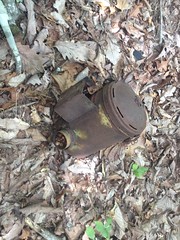
And down in one of them, I could see what was left of pipes that presumably once supplied water to the mining community.

Pipes Buried in Little Log Creek Dam

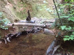
They were buried in the dam when it was built, and presumably buried to their current depth as the lake filled in.

The mine cuts uphill from this lake were much smaller than the cuts above the old lakes further downstream. So, presumably they didn't contribute as much sediment and this lake didn't get completely filled in. There are several channels in the face of the dam though, and it looks like maybe it had been overtopped in a few places before the creek finally settled on the rift it currently occupies. I wondered if it had failed catastrophically at some point. Maybe somebody knows.

It was getting late, and my shoe was feeling sketchy, so I headed out the north end of the system and took the roads back around to my car. Ahh, diversity of trail experience. One of my favorite things.

The movie crew was completely gone when I got back. As was every other car and truck. I'd seen a couple of guys on ATV's parked at Miller Chapel, for some reason, but it was otherwise a ghost town.

Another excellent day at Pine Log. It definitely qualified as Adventure, and I'd been a bit behind on my Adventure quota.

There's still more to see out there though. Maybe me and Billy can hit it up next weekend.

Moss Branch

Last Saturday was the monthly work party at Jake/Bull Mountain. I'd missed April's party with the flu, so I was excited to make this one. The girls wanted to come too, so we all went up together.

The drive over was kind-of awful though. From my place, it's actually fastest to get there by going around 285 and up 400, but the bridge over the Etowah on 136 is still closed, so I figured I'd go up 75, through Tate, and up 186 instead. But, in Tate, I (and like 15 other cars) got stuck behind a lady going 35 miles an hour, for the next 20 miles, all the way through the mountains, with no possibility of anyone getting around her. Then, when I eventually got on Hwy 52 the guy ahead of me was going 40.

Sunday drivers, getting a head start, one day early. I guess they didn't have anywhere to be. We did though, and we ended up getting there a few minutes late.

Since the work we wanted to do was a ways up in the woods, we all met at the old game-check station lot instead of the Jake Lot. It was kind of a small turn-out though. Only 6 of us total. Stan and another guy who's name I have forgotten because damn it, I'm terrible with names, had some downed-trees to attend to, so they headed off toward Black Branch. Debbie, the girls and I headed down Moss Branch.

We took the old trail down to the creek. There were a great many downed trees and Debbie appeared to be a little uneasy about the possibility of encountering timber rattlers among them. We were careful though, and as fate would have it, we didn't run into any.

The Moss Branch Trail was rerouted in 2008, I think, but the approach to the creek itself couldn't be, so a chunk of the old trail is re-used right there. To the south, it kicks up off of the creek in 3 sections. Section 1 is steep, probably more 10%, and goes for about 100 yards. Section 2 is shallower, and goes for another hundred yards or so. Section 3 is where the reroute peels off to the east. It's either flat or might even reverse grade for a short bit. Sections 2 and 3 were in good shape, but the rolling dip at the interface between section 1 and 2 had gotten backfilled, over topped, and channeled. The trail below was starting to get channeled too. So, that was our priority.

The girls and I dug out the backfill, while Debbie did the same to the dip at the interface between sections 2 and 3. Then, we all rebuild the hump together.

This would be no ordinary hump of dirt though. We busted up the old hump a bit, hammered as much chunky rock into it as would fit, covered that over, hammered a bunch of flat rocks into that too...

Embedding Rock in the Rolling Dip

...and covered them over as well.

Finished Dip

Then we placed flat bits of rock on the downhill side, where the trail itself was starting to get channeled.

Rock on the Downside and Debris to Left

Also, when digging out the dip itself, we made sure to angle it at a much more gradual angle than it had been originally. Hopefully it will take longer to backfill again. We tested it with the soccer-ball too, and it worked as expected.

On the uphill side, we cut back the encroaching branches and piled them up on the downhill side. Hopefully this will encourage climbing traffic to go uphill of the hump. If it gets cupped up there, then it will still function. The dip itself ought to encourage descending traffic to go the uphill side of the hump. The rock inside of the hump ought to protect the hump from any traffic that goes directly over it, at least to a greater extent than pure-dirt would. Also, any dirt that does get loosened and runs downhill should help cement in the rocks on the downside.

That's the idea, at least. It's all by the book. We'll have to see how it actually performs.

On some previous work day, Stan had flagged a bunch of spots that needed attention, so we hit as many of those as we had time for on the way out. Most were nicks or rolling dips that needed clearing. Some were sections that needed deberming. Most of the berming was actually deposition, where leaves had piled up, turned into topsoil, and caught a bit of runoff. As opposed to where the center of the trail had gotten packed down. That kind of deberming is super easy, and I was able to knock out 50 foot sections with two quick passes of the McCloud. Some of the nicks had standing water in them though, and took a while, even with 2 of us working at a time.

Still, we were working quickly and got a lot done, but we did eventually run out of time, and only finished about half of the flagged work.

I had to fight the urge to go back up the next day and finish it. I bet I could have knocked the rest of that trail out by myself in 3 or 4 hours.

When we were done, the girls and I couldn't hang around for long. We had to try to get back home for 2:00, and it was already 12:30. Fortunately we didn't get stuck behind anybody driving 20 miles an hour under the speed limit on the way back, and it worked out pretty well.

Monday, May 1, 2017

Pine Log (Sugar Hill)

Yesterday I felt like exploring. Usually that means hiking, but given how much of the stuff to see at Pine Log is right off of the road, I was on the bike again, seeing what there was to see.

Actually, the first interesting thing was on the drive in. I stopped at the local convenience store that I often stop at on the way in, and got a photo of my favorite bathroom sign of all time.

No Missing and Please Flush

"No missing, and flush please"

So many things to love about this sign...

First, the message is so oddly stated: No missing. You heard me. No missing. Missing is not a passive activity. You choose to hit or miss. Choose to hit. That is the acceptable choice.

Second... What is going on in the picture? If you're a woman in a business suit, with a briefcase, don't peel the large black wall covering off of the wall behind the toilet. Without the message, that's what I'd imagine it means. Why the business suit? Why the briefcase? Those are fun details.

Third... The "Please" is clearly an afterthought.

Fourth... The sign is a printout of a photo, of another sign. So, these guys didn't come up with this sign. Someone else did, and posted it somewhere else. Then these guys took a photo of it, printed the photo, and posted it themselves, strange wording, ambiguous picture, and all.

Fifth... There's a second sign on the door, opposite this sign, but it's black and white. So, they made a color copy, and a black and white copy, separately. Not just 2 color or 2 black-and-white copies. One of my favorite things in the world is noticing subtle differences in things that serve the same purpose. Like, look at two locomotives next time you get a chance. They may be painted the same, but they are subtly different. It seems that no two are alike. It was like that with these signs. Why different? Who knows? I love that.

But, I digress. Back to Pine Log...

I mainly wanted to check out the Sugar Hill area, on the north end of the property, but as I was also interested in getting in some good climbing miles, I parked in the lot at the south end.

There was a horse trailer in the lot when I pulled up. I often see prints on the roads, but I hadn't yet run into anyone riding. I kind-of hoped I would, but right as soon as I pulled away from my car, I noticed the horse and its rider at the far end of the lot. They'd already finished their ride. Well, I guess that still counts as running into them. Beautiful, young, white horse, who wasn't afraid of me on the bike. The rider had a new-looking, bright blue camelback too, which made me jealous because mine is old and busted. We had a little chit-chat, and I headed off up the hill.

Somewhere back there I saw this corn snake crossing the road, and managed to get a shot of it before it got away.

Corn Snake

I didn't see anyone in a vehicle, on foot, on horse, or on a bike all the way up and over Pine Log Gap and it made for a relaxing ride. At least, as relaxing a ride as it could be, given the climbing.

My first stop on the Sugar Hill side was the Bluff Cut Pond. Basically, if you bomb down off of the gap, the road bends hard right, and abruptly flattens out and straightens out. At that point, it joins the old railbed of the Iron Belt Railroad. To the left, the old railbed continues up into the woods a bit, leading directly to:

Bluff Cut Pond

...the Bluff Cut Pond.

This was once part of the Sugar Hill Iron Mine. One of the earliest cuts, actually. You can still see iron ore on the walls of the cut.

Bluff Cut Ore Wall

I guess that ore wasn't decent enough to keep mining.

The cut now remains filled with water. There were ten billion waterstriders flitting around on the surface of the pond, and small fish were eating them left and right. I didn't expect there to be fish in that pond, but I guess nature finds a way.

There are actually two old railbeds jutting off of the main road. One goes directly to the pond. The other is a reroute, skirts the south side of it, and becomes overgrown quickly, but allegedly leads to another, unnamed mine cut uphill from the Bluff Cut. The unnamed cut is alleged to be the last cut ever worked at the site. I'll have to bring my hiking shoes and go check that one out some day.

A ridiculously steep road next door to the Bluff Cut leads up the hill, and as I discovered later, out of the WMA (though the border is unmarked in the field), to a campsite, presumably on private property.

Which is too bad because the views from up there are pretty nice.

Rydal:

Rydall View

Pine Log Mountain:

Pine Log Mountain View

Further north along the road is the Sugar Hill Pond.

Sugar Hill Pond

This was the first mine cut in the area, originally called the Pine Cut. Same story as the Bluff Cut. It was mined out, abandoned and eventually filled with water to form a pond. I didn't see any evidence of fish, but who knows?

There were these two guys parked next to the pond when I rode up, who seemed to be in a bit of distress. Just to be sure, I asked one of them if this was the Sugar Hill Pond, and he confirmed that it was. He also told me that he and his buddy had caught a 6-foot king snake on their property, put it in a bin, put the bin in the truck, and driven up to release it in the woods. But, it had gotten out of the bin at some point, and was now somewhere in their truck! Their dog seemed to be aware of the problem and wouldn't go near the truck.

Oh, man!

At least it was a king snake.

I wished them luck, and they wished me luck, and we both got back to it.

Downhill a bit the road passes through a railroad cut.

Iron Belt Railroad Cut

I could see the Cripple Creek Ore Bank downhill to the right. It's another old mining cut, but it's tough to see in the spring. It had water in it before the trees started leafing out, but it was pretty dry that day. I'll have to check it out some other time too.

I met a guy walking his dog a bit further down the road. Big, friendly German Shepherd. Gave me lots of kisses, and let me give her lots of scratches.

I followed the old rail bed where it bent away from the road. To the east was the Kinsey Cut, the largest cut of the entire mine. It follows the road north for a long way, and butts up against the railbed. Uphill there were a bunch of fragmented cuts, not just one big one. Various sources allege that there were two cuts in the area: the Sugar Hill Cut, and the Kinsey Cut, and they were eventually merged together. Uphill from the railbed is Sugar Hill proper, so it seemed likely to me that the cuts uphill are Sugar Hill, and the ones below were Kinsey, but for all I know Sugar Hill was cut above AND below the rail. I can't find any detailed info on it.

I did find this weird shaft out there on the west side of the rail.

Shaft

A well? An old pit mine? A test shaft? I saw Mike Rowe filling in old mine shafts on Dirty Jobs once, and they looked much like that when he was done. I wondered if that one was deeper than it looked, and had just gotten plugged with rubble and deadfall over the years.

Further north on the main road, I crossed Sugar Hill Creek. There were a bunch of male tiger butterflies congregated there, displaying for the ladies.

Male Tiger Butterflies

Total sausage fest though.

Poor guys.

To my right lay The Great Rift. Sugar Hill Creek had been dammed. The lake had quickly filled in (presumably from the ungodly mine runoff) and become a meadow. The creek overtopped the dam, and began eating its way back into it, and back into the meadow, forming The Great Rift, as I have come to refer to it. When I first saw it, I was tired and in no mood to explore it, but I was yesterday.

It was rather difficult, actually. The creek itself was alternately incredibly muddy, incredibly rocky, swift, slow, deep, and shallow. There was no neat shore. Too much weight on rock or dirt sent it pouring into the creek. Two different times I found myself wondering if the whole hillside wasn't about to come down.

The Rift 1 The Rift 2

Idyllic mountain stream or monstrous dam cavity? You decide!

I'll tell you what I decided though. I felt like I was being lured into a trap. Like some kind of geological Venus Flytrap. F-you mankind. Dam me? Give me time. I'll eat your f-ing dam. Come on back in here and see. See what I've done. Come on... look around... I'll drop these f-ing walls on you.

(Geological Venus Flytrap likes to cuss.)

There were innumerable Indian Strawberries back in there though, so if you're hungry...

Indian Strawberry

At the time, it just felt like more of that Venus Flytrap action. Tempting me with fruit. Luring me in deeper.

I passed some folks fishing on Neel Lake. Two guys were even packing up a pair of fishing kayaks.

On East Valley Road, the sun was ahead of me so I flicked on my red blinky light.

I so badly want there to be a legal way to get from there to Oak Street, but every neighborhood I tried had one of these at the back.

You Shall Not Pass

The land didn't appear to be owned by a single owner though, so maybe farther on there'll be something.

I took 411 back to White and from there, took the road back to the car. Last time I'd ridden it in the dark, and it seemed to take forever. I felt better yesterday though, and it was still daylight, so I guess between the two the time flew by. I'd wished I'd brought my card with me though. I was getting hungry, and there's a gas station at the intersection with East Valley Road. I sure could have gone for a chocolate iced honey bun right about then.

On the way home, I got some dinner at Wendy's, but I had a hell of a time making the left off of the highway. I saw a break in traffic, and pulled up a bit to get ready to go, but then, the lady who was turning right (my left) stopped, to let me go ahead of her. People, please, don't do this. I know you're trying to be courteous, but it's always a disaster. The cars behind her started to back up, and some started going around her. If I'd gone, I'd have been hit by one of them. Also, the cars she backed up closed the break in traffic, so I just had to wait longer. And, I was a little bit out in the intersection, which would be bad if my light turned red. And the guy behind me had already pulled up a bit too. Right as I decided, OK, I guess I'll go, she went! Ha! Classic! Then, the whole scene replayed again with a second woman. Finally, after her, I was able to go.

It was worth the wait though. My Wendy's was delicious.

Cochran Mill

I rode with my brother at Cochran Mill last Thursday evening. I think it was last Thursday. The flowing singletrack was a welcome change from the endless gravel and unmaintained road miles I'd been getting so much of at Pine Log.

We spun two loops on the hill back by Henry's Mill before heading back to the lot to meet Justin. John noticed Glen's truck in the lot too. We hadn't planned to meet him, and he was out on the trail somewhere, but we hoped to run into him.

We ended up heading up the road to hit the Big Ridge Loop, and ran into Glen just as he came off of it and was planning on going home. Glen is funny. He's well known for short, incredibly fast rides. Like, he'll drive out, ride for an hour, average 17+ MPH, and go home. I remember way back in the cross-country days, he'd ride so hard on his first lap, that people would try to follow him, and blow up. Then he'd ease back to a reasonable pace, and the rest of us on his team would catch him and pass all of the guys he shelled. I don't know if he planned it that way, or if he was just riding, and that's how he likes to ride, but it worked out really well for us, and not badly for him either.

Anyway, there's a new section of trail that was recently built, called Tasty Grub. It's basically a side-loop off of Big Ridge, kind of early on. Glen followed us for that, then headed back. We finished out Big Ridge, and I managed to flat right before where you turn to head back to the road.

One of my CO2's was empty and the other didn't do an exceptional job of inflating the tire, so I had to nurse it a bit on the way out.

It was officially dark in the woods as we rode out. I'm not sure how we managed to see the trail. Justin actually had to stop and to put his headlamp on.

Two days later I met John out there again. He tried to get Marc and Justin to join us but they were both heading up to Mulberry Gap for the Brutal Loop, which is what I probably would have been doing too, if I'd had the foresight, and the cash, at the time.

So, it was just me and the frere. We planned to ride the whole system in 4 lollipops, which I had recently calculated to be 20.6 miles, give or take.

We ran into Karen (a friend of Glen and Justin's) back near Henry's Mill, and then into a large black rat snake a few seconds later.

Black Rat Snake at Cochran

We ended up running into the same snake as we finished up the loop too. It had basically gone about 15 feet in however long it took us to ride. Ahh, the life of a snake. Eat. Conserve energy. Repeat.

A huge blowdown had been cut out on the Henry's Mill trail. Little did we know that there had been blowdowns all over the place.

We had to take an alternate route to get around another one on the east side. Fortunately, the alternate route was clear.

There were a lot of people on the Cascades trail. The various falls were raging, the pools were deep, and folks were out enjoying the water.

There were a few downed trees, including one pretty significant section near Still Creek, but we made it to the upper falls without too much trouble. There's a lot of slickrock up there though, it had a lot of water trickling down it, and I was a little apprehensive about sidehilling it. I could imagine it taking out my tires and sliding all the way down to the creek. Fortunately there was a good line, it was pretty obvious, and there was no such calamity.

On the Nature Trail, however, we faced no shortage of calamity.

There was a blowdown stretching from the creek, all the way up to the top of the hill, and the whole area smelled strongly of pine. We had a hell of a time carrying over the first set of trunks. The next set was even worse, and kept pushing us further from the trail and further into the swamp. We knew the trail eventually climbed the hill, but as far uphill as we could see there was just more blowdown.

Eventually, we gave up, backtracked, and headed out on Cascades again. We even warned some hikers on their way in. They'd apparently had a tough time with the Waterfall Trail already, and weren't looking for more of the same.

In the middle of all of that, we ran into another snake.

Another Black Rat Snake at Cochran

Another black rat snake, to be exact. Seems like the most common snake I see.

Big Ridge, Tasty Grub, and 5 Turn Hill were all clean and clear. Other than a few bad lines, we didn't have any real trouble with them.

Thank goodness.

All tallied, we'd ridden more than 21 miles, even without the Nature Center/Waterfall loop. On the one hand, my route calculations must have been off somehow, but on the other hand, we ended up riding about the distance we'd planned on anyway, so it all came out in the wash.

Good times!

In other news, I recently also figured out how to add Cochran into my Dirty Sheets 50, making it a Dirty Sheets 75, so I'll have to give that a try sometime in the next few months too.

More Pine Log

Yep. I can't get enough of that Pine Log WMA, and Sunday, two weeks ago was no exception. There's still a lot out there that I haven't seen yet. There's a 4th iron furnace, some old lumber mill ruins, ruins at the Sugar Hill Iron Mine, and dozens of old roads and trails... Plenty yet to see. But, most of that will have to wait. It's still turkey season, and the WMA is a popular place for that, so I stayed on the bike and stuck to the roads, on that trip.

One or two of the "roads" looked a lot like this.

Rutted

I'm sure they're fun in a truck but I didn't have the urge to drive mine back out there and find out. They were kind-of fun on the bike, but as they led to nowhere, that one time is probably the only time I'll ever ride them.

I found another well-marked property corner too.

Property Corner

In most places the WMA boundary is just marked by trees with yellow stripes on them, and it's a bit of a fuzzy boundary. No fuzz here though.

The WMA is logged pretty often, and though it results in some ugly woods, it also results in some spectacular views.

View

Rare in Georgia, actually.

So, I have mixed feelings about it. Ahh, internal conflict.

It's spring, and there were a ton of whatever this is, blooming all over the place.

Some Kind of Azalea

Some kind of Azalea?

I wish I knew. To me, they looked like Wild Azalea, only pink instead of that orangey color. But I don't know flowers as well as I probably should.

I was also riding down the road, when I saw, at the top of a little hill, what appeared to be a pair of turkeys, just hanging out. This seemed like quite a find to me, given the season, so I took a far-away photo (which came out blurry). I expected them to run or fly away as I approached, but they didn't. Eventually I realized that they were decoys.

Turkey Decoy

But, what didn't occur to me, and it seems really dumb now, was that the guy who set them up would be right there, waiting for real turkeys to make the same mistake I did.

If it'd been a turkey (a real one, not a figurative one, which I certainly was) then I'd have been shot. I stood there for like 10 seconds, taking that photo before I noticed the hunter sitting in the brush, fewer than 15 feet away from me. On the one hand, he was very well camouflaged, but on the other hand, I have a human brain, which knows about camouflage, and should have deduced his presence, despite the fact that I couldn't see him. I only noticed him when he waved, and made a slight noise.

Ha!

I waved back, we both smiled, and I took off.

I guess decoys work on people too.

I did make a slight effort to locate the old mill. I figured it must lie on Stamp Creek, as it was alleged to have been powered by it, and there were only 2 places along Stamp Creek that I hadn't looked already: south of the Lewis Furnace, and north of the intersection with Grassy Hollow Road.

There are several meadows and campsites south of the Lewis Furnace, people fish up and down the creek there, and it's a scenic spot...

Bend in Stamp Creek

...so I figured it was safe to go looking around there. At least, I wouldn't disturb anyone's hunt if I did.

I found some buckeye.

Buckeye

And various old piles and walls of rock.

Rock Pile

So, I felt like I might be on the right track. But the road ended at a campsite and the fishing trail beyond ended before long too. All I found back there was an old can of corn.

Illegal Fishing

It it legal to fish Stamp Creek with corn? I know there's one little section of the Chattahoochee that you can, but I thought that it was otherwise illegal. I even remember reading a story about a guy who got the section wrong, got cited, and through a comedy of errors, ended up in jail for a while.

I could see that the trail continued on the other side, but I was getting pretty far from my bike, the soles of my shoes are worn out, and I was getting pretty deep in the woods. Someone might be hunting back in there.

Ehh... What I really need to do is wait until late May and just walk up the creek until I find the furnace and the mill. Yeah, that's what I'll do.

From there, I spun the Grassy Hollow loop. According to topo maps, there's allegedly a trail running down from the gap, through Grassy Hollow itself, and a small pond in the depths of the hollow. I didn't see anything discernible as a trail at the gap though, and I wasn't in the mood to go pushing through the brush to try and find it.

I put that on the maybe-later list too.

I did notice that the road was gravelled with iron slag.

Iron Slag Gravel

Later, I noticed that many of the other roads were too.

No doubt it was the byproduct of the area's iron production. I wondered if it had been done in the early 1800's though, and was just still there, or if, at some point, the DNR was like: "hey... you know, we have all these old slag piles..."

And, that was about it for that trip.

Not terribly exciting, but I got in some good miles.

I actually went back a week later and had a similarly uneventful ride. I did run into a black racer though. First snake this year.

Black Racer

So, I guess that counts as an event.

Event!