Tuesday, January 31, 2012

Jake - Winding Stair - Noontootla

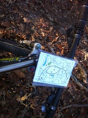
On Friday afternoon the gears were turning. I wasn't going to let another weekend slide by, especially when the weather was supposed to be so nice. I called my buddy Tim to see if he was down for a ride on Sunday. Yes, Sunday. I was planning ahead. He was down. My brother was too. The crew was coming together. I had an idea for a route too. It was a little ambitious but you gotta bet big to win big, right?

We met at 6:45 AM at the Atlanta Bread Company lot in Cumming. By then my brother already had an hour of windshield time behind him. When we get together, it's usually a bit of a hike for one of us so we usually try to get something worthwhile done. I hoped that the route I had in mind would count as "worthwhile".

John had brought a buddy of his named Howie that I'd never met before but who he alleged to be a strong rider. We didn't need all three vehicles so Tim put my bike on his rack and I got a chance to ride in his bad-ass Bronco, which I suddenly realized I'd never actually ridden in before. When we were fiddling with my bike I noticed something strange about his: gears. I've always known Tim to be a devout singlespeed rider. He has supposedly ridden gears out west a few times but I'd never seen it. He broke a frame a little while back though and since then he's been trying desperately to get as much as a return phone call or email about it so in the mean time he's been relegated to the back-up bike which, apparently, has gears.

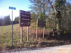
We arrived at the Bull Mountain Lot at about 7:45 by way of an unusual route that I'd never taken before. A friend of Tim's turned him on to it and I might have to get the road bike out that way next time I get the urge to ride up to Bull and back.

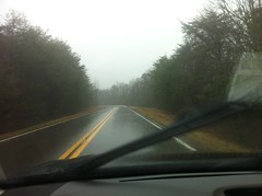
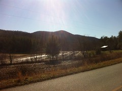
It was freezing, at least by mild-winter-in-Georgia standards. The day before it had been in the 60's all day and I was looking forward to more of the same. At that moment, it was 27. Hey, it'll warm up, right? Yeah.

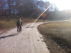
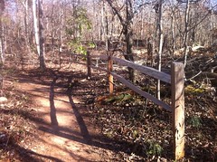
We headed up the trail at the back of the lot which despite the freezing temperatures was somehow muddy with actual mud. The first 50 feet were the worst, but anywhere that it was slightly flat there was standing water, hoof prints and tire tracks. We passed a couple of riders getting dressed at the lot on 83 and talked to them for a minute. Apparently we weren't the only ones up there looking to get an early start. In fact, the internet had been abuzz all day on Saturday. There were at least 3 other rides planned.

The 83 Bypass was slightly improved over that first trail. The Bull/Jake Connector was even better. Jake Mountain was clean and pretty. We ran into a guy named Chris somewhere in there. He was new to the area and he joined our crew. A few minutes later I'm pretty sure he wished he hadn't.

 Jones Creek

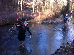
Tim had asked me about the route on the way up and when I told him he immediately realized we'd be crossing Jones Creek. I told him not to mention it to anyone else. There are no rocks or bridges. If you want to get across, you can't do it without getting wet.

I pulled off my shoes, socks and knee warmers and waded across. Soon enough the rest of the guys did the same. If anyone had gotten very cold, the wall of a climb up off of the creek warmed them right back up.

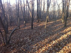
We took Jake north and the trail conditions were, at least to me, very obviously different up north of the creek where we hadn't done any finishing work yet. It wasn't bad, but there was occasionally mud and standing water. We passed on Black Branch and just kept heading north, paralleling 28-1. The trail up there doesn't get nearly as much traffic and though it hasn't had any finishing work done at all, was pretty nice, all-in-all.

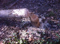
We left the singletrack across the street from No-Tell and continued our push north on FS28-1. Just south of Camp Wahsega it appeared that a tree had fallen across the road and that somebody had cut it up and drug it out. A few scraps remained, but I was careful to dodge them. Tim was not so lucky. I'm not sure whether he was at an odd angle with the guy ahead of him and he couldn't see the limbs or what, but it sounded like he had ridden directly through the boughs of a fallen branch. I looked back and he was still up and rolling though, so I didn't think much of it, but a minute later neither he nor Chris were behind us anymore and we spun back to see what had happened.

What had happened:

 Total Destruction

That is absolute, total destruction right there. Apparently a stick had gotten into the derailleur and torn it off. Then the derailleur got into the spokes and after breaking a few, the rest of the drive-side went like dominos. I imagine one of them went through the rimstrip on the inside too because his tire was flat. I've never seen such complete devastation. What I'd thought was the breaking of boughs had in fact been the breaking of spokes.

No amount of duct-tape or zip-ties could get him rolling again. Chris had heard us talking about the route, had already decided that it was at going to be at least twice as far as he wanted to ride, had already discussed how to get back from where we were prior to The Destruction, and volunteered to ride back, grab his car and pick Tim up. I hope Tim got his contact info because he seemed like a really great guy and I hope I get to ride with him again. Thanks so much Chris.

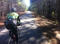
It sucked to lose Tim and Chris but we pushed on anyway. I'd been up that way not a month earlier, Cooper Gap road had been freshly regravelled and I was worried that it was going to be a wrestling match all the way up. Nothing could have been further from the truth though. Apparently the gravel settles right in because aside from some extraneous bits to either side of the road, it didn't look any different than it always looks. I guess I shouldn't say that it didn't look ANY different. The washboards were gone, which was great. So, it was the opposite of what I'd expected - better and easier. Woohoo!

The frere went a little hard when it got steep and I eventually reeled him in for the KOM points at Cooper Gap. Howie was hanging right in there too. He's a strong roadie but he hasn't done a super ton of mountain biking yet, especially in the mountains-proper, so a lot of what we were doing was new to him but you wouldn't have known that from just watching him ride.

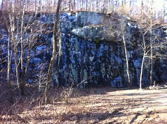
We hung a left at Cooper Gap, rolled past the quarry which wasn't as spectacularly frozen as it is sometimes...

 Frozen Quarry

...and continued west to Hightower Gap. We passed a truckload of hikers, presumably shuttling to some starting point on the AT, and a jeep or two but we didn't see anybody on bikes or on foot.

At Hightower we headed north toward the fish hatchery. It had been colder up on the ridge, but on the north side it was even colder still. I hadn't really planned for sub-freezing temps. I was basically wearing my summer kit plus a summer base layer, plus knee and arm warmers and shoe covers. I'm usually warm in that down to about 40. Below that though, I usually wear a fleece-lined bib, fleece-lined jersey and a windbreaker, which is good down into the teens. I'd brought my Dri-Ducks and had actually worn the jacket for the first 5 miles or so and I thought about getting it back out but I realized that I was actually ok. My upper legs and upper arms were a little cold but I was otherwise pretty good. The base layer did a great deal more than I expected to block the wind, which is funny because I wear it in the summer as a jersey for the exact opposite reason. It was odd. We bombed down into the Rock Creek valley, past old Edmondson Pond, turned Edmondson Wetland, now completely dry. Someone had even removed the sign. We passed the lake, passed the Church...

 Pleasant Grove Church

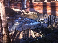
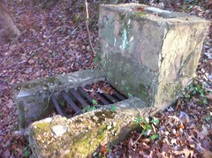
...and paused at the recently refurbished bridge on FS333.

By then I was pleasantly surprised with with how warm I'd managed to stay except for my left foot. It wasn't numb but it was unsatisfyingly tingly. No amount of piggie-wiggling did anything useful. John recommended I loosen my shoe. I thought I'd made sure it was loose enough back when we crossed Jones Creek but I fiddled with it anyway. Turns out that was the problem. One click made all the difference in the world. Within minutes both feet felt great.

We saw a pair of tire tracks on 333. John recognized one of them as Small-Block 8's but I have no idea who rides those. We hadn't seen them yet that day, but we might not have. The gate was closed on 333 and the rest of the roads were open to traffic. They might have been there from the day before even.

333 was fun. The sloppy section where it becomes a county road was only sloppy for about 30 feet, but it was so sloppy that I carried instead of even trying to ride through it.

Howie was on a singlespeed so we had to keep the tempo down a bit on the flats but even so, the rollers on Doublehead gap flew by.

 All Smiles

We rolled by Big and Little John Dick Mountains...

 Big John Dick

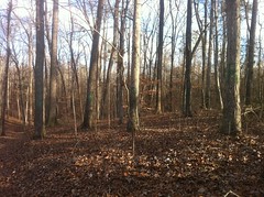
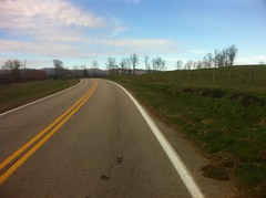
...and plenty of beautiful rural scenery.

At FS58 we headed back north, up Noontootla. There was some inaccurate signage at the bottom.

 Inaccurate Signage

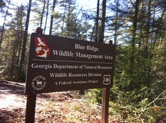
Or at least, I'm pretty sure it's inaccurate. As I understand it, the Georgia DNR gave up the Blue Ridge WMA. It's just part of the National Forest now and no longer a WMA at all. Nobody has taken any of the signs down though and that one looked really new. So, maybe I'm wrong about that somehow. Maybe it is still a WMA.

Noontootla is popular for a variety of reasons. We saw hoof prints and several vehicles passed us. Many of the campsites were occupied and we waved to the campers.

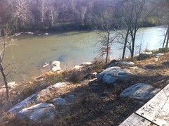
As we rode by Noontootla Falls I mentioned to John that it's funny that with the dozens of times I've ridden by, I've never actually seen the falls except for what you can see from the road. He was surprised and said something like: "Go ahead and run up there, I'll wait."

So I did, though "running up there" probably doesn't accurately describe the strenuous and technical climb that turned out to be involved in getting up to the cascade. I managed it though, in bike shoes, no less, and it was difficult to find a spot to get a good look, but the reward was worth the effort.

 Noontootla Falls 1  Noontootla Falls 2

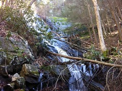
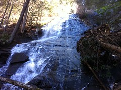
The water was roaring. There's a big slab of rock to the right that I guess was a former route of the falls at some time. The current face has all kinds of squiggly little channels running down it. I ended up crossing over at the base and going back down on the north side. I thought it might be easier. It turned out to be infinitely rockier. I'm not sure I'd call it easier.

When I got back down my brother was gone. I figured it had gotten cold standing there waiting for me and I could see that there were now more than two sets of tire tracks heading north so I followed.

The climb up Noontootla is usually longer than I think it's going to be, but for whatever reason I felt good that day. Before I knew it I was crossing the AT. A bunch of guys in camo jumped in a Civil Air Patrol van as I passed and later they passed me heading uphill. I passed the sign for Hickory Flatts sooner than I expected. I felt great. I'd been eating Zingers all day. Perhaps they are the perfect cycling fuel.

Right in there somewhere I heard a sound like a helicopter, but not like a Huey and not like the Blackhawks I usually hear around there. For a second I thought of the Lifeflight chopper I'd seen the last time I went hiking up there but no, it didn't sound like one of those either. Where was it?

It never went away, and way up near the top I finally got a good look. It wasn't a helicopter at all. It was one of those crazy planes with the huge props and variable pitch wings. It had been circling the area for a while and continued to circle for the next half hour or so. I even saw a second one in formation later, or maybe two separate ones. A long time ago I'd read that the CAP do search and rescue training up there, especially when it's cold - Operation Deep Freeze or something. Maybe that's what they were up to.

When I got to Winding Stair Gap, my brother and Howie were waiting for me. John was lying on his back with his legs up in the air, crossed, and leaning up against a tree. We took a break for a few minutes. I ate a Crunch bar. It was much warmer up there than it had been on the north side of the ridge. Noticeably warmer. In fact, the entire rest of the ride felt comfortable though I'm not sure it ever got up above 40.

We bombed down Winding Stair, which appeared to have been at least regraded, if not also regravelled recently. At Turner Creek we hung a left and rode it until it teed back into Winding Stair. My original, ambitious plan had been to then head down 77A, take Lance Creek Road up to the top of Bull and descend Bull proper back to the car. John and Howie were satisfied to call it a day though, and honestly, it would have been a long climb up Lance Creek. I think I could have done it, but it would have taken a while. Ok, no more climbing. We headed back.

 The End

Long live long rides. I'm not sure how long it was. It seemed like around 50 miles. It was definitely a nice change from the standard 100% gravel road Winding Stair/Noontootla loop that I usually do. Not that I don't like that loop, but it was great to start and end on singletrack.

Howie gets the hardman award for doing it on a singlespeed, but more so for being inconspicuous. On a ride like that, there's usually somebody off the back all day. Admittedly sometimes that's me, but more often it's the guy you haven't ridden with before. Not this time. Nice job Howie! I hope I get to ride with you again soon, and maybe that Chris dude too, and Tim, of course, if you get that wheel fixed, or if Vassago ever calls you back.

Saturday, January 28, 2012

Wells Tract

In her words, I kidnapped my wife for an hour and a half today and drug her around down by the river in Roswell.

A while back, the girls and I rode the Riverside Trail, and on that day I discovered the Wells Tract off to the right hand side. At the time, we had to get back and I couldn't tell if it was open to bikes or not, but I put it on the list.

Today was the perfect day to check it out. It's been raining and somewhat cold for a while now, but for some reason today it was 60 degrees, sunny and breezy and Kathryn was in the mood to go walking around.

The main trail was a tunnel of green. Winter in Georgia:

 Wells Tract Trail

No doubt next week we'll have snow.

The trails were all flat and graveled - typical urban trails, but the woods along the Chattahoochee is always nice and this area in particular was extra scenic. There was a little feeder creek and multiple ponds.

 Wells Tract Pond

There were a couple of mallards in that pond.

We did a few loops to make sure that we saw all of the system trails. Kathryn talked on the phone for most of the first loop. Heh.

There were quite a few little side trails and we even missed one of the official trails at first because it looked exactly like the side trails. We were persistent though and ultimately rewarded with a nice walk down by the river.

 Chattahoochee River

On the way back we had just enough time to check out one more little trail near the lot. It led past what I guess is an old gauging station, the only structure we'd seen all day.

 Gauging Station

It's a nice little park. Kathryn was pleased that it was flat. I could have gone for some elevation but getting a workout wasn't really the idea, I just wanted to get out in the woods, spend time with Kathryn and get a little exercise for both of us.

I looked and looked for signs indicating whether bikes are allowed in the Wells Tract, but I didn't see anything. The Riverside Trail is open and there were plenty of tire tracks in the Wells Tract but they could have been from jogging strollers. It would be a nice little loop to add on to the end next time I'm out there with the kids. I'll have to inquire.

Thursday, January 26, 2012

Cumming GA

Rain, RAIN! ...and the devastating stress of life. Those are the culprits. They're making me slow. They're making me unhealthy. How do I catch them? How do I put them down? Can it even be done?

This past weekend I had CoTrails meetings all day. We're making a lot of progress and it's very important, but of course, I'd rather be playing in the woods than working. That said, it rained ALL weekend. Literally, ALL weekend. So I guess it worked out just right. I got to hang out with Clark, Suzy, their herd of greyhounds and a couple of their friends. Josh Fix was up for an entirely unrelated Trail School. I got to eat dinner with Woody and his wife and of course I got to spend a time with all my CoTrails and FS friends, and an entirely different Woody of Trail Dynamics fame. It's unfortunate you can't stay fit by learning and working and socializing and watching it rain. If you could, I'd have it made.

There was one day earlier this week that I might have gotten out for a few hours, but I was just way too busy. This morning I got up, determined to put down some miles before lunch but it was super foggy and though I couldn't see it, the drip-drops on the chimney told me it wasn't just foggy.

Around 2 it cleared though. The streets were wet but there was no actual water falling from the sky and I figured that was about the best I was going to get.

I kind of had a mission today. I GPS'ed Central Park 500 years ago but for whatever reason I didn't take a photo of the lot or the kiosk and that generic little trailhead symbol on my map has been bugging me ever since. I always figured I'd be back for some reason, but the girls are too old for the playground any more and we just haven't been there in a while. No more! I rode directly there and took my precious photos.

Ha!

Then I just kind-of wandered. I found a short little dirt road off of State Barn. Who knew that was there? I wonder how much local dirt there is around these parts.

On the back side of Sawnee Mountain, north of where I usually ride, I discovered a bit of rustic flair between the Sawnee Feed Company and a few homes up the road.

I climbed over Sawnee itself from the back and spun a loop up through the park at the top. I've still got power but it feels like certain individual muscle fibers just don't want anything to do with climbing.

It was sort-of dryish on the west side but coming back down the east, it was wet again.

Somebody's bull had gotten over the fence at the base of the mountain. It was just standing there, half out in the road. There were cars stopped in either direction but it was completely oblivious, looking straight ahead at the cows in the pasture across the street. I rode up though and that was all it took. On sight of me, it spun around and leapt back up the hill and over the fence. I've never seen a bull jump like that. It was really amazing. So, note to self, without a fence in the way, cows are scared of bikes. Maybe.

Around the corner, there was a guy working in the same pasture. I tried to talk to him but he didn't speak much English. Darn my luck. Falo Portugues mas nao Espanhol. Actually it wouldn't have been any better if he spoke Portuguese. I know all kinds of words related to business and computers but I realized, standing there, that the words "cow", "fence", "hole" and "road" weren't coming to mind.

Rolling back into town it started sprinkling. I debated cutting it short but I really wanted to do my little Melody Mizer loop. Who cares if it rains? It wasn't cold.

And it rained. Rained and rained. But it wasn't bad. When I got home Sophie was all: "You're wet! Wet and red! You forgot to put on sunblock! No, wait. You're red because it's winter! You forgot to put on... snowblock!" Heh, snowblock.

What a day. It's still raining now. Maybe this weekend it will be dry. I can't even remember what the woods looks like.

Sunday, January 15, 2012

PaCo Mixed Loop

My road bike is dirty. By itself, that's not really news, as my road bike is generally pretty "dirty", but today it has ACTUAL dirt on it, and though that's not completely unheard of, it is a little out of the ordinary.

This morning, I met my brother at the Silver Comet's Rambo Trailhead at 9 with designs on riding the PaCo Mixed Loop. PaCo is short for Paulding County, thus the Singletrack Samurai-esque spelling. It felt cold. It was definitely colder than it's been yet - 31 at the lot, but I expect that it will be substantially colder in the coming weeks and I'm sure I'll soon be laughing at the idea that 31 felt cold.

I didn't know how cold it would be so I ended up bringing every stitch of clothing that I owned, just in case. I opted for some fleece-lined tights, but they ended up being a little too warm even. I should have known. They say if you're not cold in the parking lot, you're overdressed and that certainly turned out to be the case. I didn't have that much of a choice though. My old winter bibs are long dead. Both of the chamois are dead in my summer bibs and all I had left were the fleecy tights and a pair of inexpensive, ill-fitting summer shorts. Man, I really need to upgrade my wardrobe.

We headed east out of the lot and almost immediately passed the guy that had parked next to John on his way back in from a run. A few easy miles later we turned off onto the first "mixed" section of the loop.

They call it the Mixed Loop because, though it is all road, you get just about every different kind of road there is at some point during the loop. For example, right off of the Comet, you turn onto a dirt and gravel road.

 Dirt and Gravel

They say "dust off your cross bike" for this loop but we hoped that the regular old road bikes would be sufficient. The frere and I both ride them on dirt and gravel all the time and I hadn't yet personally run into a road south of the mountains that I'd be worried about whether I could get down. For the most part though, we've ridden road routes with a mile or two of dirt here and there. Today's loop was like 50/50, or maybe even 60/40 with the 60 being dirt.

A few miles in, I had a sudden, sinking feeling. I think the route is supposed to be around 50 miles, and I'd grabbed 50 miles worth of food at the gas station on the way over, but I suddenly realized that I'd left all of it in the car. I had water, but no food. The realization induced Pavlovian hunger pangs and triggered memories of splitting headaches, aching joints, tunnel vision and that horrible feeling where you realize that your speed has become proportional to the distance you have left. I was saved though, John had brought 2 packs of Clif Blocks "just in case." I hated to provide that case, but I was very thankful that he had them.

We hit a few difficult chunks of road somewhere in there. One had gotten muddy and a little rutted. It was almost dry, but not quite and you just had to pick a tire track and hold it all the way up the hill. I don't know if he carried more speed into it or if he has a slightly bigger granny gear than I do but John was able to make it up that hill, though quite slowly at the top. I nearly made it but finally lost traction about 90% of the way up. I prayed it would be the only bad spot and as luck would have it, that was the case.

We alternated between dirt, gravel, hard-pack, deteriorated asphalt, beautifully smooth pavement, rough pavement... Everything!

The ride was fun, but I was having a very difficult time, fitness-wise. I'd start to go anaerobic the instant I tried to put down any power, I couldn't breathe deeply, I was breathing fast, I couldn't catch my breath without really easing up. It was like jumping back on Isabel's skateboard after 20 years. I could look at a hill and in my mind, I could imagine what it should feel like to climb it, but I had an impossible time getting my body to do the things necessary to make my real feelings match the ones in my head.

The scroll of excuses pouring out of that lame part of my brain was long and most of them centered around weather and lack of sleep, blah, blah, blah. Whatever. No excuses could change the fact that I got dropped, over and over.

 Pavement

It was no good, but usually if the ride is long enough and I get some good recovery on an easier section, then the next tough section feels easier and after a few hours, I'm back to normal. I was banking on that and hoping for an easier section, but instead the road turned into gravel again and we just climbed up, up, up and over Braswell and Brushy Mountains. I got so tired that I could barely even talk right. I kept slurring. The climb was a series of step-ups and in theory I could get some rest between them, but it was no use.

I had a little mental game going on too. Brushy Mountain lies at the heart of the Paudling Forest. It's small game season now and there were a lot of hunters out. I didn't realize, but I haven't done any dirt road rides since coming back from Florida, and it seemed like every truck in the woods today was a white pickup. The guys that chased me around Central Florida drove a grey truck, but white was apparently close enough in my mind. Every time we'd come around a corner and see a guy in a white pickup, I'd get a little flashback and a small shot of adrenalin. It wasn't that bad, and the more trucks I saw, the less significant it was but for a while, it was a factor.

Finally, on the back side, dirt became deteriorated asphalt, crumb-gravel became pavement and eventually, I got that rest that I needed. I could breathe again, I could punch it over little hills, I could crank big ones without going anaerobic. In fact, nothing even looked that big any more. I felt like myself again, or at least less like the shadow of myself that I'd been feeling.

I submit as proof that I had become myself, that I made a navigation error in keeping with the typical navigation errors that I don't seem to be able to avoid making. At an unsigned intersection, it felt right to stay left, so rather than check the map, we stayed left and rode downhill for about 5 miles before I realized the mistake.

Ah, yes. I can say it again: Don't trust me to get you anywhere.

The return was an easy tempo climb though and my lungs were finally working for real. Yeah!

We got back on track south of Yorktown and the rest of the ride was fast and fun. There were some mean kicks near the end and I struggled, but nothing like earlier. In fact, the biggest problem I had was that I didn't drink enough and my thighs started to twinge. I'm not sure why. I don't usually have that problem, but I did today. It's so disappointing when you've got a ton of energy but your legs aren't in any mood to do anything with it. Come on!

It wasn't that big of a deal though because right as it happened, we hit some flattish dirt again and the the Silver Comet a mile or so later.

 Silver Comet

I'd heard that the loop was 50 miles, but it didn't seem like anything close to 50 miles. It seemed more like 30, including getting off route and back. I'll have to see what Google Maps says.

The route is incredibly fun, if you're into that sort of thing. The diversity of scenery, terrain and road surfaces keep it interesting. Highly recommended!

Ride it.

Saturday, January 14, 2012

Jake Mountain

This past Saturday was work-day at Jake Mountain. We didn't have one in December so I actually found myself very much looking forward to this one. For months, we've been doing finishing work on the Jake Mountain and Moss Branch trails. There's one section left between the intersection of those two trails and Jones Creek that still needs work. We'd planned on getting to it this time, but Debbie had been up there earlier in the week and it turned out that there were a few sections of trail that needed more attention so we decided to work on them instead.

I think there were 16 or more of us. We split up into 4 crews. I took a crew down the Bull/Jake Connector.

That trail had been built 5 or 6 years ago but finishing work had never really been done on it. This past year, we ran a Dingo down about 2/3rds of it, but just past where the Dingo work stopped, there is trouble.

There's a step-up there that's just slightly too steep for the traffic and a groove is wearing into it, little-by-little. Give it five more years and it'll look like the old trenches on the old Moss Branch Trail. Deberming it by hand isn't feasible. We're going to have to armor it with pavers, rock and gravel. It will be quite a project.

In the mean time though, we debermed about 200 yards of trail uphill from the bad section and cleaned out as many old nicks as we could find.

Isabel unearthed a hibernating toad.

 Hibernating Toad

At first we thought it was dead. Then it started stretching and we thought it was a zombie. It was only then that we remembered that toads can hibernate.

Zombie toad!

It had rained a lot over the previous week and even a little bit that morning but aside from the specific spots we were working, the trail was in extremely good shape. Several groups of horseback riders passed us and a group of mountain bikers too. Except for the low spots that we were actively clearing out, you could not have looked at the trail and determined how many riders or how recently they came through. I remember Woody mentioning that way back. A well designed trail can be ridden wet. That would appear to be the case.

The soil was wet and heavy. The work was difficult. Everybody swung hard though. Nobody sat up.

 Trail Crew at Work

One semi-interesting event did occur while we were out working. We often move to a new section of trail, drop our backpacks on the backslope and work toward the downslope. We had done this and a little while later, group of riders came by on horseback. The lead horse was very frightened of our backpacks, lying there in a little pile. It stopped for a while and thought pretty hard about it, and once it jumped backwards about 6 or 8 inches, all at once. The way it jumped was kind of up and back with all feet at the same time and it seemed so unusual that Isabel kept talking about it all day. It was interesting to me too because I know horses can be afraid of bikes, and I've always heard that they can also be afraid of bright colors and of backpacks and of things on the backslope (because predators generally attack from uphill) but I hadn't seen it until then.

Speaking of predators on the backslope... I've mentioned that to the girls before, kind of in passing and Isabel apparently paid attention because whenever a group would come by, she'd tell Sophie to move to the downslope and tell her exactly why, and tell Greg, and tell Jeremy, and even tell the equestrians in our crew.

It's amazing to me how much they pick up.

We'd walked out to the end of the chunk we needed to work on and worked back toward the parking lot. The half mile or so nearest the lot was in much better shape than further out, though the sections had been constructed identically. There were a few little nicks that needed work though, and we quickly discovered why everything was in such good shape. The soil there was exceedingly rocky; just shot through with gazillions of little pebbly chunks and dude, it took like 20 minutes to do there what it had taken us 10 to do further down. We were so close to the lot too, it was like running out of gas within sight of the gas station and having to push your car up to the pump. Yes. Admittedly, I've done that.

We got everything done that we'd hoped to accomplish and the other crews reported similar success. It was a really productive day. I think collectively we turned in 101 hours or something. Woohoo!

Back at the lot we pigged out on lunch, graciously provided by the CTHA, and sat around a'jawin for the next hour or so.

A group of riders who had apparently come from a long way away and were completely unfamiliar with the trails rode up and headed out.

 Riders

It gives me a very good feeling when I see someone enjoying those trails, even if they're enjoying it in a different way than I do. In fact, I think it might even feel even better when I see someone enjoying the trails in a different way than I do. I guess it's because I can see that the impact extends beyond myself and my community. Whatever it is, I love it and I'm already looking forward to next month.

Vickery Creek

It's been one week and one day since my last little adventure and I'm just now sitting down to write about it. How does that even happen? In the past, it always seemed like I had plenty of time to do stuff and even more time to write about it. Lately, it just hasn't been the case. Man, I hope it's temporary.

Please, please, please...

Two Fridays ago I got out of the house for a couple of hours to finish exploring all up in and around the Vickery Creek area. This time, it hadn't rained continuously for several days, and the creek itself was relatively low. I could, for example, actually see the little shoal beneath the bridge.

 Shoal on Vickery Creek

My goal for the day was to see the rest of the park. I tried to see it all last time, but I got perpetually sidetracked and before I knew it, I'd run out of time. The same thing almost happened again though. Right near the covered bridge, there was a small maze of trails running up, down and around the hill by the creek, in the "Mill Point" area, or so I have dubbed it. It took forever to explore them but I managed to get it done.

I think I might have confused and possibly scared a girl though. She was by herself, down by the creek, playing around with rocks and sand and I kept looping back and passing by her. If some old dude kept passing back and forth by my kids over and over, they'd wonder what he was up to. I had my GPS and map out, but you never know if people know what those are or not. I hope I didn't creep her out too much.

Eventually I got away from Mill Point and started making real progress on the system.

Along one of the main trails, there were several sections of fence. It was clear in a few spots that they'd built it to keep people off of some old, user-created, fall-line trails that they'd also covered up with brush, but in some spots, the purpose of the fence wasn't all that clear.

 Fence Along Trail

Eventually I made it down to the Riverside Road lot and followed a trail out along the river for a while. There are maps at various corners, throughout the system and they all showed a closed section along the river. Eventually I discovered that section, and I think I know why it's closed.

 Fall and Die Sign

There was a cable stretched between two trees and a "you could fall and die" sign behind it. A few years back we had some major rain and flooding. Along the Chattahoochee up my my place, it created some impressive washouts. Down by my brother's place, along the Dog River in Douglasville, it was really amazing. I imagine Vickery Creek suffered a similar fate. The trail, being right on the river, and apparently dangerous enough before, probably became pretty nearly impassible.

It was hard to resist the urge not to keep going and check it out, but I did. Barely.

Heading back toward the rest of the park, I noticed a tree that had been cut down by a beaver.

 Beavers

Up by my place, I've seen plenty of trees that have been gnawed on and plenty of old stumps, but never an entire tree, recently felled, until now. The limbs had been gnawed off and dragged away and the beaver appeared to be in the process of cutting the tree up into sections. It was fascinating. I always wondered how they managed to move an entire tree. Apparently they don't, they cut it up. It seems so obvious now.

Back on the main trail, I ran into a couple that was utterly lost. At first I thought they must be joking because the guy had an old, white beard and from the looks of him, I'd have thought he'd spent the last 10 years of his life hiking the Appalachian Trail. I guess looks can be deceiving though because they were, in fact, quite lost. They had some issue with the signage. Something like "the map tells you where you are but not which direction you came from." Obviously, the map can't know which direction you came from, but I didn't mention that. I just walked with them back the the previous map and showed them which way to go.

There were a couple of side trails that led down to the end of some local neighborhood roads and I checked those out, but I didn't see as many interesting sights as last time. There were a few though.

For example, there was this really weird bush. Somebody tell me what this is.

 Weird Bush

Evergreen, leaves shaped like maple, but waxy and thorned like holly. Weird berries. Bees were buzzing all over it. I've never seen it before. It had never occurred to me that bees even existed in the winter. Weird.

Just past the weird bush, I ran into a jogger with a really friendly dog. Just about everyone out there other than me was a jogger and 90% of them had dogs. It's an in-town trail, so technically you have to have a leash, but almost nobody does. That said, virtually every off-leash dog was either ambivalent or super-friendly, but their owners seemed to be very self-conscious about breaking the rules. This guy was, in particular, but I was just happy to get to scratch his dog. Man, I wish I could have a dog!

If you just go by the maps along the trail, the system seems like a spider web. But after sufficient exploration and after taking note of some of the old, overgrown side trails, the layout of the system started making sense. It became clear which trails were old roads and how they used to connect up to each other. I started to remember where I was. I didn't have to check the map so much. It was a nice, familiar feeling.

Just uphill of one of the odd trails that I first thought was a side trail but which turned out to be an actual system trail, I noticed a weird little concrete structure.

 Grill, Or Something

It turned out that it was in the backyard of an old house. The ruins of the basement lay nearby.

 Old Basement

What was the concrete thing though? It reminded me of an episode of Mythbusters. Adam once said he loved to find old, confusing pieces of equipment that clearly must have had some purpose, but try as he might, he couldn't determine what it might have been. The purpose had been lost to time. That's how this thing was for me. The best I could come up with is that it was some old grill. There was what looked like it might have been a chimney and certainly there were rusty old rails, but the rails were flat and wide, there wasn't any obvious evidence that any burning had gone on, and why would there be a chimney at all? It made me suspicious of some distinctly different purpose, and I stood there and thought about it for a while, but nothing came to mind. Sherlock Holmes would have been terribly disappointed with me, had he actually existed, that is.

Further on, I encountered another mystery, though it turned out to be a little more discernible than the last. It's hard to see in the photo, but somebody painted H-E-L-P on the trees. If you stand at just the right angle, you can read it.

 Help

The trees were dissimilar though: white oak and maybe red oak, neither rare, so it didn't appear to be an appeal to save any particular kind of threatened tree. I ultimately decided that maybe someone was appealing for help for trees in general, or perhaps for the park, in general. With the steady urbanization of Roswell over the past hundred years, I could at least imagine that was the message. "The trees themselves cry out for help!" Or something similar.

Up the trail a bit though, I encountered a distinctly different viewpoint. It is very hard to see in the photo, because someone painted it in dark green, but if you look closely, you can see the letters P-A-P-E-R.

 Paper

"The trees themselves cry out 'We are paper!'"

The duality of man.

And with that, I'd explored the entire system. Every inch of trail. It was still a long walk back to the car though, and on the way, I stopped to examine something that I'd noticed all day. Probably every quarter mile or so, there was a little blue or green bag, at the edge of the trail.

 Doggie Bag

I'd seen them all day. I've never seen them anywhere else. I was very curious what they were. Having accomplished my objectives, I felt free to indulge my curiosity and immediately wished that I hadn't. The bags were, of course, full of dog poo.

There are signs all over that say "pick up after your pets" and cleverly "it's your 'doodie' to pick up after your pets" and so on... But it occurred to me, the signs don't specifically say that you should carry out the turds because they're an eyesore, somebody might step on them, a concentration of them getting into the watershed can bump up the local e-coli level, etc. etc. etc. The signs just say that you have to pick them up. This is classic for North Georgia. Leave it to a North Georgian to follow instructions to the letter, but to miss the point entirely. On the other hand, leave it to a North Georgian to give very specific instructions but leave out the point, entirely.

The bags appeared to be made of some odd material too, like maybe they're those biodegradable plant-bags or something. So, I'd bet that the people using them are doing their best to be environmentally conscious. E for effort. At least they're trying. And honestly, I'm not really sure I have any issue with it, one way or another. It kind of reminded me of the beheaded deer carcases I see scattered all over the roads at the end of each deer season. We don't have chronic wasting disease here. Yeah, it's an eyesore, but is it REALLY hurting anything? Maybe. I have no idea. Yeah, the poo gets in the watershed, but so does the runoff from everyone's yard. Eh, I'll leave it to somebody else to have an opinion about that one.

It took infinitely longer than it seemed like it should to get back to the car. Near the end, I got stuck behind some college kids that had apparently been out jogging but were now cooling down and walking extra slow. It didn't matter though, I had plenty of daylight and I was just happy to be out of the house.

All right, so the exploration of Vickery Creek is now accomplished. Yay! On the other hand, there are still Allenbrook House, Ivy Mill, Oxbo and Old Roswell Trails nearby, begging to be explored as well. So, I guess, for that, also yay!

I wonder if I can convince the kids to help me out with those trails. It doesn't seem likely these days, but I guess I can dream.

Thursday, January 5, 2012

To Bull and Back

A long time ago on some forum or something, I mentioned that I'd done a long ride up at Bull Mountain and I think it was Neal Nichols who joked in response that I probably rode there from my house, which is like 40 miles away. Ha, ha, we all laughed, but apparently the incident planted a tiny little seed in the back of my mind.

When I leave the house for a road ride, I rarely have a destination in mind, I usually just feel out a route, but over the next several months I found myself feeling like riding further and more directly north. A few weeks ago, about ten miles into the ride, it suddenly occurred to me that I wanted to ride to Bull and back and I got as far north as the kangaroo place before running out of time.

Today I had all the time in the world though and for the first time since The Circumnavigation of Lake Lanier, I left the house with a purpose.

Dawsonville used to seem like a long way away but I barely noticed the ride up today. It was familiar and I guess that makes the miles fly by.

 Dawsonville

I'd eaten only a bowl of Raisin Bran that morning and my stomach was feeling a little empty so I stopped at a gas station just off the square for a pair of Whatchamacalits. One, I ate directly, or at least about 85% of it directly. The other I saved for later.

The last few times I'd been up that way I'd headed east out of the square and then North on whatever road becomes Bailey-Waters. I don't know why but today I felt like heading due north on Shoal Creek and picking up Hwy 136 instead.

I doubt there was any difference in distance or terrain though, and before terribly long I was again at the kangaroo place.

 Kangaroo Land

I actually got kind of excited as I rolled by, I guess because I hadn't made it that far yet and for the first time it appeared like I might actually achieve my goal.

It had always seemed like Bull Mountain was only about 5 miles north of the kangaroo place, but I think that's just because I've always been driving. If it's only 5 miles, it's a long 5 miles. And hilly. HILLY! About halfway down Bailey-Waters I could see the Blue Ridge barely peeking over the top of the hill.

 Mountains in the Distance

My destination was at the foot of that ridge but it looked so very, very far away.

A mile or so after jogging right on Hwy 52 a girl screamed as their car passed and it startled me half to death. I can't remember the last time I shook so hard when somebody yelled at me but man, I shook that time.

It seemed like it took a year to get to Nimlewill Church Road, and I really didn't remember all those little rollers being there. The ride down to the church itself flew by though and before long I was in the lot, in sight of my goal.

 Nimblewill Church

The aforementioned goal, achieved:

 Bull Mountain Signs

Or, at least, half achieved. For it to truly count, I had to make it back home too.

As I stood there, screwing around with my phone, a guy with a mountain bike on the back of his car drove by and waved. When I rolled out, I noticed a lone car parked in the Jake Lot too with somebody sitting there, either about to head out or just getting finished. Just up the road, I passed another guy with a bike on the back of his truck and he waved.

It was surreal being there on the road bike, kind of like when I volunteer at a race. My instincts tell me to be excited and that I should be doing all the things that I normally do to get ready for a ride. But what is this? I have no mountain bike! Did I forget it? Oh, wait, no. Everything is fine. I'm here for something else. But, wait, my bike! Oh, yeah, heh, remember... Not here for that. ... My bike!? And so on.

It wasn't until I was well away from the lot that things started to seem normal again.

I stopped briefly at the old Grizzle's Store.

 Grizzle's Store

Long ago I used to take a route up to Bull that went right by the store. Now I go a different way and I realized that it's been a really long time since I'd last seen it. I had to stretch my mind a bit to remember, but it was when Billy Pickens and I rode up there after Hurricane Ivan had taken out a bunch of bridges. We couldn't drive to the church from either direction, parked at the store, rode down the road and had to hike-a-bike across a creek where one of the bridges had been washed out. We then proceeded up to Nimblewill Gap, quadruple-flatted and I had to ride a flat tire down FS28-3 and beyond to Hwy 52 and then head east in the dark while Billy went and got the truck. It was quite an adventure.

I took Hwy 52 east to Hwy 9 and then headed south. It was somewhere in there that I first felt like I would actually make it back. For some odd reason, I never feel like I'm making real progress until I turn and head in the general direction of the end. Even if I'm well over halfway, until I make that turn, it just doesn't feel right.

I had to stretch my mind to remember the last time I'd been on that section of Hwy 9 too. It was AGES ago, even before that quadruple-flat adventure, probably 2002 or so. There are some big, twisty climbs up off of the Etowah. Yes, indeed, there are.

Somewhere, not too far north of Dawsonville I rode past this burned up old homestead that was too interesting to just ride on by.

 Burned Out House

The dual chimneys are still standing, along with the brick columns that held up the porch, but the rest is a total ruin. Kathryn would have loved it. She loves old broken down buildings.

Not far south of that I started to get light headed and weak-kneed climbing some long, steep hill. I was short on calories and there were a gazillion miles left to ride. I ate the little nub of the first Whatchamacalit and eased up, but it wasn't enough. I was getting weaker by the mile. It was that long, slow bonk where you either barely drag yourself home after teetering on the edge of hypoglycemia for hours, or suddenly crater halfway up the last hill.

I stopped at a gas station in Dawsonville again. This time it was the one across the street from the last one I'd stopped at. I refilled my bottle, ate the other Whatchamacallit, warmed up in the direct sun for a few minutes and hit the road again.

It's only about 20 miles from the Dawsonville square to my house but it was the longest 20 miles in the world. I never really bonked but I never really recovered either.

A few miles north of town I jumped again when an Outback just like mine (but green) drove by and the dog in the back seat with it's head out the window barked as it passed. For some reason, apparently, I was all nerves today.

As I rolled into town it wasn't officially dark, in that you couldn't really see any stars yet, but everybody's headlights had been on for a long time and I'd turned on my flasher ten miles earlier. I had a red, rear flasher, but nothing up front. I own a little white bar-mountable light, I should just put it on my bars and leave it there all winter.

I'd mentioned before heading out that I was worried I'd be about 15 minutes short on time and it turned out that I was right on the money with that prediction. The hills in my neighborhood seemed taller than ever, especially in the failing light, and for some reason there were dozens of people coming home from work, right then too. I made it though, and all's well that ends well.

I wasn't sure of the mileage before I left. I guessed around 70 miles and upon returning, I checked Google Maps and it shows it to be right about that far. Not too bad of a ride. I've been hoping to get in some longer rides this winter. Next time I'll have to manage my nutrition a little better but it felt like a pretty good start.

Monday, January 2, 2012

McIntosh

Yesterday my Dad and I tried to ride 5 Points. I had a great time up there with Travis, I knew he'd love it and I wanted to see where the Long Branch Trail went, so we met at the corner of I-75 and 140 and trekked on up there. Both of us checked the weather the previous day, and the previous night, and that morning and still we got rained out.

 Rain

Baaahhh!

5 hours of windshield time, down the drain. Such is cycling though.

Today we endeavoured to make up for it but we didn't have the same kind of time to spend so we hit a local trail, or at least a substantially more local trail - McIntosh Reserve. My Dad and my brother and I used to ride and race there a good bit in the early 2000's. Some time ago it flooded really badly though and much of the park was under several feet of water for a year or more. Around that same time, trails started popping up in Paulding County and at Clinton and nobody even talked about McIntosh any more. It seemed to have been all but forgotten by the collective Atlanta-Area Mountain Biking Consciousness.

In truth, I wasn't sure it was still even open, so I actually called to make sure before we made the trip down. Yep, they were open, and they have a website, and there was even a map. Woohoo!

I picked up my dad from his place and met my brother at his place and we headed over together. The lady at the front gate was very friendly but she talked my brother's ear off. She was concerned for us being out in the woods because it was already 'cold' (48 degrees) and the temperature was supposed to drop and the wind was pretty strong. She was also really worried that we didn't have enough time (3 hours) to ride the entire 12 miles of trail. It was a bit brisk, but the wind wasn't a big deal and we were pretty confident that we could knock out the miles.

We parked down by the river and got dressed. A cat was roaming around the lot and though it was a little apprehensive at first, it eventually let me scratch it for a few minutes.

I taped the map to my stem and we hit the trail.

 Map

Right away, I could see that it might be a long day. Mountain bikers may have forgotten about the trail but it appears to have become even more popular among equestrians. The first hill didn't run straight up the fall line, but it definitely didn't follow the half-backslope rule. The soil there is somewhat sandy, and between the grade, the hoof prints and the dense leaf cover, it really took some effort to climb.

I know my Dad's pace, so I just started up the first hill at that pace, but my brother doesn't usually ride with us and it threw me off. I heard him right behind me the whole time, confused that for my Dad being right behind me and rode harder up the hill than I otherwise would have. We ended up dropping my Dad and he over-worked himself trying to catch. He didn't blow up completely, but he wasn't far from it. It took most of the ride for him to recover. I did that once on the Dalton Pinhoti with my brother and Mark Baldwin - I blew up on the road before we even got to the trail and it took 20 of the 32 miles to recover. I almost did it on P1 on Andrew's birthday. It's so easy to do, especially when you're first getting warmed up.

We rode all around the Southeast corner of the park. The trails were soft and leafy and bumpy and eroded. They were definitely challenging, with plenty of technical climbs and descents, but they were very rough and it was difficult to carry speed.

We crossed a creek by a little water park and meandered past an old cabin.

 McIntosh Reserve Cabin

Apparently the land is named after William McIntosh, an Indian Chief of both Creek Indian and British descent, thus the English name, who ran a plantation on the grounds. He served under Andrew Jackson and had a distinguished military and political career, helping to establish many US-Creek treaties. Despite all that, his cousin on his Dad's side got elected Governor of Georgia by promising to remove all Native Americans from the state and that put him on the Creek's bad side. Ultimately they murdered him and burned his plantation.

I'm not sure whether the cabin was left unburned or whether it was built later. There are interpretive signs all over the place though. If we'd been in less of a hurry, I might have read them. Apparently there was a Civil War battle somewhere around there too but I didn't see any signs for that.

There's a big hill down by the river with a pavillion where you can get a good view of the river.

 Chattahoochee River

A lady and her daughter were looking around too and talked our ears off about kayaking.

We sort-of rode a more-rideable-than-it-looks trail over the rocks behind the overlook, past the Council Bluffs where Indian Chiefs used to meet, along the river for a while and back up into the woods.

The trail was hard to follow in some places. Hard to even see.

 Trail

The hills were steep and chunky. The flat spots appeared to collect water and hoof prints. In antiquity, there was always a horse-line and a bike-line. There was always a path of packed-down trail to one side or the other of the hoof prints. Not so much any more. We just had to power through them.

It's more or less one long, difficult climb to the north end of the park, away from the river, and then a long descent back to the south. There was a side-loop off of the main trail heading back south and it was actually really nice.

There was a mile or so of trail that we hadn't ridden yet so we looped back over toward it on the pavement. On the way, we ran into the lady from the front office. Again, she expressed strong concern over us being out in the cold and it seemed inconceivable to her that we only had a mile left to ride.

My dad had whacked his knee earlier trying to climb one of the sketchier little kicks so he bailed off back to the car. John and I hit that last little bit of trail and joined him. We probably had enough time to spin another, abbreviated lap but we were just as satisfied not to.

The trails out there aren't bad, they're just not great, given what else there is to ride these days. I hear complaints all the time about how all the new trails people are building are too sanitized and too easy. There's always McIntosh.

Sunday, January 1, 2012

Silver Comet

Yesterday we dialed in Sophie's bike and this morning we all felt like putting some miles on it. The Silver Comet seemed like the perfect place to do that. It's long and straight and easy and there aren't too many road crossings to challenge her new braking skills.

Allons-y.

It was unexpectedly warm at the Tara Drummond lot but then unexpectedly cold when we got going. Not too far in, we actually had to turn back to get jackets and spare clothes. Fortunately we'd only gone a mile or so, but unfortunately it was mostly uphill back to the car.

On our second attempt, we made a great deal more progress. We rolled through several little tunnels and out across an old train trestle that took us high above some little creek below.

 Paulding County Trestle

Somebody's property backed up to the creek and they had put out a lawn chair and an umbrella on the bank. At first I thought that somebody was sitting there and I prepared to wave, but then I realized, it wasn't a person sitting in the chair, but rather a skeleton.

Ha.

I wonder if it's there all year or if they've just been lazy in picking up their Halloween decorations.

The Silver Comet trail gets pretty remote out west of Dallas. It crosses the Paulding Forest and there are few signs of civilization.

We saw one or two road crossings and two or three houses but that was it. The houses were interesting too. One looked as if it had exploded all over the property, in classic North Georgia form. I didn't know that happened this far south. I guess it does. The other had a small lot to the side that, given the ruts, was dedicated exclusively to mudding. A big, jacked up 4x4 was parked at the edge, facing the clearing, eagerly awaiting the next rain.

I think I like the Silver Comet out that way a bit more than I like it closer to Atlanta. The geography is much more complex.

 Paulding Forest

You pass through deep cuts and over even deeper fills. We were always surprised by how cold it got when we were down underground like that. There were several long stretches and a few times we got to the point of shivering.

Looking at a map later, it seemed that for the people that had to lay the old railbed, there was no easy route through those woods. An old mountain range, now worn down into thousands of little hills, comes slanting in from the northeast and there's nothing to do but push though it as quickly as possible. There's no great contour to follow. It looks like they had to cross one major creek at right angles and then they tried to follow another one northwest, as much as possible, but even that was hard to do.

When they hit Brushy Mountain, there was only one thing to do. Drive right through it.

 Brushy Mountain Tunnel

Sophie has always liked tunnels but riding through that one was surreal. It's just so tall. You get a clear sense that it was designed for some other purpose and it almost feels like you're intruding. Combine that with the length and about halfway through, you start to feel a little like you've overstayed your welcome.

We got passed by several riders who commented in how surprised they were to see the kids out there. We were a long way from parking lots in either direction and I guess they knew how far they must have ridden.

Most people were friendly but somewhere in there we got passed by a older lady and her friend. The friend was lagging behind a bit and almost looked homeless. The lady was extra chatty and about half of the things she said were friendly but the other half were decidedly negative. She commented, for example, on how it would be much easier if the girls were on road bikes and that she HATES hybrids and a few other odd things. It was just enough to make me a little uneasy. If someone doesn't know any better than to say unfriendly things, it makes you wonder if they know any better than to do unfriendly things too. I was relieved when they were gone and Isabel indicated as much herself.

We stopped for a snack at the county line and the kids were more fascinated than I expected that they could be in two counties at once.

 Kids in Both Counties

On the west side of the tunnel, we noticed more old railroad debris than in the east side. There were old ties piled up here and there and even one old rail. There were old telephone poles still standing beside the trail in some places and odd concrete boxes chucked off to the side. It brought again to mind the great argument... Trash or artifact?

We continued west to Coots Lake Beach.

 Coots Lake Beach Sign

The lake itself looked uninviting.

 Coots Lake

There we set a spell and checked the mental math I'd been doing for the past hour or so. We'd started around 1 and it had taken us 2 and a half hours to get there. Most if it was climbing though and we'd stopped for at least 20 minutes so far. We had about 2 hours to get back if we wanted to get home by 7 for dinner with my and Kathryn's folks, who are both in town. If we didn't screw around, we had plenty of time.

And for the most part, we didn't screw around. I had to stop to pee twice but other than that we made great time.

The second time we stopped, there was this oddly misspelled graffiti on the curb.

 Cliff Barr

I can understand misspelling Clif but who doesn't know how to spell "bar"?

It seemed like an odd word to get wrong.

We got back right on time and made it home right on time too. Sophie did great all day. We were able to go much faster, she's got the brakes down and she's figuring out the mysteries of shifting. The only problem she had was that the shifter is still stiff and it gave her a blister on her thumb. It was a minor inconvenience though. Overall, she loves her new bike.

All tolled, we rode 27.58 miles. I was shocked when I read the number. Yeah, it was all on flat, paved trails but still, it seems like a long way for a kid to ride her bike. The girls seemed pleased with it too, as our previous record was right around 20 miles.

They didn't seem too worn out from the effort either. I needed a nap but they were bouncing off the walls all night. I wonder if I can coordinate something even more ambitious next time.