Sunday, January 31, 2010

Winding Stair/Noontootla

Finally I got to ride my mountain bike. Finally.

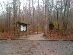
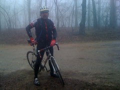
It rained and snowed and iced all day yesterday, but today it was sunshine and blue skies. I'd read that Mike Horwitz had an all-FS-road group ride going on up in the Blue Ridge WMA and that sounded just right.

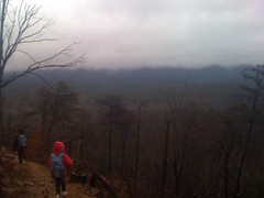
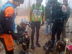
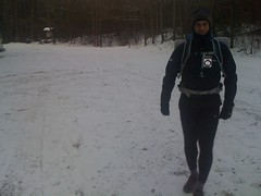
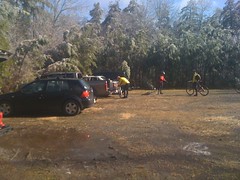
We met at the Jake Lot around 10 and were pedaling by 10:40 or so. It was cool, I met a bunch of new folks, and got to ride with a couple that I don't usually get to ride with.

 Getting Ready

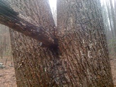
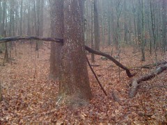
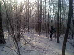
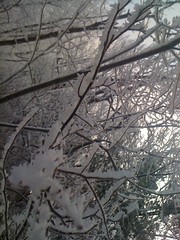
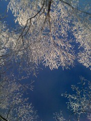
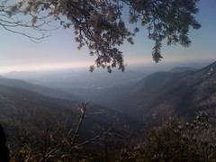
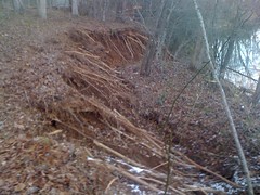
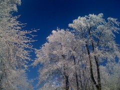
Yeah, the sun was out, but every branch and needle of every tree had a thick coat of ice and it was melting fast. Every few minutes, another tree would shed some huge amount and it would come crashing down like somebody dropped a chandelier. Not a good day to be in the open woods.

 Icy Trees

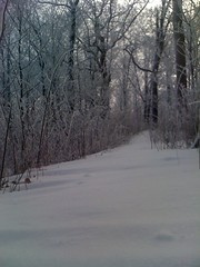
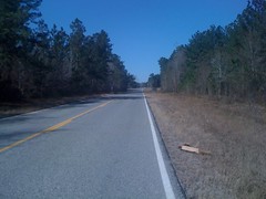
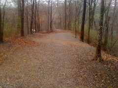
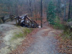
The roads were a little wet, but pretty nice.

 FS80

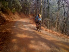
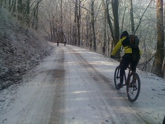
On the north side of the ridge, it was a different story. 42 was icy and dry snow lingered in the woods. A couple of riders got off the front on some descents. I'm a pretty good downhiller, but I didn't have the courage to keep up with them. They either really knew what they were doing, or really didn't know what they were doing. Nobody crashed, but I saw a couple of really sketchy slides.

 FS42

At Hightower Gap, somebody had parked a truck under a tree, and every minute or so, the tree bombed it with a shower of grapefruit sized hail. I see an insurance claim in that guy's future.

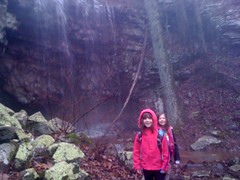
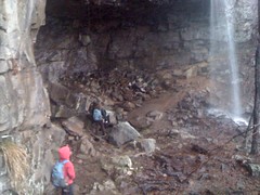
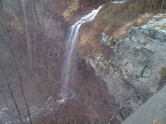
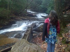
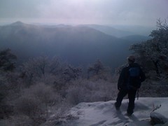
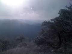
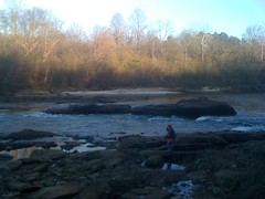
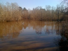
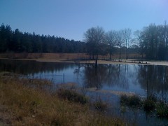
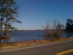
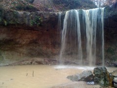
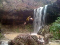
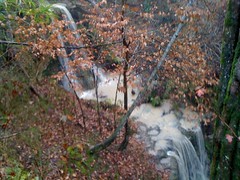
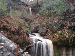
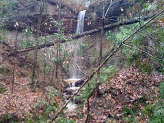
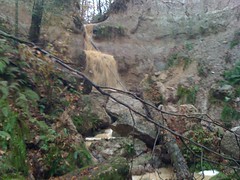
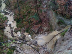
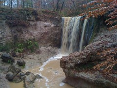
Descending FS69 was a rolling shower, or more like a firehose aimed at my face. And every other corner was a sheet of ice. Tricky, tricky, tricky. Rock Creek Lake looked awesome though. The surface was as still as a sheet of glass and the mountain behind it was icy-white.

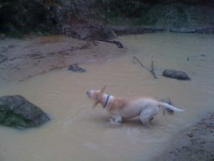
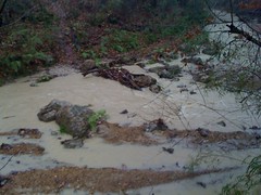
At the end of 333, some locals were git'en'er done with a pickup in an awesome mud pit. They knew what they were doing, but they almost ran over one of our bikes. In their defence, they probably couldn't exactly see it lying on the ground, coming around a corner, but it was a close call. If Matt hadn't pulled it out of the way there would have been some carnage.

I felt good, but I had a plan and it might eventually involve some suffering. I need to start losing weight for the race season and an upcoming Trans-Georgia attempt, so I'd intentionally had a light dinner last night and a light breakfast this morning, and planned on sitting right on the edge all day, keeping myself alive with Clif Blocks. If successful, I'd create a tremendous glycogen deficit, without actually bonking. I do it all the time and it seems to work, but it's easy to let it go too far, or not bring enough food and actually bonk. If you bonk, it still works, but, it's miserable.

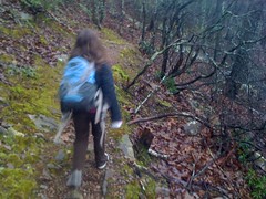
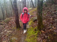
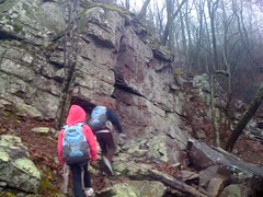
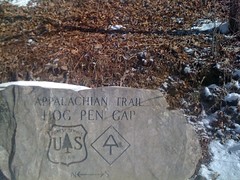
Climbing Noontootla, I still felt strong, but I needed to pee and pulled up ahead of the group for a few minutes. When I stopped though, they were right behind me. I guess they thought I was attacking and countered. Next time I should probably tell them what I'm doing :) That break and the attempt to bridge back up was all it took to push me over. Five minutes later I was out of fuel and out of blocks. I'd bonk completely in about 10 minutes, so I just kept throttling back to keep it perpetually 10 minutes away. But, every kicker required a little extra effort, and with each hill... Five minutes, three minutes, one minute. Done. And still 2 miles from the top. Those last 2 miles were just a crawl of tunnel vision and nausea. It didn't help that the ice on the road was like a slushie and every mile took a mile and a half's worth of effort.

At Winding Stair Gap, four of the lead riders didn't even stop, but the two guys I got up there with did. The guys behind us didn't know where to go, so we waited. I sat down on a stump until the funk passed. It wasn't super cold, but it was cold enough and we were all starting to get chilled. The guys behind us could be 20 minutes back, so I grabbed a bunch of deadfall and built a little fire. I'd brought some "Strike-a-fire" sticks, but they'd got a little wet and just would not strike. Fortunately one of the other guys had a lighter. Score. We were in business, but it was short lived. The rest of the guys showed up only a few minutes later. I was almost disappointed. It would have been nice to get warm.

We took off, and immediately I noticed my rear tire was soft. I juiced it. If it leaked again, I'd change it. We couldn't really let it go on Winding Stair. Slushie snow again. The rest of the ride was pretty uneventful except I had to walk the last 10 feet of the last climb from all the chain suck. Actually, it's remarkable that I managed to stave it off until then.

Me and Mark Johnson ate at Moes. We wanted to eat at Quizno's but it was gone. My face was covered in mud, but I didn't notice until I glanced in the mirror after we ate. It looked like somebody had tried to give me a spray-on-tan with a dirty airbrush nozzle.

Great ride though. Just what I needed. The group was cool and all pretty well matched too. We had to regroup a few times, but never had to wait more than a few minutes. Now if I can just get a repeat next weekend. Here's hoping.

Saturday, January 30, 2010

Keown Falls

After a driving marathon to Hilton Head and back for Isabel's gym meet yesterday, I slept way in today. We got a late start, but the girlies and I still managed to get in a little adventure.

Keown Falls.

 Keown Falls Trailhead

We'd been there before, but it was years ago, in the summer, and the falls were completely dried up. I'd vowed to return after a good rain, and today pretty well qualified.

We hustled up the trail, counter-clockwise.

 Iz on Keown Falls Trail

 Sophie on Keown Falls Trail

At the top, there are all of these gnarly rock formations. Iz said if she was Survivorman, she'd crawl up under them and sleep.

 Kids Near Rock Formations

There's also another falls. Not Keown Falls proper, but still pretty good.

 Kids at False Keown Falls

Past the first falls were even more gnarly rocks. They were all blocky and cool; kind of looked like they were made out of big legos.

Keown falls itself was impressive. Looked like we picked the right day.

 Kids at Keown Falls

There's a pretty good cave going back behind it and the kids climbed all around on the rocks back up in there.

 Kids on Rocks in Keown Falls Cave

We didn't stay long, it was about 5:15 and already starting to get dim. We did make a quick trip up to the overlook though.

 Keown Falls 2

There are a bunch of stairs leading to the overlook. Last time we were there, they were building the railing. This time, the stairs were very slippery and we were glad to have it.

 Kids on Keown Falls Stairs

Along part of the trail leading back down, it looked like there'd been a fire and they'd cut all the burned trees down, leaving a spectacular view of Furnace Valley.

 Furnace Valley

We got off the trail right at 6. I wouldn't have wanted to be out much longer than that.

We grabbed dinner at Rico's Pizza in the middle of nowhere east of Calhoun. We just happened to drive by it by accident. Good pizza. And we got some live entertainment while we were there too.

Sunday, January 24, 2010

Brawley Mountain

Man, what's with all this rain? I was rationing water last summer, now it's cats and dogs every other day.

No bike again today, just feet, on Brawley Mountain, from the west this time.

I parked at the end of FS119. Last time I was out there, I drove out to the end, but apparently they close it in the winter. I guess I'm getting used to the rain. It was really coming down, and I was soaked to the bone in 20 minutes, but I never really felt uncomfortable all day, even though the temp never got much over 40.

FS119.

 FS119

At the end, there are a couple of trails I hadn't been on. One heads up toward Garland Gap. The other is just a closed section of 119. Last time I was up on Brawley, I'd found a trail leading down Rocky Knob Ridge that bent around to the west at the top. Maybe it would come down and join up with one of these. Or maybe not. Only one way to find out.

Old 119 was clean for a while, but eventually the trees started closing in.

 Old FS119

And there were all these curled up pieces of corrugated plastic strewn along the trail. Like one every hundred yards or so. I guess somebody dumped them out there, but it's odd that they wouldn't have all been in the same place. Little mysteries.

The clean trail ended at what might have once been the clearing at the end of the road. These days it's super overgrown. The trail did continue past the northern corner of the clearing, but it was so completely overgrown with thorns that I just didn't have the will to push through it.

I needed to head sort-of west-north-west to get to Rocky Knob Ridge. Time for a little bushwhacking. The open woods turned out to be a clearer than the trail, and a lot easier going, except for being really, really steep. Before long I found a old logging road, then another, then some gnarly old bones that hadn't been picked clean yet. Nasty.

 Bones

The old roads eventually led to Rocky Knob Ridge. Lower down than I'd hoped, but at least I was on the right trail. I followed it around until it teed into the Benton MacKaye at a big, flat clearing. There were some pretty cool rock formations on the hillside to the east.

 Rocks 1

 Rocks 2

From a distance, they looked like they had little caves at the bottom, but close-up they weren't so spectacular. I could have climbed up under them, but water was clinging to the rock and pouring down into the space. Imagine how disappointing it would be to get caught in the rain and climb up under there hoping to stay dry, just to have it then concentrate the rain on you.

There was also this cool tree thing. Two trees had grown up together, a third had fallen into the crack between them, and then they kept growing around it.

 Tree in Split 1

 Tree in Split 2

If the old roadbed kept going, I couldn't figure out where. Sometimes old roads disappear in big flat clearings, just to reappear somewhere on the other side. I looked around for a while, but not too long. It was actually getting late and I wanted to get home to watch the Saints game. I ended up taking a side trail and doing some bushwhacking until I hit the Garland Gap Trail.

I still had a little time though, so I took it up to Garland Gap and back down to 119. I'd seen hoof prints on 119 when I first started out, and there more were leading up and down the trail. I'd kind of hoped to run into the guy on the horse, but no luck.

The trail was rough and super slippery. On the way down, I slid with almost every step.

 Garland Gap Trail

The hike out was uneventful. Step, step, step. I even lost track of where I was and it surprised me when I realized I was close to my truck. I really pushed the envelope driving back in the rain, but it paid off. I got home in time to watch all but a few minutes of the Saints/Vikings game. Best game ever. Now the saints are on their way to the Super Bowl for the first time in history. Go Saints!

Saturday, January 23, 2010

SAG'ging the Southern Cross

Today the girls and I manned the SAG stop for the Southern Cross, a very unconventional cyclocross race hosted by Eddie and Namrita O'Dea. Racers rode a fairly conventional cross lap around Camp Wahsega, then 54 miles of gravel roads and pavement in and around the former Blue Ridge WMA, then another quick lap around Wahsega before falling over dead.

Rather than race, me and the girls manned the SAG stop at Winding Stair Gap. It was weird walking around before the race without that pre-race focus, and later it was even weirder walking around afterward without that hypoglycemic shock. We volunteered at this race last year too, but I forget.

Sophie likes to explore her world. She wandered all around the camp, checking things out. She spent a surprisingly long time just standing there, looking at Ward Creek.

 Sophie at Ward Creek

Just before the start, we took off with Chris Hines up to Winding Stair gap. Hirsch and Colin followed us. Colin stayed, but Hirsch continued on to his station. We set up shop, got a fire going and toasted marshmallows.

 Girls Around the Fire

It wasn't super cold, but it was in the low 40's, extremely foggy and there was a steady wind from the south. Added up, if you weren't by the fire or riding hard, it was uncomfortable.

Riders started showing up well ahead of when I expected. The leader was wearing an aero time-trial helmet. Kinda weird.

After the last rider, Bruce Dickman appeared out of nowhere. He'd left from Wahsega around 8 AM, well before the other riders, not racing, just out for a ride.

 Bruce

He hung out for a while and eventually pushed on. Before long, the Chili Dawgs started showing up. Mike Palmeri of Cartecay Bikes leads a series of group rides each winter called the Chili Dawg rides. Today they were in the area and just happened to pass by.

 Chili Dawgs

Eventually riders started coming back at us from the other direction. Aero helmet guy was in first, well ahead of second. I guess he figured if he was going to wear that helmet, he'd better be able to back it up. Man he did.

Colin rolled over to Hightower to direct traffic there. A little while later I drove over and brought him a propane heater. I'm not sure how warm it kept him, but I hope it at least helped.

The rest of the riders came through. Nam came through sweeping. Hirsch came back. Etc.

Back at Wahsega, the girls and I milled around before the awards... checked out the falls...

 Iz at the Falls

All done. It's fun to race, but it's also fun to volunteer. You get a totally different perspective and it feels good to give back.

I hope I get to ride tomorrow. It's supposed to rain though, I think. That's been my luck all winter. Every day I can ride it's raining. Every day it's dry I've got something else to do. We'll see I guess.

Monday, January 18, 2010

Oak Mountain

My buddy Brooke was in Birmingham this past week for her niece's baptism. While she was in town, she invited some of us over to camp and ride at Oak Mountain. Me and Joe, another old friend of hers, were the only ones that could make it. She and Joe went riding Saturday, but since Iz had a gym meet Saturday afternoon, I couldn't make it until Saturday night.

I've run into trouble every time I camp at Oak Mountain, and this time was no different. I'd arrived too late and couldn't get in, and try as they might, Brooke and Joe couldn't convince them to let me in. We had to employ some creative measures, but an hour later I was sitting by the fire. Unfortunately, we only got to hang out for about an hour before it was time to crash out.

The next morning, Joe cooked up some eggs and biscuits. Brooke and I retrieved my truck. We hung out for a few more hours and they got on the road.

It was still raining a little, and in the 40's, but Oak Mountain is the best trail there is in bad weather. I'd brought all my UL camping gear that I plan on taking with me on my next Trans-Georgia attempt, so I spun a lap with it on. The pack was comfortable. It basically felt like a full camelback. Nice. I'd originally wanted to do 3 laps, but it was cold and wet, and I just couldn't motivate myself to keep going. I tried to spin around the new Lake Trail they're working on, which isn't finished and just ended abruptly. I followed the pin flags for a while and eventually just had to walk out. I should have just gone out for another lap, it probably would have taken the same amount of time.

I only took 2 pics all day. There's an old homestead along the bike trail.

 Oak Mountain Chimney

 Oak Mountain Spring House

All in all, it was a so/so trip. It was great to see Brooke and Joe, but we didn't get to hang out for all that long, the weather sucked and the ride was OK at best. Some days are just like that though. Better luck next time.

Sunday, January 10, 2010

Appalachian Trail

NOBODY wanted to ride with me today. Apparently, 50 miles on forest roads with temps in the teens is considered unpleasant. I really wanted to ride, but not enough to go alone. My brother wanted to do a bunch of miles on the AT to test out some new equipment. Not exactly what I was looking to do, but close enough.

We met at Atlanta Bread at 6AM. 6AM! Nothing like getting an early start. We parked at the Byron Reece Trailhead and were walking at 7:50.

 Byron Reece Trailhead

It was cold, for me at least. Low teens. 14 I think. We headed east towards Hogpen. The plan was to hike out as far as time would allow, spend about an hour eating lunch, then turn around and head back.

Immediately we could tell we were in for an interesting day. The woods were full of snow.

 John in Snowy Woods

The trail was covered with snow. Each step took two steps worth of effort.

 Untravelled Trail

Even the trees were covered with frost feathers.

 Frost Feathers

 Trees 2

There were several awesome overlooks.

 Me at Overlook 2 Again

 Overlook 2

 Overlook  2 again

 View

The descent from Green Cliff Top down to Tesnatee Gap was long and rough. We were digging postholes up to our knees, and in a few places, it was extremely slippery. The climb back up from Tesnatee wasn't any easier. Fortunately, it wasn't that long.

At Hogpen Gap, we rejoiced. As difficult as the climb up off Tesnatee was, it was nothing compared to climbing Hogpen on a road bike. The very idea of standing at Hogpen without feeling two steps from dead was elating.

At the kiosk, someone had dumped a pair of stinking, soiled pants and underwear. A little mouse was running in and out of them. NASTY.

 Hogpen Gap Marker

We pushed on past Hogpen to the foot of Strawberry Top, but it was getting close to noon and we were nearly out of time. We turned back, picked a campsite and sat down for lunch. John wanted to see if his alcohol stove would work. It was around 18 degrees at the time, I think, and it worked just fine. He ate cranberry stuffing. I ate mashed potatos. The warm food felt good, but I kept getting over-eager and burning myself. Getting up to leave, I noticed my knees were giving me a little trouble. They do it all the time. It's something I need to figure out, but since it just hurts, but doesn't affect my performance, I keep putting it off. Lame.

The walk back was a good bit more difficult than the walk out. The climb up to Green Cliff Top was long and steep. The climb up to Levelland was harder than I expected too. On the upside, I'd been contending with a frozen camelback tube all day, but the temperature finally got up right around freezing, and with the direct sunlight, I was finally able to thaw it out and drink. At Green Cliff Top, we stopped and talked to a guy for a while; the only soul we'd seen all day. As we got near Neels, we ran into others.

Most of my gear worked well. I could have even worn less. My bro's gear appeared to work pretty well too, though I think he was a little colder than I was sometimes. He's got a balaclava that I covet. Must have one. I also need to just start bringing bottles, rather than a camelback, or something. That frozen tube was the biggest problem I had all day.

Despite the difficulties, it was a great day. We never get temps or snow like that, and it made for a unique experience. I'm still savoring it. It could be a long time before we get to do anything like that again.

Saturday, January 9, 2010

Bowman's Island

Me and the girls ran around town all day today. We brought the camelbacks just in case we'd get an opportunity to do some hiking. Things took longer than we expected, but on the way home we had about an hour to kill and Bowmans Island was right there...

There was a little quadrant in the southwest that we hadn't explored yet. Last time we were out there, we saw some folks fishing on the west bank, so we figured there must be some trails over there.

Yeah, there were. Some of them were kind of hard to see with all the snow and leaves on the ground, but we made our way around. We even found our way down to the shoals, and there were a couple of guys fishing there.

 Iz at the Shoals

The trail along the river was rough and I banged my head hard on a stubby little branch after ducking under a downed tree. I think I need to wear a helmet when I walk too. My head still hurts and I've got a nice lump going.

We saw lots of animal prints in the snow. A raccoon had walked all the way down this log.

 Raccoon Prints

There was also this awesome landslide, I guess brought on by the floods a few months back.

 Landslide

I think we hit every trail out there. From the shoals, we found an old roadbed leading up to an abandoned looking house with a bunch of construction equipment in the yard, and a trail leading back to the parking lot we parked in.

There was a ton of poo out there too. It looked exactly like the llama poo I'd seen all over the Trillium Gap trail in the Smokies. There is a farm north of there, maybe they have llamas. I didn't see any tracks though. Kinda weird.

Monday, January 4, 2010

Bundick Lake

This past Friday I was in Dry Creek, Louisiana, for my sister-in-law's wedding. There was a lot of work to do, but I was able to slip out for about an hour to get a road ride in around Bundick Lake.

In Georgia, we'd call roads like this flat, but they do undulate a bit. In Louisiana, the wind and road surface are more significant than the terrain. It was definitely windy, and one of the roads was really rough.

 Hwy 1472

The lake itself is surrounded by private property, mostly tree farms, except for a couple of spots. There's public access at the north end.

 Lake Bundick 1

The road crosses over a bit of the lake as well.

 Lake Bundick 2

 Lake Bundick 3

The night before, my wife got an awesome photo of the full moon rising over the lake at the spot in the photo above. It was a blue moon, no less.

It was a pretty good ride. I'd like to have been able to see more of the lake. I suspect now that I have family there, I'll be back. Maybe next time I'll get to take a boat out and do some fishing or something.

Clark Creek

All last week the weather was good except for Wednesday. Wednesday it rained all day, pretty torrentially at times. Since nobody else wanted to do anything, I took the opportunity to run around in the woods a bit.

My father-in-law had sent me a link to a website talking about the Clark Creek Natural Area, up north of Tunica Hills right at the Louisiana/Mississippi border. The photos on the site showed a bunch of waterfalls and they all looked pretty awesome. With the rain, they should look even better.

I drove up past St. Francisville, to Pond Mississippi. I'm not sure Pond qualifies as a town. There is a pond there though, and an old store.

 Pond Store Sign

 Pond Store

I stopped at the store to get a map. There were 3 other guys there, just stopping by as well. One of them asked the lady behind the counter about the ancient cash register she was using, and she proceeded to give us a tour of the entire store and the house attached out back, including every antique item and its history. It was fascinating, at least to me. The cash register, for example was from around 1850 and still in use. There's a deteriorating flat grand piano in one of the store rooms. She's got a large collection of bottles, including one from the Bayou Sarah Candy Company, which was washed away in a flood, along with the rest of the town. If you're in those parts and you like old stuff, be sure to stop by.

I couldn't stay all day though, I had some walking to get done...

 Clark Creek Sign

I met this dog at the store too. He was really friendly and tagged along as I walked up the road. He even followed me into the bathroom.

 Dog

The trail started off as an old, roadbed.

 Clark Creek Trail

Wherever it was really steep, there were stairs.

 Clark Creek Trail Staircase

I got off of the main trail and picked up the Primitive Trail at the first creek crossing. The dog was still tagging along, and he loved the water.

 Dog in the Creek

The primitive trail was actually pretty easy to follow, and not so primitive for a while, but at the next stream crossing, I had to descend a near vertical staircase of roots to the creek, cross it and make my way down a treacherous bluff to get to the base of the waterfall there. The dog even had a hard time getting down.

 3rd WF

It was worth the effort though. The falls were spectacular.

And so it was all day. Falls, after falls, after falls.

 1st Falls on Primitive Trail 1

 1st Falls on Primitive Trail 2

 1st Falls on Primitive Trail 3

 2nd Falls on Primitive Trail

I finally got wet in this creek, up to mid-thigh.

 Rough Creek Crossing

And more falls...

 3rd Falls on Primitive Trail

 4th Falls on Primitive Trail 1

 4th Falls on Primitive Trail 2

The entire Clark Creek area is steep, deeply channeled loess bluffs. Complex topography to say the least. For the most part, the falls were bordered by cliffs and loess is unbelievably slippery. It makes Georgia clay look like sandpaper. I had to be extremely careful going off trail, and even on some of the steeper sections of trail, I had a hard time staying on my feet. The hike turned out to be way more dangerous than I'd expected and way more strenuous.

I did see some cool stuff though, in addition to the falls. These two black vultures, for example.

 Vultures

And a shelter.

 Shelter

I saw a bunch of deer too, including a pretty big buck.

Not long after passing the shelter, the dog took off. His tail had been hanging low for about a mile and I think he'd had enough.

I'd had enough too, I was soaked and freezing, but I did stop by a few more waterfalls, including this one.

 1st WF

There are apparently over 50 falls in the area, only some of which are near established trails. I think I saw 7 or 8 total. The main trail is wide, gravelled and easy and there are 3 or 4 right off of it. I'll have to bring the kids out next time I'm in town.