Saturday, July 31, 2010

Central Park and Buford Dam Park

My girls are too old not to know how to play softball, football and soccer. Well, they know how from watching TV but they don't KNOW how. Until today. This morning, me and Kathryn grabbed a bunch of used gear at Boomerang Sports. Sporting goods are perfect for recycling. Kids outgrow gear way before it's worn out.

At Central Park it was 99 degrees. We played softball for two hours before dying of heat exhaustion. Hiking and biking in 99 degree weather is easy. You're moving. Standing around, throwing a ball, not as easy. Iz took to everything naturally. Sophie, not as naturally. She's kind of a lefty, but not with everything. We may have to let her try both ways next time.

After dying of heatstroke, as mentioned earlier, we went swimming at the lake. Or more precisely, wading. We didn't actually swim much.

 Buford Dam Park Beach

Fish nibbled on us. The water was really warm. If you walked far enough out it got cool down by your feet. Next time we'll go swimming in a river.

The girls built sandcastles.

 Building Sandcastles

Kathryn supervised.

 Kathryn

Iz wasn't going for anything as pedestrian as a castle, I mean come on. She built mountains with a river flowing between them.

 Iz's Sand Mountains

Eventually some clouds rolled in, the temperature dropped and it even rained for a while. We'd had enough.

We went downtown for some dinner at Antico's Pizza. We ended up getting a 4 cheese calzone which was OK but the cheese was a little weird. I think it'll be better if I go on a weekday with less pressure to get in and out.

Sophie got tired on the way home and resorted to some extreme measures.

 Sophie Trying to Sleep

Rest and rest little girl.

Thursday, July 29, 2010

Weekly Beatdown

ORAMM beat me half to death. I've got scrapes and bruises all over. I don't think my ribs are fractured though, just bruised, and not even that badly. But I'm sore. So sore. I felt slow and fat on my commute. It was super hot. I sat in with the B group for a while. Four or five guys were riding really aggressively and wouldn't really let anyone else get up front. Fine by me. All but one of them cracked and I ended up having a pretty easy time rolling to the front on most of the tougher climbs. Apparently I can feel terrible, but still be pretty fast. I ran into this phenomenon post-TNGA too. Weird. I'd like to feel good and be fast though. That would be better. Maybe when I heal.

Monday, July 26, 2010

ORAMM

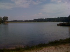
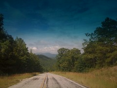
ORAMM - The Off Road Assault on Mount Mitchell - 63 miles, 11,000 feet of climbing. Or is it 15,000? Both have been claimed for the same route. My take is when you're climbing that much, it doesn't really matter. It's just climbing all day.

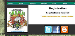
I almost didn't get to go this year. They capped registration at 400 riders and 400 riders signed up before I did. Fortunately there were drop-outs and through an unexpectedly simple and inexpensive process, I managed to get in.

Saturday morning, I got my stuff together, took Isabel to a birthday party for one of her friends, and replaced the battery in my truck. It's been hot this summer, and if there's one thing car batteries don't like, it's heat.

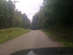
Eddie O met me at Hamilton Mill and we carpooled it up to Old Fort.

It was warm.

 103

About half way up I realized that I didn't have the AC on "max". Click. Ahhh.

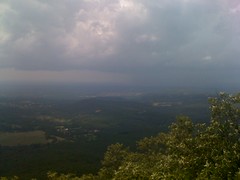
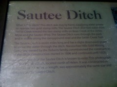
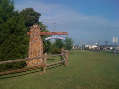
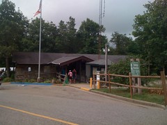
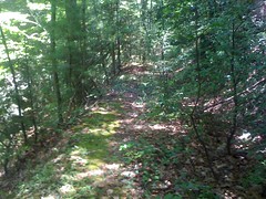
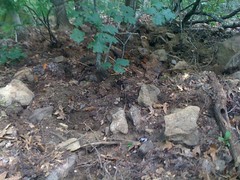
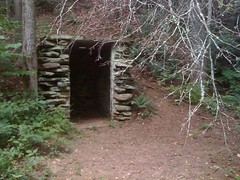
We camped at the Curtis Creek Campground...

 Tents

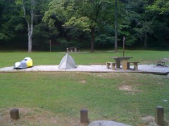
...which had apparently been a CCC camp way back.

 CCC Plaque

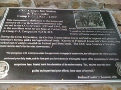
Last time I was up there I'd seen this weird little building. I guess it was a CCC shed.

 CCC Building

Dinner was pizza in Black Mountain.
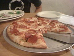
 Pizza

Good pizza.

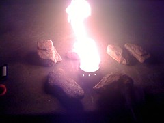
I'd forgotten my stove and cup so we rigged up an alcohol stove out of pineapple cans and fueled it with that stuff you put in your gas to get water out. Alcohol stoves are supposedly awesome because they're lightweight, easy to make and fuel is prevalent. I'm not so sure about the "fuel is prevalent" part though. It took 3 gas stations and 2 grocery stores to find fuel. Though I did realize later that at the first grocery store, instead of insisting on Heet, I could have just gotten a bottle of actual isopropyl alcohol and forgone the search. So, maybe fuel is prevalent. It was odd that I couldn't get it at 3 different gas stations though.

The stove worked well in our test.

 Stove Test

We ate a lot of pineapple. It was a little warm and the full moon was a searchlight so I didn't get a ton of sleep. But I'd slept really well on Friday night so hopefully it wouldn't matter.

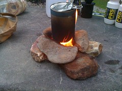
The next day, we got up and ate. Eddie made coffee. I had to pile rocks up around the stove to keep it from going out when I set the can down on it. Guess I should have poked more holes in it.

 Boiling

Camping's great and all, but it was just the means. The ends were ahead.

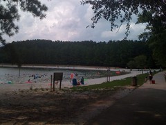
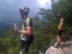
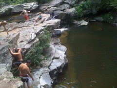
We got to the ORAMM at about 7. Eddie sprayed himself down with Axe so that the throng of chasing ladies would block his competitors.

 Eddie

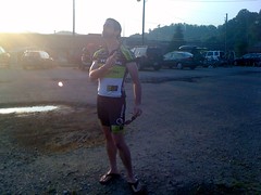
Seriously though, that's bug spray or something. Awesome photo though.

The line at the bathroom was so long I was legitimately worried about missing the start.

At the last minute I saw SGC boys Steve Julian and Josh Fix drive up. I have no idea how they managed to make it to the start on time, but apparently they did and even rolled out ahead of me.

Go!

The next 7 hours and 35 minutes would provide me with many opportunities to confront and manage Adversity. I have argued before that Adversity is a gift, and I stand by that, but seriously, it must have been Christmas.

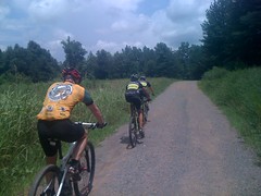
The start was lazy. I bridged and bridged and bridged until I was in the lead group, which was a group of like 100 people. I felt good on the climb up Old 70. I can usually tell there if it's going to be a bad day or not. It didn't seem like it would be. I'd kind of just gotten over a cold. That didn't seem to have any effect. Nor did the heat, nor lack of sleep. Awesome.

Kitsuma was easier than usual. An unprecedented number of riders were actually riding and cleaning the switchbacks. I popped my chain on top of Kitsuma, and got that terrible sinking feeling when I realized "that's what I forgot..." A powerlink. Mark Johnson stopped for me, thinking he might have one, but he didn't. At Yargo, I'd believed that it was the oldness of my chain tool that made it impossible for me to fix the chain without a link, but as it turns out, actually, an old chain has wallowed out plates, allowing the pin to wander around, but the plates on a new(er) chain has solid, straight holes which guide the pin properly back into place. Score.

My chain was fixed, but my front derailleur had apparently slipped. In middle-big, the chain would drag. I couldn't drop to the little ring without unclipping and pushing the chain over with my foot. In the big ring, the chain kept flopping off to the outside if it was too bumpy. Adversity. Bring it on.

I rolled past SAG 1, climbed Star Gap. Fewer people were riding those switchbacks. Steve was hanging out on top. He jumped on and rode with me for about 100 yards before giving up and walking. Somewhere in there, I passed Mark Johnson again. He was on the side of the trail, I think just getting food out or something. He said he was good though and I kept going.

The doubletrack descent off the back of Star Gap was ludicrous. Loosest gravel ever. I really struggled to hold a lines. ORAMM is funny. You have to run fairly high tire pressure to keep from flatting on the hundred million roots and rocks, but that high pressure does you no favors on the gravel or on the hundred million steep, technical climbs. "Choose the form of your Destructor!" In each right hand turn, I'd start hard left, sweep through the apex and end up hard left again. I'd done this for the entire descent, not considering that somebody would try to pass me on the inside, which somebody did. All I could do was stay left and hope the gravel would hold, which it didn't. The crash hurt, really bad, but it didn't knock much energy out of me. I jumped up and was back on the wheel of the guy that passed me in 20 seconds. My right knee and left forearm were bleeding like they were connected directly to my heart, but I could see that it was stopping. My left hand was torn up, but not bleeding. My right ribs really hurt. My right shoulder had popped out and back in. No problem, I've ridden through much worse.

At SAG 2 I refueled and replaced a bottle I'd lost in the crash. Curtis Creek was not an easy climb, but I had it. It was long and steep, but not murderous. I was on top of nutrition and hydration, I wasn't bleeding any more, I actually felt good, and I passed people all the way up, including several riders who'd cracked and headed back down.

The next long climb I felt even better on. Middle ring spinning all the way back to the parkway.

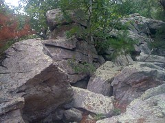
No cramps hiking up to Heartbreak Ridge. I did end up tipping over and falling off the side of the mountain in a goofy, rooty, off camber section with a tree leaning out into the trail. It looked like I wasn't the only one though.

I used to descend like mad, but three different riders passed me on that descent. I think mainly, the issue is my rear brake, which vibrates and groans horribly. There's no feather in that brake. It's either off or on hard. I can make it grab even harder, but I can't control it precisely. We'll see. I managed to down almost two bottles while descending. It was getting hot.

Coming around one switchback, I got clotheslined by a vine, covered in thorns. It shredded my left arm and my face. I even got a thorn stuck inside my mouth. If you've ever been scratched by thorns, you know how those cuts bleed. It was horrific. I was disappointed later with how minor the scratches on my face were compared to how much they bled. If it's going to bleed that much, it should look awesome later too.

At SAG 5 the guy asked "Are you still having fun?" At first I said no, but then changed it to "It comes and goes." I still felt good, but the hand-slamming downhill wasn't much fun. Another guy dumped ice cold water down my back. I realize most people like that when it's hot, but I can't stand it. I'd rather be hot. Speaking of hot...

The climb up Mill Creek Road was hot. 6 miles. Lots of sunshine. On that climb, I'm usually just surviving. My knees and back usually hurt. This time, I'd done enough pre-ride stretching, and used enough different climbing techniques all day to conserve my back. I spun up that climb too.

Kitsuma was another story. I walked three of the switchbacks, one of the little kickers and one of the long kickers. It was now almost unbearably hot. On the long kicker, I was exposed to the sun and about 20 yards from the top I realized that if didn't get going again and get that breeze to cool me down, I was going to pass out. Tunnel vision... Ringing in my ears... No good. I made it though.

On the way back into town, I caught up with a guy that got past me earlier. We worked together all the way back. At first, we kind of half-heartedly tried to crack each other but it wasn't going to happen. Turned out we were in different classes anyway.

Done. 7:35. Is that good? You tell me. It's 30 minutes faster than last year, which was 30 minutes faster than the year before, but lots of people ride it much faster than that, including Eddie who did it in like 6 hours or something.

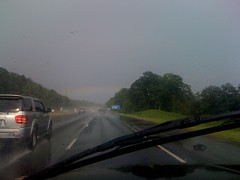
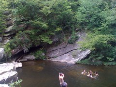
I cooled off in the little creek that runs by the start/finish area, grabbed a coke and we bailed out just before a massive storm hit. I hung out with Josh Fix a bit right after I came in, and I wanted to hang out with Steve for a while, but we really needed to get on the road and I didn't know how far back he was. Sorry bro. Next time.

We ate at the Outback in Hendersonville. Their AC went out and our waiter said she hoped we didn't mind if it got a little warm. Eddie laughed. "You have no idea what we just did today."

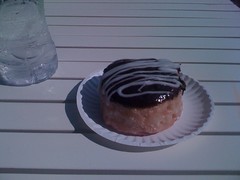
I ate again at Parma near the Mall of Georgia. I've taken two photos of the mac and cheese there already, so refer to them. It's really good.

Back home, I showered and scrubbed my wounds but there's still dirt in some of them. Hope that works out.

The carnage:

 Hand

 Ribs

 Knee

 Thigh

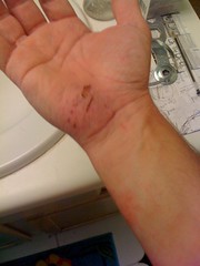
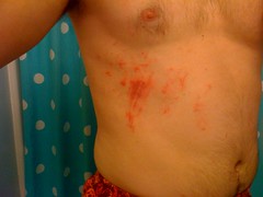
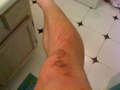
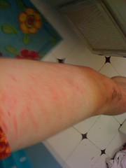
Man, it looks so much worse in real life. I'm looking at my hand right now and it looks so much worse than the pic. Maybe I can get Kathryn to photoshop them into looking really bad.

My goal for ORAMM was to "ride it without suffering." In retrospect, I'm not sure that's actually possible. But, I did manage to ride it without bonking, cramping, suffering through back and knee pain and without going insane, all of which I've dealt with before at ORAMM. I guess I accomplished my goal, maybe?

Goals aside, I had the opportunity to manage a great deal of Adversity: chains, derailleurs, crashing, thorny clotheslines and heat. A day like that is always good.

I think I'm going to skip ORAMM next year. Maybe do the PMBAR or something else. While I was ORAMM'ing some guys down in Florida rode their new TransFloridA route. THAT would be awesome. Maybe I can do that next year.

Wednesday, July 21, 2010

Weekly Beatdown

I'd be winning, if it weren't for all this losing I keep doing.

Who wants to lead the roll-out? Apparently that's a trick question. Nobody. Nobody wants to lead the roll-out. Yeah, put me up front and nobody wants to follow my wheel either. "Slow down some more, we're still dropping back."

Apparently we're rolling straight through town now too. Good idea. Wish I'd known though before I created another car full of anti-cyclists by being the only jackass blocking traffic in the left lane. In a group full of center-line crossers, as out of my way as I go to be courteous, somehow, today, I'm that guy. Nice.

And I've got a cold. And I just committed to ORAMM today, before I realized I've got a cold. Can't wait to see how that turns out.

What else? Oh yeah, guys I've been riding with for 5 years act like I haven't been riding with them for 5 years. Yeah man, I know what you're up to, but I am coming over. Feel free to do the same. All you'll get from me is "hold up, I'm on your left." In lower case.

Got in a good 3 man break. Then a 4th man caught us and busted it up.

Near the end, I got dropped and bridged back 5 times at least.

Riding through the parking lot, an elderly gentleman drove directly from an aisle of parking spaces, out across the lane I was in, into a bank parking lot. It took a hard turn to avoid getting hit. If there'd been another rider behind me or beside me, I'd have been hit. The guy clearly had no idea he did anything wrong either, judging by the look he gave me. I hope he realized what he did later.

So today I sucked. The ride sucked. The heat sucked. Everything sucked. Mostly I sucked.

I wrecked the one potential upside too. A truant Michele Z was present today, finally able to getting back on the bike. Would have been cool to hang out and chat, Reality was even serving us food. But it would be 30 minutes before the festivities began and I was feeling too hungry for that. I killed myself to get home, only to find my family had already eaten, which they always do on Wednesday, and which I should have remembered.

Fail.

Sunday, July 18, 2010

Pine Log WMA

Travis and I were thinking about exploring up at Frady Branch today, but all the rain we've had has washed out several bridges in the area, and the entire trail system was closed. Strike that.

He suggested Pine Log. Neither of us had ridden there, but Ed and Nam have. We had a plan. I love it when a good plan comes together.

On the way in, I got stuck behind some turkey traffic.

 Turkey Traffic

I've heard that Pine Log is confusing. I've heard that you can ride around up there all day and miss all the fun stuff. There was none of that today.

 Paceline

We rode a great loop. Mellow climbing on forest roads, turned double and singletrack. Steep singletrack, up and down. "Shallow Tibbs." Rocky ridgeline trails. Everything.

Cool rock formations...

 Rocks Near the Overlook

Spectacular views...

 View West from Overlook

Good friends...

 Ed and Travis at the Overlook

On the way out, the sky really unloaded on us, but it was refreshing... "Sweet, summer rain. Like God's own mercy." No mud either. Fun, actually. I hope my bearings are as happy tomorrow as I was today.

Pine Log is an oddity, at least for North Georgia. A WMA, but not on National Forest land. It's private land leased to the DNR, I think by a tree farm for a furniture company or something. I ride all over the National Forest and I'm really used to the roads and trails there, but this one has a totally different feel. For example, the road we climbed in on became brushy, became doubletrack, became singletrack, became nothing but exposed rock, but since it's closed to vehicles almost all the time, there were no humps or ditches, and it gets enough traffic to stay clear. On the other hand, every creek crossing was paved, all the way up. Just different.

No IMBA trails up there either. Some important trails at lower elevations meander up ridges through stands of young pine. If nobody rode them for year, you'd never find them again. On top, it's almost like old growth forest; lots of space between the trees and very little underbrush. With all that space, where it's rocky, it's hard to find the trail. A few of the trials could deteriorate quickly if they got too much traffic. Others are so rocky, it would take a LOT of traffic to affect them very much. I imagine, at least for now, the trails are sort-of self-regulating. They are extremely challenging, both physically and navigationally, while the roads are long and seem pretty interesting. Perhaps most traffic sticks to the roads. I wonder though. I'll have to come back again next year and see.

After the ride, I went for a swim in Stamp Creek; the very definition of refreshing. Heading home, I drove through storm after storm after storm. Between them it looked like it hadn't rained there all day.

For our efforts, we were rewarded with this rainbow.

 Rainbow

Another great day. How'd I get two in a row?

Saturday, July 17, 2010

Smith Creek Trail

The weather forecast called for rain today. Sort of. 50/50 chance. Everybody I knew was getting a quick ride in. I was hoping to get in a long day, but I really didn't want to ride in the rain, so the girls and I went up to Helen to hike Smith Creek Trail.

 Smith Creek Trailhead

I called up Clark, but he was busy all day. Just me and the girls.

At the trailhead there was this sign, talking about the Sautee Ditch.

 Sautee Ditch

Apparently way back, they'd created a canal, collecting up Smith Creek's feeder streams and sending them down to a mill of some kind, somehow involved in gold mining. The ditch is still there, for the most part. Some of the streams have eaten through it, but many of the dry prongs still end at the ditch. The trail leaves the lot, parallels the ditch, enters it, follows it for a while, then diverges, paralleling the ditch again before finally ascending the south side of Hickory Nut Ridge along an un-named creek, parallel to the Hickory Nut Trail.

 Girls on Bridge

For a while, the trail followed an old roadbed, diverging briefly into singletrack to bypass old fords.

 Smith Creek Trail

I didn't see a ton of odd foliage or strange terrain, but it was extremely ferny at a surprisingly low altitude.

 Ferns

Moments after snapping that pic, we watched a young black bear climb down a tree and straight up an incredibly steep hill. He kept an eye on us over his shoulder as he climbed. It was the first black bear the girls had never seen in the wild and they were awestruck. I had as much fun watching their faces as watching the bear.

The trail eventually became pure singletrack and wound around, up, and over Hickory Nut Ridge. Now and again there were rocks to scramble over.

 Girls on Rocks

And then it rained. The girls generally hate getting caught in the rain, but today we brought dry clothes to change into, talked about how we would almost certainly get caught in the rain before even leaving the house, and perhaps most importantly, all wore hats. I didn't hear a word of negativity. To my amazement, they actually had fun walking in the rain.

 Rain

About 20 minutes later the rain quit and we got caught and passed by a family who'd been parking their car when we left. It looked like a dad and his three daughters. His two older girls looked to be about the same ages as mine and his younger daughter was about 4 years old. They were trucking. I was impressed.

The Smith Creek Trail ends at Anna Ruby Falls.

 Girls at Anna Ruby Falls

Iz declared that the falls on the left was Anna Falls and the falls on the right was Ruby Falls.

Everybody there was wearing a poncho. Most were smoking. It seemed way out of place to see folks smoking, way up in the woods, but really, there's a parking lot less than half a mile downstream. Fat lot of good it did us though, we were parked 5 miles away.

Back on the trail. It had taken us right at 2 and a half hours so far, including a short stop about halfway in. We tried to pick it up a bit on the way back, but all three of us were struggling. We stopped at the halfway point again, pounded Clif Blocks and potato chips and 3 minutes later, everything was all right. Our legs were back, and it helped that it was all downhill from there too.

Salamander!

 Salamander

It was uneventful after that. 5:20 for the round trip. Good job girls. Good job.

I was really impressed with them today. They moved with a purpose. They talked and joked and laughed. They helped each other out. They shared. Zero negativity.

We topped it off with dinner at the Troll Tavern. I kind of wanted to go somewhere else, but the girls both wanted to go there, and honestly, they earned it.

Wednesday, July 14, 2010

Weekly Beatdown

The guy ahead of me made a career out of his trip to the bathroom and I missed the B group roll out. My bridge attempt was hopeless. Darn traffic lights. "Cat up Dave." Yeah, yeah. At the top of Sawnee I waited and jumped in with the A group, which was riding aggressively, but not faster than I could hang on to. Maybe it would turn out to be a good day.

Crash!

Not me, but a rider up the road. The A group was flying through a disorganized bunch of C group riders and one of the C riders went down. It was mean. Busted ribs, a lot of bruises, even more abrasions, and a deep puncture wound to his right shoulder. I took some First Aid courses way back and I was doing my thing, but it turned out we had an actual ER doctor in our group too. Score. I've been in too many of these bad-injury/first-responder situations. I don't even get jumpy any more. That's too many. I was joking with Todd that somehow my presence must be causing them. Typhoid Dave.

There are few sounds that make me feel as confident in humanity as those that precede the arrival of emergency medical services. Sirens, chopper blades, a fire engine's horn, the idling engine of a helicopter, hustling footsteps... "We're here to help you, all of us, whatever you need, whatever it takes." It's like that. I hope I never get jaded to it.

After all that, I was not especially motivated to ride. I led the remaining C group. We probably rode like 8 miles, but it was good. The best time I've ever had riding 8 miles at 10 miles an hour.

Nooooooooooooo!

 oramm-full

Damn my procrastination.

Monday, July 12, 2010

Bonita Lakes

The thermostat at the Days Inn in Merdian has a very different idea of 70 degrees than I do. I set the knob at what I figured would be about 74, based on where it said it should be set for 70, but I woke up sweating every 20 minutes and drank 4 glasses of water before finally setting it colder at about 4AM. Not the best sleep ever, but hey, what are you gonna do?

I finally got up around 7:30, hit the continental breakfast, and my wife called at 7:45 saying that they were leaving Baton Rouge. I had 4 hours to ride. Should be plenty of time.

 Bonita Lakes

The last time I was at Bonita Lakes was in 1999. Back then, the trail started at the dam between the North Lake...

 North Lake

...and the South Lake.

 South Lake from the North

Today there is pavement leading across the dam and a very nice-looking trailhead, complete with a map.

 Bike Trailhead

I strained to remember whether there was pavement across the dam ten years ago or not. It seemed like there wasn't, but the more I thought about it, I couldn't really be sure. Funny how you forget things. I did remember that there were random trails going everywhere, me and Kirk got lost all day and probably rode the same loops 50 times.

Today it was a little better. But only a little. With my GPS, I was able to decipher the maze, but I could never ride for very long before coming to another 5-way intersection. The trails themselves were pretty nice. Mostly flowing sidehill, with just enough chunky fall-liners to keep it interesting. The tread was pine-needly, packed sand and crumbly rock. Reminded me of Big Creek in the ATL.

 Singletrack

If I'd known a route through it, it would have been really fun. I remembered this overlook from '99. They were still building the mall back then.

 Mall

After thoroughly exploring the first little section of singletrack, I took the "improved trail" around the park.

 Improved Trail

Ten years ago it was a rutted out fire road. The signs along the trail show it to be a hiking trail, but the map says it's open to bikes as well, and there are several bike trails you can't get to without riding it. I even passed a park ranger in his truck, heading the other way. He just waved. I guess it's open to bikes.

The improved trail was scenic, running along, or crossing the South Lake at several points.

 South Lake from the Middle

After a big loop around the park, I explored more singletrack. The trails further into the park were less of a maze and more fun to ride. I ended up using all my time, but I have a feeling that I only rode about half of the trails out there.

It was hot too, or at least it felt really hot. I drank all I could, but it still wasn't enough. After meeting my family at the Cracker Barrell, I chugged 2 mugs of lemonade and gave myself some world class heartburn.

I end up in Meridian about twice a year, retrieving my family, so I imagine I'll have plenty more opportunities to learn the trails. Maybe next time I can spend some time just riding them.

Saturday, July 10, 2010

Cheaha and Chinnabee

My family's been in Baton Rouge since our vacation last week. This weekend Kathryn's folks are driving her and the kids to Meridian, and I'm going to pick them up there. Usually I just drive over Sunday morning, pick them up and drive back, but this weekend, I had a better idea.

There are several trails between Atlanta and Meridian. I would drive over Saturday, ride some of them and camp in Meridian. I can't lose with that plan, right? Why did I never think of it before?

My brother lives along the route, so he joined me. We rode Cheaha.

 Cheaha

That's Mt. Cheaha way in the back of that photo. The last time I rode Cheaha, I DNF'ed a SERC race there. I got the holeshot and flatted about 2 minutes into it. It was the first and only time that I chose not to bring a spare tube and CO2 to save weight. The only other time I rode there was in like 2002 or maybe before that even.

The trailhead is lavish as trailheads go, featuring not only bathrooms and a kiosk, but an entire country store.

 Cheaha Country Store

I vaguely remembered the trail being really rocky and steep. Yes, it was still rocky and still steep. My brother was on a singlespeed. "I'll just throw an 18 on, that should be OK for Cheaha." Climbing Deer Run, I was struggling with the rocks, trying to keep up the pace and stay out of the gran-gran, and he was behind me, standing up, crushing that 18. I think he walked maybe 50 feet of the climb. Hard.

A guy and his girlfriend were out there too. They didn't look super-extra fit and they'd just climbed that Deer Run climb. He asked us for the quickest route out and they rolled back to the parking lot, cutting the ride short before his girlfriend transferrence'd her suffering onto him. A wise choice.

The first lap was just brutal. Bouncy, chunky climbing and tooth-rattling descents. John said that his experience out there was that the first lap always sucks, the second is easier and he's never motivated to do a third. As he predicted, the second lap, for some reason felt just like any other trail. Easy climbing, it was still rocky, but somehow it wasn't a problem. Sea legs, I guess.

We explored all over on the second lap. I tried to ride up Relentless, which is an old road, turned meandering erosion channel. I got stalled out like 4 times. The last time I rode it I didn't even have a granny gear on my bike at all. I can't imagine how I did that.

There was also this crazy rock thing. Kind of a cave. It looked like big slabs balanced like Stonehenge or something. And there was a glass-clear pool of water at the base. Neat.

 Cave and Pool

I think I did some damage on the TNGA that will take a while to heal. My left hand has some kind of perma-bruise going and my left calf has a knot in it that won't go away and it's making my foot flex more than I want during my pedal stroke. Neither seem to hinder my riding but both are annoying. Bruises and knots aside though, I had a good time. It wasn't "woohoo!" fun, but more like "man, check out what we just rode" fun.

If you go to Cheaha, don't go looking for flow. No IMBA trails up there. I think you'd just break a Dingo if you tried to make one. There is some pretty bad erosion, but just in a couple of places, and nowhere near any creeks that I could see, so I'm not thinking there will be any flow-inducing re-routes any time soon. Even the un-eroded trails are super chunky, because of all the rock. It's just that kind of trail. Embrace the chunk.

Neither of us were motivated to ride more. But we were both heavily motivated to go jump in a river.

Up the road a ways, we walked out on the Chinnabee Silent Trail to a waterfall on Cheaha Creek...

 Falls on Cheaha Creek

...where it is difficult to get a photo of the actual falls. We jumped off this ledge into the pool, over and over and over. The water was exactly the right temperature.

 John Jumping into Cheaha Creek

I tried to get a photo of the frere, but it didn't work out very well. That's him at the bottom, just as he entered the water, which is also out of frame.

On the way back I realized I'd left my Dr. Pepper and had to run back to get it, though judging by the amount of garbage along the trail, I don't know that anyone would have thought twice if I'd left it.

Speaking of Dr. Pepper, I grabbed another one at the store on the way out...

 Alabama Dr Pepper

... and took a bad picture of that too. Man.

There is nothing like an Alabama Dr. Pepper. Far smoother than a Georgia Dr. Pepper. Seriously. Have one, you'll see what I mean.

The frere rolled back home. I proceeded to Meridian. We got lucky with the weather. There was a 50/50 chance but it stayed dry while we were out having fun. I must have driven through ten different storms on the road though.

In Meridian, I'd hoped to camp at Bonita Lakes park, but it turns out there's no camping there. There are plenty of trails though. I hope to hit them tomorrow morning while my family's driving in. The weather is supposed to be good. I got a room at the Days Inn, but next time I'm staying at the Astro Inn. $24.99, and from the outside at least, it looks a lot nicer than the Summerville Motel we stayed in during the TNGA, which was well within my standards.

Amazingly the Days Inn has both Wi-Fi and Vs. I just watched a stage of the Tour de France.

Time to get some sleep. Maybe one more Alabama Dr. Pepper first.

Thursday, July 8, 2010

Commute

Today's commute was slightly interesting. I skipped the beatdown yesterday and took a nap instead. A nap is the diametric opposite of riding. Ahhh. Today I jumped out on the road only to realize that I'd left my water bottle on the counter at home. I was relegated to the Racetrack dork bottle.

 Dork Bottle

Now I look ridiculous to both non-cyclists AND cyclists. Well, if I had to stop for the dork bottle, then I figured I HAD to stop for a doughnut, just to even things out.

 Boston Creme

Yum.

The dork bottle had a loose fit and rattled around all the way in. I'm going to have to wrap something around it for the ride home, which will be even dorkier. I think, also I need to get my front wheel either tightened up, or maybe even relaced. That freakin' think is creaking me to death. I fear my road bike is finally going the way of my mountain bike - rolling junk show.

Tuesday, July 6, 2010

Cold Mountain

I planned on riding my mountain bike today. I haven't been on it since Conyers and my back wheel is out of the shop. But I drove in from Florida yesterday, slept late, failed to coordinate with anybody and just didn't have the motivation to put my cassette, rotor and tire on. Lame. And man, I've had enough of the road to last all year, though I know I'll be back out on it later this week. I almost just stayed home, but eventually I remembered that there's this trail on the map that goes up over Tickanetley Bald and I've been wanting to check it out for a while. Yeah, I'll do that.

There's some weirdness on the map at the east end of the trail. I wasn't sure what I'd see when I got there. Turns out there's a private drive there. Actually, it looks like there's almost no easy way to enter that particular wilderness area unless you own property backing up to it. To get to that particular trail, it looks like I'll have to wait until they open up Rich Mountain Road for the season, walk for like 5 miles or bushwhack for farther than that. Not today.

I'd also been wanting to check out Cold Mountain. It used to be an 4WD playground, but the forest service shut all that down a few years back. What would it be like now?

I parked at the end of FS338 (Rich Mountain Road) up by Stanley Gap and jogged over to Brownlow. The last time I was there, it looked like there was a trail leading up the knob to the right, and the low-res topo maps show a trail leading from there up over Cold Mountain. There was a trail, for about 20 feet, then nothing.

I whacked and nav'ed until I ran into an old trail that led down to Brownlow Gap Road. I'd been wondering about that trail. Cross that one off the list. More whack, more nav. Found another trail I'd also been wondering about. More whack, more nav, and finally, I found the trail I'd been looking for.

It was a tough climb, but not too tough. Kind of overgrown, but not too bad. There was a lot of brush on the roadbed, but you didn't have to push through it except every now and then.

 Old North Cold Mountain Road

I took one wrong turn and was reminded that I wasn't the only one in the woods. Bear sign...

 Bear Turd

There were large scars on the hill where it climbed up off of the road, but I couldn't get a good picture of them. Gnarly.

It was more difficult than I thought it would be to keep track of where I was. The trail was really twisty; back and forth across the ridge and a couple of switchbacks. I could kind of match it up to the terrain, but really there were always a couple of different places I could be. Nothing visible to sight on. Finally I got to a rock that at one time must have been a sweet overlook, and I could see a peak. I thought it was Big Bald, but it was actually Horsepen. That really threw me off.

Cold Mountain has two peaks. When I got near the top of the northern peak I finally got straight on my location. The trail didn't go over the top, so I made a quick side trip.

Looks like a popular place...

 Cold Mountain Campsite

The fire looked like it might have been burning the night before.

There was also this ancient flashlight. Garbage or artifact?

 Ancient Flashlight

The trail kept going toward the southern peak, but apparently that's a less popular attraction. I kept debating with myself whether to mark it "overgrown" in my GPS. And then it just ended.

There were vague trailish things leading on. Game trails I think. I saw deer tracks on them. I followed those around to the ridge on the south side of the southern peak. The peak was covered in thorns, poison oak and ivy and other crap I didn't feel like pushing through. Screw the southern peak. The ridge south was easy to follow and before long I was kind of on a trail. It was clear that people went that way at least and the trail got more well defined as I went.

And then I saw this...

 Deep Rooting 1

That's a hole, about 5 feet in diameter and about a foot deep. It looked like what you see when a tree falls over and the roots tear the ground up, but there was no tree. Just the hole. I guess this is pig rooting, but those rocks are like 20 to 30 pounds each. I imagined the pig that could just casually nose those around. One of those 600 pound Pig Bomb pigs. Not something I want to run into. As I walked on, I found myself keeping track of which trees I could climb.

The trail teed into an old road, which led to Rich Mountain Road and a bouquet of flowers.

 Flowers

I was close to that Tickanetley Bald trail, but I really didn't feel like it. I guess it should have occurred to me that I'd be tired of walking after all that theme park action last week. Why didn't I think of that this morning?

The old road looked like it might lead down along upper Stanley Creek. That would be way better than walking back on Rich Mountain Road. I gave it a shot.

Yay, more craters...

All available sizes | Deep Rooting 2 | Flickr - Photo Sharing!

and even more!

 Deep Rooting 3

Pig Bomb.

Maybe something else digs those. If anybody knows for sure, let me know. I kept imagining killer monster pigs.

The old road was a reasonably clean trail. I'd say about like the Hickory Nut the last time I was up there. I'd bet that before this past Spring's storms, it would have even been really nice.

Apparently it was rideable in the past, by folks who can't hop logs even.

 Chainring Scars

And before that you could drive on it I guess...

 Stove

There was this weird hole too. It looked like the den of some animal.

 Den

The hole was about a foot deep with a small cave at the bottom, clearly excavated by a small mammal, per the claw marks. It looked like there were bees inside the little cave. I tapped at it with a long stick, hoping whatever was in there would pop it's head out, but all I managed to do was make the bees fly out.

Then I realized it could be a skunk's den and got right out of there.

Down near the creek, I found this 100 gallon barrel, another 55 gallon drum and some scraps of metal.

 Barrels

An old still? I keep wanting to find the definitive ruins of an old moonshine still.

The trail came out on Rich Mountain Road where I expected it to. There were a couple of trails and campsites down near the road too. Next time maybe.

I jogged back to Brownlow Gap and walked out from there. This single semi-ripe blackberry was the only wild edible I saw all day.

 Blackberry

I guess technically I could have made gumbo file or sassafrass tea. I'm not talking about that. Basically fruit. That's the only fruit I saw. It tasted OK.

Ehh, that's how the whole day was. OK. On paper it was great, but really, I'm burned out on walking and riding, even fishing. I need a few nights of good sleep.