Sunday, Sunday, Sunday...
Saturday night I could not sleep in our bedroom without breaking into a coughing fit every 5 minutes. Kathryn's been gone for a week, and now that she's back she's sleeping with the fan on, and I guess the dust is too much for my lungs these days. I ended up on the couch, on my back, slept really bad, and went back to be upstairs, with the fan off, as soon as Kathryn was up.
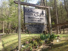
Unfortunately I didn't get up from that until about 2PM. But, hey, it's spring, it gets dark pretty late, and I like riding in the dark anyway, so that didn't stop me from having lunch with the family before heading up to Mulberry Gap for the first reasonably serious ride since that horrible flu a month ago.
I'm still not well. I think I might be trying to get bronchitis, but I've been trying to knock that back with Tussin-DM. Which, itself, knocks me back. Is that stuff supposed to make you sleepy? It sure seems to.
At any rate, I arrived at MGap around 4 and parked in the day-use lot. Andrew was on a riding mower, buzzing all about the property. It appeared to struggle a bit with the grade, but still, he managed to beat me up the hill to the house/store. I had to go to the store because I'd left my house with 2 flat tires. I'd topped them both off, figuring, hey, I must have a slow leak, but no, they were dead flat when I got there.
Fortunately, the recently-expanded store had just what I needed, and I didn't have to spend 20 minutes looking for leaks and patching them in the parking lot.
Andrew had work to do, but I saw Kate and Ginni, and spent some time talking with them. Diane's been in Florida a lot, so I didn't get to see her, which is kind of a drag, because I've missed her every time she's been up here, probably for the last 4 years. I've talked to her on the phone, and via email, but not in person. It actually made me a little sad thinking about it.
Post-greetings, I headed back to the car, and spent 20 minutes swapping tubes. A few years back, I got Glen to replace my aging rear 317 with a 717, and damned if the 717 isn't just slightly larger diameter. Just enough to make it nearly impossible to get the tire off of the rim without a tool. I swear I've done it before, but I could not get it that day. Fortunately some folks who appeared to be associated with Blue Ridge Outdoors magazine had just ridden up behind me and they loaned me a tire tool. Thanks guys! I owe you.
Oh, yeah, also, when checking my tires for thorns, I pulled one out that was at least 3/4ths of an inch long. I must have picked that up at Pine Log, but it seems like I'd have remembered something with thorns that long.
Ok, finally!
On the bike!
I had a semi ambitious plan: P3 -> P4 -> Tatum Lead -> P5 -> FS3A -> P6 (I guess? P-Dennis-Mill.) -> Dennis Mill Road -> Old Federal Road -> Cool Springs Road -> CCC Camp Road -> Done!
Kate said that's like 35 miles and 5000 feet of climbing.
Excellent!
I'd never actually ridden the Dennis Mill section before, but I'd heard that it's fun, and I wasn't going to miss out on it an longer.
On the first little kick up to Mulberry Gap Proper, I could tell that it was going to be a long day, so I settled in and didn't push too hard. I felt like I needed to ease back into it.
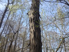
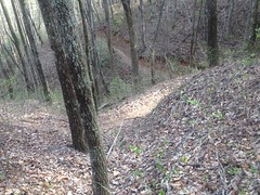
I had a good time on P3. It's work, but I had it. I did dab once though. On the initial climb up Turkey Mountain, I could see the cliffs really well. They're hard to see in the summer, and I hadn't been there all winter, but I could see them really well, and I was preoccupied trying to find a good place to get a photo, when I just rode off of the trail. Ha! Pay attention Dave! Unfortunately, there was a big dead tree in the way. I wasn't going to get a shot without going back downhill, and there was just no way I was doing that.
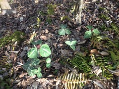
There were trilliums everywhere though.
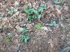
I figured, while I was stopped, I'd get a photo of those.
Yeah! P3!
With its stacked switchbacks.
And its dead tree arch.
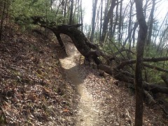
Not to brag, but I cleaned every switchback.
Ok, maybe I am bragging.
I didn't realize that I had though, until I saw Hwy 52 ahead of me, and I was like: "Oh, no more switchbacks." I usually dab on at least one.
On the short little jog up 52 between P3 and P4, I heard a vehicle approaching from behind, and it sounded like it was tearing itself apart. I'd already crossed the road to pull onto P4, and I was glad I did, because from the other side, I wouldn't have been able to see what was going on. The car was an old Ford Explorer (I think), and the crazy noise was coming from the drivers-side, rear wheel. The tire had come completely off, and the guy was just grinding the rim on the road. He didn't appear to be running from the cops, or anything, it seemed like maybe it had just happened, and he couldn't find anywhere to pull over, so he just kept going. I'm not sure he could have been in a worse spot, either. He was near the top of Fort Mountain and it's a long, steep, twisty descent, in either direction.
A guy on a motorcycle was following him. I made a bit of a "Yikes" face to him, and he shrugged his shoulders and shook his head.
I really wondered later, how it played out. I hope he was able to find somewhere to park and change the tire.
P4 was in better shape than I remember it generally being. I guess it gets a bit more traffic these days.
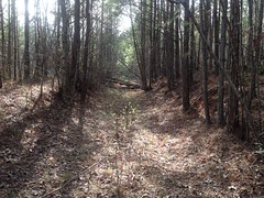
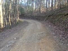
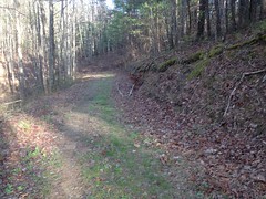
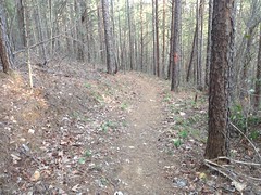
As soon as I turned off of P4, I began to dread The Wall on Tatum Lead.
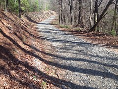
(which doesn't look like much in the photo, but dangit, it is)
It's steep, and gravelly, and it keeps bending around to the left, and it looks like you're done, but you're not done. You're never done. I've had multiple people, independently finish the TNGA and tell me: "there's this one hill, on some gravel road..." and I know immediately which hill they mean. It's that one.
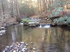
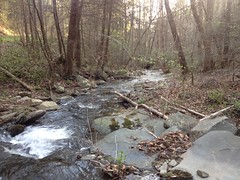
But, once you're done with it, there's a long, luxurious descent along the Tatum Lead, and then down P5. Actually, I shouldn't describe the P5 descent as luxurious. It's very technical, and there were 6 or 7 trees down that I didn't dare trying to hop. Not because they were too high, but just because the descent was so steep. I worried I'd be in the air for a while, picking up speed... Better to step over them.
Lower down, it's a lot flatter, and I was having actual fun with the deadfall. Speed-hops and nose bumps for days. Woohoo!
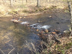
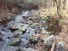
With all of the recent rain, Baker Branch was high, and the various creek crossings were tough to keep my feet out of.
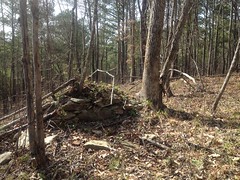
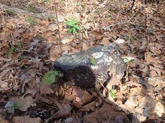
Down where it flattens out, it sure looks like it would have been a good place for a community. I imagine that whole valley must have been populated at one time, kind of like the Dick's Creek area, below Blood Mountain. I looked and looked though, and I only saw one little rock pile, that might have once been a chimney, but there's no telling.
I did see 3 turkeys though. One was up in a tree and flew away as I approached. The other two were crossing the field where you cross Baker Branch proper. I tried to get a photo of them, but they were too quick and too far away.
The turkeys are significant for 2 reasons. First, it's turkey season, and whatever season it is, I rarely see that animal. It's like they know. And, second, I was riding the Pinhoti trail, and Pinhoti means Turkey in Cherokee.
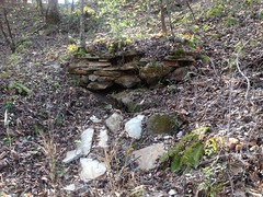
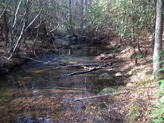
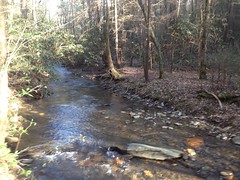
At FS3A, I hung a left, dove down to Rock Creek proper, and climbed up to the Rock Creek Trail Lot.
To my left, I spotted an old chimney, just uphill from the creek.
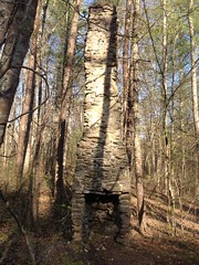
It seemed familiar. I think my Dad may have noticed it, and pointed it out, the one time he and Billy and I rode Rock Creek. Man, that was a hell of a day. We did P3 -> P4 -> Tatum Lead -> P5 -> FS3A -> Rock Creek -> Tatum Lead -> P4 -> P3. Might be the most climbing my Dad had ever done in one ride. My ride would be longer, but I'm not sure it would even have as much climbing as that day had.
At the Rock Creek trailhead, there were mixed messages.
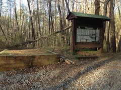
There was a sign inside of the kiosk saying that the trail was closed, due to a landslide. However, the trail is gated, and the gate was open. So, is the gate wrong, or is the sign wrong?
Also, landslide? That just made me want to ride up and see it.
But, not enough to actually do it. I wasn't even halfway around my loop, and I hadn't yet ridden the part I was specifically out there to ride.
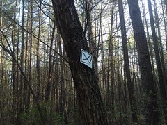
It had been a while since I'd seen a Pinhoti marker too. I was pretty sure that the trail was down that way, but I didn't have a map that showed it. I remember thinking: "Man, if the trail isn't this way, then it'll be a long climb back out."
Fortunately there was one on a sign nearby. And, it seemed like every time I had that same thought, I'd see another marker within a minute or two.
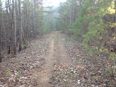
So, it turns out, P6 is like a very stretched out version of P2.
First, there's a long gravel road climb.
Then, it becomes grasstrack, and you follow that for a long time too.
Somewhere on that grasstrack, I saw another turkey.
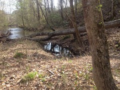
Unlike P2's grasstrack, P6's has a creek crossing.
Some unnamed branch, it turns out. And good luck riding it, or keeping your feet dry if you walk it.
Then there's a short little bit of doubletrack.
And then glorious, P2-ish singletrack forever.
It just goes and goes. There's a kick in the middle too, up over some gap, and it's kind-of steep, but it's not terrible.
I'd been following hoof prints since the road too. They appeared to be going 1-way. It made me wonder what loop they'd done, and whether it'd be fun on a bike too. I also saw other "indications" that horses had been through, and as I neared the end of the trail, the indications looked pretty fresh. I thought I might catch them even.
Two things got my attention towards the end though, so if I would have caught them, I lost all chance of that pursuing these diversions.
The first was this overlook.
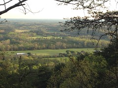
It grabbed my peripheral attention, just barely long enough to register. One could easily be forgiven for missing it, as it's like halfway down a steep descent between switchbacks.
The next was this Pinhoti dedication.
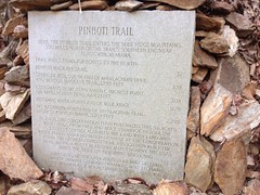
Again, one could be forgiven for missing it, as it's at the bottom of a descent, right when you're prepping to switch right across a little creek.
I was like: "that rock looks out of place" because of the color, and didn't notice that it was square until I did a double-take, after crossing the creek.
Hey, I know some of those guys! Conrad, Rick, Ginni, and Larry Wheat. There was a time when nearly every time I'd ride in the mountains, I'd run into someone I know. But, I never expected to run into someone I know, engraved in a granite monument.
I love it!
From there, it was a short run to the Dennis Mill Lot.
There were 2 guys sitting there on the tailgate of a pickup with a hitch for a gooseneck trailer in the bed. They asked me how I liked the trail. The trail was great! I told them I'd ridden from Mulberry Gap, and they actually knew where that was. I expected them to be somehow associated with the horses I'd been following, like maybe they'd pulled their trailer in, and unhooked it up the road or something, but they weren't, and they hadn't seen any horses come through. Dangit. I was curious about their loop. I asked them what they'd been up to, and the one guy said: "Not much... Just sittin' here" and he smiled and kind-of chuckled like it hadn't seemed like a funny thing to do until he said it out loud.
I wished them well and headed north on pavement.
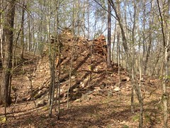
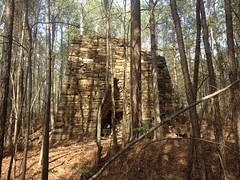
Just up the road was Dennis Mill proper, or what's left of it at least.
This must have been a gate house.
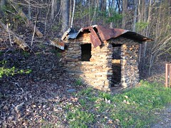
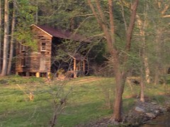
The larger building further upstream must have been associated with whatever work they were doing there.
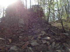
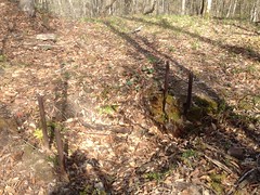
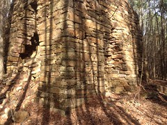
The mill race is gone, as is the mill wheel, but I could see what I thought might have been the remains of the outflow box (whatever the real name for that is, sluice maybe?) parallel to the building, along the creek.
I don't know what they produced there, and the internet doesn't seem to know much about Dennis Mill either. There's a modern house across the creek from the old mill, and there was a lady on the porch with a wide brim hat. I thought about trying to get her attention and asking her about the mill, but she stooped down right as I looked her way, and didn't get up for a while, like she was tending to some flower boxes or something.
I had miles to go and people not to bother, so I pushed on.
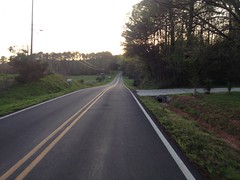
The Pinhoti continues left on Old Federal Road, to Ramhurst, but I took a right and spun up to Hwy 52. There, I availed myself of The Stallion's hospitality.
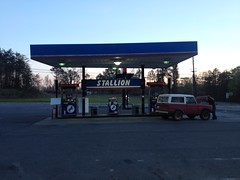
Mmm, delicious Orange Gatorade. I had a couple of Kind Bars in my pocket too, and I ate one of them. I'm not sure how kind they really are though. They're basically composed of the same colon-blocking materials that I'd naively loaded up on the first time I tried the TNGA - nuts, berries, and a little chocolate. I bring them when I've got some pork to burn off, but I don't want to feel hungry. They are good for that. But, I had no illusions about actually processing the calories any time soon.
By the way, the guy in the classic Bronco is starting it by shorting the starter solenoid with a screwdriver. Heh, heh. Yep, I've been there, buddy.
Cool Springs Road is a lot longer than I remember it being. Like 3 times as long. Fortunately, I got some great value out of it.
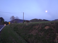
For example, there was this moon-over-Fort-Mountain that I got to see for a while.
And I got to watch the sun set over the fields to my left.
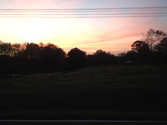
The sky was all pink and blue for the longest time.
Later, a fresh clear-cut offered the most perfectly framed view of Fort Mountain ever, but it was too dark to get a good photo of it. A dog chased me down the road near that spot too, but it was a very half-hearted chase. Like, I'm supposed to do this... Sighhhh... Ok, let's do this. Does that count? Cause, I'm done.
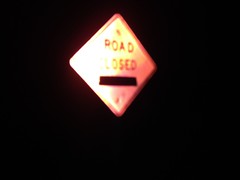
It was formally dark when I hit CCC Camp Road, and there were signs indicating that the road was closed ahead where it becomes gravel. I'd heard that there were landslides along the road months ago, but I'd also recently heard that the repairs had been completed. Hmm...
The only other way to MGap, is to backtrack to Hwy 52 and climb over Fort Mountain. No way I was doing that. I'm not sure I'd have had the strength and energy, if I tried. I had light and time though. I figured, worst case, I'd carry my bike on an extended bushwhack around the problem areas.
Just past the Emery Creek trailhead, there was another sign...
...and a makeshift gate.
Bikes are allowed on FS roads, even gated, closed FS roads, and foot traffic is legal literally anywhere in the forest, landslides notwithstanding. I went with the theory that those rules would apply in this case too. Plus, I could see bike tire tracks ahead of me, leading in one direction, so I figured the road was likely passable.
Indeed it was, and it was in the best shape I've ever seen it. I guess they improved it a bit to get the equipment in. There had actually been two landslides. Both were repaired, though it looked like they still might be touching up the second one. The first one looked like the slide on FS44, and was repaired in similar fashion. The second looked more like the one on the Bear Creek approach.
Goodness, the night was dragging on. I was pretty tired at that point. Much more tired than I classically would be at that point in a 40 miler. CCC Camp Road is basically one long climb up Holly Creek. It's not steep, except in a few spots, but it's a steady grinder. When I got to the intersection with Mulberry Gap Road, there was a sign saying 1.5 miles to go, and all I could think was: "Oh, God, don't tell me!"
I passed the chapel though, and the firetruck, and before I knew it, I saw the Mulberry Gap fence line. I remember thinking that it couldn't have been a mile and a half. No way.
Yes way! And, my truck was right there. All right!
Goodness again. 38 miles, 5000 feet of climbing. 5 hours or so. It took a lot more out of me than I expected, but hopefully just because I'm still shaking off this flu.
It was like 9:45 when I finished and when I got into town, my only dinner option was Wendy's. The tribulations I suffered there shall go unmatched for years to come.
I couldn't fit my bike under the drive-through, so I tried to shove it in the back of the car, but without putting the seat down, I need like 1/2 inch more, and there was just no way to get it. So, I had to pull it back out to prevent it from just sliding out haphazardly, put the seat down, and try again. Ok. Success.
Next trial - ordering. "Number 6 plain." "Small, medium, or large?" Perhaps I've been away from Wendy's for too long, because the option of small, medium, or large for a combo was foreign to me. "Small, medium, or large drink?" (long pause) "No sir, small, medium or large combo?" No idea. "Medium." Seemed like a safe option. I interrogated the clerk further at the window. Turns out the size applies to both drink and fry. Nice. Also, medium was what I wanted, so I guessed correctly.
It would take 7 minutes to cook my sandwich, so I had to pull up and let another guy through, but the clerks can't leave the store after 10, so they eventually had to wave me back to the window. When I received my order, I could tell by weight that the sandwich had everything on it. It did. She offered to take care of it, and I handed her my sandwich, but by "take care of it", she meant remove the everything and give me back the same sandwich with a new top bun. I had been in this same situation at Cielo Blue the previous weekend, and felt like I had been too picky, so rather than send it back again, I removed the little bits of contaminated breading and ate the sandwich. The first 5 or 6 bites tasted of lettuce, but after that it was fine.
I think it helped that I was really, really hungry.
All right! Dennis Mill. I have now ridden it, and I love it, and I'll have to add it in to my list of great places to ride. I can imagine a "real" loop out there too. Instead of taking the roads around the back side of Fort Mountain, go Peeple's Lake Road -> Rock Creek -> Tatum Lead, and backtrack to MGap. That would be a lot of climbing.
I think I'll save that one for when I'm feeling strong.