TNGA - Trans North Georgia
Three hundred and fifty odd miles and 56,000 feet of climbing. Johnny, Norma and I started out Monday, May 17th at 8 AM and finished Saturday, May 22, at 11:21 AM. It's going to take me a few days to get my head straight. Right now it just feels weird not to be riding.
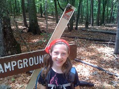
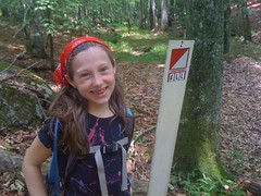
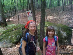
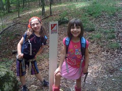
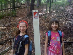
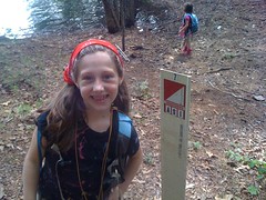
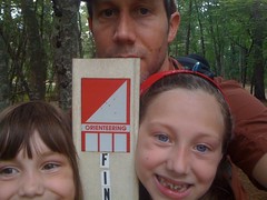
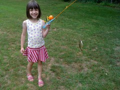
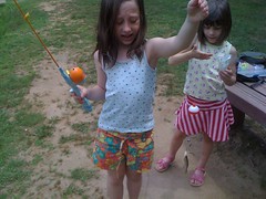
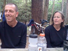
Last Sunday I did some fishing and a little light hiking with the girls. Norma and Johnny both did adventure races. Adventure races! That's how they warm up for this kind of thing.
We all met up at their house Sunday night. The next morning, Norma's daughter Erin, her husband, and their perpetually happy dog dropped us off at the South Carolina border. We got rolling a little afer 8 AM.
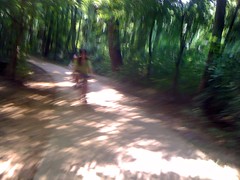
There was a lot of climbing on the first day, up through Warwoman, but we were fresh. The weather was threatening, but it only rained on us for a few minutes. We ate about once an hour. I ate
little chocolate donuts, two an hour, every hour, for the entire week.
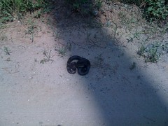
We passed a group of campers near Wilson Gap and later, a group of at-risk teens on a Wilderness Therapy retreat. At the bottom of Darnell Creek Road, somebody had abandoned a litter of kittens. Little grey kittens, crying and covered in flies. It was absolutely heartbreaking.
We grabbed some food at a gas station in Rabun Gap. We were counting calories, in reverse. I tried to eat at least 600. An ice cream sandwich, a candy bar, a little bag of chips and half a soda. This would become a ritual.
We rolled over Patterson. Johnny'd cracked a few ribs a few weeks back and some muscles in his back were starting to bother him. There were more campers on FS36C. Down Chestnut. Up Tallulah. Across Charlies Creek, past where I'd camped the first day last time. It felt good to pass that spot.
At some point, Johnny's rear tire started losing air. It looked like the valve stem was loose and leaking, but we couldn't get it very tight. Stan's was sealing it up slowly, we just pumped it up a bit every hour and eventually it seemed to hold.
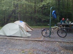
Up and over Dick's Creek Gap, down Kennesaw through ten thousand creek crossings. We didn't even try to stay dry. At Moccasin State Park we called it a day. 9 and a half hours, 70 miles. Not an easy day, but we had it. Good, good, good.

The campground host was extremely friendly. He was amazed that we were camping in tents, and stunned that we'd ridden bikes in. Everyone else had an RV or at least a camper. To them, we were roughing it. To us it was luxury. We set up camp, took SHOWERS, got SODAS from the vending machine and went for a little stroll out by Lake Burton. I was wearing Dri Ducks and we were all wearing these goofy home made shoes made out of insoles and shoelaces. The looks we got... I'm guessing people could have thought about it for days and never figured out why we were wearing them. (They're much lighter than the lightest flip-flops.)
I ripped the seat of my Dri Ducks almost immediately and had to put them back together with duct tape. It worked, but the duct tape slid around a bit and for the rest of the week, every time I'd stand up, I'd have to peel the pants off my butt :)
Johnny is a UPS driver and ran into a guy he used to deliver to a few years back. What are the odds of that? He gave us a multi-tool which Johnny used to tighten his valve stem.
Johnny and Norma ate Mountain House meals. I ate beef jerky, a Knorr Noodle Side and Cup Noodles. This would also become a ritual.
The next morning it was cold but I had fresh legs and felt great, except for severe sit-bone pain and a little swelling. Norma was hurting too. We pushed through it. Later I would discover that there's a maximum amount of sit-bone pain. It's easy to reach, but impossible to exceed. If you get used to it, you're good, it gets better after an hour or so, and though it doesn't seem right, putting pressure on the swelling makes it go away.
We rolled up Wildcat and over Addis Gap. I flatted coming down the back side. The carbon insole in my left shoe had broken too. When I stood, it would bend in the middle and put pressure on my arch. Annoying, power-robbing, but not unmanageable.
We grabbed more calories at the gas station on Hwy 75 and started up Tray Mountain. It felt really good to pass the point where I bailed in September, and even better to pass it spinning in the middle ring.
The Hickory Nut was a mess: overgrowth, dense ferns, downed trees. Nervewracking. It was much nicer last fall, but all of this rain... Norma crashed and bruised her wrist but fortunately didn't break anything.
We cruised through Unicoi and fueled up at the gas station at the corner. I grabbed a tiny bottle of sunscreen and applied it liberally.
The freeze-thaw had cracked up the pavement on the north face of Hogpen and earlier this year, it was closed just above Raven Cliffs Falls. We were prepared to walk, but when we got there, the signs were gone. Hogpen is hard enough on skinny tires. On knobbies, with packs it was harder, even with the extra gears. Johnny's back was killing him and the back of his right knee had started acting up too. When it was time to eat, we stopped in one of the turn outs near mile 4 and laid down on the ground under an oak tree for probably 20 minutes, just looking up at the sky. So nice.
The rest of the climb wasn't any easier, but we got it done. The road was only closed for about half a mile near the very top and down the back side to Tesnatee Gap. There was nobody there, but we walked it anyway. A minute later, some DOT guys showed up, patrolling the new pavement. Yay, good Karma.
I was spent after the climb and for some reason, I'd mis-remembered the Hatchet and Helton Creek roads as being mostly downhill. Johnny slipped out in one of the creek crossings and got soaked, but was otherwise unharmed.
When we got to Vogel, for some reason, Norma was feeling great but me and Johnny were suffering just to climb the little hills in the park. 50-odd miles, ten hours. Much harder than day 1.
It took us two tries to figure out where we were supposed to camp, but again, there were showers and sodas. Score. The water came out of my shower head in a gentle sprinkle. The water came out of Johnny's shower head like a firehose. It was hilariously disproportionate but it still felt great.
The noodles I'd picked up in Helen were "hot and spicy." It was all they had. They should just go ahead and label them "chemical burn." The first batch was challenging to eat. I poured the water off of the second batch into a cup and Johnny tried to drink it, unsuccessfully.
We took a walk around the park. Norma showed me how to identify some trees that I wasn't sure of and some others that I didn't know at all. Then we just hung out and rested until dark.
The next morning was freezing, or at least it felt that way in our wet clothes. We grabbed a little breakfast, climbed Wolfpen, kept climbing on Duncan Ridge, and bombed down the back side, shivering to death the whole time.
At the Cooper Creek store we performed the food ritual again. Johnny found a honey bun with a mind-blowing 760 calories. I wouldn't have guessed that such a thing existed. We were so hungry, if there had been two, he'd have eaten them both.
We rolled through the former Blue Ridge WMA, took Old Dial to Shallowford and stopped at the store there. We were still kind of full from Cooper Creek, but there were some hard miles ahead and we needed every drop. Me and Johnny Split a pizza. He and Norma split a Salad. Norma ate a grilled cheese sandwich that she'd been talking about since the night before. The store had tons of food, but not a lot that was easy to carry or cook while camping. We cleaned them out of what they had.
I walked around the side to the bathroom and a guy had backed up his truck there with a big box on the tailgate. "Hey buddy, could you give me a hand with this?" Instinctively, I was all "sure, no problem" and THEN I remembered I was halfway through a state-crossing bike ride. It was too late though. He said: "It's not heavy-heavy, just..." and then trailed off, trying to pick up the box, which weighed probably 160 pounds. He kind of slid his side off of the truck and I had to scramble to get my side off, then he sort of indicated where we needed to go and ran it dead into a pole. I almost dropped my side, somehow managed to maneuver it around the pole and staggered onto some gravel to set it down. As we bent down he leaned the entire thing into me. All I could do was squat and drop my side when it was an inch off of the ground, which sent him tripping forward and slamming the whole thing toward me again. My right pinkie got crushed underneath and my right wrist got tweaked so bad I had to pop it to get it to bend right again. Woohoo! It turned out OK, but I'll have to remember to decline moving heavy things next time I'm on a long bike ride.
Onward, onto the first real singletrack of the route: Long Branch, Green Mountain and Stanley Gap. Stanley Gap was almost unbearable. Sitting for any length of time had become torture and you can't stand up much on Stanley. I was riding all over the trail and sometimes too slowly for the other guys with their 29'ers. It turns out that I can ride slower than Johnny can walk. I'm not sure whether that's good or bad, but it was funny.
We tanked up at Rock Creek. Norma slipped and fell in, but didn't get hurt. I dropped 6 donuts on the ground, but I couldn't spare them, I just had to clean them off. No problem, just a little extra flavor.
We rolled through Cherry Log, up over Bushy Head Gap and down into Devil's Den, The push over Bushy Head Gap itself was murder. At first FS797 was cool, but it just got steeper and steeper and steeper again. I walked a lot and fell behind for a while. At great length it did flatten out, but that road just goes on forever. It was getting dusky. We were getting desperate.
At the end of 797 there's the Double Hogpen Connector, or at least that's what I call it. In 2008 it was rough and steep, but clear, and we pushed up it. Since then, the forest service has gotten serious about keeping ATV's off and the rain has taken care of the rest. We climbed the tallest Kelly Humps I've ever seen and pushed through dense brush and downed trees up a barely discernible trail. The descent down from Flat Top is awesome, but I'm rerouting that section, it's simply too difficult.
Speaking of Flat Top, we FLEW down that and eased on into the Jacks River Fields campground. We were all hurting, badly. 13 hours. 78 miles.
Norma and Johnny were out of Mountain House meals and were relegated to my diet. I was starting to notice how much salt was in my diet. The noodles didn't even taste like Chicken, just salt.
No showers. No soda. No cell service. It didn't matter. We slept very well that night.
The next morning was the coldest yet. South Fork was wet. The Pinhoti beyond was steep and soft. FS64 was OK but again, I had to walk a bit and fell back for a while. The descent down Bear Creek was refreshing and by Pinhoti 1 I was recharged. We all felt good on 2 and 3. We even ran into some other riders up there on vacation. One of them almost ran into me on his way back down from Hwy 52. I got out of his way, but he couldn't have stopped if he wanted to. No good.
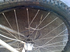
I popped a spoke on Pinhoti 3. At least I think it was on Pinhoti 3. Somewhere in there.
We walked the horrible climb on Tatum Lead, flew down Pinhoti 5 and found some wild strawberries at the end of the long field crossing there. Running low on energy and with only scraps of food left, they were welcome fuel and man they tasted good.
The rollers on Peeple's Lake Road were brutal, but they were running the grader up there and at least the tread was nice. The gas station in Ramhurst looked like a 5 star restaurant. Norma saw some kind of sandwich wrapped in foil and bought it without even finding out what it was. They even had Mountain Dew Livewire, my favorite drink in the world, and virtually nonexistent in Georgia. We feasted.
The push to Dalton was fast and easy. I don't know how many miles we rode or how many hours. We were at like 275 of 331 miles, so whatever that is. It seemed like a short day. We were feeling good when we checked into the Days Inn near I-75.
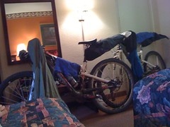
I always say I love the outdoors, but that the outdoors really makes me love civilization. We were loving it that night. We ate dinner at Longhorn and even watched some TV. Good sleep. Long sleep.
It stormed all night and the next morning it was still raining. We filled up on complimentary continental breakfast and stocked up at the gas station across the road. It was going to be a long, long day. We planned on finishing, but we had the Snake Creek Gap TT route to ride (backwards) and a ton of Pinhoti after that. It would be hard, but we were resolved.
It had at least stopped actively raining when we started climbing up Dug Gap Mountain. But, the rocks on the ridge were slippery, brush hung out over the trail, wet pines provided a perpetual shower, there's some kind of grass that grows up there with little spear shaped seed pods that stab into your socks, there were thorn bushes everywhere. Endless adversity. Good old adversity. We pushed hard. On that trail, you don't move forward if you don't push hard. I never felt good or strong though, not for a minute.
A stick wrapped itself up in my rear wheel and popped another spoke, right next to the one from earlier. Two down. I've ridden a wheel with three popped spokes, but I had to bend the rim by hand to make it ridable. I really didn't want to have to do that. I was extremely careful from that point on.
Apparently I'd picked up a thorn or two, my rear tire was losing air. Please hold together...
I was stunned that I didn't pinch-flat coming down off of Johns Mountain. On that grassy FS road heading down to Dry Creek I caught the edge of a rut, got slung to the left, crushed my face into a tree, spun a complete 360 and somehow came out of it rolling in the right direction. I'd lost my glasses though and split the bridge of my nose. By the time I'd stopped the bleeding, Norma had found my glasses and had a band-aid ready for me.
Dry Creek was high and muddy, we declined to fill up there. A hiker passed us heading the other way. We pushed on to Manning Mill and the creek just before the trailhead there was a slightly less muddy than Dry Creek. No more water for miles, we had to go with it.
I missed a turn and got us lost for about 10 minutes on the way up Strawberry. The switchbacks were unrideable. We were human weedeaters on the grasstrack. I guess that section doesn't get much traffic.
I pumped up my rear tire a couple of times, but it just wouldn't hold. Between that, the warped rim, the conditions and my general lack of energy, I couldn't hold a line to save my life. My rear wheel would just wander down into the worst part of the trail, over and over.
On the way to Mack White Gap there was more spear grass, more human weedeater, more sketchy climbing and more please-hold-together descents. Again, I was stunned that I hadn't flatted altogether.
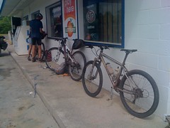
At Mack White, we coasted down to the Gore-Subligna Road and grabbed some much needed fuel at the gas station there.
It was 6:30. We'd ridden ten and a half hours and only 50 miles, but we were at mile 325. In theory, there should only be 6 miles left, but knowing the area, we had more than that. I'd miscalculated the distance. Or Johnny's computer was off, or our detours had added up, or maybe some combination. I guessed 25 or 30 more miles, ten or fifteen back up on the ridge and the rest on a rail-trail or road. At the rate we were going, there's no way we'd even make it off of the ridge by dark and there's no water up there.
I'd known about the gas station, but I hadn't known about the Summerville Motel next door. Pure luck that it was there. It was disappointing not to finish, especially after such a hard push, but we accepted it and got a room. $27. The least expensive room I've ever stayed in.
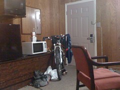
The shower head was way off to the right and immovable, you had to sit sideways on the toilet and lie diagonally across the sofa mattress, but none of that mattered in the least. It felt fantastic.
I finally got to survey the damage to my face.

We cooked in the room, ate all we could, watched a little TV and crashed out hard.
The next morning I was completely refreshed. I found and patched the hole in my tire, but it still wouldn't hold. Eventually I just swapped it out with the one I'd pinched and patched earlier. That held.
The trail from Mack White to High Point was just fast and fun. Way better than I remembered. The rail-trail was fast too. Somebody had regraded it since the last time we were there. And last time we were pushing Travis after he'd sheared off his derailleur. It goes by a lot faster when you're just riding it.
We hit the border at 11:21 AM.
Done.
Cell service at the border was sketchy. When it was sunny we had signal, when the clouds rolled in it went away. Still, we managed to coordinate a pick up.
Norma's brother in law took us to their place north of Rome and Kathryn picked us up from there.
I can't believe I didn't taco my wheel. Might be time to get it relaced. None of the shops nearby like doing Ti though.
So that's how it all went down, but that doesn't come close to describing it. I don't know what words to use to really get it across, I'm not sure there are any. I'll try though...
The route is hard. Much harder than you think. There is so much climbing and so much technical singletrack. It is easy to underestimate and I think people will underestimate it in September.
Johnny, Norma and I were surprisingly well matched. They can usually ride me into the ground, but they were carrying a little extra weight and it evened us up pretty well. That said, there'd be a point in every day where each of us would struggle, then eventually come back.
Every day started off fun, eventually transitioned to work and then finally to suffering. Even when we finished feeling good, a good bit of that good feeling was just being glad we were done.
My hands, feet and sit-bones have deep, deep bruises. It's actually painful to type, but it's getting better quickly.
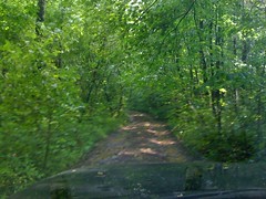
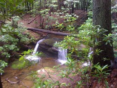
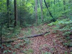
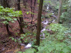
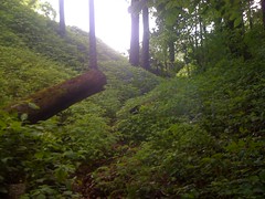
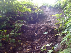
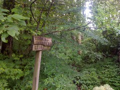
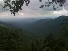
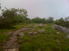
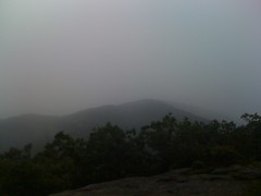
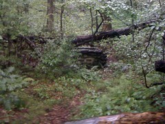
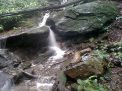
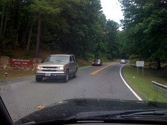
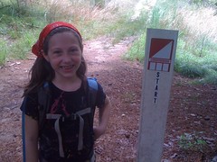
I wish I could have taken more photos, but that meant digging my phone out of my pack, where it was buried, safe from rain or other water. We rarely stopped long enough for that.
Each morning we'd start out freezing and around 2 PM it would be 90 degrees. On this ride, I both shivered uncontrollably and got badly sunburned. Even so, we got so lucky with the weather. It could have been much worse. It even threatened here and there, but we got lucky.
Food... Carbs all day, protein at night. We gave up gels, blocks and bars for candy, chocolate donuts, noodles and beef jerky. Nutrition was a strategic challenge too. Eat now or eat later? Hump that food over Stanley Gap, go hungry the next day or go a mile off route to get food later? Ride hungry. Ride thirsty. Ride in debt. You're hungry but you CAN keep moving, just don't burn it too hard.
We absolutely cleaned out the gas stations. It's going to be interesting in September when there are more than just 3 of us on the route. There won't be a Cup Noodle or Top Ramen in all of north Georgia.
The motto all week: "How do you eat an elephant?" "One bite at a time." Each trail was a bite, or each mountain, or each gap. We ticked them off, one by one. One bite at a time.
It was very weird at the end. I thought I'd be elated. But really, it just felt like finishing up another day, and a short day at that. If we'd been able to finish the day before, I think that would have been elating. Johnny and Norma are too cool to say anything but on day 5, I was the one with no energy and multiple mechanicals and I miscalculted the distance and crashed. It feels like I let them down. I hope they don't feel that way, but it wouldn't be wrong if they did.
Travelling together was fantastic. There's just nothing better. Those guys are great, no-stress company, their strength and hardness are more inspiring than you can imagine, and Norma's planning was key. She'd researched the campgrounds, knew what facilities they had and planned ahead out how far we needed to go each day. Without that, I don't know that I'd have pushed as hard or recovered as well. Being able to coordinate a pace was great too. Pick it up? Roll it back? Give it a try and see how the other guys react. Awesome.
I really WANT to feel great about this ride. We proved it could be done and determined what route changes need to be made. Those were our objectives. We accomplished them. But my actual feelings are mixed, conflicted and complicated...
Getting it done feels like an accomplishment. It feels so good to know that we could push that hard, for that far and that long.
I'm disappointed with myself though, about day 5 for the reasons I mentioned above. That day was so unbelievably bad that it taints the accomplishment. I can't even think of a metaphor. Maybe that's common on these things. I just have no idea.
It also dawned on me about halfway through that I had no specific set of rules in mind. Was this a three person team effort, three solo riders travelling together, or something in between? Should I focus on supporting the team or on following ITT rules? I'm not plugged into the adventure race scene or the endurance ITT scene. I had no experience to fall back on and no idea what to do. I was out of my depth but already well committed. I just should have thought about that ahead of time. Another shadow on the accomplishment.
Speaking of endurance ITT... Does this effort even count? I'm reasonably familiar with the CTR and Tour Divide rules, but I can't quote them, and I'm sure there are commonly accepted interpretations of the rules that I don't know. We collaborated on gear, we followed Norma's plan for how far to go and where to stop each day, we took breaks together and shared campsites, pizza and hotel rooms. I got a cup of hot water from the jet boil once and used it another time to firm up my noodles. I had plenty of fuel, it was just convenient to do. What are the rules there? I honestly don't know. I know there is a "no drafting" rule, but I was happy to pull. I did try to avoid drafting myself, but is there a specific distance? If we'd hit a climb or really heavy traffic, we'd bunch up for a bit and stay that way for a while. It just happens unless you try hard not to. What about that? When I smashed my face, Norma gave me a band-aid. Should I have rejected it? I used their pump once because they just had it out already. We held each others bikes up. What's the rule there? I wish I'd even thought about these things before we started. Another shadow.
Tainted victory. Beautiful, tainted victory.
I seriously doubt I'll do this thing again unless I make some major leap in fitness. I am starting to get curious about the Colorado Trail though. My body is already starting to heal. I might even hit up the group ride this Wednesday.
Somebody's going to ask about the gear we took. I can't remember Norma and Johnny's offhand, but here's my gear list:
* Gossamer Gear Murmur pack
* A trash compactor bag for a pack liner
* Big Agnes Seedhouse SL1 tent - just rain fly, poles, 8 stakes and footprint
* Thermarest AirLite pad
* Mountain Hardwear Phantom 32 bag
* Snow Peak Ti 450 cup
* A whole pack of Esbit Tablets
* A mini Bic Lighter
* DriDucks jacket and pants
* "Shoes" made out of insoles and shoe laces
* iPhone and charger
* Colgate wisp toothbrush
* a few feet of dental floss
* 3 mini packs of Chamois Butt'r
* a 4mm allen wrench
* a 5mm allen wrench
* the chain tool and main screw from an Alien multi-tool circa 1999
* Blackburn mini pump
* a bottle of tri-flow
* a tiny bottle of SPF 50 sunblock
* Potable Aqua iodine tablets
* a pack of Park tire patches, the peel off kind
* 2 Park tire boots
* a SRAM power link
* a camp towel cut to just barely larger than my hand
* a spare pair of socks, from the Dirty Spokes series
* a few feet of duct tape, folded over until it was flat
* my check card
* my drivers license
* $100 in cash (I ended up getting more though)
* route map printed on 2 sheets of waterproof "adventure" paper
I wore random biking clothes except for a sleveless craft coolmax base layer instead of a jersey; much lighter and holds almost no sweat weight.
Since the last attempt, I lightened up my bike and gear by 8 and a half pounds and my body by 4 pounds. The bike weighed around 21 pounds and my base pack weight without food was 7 pounds or so.
My brother John did a lot of food research. He and I did lots of gear tests, both on bike and foot, in all kinds of weather. It was invaluable.
For breakfast and dinner, I mainly ate Ramen, Cup Noodles and Knorr Pasta Sides. I carried little chocolate or powdered donuts and ate 2 an hour. I mainly carried just one full bottle, but occasionally I'd fill them both. Every time we'd stop, I'd eat 600 calories or more in candy, some kind of salty chips like Doritos, an ice cream sandwich and drink at least half of a soda.
I didn't carry a spoon or fork, but made chopsticks from nearby trees. This worked great until we got into a hotel room. I'd reccomend bringing a spork or something.
To cook, I'd put an esbit tablet on a rock, pile 3 or 4 rocks around it and set my cup of water on top of that. It usually boiled, but not always. I'd just pour the hot water into the Cup Noodle cup to cook those, and reuse the Cup Noodle Cup to cook ramen or Knorr. Pouring water directly into the Knorr package works pretty well if you dump out half of the noodles and do it twice.
I can't even remember what all else we carried or did.
Man, this is turning into a book. No more. I'm too tired and I've got work tomorrow. One last thing though. Thanks so much to Norma and Johnny for riding with me, thanks to Travis and Russell for pioneering the route with us back in '08, thanks to my brother John for the research and all those rides and hikes testing stuff out, and thanks to everybody else who helped me get this thing done. It's been a long time coming. Now somebody go out and do it faster.