Sunday, April 22, 2018

Bull and Jake Mountain

Last week me and Iz were doing trail work, ran into a guy riding a motorcycle on Jake, got a couple of photos, passed them on to Stan, who passed them on to the USFS... Stan and I also talked about putting up some laminated flyers in response. I put together a sample, he liked it, sent me a list of locations that would be good to put them up, etc.

So, today I did that - put up flyers at various points in the system.

Less Heavy Handed

That's my flyer. I believe that it kindly requests that people not ride motorcycles on the trails, and includes a nod to that particular rider's effort to ride with respect for the forest.

I also laminated and hung them in such a way that they can't just be torn down. At least not easily.

I was a little surprised when I got there that someone had already made their own signs and posted them at the kiosk, port-a-john, and at the entrance to the Jake trail.

More Heavy Handed

The message is a bit heavier handed than I went for, and being the guy that was there and took the photos, I think it overreacts a little. He was riding in the rain, but I didn't see that he did any more damage to the trail than we did walking on it. The trail design is due as much thanks for that as his efforts, but for whatever reason, at the end of the day, his trail/forest impact was minimal. This guy in particular wasn't riding in any way that a hiker or mountain biker would be worried about either, so I can't say that it is likely he'd injure or kill one of us.

However...

Riders on horseback are another issue altogether. I'm not sure that they'd _likely_ be killed or injured, but it's definitely more likely that they would than a hiker or mountain biker. There are no trails in Georgia that are open to horses and motorcycles, so the two user groups have little or no interaction. I can definitely imagine a guy on a motorcycle not knowing how or even whether to communicate or yield to a rider on horseback, looking like an alien robot monster to the horse, spooking the horse, and the horse throwing its rider as it spins and bolts. I wonder if that can be characterized as likely though, or just possible in general and more likely with certain horses. There are plenty of trails in Louisiana that are fully multi-use: horse, hike, bike, motorcycle, and ATV. I wonder if there are issues with that on those trails. It could be that no one rides horses on those trails, even though it's legal. Ehh... I wonder, but it's really moot. A rider on horseback at Jake and Bull shouldn't have to worry about any of it at all.

...and so we put up signs.

I guess we'll see what shakes out of this. I hope our message isn't too mixed. I also hope our efforts don't just escalate the conflict.

Jake Mountain

Isabel is about to graduate and a few weeks back she needed a few more community service hours to get a cord from the National Honors Society. The last Jake/Bull workday had been cancelled due to rain, so I coordinated with Debbie and Stan to get up there and do a little work with Iz this past Sunday.

There were 2 things that were high on the list: clearing lines of sight on the Jake Mountain trail, between the Moss Branch trail and Jones Creek, and filling in the geotextile that had been laid across a little Jones Creek feeder, just that side of Jones Creek proper.

Sounded good to us. We got right on it.

It rained on us the whole way up and it was storming around Cumming, but the forecast said that it would clear right about the time we ought to get there, so we kept our hopes up.

The weatherman was right, as it turned out, and it was barely drizzling when we got there.

The one thing we weren't sure of was the gate on 28B. It ought to be open, but no one knew for certain. If it hadn't been, we'd have had to walk in an extra mile or more, but it was, and we were thankful.

It was a quick walk to the singletrack, and the Moss Branch intersection is right there, so we got started immediately.

Lopping

We basically cleared brush and lopped low branches around every curve, corner and switchback. The general idea is to make it possible to see someone coming around the curve or corner. If you can see someone coming, you can safely ride faster, or safely see someone else who's riding faster. It's good for faster moving mountain bikers to be able to see slower moving traffic coming the other way, as it's almost always necessary to yield to or communicate with the slower traffic. It's also good for horses to be able to see approaching traffic before it's immediately in front of them.

Here's kind-of an illustration of what we did.

Before:

Before

(Isabel's sleeve is that white speck left of center)

After:

After

Unfortunately, Iz took off her jacket, and was standing slightly to the right in the second photo, so it's not a perfect illustration. But, that's how it was before and after - that kind of difference at that kind of distance.

We ran into a couple of cool things while we were working.

Iz found this weird growth on a blackberry bush.

Weird Growth

And there was also a small scorpion under a rock on the trail.

Scorpion

Makes you wonder how many thousands of them you walk or ride by every day.

Also, it alternately drizzled, rained for real, and cleared up, like 4 different times while we worked. We never got super wet, but it always seemed like we were about to right before it stopped raining.

We eventually got down to the geotextile, which was, fortuitously, right where we needed to stop lopping.

Before:

Geotextile Before

It took me a minute to figure out why we were doing anything. The geotextile is exposed, but it was still holding a ton of rock and gravel, from about ten feet from the creek, all the way across it, and up the other side. It appeared to still be completely functional, at least in preventing impact from users crossing the creek.

But wait!

It eventually dawned on me... When the textile gets exposed, it's super easy for hooves (and feet for that matter) to get caught in it, especially where it's underwater. I remembered someone mentioning that 10+ years ago in one of those trail maintenance classes.

Ok, ok, ok. Got it.

We started by filling it with medium sized, chunky rock, and bigger rocks downstream of the crossing.

Geotextile After Big Rock

These rocks were provided by the little creek itself. Just upstream was an inexhaustible trove of them. We had to do this relay though, where we'd throw the rocks into a pile 10 or 20 feet downstream, then throw that whole pile another 10 or 20 feet downstream again, then chuck them onto the geotextile, and finally place them carefully when we had a big enough pile going.

Then, we dug up gravel from various little gravel bars downstream of the crossing, piled it onto my jacket, hauled it back up to the crossing, and spread it all over to fill in between the rocks.

Geottextile After Gravel

That step was backbreaking. First, we'd only brought loppers, a pulaski, and a saw with us. No shovel. My kingdom for a shovel! Also, even if we'd had a shovel, we still would have had to use the jacket to transport the gravel. One shovel-load at a time would have taken forever. But, it was like 100 pounds of gravel each time, over rough, rocky, rooty, and brushy terrain. And, it took 6 loads of gravel to cover the crossing.

There was a bit still exposed uphill to the north, but we couldn't come up with a decent strategy for filling it.

Exposed Geotextile

We eventually tried trimming it, but the loppers weren't up to the task. I remember saying that I wished I had a box cutter. I'm an idiot though, because I had a knife, with a half-smooth/half-serrated blade, dangling off of my camelback, at the time. No idea why I didn't remember it at the time, but I didn't. Maybe next time I will.

The hike out was mostly uphill and seemed a lot longer than the hike in. Whooo! I'd also packed the jacket that we used to tote the gravel in my camelback, but it was still super wet from having been washed in the creek after every load, and it dripped water down the back of my pants all the way out, which was just maddeningly uncomfortable. I eventually took it out, put the hood over my head, and draped it over my pack. This helped a little. Rather than dripping down at my waist, it dripped down at the backs of my knees. Dealing with the drippy jacket was by far the toughest part of the day.

One more thing worth mentioning...

When we arrived, we ran through the Jake lot to hit the port-a-potty, and there was a guy parking his motorcycle trailer there at the time. I didn't think anything of it, as we regularly see people trailer their bikes there and hit the forest roads nearby. I've seen that like 10 times.

About halfway between Moss and Jones Creek though, we heard a guy approaching on a motorcycle. Again, I didn't think anything of it at first, he could be over on FS28-1. He did sound close though, and it turned out he was riding on the Jake Mountain trail...

Motorcycle on Jake Mountain Trail_Moment 2

...which is decidedly against the rules. Debbie and Stan mentioned that they'd either seen tracks, or heard secondhand of them, but I'd never seen it myself until that day.

It's tough to be too critical of the guy though. On the one hand, he's breaking the rules, and in doing so not respecting the design, maintenance, or user experience goals of the trail. On the other hand, the guy seemed to be riding with a specific goal of minimizing impact. When he came up on us, he was riding at mountain bike pace, waved, waited for me to wave him through, and mentioned: "I'll keep it quiet..." which I took to mean keep his engine quiet and pace down. Walking the length of the trail after he came through and keeping an eye out for impact, I can't say that there was any to speak of. There were tire tracks in the deposition at the bottoms of some of the grade reversals, but the displacement was only marginally worse than that of our own footprints, and that soil is destined to be cleaned out anyway. I guess that says a lot about the trail design, but it also says a lot about how conscientious he was.

It made me think a bit about motorcycles on multi-use singletrack. Logistically, why couldn't a conscientious guy on a motorcycle ride the Bull and Jake trails? I'd be curious to compare soil shearing on clay between horses and motorcycles on a 10-15% grade climb. I'd also be curious to see how feasible it is for a motorcycle to yield to a horse by getting off trail on the downside. I suspect that would be tricky, and do some damage getting back on, but I don't know. I'd have to see it. I'd also be curious to see the impact of crossing a creek like Jones Creek. Mountain bikers have to walk it, and carry our bikes up and down the banks. Motorcycles can't be carried like that, but I'd have to see how managing it compares to a horse or hiker. Otherwise I couldn't think of any logistical problems.

Of course, ultimately, conscientious use can't be expected. Trails just have to be designed to take what the least conscientious user can give. So, motorized trails generally need to be wide enough to be maintained with motorized equipment and kept away from the watershed. I guess that's unfortunate for the rider who knows what he's doing.

All that said, it's against the rules, and there's been a bit of it lately, so we're going to put up some signs, kindly requesting that people don't ride motorized vehicles on the Bull/Jake trails, and see how it goes.

I do feel bad about putting that's guy's photo on the sign though. It kind-of vilifies the wrong guy. It's the only photo I've got, so it's the only one I can use, but I can't honestly say, personally, that I'd mind sharing the trail with him.

Saturday, April 21, 2018

PaCO Mixed Loop

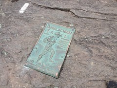
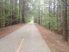
Last weekend seemed like a good time to hit the PaCO Mixed Loop again. PaCO stands for Paulding County, and the loop is mixed because it's part gravel, part road. People generally ride it on cross bikes, or just on road bikes with 25's. I rode it on my mountain bike last time and told myself next time I'd hit it on the road bike. But I forgot that I'd made that decision until I was a few miles from the trailhead, with my mountain bike on the roof.

Ehh... It's still fun on the mountain bike.

On the drive over, I took some back roads to avoid the highway through Hiram, or more precisely to avoid the dozen or more 5-minute traffic lights through town there. As such, I arrived at the Rambo trailhead on the Silver Comet after only about 45 minutes of travel. Way better than last time.

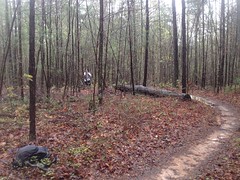
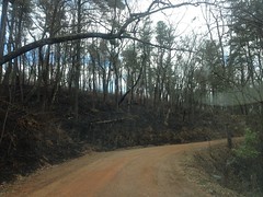
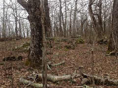
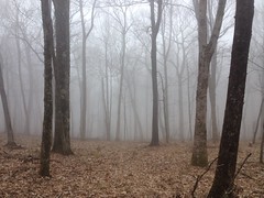
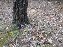
It's early spring, but the trees in the lot, and down the trail looked like fall. Fall colors in spring. A lot of them are still flowering, and only some of them have even started to leaf out. We've had a particularly spectacular spring this year, for some reason. I guess it has to do with all of the rain we got. It was terrible for riding on the weekends, but maybe good for the trees.

I left the lot at about 3PM, I think, heading west.

Riding Out on the Silver Comet

I only kind-of remembered the route. I mean, I generally knew it, but I didn't remember every turn or how far it was between them. I'd printed out a map, and made some notes on it, but apparently even that didn't jog my memory very well. In particular, it seemed like I was on the Comet for a long time before hitting the first turn. Way longer than I remembered it being. It turned out to be fine, but it also reminded me of the scale of the map. I guess my maps are usually twice as zoomed in as that one was. Everything was twice as far as it seemed, intuitively, looking at the map.

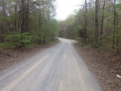
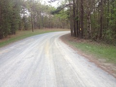
I turned right off of the Comet onto a super rough road - not unpaved, but super rough. I remember the road in front of my Grandma's house in Covington, LA being rough like that. Too rough to ride a skateboard on. We used to bring our skateboards, but we could only ride them in the driveway, or otherwise walk a mile to the nearest decent road. We'd generally avoided doing that, but one day we did. Turned out that the whole rest of the town had great roads and fun stuff to skate. Stuff that we'd been missing out on for years, all for not wanting to walk what seems in retrospect, a very short bit.

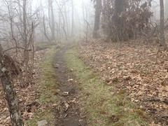
I think the next road was Johnny Monk Road, which was all gravel. I didn't recognize it at first though. Since I was last up there, someone cleared a wide strip all down the left hand side of the road, and grass had grown back in. Not sure what it's for though, I didn't see any gas line or power lines, or anything.

Johnny Monk Road

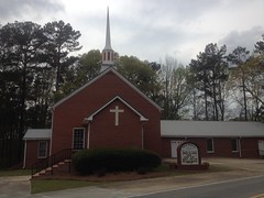
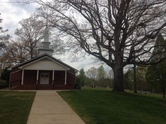
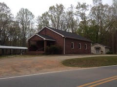
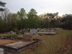
There were a couple of paved roads after that, and some churches and cemeteries.

High Shoals Missionary Baptist Church High Shoals Missionary Baptist Cemetery

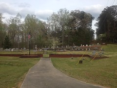
High Shoals Falls is somewhere near that last church. I've never been there, but I hear they used to baptize people in the water below the falls way back. I dig stuff like that, so I can't really come up with a good reason for not having been there except that I just keep forgetting about it. Maybe next time.

I felt pretty good at that point in the ride. I'd been riding pretty consistently for the past few weeks, and getting good sleep too, and it was paying off.

I remembered Thomas road being tough, but I felt like I was crushing the pedals all the way down it that day.

There's a bit of a view to the south, somewhere along the road...

The View from Thomas Road

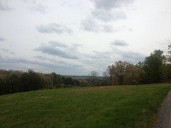
...but it's tough to take a photo of. There's this one little spot where it's spectacular, and then everything gets in the way if you miss it.

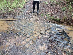
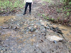
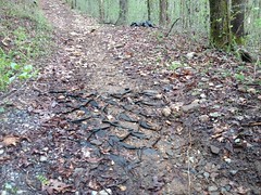
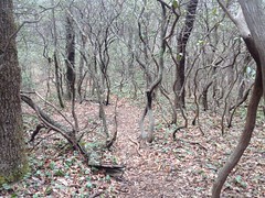
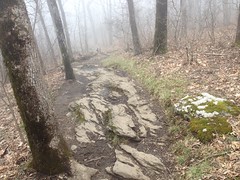
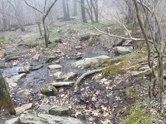
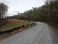
Thomas road starts out as asphalt, quickly becomes deteriorated pea-gravel on old asphalt, then transitions to actual gravel at some point:

Thomas Road

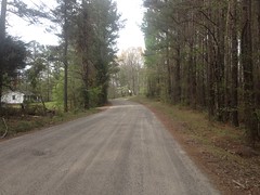
The transition is subtle though, and I didn't notice exactly where it happened.

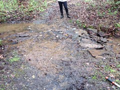
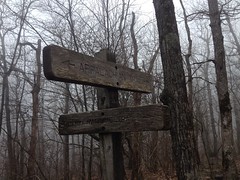
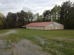
I guess that I should mention that the loop I do isn't the standard PaCO Mixed Loop. There are short and long options of the standard route, which are like 32 and 37 miles respectively. The loop I do adds a bunch of roads to the north of the short loop, for a total distance of 60 miles.

Actually, the last time I did it, it was just short of 60 miles. Since then, I discovered some additional gravel and added it into the route this time. Most of that gravel was in the vicinity of Narroway Church:

Narroway Church

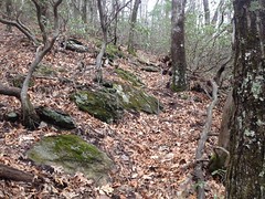
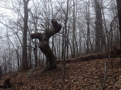
There are a couple of old farms back in there, and it seemed like everybody had a lake in their yard, so I enjoyed the scenery. Extra dirt is always fun too, and I think there was some extra climbing, which I was up for.

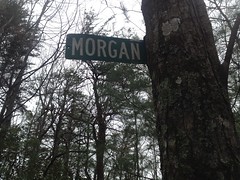
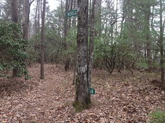
At the north end of the loop, Lucas Road cuts across the north end of the forest.

Lucas Road

There's almost nothing at all on the map to the south, for a long way. There are a couple of WMA's, but they're huge and I don't know if they're open to bikes. I always imagine land like that being dotted with old chimneys, rock walls, and stills. Some day I'll have to get out there and see.

Lucas Road eventually becomes paved, and there are farms to the left and right, all the way to the highway. The first farm was a goat farm, and there were like 300 goats congregated in the southeast corner of the field there, right by the road. They were alternately scared and intrigued by me.

Goats

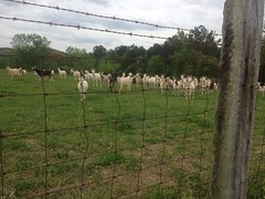
When I pulled up, they all ran over to see me, then when I stopped, they ran away, then immediately turned around cautiously approached at first, then decided I was cool and ran back over.

Ha! Goats.

Plant Bowen is another prominent feature in that part of the state.

Plant Bowen

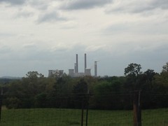
It randomly pops up on the horizon as long as you're generally looking west.

Other than that though, it's all cows, horses, goats, crops and ponds.

Saggus Pond Fields of Something

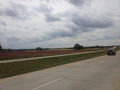
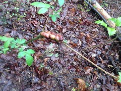
I think one of those fields is cotton, but I don't know what the other is. Fall colors again though. Fall colors in spring. those fields are everywhere up there. Those 2 crops in particular.

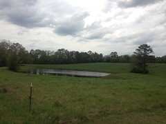
Most of the cow pastures had little ponds too, and the cows were either wading in them or congregated at the edges. I've seen plenty of cow pastures with access to water of some kind - usually a big creek flowing across it, or a large pond notched in between a couple of hills by a small dam. These were very different though, they were almost universally formed by C-shaped levees at the base of a hill. If one was empty, it might make you think it was bomb crater. I'd seen similar ponds in the Armuchee area, though none in cow pastures, just sitting kind-of near a house. I saw a dozen or more that day though, and they all had the same purpose.

I'd also seen a few of them in the woods of the National Forest - one near Bull Mountain, another off of Chester Creek, and another below Horse Range. They were just up in the woods though, and dry. At the time, I'd puzzled over them. They looked like the ones I'd seen in Armuchee, but at the time I could only guess what the purpose of those was too.

Mystery solved! There were apparently cow pastures back in the woods at some point, and the craters were cow ponds. The land around the Armuchee ponds must have also been pastures at one point. I discover stuff in the woods all the time, and I most often end up with new questions. As much as I love that, I love it even more when I end up with an answer.

Between the northwest end of Lucas Road and Braswell, it's all pavement. Like 15 miles of pavement. The mountain bike feels like the wrong tool for the job in that section, but it's not all bad. If you're hungry or thirsty, it's a lot better than being in the middle of the woods.

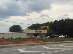
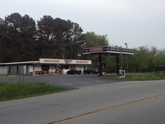
There's a Dollar General...

Dollar General

...and just up the road there's a T&M Store (whatever that stands for) and the nondescript restaurant named "Restaurant" across the street from it.

Last time I was up there I was out of water at the Dollar General. But, that time it was like 102 degrees outside. This past weekend it was only 86, which is warm for this time of year, but generally pleasant. I still had one full bottle and about a third of the other, so I didn't stop.

Near the Davistown community, a truck came tearing around a corner about 100 yards ahead of me, entirely in my lane. No part of the truck was in the correct lane. The driver saw me though, and gave me an apologetic wave and nod after pulling back into his own lane. I gave him a "no problem" wave and nod, and he gave me a "thanks" nod.

It made me smile thinking about how many different things we were able to communicate with just waves and nods.

It's mostly flat for most of that 15 miles, but toward Braswell you climb over Knox Mountain and it's not so flat.

You also pass by Pizza Farm, which always sounds super enticing.

Pizza Farm

One day, I'm going to have to ride from here out to there on my road bike, eat there, and ride back, or something. The place is always packed though. I wonder if I should make a reservation.

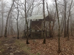
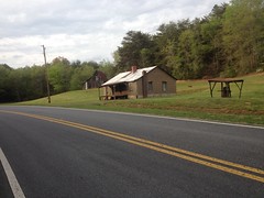
There are a couple of historic building on Knox Mountain Road.

Old Buildings on Knox Mountain Road

And a couple more as you approach Braswell. I thought about taking more pictures, but that would have taken all day.

When I got to Braswell, I had about half a bottle left. It seemed like I ought to be able to make it to Yorkville, but it was also Saturday, and the local convenience store might be open. The last time I did the loop, it was Sunday, and it had been closed, but this time I had a chance.

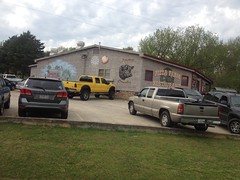
There wasn't anyone in the parking lot, but it turned out that the store was open. It wasn't a convenience store any more though. It was now Richard's Bottle Shop.

Richards Bottle Shop

Hmm... I wondered if they had anything that wasn't liquor or beer. Turned out yes!

Snack

They had a cooler with several bottles of water and even one bottle of orange juice.

Score! I downed the orange juice and refilled my empty bottle with water.

Also... The lady that runs the store had put a hummingbird feeder out front, and there were hummingbirds coming and going constantly the entire time I was there. It's amazing, you never see them, ever. But, if you put out a feeder, a new one will fly by every minute, and then another one will come a few seconds later and chase off the first one.

Actually, when I got there, the lady was walking around the store with a broom up in the air, swinging it at a hummingbird that had gotten in but couldn't find its way out. Apparently two of them had gotten in, one had already gotten out, but the other one was totally confused and had been buzzing around like crazy for the past hour, driving her nuts.

I don't know hummingbird species at all, but usually you just see little green ones with short tails and red chests. This one was totally different. It had a long tail with little embellishments off to either side. I couldn't tell the color though, because my eyes hadn't yet adjusted to the light in the store.

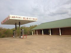
The town of Braswell consists entirely of: a liquor store, a night club, an establishment of unknown purpose with a sign on the door saying no one under 21 admitted, a municipal building (police station), 2 rows of apartments, a two small neighborhoods with like 20 houses each, and The Palace.

The Palace

I have no idea what The Palace is, but last time I rode by it, it looked like it had been abandoned for decades. Since then, it's been refurbished and repainted, but I still don't know its purpose is. My first impression was bingo hall, but really I have no idea.

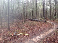
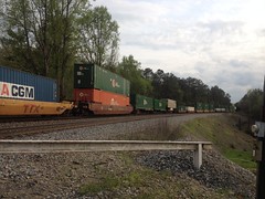
Several trees had fallen across old Skyline Drive, and when I got down to the train tracks, I had to wait for an actual train.

Train in Paulding Forest

I was still feeling strong on the climb over Brushy Mountain.

Brushy Mountain Road

Though, I realized it had been a while since I'd done anything decently long when my palms starting to get sore.

At least 3 turkeys ran across the road in front of me on Brushy Mountain Road and Yorkville Pass. I think it's turkey season right now. You know turkeys - they like to tempt fate.

I made it to the Yorkville Grocery with plenty of water and even some Gatorade left, so I didn't stop.

Yorkville Grocery

At the Y at Goldmine Road, it's safer to hang a right, go behind the cars backed up at the intersection and cut through the Darlene's Pizza lot, than to try to cross your lane of traffic and then cross in front of the backed-up cars. When I did it though, I noticed that the pizza place was closed.

Way back when I was first exploring the area, I kept seeing it open and always wanted to try it, but I always had to get going and kept putting it off. Fortunately, I didn't put it off forever, and on my last exploratory trip, made a point of eating there. It was good too. It made me sad that it was closed, but happy that I'd managed to eat there when it was still open.

Almost done. Just a little kick up Goldmine Road, and Willow Springs Church Road, past its namesake...

Willow Springs Baptist Church Willow Springs Cemetery

And... Dangit, I still had to ride back on the Comet. I'd forgotten about that last time too.

It's like 3 or 4 more miles too, it's not a quick little jaunt.

I was ready to be done when I was done, but I still felt strong. I still had energy, but my hands and feet (and butt) were tired.

I grabbed some dinner at La Cocina, a Mexican restaurant nearby. I think I got the Chili Colorado, but I don't remember for sure. I did hear part of a conversation at the next table, where a guy said: "...he used to work Anne Rice's balls..." and some of the other people at the table hadn't been paying attention, and they were like "What?", "Anne Rice doesn't have balls", and "What do you mean he 'worked' her balls?" It was hilarious. Apparently she used to hold Vampire Balls and it was a big event. I'd never heard about that, but it sounded plausible.

It seems like there's more to tell, but I don't remember it well enough to tell it. I've got to start journaling day-of or day-later. This weeks-later thing isn't nearly as satisfying.

It'll have to do for now though. Busy, busy, busy...

Sunday, April 8, 2018

Springer Mountain

I was on the bike all week - Allatoona, Blankets, and the road, but this past Saturday it rained all the morning, and though I wanted to get in something long, I wouldn't be able to do it on the bike.

Springer Mountain was the obvious choice, as I'd made a half-effort the previous weekend to get up there.

I intended to park at the end of FS877, back behind Bull Mountain, but the last time I was up there, there were controlled burn signs everywhere. They were apparently going to start burning the next day.

Boy did they!

Controlled Burn

Burn!!!!

Feel the burn.

"Blackend is the end..." I was singing that all the way to my destination.

Jones Creek and the various roads back there were good firebreaks, and the woods was untouched just a short distance down 77A, so I lucked out and didn't have to go walking through the char.

I parked past the third ford and headed up the old Jones Creek Road, hung a left at the Little Road sign and whacked up to Bear Hare. At the cairn, I hung a right and followed the trail up Saddleback Ridge. It was easier to follow this time, and it didn't look as indistinct as it had the previous time. I guess it was familiar to the back of my mind, or something.

There are several pink ribbons up there too, to nudge you on through the less distinct sections.

Pink Ribbon on Saddleback Ridge

Above the ribbons, the trail is a lot more trailish.

It passes through a bit of rhodo jungle.

Saddleback Ridge Trail Through Rhodo

And skirts a lot of rocks.

Saddleback Ridge Trail Through Rocks Rocky Springer Mountain

Again, I saw indications of horse and Ranger traffic, but nothing else. No bikes. No casual hikers.

Last week I'd wondered if the trail sidehilled to the little gap between Springer and Ball Mountains, or if it just led straight up to the top of Springer.

Turns out it heads straight up to the top of Springer, directly to the Southern Terminus of the AT.

AT Southern Terminus

When I got there, there was a couple taking a break. They looked like through-hikers, coming up from Amicalola. They were both smoking, they had a cute little dog with them, and they had a lot of gear. It was one of those where they either really knew what they were doing, or they really didn't know what they were doing. I couldn't tell which.

I didn't stop to find out though, just said a quick hello and took off towards the Springer Shelter.

AT Near Southern Terminus

I'd been there twice before, but never really looked around much, and I figured "hey, I'm in the area..."

There are 2 privies.

Southern Springer Shelter Privy Northern Springer Shelter Privy

There's a bit of a garbage dump behind the southern privy.

Garbage Heap Past Privy

There's a bit of a group-camp with a bear-box nearby. Then there's the main shelter.

Springer Mountain Shelter

It has those cables that you can use to hoist your gear into the air. I can't remember what those are called now. There was also a bear box nearby, in case you trust it more than the cables.

A super old and busted sign pointed the way towards water.

Super Old Water Sign

And the little creek was deeper and wider than I expected for how close to the summit it was.

Springer Shelter Water Supply

Past the creek there were 6 or 8 more campsites along the trail that wound back south around the top of the mountain.

There was a veritable maze of trails up there leading between the various campsites and structures, and I made no effort to decode them, except for the main trails. There could easily be one leading down the mountain in some odd direction that I just didn't see. If there is, maybe I'll discover it some day, but not that day.

A little further on I picked up the Benton MacKaye trail...

AT and BMT

...and took it in the direction of Ball Mountain, past the memorial.

Benton MacKaye Memorial

The BMT is really grassy up there.

Grassy BMT

It was also super, super foggy.

Spooky Haunted Forest

I think the only times I've ever been up on Springer Mountain, it's been in almost the exact same conditions. Super foggy, wet, and cold. That day was no different. Earlier, I'd been climbing and it had kept me warm, but now that I was just milling around on flat ground, the chill was setting in, and I had to put on my jacket.

All I had with me was my rain shell, but it turned out to be plenty. I even unzipped it after a while.

I planned on taking Ball Mountain Ridge back to the truck. I'd heard there was a trail leading down it a few months ago, allegedly popular with the Rangers. I found the trail straight away, but I wondered if there wasn't another trail leading over the top of Ball Mountain to FS42. It seemed like there might be, considering that the Rangers generally appear to avoid the AT, BMT, or other major trails, except to cross them. I didn't find anything, but it's possible that something more distinct might stand out in the summer.

The trail down the ridge there is really similar to the one running up the ridge to Springer - steep, alternately well defined and indistinct, randomly ribboned, and apparently used by the Rangers and riders on horseback.

There aren't too many notable features though.

There was this one gnarly tree.

Gnarly Tree on Ball Mountain Ridge

And I saw some kind of black salamander up there.

Black Salamander

I felt kind of sorry for him though. He couldn't have been further from water, and he was heading up the ridge even further away from it.

Oh, yeah, there is one very distinct feature of that trail. The Morgan Dairy sign.

Morgan Dairy Sign Upper Rear Morgan Dairy Sign Upper Front Morgan Dairy Sign Lower Front Morgan Dairy Sign Lower Rear Morgan Dairy Sign

It looked like someone had cut a Morgan Dairy Road sign in half, notched off the rounded edges, and hammered it into the tree there. I imagine, in antiquity, Morgan stuck out of one side, and Dairy out of the other. It looked like maybe one side had fallen off though, and someone had jammed it (backwards) in between the two trees there.

So far, I've seen Silver Dollar Road, Farm Road, Little Road, and Morgan Dairy Road signs on various trails leading up into the general Jones Creek watershed. I really hope I run into someone who knows the story behind these some day.

The salmander was the only wildlife I saw all day. I haven't seen much in the way of wildlife yet this year, actually. I guess it's not quite spring yet, up north, and up high.

There were purple flowers popping up here and there though.

Purple Flowers

So, it may be spring up there pretty soon.

There's one spot where the ridge bends to the left, the trail isn't super clear there, and it's easy to get wide. Then, down near the bottom, the trail disappears suddenly, and it's easy to get off to the left if you're not visualizing the terrain well enough. Or, at least that's what happened to me.

At the very bottom, there's a bit of a trench, where the trail was more heavily used way back, maybe as a skid, or maybe just for whoever lived back in there to get up into the woods.

Ultimately, I ended up in the food plot at the end of FS877, right where I wanted to be, and my truck, with its heater, was a welcome sight. I'd gotten a good chill up on Springer, and though I felt OK, I really hadn't totally gotten over it.

Driving out, I passed a guy with a pretty loaded-up bikepacking rig, pumping water out of the creek into a bladder. I wondered where he was coming from and where he was headed. I'm not aware of any popular routes that would put you on 77A or 877.

Adventure! I guess.

I ate at Burger and Shake in Dawsonville, but I didn't get a burger or a shake. I got a chicken sandwich instead, and I think that I prefer their burger. I just forgot to order the shake, and only realized that I'd forgotten as I walked back to my car, in the cold, misty, drizzle, and didn't feel like turning around to go back for it. A little further down the road I saw the sign for a Marble Slab Creamery, and having warmed up by then, decided that I must have a shake. It turns out their shakes are $7. My goodness. They made a joke about a $5 shake in Pulp Fiction. "That's milk and ice cream, right? And it's $5?" No, these days, it's $7.

It was a pretty good shake though. I'll give them that.

It rained again last night, so today I'm sitting around the house working. Looks like it's going to turn into a no-bike weekend. I guess, technically I could still go ride later, if the trails are open. The family's on their way home from vacation in Gulf Shores though, and I'd like to hang out with them this evening, so we'll see.

Decisions, decisions.