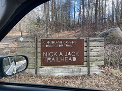
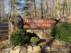
Since last exploring the Cloudland Canyon area, I discovered that there were, in fact, 3 additional trail systems up that way - Moonshine, Durham, and the Lula Lake Core Preserve. Durham wasn't officially open yet, but the others were. It also looked like the CCT continued north from Nickajack, at least to the community of Lookout Mountain, at least according to the map.
Hmm...
On it!
A few weekends ago, I headed back up.
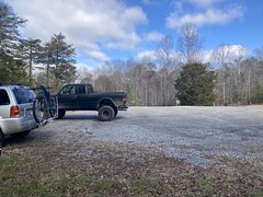
I'd planned on parking in the Lula Lake Lot, riding north and hitting the Moonshine stuff, maybe continuing on up to Lookout Mountain, then spinning back and hitting the Core Preserve. When I got there, though, the lot was full. Like, there was a sign saying that the lot was full, and don't park along the road.
Interesting...
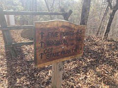
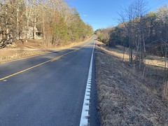
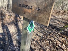
The CCT allegedly kept going up to the community of Lookout Mountain though, and it looked like I could figure out where it teed into the road up there, if I looked. Maybe I could park there and ride south. I headed up the road to figure all that out.
It turned out that what was labeled Lookout Mountain on the old topo map was actually Covenant College and a bunch of neighborhoods. The trail appeared to go through or skirt a park with a bunch of soccer fields. I also found where it crossed the road.
It looked like there were even more trails going north.

So, as usual, I'd have more to explore at some future date.
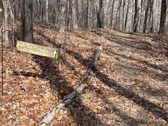
It also turned out that there was a network of trails in and around the park.

The "No Motorized Vehicles on the Trails Please" part of the sign even suggesting that non-motorized vehicles (like bikes) were allowed on the trails. So, again, even MORE to explore at some future date.
I ended up parking up near the road, getting changed, and running into a couple of ladies who had been out running earlier. They answered a few questions about the local system and pointed me to a connector leading to the lot from the CCT. Nice. I wouldn't have to go back out to the road to get on it.
And get on it, I did!
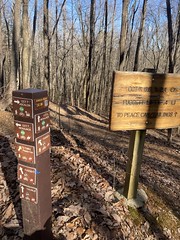
The CCT up there was more of that fast, benchy singletrack that I'd come to expect. I basically skirted the outside of the park before joining a gravel road. A sign said "CCT that way", but "that way" just led out to the main road and a gravel parking lot.
???
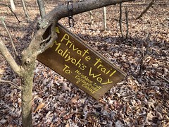
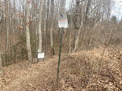
There were a couple of side trails though, so I checked them out, and it turned out that one of them was the CCT, though it was completely unmarked and looked more like a fire road than a fancy new bike trail.
I managed to explore all of the little side trails though, and all of them appeared to go to the same house, which was strange. There was also a jump line, and the jumps looked super tame. I was confident that I could safely ride them, but the last thing I needed was to be wrong and ruin my day. So, I figured I'd hit them when I got back, if I still felt strong.
The woods back there appeared to be an old ropes/climbing course.
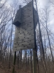
I couldn't really tell if it was truly abandoned though. Some of it looked still usable, if not still in use.
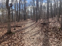
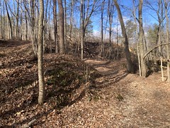
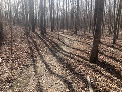
The trail through there was more of that super fast, nontechnical bench action.
I managed to miss a turn somewhere in there and end up heading back north for a while before running into some ladies who knew where they were. They gave me good directions though, and I managed to get back on the CCT pretty quickly.
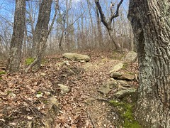
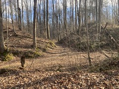
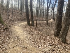
It was pretty abrupt how less well traveled the CCT was south of the college system.
Still pretty fast and fun though.
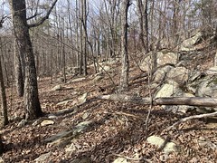
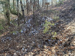
Somewhere in there I ran across some ruins, but they were kind-of spread out and difficult to get a good photo of.

I could imagine in the summer, you might miss them entirely.
At a point, I crossed a right-of way, and I swear it was almost entirely downhill for the next several miles. I saw the White Lightning Trail off to my left, which was part of the Moonshine system. This was encouraging. I was on the right track. I eventually saw other trails too. All very encouraging.
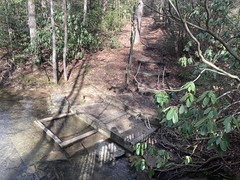
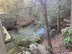
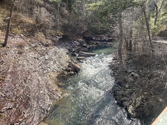
The only creek crossing was at Gerber Branch:
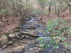
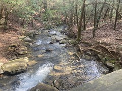
It had that Appalachian creek feel to it, but it made me wonder of Lookout Mountain counts as even being part of the Appalachians. I guess it must be. It's not part of the Blue Ridge or Cohuttas or anything, but it must still be part of the Appalachians, right? Though Sawnee isn't... I'm sure the internet knows, but I'm too lazy to look it up right now.
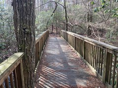
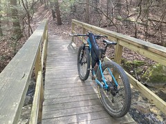
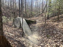
Further on there was a cool bridge thing that led up onto a rock, but stopping to get that photo robbed me of the speed that I needed to get over the tricky roots and rocks at the top of the next hill.
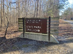
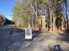
It was a bit of a climb up off of the creek, but it wasn't too far from there out to the road that I'd driven in on. Just down the road, like close enough that I could see it, was the lot that I'd wanted to park in. I rode down to it, hoping to see why it was so busy. I figured there might be an event going on, but it turned out no. The trail system is only open on the first and last weekend of each month, and to park in that lot, you had to purchase a permit online for $5. You could also buy a permit from these 2 (stoned) guys sitting under a pop-up tent, but only if there was room in the lot at that exact moment, which there never was.

I talked to the 2 aforementioned guys for a few minutes, and got the 411 on the system. All trails were open to bikes, and at the north end, there was a waterfall, which appeared to be the main attraction in the area. Since I wasn't parking a vehicle there, I was welcome to ride whatever I wanted, free of charge.
Awesome!
And, what luck, to have gotten there on a weekend that they were actually open.
They even gave me a map of the area. It turned out to be the same as a map that I had printed online, but it also had a bunch of route descriptions on it, which my map didn't have.
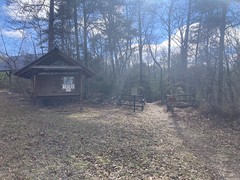
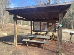
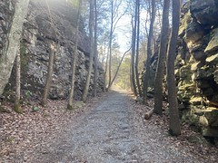
The "trail" to the falls was really just a gravel road. Part of it was paved, even. It looked like, maybe in the past you could just drive down there, but recently they closed it to vehicles. There was what looked like it used to be a parking loop for a picnic area, with all the standard trailhead amenities.


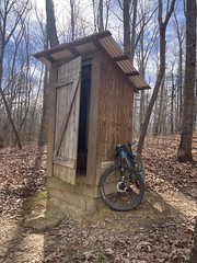
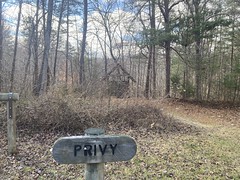
My favorite thing was this privy:
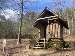
#2 only.

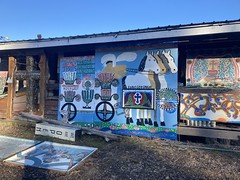
That lichen-covered See Rock City birdhouse thing was also cute. When I rode by the maintenance shed, I could see several more new-looking ones inside. Spares, I guess.
Down the road a bit, there was a cut going back left, lined by lego cliffs on both sides.

It looked like a former route of the road. It was kind of narrow though. Maybe they needed to widen the road for vehicles and it was easier to reroute it than to blast all of that rock.
Hmm...
I passed like 100 people walking in both directions, along the road. So many that I really had to just roll it back to leisure mode and not even try to "ride". The falls seemed to be a pretty popular destination.
I eventually crossed over Rock Creek...

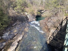
...and rode through a really deep cut.
This had to have been a railbed at some point. There's no way they'd make a cut like that for a wagon road.
When I made it through the cut, there were a bunch of picnic tables lined up along the old railbed ahead of me, and it was pretty open to the left.
I wasn't 100% prepared for how spectacular "the falls" was.
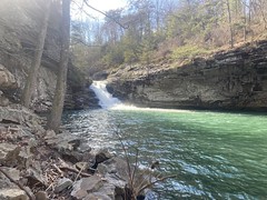
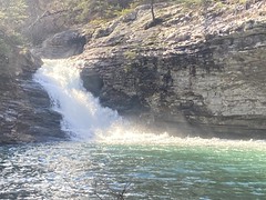
In Georgia, nearly every falls is a sliding falls. It's pretty rare to see water pouring over the edge like that. Occasionally, it'll pittle over the edge of a big cave or something, but blasting over the edge like that is just about unheard of.
Wow!
The lake that it spilled into - Lula Lake, I guess, was equally beautiful.

The photo doesn't do it justice. The water was so beautifully green! And off of that giant lego rock overhang behind it, dozens of little trickles run off of the overhang and drip into little permanent splashes in the lake. I abandoned my bike, climbed down and just stood there taking it all in for like 20 minutes.
Little did I know though...
Further downstream was an even more spectacular falls!
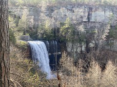
This one was like 5 times the height of the other one.
There was a trail leading to the bottom, but it was kind-of long, and looked pretty sketchy in bike shoes, so I didn't risk it.
Again though, I just stood there looking at it, amazed, for like 10 minutes.
There were a bunch of other trails in the park, but looking at where they teed into the main road, none of them looked super fun to ride. They were either really steep, or stair-steppy, or super narrow. They looked fun to hike. Less fun on a bike. I would have to come back on foot, for sure.
As I headed back, I spotted a lady with a green vest and some informational-looking stuff on the table next to her. She seemed like she might be able to answer some questions.
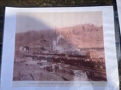
First question: Was this a railbed?
Yes! And she had photos!
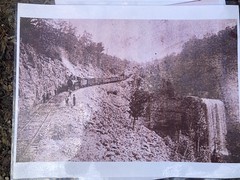
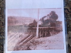
The train picked up coal from the 5 Points area, ran it down into the valley below, and eventually to Chattanooga and who-knows where else.
She even had a photo of one of the coal washers up by the mine.
When I got home, I tried to see if I could make out the entire old railbed on Google Maps. It turned out that the terrain layer for that area is based on lidar data, and it was easy to follow the railbed up from the valley, all the way to 5 Points. I wonder how much of that is on public land.
My second question was: Why is the water so green?
The Little Colorado, for example, is super blue from the travertine deposits that it erodes. I expected an answer like that. Some mineral. Apparently the water isn't usually that green. It turns quite brown in the summer. She didn't really know why it was so green this time of year. I'll bet there's a reason though. Probably some mineral. I'll have to research that a bit...
There were 2 ladies and a dude hanging out, also asking questions, and we all got to talking. They all live in Chattanooga, and urged me to move to Chattanooga because of how fun it is to live there. We also got a good bit of the info lady's life story. She apparently moved around quite a bit.
I eventually started getting a little cold and had to get going, so we all said goodbye, and I took off back into that deep railroad cut, which was really freaking cold.
When I got back to that pop-up tent in the lot, I talked to the 2 stoned dudes again and they told me that they were wrong earlier: I actually was supposed to have paid them $5 for a permit, even if I wasn't going to park, but not to worry about it. It turned out that I actually had 2 $5 bills on me though, so I gave them one of them anyway!
I also talked to them about the CCT heading south. On a map I had at home, it looked like it went all the way to Nickajack Road, but their map didn't extend that far south. They assured me that it did though, and that it was, in fact, open to bikes, and that my $5 covered the permit that I needed to ride it.
Ha!
So, I rode back to that picnic area earlier, and crossed the Bridge With the Most Dangerous Steps of All Time.
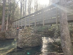
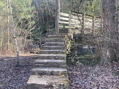
Seriously, those steps are like 8 feet high and fairly narrow. The bridge is even narrower. When I got to the top step, I had to adjust my bike on my shoulder to fit through the space, and nearly stepped over the edge when doing so. It's a long way down.
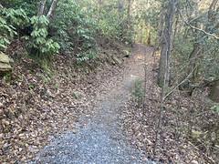
The trail on the other side reminded me of the Pine Mountain trails. Open to bikes, but not specifically intended to be ridden.
I don't ride trails like that too often these days though, so it was a lot of fun, if slow going.
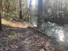
The run along the creek was a real treat.
I had to make several turns to stay on the CCT, but they were all well marked.
The trail kind-of alternated between fast and fun and very technical. I eventually popped out on Nickajack Road, but looking back at the trail... If I didn't know it was there, I wouldn't know it was there. I don't remember any little carsonite signs or anything. There was certainly nothing up by the road.
I took roads back to the lot, then continued up a bit and started backtracking on the CCT. I'd done all kinds of stuff, but still hadn't actually ridden the Moonshine Trails. It was finally time to do that.
I first rode Firewater, which was a blue trail, and yeah, it was definitely more challenging than the CCT, but not super difficult. It was appropriately blue, I'd say.
About halfway around, there were some weird, discarded concrete footings lying near the trail.
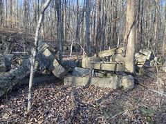
I guess a road must have led out to that spot at some point.
Off of Firewater, there was a black side trail called Bathtub Gin. I took that, then rode another lap of Firewater without taking it the second time. Bathtub Gin was definitely more challenging that Firewater. Appropriately black.
Coming off of Firewater the second time, I ran into a guy with a dog and we talked a bit. He said folks usually climb the CCT and descend White Lightning from the north. It's a good climb, but obviously way more fun to descend. It was the only trail left that I hadn't ridden though, and I needed to be heading back to my car, so I figured I'd climb it anyway. He was also planning on climbing it that day, so I followed him for a while before he eventually let me by. It was funny, there were a bunch of switchbacks, he was never more than 1 switchback below me, and his dog kept cross-cutting them up to where I was, then waiting for him, then cross-cutting again. It was fun to have a (friendly) dog chasing me.
I eventually got back on the CCT and started heading up towards the college. I had to stop for something though, at some point. Maybe to put my windbreaker on or something, and the guy and his dog caught me when I was stopped.
Him: "I have a crazy idea... I'm parked down at the church, past the Lula lot. You want to bomb all the way back down there and I'll give you a ride back to your car?"
Me: "Heck yeah, let's go!"
And, man did we bomb back down. He was totally right, White Lightning is super, super fun to descend. We switched off leaders several times, and it was also super fun to follow someone. I don't get a lot of changes to do that these days.
I want to say there were 2 little kicks somewhere down in there, including one that had that weird bridge-to-rock thing on it. That time though, since I didn't stop to take a picture, I was able to carry speed into the tricky roots and rocks at the top of the next climb, and make it up. Ha!
When we got back to his car, he introduced himself. He was Corby and his dog was May Bell. Not Mabel, but May Bell. He lived up north in Fairyland, which is actually a place. I didn't make that up. A bunch of the neighborhoods up there are named after Rock City attractions, including his.

We had a great time talking about all kinds of stuff on the way back. Then he dropped me off at my truck and headed off.
Super cool guy, I hope I run into him again!
Looking at strava, I hadn't even ridden 30 miles, but somehow it had taken all day. That's how it is when you're exploring, though.
I was starving, and I knew exactly where I wanted to eat - The Lookout Mountain Pizza Co. I'd stopped by the last time I was up there, but they hadn't opened up for the evening yet. I figured they'd have to be open by the time I arrived, so I headed down that way. It was a pretty straight shot too. I was on Scenic Hwy, and they were also on Scenic Hwy, just a ways south.
On the trip down, I realized why it was called Scenic Hwy, or more specifically The Lookout Mountain Scenic Parkway. There are some pretty breathtaking views to the west from right along the road. I'll have to ride it some time, and take some photos.
I eventually arrived at my destination...

And, yes, they were open!
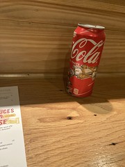
Being alone, I sat at "the bar", which faced a wall, but from where I sat, I could see the kitchen pretty well. They had a proper wood-fired pizza oven going. Hmmm... This might be pretty good.
They brought me a tallboy coke to drink.
Followed by a damn good wood-fired pizza.

Man, it was good! It was so good that the next time I was at Siracusa's I apologized to Dave for cheating on him, but figured it was better that he hear it from me than from someone else. IDK if I can describe it right, but wood-fired pizza tends to form thin little almost-burned bubbles, and they're a little bitter, but if you eat one with a bite of sauce and cheese too, it all works very well together. It was like that.
Mmm, so good.