Sunday, December 30, 2018

Mulberry Gap Fireball Fiasco

Today I rode Mulberry Gap's Fireball Fiasco ride. It was basically a poker run, with a few variations. We got a card for hitting each checkpoint, as well as for various weird activities, and for how quickly we finished. We then had to make the best 5-card hand out of how ever many cards we got. Best hand wins. If you got more than 5 cards, then you had a better chance of being able to make a good hand, but there's still a significant amount of luck involved, so it's really about the journey, not the destination, and just about having fun, of course.

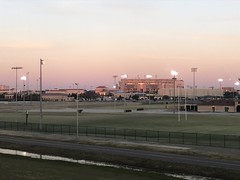
I got up at 6:30, left at 7, and made it up there by 8:30. The ride started at 10. Most everyone had spent the night on premises, and was already there, eating breakfast, when I got there.

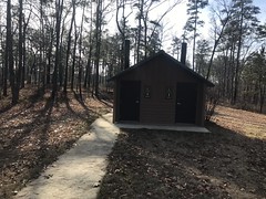
Their Christmas tree was still up, and man what a tree!

MGap Christmas Tree

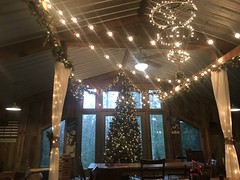
The barn was still generally adorned in holiday cheer. Everybody there seemed to be in good spirits too, despite the terrible weather we've had, basically since Thanksgiving. It was dry a few days ago, for one day. I took advantage of that on the FS roads in Alabama. It started raining again that evening though, and has been since. It was 49 degrees on the way in to Ellijay. Probably colder on the north side of the ridge there, and misting steadily. At higher elevations, it was foggy.

We all got kitted up and gathered outside of the barn at 10 sharp. There were a ton of people that I'd probably ridden with once or twice, as well as some good friends including Mark Baldwin, Marc Hirch, and Norma Rainwater.

Norma!!!! Hadn't ridden with her in like 6 years. She was there with her friend Linda, who I'd ridden with a few times. Johnny, surprisingly, wasn't there. I didn't realize they existed apart. I couldn't think of a time when I'd seen one without the other.

Let's get down to business though...

The first activity was a shot. Actually, about 1/4th of a shot. You had 3 options - one small shot of Fireball Canadian Whiskey (the traditional option for this ride), a small shot of George Dickel Bourbon chased with a shot of pickle juice, or a small shot of straight apple cider vinegar.

If you poured 100% of the alcohol that I've consumed in my life into a shot glass, it would probably just reach the rim. I don't drink, as a rule. But, I have made a few exceptions over the years. I've sipped a few drinks that were offered to me, to avoid offending my host, and there have been a few games or activities where the prize or punishment was a sip of something or other. Eg. I took a sip of Cinnamon Schnapps after finishing the Firewater 50 way back, and I sipped some crazy drink they make out of grain alcohol and sugar cane in Brazil once.

That said, the Fireball still seemed like the best option. Pickle juice would certainly induce vomiting. Cider vinegar was almost as likely.

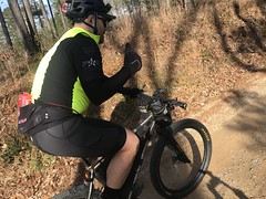
Fireball down. "Holeshot gets the win!"

And I was gone!

The first checkpoint was Holly Creek Picnic Area, and I probably got there 3 or 4 minutes before the next group.

Holly Creek Picnic Area

Mark, Marc, and Chris beat me back to MGap, but then apparently screwed around down by the cabins for a while. When I finally left, I thought they'd left before me, but they hadn't. I was ahead of them for the rest of the day. Ahead of everyone, it turned out. I didn't realize this though, and only found out at the end of the day.

But, back to the action...

When I got back, I had to take another little shot. Fireball again. And, I had to ride a little clown bike under a limbo stick twice. The guy ahead of me didn't make it, so I figured I ought to duck down a lot, which I did, and made it! Turned out I made it by like 6 or 8 inches though. One advantage of being short: clown-bike limbo is easy.

We had to pick up 2 checkpoints on the next leg of the ride. The first was Gates Chapel Road and FS241:

Gates Chapel and FS241

I'd taken Shakerag over to Gates Chapel, then headed toward Barnes Creek Road (FS90) to the next checkpoint.

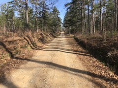
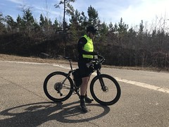
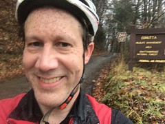
It was still raining lightly, and super wet, but the temps were probably up to the mid 50's. I'd been comfortable all day, even tearing downhill, in my standard kit, knee warmers, and windbreaker. I'd brought arm warmers, in case I found that I needed them, and even brought my hunter orange vest in case I found that I needed more wind-breaking. But I never needed either. I was super comfortable, even in the rain, all day.

My feet were in exceptionally good shape. My folks had bought me 2 pairs of Smartwool Hike Liner Crew socks years ago. I finally wore them out about 3 years back, went to REI looking for more, and was disappointed that they no longer carried them. I bought 5 pair online for Christmas though, and finally got to wear them today. They are, hands down, my favorite socks. Very thin. Adequately insulating. Very windproof. They work great in all weather conditions. With no shoe covers, they work into the low 30's. With shoe covers, down into the teens. Wet or dry. I didn't think about my feet once today, other than to write this paragraph.

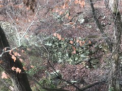
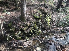
As dismal as the conditions were, there is a certain beauty to it, if you're in the right mood.

Dismal but Beautiful

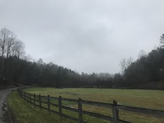
The creeks were all very high too. Every little stream was clear and moving, even the ones that are usually little trickles. Again, easy to enjoy if you're in the right mood.

I was. I'd have taken more photos if I wasn't on a mission!

Next checkpoint: start of the P2 Grasstrack.

P2 Grasstrack Start

Got it.

I ran into some random dudes riding around in the lot while I was up there too. They weren't doing the ride though, just out riding by themselves.

First non-participants I'd seen all day. I hadn't seen anyone on the road. Nobody was milling around their cabin. It had been unusually quiet.

I took FS90 up to Holly Creek Gap and bombed down CCC Camp Road back to MGap from there. There was a couple walking their dog on that road. I hollered to them, but they couldn't hear me, so I slowed down to their speed and hollered again. They heard me the second time, but it still startled them a little. We all laughed.

Next activity: another (groan) small shot of Fireball.

And after that, I had to ride the clown bike again, this time with one hand, as with the other I had to ring-toss an over-inflated tube onto a weird 5-post thing, without riding past some cones about 8 feet away from it. Those clown bikes are hard to ride, especially in clipless shoes. I ended up riding over the tube and getting it caught under the bike. Reset. Better luck on the next try. Kind-of did it. Got the tube around one of the smaller posts. 1 point. Good enough.

Next checkpoint: Bear Creek Overlook.

I trucked it right back up over Holly Creek Gap and on up past Barnes Creek Falls.

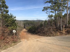
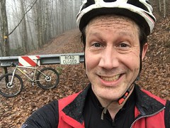
I guess I didn't mention earlier. 100% of the ride today was FS roads. No pavement. No trails. Just dirt roads. I think we were technically allowed to ride trails, but it would not have helped reach the checkpoints any faster, and the tread would have been terrible. I rode 100% FS roads. I think Mark, Marc, and Chris hit P2 at some point, but it wasn't any fun.

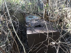
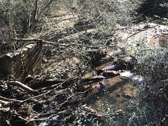
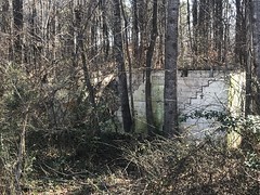
Somewhere on FS68 (I think), there had been a landslide on the downslope side of the road. The crew was still up there, repairing it with rock and concrete.

Landslide Repair

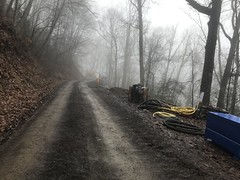
I'd seen another, similar slide staring to form near Emory Creek earlier that day. That's another thing this much rain brings. Whack-a-mole landslides. We've had a couple of years of that in a row, recently. Some part of the year has been really wet, and roads have gotten washed out left and right.

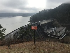
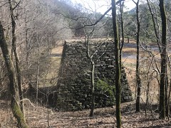
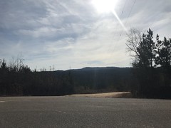
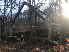
Yay, Bear Creek Overlook.
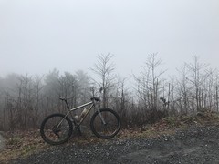
Bear Creek Overlook

Lovely view today.

The traffic had really picked up on the way up there. I must have gotten passed by at least 15 trucks/jeeps, going one way or the other. One had a mulberrygap.com sticker on the back, so it might have been someone involved with the event, but I didn't see who, or talk to them.

On the way back down, I probably didn't pedal for like 3 miles. I couldn't remember ever bombing down that particular route. 68 to Holly Creek Gap, then down CCC Camp Road to MGap Road. I got behind one guy from Missouri with a hitch rack who made an effort to keep from slowing me down, but when it got less twisty, I still pulled past him. No idea how fast I was going, but I bet it was high 30's or low 40's.

Super fun.

I also passed Mark, Marc, and Chris on the way back, only then realizing that I was ahead of them. I passed one lady too. Turned out that the 5 of us were the only ones who'd even attempted the final checkpoint.

Turned out we rode right at 30 miles total. I was glad to have been able to get in so many miles. That's long for such a wet day. It didn't seem like that many though. I imagine because of all the backtracking.

I dreaded another shot, and fortunately, didn't have to take one!

All done.

I got cleaned up and headed to the barn for the feast. Potluck supper time. I'd brought a giant tray of bulk chunk mac and cheese. Someone else brought a similarly giant tray of lasagna. Between the two of those, and some cool cheese that had some sprinkles on top that made it taste like a piece of pizza, I was well nourished.

I also had a note on my truck that said that my brother had arrived. He was in cabin 2B, and was spending the night up there for the next 2 nights. I ran down and got him, and we all hung out in the barn for a while.

It was eventually poker hand time, so we got our cards. Despite having the most cards, all I could come up with was a 6-high flush. Only good for 4th place. Dangit.

First place got all kinds of swag. Second and third got hats and scarves. Forth, only bragging rights.

Well, at least I have those.

I'll be up there again tomorrow night, for New Year's. I should have the family with me too. Hopefully the rain will hold off enough for the New Year's Day ride.

Fingers crossed.

Saturday, December 29, 2018

Cooper's Furnace Day Use Area

Billy called me yesterday, right before I left work to see if I wanted to go running around in the woods today. His in-laws were apparently going to be in town, and give him and Megan a break, however momentary, from raising their little ones. It took me a while to get back to him, but late last night we firmed up some plans, and he met me at my place around 8:30 with Adventure on his mind!

The destination I had on my mind was the Cooper's Creek Furnace Day Use Area, home to both Allatoona Dam, and the Cooper's Iron Blast Furnace.

When we got there, it turned out that the front gate was closed for the season. So, we ended up not being able to park in any of the lots, but there was a clear enough spot up the road a ways, and we didn't mind walking in, so our plans weren't totally ruined or anything.

On the walk in, a guy passed us in an F-250, windows up. Even with the windows up, the asphyxiating aroma blasting out of his rig made me wonder if Snoop Dogg had recently taken up farm work.

My god!

It's everywhere these days. I can't walk through the Wal Mart parking lot without getting knocked down twice on the way to my truck.

On approach, the Cooper's Furnace towers over you like an Aztec temple.

Cooper's Iron Blast Furnace

It's remarkably well preserved, compared to the other, smaller, and even younger furnaces in the area. I'm not sure what to attribute that to, especially considering it's size, and output capacity - like 9 tons of iron a day or something. I'd think Sherman would have made a point to destroy it as completely as possible.

You can't get too close to it these days, at least not legally, but it is certainly impressive.

The other impressive engineering feat in the area is the Allatoona Dam.

Billy At Allatoona Dam

It was built in the late 1940's to "hydro-electric up the whole valley" and it's the only dam I've been to where you can walk up so close to the base. I haven't been to all that many massive concrete dams though. Lanier and Hoover are the only two that come to mind. At Lanier, you can barely even see the powerhouse. Hoover is several levels more amazing, but we could only walk around on top of it. It's way more impressive when it looms over you.

While we were there, we could see across the river into the parking lot on the other side. A family drove up in a pickup, bed full of garbage bags, and proceeded to unload them into the dumpster at the back of the lot.

Ha!

Garbage day!

There's a whole system of trails in the area too, and we got to exploring them directly.

We first followed the signs for the Nature Trail, but ended up not actually taking the trail itself at first. Instead we followed this super steep gravel road up to the Allatoona Lake Project Management Office/Visitor's Center, and a nearby overlook above the dam.

There was a surprisingly clear lake along the way.

Nature Trail Lake

And the view of the dam from up there was pretty amazing too.

Allatoona Dam from Overlook

I liked it better from below, but still... Pretty amazing.

From there, we followed the surprisingly well built, and surprisingly technical Laurel Ridge Trail for a while, picked up a connector at the end of it over to the Pine Mountain Trail, and ran into a bunch of mountain bikers in the Pine Mountain Lot.

What? Was there a bike trail in the area?

Turns out yes!

Pine Mountain East is apparently open to bikes 2 days a week. Wednesday and Saturday, I think. Don't quote me on that though, I need to double check the Wednesday. I'm pretty sure about the Saturday though, as today was Saturday.

They took off, we backtracked, and picked up the Cooper's Furnace Nature Trail. I think. Or maybe it's just the Cooper's Furance Trail. I need to double-check that too. I should have taken a photo of one of the fifty or more maps posted all over the place.

Whatever that trail is called, it follows an old railbed that leads up from the furnace, through the draw there, and up over the ridge. I assume from there it follows modern Hwy 249 (or whatever the local road name is), but I couldn't find any direct evidence of that, or info on the web about it.

A couple of old rock walls remain though.

Old Railbed Rock Wall Old Railbed Rock Wall Near Switchback

That second one is near a switchback.

The switchback is odd though. It's clear, from the grade, where it ends, but more trail continues beyond the end of the switch. There's also a little trail paralleling the old railbed. It made me wonder if there's a mine further up, and the rail cars might have been loaded from the trail above the track.

There's a little info about the rail in the park, but not much. It must have hauled ore in and ingots out, but it's not clear which direction it went with either. There was more old railbed on the way in and out of the park too. I know the old Iron Belt used to run a bit to the west. Presumably this rail was a spur of that, but it also looks like it heads north on a totally different route, so who knows?

There was a cool sign nearby too. The tree was eating it.

Tree Eating a Sign

It had pulled through the nails, and the tree itself is now the only thing holding the sign in.

We took another little trail up above the furnace.

Cooper's Furnace from Furance Overlook

Ore would have been run up there on another rail spur, unloaded, and then hand-trucked over a wooden bridge from about the point where we were standing to the top of the furnace, and loaded in from the top.

There would have been a massive water wheel in the Etowah itself, driving bellows and who knows what else. Apparently there was a whole iron works there at some point, not just a furnace. I wonder if there are any photos, drawings, or diagrams of that somewhere...

We needed to be out by about one, so Billy could get back by two. So, we didn't get to hit every last thing there. But, we still had a satisfying hike - 6 or more miles, and we saw a ton of cool things.

Traffic was unusually heavy on the way back, but we still made it home on time. I was starvin like Marvin when I got back though, so the girls and I grabbed some late lunch at Willy's. So satisfying.

Tomorrow's the Fireball Fiasco at Mulberry Gap. One part ride, one part weird games, one part potluck. I just made a huge dish of Bulk-Chunk Macaroni and Cheese. It's traditionally been a hit with my extended family. I'm curious to see how well it goes over among the general public.

Thursday, December 27, 2018

North Cooper Lake Park

I went for another walk at North Cooper Lake Park again today. Just needed to do something quick to work some of yesterdays miles out of my legs. My map had plenty of little unexplored spurs on it, so I figured I'd hit as many of those as I could in an hour.

It looked like somebody had been out there with a leaf blower on the main trail, and one of the spurs that I'd noticed the previous day looked a little more leaf-blown than before. Hmm... I followed it.

And, man, the junk I found.

One hour something...

One Hour Something

Appliances galore.

Old Oven

A car, half buried, with a tree growing on top of it!

Half Buried Car With Tree Growing on It

An old homemade trailer.

Trailer

The sheer volume of appliances and other large items suggested more than a casual dumping ground. Had this place been a landfill?

As it turned out, I didn't have to wait long for the answer. I heard a leaf blower in the distance, and before long, came upon the guy wielding it. He confirmed my suspicions. Yep. It had been a landfill. Some of it had been buried long ago, but more recently, the dirt that was excavated from the ball fields on Concord (Brinkley Park?) had been dumped there to cover up what was still exposed. With that knowledge, a bit of quick Googlage resulted in additional confirmation when I got home.

I got a shot of the old water treatment building too.

Water Treatment Plant

When I'd passed it in the woods though, it looked like the land had been cleared, and I wondered if it had been demolished the day before or something. Turned out I was just looking in the wrong place. I'd mentioned that I thought it was gone to the other guy though, and I imagine he might think that I'm crazy.

There are still more trails out there. It might take another trip or two to hit them all. Fortunately it's not a huge piece of land.

Wednesday, December 26, 2018

FS500

The night before Christmas Eve, I was at a Christmas Party, and I got a text from my brother indicating that he'd be at Cochran Mill the next day, at 10AM, and did I, Justin, Glen, and/or Howie want to meet him for a couple of hours. I didn't get a chance to text him back, but it was adequately dry the next morning, so I met him, and we rode for a couple of hours. Justin met us out there, and we did basically the second half of the ride with him too. During the ride, he mentioned wanting to do some gravel soon, and I was like "sure, I could do some gravel, just let me know."

Christmas evening I get a text, like 9:40PM, about riding some gravel in Alabama. Intriguing. I'd dumped the USFS GIS data for most of Alabama into my trails site some years back, but hadn't ridden any of it to speak of. I didn't even know how many miles one could reasonably ride out there. He had 40-50 in mind. All right!

8AM the next day, we met at the Post Road Park-n-Ride in Douglasville and headed west to Heflin. Or maybe Cleburne I think is closer to where we started.

Whatever the city is, we parked at the Shoal Creek Work Center...

Shoal Creek Work Center Ranger Station

...and headed north from there.

Almost immediately, like minutes into the ride, I realized that though I'd brought Clif Bloks with me, I'd left them in his truck.

Goodness.

Classic.

Glad I realized then though, and not hours later when I needed them.

Ok, reset.

We headed north on FS500, and pretty much just rode that north until we hit Hwy 55, then turned around and rode it back.

For the first hour I felt terrible. Cold. Breathing hard. Couldn't get a good breath. I'm not sure how cold it was, but it was typical of cold-weather riding.

The roads up there are super, super punchy. Steep climbs. Steep downhills. More steep climbs. Lost of shifting. Lots of spinning. It's like riding the ridgeline between Mountaintown and Windy Gap. Kind of tough.

Justin has a 36 up front, and an Eagle 10-40'something in the back. I had a 32 up front and an 11-40-something, so he had that little bit extra on the descents and flats. John and I'd ridden some Dirty Sheets with him a while back and had trouble keeping up. It was like that for most of the day out there too. I've been riding my 1x11, mostly by myself, for the past 6 years, and though it's probably fine on singletrack, it's tough to keep up on gravel. I could use some more gear. I'll be looking into that soon, I think.

We passed a few hunters, and a few cars passed us, but only a few. There weren't a lot of folks out there.

A little past halfway out, we rolled through the Coleman Lake Campground...

Coleman Lake Campground

...out to the day-use area.

Coleman Lake Day Use Area Pavilion Coleman Lake Day Use Area Facilities

Justin wanted to see if the water was on year round or not.

Coleman Lake Day Use Area Water

Turns out no.

I was super confused by this nonsense:

Coleman Lake Day Use Area Electrical Plug

Who is this Plug guy, and why would he be campaigning at a day-use pavilion in the middle of nowhere? What's with the low-budget sign on the chunky wood backing?

I was clearly low on brain sugar. Around the back side, was an outlet. "Ohh... Electrical Plug."

Heh. I literally didn't think of that.

From there, we pushed on, further north.

Though the road was punchy, its tread was sublime.

FS500

Rarely any loose gravel. No wrestling match. Just smooth, hard packed dirt, most of the time. I loved it.

Justin on FS500

We were both digging it, it seemed.

Somewhere in there, I started feeling better, and continued to feel great all the way to our destination, Hwy 55.

Justin at Hwy 55

The views were spectacular from up there.

Spectacular for Alabama, at least.

View South From Hwy 55 View North From Hwy 55

Georgia and Alabama seem to have that in common. You rarely get to see a long way without trees in the way.

We didn't hang out for long. There wasn't much to do there, and we didn't need any rest. So, we got right back to it. I continued to feel good for the next hour, and then suddenly just didn't. I had plenty of energy, but my legs were like "screw you Dave, we're done" and started trying to cramp. I say trying because they never full-on locked up, but they'd twinge and twinge, and once I stopped to pee and my left thigh looked like there was an alien in there, trying to escape.

That passed though, after about half an hour, and I was back to feeling reasonably good. A little depleted, but I started feeling like I'd be fit to continue for some time. Unfortunately, within half an hour we were back at the truck. Or maybe it was actually fortunate. I'd hate to have discovered that I was wrong, which I may well have.

Tough, punchy route. Apparently it's a chunk of the annual Skyway Epic 60/100/200. The whole route is apparently like that. I intend to do that ride at some point though, so I'd better get used to it.

We grabbed some Subway on the way out - meatball on wheat, and my mind was still only operating at about 75% capacity. I remember joking with the lady behind the counter and thinking that she was really funny. I don't remember eating the sandwich, but I must have because I do remember crumpling up the paper after.

Not sure why that ride took so much out of me. I guess I can chalk it up to all this rain we've been having. Maybe.

Whatever, it was still a good day. 43 miles in under 4 hours, off road. I guess that's decent. I hope to get in a bunch more of that kind of riding over the next few months.

Wish me luck.

North Cooper Lake Park

A few days ago, it was Christmas Eve, and though it had rained (again) the day before, it was reasonably short-lived, and by Christmas Eve itself, it was dry enough to go for another walk. I hadn't been to North Cooper Lake Park in as long as I could remember (over 8 years, it would appear), and it's the second-closest park to my house, so I went there.

Turned out there was an official-looking spur leading off of the main trail, and me without my GPS!

Never again!

Fast-forward one day (Christmas day). Everybody gets up, does the Christmas thing, eats, takes naps. Except me. I go for another walk at the above-mentioned park. This time, with GPS in hand.

That trail spur went and went, and the further it went, the more official-looking it was. There were various little bridges here and there, made out of railroad timbers, or 2x4's covered in chicken wire. Somebody had put a lot of work into it.

Good Bridge

I started making odd little discoveries too. There's a weird abandoned building out there. It's circular, one story, like 40 yards in diameter, covered in vines, and I can see an open door, but I can't get close enough to tell what the heck it is. There are signs in the park itself forbidding closer inspection, and from the woods, it's surrounded by a fence.

It looks water-treatment-ish, but I really don't know, and the internet doesn't either.

There are some old, unmaintained pipes leading away from it, and a weird metal box that looks like it's somehow associated with them.

Weird Metal Box Water Treatment Plant Ruins

And some old brick footings nearby...

Old Brick Footings

But none of it made a lot of sense at the time.

Further up, there was a lot more general rubble being used (it appeared) as erosion control for the nearby retention pond.

General Rubble

It seemed like maybe the brick footings were just more rubble, as opposed to actual footings for a structure near their present location.

Then I stared finding trash. Big trash. Like a washing machine.

Washing Machine

Way back up in the woods though. Nowhere near any place that you could get the vehicle that would have been necessary to transport it in. So the woods must have looked pretty different a while back.

There was more such trash all over the place. I quit even marking locations of them. Just stuff all over.

A little spur of a spur led down to a feeder creek of Nickajack. Upstream was Cardinal Lake, formerly known as White Oak Lake, so I got to thinking of the creek as being White Oak Creek, but I have no idea what it's actually called, if anything.

There was some weird blue gas tank on the other side, that I didn't feel like getting wet to examine closer.

Gas Tank or Something

Didn't look like trash though. Looked like it was currently in operation, so that made it even weirder.

Upstream a bit was a little shoal. Almost a falls.

White Oak Creek Shoals

But not quite.

The main trail had a couple of branches, and there were some former routes and whatnot, but it wasn't a complete spider web. I didn't have time to explore it thoroughly, but I figured that was cool - reason to come back.

There was even more weird trash toward the end of the trail.

No idea at all what this is.

More Weird Trash

Or this strange, rebar and sheet metal concoction.

Sheet metal and Rebar Weirdness

The neatest thing out there though, was an old abandoned antenna.

Abandoned Antenna Base Abandoned Antenna

Completely surrounded by trees. It must have once sat out in a field, but not any more. In the summer, I'd bet you could miss it entirely.

The associated radio shack was close to the road.

Abandoned Radio Shack Abandoned Radio Shack Interior

The roof was missing, the interior had been gutted, and a tree had toppled about half of one of the walls, but enough of it was left to be recognizable. A big bundle of cables still ran from the tower over to it, and up over one of the walls.

Again, no idea what it was for. It's not on any maps, and the internet has never heard of it.

And that was it for that little stroll. I got back just in time to get dinner started - chicken, mac-n-cheese, sauteed green beans, King Hawaiian rolls, and pumpkin pie. I'd gave the chicken a C, and the beans a B+, but the rest was top notch. Not sure my little walk did enough work to make room for it, but it sure was good.

Heritage Park

Here in Georgia, it has pretty much rained, non-stop, since Thanksgiving. I've been joking that it must have set the record for most weekends ruined in a row. I think there was one Saturday, a few weeks back that was dry enough to get out on the road. That was a pretty good ride, actually too. I just spun out and back on the Silver Comet, and ended up riding with a guy and chatting most of the way.

But then it rained again and again and again...

Finally, this past Saturday, it was dry enough to go for a walk. And, just a little walk at that. Not a run. Not a jog. Not even a hike. I wore the same clothes I'd been wearing all day, just grabbed my camelback and hit the closest conceivable thing: Heritage Park.

I'd been there before, with Kathryn, some 5 or 6 years ago.

You basically walk out along Nickajack Creek until you come to the old Ruff's Mill Factory Ruins.

Ruffs Mill Factory Ruins Ruffs Mill Factory Ruins Inside Ruffs Mill Factory Storage Building Ruins

Then you explore those for a few minutes, before turning around and heading back.

And, that pretty well describes what I did.

Given the context, I really enjoyed it too. The weather was crisp, but not cold. There were plenty of people out walking their dogs, so I got to see a lot of really happy dogs. It was great. Wouldn't want it to become a mainstay, forsaking other opportunities, but I was happy to get out and do something, and it really hit the spot.

St. Gabriel

Man, I'd have sworn I wrote about this, but it looks like I didn't...

Rewind to a month ago, to Thanksgiving day. I'm in Gonzales LA, I'd ridden a big chunk of the Levee Trail the day before, and decided to ride the rest of it, in the Baton Rouge direction, the next day. Thanksgiving morning, I got up early, headed out to St. Gabriel, parked at an official trailhead...

St. Gabriel Trailhead

...with a cute little water park nearby...

St. Gabriel Community Park

...and headed north.

The trail up there was paved for a while.

Paved Levee

But pretty soon, it reverted to good old gravel.

Unpaved Levee

Ahh, gravel.

The levee itself isn't much to look at. Looks basically like that previous photo for miles and miles. But you do get good views of the river from time to time, and its ships and barges, and whatever else.

Tanker on the Mississippi

Heading north, there are two fenced in areas that you pass through. Both are small. Neither have gates, but both have cattle guards on either end. It would seem that people graze cattle up there. There are No Trespassing signs to either side, but it was much like the fenced-in section that I'd been formally told was ok to ride to the south. There were plenty of tire tracks through those sections too, and what little signage there was forbid unauthorized motor vehicles, but said nothing about bikes or pedestrians. I was a little nervous riding through those sections. No idea what the final word is on them.

I basically rode north until I encountered the L'Auberge Casino.

LAuberge Hotel LAuberge Casino Sign

Where I found out later that my cousin-in-law Chris Paul works.

That was new since I'd last been up that way. The road leading away from the Casino toward Baton Rouge becomes Gardiere Lane, which my in-laws used to live very close to. When they lived there, I'd bring my road bike, take Gardiere to the River Road and do a big out and back on it. No Casino in those days.

I took the River Road back, just to get some variety.

There were dozens of these signs all along it.

Levee Rules

Very specific set of things that you can't have up there. Only a $50 fine though! Ha!

There was a sign a bit north of one of those fenced-in areas that said something like "If you're caught in the fenced-in area, you will go to jail, I promise." (wish I'd gotten a photo of that sign) But it was like a half mile north of the fenced-in area I'd been worried about, and that fenced-in area just had more of those other signs posted around it.

No idea what fenced-in area the threatening sign was referring to.

I got back in decent time, feasted on Thanksgiving goodness, and visited with Uncles Paul, Joe, Dana, and Aunts June and TD, and Missy and Ali, until everyone got tired and went home. It was late-ish by that time, but there was still time to try and get in another ride. And I had calories to burn off. Delicious Tee-Wayne's deep fried turkey calories, in particular.

Too good! Ça c'est bon, yeah!

I parked in some L'Auberge side lot, climbed up to the levee, and headed north again. There was a guy on a road bike coming off, right as I was getting on. Yeah, it was late for sure.

Again, the trail was paved for a while, then gravel for most of the way into Baton Rouge, but close to Tiger Stadium, it turned back into pavement.

Tiger Stadium

I basically rode north until I hit a trailhead that I'd been to once before, way back when they first started building the paved trail.

It was close enough to get a good view of the bridge.

Mississippi River Bridge

And look at that sky.

That Louisiana Sky.

I don't remember much about the ride back, except that I was glad that I had my commuter lights, and glad that the batteries still worked.

It was dark when I got back to the truck, but the lot was really well lit. I also remember crazy lights running up and down the north-facing side of the hotel. I could see them from a really long way away. Long enough to think I was closer than I was.

So, I'd ridden as much of the Levee Trail as was marked at the time, on gravelmap.com. There might be more sections to the south too. I'll have to check those out next time I'm in town.

Hopefully that'll be sooner than next Thanksgiving.