Sunday, May 31, 2009

Bump'n'Grind

show on map

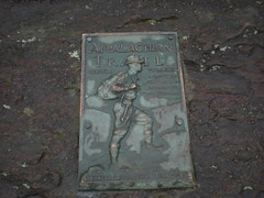
Bump'n'Grind is a great race, on a great trail, at a great park, put on by great people. I've ridden it every year I possibly could since '99. I'm more into endurance these days, but the BNG is near and dear. I'll make an exception. This year my family came with me. We spent the whole weekend doing cool stuff, seeing good friends and eventually racing, or at least I was racing, you get the idea.

Saturday morning we hit the road.
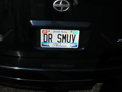
Vanity plate.

 1 - Blk Knt

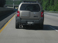
Oh, Black KNIGHT. Got it. Not the first thing that came to mind.

My bike's been in the hospital for a week, in Douglasville. Fortunately, Douglasville is between Cumming and Birmingham and we were able to roll by and pick it up.

It was like a whole new ride.

Apparently at Yargo, a bottom bracket bearing had seized up, the crank wallowed out the hole and it was just riding on the plastic ring. I didn't even notice, that's how muddy it was. Glen hooked me up with a new spoke, new big ring, brand new Chris King BB, rebuilt rear hub and a serious tune up. Ahhh, el luxurio.

Bike Shop. Waffle House. Back on the road.

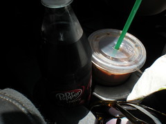
When I'm in Alabama, I'm drinking Dr. Pepper. No matter where she is, Kathryn is drinking an iced, decaf, soy, 2 pump peppermint, 3 pump mocha.

 2 - Alabama Dr Pepper

Yeeeeeeeee Haw!

 3 - Talladega 1

 4 - Talladega 2

I joke, but I'm well into redneckery. For instance, it was in the 90's all day and I've got no AC in my truck. Yeah, I could stop right there, but there's more. We rolled to Birmingham with the windows down, and as such, my left arm got a wicked sunburn. Only my left arm. Yeeeeeeee Haw!

I'll be smarter tomorrow though. The commericals promise. It's magic.

 5 - Holiday Inn Express

We checked in quick and bailed out even quicker, to the zoo. One of my best friends of all time, Kirk Beeson, lives nearby and he met us with his young son Jack.

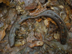
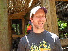
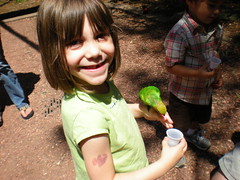
The Birmingham Zoo is good. Especially the Lorikeets. There's this big aviary with like 50 birds that you go into and you can buy little cups of nectar. The birds love the nectar and they'll fly down, sit on your arm and drink it.

But you can fool them too. Even if you don't buy the nectar, you can just hold your arm out and they'll jump on. This one climbed up on my shoulder, chomped all over my ear and groomed the heck out of my hair.

 6 - Lorikeet Chomp

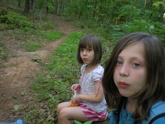
Sophie and Jack loved it, but Iz just thought it was creepy.

 7 - Sophie and the Lorikeet

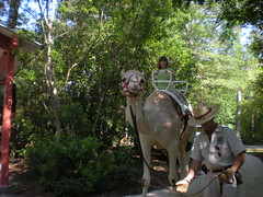
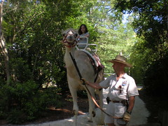
Spike the camel was cool. All the kids got a ride. While they were riding, Dr. Livingstone called and asked the camel dude for his outfit back.

 9 - Sophie Riding the Camel

 10 - Iz Riding the Camel

Near the front, there's a lake with a fence around it and a gum machine full of fish food that you can feed to these ridiculously big Koi. A pair of swans live there too, and the male attacks anyone who gets within a foot of the fence. Sophie tried to feed him and almost got chomped. Pretty soon we were all teasing the swan, and then it bit the crap out of me. Yeah, that's what I get.

The zoo was cool.

What's with all the vanity plates though?

 11 - Dr Smuv

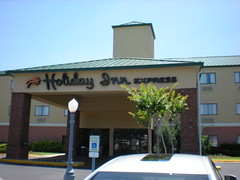
We ate at Macaroni Grill and tried to go see the statue of Vulcan, but the park was closed for some private event. Blah. Kirk lives like a mile away though. We hung out at his house for a while and eventually went back to the hotel. The girls and I watched the second half of Night at the Museum and I crashed out for the best night's sleep I've ever gotten (at a hotel) in my life.

6 AM.
Shower.
Breakfast.
Check out.
Registration.

Trouble.

I went to check the air in my front tire and that little presta-valve screw thing had broken off. Weird. No problem, I have a spare right? Nope. No spare. Glen did though. Thanks for the rescue man. But that was just one problem. Oak Mountain eats tires, and it's foolish not to carry an extra tube. For some reason I had 3 road tubes. Oh well, better than nothing. Problem solved.

Warm up time. I guess 2 days of commuting and a walk around the zoo are good prep. I felt just right. No need to warm up too much, time to do some visiting.

Teammates and friends.

 12 - BORs

 13 - Brooke

 14 - Russell

Kathryn tried to take a pic of me starting but some dude stepped in the way at the last second.

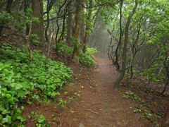
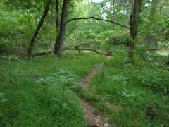
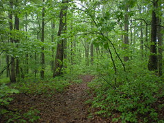
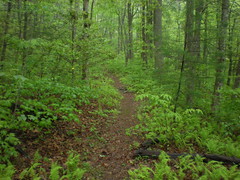
The course was fast. The race was fast. I ended up sparring with one guy all day. It was everything that I love about racing.

The first half was uneventful. I went into the woods mid pack and worked my way through traffic. Nobody got past me on the forest road. I led the mean little climb off of it and put distance on some folks on the next descent. I pushed hard on the fire road climb, picked off a few more riders and slammed it across the top.

And then, disaster. A stick jammed between my chain and rear cog and would not clear. I jumped off, pulled it out, jumped back on, tried to pedal, jumped off again, fiddled with the chain, jumped back on... Finally. At least 7 riders passed me, but I could see them and there was a long descent ahead. Lucky me. I picked them all back off, and a few more.

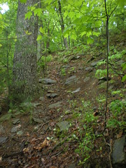
On to the Bump Trail. Woohoo!!! Cleaned Blood Rock. Passed 3 riders in the chunk below it, and all of a sudden everything got loose. My front tire was washing left and right. I thought I'd flatted, but then it came back. Must have just been the trail. Weird.

Crossed the road, pulled into a series of climbs, and pretty much stayed on the gas from there on. A train of riders pooled up behind me and I just could not shake them before the last section of trail. We crossed a little road and pounded up the worst climb on the whole trail. I absolutely hate that climb. It's short, but it's just ledge after ledge after ledge, and steep. Today I had it though and started creeping away from the train. The last few miles are rolling and twisty; Mr. Toad's Wild Ride, they call it. Every turn I put a few feet on the train. Soon enough, they were gone.

All done.

The only thing that sucks about Bump'n'Grind is that it always, every time, without fail, takes hours and hours and hours for them to post the results and even longer for the awards. The heat just adds insult to injury. Today was no different, except that this time my family had to wait with me. Kirk showed up though! That was cool. At infinite length, I found out how I did. 10th. Not what I was hoping for, but it'll do. Glen got 6th, Russell got 3rd. Nice job guys.

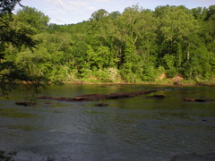
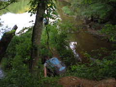
On to the beach. Earlier I was saying that Oak Mountain is so great. It is. Lakes and beaches. Delicious. I can't even describe how good the water felt. It's just not possible.

 15 - Sophie in the Sand

 16 - Iz in the Sand

 17 - Kathryn in the Sand

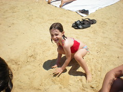
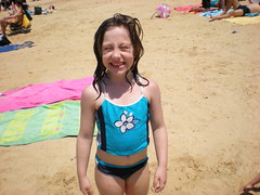
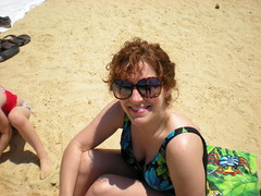
I didn't want to get out but we had to get going.

We grabbed some lunch at The Purple Onion, which is sort of a Mediterranean fast food joint. I'll go back, but next time I'm just ordering 1 gyro plate and sharing it with somebody. There's no possible way an individual human could eat all of that. No possible way.

The drive back was miserable. I was short on fluids and getting sleepy. Kathryn and the kids were already crashed out. I had to stop twice for drinks and candy. We made it though and I feel fine now. Maybe I'm just coked up on Mountain Dew. Either way, good weekend!

Monday, May 25, 2009

AT Approach Trail

show on map

Once again, I barely feel like a cyclist any more. My mountain bike is in the shop with a popped spoke and a worn-out big ring. The rain has kept me off of the road all week. The last time I rode was weeks ago. No good. The forecast called for rain yesterday, so I figured I'd just do family stuff, but then it didn't rain! Come on!

Today it would certainly rain. These days, when it's raining, I'm walking, and so is my brother.

Amicalola.

 1 - Amicalola Interpretive Center

 2 - AT Plaque

We stepped through the AT gateway, as if to start a 2100 mile journey. Divide that by about 100 for us though, we're just day-hiking.

 3 - AT Gateway

The approach trail runs through the park, up some stairs and past the falls. One good thing about all this rain is it makes waterfalls look awesome.

 4 - Amicalola Falls from Bottom

 5 - Amicalola Falls from Top

There are like 700 stairs leading to the top of the falls. I've climbed them before with my wife and kids, but today I was following my brother, and feeling the burn.

We didn't stop climbing when we reached the top of the falls. The burn was gone, but it still wasn't easy. This section of trail is called the "yard sale" or something like that. It's here that people start to realize they're carrying too much and start ditching the junk. We didn't see much today, just a light jacket, which looked like maybe somebody just dropped it accidentally. Apparently my map had heard about this place though, and worked it's way out of my pocket. It could have joined the fun, but we just happened to pass a couple going the other way, right then, who noticed it.

 6 - AT Approach Trail

There used to be fire tower on Frosty mountain. Two pylons remained in the center of a clearing. A third was downhill a bit. Was the fire tower mounted on uneven pylons? I guess it could have been. Odd though.

 7 - Frosty Mountain Fire Tower Ruins

As we approached Nimblewill Gap I saw 2 cars parked there, a Jeep and a little Honda, covered in mud. FS28-2 is a decent road, but with all of the rain we've had, some sections could have gotten pretty bad.

I was just saying to my bro that I was impressed with whoever drove the Honda up there, and then we ran into them; a guy and his girlfriend. They greeted us with the most confusing question I've ever heard: "Is this the trail that Jesus took when he walked to New York?" All I could think of was: "I don't know about Jesus, but Jesus (hey-soos) may have walked to New York from here." I guess it was the right answer because they cracked up and we ended up talking with them for a while. Turns out that the guy's last name was Seabolt (as in Seabolt Branch, Creek, Coves, Trails, etc.) and the girl's last name was Turner (as in Creek, Trail, Cemetery, Road (in Cumming) etc.) and they were getting married at Nimblewill Church in a week. The encounter provided further evidence of my theory that you can't do anything in North Georgia without meeting someone with a road, city or geographical formation named after them. Awesome. I needed to change my pants from the waterproof sweat collectors to lightweight zip-off-the-legs luxury. I did that, and more comedy ensused. It was fun hanging out with the future Mr. and Mrs. Seabolt, but we had a long way to go and had to start getting there.

But not before a quick, but important, photo.

 8 - Nimblewill Gap Memorial

I expected to climb over Black Mountain, but we skirted it instead. Before long we were passing the shelter and on our way up Springer.

 9 - AT Approach on Springer Mountain

The Southern Terminus of the AT.

 10 - AT Southern Terminus Plaque

 11 - AT Plaque on Springer

I need to get a book on the AT or something. Why isn't the Southern Terminus at the Nimblewill Falls Interpretive Center? Why is the trail we've been on all day just the approach trail and not part of the AT itself? Why was the terminus moved from Oglethorpe Mtn.? I must know these things.

No view today.

 12 - No View From Springer Today

The frere was disappointed. He'd heard that Springer had a meadow on top with an awesome view and had imagined a bald or maybe something like Blood Mountain. There is a a bunch of grass growing up there, and a view (except for today), but it was lamer like he'd imagined.

We took a quick trip to the shelter to rest and refuel...

 13 - Springer Mountain Shelter

...and started back. Backtracking is intolerable, so we took the Len Foote Hike Inn Trail, which featured this guy...

 14 - Orange Salamander

...and this magnificent structure.

 15 - Hike Inn 1

I've been wanting to go there with my kids. I think they can handle the trail. We'll give it a try later this year.

We did a little a-sett'en down on the front porch with some folks who were staying overnight.

 16 - Hike Inn 2

At this point, I had plenty of energy, my legs were fine, but my feet were not. Every step felt like getting slapped with a 2x4 or something. I am still too soft for this sort of thing. At least the trail was nice.

 17 - Hike Inn Trail

The horrible thing about the Hike Inn Trail is the random mile markers. Mile markers are cool when they're placed at even intervals, like every mile or half mile or something. The Hike Inn Trail markers were placed randomly, or at least it seemed like they were random. For example, there were markers at mile 1.2 and 1.9. My feet were screaming, and I know it's impossible, but I'd swear we walked at least 2 miles between markers 1.9 and 1.2.

When we got to the falls, the sun had come out and the view was pretty nice.

 18 - View From Top of Amicalola Falls

Descending the stairs punished my knees in the same way that the trail had
punished my feet.

Soft.

Near the bottom, John noticed the wreck of an old car. The staircase had been built right through the middle of. I'd read a story about it on the web once. A moonshiner had missed a turn near the top of the falls and driven over the edge. I can't find a link to the story now though.

 19 - Wreck at Base of Amicalola Falls

I was looking forward to getting a snack at the interpretive center, but they were closed when we got there. Imagine if you hiked the whole AT and were looking forward to a snack and it was closed. What a drag.

We did about 20 miles. My feet and knees are wrecked, but not as wrecked as the last time I did the same distance. I guess that's good. My brother was talking about doing a road ride tomorrow on the Silk Sheets. I won't be making that. Hopefully I'll be recovered enough Tuesday to ride to work.

Wednesday, May 20, 2009

North Bowman's Island (Yet Again)

show on map

Last weekend's exploring left my right thigh pretty sore. Why just my right thigh? Who knows. As such though, I bailed on the weekly beatdown in favor of some hair of the dog. There are still some trails in the Bowman's Island system that we haven't been on, so me and the girlies went there.

We followed a fishing trail down to the river.

 1 - Chattahoochee

Then cut over to the Northern Trail and picked up the ridge trail. Sophie found some kind of fuzzy flower thing and demanded a picture. It was cool, but I didn't know what it was. I need to learn more about the local flora.

 2 - Sophie and Flora

There's a pile of rocks just after the start of the trail. Could be an old crumbled chimney, or maybe just a pile of rocks.

 3 - Ruins

Ridge trail. PAO trail. Food break; Clif Blocks and Cheez-It's. Yum.

 4 - Food Break

We backtracked over the ridge and picked up the fishing trail again.

 5 - Girls on Northern Trail (Ridge Trail)

There are basically 2 parallel trails leading along the river. We followed the one at the very edge, through gully after gully.

 7 - Gully Crossing

The girls had a good time climbing down and back up. Sophie cracks me up: "These are Italian Stairs daddy. I mean Indian Stairs."

 8 - Sophie Climbing

Lush.

 9 - Lush Vegetation

We'd been on this same trail a few weeks back from the other direction, but didn't get too far before running out of light. Our plan was to get to that same spot, hang out for a while, then turn back. We were getting close when we ran into a pair of geese just hanging out in the river, honking like crazy. Out of nowhere, Sophie bent over and started honking back at them. Not exactly honking though, more like "Quonk!" "Quonk!!!" Me and Iz were just cracking up. The funniest part was that the geese got quiet, and then whenever she'd make her crazy noise, they'd respond softly. Hilarious.

 10 - Girls Descending

When we got where we were going, the kids kicked off their shoes and waded into the freezing water. The geese had moved downstream to check us out, but kept their distance. We didn't hang out too long, the sun was going down and it would be dark in the woods.

On the way back, we took the trail further away from the edge, avoiding the gullies. We kept seeing deer, but never got close enough to get a good view. Sophie started getting nervous about the darkness, so I made her the leader and she realized how easy it was to see the trail and how light the sky was, even though it was dark in the woods.

The trail tee'd into the Northern Trail by a scenic little feeder branch, but it was too dark for a photo. We stopped there for a second then pushed back to the truck. Not a bad way to end the day.

Sunday, May 17, 2009

Long Mountain Area

show on map

Rain. Every day. Except yesterday. My mom had the kids though, so me and Kathryn did couple-stuff yesterday. Today I could get outdoors, but, the rain. The RAIN. I've had a years worth of wet riding already this season. I couldn't bring myself to even think about pulling the bike out.

Yesterday I bought some new trail shoes. Apparently I have some dainty little feminine feet. The men's sizes don't fit right. My last pair were women's shoes and again, this time, women's shoes. Oh yeah. They fit though, and they must be broken in.

West of Cooper Gap there unexplored trails. I'm sure somebody knows them, but I don't. That's what I mean, unexplored by me. One trail heads south from Locust Gap. "Trail" is a pretty loose term for this one. Remember in Lord of the Rings, where Frodo has to climb this ridiculous steep staircase and there's a huge spider at the top? Maybe you don't, but I'm a nerd, so I remember. The Locust Gap Trail is kind-of like that, but without the spider.

 6 - Cirith Ungol 1

 7 - Cirith Ungol 2

Sketchy, sketchy, sketchy. I slipped a couple of times and almost got tangled in barbed wire.

 8 - Barbed Wire on Cirith Ungol

Why barbed wire? There are a lot of old fence lines in the forest, but way up here? Maybe someone dumped it off of FS42 and it's been making it's way downhill, slowly, for years. Who knows.

I hoped the trail would suddenly turn east and end up on Lumpkin Ridge, but no luck. It just went directly down and ended at a creek. No hint of a trail beyond. There were footprints though, on both sides of the creek, perhaps from the Rangers of Camp Merrill, or the students of Hidden Lake. It looked like they'd been climbing. I can only imagine how hard you have to be to climb that trail. I CAN'T imagine it with a 60 pound pack and a weapon. Hard.

I quickly gave up sidehilling and just walked down the creek bed itself. There was virtually no deadfall and plenty of rocks to step on. No rain yet, but it was cloudy and windy, and the trees were full of last night's rain. Every now and then I'd get a little shower, but it wasn't too bad.

I did see ten thousand snails and slugs though, and a salamander with no tail. I tried to get a picture, but he was too quick.

No matter how "middle-of-nowhere" you think you are, someone else has already been there and left trash.

 10 - Bottle

I'm rich! Or a fool.

 11 - Fools Gold

The Ward Gap Trail was right where it was supposed to be. I took it back up to 42.

 12 - Ward Gap Trail

I milled around a bit on the knob between Ward and Locust Gaps. Apparently some Rangers had milled around up there too. Maybe putting a hit on the road.

 13 - Unspent Rounds

Enough of that area. There's more stuff to the North. I jumped in my truck and took a quick trip to a campsite just down the road, on Long Mountain. A trail leads from there to the AT and beyond.

 14 - North Long Mountain Ridge Trail

Artifact.

 15 - Broken Horseshoe

The AT's been rerouted back up in there, and I've always been curious why. At first, it was the same as the other sections nearby; an old road bed, a bit below grade but not terribly worn, kind of close to a drainage, but despite the recent rain, the drainage was dry. Eventually there was a trickle, but it quickly joined Blackwell Creek.

In antiquity, a bridge spanned Blackwell.

 16 - Bridge Ruins

Beyond that, the trail was a clean bench cut. An old barbed wire fence ran down the left side.

 17 - Old AT 1

But past that it was a different story. Over the years, a little creek had changed course and devoured a culvert and about 50 yards of the roadbed. Past that, the trail ran up along the creek with no grade reversals, dips or water bars. Puncheons had been built up one side, causing water to drain down the other, away from the creek, no doubt contributing to the destruction below. They couldn't drain the trail into the creek, there wasn't enough of a buffer. Further up there were a couple of fall line trails and some ridgeline trail. Good idea to reroute it.

The whole trail was being reclaimed by Poison Ivy. Fortunately, I'm not allergic. My wife is though, and my older daughter. They'd break out at the just the sight of this much.

 18 - Old AT 2

The rain was really coming down now. I'd been ignoring it for a while. My pack had been kind-of keeping me dry. But, it was getting pretty bad. Time for the rain gear. Next time I'm at REI, I'm going to look for waterproof gloves and a hat. I wonder if those exist.

The old AT tee'd into the new AT on Gooch Mountain at a campsite. An old roadbed continued south from there, but it would have to wait for another day. I headed west to Blackwell Creek.

The whole area was covered in chestnut trees. I didn't see any tall ones, but there were saplings EVERYWHERE. There are virtually none where I live. There's one in the near right of this shot, with a chestnut-oak towering over it.

 19 - AT

My brother and I had gotten water from Blackwell the last time we came through here and I'd seen a little bench cut just up the hill from the intersection. There is a trail that parallels Blackwell, but it doesn't match the trail on Topo maps of the area. This little trail appeared to match the map. I'd hoped it would lead by a waterfall or something, but no luck with that. It led upstream for a while, but the creek had apparently changed course and eaten it up. Before long, it was gone without a trace.

I cut cross-country to the other Blackwell Creek Trail, took it North to the old AT and then back South to FS42. The last time I'd been there I didn't know how to use my GPS real well. This time, I got a good accurate track. And some pictures.

 21 - Blackwell Creek Trail

Near the southern end, there's an old chimney or something. Not really sure what it is. Neat though. I wonder who lived there. I guess maybe the Blackwell's.

 22 - Ruins on Blackwell Creek

Across 42 there's an old road leading south down into Cane Creek Cove. I followed it for a few hundred yards, but it was really overgrown with some kind of onion-smelling crap. Ehh. Maybe another day. I was more interested in a trail to the west, at a bend in the road. I've seen it a billion times, but never checked it out.

At the bend, across from the trail, there's a big poplar tree. Really big. I should have put my poles or something down by it for scale. Seriously, it's big.

 24 - Big Poplar 1

 25 - Big Poplar 2

The trail goes straight up to Long Mountain ridge. Whooo. Steep. On the ridge, trails led left and right. The left trail might lead all the way down to FS234. That would be awesome. But, my truck was to the right and it was getting late. The right trail might lead to my truck. I went right.

Mountain laurel was blooming up there. So was this, whatever it is.

 26 - Flowers

The trail disappeared after a few hundred yards. I turned north to stay on the ridge. Hey, look, another trail, marked with ribbons, no less. Maybe it would lead to my truck. No, it disappeared quickly too. Then the brush got dense. It took forever to push through it. I got off course a couple of times, and in keeping with today's theme, every square inch of ground was covered with Poison Ivy.

There were quite a few of these rock piles up there. I've seen similar near the Benton MacKaye on Rich Mountain and in a few other places. There is no trail here though, just woods. Are these natural formations? Indian graves? Alien artifacts? Since I don't know what they are, they MUST be alien artifacts, what other proof do you need? :) The geotag is off pretty badly on this one. Apparently the GPS reception was pretty bad up there. See, only alien artifacts can disrupt a GPS signal. The piles are all over the place up there though, stay on the ridge, you'll find one.

 27 - Rock Piles

At great length, I got to a trail I recognized and followed it home.

 28 - South Long Mountain Ridge Trail

Yay. End of a long day. My legs are tired and my thirst for exploration is well quenched, for now.