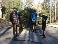
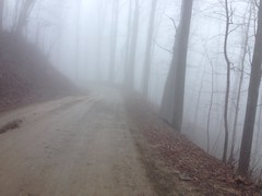
Rain, rain and more rain. That's what we've had most weekends now, for months. This past weekend was no exception. Saturday it rained. Sunday the trails were still drying out. It got kind-of cold too. I think it even froze Friday night.
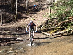
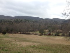
Sunday I wanted to ride, but I had to wrack my brain a little to decide where. Noontootla is my go-to FS road route, but I'd done that semi-recently. It seemed like there was some little bit of something that I hadn't yet explored at Berry College, and upon checking my map, I confirmed that there was.
Decision made!
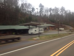
Berry College.
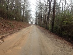
I parked at the near end of CCC Camp Road (AKA Seven Bridges Road. Yes, that Seven Bridges Road)...
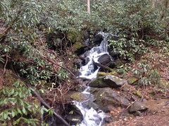
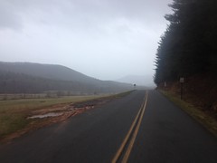
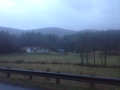
And headed off down that-a-way to the Mountain Springs Church area.

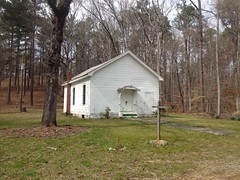
I'd been to it before, but apparently not taken any photos. Don't remember why.
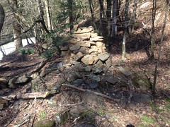
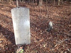
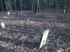
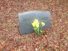
It looked like they were starting to get a little cemetery going on the hillside nearby...
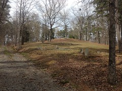
...so I followed the road up it, and bam!
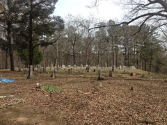
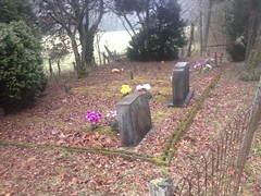
They weren't just starting. They'd used up so much of the top of the hill that they had to start working their way down it, I guess.
I poked around some of the other roads in the area until I was back around to my truck, and then I basically started the ride over again. Out on CCC Camp, but this time up the Hurtin' Gator to the top of Lavender Mountain. Whoo, my little Gator was hurtin' too. Not my best climb. And, having routed my chain correctly earlier, I didn't even have an excuse.
Instead of pushing on up to the House o' Dreams, I dropped down a bit and picked up the little bit of Mountain Goat that I'd never ridden before.
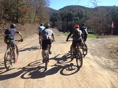
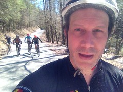
I wasn't alone out there that afternoon either. I must have passed 20 or more couples hiking, both down the road, and on various little side trails that I definitely need to get back up there and explore.
One of the reasons everybody was out seemed to be all of the redbud that was blooming up and down the road.

They flanked the downhill side of the road, all the way down it. Beautiful, bright purple flowers everywhere. Dazzling and vivid. They really grabbed your attention, way more than the photo suggests.
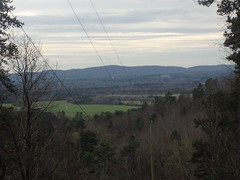
There was a little powerline cut up there too, and I could see whatever mountain that is in the distance. I remember figuring out what there were once. It's like Armstrong mountain, or something like that.
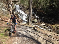
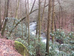
Another little bit that I'd never ridden was the road that leads down past the reservoir.
Man, was I glad I rode it that day though. It doesn't just shoot past the dam, it winds around the lake for a while, and there are a couple of little spurs that lead down to nice spots to relax and take in the view.
One spot was occupied by another mountain biker, who'd ridden up with a hammock, strung it up between a couple of trees, and appeared to be napping when I passed him.
Another led to a memorial swing.
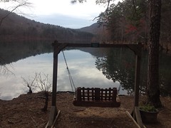
With its own customer service line.
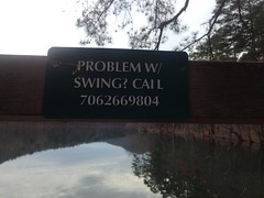
I imagined calling it and getting connected to an offshore call center. Ha! The thought made me smile a little.
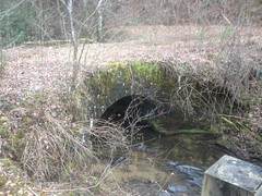
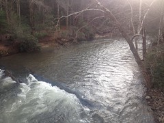
The intake was really cool looking.
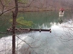
Just a big, boxy hole in the water.
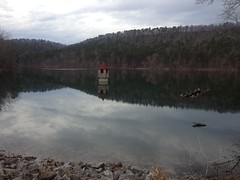
I'd have been tempted to take a swim if it were warmer out, but there were several signs prohibiting it. I guess that's just as well too, because I might have been tempted to check out the intake, and that might have ended in a violent, possibly deadly waterslide.
Across the dam I could see more hiking trails.
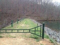
And there were some stairs down to the creek to the left.
Yep. Need to go back there and do some hiking.
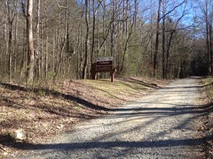
I dropped down off of the mountain and took some trail that I forget the name of out to the Possum Trot Church. From there, I explored the Clay Mines Roads a bit, and found the actual Clay Mine, though I didn't realize what it was until later and didn't get a photo of it. The various silt ponds downstream of it were a lot less photogenic than the reservoir, so I didn't get a shot of them either.
From there, I rode west on Technology Parkway, hung a right on Fouche Gap Road and climbed up over the gap. It's a longer climb than the Hurtin' Gator, and I think it's steeper too, but it was paved, and I was a lot more warmed up, so I had a pretty good time of it.
A truck passed me right as I peaked out and then struggled to stay ahead of me on the twisty descent. If a screeching tire is a happy tire, then he had some really happy tires.
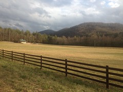
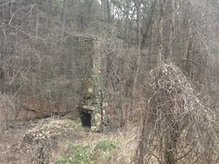
I felt good on Sand Springs Road too. It's a steady climb, but it's not too steep.
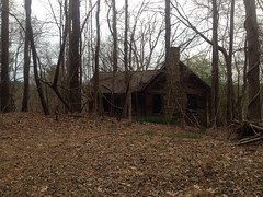
I'd seen the ruins of an old farm on it last time, and this time I stopped to take a couple of photos.
There were Trilliums popping up everywhere along the road there.
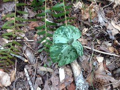
Just starting to pop up.
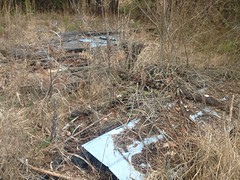
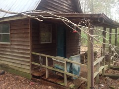
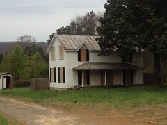
At Texas Valley Road, I noticed this old shingle shack.
It looked a good bit more modern that the rest of the ruins, and more recently abandoned. It looked like it might predate the ADA though, so the ramp was kind of confusing. I guess they wheeled stuff in and out of it regularly. But what? What would fit between those rails?
Little mysteries.
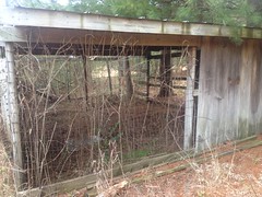
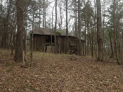
On East Texas Valley Road, I passed another old farm.
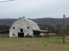
That one is actually on the WMA property, but it's fenced off, so you can't get a great look at it. I wonder if they plan on restoring it or something. It seems like it wasn't boarded up last time I was up there.
I hung a right on Scenic Road, which kicks up a bit, and then another right on Lavender Mountain Road, which runs up the spine of the mountain. I felt great climbing all of that, and debated continuing on up to the House o' Dreams, but it was getting kind-of late, and though I wasn't worried about running out of daylight, I didn't want to get home at midnight or anything.
So, I bombed back down the Hurtin' Gator and rode back out on CCC Camp.
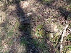
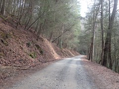
CCC Camp is also called Seven Bridges Road because if you ride out on it you'll count 7 bridges, but then on the return trip, you'll only count 6. The spirits must have played a trick on your mind, so it's haunted or something. I'm not sure if the big bridge at the WMA gate counts as one of the bridges or not. If not, I was inclined to call it Zero Bridges Road because you have to look pretty hard to notice any bridges at all. Maybe calling it Seven Culverts Road would be more accurate. Still more accurate would be calling it Seven Not Even Very Obvious Culverts Road. I think the road was rerouted at some point though. I think topo maps still show it bending at the end and leading directly to that church, rather than ending a bit to the south. It's been logged pretty heavily recently too, so it's possible that the culverts/bridges were more visible at some point in the past, but recent widening and regrading to support heavy trucks has obscured them. I didn't count them, but most of the culverts looked modern. I did see one old-looking rock culvert though, way down on the west end of the road. It was visible on the north side of the road, but I didn't notice anything on the south side, I couldn't even tell that there was anything to drain. It'd be funny if that's the whole deal with the road - that one drainage has gotten backfilled and obscured on the uphill side.
Who knows?
I packed it in and grabbed some Mexican food in Rome. Some pork dish. Super good. Good enough that I wish I remembered the name. Hopefully I'll just recognize it next time I'm there, whenever that may be.
The trip home was uneventful, if I remember correctly. Oooh, I think I may have left my clothes on the garage floor though. They may still be there. Yikes. If I want to ride tomorrow, I'd better wash them.
Yeah, time to wash some clothes.