Monday, April 25, 2016

Pheasant Branch

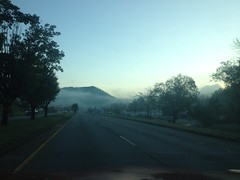
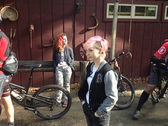
Sunday morning I woke up with my head pounding. The Brutal Loop had lived up to its name and I'd forgotten to keep a glass of water next to my bed to quench the midnight thirst. Two glasses later though, my skin started feeling cool and my head started feeling normal. I needed some kind of recovery and I didn't feel like even thinking about my bike.

Some light hiking might do the trick. If I could fit in a relaxing dip in some random stream, that would be even better.

I knew just the place.

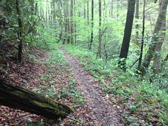
Unfortunately when I was about 1 mile away from the place I realized I'd left the maps I'd printed out at home. That's a new one. I've forgotten everything from shoes to jerseys to my camera/phone but I'd not, until yesterday, ever forgotten a map. I'd originally wanted to check out the old railbed that appeared to run up along Dover Creek, but I didn't know the area well enough to be able to even find it. Which of these dozens of creeks is Dover again? The second though, Pheasant Branch (or Pleasant Branch depending on which map you look at) was pretty hard to miss, and I'd been there before. It would be a new challenge navigating off trail with no map, but I felt up to it. Worst case, I had the GPS to tell me where I was parked. What could go wrong?

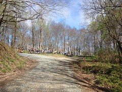
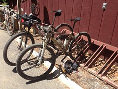
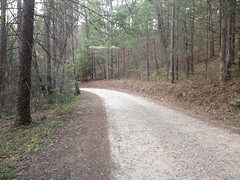
I parked at the last campsite at the very top of FS244, which lies just south of the Raven Cliffs Wilderness.

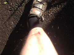
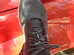
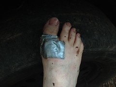
I got dressed, patched up my feet...

Heel Patch

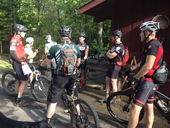
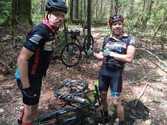
...and checked my gear. Right before I got going, a couple that I'd passed on the way up drove by, parked a little further up the road, and headed off into the woods.

The end of that road is just about the most remote place that I know of, that you can actually drive to. 4 miles up a rough road, across two creeks, at the top of a mountain. No roads or inventoried trails for 4 miles in any direction. What are the odds that we'd both choose to be in that exact spot, at that exact time?

There are 4 different trails up there - one to White Oak Gap, one that's really just a firebreak and goes straight up the ridge, one that goes to a food plot, and one more that looked somewhat overgrown. There's actually a little jeep loop too, but I'm not counting that one. I wasn't sure which one they'd taken, so I took the overgrown one, figuring I might avoid bothering them. Nope, the trail I took was apparently the original route up to the food plot, and I ran into them almost immediately.

"Sorry guys, don't mean to be all on top of you like this. I'm just up here exploring."

They were very gracious. I felt bad though. Best case I might have interrupted some plans for romance. Worst case they might have thought I was stalking them or something. We got to talking though, and they'd lived in the area their whole lives, so I quizzed them for information about the local trails. Turned out I knew far more than they did and they thanked me for the info about the White Oak Gap trail. There'd also been what looked like a controlled burn the previous week, and we talked a bit about that too.

At the north end of the food plot I found a really old road, turned trail, heading in the direction I wanted to go.

Walnut Gap Trail

It blended into the backslope at Walnut Gap (though I didn't know the name of the gap at the time, because, no map), but there was a firebreak running along the ridge to the right, and diving down toward Pheasant Branch to the left. Score!

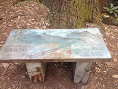
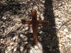
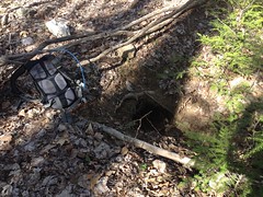
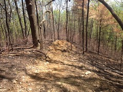
At the gap there, I noticed a couple of boards nailed to a tree, for some reason.

Old Sign

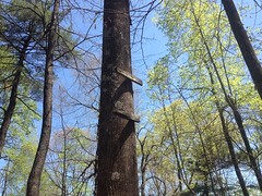
It didn't seem likely that they were part of an old tree stand. Was there a sign here at some point? What could it have said?

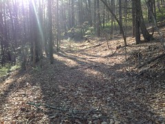
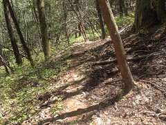
I puzzled about that as I scree-ran down the firebreak. With all the recent rain, to describe the soil as "loose" doesn't really say it. I probably sank an inch into it with each step. I had arrived at no conclusion about the old sign when something else grabbed my attention.

Ineffective Firebreak

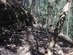
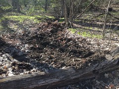
Admittedly, I don't know too much about such things, and maybe this is somehow correct, but for a firebreak, it sure didn't seem to have done much breaking of the fire. While the road had been very effective lower down the mountain, up here, the earth looked equally scorched on both sides of the break.

As I descended into the Pheasant Branch valley, I came upon the end of the disturbed soil, and realized that whoever plowed that particular break must have figured that he was getting close enough to the creek and stopped there. Unless it was intentional, for some reason, I don't think he was close enough, as the fire appears to have burned down around the end of the break.

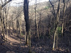
Though it was a gnarly, burned out wasteland...

Burned Out Wasteland

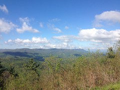
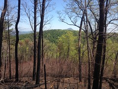
...there were a few distinct benefits to the fortunate off-trail hiker. Primarily, the lack of ground cover meant way less whacking of shins and shredding of ankles. But, also, I could actually see the surrounding ridges in every direction. For example, Allison Ridge lay ahead of me, with Mount Yonah towering over it in the distance.

Mount Yonah From Below Walnut Gap

I very much enjoyed being able to actually see stuff, and took my time descending into the valley.

On a shaded relief map, the Pheasant Branch Valley looks like a great crack in the earth. In fact, if you pair it with the Bearden Branch Valley to the north, it looks like an even longer crack. It's perfectly straight, heads due north and south, and except for a short interruption in the vicinity of the various roads in the area, runs for 4 miles or so.

I've wondered if there's a fault there or something, that locked those unrelated creeks into such perfect conjunction.

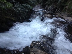
Down at the bottom of the crack lay Pheasant Branch, an otherwise unremarkable creek. Locked in like that, it had long since worn away any interesting features, and was extremely shallow in grade. I guess that's why it's so easy to mistake for Pleasant Branch. The names look kind of similar, and "Pleasant" makes sense, given the shallow, featureless grade.

If it was once a pleasant stroll though, those days are long gone. It's not quite rhododendron hell down there, but you work for it.

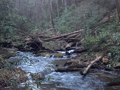
I had assumed that there would be a rail leading up the valley, because of how shallow it was, and because the northern end ties in to Dukes Creek and there are all kinds of old railbeds in that area. Overgrown railbeds are hard to spot though, especially when the terrain is shallow. I thought I found one though, and I followed it north.

Old Pheasant Branch Railbed

A bit further on, I noticed an old rusted out iron drum lying in the creek. I'd normally take that as an indicator that logging activity had occurred in the area, or that there was once a campsite there, but there had been a clear cut up the ridge to the east some time ago and it could have rolled down from up there.

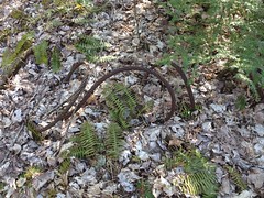
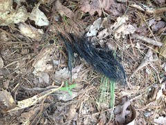
Further on still, I found various cuts and fills and notches. Unless I imagined them, which was possible. Then I found an old cable.

Old Cable

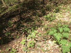
Evidence? Maybe, maybe not. Those are used for everything in the world, and still might have been from that modern clear-cut.

But!

Eventually!

The smoking gun:

Trestle Spikes 1

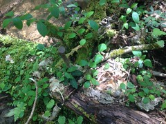
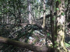
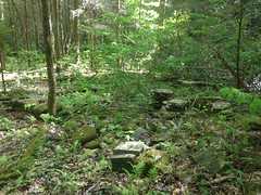
Doesn't look like much, but there were two tree trunks, laid parallel to each other pinned together with cross-ties, by these giant spikes.

Spikes!

Trestle Spikes 2

Spikes!

Trestle Spikes 3

Here, you can see the parallel trunks.

Trestle Ruin

It looks like almost nothing in the photo, but in real life it's really obvious. There was a fill running along the west side of the creek and where it got too swampy they'd built a low trestle and I guess just abandoned it rather than take it apart and reuse it.

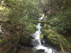
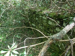
At the north end of the trestle, a weird triangular rock wall divided the creek and rose some 6 feet up into the air as the creek dropped out from under it into a small cascade.

Ambiguous Rock Wall

At the time, it was enigmatic. Clearly constructed by man, and almost certainly part of the old rail, but I couldn't divine its purpose.

I appeared to be at the point where the creek hooks hard right and joins with Dover Creek. At the time I couldn't remember the name "Dover Creek" but I knew where I was. I'd been looking for that spot, actually.

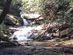
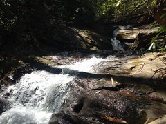
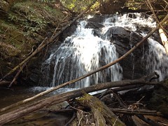
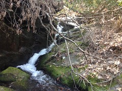
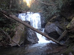
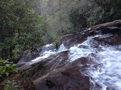
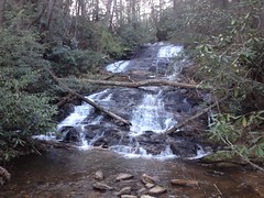
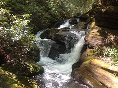
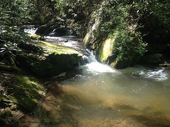
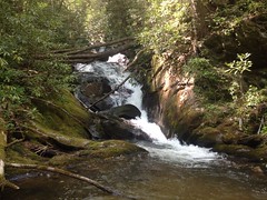
The creeks joined at the bottom of a pair of falls.

Pheasant Branch Falls:

Pleasant Branch Confluence Falls

And what I guess could be called Dover Creek Confluence Falls:

Dover Creek Confluence Falls

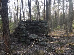
I searched all over for the rail and soon found it running along the south side of Dover Creek. The triangular rock wall I'd seen earlier was actually the far end of a massive stone fill that stretched out forever to the east. Over the years, the creek had rerouted itself and eaten away at the wall until the bit in the middle was all that was left. I could probably draw it better than describe it with words, but I'm too lazy to do that.

The stone fill went on and on and on.

Very Long Rock Fill Rock Fill

I never reached the end of it. I knew I was getting close to the border of the Dukes Creek Conservation Area and they are very strict about visitors. On the only other entrance that I know of to it, there are no fewer than 7 signs telling you to stop, and that you must have a permit to enter. What idiot would bushwhack in from this direction? It seemed unlikely that the border would be marked, so I kept my distance.

That said...

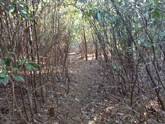
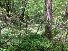
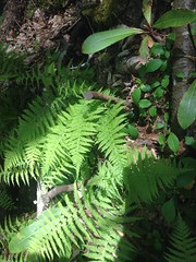
I did follow the old rail for quite some distance, and it was absolute rhododendron hell.

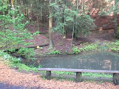
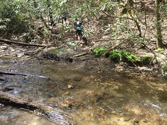
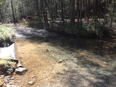
Screw fighting the woods. The creek below looked really inviting.

Pool on Dover Creek

I was hot and a little tired, and it seemed like a good spot for a snack, and a swim.

The Water Was Too Cold

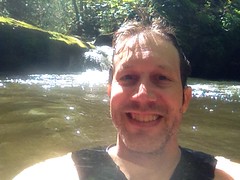
Man was I wrong about the swim though.

It felt good standing knee deep in the water, and it felt good to wash off, but the full body immersion could not accurately be described as feeling good. It usually takes a minute, and by torso got accustomed to the cold after a few minutes, but my arms never did and just kept hurting more and more. I guess that's why my smile looks so forced in that picture. I found out later that it was only 60 degrees outside. The water had to be in the 50's.

I think I'll wait for a warmer day to try it again.

I could see dangly arms of magnolia and rhododendron strangling the old rail bed and it looked like it would be a lot easier and more fun to bounder hop along the creek.

Dover Creek Boulder Hop

I ended up climbing up several shoals and short cascades before eventually climbing over that Dover Creek falls I'd seen earlier.

At the top there was a big flat spot with even more enigmatic features. A notch cut in 20 feet up the hillside. A skid to nowhere. These weird stone structures.

Weird Stone Structures

Too far away from the old railbed to be ruins of the fill. Old enough to be overgrown with moss. I'd guess the remnants of a chimney, but it would be a terrible place for a house. Perched between two waterfalls, no road in, and it'd be washed away by one heavy rain.

No idea.

I mentioned "between two waterfalls". Just upstream lay this monstrosity.

Lower Dover Creek Falls

I hate that I never have anything to show scale other than my camelback, which I can't just tell "go stand over there".

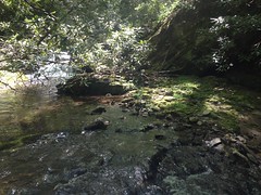
So far, Dover Creek had been pretty good for boulder hopping, and I managed to climb up over that falls too.

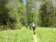
Ok. I knew that the road was to the north and west. If I headed either of those directions, or both of them I ought to hit it eventually. Due north didn't seem like a good idea because there's a weird pinch in the road, I could end up walking parallel to it for a long time without actually hitting it, and then I'd still be a long way from the car. Heading more west than north would just put me closer and closer to the car when I finally did hit the road.

But I wasn't sure of the terrain. I didn't know if I had to climb directly over ridges whack through tough brush or what. I ended up sidehilling on pig trail after pig trail through more burned out wasteland for most of it, but I eventually, more or less followed Dover Creek and Winkle Branch back to the road.

This took forever.

For. Ever.

About halfway on, I realized that the road must be over the ridge to the north of Dover Creek, but the ridge looked completely barren, fortified with exposed rock, and inascendible, so I just kept pushing west until it looked a lot better. It was around Winkle Branch that I was able to turn north.

There's a long sliding falls on Winkle Branch. It's not very photogenic, but it's semi-impressive in person.

Long Sliding Falls on Winkle Branch

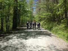
As luck would have it, I hit the road about a block from my car. I will admit that at the end there, I checked the GPS a few times to make sure I wasn't just heading off into oblivion, and it was reassuring to find that I wasn't. At some point I guess I'll have to work on navigating without the map or the GPS. One step at a time though. No need to do everything today.

The couple I'd seen earlier were gone when I got back.

I discovered later that I'd only walked 4 and a half miles. In 7 hours. That's how tough the terrain was. Admittedly I was more focused on enjoying the woods than cranking out miles, but it seems like I'm usually faster than that, even when I'm taking it easy.

On the way home I had some Tacos La Cabana, at La Cabana, and they were delicious. I also grabbed a Dr. Pepper at the Kountry Kupboard in Cleveland, next to the Laundro-Mutt dog wash. I got home a little early actually, around quarter to nine. It pays to get an early start, I guess. I'll have to do that more often.

I was pretty satisfied with the Adventure, overall. That railbed fill is the largest intact structure I've found yet in the National Forest. The trestle remnant is probably the second largest, and it's always fun to find definitive proof of something you suspect. I keep hoping to find an intact, standing trestle, or the broken wheels of a derailed train car or something. Such things litter the Silver Comet Trail. Perhaps they litter the forest as well, if you know where to look.

I'll have to remember to bring my map next time and explore the old Dover Creek rail.

I wonder what it would take to get access to the Dukes Creek Conservation Area...

Sunday, April 24, 2016

The Brutal Loop

The Brutal Loop!

Sounds terrible. Why would I want to do anything named The Brutal Loop?

Well, for one, Mulberry Gap was hosting the event and it's been far too long since the girls and I were regulars up there. I managed to see Ginny a few months ago but I haven't seen Diane in years. They missed the girls, and the girls missed the magic. Kathryn, for some reason, had never even been there. Opportunity!

Also, since cracking myself up a few months back, I've gotten comfortable shredding in-town singletrack again, gotten comfortable kicking around in remote locations again, and gotten somewhat comfortable climbing in the mountains again. A week or two ago I did a decent loop at Bull Mountain and felt good about it. Getting broken off in the Cohuttas seemed like the next logical step.

To those ends, I woke everyone up at 5:30, and after some breakfast at Waffle House, we drove up to Ellijay, and arrived when you still couldn't even see the actual sun over the ridge yet.

Early Morning Ellijay

As we approached MGap, the sun started peeking over though, and it made the dew on the pine trees glow a faint orange, like some kind of backwards autumn where it's the evergreens that change color. As many early morning rides as I've done, I'd never noticed that particular effect before.

We drove in, parked near the barn, and walked over to the house to check in. A few minutes later breakfast was being served, and not too long after that I started getting ready to ride.

The brutality started early for me. I lost control of my feet climbing the slippery stairs up to the bath house and danked both shins on the next step.

Shin Dank

Ha!

The day was already living up to its name and I hadn't even begun to ride.

As it approached 9 o'clock, I was ready to go but it didn't look like anyone else was in too much of a hurry to get moving. The advertised 9AM start was looking like more of a suggestion than a deadline and I took the opportunity to mill around the property a bit.

It was 2012 when I last camped up there, for the 2012 TNGA, to be exact. A few things have changed since then. The Barn is much more of a focal point than it had been in the past. It's been enclosed, floored, and climate controlled. Its kitchen has been improved as has its deck and nearby campsites. The game room has been consolidated into the barn as well. The Meeting Place has been converted into a group cabin. The chicken coop is gone - they were going through so many chickens that they were at risk of having to comply with all kinds of farm regulations, or something like that. The house has a small store now. There's a trail that runs around the property, with tough climbs and fun obstacles. Diane and Ginny have handed off most of the operations to Andrew and Kate, who apparently have a booth that they take to races and shows, all over the place, getting the word out. They host tours and events year round...

And I'm sure much more.

The Koi Pond is still there though.

MGap Pond

The campground and cabins and hot tubs and bath houses are still there too. Ginny is still cooking, and the food is still delicious.

Oh, man, I've missed that place.

In my wanderings, I ran into Mark B. who I had no idea was going to be there. Ha, ha! He values punctuality, was also ready to ride, and somewhat frustrated with the delay.

I ran into Farmer G as well and talked with him for a while. At first, neither of us recognized each other in street clothes. It's always funny to me when that happens.

When I got back to the barn, I found my whole family riding these little circus bikes in circles, inside, which is apparently something that you're welcome to do. There were several acoustic guitars there as well, and while waiting, I tuned one of them and tried to play it, but man, I'm rusty. My fingers just wouldn't do what my mind wanted them to do.

Eventually we all got organized and grouped up for the start.

Mark B and Friends

My family was outside too, to see me off.

The Family

Sophie kept wanting to ring this big bell next to the road. There's a sign next to it that says "Ring Bell, if no Answer, Pull Weeds" so I told her she could ring the bell, but she ran the risk of having to pull weeds, and I think it was enough to dissuade her.

After a quick riders meeting we took off down the hill and started climbing FS68.

Climbing FS64

I felt weak from the start, but I knew I would, so as unfortunate as it was, at least it wasn't unexpected. I managed to stay about mid-pack I think, for a while, but only for a while. I don't think I dropped to dead last, but I wasn't too far from it.

With all the rain we've had lately, there have been several washouts in the Cohuttas. Most between Three Forks and Dyer Gap, but I got to see one of them on the approach to Barnes Creek Falls.

Washout

Yikes!

I was surprised to see a small regroup at the Bear Creek Overlook.

Regroup at Bear Creek Overlook

It wasn't the whole group, but it was about half of the riders ahead of me.

It had been a while since I'd been to that overlook too, and the last time the sumac was too tall to see much. Fort Mountain was unobstructed today though, except for the clouds sitting on top of it.

Bear Creek Overlook

Strangely, I felt a little better on the climb up to Potatopatch. Or maybe just everyone else felt worse. Either way I managed to more or less hold my position, which wasn't great, but at least I wasn't last.

About half way up, a convoy of vehicles with Forsyth County plates passed us. Must have been 7 or 8 of them. I figured they must all be together but it didn't occur to me why. I hadn't paid attention to anything but the plates though. Another rider said he thought it looked like a boy scout troop. Ahhh... That made sense. We never saw them again though.

I was surprised again at Potatopatch proper. The entire field was parked up there regrouping again.

Regroup at Potatopatch

And I wasn't last after all. We waited at least 5 more minutes while more and more riders arrived.

The run along the ridge was really nice. It had been cool at the bottom of the mountain just because of how early it was, but as we climbed, the sun had come out and it was starting to warm up. Up on the ridge, the sun wasn't hitting us so directly, and it was nice and cool again.

I forget how much elevation you actually gain as you head over to Three Forks. I was feeling better and better though, and though I noticed the climbing, I felt ok doing it. Much better than I had earlier, at least.

We regrouped again at the Mountaintown Overlook...

Mountaintown Overlook

...and one of the guys took a group photo.

At Three Forks, the gate was closed to keep people from driving into the washouts. The East Cowpen Trail leads north east from there though, off into the Wilderness. It's a popular trail and its parking lot is a little small for how many visitors it gets. Today the lot was full, and cars were parked up and down FS64 as well. Since the gate was closed, several cars were parked in front of it as well. The cars kind-of made a chute, directing traffic towards the trail. I was behind two riders who were unfamiliar with the area and, I guess, thought that East Cowpen was Mountaintown, so they headed straight down the chute.

Riding a hiking trail, in the Wilderness, even by accident, is actually a Federal Offense, so I was all: "Wait!!!! Stop!!!! Hiking Trail!!!! Wilderness!!!!" and they were like "Oh man! Ooops! Thanks!" and as I turned around, the entire rest of the field, 20 or more riders had made the exact same mistake. I wondered if I hadn't more or less accidentally ended up at the head of the group, how many of them would have ended up riding off into the Wilderness, unaware.

We got on track though, and the road over to Mountaintown was a lot of fun. First extended descent of the day. I missed the big ring a bit, but not enough to want to put it back on. I didn't see any more washouts though. They must all be further east.

We regrouped again at the top of Mountaintown, and the ride leader told us to give him a few minutes before coming down, to let him set up to take a video. There was a group of a few guys ahead of all of us, and two riders from our group had gone down ahead of the ride leader, but the rest of us waited. Of the remaining riders, I ended up leading the charge, and realized that it's been a while since I rode Mountaintown. I think the last time was during the Drama Queen ride in 2011 or 2012. The water bars at the top seemed much taller than I remembered. They were as oddly placed as I remembered though. You always have to turn coming over them. They all look good to launch, and it's tempting, but you'd almost certainly end up off line if you tried, either hung up on the backslope or tumbling down the mountain.

I passed the ride leader at the bottom of the first descent and got on what I think of as Mountaintown proper - the old roadbed that crosses 18 creeks or more.

It was damp back in there, and slip management was the name of the game. It wasn't really muddy, just wet, and the spray and little bits of debris didn't make it any easier.

Mark and Ed were behind me. We crossed several creeks, all rideable. I crashed at the bottom of the chunky descent adjacent to the first waterfall though. Man. It was almost the exact same spot that my dad crashed 14 years ago, and for almost the same reason. I'd ridden through the chunk, felt like I was out of it, started looking down the trail, and caught my front wheel on one last rock. If it hadn't been so wet it might not have mattered, but it sent me into the backslope and I got spun around 180 as I bailed. It wasn't bad though. It sapped my energy, but I wasn't hurt or injured. Later I discovered that something had apparently whacked the bridge of my nose, most likely during that crash, but I didn't notice it at the time, and it doesn't hurt now, you can just see that it happened.

The creeks started getting less rideable and more walkable after that.

Mountaintown Creek Crossing

It's so beautiful back in there, but it was hard to enjoy it with the slippery conditions. I stopped and took a few photos though, so I could enjoy them later, should I so choose.

Mountaintown Creek Trail

I'd like to have taken more, but I didn't want to dally about. It was tough going. Slipping all around takes a lot of effort to wrangle, and there was a lot of debris on the trail. I don't think I've ever worked that hard on that descent before. I didn't get any of the recovery I'd hoped to.

Mark and Ed were waiting at the Pinhoti intersection.

Mark and Ed

We waited for the next group of riders and rode out with them.

I want to say only two of the rest of the stream crossings were rideable. There were several mud holes too. "Ride directly through the center of the mud hole" goes the conventional wisdom. Manual if you can. While unintuitive, and unsightly, the mud will actually just settle back in and riding around widens the trail. Ok. Right through the middle then, of several that were deep enough to sink cassette deep in. Skills though! I didn't crash and even managed to carry speed out of them. Woohoo!

They left me a little muddy though.

A Little Muddy Also a Little Muddy

When I got back later, Kathryn was like "Why are you so much muddier than everyone else? I mean look at Mark. He looks like he didn't even do the same ride." Yep. Mark was all: "That's right. Skills." Ha! No! I've got skills, I just care. That's why I'm so muddy, cause I care. About the woods.

We regrouped again at the bottom of Bear Creek, but eventually reasoned that the vast majority of the riders would take eons to get down the trail, and were probably spread out by miles. The sun was blazing too, so we headed up to the bottom of the Bear Creek Trail proper. There were dozens of Tiger Butterflies swarming around up there. All males though. I didn't see any females. Poor guys. They were all: "Woohoo! Party! This party's for the ladies!" And then only dudes showed up.

The next group to arrive was the singlespeed pain train. They'd stayed together most of the day. Nobody was behind them for miles though, so we rolled out together. They stopped again at P1 but I was getting weary of all the stopping and starting so I kept going. I figured they'd catch me eventually.

I was getting hungry too. I'd brought enough Clif Blocks to eat 3 an hour, and I'd just finished the last 3. It was time to get back.

As expected, the pain train caught and dropped me at the tail end of P1.

Singlespeed Pain Train

But I ran into them again at the road.

I ran into Trudy at the head of P2. I recognized her immediately as I approached from the rock candy in her hand. She loves her some rock candy late in a ride. I also recognized her by her Dutch Monkey jersey and brand new, bright yellow frame bags. I knew she'd be up that way, and I thought I saw her truck at the start, but she didn't roll out with us, so I thought I was mistaken. Nope. She just did an entirely different, and I suspect, much longer route. She'd apparently taken the old Cohutta Death March route up into Tennessee and back. She had to be on mile 60 when I saw her. Instead of just rolling down 68 to MGap though, she apparently wanted to get a little singletrack in at the tail end there.

Hard.

The singlespeed guys dropped me on the climb up to the singletrack, but I more or less hung with them on the descent. That is, until I dropped my chain. Seriously!? I have a clutched derailleur and a newfangled chainring that's designed specifically to NOT drop the chain. "Dropped chains are a thing of the past" says their marketing literature, or something like that. Ha! They haven't ridden the end of Pinhoti 2 yet. In all fairness, I probably need to remove a few links. I left it long in case I wanted to swap the 30 tooth ring for a 32 or a 34. I guess that's the cost. I might be able to adjust the clutch too. All I know is, the chain slap was indescribable, and then I dropped it, and then I couldn't just drop the front ring and pedal it back on, because there was no front ring to drop! What a disaster! Oh, the humanity!

The singlespeed guys were stopped again at the bottom of P2 and once again, the dropped me on the climb to Mulberry Gap proper (the geographical location).

Getting Dropped Again

On the MGap property, the climb up to The Barn was the final insult and I nearly cramped as I crested the hill.

But...

Done!

Done

Brutal!

As it should be, I guess.

I refueled with a bratwurst and some baked beans. My family had been running around all over the property taking photos, playing with dogs, riding the circus bikes, and playing life sized Jenga which shakes the ground when you lose. Seriously, it's got to be made of at least 40 pounds of wood.

I hosed off in the shower but I didn't have the energy to get as clean as I probably should have. All I had to dry off with was my napkin sized camp towel that I'd trimmed down for the TNGA too. It was much like that scene from Planes, Trains and Automobiles where Steve Martin was trying to dry off with a washcloth.

Trudy was finished with her ride and dead tired. She did not want to walk down to the lower bath house, but the upper one was occupied. Upon walking down though, she realized she'd left her clothes at the barn and had to walk all the way back up, get them, and walk all the way back down again. I only know this because I managed to drop my bib and one sock on the way out of the bath house, didn't notice until I reached the barn, and had to walk all the way back down to get them myself. To an outside observer, we must have been quite a pair.

On the way home I had to get Kathryn to take over driving just south of Woodstock. I was that tired. As luck would have it, we hit bad traffic almost immediately and got stuck in it all the way into Smyrna.

Goodness! What a day. I had a good time, but I never felt strong. Not once, all day, just better or worse, here and there. I was weak climbing, and I recovered slowly. I couldn't keep my heart rate up. My legs wanted to cramp off and on, but never did. Then they'd be fine later. I'd get super tired, but if we stopped for 5 minutes, I'd recharge and feel good again for the next 30 or more.

So weird.

I need mid-week miles and good sleep. I need events to look forward to too. Group rides, races, and the like. As I sit here, I'm motivated. We'll see if that persists :)

Thursday, April 21, 2016

Davis Creek

Sunday! Sunday! Sunday!

This past Sunday I explored vast uncharted swaths of the Raven Cliffs Wilderness. I say "uncharted" because no maps show any trails there. There are several though, as Lidar data reveals, to the trained eye. They looked like they'd be pretty easy to find, and who knows what wonders they'd hold? The urge to explore them was irresistible and I made no effort to.

First things first though... My new shoes were killing my feet, or my right foot at least. Goodness, it was terrible. Of course, shoes always need to be broken in, but I did plenty of that a few weeks back, and this was well beyond your run-of-the-mill breaking-in trouble. The shoe just wasn't bending correctly at the big knuckle on my big toe, and it was murder walking the few miles we'd walked the day before. After some engineering analysis, it appeared that I could resolve the problem by skipping the bottom-most lace-holes.

Fancy Lace Job

And upon doing that, it was night-and-day better. However, damage had been done, and my toe still hurt quite a bit. After a little more engineering analysis, it seemed that layering up some duct tape over the affected area would spread the force out and ought to help.

Foot Patch

And boy did it. My feet felt just right, and it was time to get a move on.

I failed to mention earlier... I parked on FS244, just past Davis Creek. There was once a campsite there, but it's blocked off with rocks now, so you can't drive back up in there any more, and there are several "No camping behind this sign" signs along the edge. Still, it looked well used and the fire ring with the I-was-just-burning-yesterday coals in it suggested the same.

As I headed toward the back of the old site, I thought I could hear a waterfall, and pretty soon I could see it.

Fat Guppy Falls Lower Cascade

There was an elaborate memorial bench back there too.

Memorial Bench

It would have offered a great view of the falls, but it was so ornate that it seemed wrong to sit on it.

It looked like there was another old campsite on the other side of the creek, so I headed over that way to check it out. This involved crossing, and the best place to do that seemed to be the ford along the road.

Davis Creek Ford

A bit of a trail on the other side led to an upper cascade.

Fat Guppy Falls Upper Cascade

And lying nearby was a Letterbox.

Fat Guppy Falls Letterbox

If the title is to be believed, then the name of this waterfall is Fat Guppy Falls. I was glad to know because so often I have no idea what a waterfall is named and what I end up coming up with is usually descriptive, but a lot less creative.

And there was another memorial nearby too.

Vanessa Hayes Memorial

It must have been a good camp site to be so significant to so many people.

To the north, I could see the old railbed that I was interested in. At least, given its location, I expected it to be a rail. At the bottom end, it was well traveled.

Old Davis Creek Railbed

And I saw several signs that it was, in fact, an old rail bed. The grade was consistent. There were several rock fills. At creek crossings, the trail ended abruptly, and picked up again, just as abruptly on the other side, as if a trestle once spanned the gap.

At a point, I ended up in rhododendron hell and when I found the trail again, it was clear that I was among few who had. It clearly got less traffic from there on, though after fighting through deadfall for a block or so, the trail cleared somewhat, and stayed clear all the way to the end.

The end:

Upper Davis Creek Falls Cascade 1

It was clear why the old rail didn't proceed any further. It was hemmed in ahead by this waterfall, and to either side by steep cliffs.

Though impassible by rail, the cascade was particularly easy to get over on foot.

Of course, then there was just another cascade...

Upper Davis Creek Falls Cascade 2

...which wasn't as easy. I got most of the way up, decided that I wasn't confident I could get over last 10 feet, and climbed back down.

The old rail was one of the trails I'd intended to explore, but there was another as well, and from where I was it looked like I could get to it by just heading due north over one little ridge and halfway up another one.

And that's exactly what it took. It's always comforting to find out that you are, in fact, where you think you are.

I followed the other trail toward the head of the valley. It wasn't likely an old rail: inconsistent grade, no rock armoring, no gaps. It may just have been an old forest road from before the area was designated wilderness. While no maps that I know of show the location of the trail, old topo maps do show two clearings way back up in there. It's possible that they were food plots once, and farms before that. The trail may just have been somebody's long driveway.

I found one of the old clearings. It wasn't so clear any more though. The trail seemed popular up to that point, and substantially less popular beyond it. Up near the very top, where the terrain flattened out, it was so hard to follow that I lost and reacquired the trail multiple times.

Somewhere up there I found this burrow.

Fox Den Maybe

Maybe a fox den? I struggled to imagine what animal would have made a hole that size. Way too big for most burrowing animals. Way too small for coyotes and bear. I decided fox only by process of elimination, and of course, I could be wrong.

I found all of this hog rooting up there somewhere too.

Pig Rooting Below Morris Gap

It looked fresh.

At the very, very end of the road, a pig trail led up toward Morris Gap. I followed it until it blended into the background and then just pushed up to the gap across country. I definitely picked the right time of the year to do it too. It looked like any later and it would be choked with scrub.

At Morris Gap I sat down on a hollow log and enjoyed the breeze for 10 or 15 minutes. I didn't have good food with me, just a couple of Clif Blocks, but they were pretty satisfying, nonetheless.

There was a tree stand to the south.

Tree Stand at Morris Gap

I guess someone figured they might as well leave it up. As inaccessible locations go, Morris Gap is pretty good. Slim chance of anyone bothering it. I sure didn't.

The descent back down the cove was kind of fun.

Davis Creek Cove From Morris Gap

I didn't exactly scree-run, as there was no scree, but I did something similar, with brush and leaves as a weak substitute.

On the way back I found the requisite mylar balloon...

Mylar Balloon

...and the requisite length of cable, coiled up in the old clearing.

Logging Cable

I usually assume a logging operation when I find a cable like that, but this one was really short. It may just have been strung between two trees as a gate. Or maybe someone dumped it back there, that being as far back as they could drive at the time. Trash or artifact? Always the question.

On the way out, most of the trail was really wide open and clear.

Old Adams Bald Ridge Road 1

I ran into several really old campsites that clearly hadn't been used in a while. One had an old metal pot nearby, flipped over to keep it from collecting water, but abandoned long enough for the bottom to rust out.

Old Metal Pot

It looked like there may have been a house up on the ridge at one point.

Adams Bald Ridge Homestead Ruins

On old twisted pipe lay nearby as well. It looked like a chunk of driveshaft to me, but I guess it could have been something else. Again, trash or artifact?

Oddly, as I got closer and closer to the main road, the trail narrowed more and more. Kind of the opposite of what I expected. There were several rhododendron tunnels.

Old Adams Bald Ridge Road 2

And in one such tunnel I found what appeared to be a tuft of bear hair.

Bear Hair

I might have called the trail The Bair Hair Trail, but there are already Bear Hair and Bear Hare trails in North Georgia, and if Bear Hare is so named because Bear Hare was already taken. I guess it could be called Old Morris Gap Road, though it doesn't go all the way to the gap, or if that ridge has a name, then it could be named after the ridge. Until I hear a real name though, I'm calling it the Adams Bald Ridge Trail, as it runs along the ridge topped by Adams Bald.

At the very bottom, within sight of FS244, the trail became substantially more overgrown. So weird. For most of the trail, it gets more and more clear, the farther away you get from the main road.

It hit the main road about a quarter mile down from my car, but I recognized the spot. There's a trail there that I always presumed led to the top of the huge falls at the confluence between Davis and Duke's Creeks. I hadn't planned on checking it out that day, but hey, I was there... might as well, right?

The trail led down to a campsite and there were two forks. One straight ahead and the other to the left. It seemed right to take the one to the left first, and it led down to the top of a waterfall that you can see from the trail when you're hiking in to Duke's Creek Falls.

The trail was incredibly sketchy, and getting a good look at the falls required a daring leap to a rock in the middle of the creek, and an equally daring leap back.

Dukes Creek Falls Upper Cascade Better Look

This was the certain death downstream from that rock.

Downstream of Dukes Creek Falls Middle Cascade

Upstream I found this massive logjam, just waiting for some good rain to knock it loose.

Dukes Creek Logjam

Every now and then I look back and say "Ok, that was the sketchiest thing I've ever done." The most recent of those was scrambling down to Vandiver Creek Falls. The trip down and back from Duke's was not the sketchiest thing I've ever done, but it was a close second. It was hands-and-feet most of the way, and I double-checked every hold. I'm sure if I were a climber it would have seemed easy, but I am not and it was not.

I imagined the range of people that might use the trail, from hardcore fishermen to half drunk locals. The idea of half drunk locals scrambling up and down made me laugh, and if I'm honest, feel a little inadequate, but still, I cannot recommend this trail.

The other fork led to the top of the massive falls on Davis Creek. The one that people think is Duke's Creek Falls, but isn't.

There's an overlook that peers down over the edge and down into the gorge.

Lower Davis Creek Falls Over the Edge

I couldn't see the observation area from up there, but it looked like if I was brave enough I take some sketchy trails down a bit where there might be a better view. I was not brave enough though. I'd had enough of that earlier.

A trail led upstream though, and I took that, past another cascade...

Lower Davis Creek Falls Upper Cascade

...through an empty campground, and back to the main road.

FS244

From there it was a quick bit back to the car, and I was glad to get back.

Whew!

Pretty cool though!

There were plenty of side trails off of that old road, so I'll be back to check them out someday. There appears to be another old railbed up the road too, so I'm not done with the area yet, in general, either.

My foot-patch held up and my right foot felt fine at the end there. I'd whacked my left heel the day before though, and it hurt terribly. Still does, in fact. I've got The Brutal Loop this weekend at Mulberry Gap, and I hope it heals in time for that. I've tried twice this week to get some miles in on the bike, only to be thwarted by work and weather. Nothing like heading into a ride with the word Brutal in the name on wounded feet, bad sleep, and no miles.

I'm looking forward to it, but I'd by lying if I said I wasn't a little apprehensive.