Friday, November 26, 2010

Bluebonnet Swamp

I was supposed to do a road ride up in St. Franciscille with Beau and Charley this morning, but bad weather and illness foiled those plans. It's been warm here all week, but a front came through last night and now it's about 50 degrees and raining, perfect conditions for a quick walk in the Bluebonnet Swamp before lunch.

 Bluebonnet Swamp Pavillion

At the interpretive center, I paid a couple of bucks and got a little info. I was apparently the first visitor since the 21st, or at least the first to sign in.

 Interpretive Center

I'd been there once before with the family and grandparents, but they've opened two new trails since then.

I say trails, but really it's all boardwalks...

 Boardwalk

...and wide gravel paths.

 Gravel Trail

I guess technically those count as trails. I was really there to see the sights though.

The sights:

 Bluebonnet Swamp

When I was a kid, we had similar terrain behind my house; dense woods for a few hundred yards, bordering a pretty sizable swamp. We cut trails all through it and built clubhouses. When it would rain, we'd walk around knee deep in the black, muddy water.

According to some literature out there, Bluebonnet Swamp isn't a totally natural phenomenon. Nobody is 100% sure, but it us believed that development to the south about 180 years ago blocked some natural drainages, hemmed in the water, and voilĂ , Bluebonnet Swamp.

At the north end of the it was all Tupelo. To the south there was a lot more Cypress.

 Cypress Knees

I'd hoped to see a more impressive set of Cypress knees but I guess that'll do.

At the southernmost point, the trail led to a library, and today, a locked door.

 Library Door

Back at the interpretive center, there were two more couples about to head out. I guess I wasn't totally crazy being out there in the rain, or at least not alone in being crazy.

Thursday, November 25, 2010

Clark Creek Natural Area

Yesterday was adventure day. The girls and I headed up to Clark Creek to see some waterfalls and get lost in the woods.

On the drive up, we passed a half dozen refineries, or Robot Cities, as the kids described them.

On the map, we designated 7 checkpoints (mostly waterfalls) and 2 mandatory sections of trail. The girls were taking it really seriously. They seem to enjoy it when there's a plan and goals, when it's not just walking in the woods.

We got to the trailhead at about noon-thirty.

 Clark Creek Trailhead

The weather was nice, and the lot was packed. I gave Sophie the map, and she got us to the CP1, the 1st Waterfall.

 Girls at 1st Waterfall

The last time I was there, a curtain of muddy water was pouring over the edge. This time, it was a set of crystal-clear trickles. Still though, most of the falls we see in Georgia are sliding falls. This was an actual water-falling-over-the-edge-of-something falls, and the girls really dug it.

Iz got us to CP2, the 2nd Waterfall, by just following the creekbed. It was wide and sandy, with a two-foot-wide, one-inch-deep ribbon of water meandering around wherever it felt like going. We had to leap back and forth across it. Or at least Iz and I did. After I told Sophie it was OK if she got her feet wet, she just walked in the water half the time.

There were a couple of people at the 2nd Waterfall.

 Girls at 2nd Waterfall

One guy climbed down and stuck his head under the water. The two girls with him looked really tired.

Downstream the creekbed was littered with loess boulders that had apparently calved off as the waterfall ate its way back into the draw. This process left sheer cliffs to either side...

 Loess Blocks Below 2nd Waterfall

...very different terrain than I'm used to. The girls commented on how slippery it was, and we had a bit of a safety briefing before moving on. In Georgia, you can trip and you might roll down a hill for a while. At Clark Creek, you can very easily slip, roll down a hill and fall 20 feet off of a cliff.

Sophie led us back up to the main trail and down to CP3: Clark Creek proper.

Iz led us along the creek bed...

 Girls in the Creek Bed

...and up the Primitive Trail toward the next CP, an unnamed waterfall south of the Waterfall Trail. The Primitive Trail is tough to follow though, and we ended up on a much more well-defined trail that took us up along a ridge rather than along the creek. We realized almost right away that we weren't where we wanted to be, but decided to follow the trail and up over the ridge to a gap, then sidehill down the draw to the falls.

Near the gap, we realized that the map didn't reveal every contortion of the terrain and we spent some time verifying our position.

The descent to the falls was rough, but not too bad. At the base, we found an old bike.

 Dead Bike

We debated it's origin for a while. It wasn't really obvious how it had gotten there. I figured I'd haul it out, so I picked it up and we headed downstream. It must have weighed 40 pounds.

After 100 yards, the stream ran over the edge of a vast, yawning chasm and we realized we hadn't found the correct waterfall earlier. There was no obvious way down. I ended up chucking the bike kind-of to the side, over the edge and we spent probably 45 minutes winding our way down to the bottom. It was a very sketchy descent and took an extraordinary effort. I wouldn't trust most adults I know to attempt it, but the girls were confident and their steps and hand-holds were careful and precise.

 Girls at Falls South of Waterfall Trail

After all that work though, it was anticlimactic. No curtain of water there either.

It was also a perfect example of how a small navigation error can have serious consequences. If we'd picked up the Primitive Trail like we'd wanted to, we'd have saved over an hour of time and incalculable effort. But we probably wouldn't have had as much fun, so hey, tradeoffs.

I retrieved the bike, followed Sophie's lead downstream, and dropped it at the base of the stairs on the Waterfall Trail. Somebody else can carry it out from there.

Sophie led us upstream...

 Girls in Clark Creek Bed

...over and around boulders and boulders. She loves climbing over that kind of stuff. It's probably her favorite thing to do in the woods, and she had that little perma-smile going all the way to CP5, the 4th Waterfall.

 Girls at 4th Waterfall

It was getting closer to dark than I wanted it to be, so we hustled to the CP6, the 5th waterfall...

 Girls at 5th Waterfall

...where we were hemmed in by vertical (in some cases over-vertical) cliffs in every direction except downstream. The falls itself was impossible for us to climb. We had another CP upstream, but it wasn't looking like we'd be able to get to it before dark. Maybe next time.

We headed back downstream and took the first available route up the ridge. It took another extraordinary effort, and again, I was amazed at how confident and precise the girls were. It was a tough climb though, and Iz was joking "Dude, my calves are bulking out!" She means bulging, but bulking is more fun to say.

On the ridge, we picked up the Waterfall Trail and headed out. At the shelter, we took a quick break, ate some M-and-M's and Chewy Nerds, and pressed on. It got a little darker than the girls generally go for before we got to the truck. They wanted me to lead, but they didn't complain. We just talked and sang some songs and before long we were out.

Driving out, we passed a family walking along the road in the dark. They had the same white lab with them that had followed me around all day last time.

We grabbed some Zapps Cajun Crawtaters at a gas station. The Robot Cities looked even cooler at night. At dinner, the girls were very excited to show everybody the photos and describe the crazy climbing. I had been there, of course, but it was fun to hear them describe it with the kind of wonder that you can only hear from a child.

Monday, November 22, 2010

Clear Springs

"Clear Springs always kills me."

I'm quoting myself with that one. When I first started riding in Baton Rouge back in '99, the closest trials were the Hooper Road/Comite system and Clear Springs. Clear Springs is so much more strenuous than Hooper, it's not even funny, but we kept going back, hoping one day it would be easy. I wondered if I'd ever be strong enough to really enjoy riding there. At the time, it just killed me. It always killed me.

Last night I got in touch with Charley Rome, a buddy of mine that I met through the Fools Gold and TNGA, who happens to live in Baton Rouge. There was a group getting together to ride at Clear Springs this morning. Sounded great.

This is how you do it. Meet up at the crack of dawn...

 Crack of Dawn

...hit the road, make a pit stop at the only gas station in the world that requires you to wear sagging pants...

 Sagging Pants

...and get to the trailhead when the rest of the world is just waking up.

 Bike Riders

Ladies and gentlemen! The legend, the rock star, the 24 hour solo champion, the generally fun guy...

Charley Rome.

 Charley

(applause!)

There are 2 loops at Clear Springs and a trail that connects them. You can make three loops if you ride a few miles of each loop twice. That's what we did. Everybody split up into small groups. Me and Charley rode together. Charley is fast. It wasn't easy to stay on his wheel.

First we hit the Mill Branch Trail. The first mile or so was clean, but past the Richardson Creek Trail turnoff, it was clear the trail got less traffic. It was three-quarter track, a little rough, but a lot of fun. Not as tough as I remember. Maybe it would be fun all day.

I forgot what the scenery was like in Mississippi. Maybe I just didn't know enough about the woods back then to notice or maybe I just didn't pay attention because of how much I was always suffering, but today I noticed. It's very different than Georgia. There's a lot of space between the trees. All that space is covered in grass or cane. There's very little scrub. The soil is all loess or something like that, and convoluted into ten billion twisty little hills. From the top of any one of them, you can see the rest, but they're hard to understand. It's impressive that anyone figured out how to make a loop through them.

We spun a loop, counter-clockwise around Mill Creek, kept looping until we got back to Richardson and hung a right. The last time I rode there, Richardson didn't even exist. There was talk of building it, but at that time, only talk. Mill Creek is an old-school trail, there's bench-cut here and there, but it's mostly fall-line or ridge-line. Richardson is IMBA all-the-way. Fast and flowing, but still a little rough, as rooty loess is prone to become.

At two spots, the trail wound around and passed right by the creek. I climbed down to take a look at the second one.

 Richardson Creek Looking North

 Richardson Creek Looking South

It seemed like 5 miles long, but it was more like 7. At some point, there's this big bridge spanning a deep draw. From either end, there's a spot where you have to turn sharply, carrying a lot of speed. Right there somebody had shoved branches through the railings, blocking it off. Charley almost ran into it. From the other direction it would have been very dangerous. You could easily have hit it and got chucked over the edge, down into the ravine. No good. We dismantled it.

At the Tally's Creek Trail, we hung a right, spun a few miles back to the car, resupplied and started a lap around that loop.

Tally's is really, really hard. Two hundred hills. Maybe more. I remember it being steep, worn out, rutted, and generally just hard. Well, Tally's has healed up a bit, and with Richardson drawing most of the traffic, it gets little enough that the pine straw never really gets worn through. Pine straw holds a little water on the trail, makes it a little soft and sinks or gets pressed down slightly into the surface. When it dries, it's like kevlar. If a trail gets remotely moderate traffic, even foot traffic, it wears away, but if it's light enough, it makes even horribly placed trails sustainable. Over the years, people laid concrete pavers in the really badly eroded hills and now soil has filled in around them. The trail was in the best condition I've ever seen.

And the woods was beautiful...

 Tallys Creek Trail

..like the swamp was yesterday. It's hard to describe. There was a lot of yellow near the ground. The trail is grey, not brown. Just different than Georgia. Georgia is pretty too, but you get used to what it looks like where you live.

I really love my tires too. There wasn't a hill out there I couldn't climb. Even when I was sure I would slip, I just kept climbing. At the "bus stop", it got tough. Either Charley attacked a little, or I was just getting blown, but there's a long climb there, he started putting distance on me and I struggled to keep up. If there is one thing the new tires aren't as good at, it's plowing through leaf duff. More contact area and lower pressure means more traction, but that also means rolling resistance, and when you're pushing through soft, slow tread, it takes even more effort.

Toward the end of that loop, we ran into some teenagers who'd gone out in the woods to smoke a cigar. They seemed surprised to see us, but they played it off cool.

At the very end, my thighs were twinging a little. On Tally's it takes 24 miles worth of effort to go 12 miles. I was tired, and ready to be done, but it didn't kill me, not even figuratively. For the first time ever, I had it. Woohoo!

Back at the truck, Charley received a ticket for public nudity; the local USFS law enforcement officer had seen him changing clothes in the parking lot. I only changed in the bathroom because we were there with a bunch of people that I didn't know and I wasn't totally sure what they'd think. My lucky day. Then the guy harassed one of the campers and followed us until we were out of the forest. The speed limit is 15, though you just have to just know that because it's not marked except once, on the way in. It took like 45 minutes to get to the highway. I could have ridden out faster.

The last time I was there, like 6 or 8 years ago, the Ranger had told us how aggressive that guy is; sneaking up on campsites in the dark to see if they've got alcohol, following people in and out, and other things that I forget now. Well, I wasn't disappointed. He certainly lived up to his reputation.

It was really cool hanging out with Charley, it was like we were old friends or something. I'm hoping that we can get together again for a road ride later in the week. We'll see. I've got quite a few items on the to-do list. Speaking of which, I've got some maps to make for the Southern X.

I'd better get back to work.

Sunday, November 21, 2010

Hooper Road Park

Baton Rouge! I'll be here all the week, visiting my in-laws for Thanksgiving. Today I had a perfect opportunity to take the kids riding on the same trails I learned to ride on.

 The Girls at Hooper

It's a little warmer down here.

 80 Degrees

Riding in the swamp was a different experience for the girls. Everything was a little unfamiliar. Trees, brush and dirt... All a little weird. Like riding on an alien planet.

 Riding Hooper 2

Louisiana is beautiful though, in it's own way.

 Hooper Swampiness

One of the trails had lots of little bridges. Sophie didn't like the bridges. They kind-of scared her, so she walked most of them.

We spent every last minute of daylight we had.

I should be able to get a few more rides in while I'm here; Clear Springs tomorrow, I might be able to get a hike in at Clark Creek, and, of course, there will be fishing.

Friday, November 19, 2010

Hawk Mountain

Last night's night-ride was really good...

Climbing up to Cooper Gap, I realized that I didn't need my light at all. The past week's rains had stripped the trees and the moon, while not quite full, was more than enough to ride by. I've been caught out in the dark a bunch, but this was a new, surreal experience, like being stuck in the world framed by a black and white photo.

Earlier, I'd heard them warming up the Blackhawks across the street at Camp Merrill. Now they were heading north, coming back and looping south, over and over. They could be dropping troops at Garrett Farms, or maybe even Hawk Mountain. I was planning on climbing Hawk Mountain later, maybe I'd see them.

On the north face, the moon was high enough that I didn't the light there either. I did use it on the descent to Hightower though; better safe than sorry. From the road, I could see Merrill below, lit up like a football stadium. They were up to something down there.

At Puncheon I hung a right and climbed Hawk Mountain. I'm really digging these new tires. Now that I've got the pressure sorted out, they're like velcro. They only even thought about slipping once and that was standing, on gravel. At the clearing, I smelled a campfire to the left, but I couldn't see it. I switched on the light for the climb up to the peak, which was tricky, chunky, leafy and damp. I'd been thinking about riding some trails later, but apparently the leaves were still holding some rain. That could be a mess. Better stick to the roads. At the top, I saw a light, then a truck, then a Ranger banner, thus solving the campfire mystery. They had a checkpoint set up and they were talking and laughing. I wondered if they'd seen me. There could have been a guy on watch 3 feet away and I wouldn't have see him.

There are big concrete numbers on top of Hawk Mountain. 623:

 623

There used to be a fire tower up there, straddling the numbers. I'm not sure what the purpose of the numbers are though. I'm sure they were put there to be seen from the air, but they're overgrown now, and I haven't seen big numbers on any other mountaintop. It's a mystery.

No longer climbing, I could tell it was getting cold. It was 50 at the car and all I needed were knee warmers, but it was now much later and I was much higher up. It's almost all downhill from there, and as you descend it gets warmer, but there's also the wind-chill. Which would win? I would soon find out.

I bombed off Hawk, rolled over to Winding Stair and bombed down that as well. My fork felt just right and I was a lot more confident in the tires. I was off the brakes but it didn't feel extraordinarily fast. It's hard to tell by yourself though. I need to follow Travis or my brother.

Ok, the wind chill was winning. I hung a left on 28-A and slipped around on leaves for a mile or two there before giving up and pulling out the jacket. Apparently I forgot to bring shoe covers though. Nooooo! Fortunately, there are a bunch of climbs on 28-1 back toward the church, including the one between 28-A and no-tell that I hate the 2nd most of all climbs in the entire forest. I passed a police car near Wahsega; the only car I saw all night.

Back at the car I had numb fingers, numb toes and my face was cramping. I turned on the ignition... 40 degrees. Come on! Not even freezing? That's just pitiful. Maybe it was freezing on top, but I was comfortable up there. Lame. Lame! Well, I was basically wearing summer gear except for the jacket and knee warmers. We'll see how fleece treats me next time. Cold or not, it was a great ride. I'll be in Louisiana all next week. Maybe I can get in a night ride down there too.

Monday, November 15, 2010

Buford Hatchery and Clinton Nature Preserve

Today (technically yesterday, now) was kid day. Me and the kids wanted to do everything that's fun to do outdoors.

First up - fishing. According to the fishing forecast, it should be pretty horrible right then, but the kids wanted to go Right Then. Ok, sure. Who knows if the forecast applies to our little pond anyway.

Well, apparently it does. It was bad. Sophie got lots of casting practice though.

 Sophe Casting

It seemed like she had it just fine for a while, then lost the trick of it. After 20 minutes of craziness, I watched her very closely and it turns out she didn't realize she could push the button down and hold it, or she'd forgotten, or something. She was trying to click it like a mouse, mid-cast. Oh boy. Now she's got it, and what a difference!

There was lots of nibbling, but Iz made the only actual catch.

 Isabel Caught a Fish

"Congratulations Isabel, you won at fishing!"

Next up - softball. Actually, next up was driving to Douglasville, then softball. We'd bought one of those ball-on-a-flexi-stick things so they could practice batting. That was pretty fun. Actual batting didn't go so well, nor did actual throwing and catching. They've discovered how to half-ass softball, and they pretty much refuse to do anything else. Iz turns to the side and tries to catch the ball as it's going past, with random success. Sophie just kind of whacks at the ball with her glove, again with random success.

They are getting good at kicking the soccer ball now though. Iz can kick the crap out of it. Sophie's still making progress, but she's doing a lot better.

We were playing in a field a Clinton and a family was there for a photo shoot. They had a horse, and one of them was riding it all around, bareback.

 Horse and Bareback Rider

Is that an Appaloosa? I wish I knew horse breeds.

When the kids were tired of getting hit with the ball, we rode bikes for a while. I taught them about bike-horse ettiquette and we had a few opportunities to practice it. We rode once around the lake, then on the second lap we tried to ride one of the more singletrack trails. Iz could have done it just fine, but Sophie needs gears to ride anything that isn't dead-flat, unless it's paved. She's just too little.

Both of the girls still have some work to do on trying. It's, unfortunately, pretty pervasive with them right now. It's fine to make an actual effort and fail because you didn't understand what to do, or you made a mistake, or you're pysically incapable, or even because you were too scared. Those things still count as trying. Making crazy noises while intentionally doing what you know is wrong because you're too lazy to even want to learn how to do it right does not count as trying. They've both got some work to do on that. Sophie more than Iz.

After that fiasco, we caught up with my brother and his family in the old Downtown D'ville area, where they have this cool fountain...

 Kids in Douglasville

...and ate at the Irish Bred Pub, which was really good. The kids fell asleep in the car on the way home. If nothing else, they got plenty of exercise.

Upper Chattahoochee

My plans to do some trail building in Albany with the SGC boys fell through this past Thursday, and suddenly my whole weekend was open. There was a TJ Patillo Memorial Ride at Chicopee Saturday morning, but I'd forgotten about it, gotten on a coding binge until about 1AM Friday night and didn't notice the emails flying around until then. I think I needed to be there at 9-something, and that just didn't sound like enough sleep.

When Sophie finally woke me up, the Upper Chattahoochee Loop was the first thing that came to mind. I drove around up there last week and realized there's some of stuff I haven't explored yet.

Exploring!

It's definitely fall in North Georgia...

 Fall in North Georgia

Like a photography exhibit of rural mountain landscapes, all the way to Helen.

I parked at the "No Camping Here" lot. The gate on FS178 was open and there were "Caution: Trucks Entering Road" signs nearby. I've never seen a logging operation active on a weekend, but I made a mental noteto be careful if I ended up coming down that way later.

I tweaked on my fork for a few minutes and started climbing 44. I had about 8 pounds of crap in my camelback. This past race season, I've kept my body weight down and joked that if you can't be strong, the next best thing is light. Maybe this year I can be strong AND light.

First I checked out a little trail leading up a knob, probably to an old campsite. There were a ton of beer and Sprite cans up there. Too many to pack out. There was no fire ring though and the river cane was all up there, taking the power back.

 River Cane

It seems like river cane suddenly started growing everywhere last year.

The campground on 44A was closed...

 Low Gap Creek Campsite

... and there were signs about the Upper Chattahoochee Watershed Restoration Project.

 Upper Chattahoochee Watershed Restoration Project

I saw some evidence of that last project week. Here, they'd overhauled the campsites - gravel tent pads, fire rings and picnic tables.

There are two fords on 44A, the second has a neat little waterfallish thing running off the edge.

 Low Gap Creek Ford

Past the second ford, the road looked like it was closed more often than not; it wasn't soft, but there was a thin layer of leafy-needly stuff. I was climbing fast enough to heft the grade, fast enough to feel washed by the breeze, but easily enough to stay relaxed, listening to the little heart-drum thumping in my head, catching views of painted ridges, feeling connected with the mountain, and feeling like I was a long way from the next person. That particular experience is unique to mountain biking. It's one of my favorite things in the world, especially when it sneaks up on me. It's making me smile right now, thinking about it.

At the first food plot, I trudged out on a side trail that led over to another food plot, then wound around the contour before dropping off percipitously like the foreman's suicidal brother in-law had gotten drunk and borrowed the bulldozer for one last joyride. Eventually I thought of a more mundane explanation, but the drunk brother-in-law theory was fun while it lasted.

Back on 44A, I dove down to England Camp Branch, launching over endless rolling dips, crossed the creek and climbed up to another food plot. Legend has it there was an apple orchard there once, but the apples are gone now.

On the last kick up to the plot, I stopped to check the map and a black bear ran across the road about 100 yards up. The whole Upper Chattohoochee is big-time bear country, and I'd pretty much expected to see one when I started riding, but that didn't make it any less cool when I actually did. The bear stopped too and turned his head toward me, but there was a tree between me and his face. He couldn't actually see me and he seemed a little confused. I thought about digging out my phone to take a photo, but I didn't want to give him too much time to decide whether he should keep moving or not, so I was all: "Yo bear, you can keep moving, I'm not coming after you" and he carried on.

Ages ago, I'd heard tale that 44A eventually tees into Jasus Creek Road. The USFS GIS data shows it ending at the old apple orchard, but there are plenty of errors in that data, maybe that was an error too. I pushed all the way around the perimeter and found the continuation of the road, but there was a Wilderness Boundary sign posted there. No bikes in the Wilderness. Man, it'll be a long walk, but I'll have to come back one day on foot. I knew the wilderness boundary was up there somewhere, but I wasn't sure exactly where. I used to have the boundaries of all the roadless areas (including wilderness) on my trails site, but the site I was getting the data from recently took down their tile server. I did find public GIS data for every US wilderness area during that coding binge I mentioned earlier though, so I'll be dumping that in soon.

Further around the perimeter, I noticed a slight clearing and a black nylon strap wrapped around a tree. That's odd... Lying nearby was a grey box. Wow, a camera trap! I've seen these on TV, but never in real life. It appeared to have been ripped violently off the tree and landed face down in the pine needles. Maybe that bear I saw earlier knocked it off. The hangers were broken off of the back, but it was still working. I placed it at the foot of the tree.

 Camera Trap

It had a semi-good view of food plot. Maybe the Forest Service put it there to study who's using the food plot. Maybe somebody put it there looking for big foot. Monsterquest!

My front tire was flat. There were no fewer than 4 thorns in it. That's two front flats in as many rides on these tires. I don't know, that's not a promising start.

It was a grind back up off England Camp, but descending 44A was a blast. My trailhead fork tweak was working out pretty well. The new tires didn't seem as nimble as the Pythons though. When you lay it over, there's no edge, just more of the exact same grip. I had to use more force to turn, and countersteer at what seemed like lower speeds, though maybe I was actually going faster and it just felt slower because it was so stable. Hmmmm.

I skipped the Jasus Creek loop... not enough hours left in the day. At 44C I paused. The GIS data shows it as FS44C. The WMA maps show it too, but the sign was missing, the gate says Road Closed and there was a half-vandalized no-motorized vehicles sign posted next to it. Maybe they closed it as part of the restoration project but it's being maintained to access the food plots. Who knows.

A few turns in, somebody had dumped an ancient fridge.

 Refrigerator

The road was a pretty consistent grade, all the way up. All of the culverts that I noticed had stacked-stone fills around them. Was this an old railbed?

I passed another gate and eventually hit some humps. There had been Wilderness Boundary signs to the right all the way up, but there was no sign ahead. My map shows the road going all the way Poplar Stump Gap, but this had clearly been the end of the driveable section for quite some time. The Wilderness Boundary might cross the road here but I had no good way of being sure. I really wanted to see if it led up to Poplar Stump, so I stashed my bike and started walking. It quickly turned into a rhodo tunnel and got really thorny at the gap itself.

There was a campsite on the AT, but nobody was camping. The AT itself was kind of wide to the south. Looking at the map later, I wondered if maybe the road had kept going along the ridge there and eventually connected up with FS850 on the other side. I've seen a photo of a logging train taken near Low Gap. Was this the railbed for that train? The geared engines could allegedly handle 6% grades but this one was around 10% grade. Hmmm again.

I had to hustle back to the bike.

 Getting Dark

The ride down was dusky but I could still see.

Back on 44, I needed light. The road was bright and reflective but I wanted cars to be able to see me. I'd brought my little commuter light to see if it would be enough on a forest road, and struggled for a few minutes to get its ultra-powerful velcro unstuck from itself, only to then discover that it had a dead battery. Yay. Good thing I also brought my real light.

I backtracked on 44 to the truck. There were only one or two climbs. I passed a few cars. It was pretty leisurely. It was also getting cold. I had cold weather gear in my pack but I just pushed through. It wasn't that bad.

For dinner, I skipped Helen proper and went straight to the Nacoochee Tavern and Pizzeria, which I highly recommend, and had their Chicken Parmesan sandwich, which I also hightly recommend. A "half" sandwich is still a foot long. I sat at the bar, near the door, so it got cold when somebody came in, but that made the food seem even warmer and the restaurant feel even cozier.

One of my potato chips had a hole in it shaped like a heart.

 Heart Potato Chip

The girls really liked that photo.

Thursday, November 11, 2010

Winding Stair

My neck is feeling pretty solid these days, but there are no more Weekly Beatdowns and it gets dark too early to ride home from work now, so no commuting either. What's a guy to do to get in a couple of miles during the week?

Obviously, night riding. Most people fire up the lights and spin a couple of laps around Blankets or Big Creek, and I'll probably do my share of that later this year, but tonight, I had bigger plans. I parked at the Mt. Zion Church across from Camp Merrill at about 6:30 and was on the bike by 6:45. It was officially dark at that point and I was officially nervous, this being the first night ride I've done in the mountains in years, and the inaugural run for this light as well. I don't remember the brand, but the battery and light are all in self-contained unit. The battery just locks into the back of the light itself. It's about the same size as my helmet cam and only marginally heavier. And, it was about half the price of a comparable Stella. If it works, it'll be awesome. It's got 4 settings, so I set it on the dimmest one, which should allegedly last 10 hours, and took off up Cooper Gap Road.

Almost immediately I ran into this little guy...

 Snake

Some kind of juvenile snake. It looked black at first, but it wasn't a rat snake, or a racer. It had some interesting brown markings developing on it's back and sort-of a trianglish-head. Maybe a juvenile cottonmouth. I really couldn't tell. It did seem weird that it was out in the dark and cold, given that it's cold blooded and all, but maybe that's when the mice come out.

I rode up to Cooper Gap, took a left, headed to Winding Stair and aside from the snake and passing two trucks, it was pretty uneventful. For the descent down Winding Stair, I bumped up the power on the light. This was the inaugural ride for some Mountain King 2.2's too, so I didn't really rail the downhill, but between the tires and the new fork, it felt way better than last time. That is, right up until I front-flatted on some large, invisible rock that hit so hard it tweaked out my right thumb. It was a quick change though, the tires came off easily. Yay.

Left onto a very leafy Turner Creek, left on FS28-1, left up FS28-A, up the No-Tell Connector, which somebody forgot about when cleaning up ribbons after the Fool's Gold. Somebody!

Don't worry, I got 'em :)

At No-Tell, it was time for some nav practice. I shouldered my bike, hiked up the ridge road to a food plot and semi-bushwhacked down to FS141. I'm weak on terrain-following, so I worked on that. No compass. I did get a little help from the Rangers though, they'd put little reflective dots on some of the trees and there was sort-of a clear path down that kind-of followed an old logging road most of the way. I'd planned on continuing across the center of the Montgomery Creek Loop to one of the trails that leads to the training course. That went well until I mistook Montgomery Creek for the Etowah and spent about 30 minutes dragging my bike up and down the only hill in the entire area that doesn't have a trail on it. Eventually I figured out what I'd done wrong, crossed an extremely slippery shoal (in cycling shoes) and climbed directly up the side of another incredibly steep hill to get back on track. I did manage to find a pretty nice waterfall that I've heard a dozen times but never had the time to go down and check out before. I'll have to go take a photo of it when it's still light outside.

I spent longer out there than I'd meant to, but my light lasted the whole time and it was fun. Hopefully I can make it a weekly thing, and hopefully the weather will cooperate.

I got off the trail around 10:30 and by the time I got back to civilization, the only place open to grab a bite to eat was Waffle House. Some dude there had a "random facts" app for his phone and was quoting them to the staff. They were all having a good time. At first it was kind of annoying, but it grew on me and I found myself interested in hearing the next fact. "For every dollar you spend on gasoline, 27 cents go to some kind of tax." "In the '80's a computer couldn't call itself IBM compatible unless it could run Microsoft Flight Simulator." I wish I could remember more. They were pretty good.

No more typing. Time to sleep.

Sunday, November 7, 2010

Andrews Cove and Rocky Mountain

"Woke up early, at about noon..." I think I started another one of these like that last year, but hey, it's fitting. I slept until I didn't feel like sleeping any more, and for the first time in weeks, I actually felt well rested. It helped that it was 40-odd degrees outside, probably 60 in my room, and really comfortable under the heavy blanket. I'm starting to feel lazy again just thinking about it.

I was off the bike all week last week. It's been rainy and cold, and my neck needs some more time to heal so no bike this weekend either.

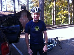
I couldn't just run out into the woods though. My Brasstown excursion left me in dire need of new shoes. My brother suggested that I skip the trip to REI and go directly to Mountain Crossings instead. It turned out to be the right move. The girl that fit me had a process that I hadn't seen before - stand up, foot forward, feet together, bend your knees, not that much... yeah, those are too small, try again... We tried a couple of different shoes. Apparently hiking shoes are supposed to slip 1/4th to 3/8ths of an inch in the back. You learn something new every day. I ended up with a pair of Keen's and Superfeet insoles. Again, I must have dainty little feminine feet because I ended up with another pair of women's shoes. It doesn't matter the manufacturer, only women's shoes fit me.

There was snow on the roof and a light dusting all around.

 Mountain Crossings

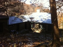
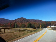
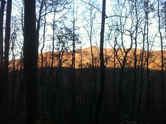
Apparently it had snowed up there last night - the first snow of the year.

With much happier feet, I headed toward Helen. I gave Clark a call but he wasn't home. I'd probably have better luck if I'd think to call him before I'm an hour away.

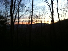
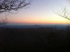
There was snow high up on the Blue Ridge.

 Snow at Upper Elevations

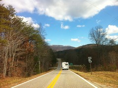
I'd be up there later. Well, one ridge over from there.

My trails site shows a couple of trailheads in the area, but despite having been in the area a dozen times, I've perpetually failed to get photos of them. So, I headed up to High Shoals, snapped a boring photo of the parking area and got stuck behind a really slow driver on the way down that I literally could have walked faster than. Technically, we were moving, but my needle was sitting on 0 MPH and he refused to let me around. "Them darn kids, always in a hurry!" Fortunately he was hugging the mountain and I was able to pull around on the inside in a turn. I hope I didn't scare him too much.

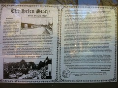
I also made a run up around FS44 to Horsetrough, showed a couple how to get there, and while trying to find an open bathroom on the way out, learned the story of Helen.

 The Helen Story

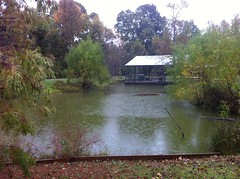
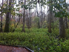
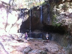
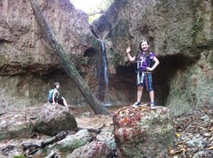
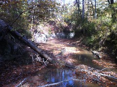
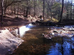
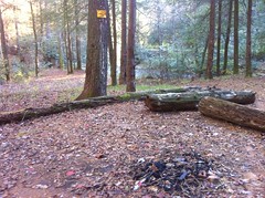
I also noticed a weird rock structure in Henson Creek, right at the edge of the campground.

 Henson Creek Rock Structure

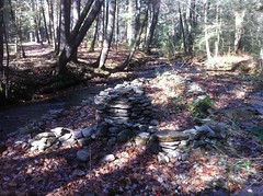
I'd never noticed it before. I guess in the summer there's too much foliage.

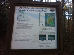
At the lower end of FS44, the Forest Service had done a ton of cleanup along the Chattahoochee. Every popular campsite and river access point now have stairs leading down to them, replacing the erosion channels created by campers and anglers over the years.

 Upper Chattahoochee Stairs

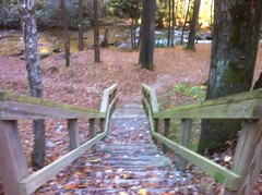
We could use some of those here along the Chattahoochee south of Lanier.

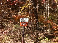
The campground at the bridge on FS44 is closed now. There's just a small parking lot. But, I guess "Them darn rangers can't tell me what to do!"

 No Camping Here

Actually when I first saw it, it struck me as a Jedi mind trick. "There is No Camping Here. You don't see any camping here. These are not the droids you are looking for."

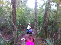
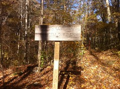
Side trip accomplished, I set about the thing I actually drove up for - hiking the Andrews Cove and Rocky Mountain trails. I could already tell I'd be walking in the dark, so I gave Kathryn a call and told her not to worry until maybe 10PM, and even then I had light and fire if I needed it.

The Andrews Cove Campground was closed.

 Andrews Cove Campground Sign

It's always closed. I've driven past it more than a dozen times and I've only seen it open once. Fortunately, there was little parking area just down the road.

The trailhead was at the back of the campground, to the east of Andrews Creek.

 Andrews Cove Trail Sign

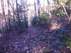
Not ten steps up the trail, I could tell it was going to be a long day. My body felt heavy, my feet felt heavy and I'd had a splitting headache all morning. I'd hoped all this would pass once I got moving, but it didn't. Maybe it would eventually. On the upside, my new shoes felt pretty good. They appeared to kind of concentrate force on my big toes. Is that bad? I don't know, I've been hiking in trail running shoes for years, I have no idea what actual hiking shoes are supposed to feel like. I just went with it.

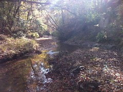
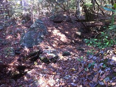
The trail crossed a few feeder streams early on.

 Andrews Cove Trail 1

I started getting warm, took off my jacket, walked a bit, took off my base layer, walked a bit more, and then suddenly noticed that my GPS was missing from my hand. Uh oh. Perhaps it was in my pocket. No, not in my pocket. Oh no.

It wasn't panic that struck me, just sadness... unexpectedly intense sadness. I don't need a GPS to navigate, especially on-trail. But, it was a gift from my mom. Unless I'm racing, I'm carrying it. I have different gear for all kinds of adventures, but it's the one thing that I always have with me. It's become more of a companion than a tool. We've done so much together. I felt a profound, shocking sense of loss.

On top of that, I didn't want to lose the data I'd gathered already that day, nor miss this opportunity to map these trails. It had to be back there, lying on the trail somewhere. I probably put it down to take off my base layer and just didn't pick it back up. I backtracked to where I took off my base layer. Nothing. ...to where I took off my jacket. Nothing. ...to the last point I remembered using it. Nothing. In the summer it would have been easy to find. In fall, it was just another brown object on the brown ground, among the brown leaves and brown rocks. I must have walked past it. It would have been easy to do. I turned around and looked more carefully. That little voice telling me to give up kept getting louder, but that little voice needs to shut up because it has to be here! It can't not be. I just had it in my hand 10 minutes ago. I was all the way back to the point where I'd taken off my base layer when I finally saw it, half covered in leaves. From the other direction, it was totally obscured. Thank you God. Onward.

 Andrews Cove Trail 2

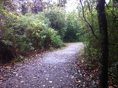
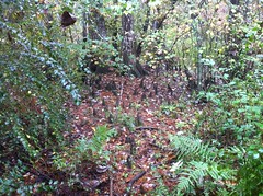
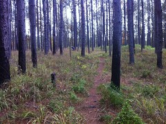
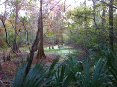
The trail wasn't actually all that interesting. Old road bed, couple of reroutes, no notable points of interest, kind of steep. I did find some trash, just off trail. "Just throw it behind that tree kids, nobody'll notice"
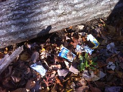
 Trash on Andrews Cove Trail

I packed it out.

At Indian Grave Gap, a guy was driving by right as I got there. He didn't notice me as he drove by, but when he backed up to head down FS839 it startled him to see me there.

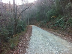
I hung a left on FS283 and walked down the road for about a block.

 FS283

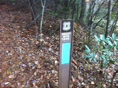
It was much colder up there. I hung another left on the Rocky Mountain trail.

 Rocky Mountain Trail Stake

It started out on an old roadbed but eventually singletrack split off to the right and the old roadbed continued ahead, overgrown.

I saw Brier Creek Bald off to the right.

 Brier Creek Bald From Rocky Mountain

I'll have to go see what's up there one day. Hopefully the brier's are confined to the creek.

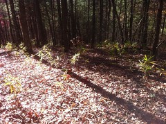
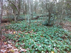
There are several Georgia mountains named Rocky Mountain. This one was turning out to be less rocky than the others. It was cold though, and not unscenic. One of the hillsides was covered by snow-dusted galax, or "Dolla' Weed" as Norma had called it once; Dolla meaning Dollar as it is similar in shape and size to a silver dollar, and green like a paper dollar.

Dolla' Weed:

 An Infinity of Snow-Dusted Galax

I'd been hoping all day that my head would quit hurting, but no amount of climbing can fix a headache, I guess. To add insult, at that point I was also starving and lightheaded. At the intersection with the AT, I took a break and ate some Twix and Dorito's.

 Rocky Mountain - AT Intersection

I was sitting in the sun too, and no longer on the north face of the ridge. It was warmer there. Probably not warm in the absolute sense, but I was getting colder much more slowly than before. Some combination of the warmth, rest and food fixed my headache. I only had one more kick to go too before a long descent. Maybe knowing that helped too.

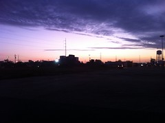
The sun was going down as I climbed the ridge up to the top of Rocky.

 Almost Sunset

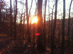
Just over the top, to the southeast, Mount Yonah breached the blue dusk like the dorsal fin of some ancient leviathan. If I hadn't been out so late, I would have missed it.

 Yonah From Rocky Mountain

That view alone made my day.

The sun was down, but it was still lightish on the descent to Indian Grave Gap, which was fortunate, as Rocky Mountain was beginning to live up to it's name. It was getting warmer too. Eventually I could even unzip my jacket.

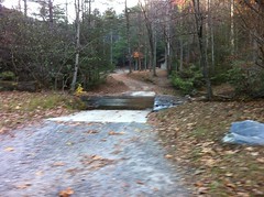
Not far down Andrews Cove, it was officially dark. I had to feel my way along the trail; the surface felt harder than the surrounding woods. Looking at the ground was useless, it was pitch black. Looking ahead, I could tell where to go by following the space between the trees. I did get off trail once or twice, but it wasn't hard to find my way back.

It's funny, the last time I was out navigating in the dark, I had an easier time than this. I guess the moon was brighter that night, or maybe it's just easier going in a particular direction than trying to follow a meandering trail. I did have one moment of slight panic when I looked up and realized I could see the stars. Near the campground, it was really dark and I had to use my light to get across the creeks.

My shoes felt good all day, no toe slamming, even after miles of down-hiking. I thought I was getting a blister on my right big toe, but it turned out to just be where part of a callous was wearing off.

Back at the truck, I called Kathryn and drove into Helen for some Chile Colorado at La Cabana. My brother called; LSU beat Bama. Isabel called, wondering where I'd put her gymnastics outfit. Back to the real world.