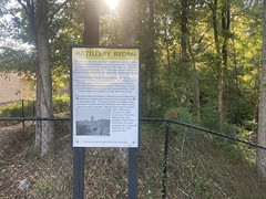
Again, I'm not sure if this is _technically_ part of the old Little River WMA or not, but in my mind it is, so that's what I'm going with.
The part that I didn't explore last weekend has sections called "Entering Bromance"/"I Banged Your Mom Last Night" and sometimes gets nebulously referrred to as "Everest". Too intrigued to leave it be, I was back up there today. Last week, one of my friends was like "next time call me and I'll show you around" and it was only this morning that I realized that I don't have his contact info. No email. No phone number. No @instafacetwitterverse. Nothing. And then it dawned on my as I was driving up there (far too late) that I could have @-commented on my previous Strava post and asked him to email that crap to me, and he would have gotten that.
This is the level of intelligence that I'm working with here.
Chris, sorry man. I didn't specifically mean to put you off. I'm just not that bright at times.
At any rate though, I returned to the old Little River WMA-ish area again today, and continued looking around.
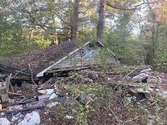
In the vicinity of the Newsome Borrow Pit, I "found" 2 abandoned houses, in the sense that I knew were they ought to be based on other people's Strava posts, had seen the road leading over to that area the previous week, and just followed it down to the houses.
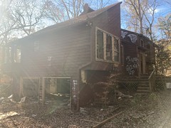
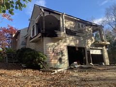
I didn't go inside, because alone and scary, but they were interesting from the outside.
Similarly interesting was a uhaul van parked at the top of one of the driveways, with some dude just chilling in it with the engine on. He seemed to be reading some set of papers and waved to me as I waved to him. MORE interesting was a black Toyota parked at the top of the other driveway with no one in it. EVEN MORE interesting was that, from the second house, I could see a guy walking out of the woods in full camo with a bow towards the first house. It is archery season until like the middle of January. That's a pretty good spot!
I rode down to the creek and followed some semi-obvious trails until I ended up on a sewer line, then followed that all the way to Towne Lake Parkway. About halfway out, I ran into 3 girls crossing a little stream, trying super hard not to get their shoes wet. Each of them had a part of a deer skeleton on the end of a stick - 2 skulls and a vertebra. They were pround of their finds and very excited to tell me where they'd been exploring, and how they found them, and all kinds of details. We were all at the intersection of 2 sewer lines, and they were a little confused about how which way to go, so I told them where each of them probably went, and that helped them figure it out. Still, they didn't seem too confident. I continued down the trail, and not a minute later ran into 3 more adults and 3 more kids. Turned out the girls were part of their group, and they'd just talked to them on the phone. Great! Nobody was lost.
I saw enough mylar balloons today to make up for not having seen many earlier this year.
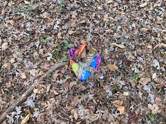
Soooo many balloons.
On the other side of Towne Lake Parkway the trail continued for a while, but eventually I'd have had to cross the creek to keep going, and screw that. It was like 10 feet down to the creek and 10 feet back up on the other side, and it was sketchier than I felt like going for at the time. I'll have to come at it from the other side someday.
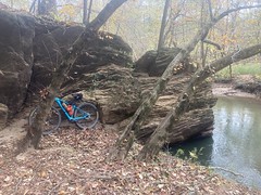
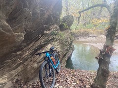
Heading back north, I kind of enjoyed the scenery more than I had heading south.
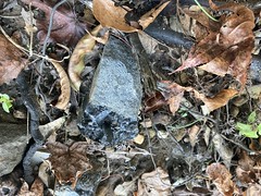
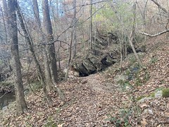
Cool rocks.
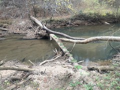
The creek was nice.
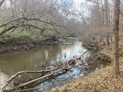
Though, it apparently floods pretty high, at times, as evidenced by the remains of a telephone pole, well above my head.

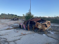
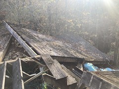
I hit every little spur on the way back, and found an abandoned car off of one of them.

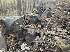
Kind-of near someone's backyard actually, but I bet it was dumped there a long time before there were houses.
I took a different route a few times on the way back. There were 2 bits of trail with alternate lines. One had a pretty damn steep descent down to a creek. Everest perhaps? In the other direction? Heh. I managed to descend the two steepest bits out there today.
Score.
I also managed to get back to the car at a decent hour. No feaking out parents and kids this time.
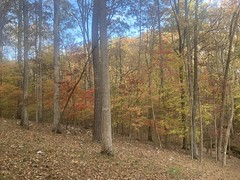
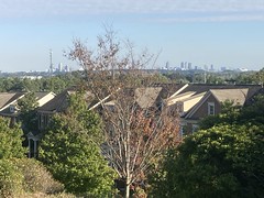
Man, fall is in full swing in the ATL metro right now. Just look at that Cypress.

Dinner, again, was that same amazing chicken sandwich at Canyon. Mmm, hmmm.
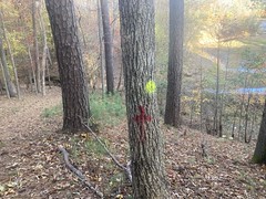
I kind-of know my way around now, but there are definitely a few trails I haven't ridden, and a few that I have, but lost the GPS data for. So, I'll be back again, I'm sure. Maybe I'll remember to get a hold of Chris next time too.