That's right, Jones Creek proper this time. There are probably a dozen Jones Creeks in North Georgia. This is the one that runs generally south around the general Bull Mountain area. The one way back up FS877.
I'd been up that way 10+ years ago, but I hadn't been as thorough as I tend to be these days, and last weekend I figured it was time for another round.
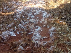
I parked just past the campsite at the end of the road, right before the last concrete ford, just this side of the gate. It was a chilly morning and there was a whole patch of frost flowers on the little climb up to the food plot.
I ended up going up and down that little hill a couple of times though. Twice I forgot something in the car. First I think it was my GPS, then my jacket. Woohoo, preparation!
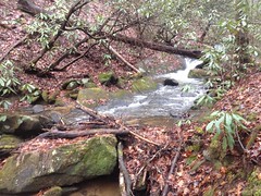
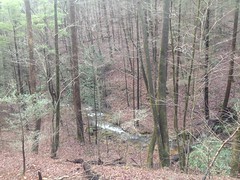
Past the food plot, to the left, it looks like FS877 used to just keep on going. At the bottom end there, the woods was wide open. From the old road, you could see a long way, and the creek was bright and noisy.
There was a bit of deadfall though, and I had to manage a couple of pretty good tangles.
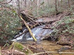
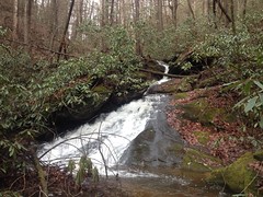
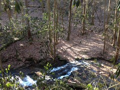
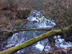
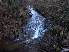
A ways up I noticed a small falls that I didn't remember from the last time.
It was a bit of an effort to get down to it though. There was a bit of a slip layer on the backslope and it was rockier than it looked at first.
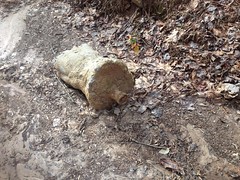
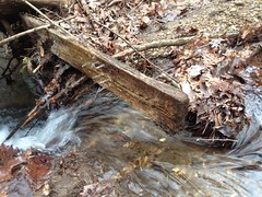
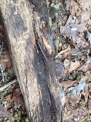
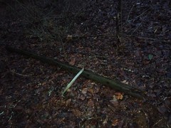
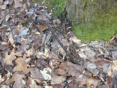
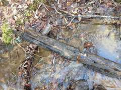
Just up from the falls there was a little spot where runoff from the backslope had eaten a chunk out of the old roadbed, and this old board was lying right in the middle of it.
Definitely a board.
Stuff like that always makes me wonder. Where did it come from, and how did it end up where I found it. It could be the remains of a cabin, fence, or some other old structure. It might have fallen off of the truck that was hauling it out as junk. Or, conversely, it might just as well have been hauled in as junk and dumped. Each seems equally likely, but the disparity in significance between the two always makes me laugh. To myself, at least.
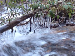
It was cold enough to make the ground crunchy, and cold enough for the trickling drips to freeze.
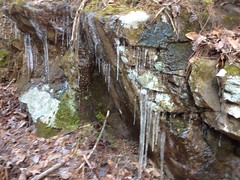
I ran into those pretty consistently, all day.
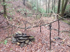
I also ran into these:
Cables everywhere.
Cables usually mean logging, so I expected to see more evidence of that further up.
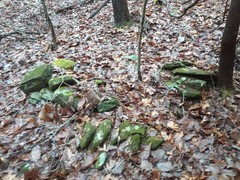
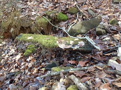
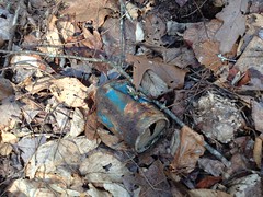
I ran into those near a spot that had clearly been leveled artificially. There was a bit of trash in the vicinity too.
This old tire was barely sticking out of the ground.
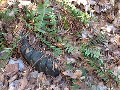
I just happened to see it by luck. It was buried in runoff and covered in woody growth. I imagine it'll be completely obscured soon enough.
Yes, that particular spot seemed like it had been popular for something. Maybe just for dumping trash though.
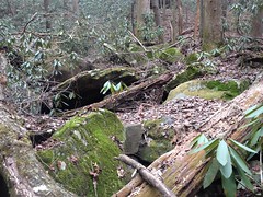
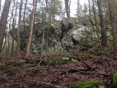
Uphill it looked really weird though. There were several deep cuts into the backslope.
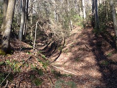
If those are old roadbeds, worn below grade, they're the deepest I've ever seen. They certainly didn't look natural. The ridge behind them didn't strike me as tall enough to produce that kind of runoff. They struck me as hydraulic mine cuts. I've never run into anything alleging such activity in the area, but I guess I've never looked for anything either. Jones Creek would certainly supply plenty of water. Hmm...
I made my way further up the old road...
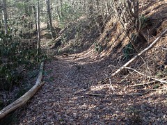
It seemed like somewhere up there I had to hang a left...
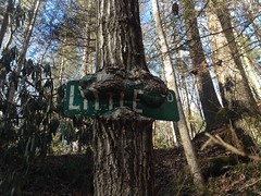
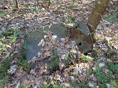
I was thinking that just as I noticed this old road sign nailed up high to my right.
Ha!
I love the consistency. There are road signs nailed up on several of the trails in the general Jones Creek watershed. I've run into Silver Dollar, Farm Road, and now Little Road. Morgan Dairy is alleged to adorn the ridge running down from Ball Mountain. I wonder if there are more that I haven't found yet. I wonder if there are any on the Bull Mountain system that I've just missed over the years.
I like how the tree is eating the sign, and how it's managed to push it's bark between the metal and the paint. The same think is happening on the Farm Road sign.
I wonder if I'll ever find out who put these up, or why.
Just past the sign, I found the left that I was supposed to hang. You've got to cross a little feeder creek, and the tree trunks in the creek look like they might have been a bridge at one point. Maybe. Another old board lying in the creek, just upstream, lent some creedence.
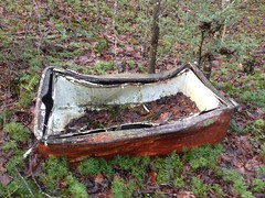
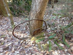
Just across the creek there was this old bent up barrel.
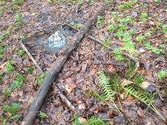
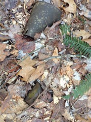
And whatever the heck this is.
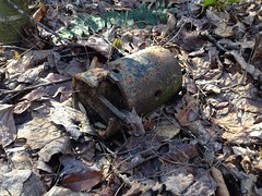
What the heck is that? It struck me as maybe a sleeve that fits a tool onto a take-off shaft, with bits of the broken tool still attached. Like, part of an old broken brush hog, or something. I don't know. Somebody tell me.
The barrel had some holes in it, but it didn't look axed. It struck me as related to logging rather than moonshining, but again, who knows?.
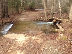
As the road draws to an end, it follows the creek more closely. Near the very end, it becomes pretty overgrown and a spur hangs a hard right up a feeder creek, and it looks kind-of like that's the right way to go. But, I knew from having been there before, that the trail to the right is a spur, and the old road actually keeps going through the overgrowth, right to the foot of a waterfall. Standing there at the time though, I couldn't hear the falls, there was no easily discernible continuation of the road, and there was no clear trail through the brush. If I didn't know that the road kept going, I might have thought that it stopped right there, and if it had been my first time up there, I might never have seen the falls. I'm not sure what made me keep going the first time. I know it had been summer. Maybe there was a more distinct trail through the brush.
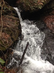
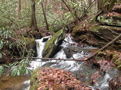
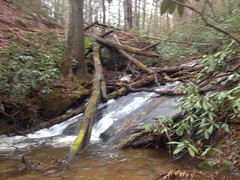
At any rate, I kept going and found the falls, right where I remember it being.
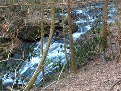
What I didn't remember is that there are really upper and lower cascades.
Lower cascade:
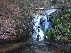
Upper cascade:
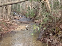
And nice flow too. Though it had kept me off my bike, the recent rain was good for something!
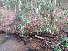
Between the cascades, the cold and the spray had made a chandelier out of an overhanging branch.
I explored that spur that I mentioned earlier and found a confusing set of disconnected trails uphill from it. There were several, distinct old roads, none of which actually connected with each other. They came close, but they didn't actually connect. There were 50+ feet of just woods between each of them. Between that and the abundance of stumps, it struck me as a modernish logging operation. The hillside would have been clear-cut and logging machines would have just driven up the draws and all over the backslope. The roads would have been notched in to make the timber easier to collect and haul out. I've seen similar operations recently at Pinelog and even locally where they're clearing for neighborhoods. That was my best guess, at least.
On the way back down I found a side loop with a really long cable running down the length of it.

It was tangled into coils here and there, and covered up in places, but I followed it for a long way, eventually coming to the frayed end of it.
Back at the Little Road sign, I checked out the other branch of the road, which showed a lot of the same signs.
It had clearly been logged, but the woods wasn't all dirty and choked. Instead, it was grassy and open everywhere.
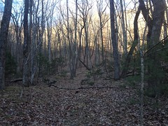
It wasn't what I expected to see. I'm not sure what they did differently, or what was different about the terrain that made it turn out like this. Whatever it was, I was thankful.
When the trails petered out, I headed back. I thought I saw a few more bench-looking cuts across the creek, but I didn't have time to check them out. Maybe next time.
I don't remember exactly why I needed to get home. I think it was to catch New Orleans get knocked out of the playoffs at the last second by Minnesota.
Yeah, that sounds right.