Monday, July 26, 2021

Tickanetley

Earlier today I checked the weather forecast. 20% chance of rain. I looked at the radar, and clicked the "future" button. Small pop-ups east of Atlanta. Nothing in the mountains.

Excellent!

I'd been feeling like riding some non-system trails in the greater Blue Ridge WMA area - trails that, due to their non-system-ness, and dubious sustainability, I limit myself to riding each of only once per year (and would encourage anyone else who rides them to do the same). I had a particular loop in mind, and it has been way more than a year since I'd hit any of those trails. I think like 2 years for one of them, and like maybe 8 or 10 for the others. Maybe longer. It would be Adventure, with that capital A, for sure.

I was excited.

But, first things first. I somehow lost my flip-belt, maybe in Texas, I don't know, and I've just been jamming my phone down into this weird leg pocket my kit has. It's not a good solution. It's bound to go flying out at some point, and I don't need to deal with breaking or losing a phone right now, so I stopped by REI on the way up to see if they had some reasonably secure way to mount it to my bike. Everything they had looked super janky, but I tested each potential solution out by putting my phone in it and just shaking the everliving crap out of it. This technique surprised the associate that was helping me, and she took a step back, possibly reflecting on the life choices that had led her to be in this situation with this, apparent, madman. After a second though, she seemed to understand what I was up to, and suggested a particular unit, which, no doubt, really held the crap out of that phone, despite looking flimsy and useless.

I'd give it a try.

I was back on the road, having spend fewer than 15 total minutes from getting off of the highway, to getting back on the highway. Most efficient run through REI ever.

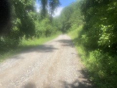
As I drove down Nimblewill Church Road, I could see that it had rained there recently. As I pulled into the Jake lot, I could see that it had rained there quite a bit, in fact. Man, come on! Seriously?

I've joked about it before, but I swear a 20% chance of rain means that it's going to rain on whatever 20% of the state that I'm in.

I got dressed, got my bike ready. There were like 6 people standing around talking about the ride they'd just finished, but I didn't know any of them. I realized I needed to mount that phone thing where my GPS was, and move my GPS, but the GPS mount needed zip ties, and I didn't have any. I asked around, and it turned out, between them, the entire group had a single zip tie. I needed two though, so I let them keep the one, and just put the GPS in my pocket for the time being. The phone mount seemed really secure, and since it wasn't in my pocket, in contact with any soon-to-be-drenched fabric, it might actually cooperate better than it tends to when it's wet. That is, if it doesn't just rain on it the entire time.

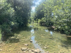
As I was rolling out, one of the guys mentioned Mountiantown Creek, which piqued my interest, and I ended up getting into a conversation with everybody about all kinds of trails, including the ones I was going to ride, and everything else up there. We could have talked for hours, but I had to get moving, and almost immediately upon doing so, it started sprinkling.

As I headed west up FS28-2, it unloaded. Big fat rain.

Big fat cold rain!

I began to question the life choices I'd made that had led me to wearing a super-thin trisuit, but soon enough realized that it wasn't the worst decision, as I acclimated to the temperature change. I was climbing, which meant it would cool off as I got higher, but also I was climbing, which meant I'd warm up quite a bit as well. Worst case, I could turn around. Absolute worst case, I was carrying a full complement of bikepacking gear and could probably get sheltered, warm and dry if need be.

I realized it had been a long, long time since I'd just ridden in the rain too. I don't think I'd done it on that bike yet, at all. It was a thing I used to do without concern. Why the concern now?

Adventure!

Then, like a lightswitch the rain stopped, or I rode out of it, and where I was, it looked like it had never rained.

FS28-2

I guess the storm had moved up from the south?

Whatever. I kept climbing.

I reached Nimblewill Gap way before I expected to.

Nimblewill Gap Memorial

I think of that climb as being interminable, but I guess the rain had been pretty distracting. I felt great. Nobody had flicked the suffering switch yet.

A few vehicles had passed me way down at the bottom of the climb. There were also a few people parked along the road, and a few people camping. Near the top, a red truck came creeping down the road, with a white-knuckled driver gently bumping over every rock. I wondered if his GPS had led him over Nimblewill Gap for some reason.

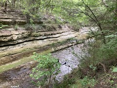
It made me wonder about FS28-3 on the other side. I've seen it in every conceivably condition, from recently regraded to crisscrossed with 2 foot deep ruts. It's always a crapshoot.

Turns out it was about like the last time I was up there. Lots of exposed rock, and some loose rock, but no ruts to speak of.

I was able to absolutely rip down that trail. Fully relaxed at terminal velocity. I'd never had it so easy on a road like that. It's taking a while, but I'm really getting to like my bike. It's very capable, and it's fun to keep finding out just how capable.

The phone mount, which had performed so well up to that point, was overmatched by the chunk though. It flopped back and forth violently, and eventually sent the phone flying. I like to have a pink phone case so it's immediately visible if I drop it in the woods, but my last one wore out, and I'm still rocking the black back-up case. I saw the phone fly out. I knew exactly where it landed. It still took me like 20 seconds to find it. I will be ordering a pink Lifeproof case as soon as the budget permits. I ended up sticking the phone in the good old leg pocket, and over the course of the day would alternate it between the mount and the pocket. I like the grabber part of the mount though. I may try to rig it up to a more stable base or something.

I'd originally planned to ride over Nimblewill, climb back up Van De Griff, take 42 to Ball Mountain, take that ridge back down, then see how I felt. If I had another climb in me, take Silver Dollar/Gold-Coin to FS141, then take roads back to the car. I probably wouldn't feel like climbing Silver Dollar, but you never know.

It would now depend, entirely on the rain. If Ball Mountain Ridge was wet, I wasn't going to ride it. Both to preserve the trail, and to preserve the opportunity to ride it. Ditto for the other backcountry trails, except for Van De Griff as it's just an old roadbed, and I'd be getting increasingly committed to it as I rode toward it anyway.

FS28-3 becomes Old Bucktown. I rode that out to Tickanetley Road, took that to Parker Road, and hung a right at Old Parker Place. There's a neat little cabin on the corner there, with a fenced in yard and a million dogs. They bark and bark at anyone riding by, and since I rode entirely along one side of the property, turned, and rode entirely along the other side of the property, the dogs barked for so long that the owner came out to see what was going on. We waved at each other and he tried (in vain) to get the dogs to stop barking.

Old Parker Place is super steep for a while, then kind of becomes rollers. It's a bit of a "highlands" kind of area, I guess. Where it flattens out a bit, there are lots of houses, some little farms, some little neighborhoods. There's at least 1 cemetery, and there might be a church. If it had a couple of country stores, it would be a highlands, but I guess you'd also need a way to drive through it. As far as I know, there's just the one road in and out.

Most of the way up, there's a pipe that you can get water from, but when I got there I still had a bottle and a half. I guess one good thing about the weather was how cool it was. I'd expected to be tanking up several times, but it turned out I was doing quite well with what I had.

Right past the pipe, it started thundering like crazy, and a few minutes later I got stormed on again.

The violence of the rain let up after a bit, but the volume didn't seem to. So much water.

I forgot to mention that I managed to fix my shifter after last week's fiasco. The shifter was fine the whole time. I'd just gotten some crap jammed in the derailleur that kept it from moving past a certain point. Funny thing though... I had assumed that I'd broken my shifter again, and scoured Atlanta looking for one. There are none to be had in Atlanta. None. The Great Shimano Shifter Shortage is bearing down on us pretty hard at the moment. I did manage to find some online, but only from a single vendor: The Pro's Closet. They had 71 of them! I have no idea why they have so many, but that's your source, if you need one. I bought two, just to be safe. And, then figured out that I didn't need any. I inadvertantly hoareded shifters. Watch though, I'll break mine tomorrow and actually need one.

I mention shifters because the rain was giving mine fits. I swear, this cable is ridiculously sensitive to water, for some reason. One drop and it becomes incredibly slow to drop out of any of the top 3 gears. The lower gears are fine. When it's dry, it works fine. I expect some shifting problems in bad weather, but it's usually double shifting, ghost shifting, or you have to go 2 up and 1 back down. I've never experienced this specific issue to this leve. You shift, then wait 5 or 6 seconds before it begins to drop. Then it finally does a few seconds after that, if you start pedaling really lightly, or slowly, or something. Or if you nudge the derailleur with your foot. Sometimes there's nothing you can do. It just doesn't shift.

I was in shifter hell, but I was resigned to it.

Finding Van De Griff was confusing. I remembered climbing all the way to the top of Old Parker Place, and it just became the trail. Now there were "This is a private drive. No turn-around" signs up after the turnoff to Rockwater. I remembered that you don't continue on Rockwater. I don't remember the private drive signs though. There were additional, new looking "No tresspassing" signs on either side of the road. It looked familiar, but I didn't want to be on somebody's driveway.

Turns out nobody was home at any of the cabins along the road, and it turned out also, that yeah, the road just becomes the trail, but it's tricky to see in the summer with brush having grown up and stuff, and there's a freshly graveled, gated drive there now that, from a distance, looks like it's what the road becomes... Anyway, I found it, and I guess the private drive thing is just to discourage people from driving down there and using their driveways to turn around. Or, maybe the road really is owned by some private entity and there's a variance for residents, like Triple Hill Road. Zillow probably knows, but I'm too lazy to look it up.

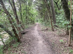
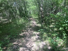
Anyway, I climbed that trail, and despite the raging storm, it was easy going on a good, solid surface. There's packed gravel under the duff, and packed clay under that.

Well, actually... about 2/3rds of the way up, there is this terrible rut, and with the torrent pouring down it, it was easy to see why it was there. It's difficult when it's bone dry, and in the rain, there was just no way. So, I walked all of that. Near the very top, you can screw up and keep going instead of taking a left, but someone had kindly blocked it off with sticks. I walked the first 50 feet of that too, but the rest was solid and rideable.

It was still freaking pouring when I got to 665.

FS665

Somehow my phone worked.

The last time I was up there, a burned out old jeep was parked on the side of the road. No longer. I guess someone came and picked it up.

The rain finally let up when I got out to FS42. However, it had clearly rained as torrentially there as it had been on me just prior. I couldn't remember if FS665 hits 42 before, or after the steep kick up from Doublehead Gap Road. I passed the 180's soon after, but still couldn't remember if they were before or after the kick. Then, I passed FS58-A, and I was pretty sure it was after the kick, so maybe I wouldn't have any more tough climbing left?

This turned out to be the case.

I'd abandoned all hope of riding anything other than gravel for the rest of the day. I no longer minded being in the actual rain, but I didn't want to spend hours and hours in it either. I'd ride to Winding Stair, and take that back to the car.

There were a couple of little climbs, and some rollers.

Nobody ever flicked the suffering switch. I never felt any discomfort in my chest. My back was another story though. My lower back was giving me the business. It gets that way sometimes. IDK, maybe I slept funny, maybe I haven't been stretching enough lately. Maybe I just don't climb like this often enough any more. Whatever it was, my back hurt and it was becoming the limiting factor.

It got drier and drier as I approached Winding Stair. My shifter started working better and better too.

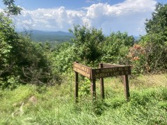
One of the campsites had 2 rainbow beach umbrellas set up at it. I also noticed what I think is a newish Benton-Mackaye Lot. Or, if it previously existed, then I don't remember it.

I noticed the Ball Mountain Ridge Trail, so I'll keep that in mind for later.

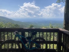
Woohoo, Winding Stair.

Winding Stair Gap

I can't adequately describe how effortless the screaming descent down Winding Stair was. It was wet, so I took it easy, but I still felt like I was flying, and I managed to set a PR. I imagine I'll set another one next time I'm up there when it's dry.

Yep. This bike is great.

I don't remember running in to anyone on the way back to the car. I had an easier time than usual with that final kick up to the road.

There were a ton of cars at Nimblewill Church. I guess it is Sunday.

Back at the lot, I got changed and packed up, and a young lady pulled into the lot right as I was leaving. We chatted for a few seconds. She'd been out for 3 hours, and might have been going out again. She didn't look nearly as wet or dirty as I'd been though. No fair.

In Dawsonville, I grabbed a French Dip at Ray's Signature Grill.

Ray's Signature Grill

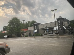
It was so wonderfully salty, which was exactly what I was craving at the time. I think I'll be eating there again.

Bearhoti

I so enjoyed my Mulberry Gap visit a few weeks ago, that I was back up last weekend.

I didn't run into a half-dozen people that I know this time though. It was all business. I was on the trail within 20 minutes or so of arriving.

Right before I left though, I noticed a cargo van full of people leaving, towing a trailer with like 20 bikes on it. According to Kate, Jen Braddock was doing a skills clinic all weekend, and that was the clinicees, headed out to P2 for part 1. Part 2 was jumps and drops, which I imagine was held on-site at the local flow trail, if it didn't get rained out. I almost signed up for the jumps and drops clinic a few years back. Not that I can't jump or drop AT ALL, but I could certainly benefit from some proper training. I lack a dropper post though, lowering your post is always step one, I paid good money to figure out exactly where my post should be... maybe later. Two years have passed and I'm still saying "maybe later."

I planned on riding the Bearhoti loop - up CCC Camp road to Holly Creek Gap, left up FS68 to the top of Bear Creek, down Bear Creek, P1 and P2 back to MGap. A modern classic. After last week's Mill Creek sufferfest, I'd hit the local trails a few times, suffered equally once, and felt great the other time. I really wanted to see how I'd feel in the mountains.

There's an old chimney off CCC Camp Road.

Old Chimney on CCC Camp Road

If I've ever noticed it before, then I don't remember.

Right before it starts to kick up, I noticed a rider behind me. Older guy, enduro-looking rig, baggy shorts. How the heck...? Ahh, wait, do I detect a faint whine? Yes. Yes, that's the faint whine of an e-bike. Mystery solved.

"What route are you doing?" He asked.

"Bearhoti"

"Me too. Do you mind if I follow you for a bit?"

"Not at all, though I think I might be following you, if you're on that thing!"

We laughed, and talked a while. His name was Andy. I forget where he was from though. He'd ridden everything up there at one point or other, but it was spread over 15 years, and he only had half of a sense of where everything was. I'm not sure what his plan was, other than to hope to run into somebody, but I didn't ask, and I guess it worked out for him!

We rode up to Holly Creek Gap together, then on up the mountain. He'd pull ahead, then wait wherever there was an option.

I felt great up to Holly Creek Gap, but someone flicked the suffering switch there, just as they had at FS17 the previous weekend. It does kick up right there, but I've ridden it so many many many times. I know how it ought to feel. I was well fed, well rested. I could hear my heart in my head. My heart rate wasn't way up, but it really felt like it was, suddenly. It kind of came and went too. It wasn't consistent. And it didn't vary with any obvious thing, like the grade, or whether I was sitting or standing. No idea, but it was uncomfortable.

At Barnes Creek Falls there was a gaggle of riders on various kinds of bikes, hanging out, talking to Andy. A family was checking out the falls, which was really raging after the recent rain. I tried to get a photo, but my wet phone and wet fingers just would not cooperate. I didn't recognize any of the guys. They were semi-fascinated with Andy's e-bike. He took off up the hill toward the overlook at astonshing speed.

"Now you do that!"

"Yeah! Here I go..."

[takes off up the hill toward the overlook at boring speed]

The overlook was the place to be.

Bear Creek Overlook

There were two vans full of people taking photos of the view, and each other. They spoke exclusively Spanish. Four guys on motorcycles passed me on the climb and stopped right before I got there. A USFS guy pulled up in a USFS truck too.

I tried to ask the family if they had seen a guy on a bike ride by, but I confused the spanish word for "look" (mirar) for the spanish word for "see" (ver), so I ended up asking "Did you look a guy on a bicycle recently?" instead of "Did you see a guy on a bicycle recently?" and it was super confusing. My spanish is terrible. I'm piggybacking off of portuguese. "To see" is the same in both, but "to look" is different, and I confuse which is different... Turns out they all spoke perfect southern accent, 3 generations raised in Georgia english, and I felt pretty silly. They hadn't seen Andy though, only some lady going the other way. I felt confident he was up the road though, so I wasn't really worried.

I talked to the USFS guy a bit too. I'd never seen him before. He'd only been on the Chattahoochee for a few years. I wonder if any of the folks I used to know are still around. George Bain was still the Forest Supervisor when I was active with them. I want to say there have been two new Supervisors since then, and I never met either of them... The guy I talked to said he had been putting up Gypsy Moth traps all over the place. I'd seen a few of those up above Helen years ago, and only recently learned what they were. We spent a few minutes pointing out different ridges and mountains and the Cohutta Overlook. For only being on the forest a few years, he'd really gotten to know it pretty well.

I met Andy at the Upper Bear Creek Lot. He'd seen the UFSF guy and didn't want to hang around the overlook. He was under the impressions that e-bikes aren't actually allowed anywhere in the forest. It occurred to me that I don't really know. I'm not sure what the rules really are. Street-legal vehicles are allowed on the roads. So, lots of motorcycles are allowed. ATV's and side-by-sides typically aren't, but I wonder if street-legal ones are. Is there such thing as a street-legal side-by-side? E-bikes are street legal. Are they, therefore, allowed on forest roads? I really don't know, and I'm too lazy to look it up. I know people ride them everywhere, and I doubt most people even think twice about it, kind of like the scooters on the sidewalks in Atlanta.

At any rate, we headed down Bear Creek, which was damp, as compared to the road. It had, apparently, rained earlier that day, but the roads had been dry. The trail wasn't "wet" per-se, but definitely "damp". You wouldn't want to ride too slowly across an angled root, for example.

He was like "Go on ahead, I think I can figure it out from here." But I was happy to stop and wait at intersections, if only to give me a chance to try to figure out why my chest was so uncomfortable, and see if taking a break helped.

The switchbacks were extra tricky in the damp, but I managed them. I sketched somewhere in there, but didn't have to walk anything.

My phone was barely cooperating with my wet fingers, but I did manage to get a single photo of my companion.

Andy

Just the one though. My phone was virtually useless.

We bombed Bear Creek. I tried to get a photo of the poplar, but it was hopeless. Somewhere in there, I sketched in one of the creek crossings and had to walk. Just in the wrong gear, it turned out.

I felt great going downhill, so heart rate is definitely a factor, but it's not the whole story. I felt reasonably OK climbing on P1, but the suffering eventually set in, triggered by no obvious thing. Throttling back didn't help. Sometimes it would go away on a short descent. Sometimes it wouldn't.

I considered taking Shakerag back to MGap, but then realized that I'd already instictively turned right to head up to P2, and I'm not going to turn around, I mean, come on.

Except for feeling terrible, I had an easy time of the climb. Like I think I climbed it reasonably fast. I felt like I was keeping a good cadence, and never had to just sit back and grind it out. Same for the grasstrack. Aside from feeling like I was suffering, I wasn't. I wasn't breathing hard. Like earlier, I could hear my heart, and it wasn't beating super fast. It was weird.

The P2 downhill was great. I realized I hadn't ridden that bike on it yet. This struck me as funny, as it was immediately after getting beaten to pieces on the tail end of P2 during the 2019 TNGA that I decided that I must, urgently, acquire a new bike, with specific improvements to make trails like P2 more comfortable to ride. Having done that, and now having tested it, I'm happy to report success. Despite feeling terrible, I apparently set various PR's during the ride, but my shifter started acting up about halfway down P2, and I was stuck with only my top 3 gears, so no PR's on P2, but it was a drastic improvement in comfort over the old bike.

I fiddled with my derailleur and shifter while waiting, but I couldn't get it to work. I was in 1 gear down from the top, and that was it. It was good enough to get me back to my car, but painfully slow for someone riding next to me, so I eventually sent Andy on his way.

I think I saw Jen driving out as I was riding in. I'm not 100% sure though. I did pass 2 riders struggling with that last kick over Mulberry Gap proper, one of whom was walking. That hill is always tough at the end of a long day.

Back a the Barn

Back at the barn, I just sat there for like 10 minutes, feeling like I'd just ridden ORAMM or something, until finally I didn't. At that point, I mosied over to the office. This time, I'd ponied up the extra dinero for a shower and dinner, and took full advantage of both. When you're filthy, a shower makes you feel like a new man. But, when you've been soaking in your own sweat for hours, and only filthy because random stuff has gotten stuck to the water that's just naturally trying to pour off of your body, the shower just makes you feel about the same as you have been feeling. Wet. Hot and wet. It's the towling off that makes you feel like a new man. Oh yeah. Towling off.

Dinner was brisket, if I remember correctly, and it was pretty good. It was the potatoes that I really remember though, and the bread. I guess I was hurting for carbs.

Me, Andy, and Kate did the jibber-jabber for like an hour, and it turns out Andy's a doctor. How crap I felt came up, and he encouraged my to get it checked out for real. I'd actually just gotten my insurance situation straigtened out the day before, and unless I felt miraculously better on the ride, planned on going in either the following day if the KP urgent care place was open on Sunday, or Monday if they weren't.

As I didn't feel miraculously better, I went in Sunday. I expected them to take an EKG, maybe an x-ray, and refer me to a cardiologist. Oh, no, no. If you mention "chest" to anyone at a medical facility, visibly distressed nurses hustle you into a bed, attach all manner of equipment to you, draw half your blood, run a million tests, and watch you overnight. Long story short... I'm not having some long drawn out heart attack, I haven't had a heart attack, my arteries aren't clogged, all my numbers look great, my xray looks normal except for old broken ribs... Nothing is immediately killing me. It's a mystery. It also doens't appear to be some obvious GI problem that seems like it's in my chest because GI problems sometimes do. No idea. While I was in the hospital, I mostly felt fine, and only felt like what I was there for a few times. Each time, it correlated with a sudden jump in BP, like from 118 to 149. But, I got a BP tester and took my BP over and over at home, and my blood pressure goes all over the place, and I couldn't correlate feeling the discomfort with anything. So weird. Anyway, I've got a follow-up tomorrow, and I'm sure there will be more.

A friend of mine diagnosed the source of the problem, quite confidently, as "birthdays".

Ha ha, very funny.

Wednesday, July 14, 2021

Mill Creek

I don't hang out at Mulberry Gap enough. Every time I do, it's great, but for the past year and a half, there's just been too much keeping me away. About a month ago I was fully vaccinated though, and this past Friday, I got to the end of some personal stuff that has been consuming a lot of time and energy as well. There was no family business looming, and work was even oddly stable going into the weekend. Seemed like the perfect opportunity to head up to the mountains.

On the downside though, I've been feeling pretty off, physically, basically since getting back from Pisgah. Weird discomfort in my chest and upper abdomen. It's not gas or constipation - I've been through the remedies for those. Woohoo! It's very unlikely to be covid or the flu - no fever, and I've had all my shots. Weird sensation that moves around on at the base of my right lung. Sometimes it feels tough to get a full breath, or if I do, I still feel like I'm short on O2. Sometimes my heart feels it does when I've been over my lactic threshold for too long, even at low BPMs, for hours or days. Then, it'll ease off and I'll feel fine, but it never really goes away. I've had this a few times before, and it cleared up on its own, but it was never this nagging. Historically, it wouldn't affect my performance either. I was always as strong on the bike, despite how I felt. This time, I definitely notice it affecting my performance around town, but I felt fine riding in Texas, so I figured it was gone, but then it kind-of came back this past week. IDK, but it's apparently not immediately fatal, and I'm going to the Dr. later this week.

So, that sets the scene.

I drove up Saturday morning, after trying to get some Waffle House, but having to settle on Wendy's instead. I parked at the end of a long line of cars, in the only remaining space available and checked in at the front desk. Kate and Andrew were hanging out in the shop, so I talked to them for a while. Zeke Lily was also there. He and Carey had been out doing some long ride, and had either just gotten back, or were stopping in. The last time I saw him was when my and Billy were riding Noontootla, years ago, and he just happened to be parking at the church right as we drove up. We shook hands, said some hellos, and they were back at it. I got something at the shop, but I forget now what it was. Kate had one of the cool new TNGA maps for me. I kept forgetting to order one.

I wanted to do the original Southern Cross Route, back when it was held in the Cohuttas - north from MGap, up to Crandall, back on Mill Creek road, then down off of Potatopatch. Something like that. All I remembered for sure about the route though, was that there was some funnily-named road up near Crandall. I had data for all of the roads, and normally, I'd build a GPS file at home, load it up, and print a map as a fallback, but I'd only decided on doing that particular loop after getting partway up there and seeing that, though it was sunny at the time, it had definitely rained all morning. I didn't know the details of the route offhand, but I'd seen Kate do it a few times on Strava, so I figured she'd know it pretty well. This was the case, though they call it the Back 40 up there. She even had a GPX file of it, and loaded it onto my GPS. That's service! Ha ha.

I'd left my pump in my Dad's car in Texas, so I borrowed theirs, and while doing so, met a guy named Chad who's been volunteering up there for a while now. After like 3 sentences, I was like: "Man, where are you from?" I almost asked "What part of South Louisiana are you from?" but I didn't want to be too presumptuous. Turned out I wouldn't have been: Thibodeaux. Ha ha! We talked all about Louisiana. Turned out he knew Mike Rasch. It ALSO turned out that Mike was staying at MGap that weekend, and was out on a ride at the time!

See, it's always a good time when I hang out at MGap.

I hit the road a few minutes later, and passed the old firetruck.

The Old Firetruck

What word starts with an f, and ends with uck? Get your mind out of the gutter! Firetruck.

At Emery Creek/Holly Creek there were a bunch of people out enjoying the day.

Holly Creek

Some guy and his wife drove up and asked me all about the local roads and points of interest. It was funny though... He was like: "I pulled over a couple of other people and asked them... You wouldn't believe it! People are just out here driving around. They have no idea where they are or where the roads go!" Something like that. It struck me, but apparently didn't strike him, that he, himeself, was out driving around, with no idea where they were, or where the road went! I could be wrong, but he didn't seem to be trolling me either. I gave them the low-down and they seemed really happy to have found somebody that knew their way around. What was really interesting though, is that he was specifically looking for the Licklog Trail, which I think is up near Chillowee, in Tennessee, north of Big Frog, and they were on the south side of the Cohutta Wilderness. It's a long way to Licklog from there. Still, they were pretty happy with the info I gave them, and I hope they were able to put it to good use.

I felt great cruising (downhillish) along CCC Camp Road, and even better when it became pavement.

CCC Camp Road

I passed a guy on a trail bike finishing up his ride near the bottom of FS218 (Windy Gap) and we hollered at each other as I rode by.

The Ellijay-Crandall Road is unmarked at its intersection with CCC Camp Road, as it turns out, so it was good that I had the GPX track. When I passed it, it seemed right that I'd want to turn about there, but I wouldn't have been sure until much later, even if I had.

"Shorty Lents" was the funnily-named road that I'd remembered, up by Crandall.

Shorty Lents

I'd been on the roads in the area before, like 20 years ago. My Dad and I got my truck stuck somewhere up there, following questionable directions to the Rocky Flats Trail, and some guys with better 4WD skills than I had at the time rescued us by basically just assuring me that I'd be able to drive it out, which turned out to be true. After finding where we were supposed to park, I remember we rode way south on Rocky Flats, then kept going past the end of the official road, ended up at the back of a some farm field, rode out to the highway, then rode back along the road we'd driven in on. The road with the field would have been Ellijay-Crandall, but I didn't see, or at least didn't recognize the field. Nor, did I notice FS630D (the Rocky Flats Trail) as I climbed FS630.

Speaking of FS630...

It was a pleasure to climb. It turned out to be about 8 miles long, about the same as Noontootla, but a little steeper, and a bit less scenic. Still, I felt pretty good climbing it, and the whole day was kind-of going pretty well.

I was near the end of one of my bottles just as I rode up on a spring that Kate had told me about.

The Spring on FS630

Remembering the lesson I'd learned in Florida so many years ago, I pounded the rest of the bottle that I had, drank as much as I felt like drinking from the spring, and THEN filled my bottle.

As soon as I got back on the bike, it was like someone flicked the suffering switch. I'm not sure why, but everything went immediately downhill. Figuratively, of course. I had another mile or two of climbing still to go, just on FS630.

It was grueling. All those issues I mentioned at the top of this post came back, fairly suddenly. My heart felt like I'd been pushing it for a long time, even though I'd been spinning comfortably all day. I'd try to get a breath, and I felt like my lungs just wouldn't expand. When I'd force a good breath, I still felt like I was suffocating. I had to stop a few times. I'd catch my breath when I did, but the discomfort in my chest persisted. I was getting lightheaded, over and over. My right wrist really hurt too, though I think that was unrelated. I need to fiddle with the grip a bit, and maybe the shifter position.

I've had all of those sensations before, on the bike even, but only when it made sense. It didn't strike me as making sense at the time. It was hot, and I was pouring sweat. But, it was Summer, in Georgia. It's hot, and I pour sweat like that every summer. I couldn't put my finger on the problem, but I was fit to continue, so I did.

At Hickey Gap, I had a hard time getting my super, super wet phone to take a photo.

Hickey Gap

The wet screen just didn't like my wet fingers. My kingdom for a phone with a touch screen that works when it's wet like that.

You can see how wet the lens was in this shot.

FS630

Pouring buckets.

At the intersection with FS17, there is a bit of an overlook, which must be a lot nicer in the winter.

Intersection wiht FS17

FS630 continues north and FS17 goes due south. The Cohutta Wilderness is to the east, and the Cohutta WMA is to the west. I think Sumac Creek creates that valley there, and the town of Cisco is somewhere to the northwest.

I was less interested in overlooks though, and more interested in the super steep-looking climb to the right. I crawled up it, grannied out, and then kept crawling for like a mile. I want to say it's another 6 or 7 miles from there to FS68. I knew this at the time, but I didn't remember FS17 being all that steep. I guess I'd never been this far down on it, except driving. Heh. It was steep, and relentless, and it never really let up. I mean, there were kicks and flats, but it was mostly just a steady grade, right up the ridge (Rough Ridge?) to FS68.

I stopped several times to catch my breath. I stopped for like 5 minutes at the Mill Creek Overlook.

Mill Creek Overlook

More sweaty lens action there.

I almost fell asleep sitting there. It was bad.

I knew that I was getting semi-close to FS68 when I hit that overlook though, so that was heartening. I walked the final kick though. There only thing more disheartening that walking on a forest road is when a truck drives by and sees you doing it. This happened. No way to play it off. I was walking on the road.

Heh. I basically wore the soles completely off of my shoes in Pisgah, they're little more than road shoes at the moment. The stitching is slowly coming apart. Both soles came off, and both have been shoe-gooed back on. I also used a couple of screws on one of the soles. "Last legs" would be an understatement. I have a new pair, which I'd brought, and left in the car, that just need a pair of cleats. But, I like to get every last mile out of my gear, and I figured: "Hey, it's gravel roads and pavement all day today. That'll be real easy on the shoes. No matter if the soles are slick and bare. I won't need to walk."

Ha! Famous last words.

I might as well have said "Hey, watch this", or "Hold my beer."

I even wondered, at the time, in my addled state, if some cosmic joke wasn't being played. I.e. I'd have had a good day, all day, if I hadn't chosen to put more miles on those shoes.

Ostensibly, the route takes you to the right, for a run up to the Grassy Mountain Fire Tower, and back. No freaking way. I was headed directly home, but, alas, it's a climb to the left as well, so I had to do that. Fortunately, the climb was short and shallow, and I suffered no additional disgrace at that time.

I remembered it being "all rollers" from there to Potatopatch, but one of them is actually pretty long. It's really more like 3 decent climbs than "all rollers". Oof.

I did notice one really, really obscure thing on the way back. East of the Emery Creek trail, basically at the top of the first climb, heading east, there's a flat spot to the south, with a campsite, and to the north, the hillside is kind of notched. Like it had been dug into, to level the ground there, maybe for a structure, or maybe for a parking area. Whatever it's purpose, it's overgrown now, but you can see how it was notched and levelled and there's a bit of a terrace there where they stopped digging...

So, there's this super, super old video:

This instance of it was uploaded in 2018, but judging from the bikes and attire, I'd guess that it was shot in the '90s. I first saw it in like 2006 or so, not on YouTube. Decent trials riding, really. Anyway, when I first saw it, I recognized Windy Gap, and I recognized Mountaintown (even that specific gravel bar that the guy was doing tricks on), and I think that's the Emery Creek picnic area at one point, but there were a couple of places that I couldn't identify.

Near the end, they're trying to ride up some little terrace, and one guy makes it. When I saw that, it struck me as being that same terrace that I mentioned above. I even tried to describe the location to the people I was watching it with, but nobody knew what spot I was talking about. Since then, I've ridden by there a few times, always meaning to see if it looked right or not, and always forgetting.

Well, I didn't forget last weekend! And... anticlimactically, I'm pretty sure it's not the spot. They're pretty well up in the woods when they try to ride up the terrace, and at the spot that I rode by, the terrace is pretty close to the road. There's also a second terrace in the video, and there's not one (that I noticed) in that spot. But, hey, I didn't forget to look this time.

That was the highlight of the push over to Potatopatch. The lowlights wer more walking, and more suffering.

Ohhh... the suffering.

But, if it's a loop, andyou mostly climb for 20+ miles, then you're bound to descend for a long time, at some point. A couple of hundred yards down from Potatpatch, and I felt a lot better. I passed some folks hiking the road with a dog about halfway to the Bear Creek upper lot. I passed several cars and trucks too, only to get repassed at the overlook...

The overlook:

Bear Creek Overlook Left 
	Bear Creek Overlook Right

...and then pass them again.

I realized that I hadn't yet descended that on this bike, and it was a dream, though the fork did chatter a bit. I may need to tighten the headset, or it may just be that way. I realized too, that there will be a lot of "Hey, I've never ridden this bike here!" in the future, and it made me kind-of eager to get out and ride some classic stuff.

I roared down the mountain for miles, then climbed that little quarter mile up to Mulberry Gap. Rasch Hole was there when I got back as was Matt Smith and various other old friends! It was dinner time in the barn, so I hung out and talked to everybody for like 2 hours. Some guys were having a birthday party outside, and they gave us their leftover ice cream, which was some extra-good gourmet action. It was like the Dutch Monkey of vanilla. I was actually pretty amazed. Eventually they started turning off the lights in the barn, and it was getting semi-late anyway, so I said my goodbyes and headed home.

I did get Rasch's contact info though, so next time I'm in South Louisiana, we'll go for a ride somewhere.

Tuesday, July 13, 2021

Boulder

Last week, when I was still in Texas, my Dad and I hit Boulder Park. I'm not sure if Boulder is technically outside of the band of black clay, but it definitely has a lot of that Dallas white rock everywhere, and, like Chisenhall, dries out quickly and even when it's a tacky, the soil doesn't cake up on your tires. Boulder is a bit more technical than Chisenhall, but there are blue and red loops, and the blue loops are less technical. Unlike many other Dallas-area trails though, they're not dead flat and smooth, punctuated with eroded drops through ravines. There are smooth sections, and of course, there are ravines, but there are also chunky little stair steps everywhere, as that white rock tends to wear like that. As with the last place, my Dad was eager to get out and ride some stuff he hadn't ridden before, but felt better about doing it with someone else tagging along, or leading, as it were.

When we got to the trailhead, the lot was almost completely full, and there were cars just parked out in the street up and down the road. Popular place! We ended up parking next to the port-a-potty, in a spot that I guess people figured they couldn't readily fit into, but it turned out we could, with plenty of space to open the doors. Maybe someone had been there and had just left. IDK.

I didn't remember exactly how the trail went. I knew it was stacked loops, and I'd looked at a map of it before we left, but I figured I'd refresh myself at the kiosk at the beginning of the trail. Sadly, the kiosk was there, but the map was long gone. Riding out, it didn't look exactly like I'd remembered, so we spun back and asked some guys hanging out at a picnic table near the lot, that looked like they'd just been out on the trail. The one guy had about as much trouble with English as I have with Portuguese, but was able to give me all the info I needed. His buddy was giving him extra info to relate to us, in Spanish, and I was happily surprised that I could understand just about everything he was saying too! I even accidentally commented on what he was saying in spanish. Ha ha, yo puedo sobrevivir en espanol, estou coloquial português (mais ou menos), et je peut parler un peu de francais aussi. Watch, now that I'm bragging, some part of that last sentence will be wrong.

Anyway, we just had to stay left, hit loops A, B, and E, and avoid the red side loops until we wanted to check them out on the second lap.

We did this, and it was great fun. The trail conditions were ideal.

Boulder Trail

It even rained on us, lightly, for about half of the final lap, but you couldn't tell looking at the trail.

For a while, we rode along, and later crossed the South Prong.

South Prong

You can see the limestone that the whole area is composed of pretty well by looking down into that creek, and into Boulder Creek which we also rode along later, but which I failed to get a photo of.

Turns out my Dad had no trouble with anything on any of those loops, though we did discuss his strategy for descending chunky descents. He tends to rely on carrying speed more than I do. He felt nervous just bumping down one of the descents, like a rock or a hole might stop one of his wheels.

Interesting!

I always try to descend under "deliberate control." The first time I encounter some long, chunky descent, I usually bump down it at a speed that would allow me to stop immediately, should I choose, using balance and pedal kicks to negotiate whatever's in my way. Then, I'll commit to riding it faster and faster as I get to know the trail, but I'm specifically choosing how fast, confident that I know what will happen as I scan ahead, and confident that I can descend the whole thing at a chosen speed, not just however fast I end up going. I guess, if I can see the WHOLE techy section, and I'm certain that I can ride it fast the first time, then I just will. But, for stuff that bends around a corner, or is obscured in any way, I won't just carry speed into it, assuming that I've got the skills to negoatiate whatever might come up. I know it's both slower, and takes more energy to do it like I do, but I've got that 100% rule, it's what I do to comply with that, and it builds tech skills, which I'll need if something unexpected does happen. For me, it's analogous to technical climbing. It's very helpful to carry speed into a technical climb, but I don't rely on being able to. I develop the skills to crawl it, and if I happen to need to, my crawl skills are well developed. I'd say the same rules apply to technical descents, at least within reason. I mean there are things that you just have to send, but I'll walk those until I'm comfortable with what I'm sending it into, then only send it when I ride up on it, and I'm like: "Oh, yeah, I'm certain I can send this, AND ride out of it." But not before.

Lame and overcautious? Perhaps. It definitely takes longer on the front end to just generally be able to ride stuff, but I think it builds really solid skills, which make it easier to learn to confidently negotiate novel features, and deal with anything that doesn't go as planned. Also, I'm sick of breaking ribs, and my Dad is sick of breaking anything.

At any rate, we discussed all of this as we rode, and on subsequent laps, he tried descending the same chunky hill with that aforementioned "deliberate control", found he was totally able to do it, and was like: "Ahh, I see what you mean." etc. IDK if he'll generally adopt the strategy as broadly as I have, but it was interesting to identify. It had not occurred to either of us what the other had been doing.

On the final lap, we hit the first two of the little red side trails. I didn't rememeber much about them, except that they're "more technical" which probably meant chunkier descents and/or climbs. Turns out the first two were climbs! Heh. Much tougher than the blue trails!

It was another great ride though. Boulder is really fun, even the blue trails, and it's especially great if it's been raining and everything else is closed.

Chisenhall

While in Dallas for the 4th, it rained almost every day I was there, but not very much, and usually at night. It was just enough to close the trails, but not enough to make it obvious that they'd be closed. I mean, the streets were dry, and it was in the 90's by noon every day. You'd think it'd be fine, but if you were to step on to that black clay, you'd see right away why the trails were closed. Terribly frustrating.

Fortunately though, there are a few trails that have different soil conditions. Goat Island, for example, is in the Trinity's floodplain. If you head west a bit, you can get out of the band of Houston Black clay entirely, but it always seems like a bit of a drive, and during the week, with traffic, it really is. However, since it was a holiday, traffic was light, a trail that we'd never ridden was open, Siri said it was about the same kind of drive as going to Goat Island, so we figured we'd give it a try.

Chisenhall! I kept forgetting the name. I kept confusing "Chisen" with "Chisholm", and forgetting the "hall" part. It looked fun on the map though, 10ish miles of singletrack. Mildly technical. Nothing crazy, but a new trail.

My Dad crashed in 2019 and broke his arm, then immediately crashed and nearly broke his neck on his first post-recovery ride on singletrack, largely due to having bought a new bike while he was laid up, not being used to the geometry, and not having really dialed it in. Since then, he's been taking it one step at a time, getting well healed, getting the bike set up, getting really used to it, and getting really comfortable on the trail again. He's super comfortable at Rowlett, Goat Island is about as non-technical as it gets, so he's gotten super comfortable out there. We also rode the East Texas Trail, which is quite long, but again, not technical at all. Eventually though, no amount of not riding technical stuff will get you comfortable riding technical stuff, and if you shy away from it for too long, you'll have to relearn everything. He's been wanting to take the next steps, and ride some different trails, but felt a lot better doing it with someone than on his own. Chisenhall checked all the boxes - new trail, mildly technical, Dave in town. Well, I guess that last one isn't a box checked by the trail itself...

At any rate, we drove out to Burleson and spun around Chisenhall all day.

Great trail, if a bit confusing.

The first bit that was confusing was the map at the trailhead. The map that I'd printed out from the web, at first, looked NOTHING like the map at the trailhead. It turned out that south is up on the trailhead map, and the trailhead map predates the "Keep on Trucking trail" which dominates the right hand side of the web map. No big deal, but it took a bit to figure out. Later on there was another kiosk with an similar-looking map to the one at the trailhead where north IS up. Ha! They're just trying to keep your nav-skills sharp, I guess.

We rode Keep on Trucking first, which had one sketchy little creek crossing, but just the one. We walked that one because we were exercising my "100% Rule" which dictates that you only ride something if, approaching it, you're like: "Oh yeah, I'm certain I can ride this." "Pretty sure" or even "darn sure" isn't sure enough. The threshold is "certain." Anything else, you walk. That's how I ride everything, unless racing. Apparently that isn't how most people do it, including my Dad, historically, but he does now. So, we walked that one crossing.

He had everything else in the park though, including some fairly deep dives down into, and across, little feeder creeks.

After riding a couple of trails, we ended up at The Hub, which was, in keeping with the general spirit of the experience, confusing.

The Hub

On the map, it looked like trails went off in 4 or 5 directions, but there were like 10 intersections there, 5 of which were labeled 1, 2, 3, 4, and 5.

???

It turned out that the map showed two trails to the left, heading over to the West Loop, but in reality there was only one trail that actually lead over to it. The numbered trails were all segments of the South Town trail, which basically went out and back, over and over. If you rode them in order - 1, 2, 3, etc. then you were riding in the right direction.

One of the other trails was just a return to what we'd ridden already. Another was an access road.

Confusing, but only a little bit. Once you figured it out, it was obvious.

The trail itself was like this:

Chisenhall Singletrack

Mostly. It would be like that for a long time, then suddenly bomb down 6 feet into and back out of a ravine. That's a good general description of Dallas trails, right there, actually.

Though the layout was confusing, the signage was actually really good.

Chisenhall Signage

We thought it was funny that we'd ridden Goat Island the previous day, and were now riding Goatman's Island.

When at The Hub, we hadn't realized that we needed to cross over to the West Loop, and rather than riding back out to it, we just rode down along the edge of the parking lot to a different trail head and picked it up there.

This was actually fortunate, because over there, you cross Village Creek, which is rather scenic.

Village Creek one Way 
	Village Creek the Other Way 
	Me and Dad at Village Creek

If we'd been going the right way, we'd have missed that.

The West Loop eventually becomes the Field Loop, and as you might imagine, it mostly skirts a field. Being the 4th proper, a fireworks extravaganza was going to kick of in a few hours, and the fireworks were all to be launched out of that field.

Setting up for the Fireworks Show

I stopped to take that photo, and a guy came ambling over to ask us not to take photos. "Ok" we both responeded, having already taken all we cared to. It struck me as odd at the time. It's public land. No expectation of privacy, and so on, but apparently not taking photos of fireworks is a thing. On the way home, we passed several fireworks stands, and on two of them, I noticed requests for patrons not to take photos of the fireworks. I'm not sure why this is a thing, and I'm too lazy to look it up at the moment, but I guess, it is, legitimately, a thing.

After understanding everything, we spun another lap around 2/3rds of it. By the time we got back to the car, LOTS of people were starting to arrive for the fireworks, and we didn't want to get caught up in the melee, so we hit the road.

Great ride though. Fun trail. Not too far away on a weekend. My Dad seemed to really start to get is tech legs back under him too. I watched him drop through ravines over and over, and each time, everything looked just right. He didn't look too far forward, his fork didn't bottom out, the back wheel was tracking like you'd want... He'd had issues with all of that before getting the bike dialed in, and I hadn't been able to see whether they'd really been fixed since. He was looking really good though. Hopefully the ride helped build some confidence.

Goat Island

I was in Forney for about a week, including the 4th of July weekend, and as we are prone to do, my Dad and I rode all over the place while I was there.

His new favorite trail is Goat Island, a pretty great system on the Trinity River. I'd discovered it while I was staying with them in 2020, got my Dad out there when he was healed up, and he's been out there just about as often as possible ever since.

The park has kind-of a strange vibe as you drive in. The roads are perpetually dirty. The whole area lies in the Trinity's floodplain, and there are a bunch of river-soil-related industrial things back off of the road, but they all have tall hedges out in front, so you can't really see them very well. Trucks are coming and going at all times, and they just track dirt all over the road. There are random houses scattered between the industrial lots as well, but they're all pretty nice places. Not at all what you'd expect in an industrial area. Then, there's the park that's nothing but soccer fields. This park is all business. Few amenities. No english. There are ads on all of the fences, but the ads all translate to "Place your ad here!" or something like that. Then, there's the gun range that you can't see, but you can hear as soon as you get out of the car.

Considering how remote and weird a lot of the places we ride are, none of that seems all that wierd to me or my Dad, but he drove my Mom back there once and the drive in creeped her out. It's just so different from anything else in the DFW metroplex. The way he described the trails made them seem remote and forbidding too, so he actually took video of our entire ride the previous time to ease her mind about it. I guess it is more remote than the rest of the trails in the area, but that's just because the rest of the trails were built at in-town parks. As remote as it feels though, you're never more than a few miles from a major road.

Being located in a floodplain gives Goat Island the advantage of being pretty sandy, which means that the soil reacts way better to getting wet than the trails to the east of it. It's silty and sandy, and not just that sticky black clay that cakes up a half inch with one rotation. It had rained a bit the day before, and most of the rest of the local trails were closed, but Goat Island was open.

I actually recognized the only other truck in the lot. It was a guy that we'd met last time we were there. He and his buddy are the ones that do most of the trail work out there.

Speaking of which, there were new signs everywhere:

New Signs at Goat Island

Ha ha!

Nice.

I think of the trail as a lollipop with a side loop, but in actuality, it's a bunch of smaller, stacked loops. The new signs make that more clear.

Next to that sign, was this gnarly, hateful mesquite tree.

Mesquite Tree

"Touch me! Go ahead! Try it! I dare you!"

So, I mentioned that it had been raining... It had rained a bit the day before, but for the previous couple of weeks, it had REALLY been coming down. The Trinity wasn't the highest I'd ever seen, but it was definitely the highest that I'd seen in a while.

Dad at the River 
	High Trinity 
	High Water at the Lock and Dam

The Dam part of the "Lock and Dam" was completely under water.

There's one part of the trail where it splits into a route to ride when it's been wet, and a route to ride when it's been dry. Both of those were blocked off, and you had to take a third option out to a road for a minute before dropping back in later. You know it's been raining when your "ride this when it's been wet" route is flooded.

Other than that, there were only 2 short wet spots on the entire trail. The trail was a bit tacky though, so some dirt did build up on our tires. My Dad rides Aspens and I ride Ikons. It looked like his equilibrium build-up was about half of mine, and it made me jealous. His were definitely Dallas tires.

The ride was pretty uneventful. Not terribly fast, but fun, if unfortunately kind of short. We had plans to go to Kaboomtown that evening for some fireworks with Daniel and his crew, who were also in town. It turned out to be a great show too. Highly recommended if you're in the area on the 4th.

JacMac

I don't ususally write about spinning the legs out locally, but a while back I ran into something that I'd never seen before near the JacMac station.

Some kind of Duplex Condo Cars.

Weird Condo Cars

Each car had a pair of apartments, or dorm rooms, or something like that, complete with a set of stairs and a railing that could be dropped down to the ground like porch steps. I mean, I've seen fancy versions of these on luxury rail cars, but nothing this utilitarian. The cars were parked on a side track, and there was no engine attached. It looked like they were planning on being there for a while.

Neat.

Also, my juvenile mind cracked up at this.

Do Not Hump

Huh huh.