Tuesday, December 7, 2021

P6 Overnight

This past weekend, I felt like camping. I didn't feel like crushing out miles, or crashing in the woods, too exhausted to move. Just camping. Every trip these days becomes a bit of a gear test, and I did need to test a bit of gear, but that wasn't the specific purpose. I just wanted to be in the woods. I'd originally considered doing some kind of Bull Mountain/Noontootla loop, but the more I thought about it, the better the Choutta Pinhoti sounded.

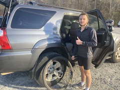
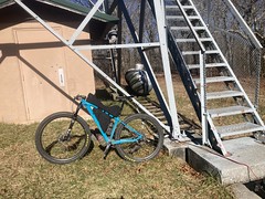
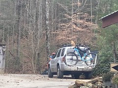
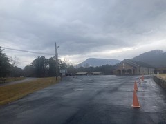
Saturday afternoon, I headed up to Mulberry Gap, parked the truck, and started getting ready. There were a bunch of folks gathered down by the campground there. According to Tori, it was a birthday party. There were a million 9 year old girls, and they all wanted to pet the cat. Actually, they all wanted to pick up the cat. The cat loves to be pet, and will tolerate being handled to a point, but he was way past that point. I saw him walking around earlier, and he gave me a very suspicious look, like: "What are your intentions, sir?" and kind of kept his distance.

Later I saw him up on top of my truck, presumably hiding from kids.

Cohutta Cat on my Truck

And he was wise to do so, for as soon as he got down, he was immediately scooped up by two girls. He got free and ran toward the house, but they chased after him yelling "We love you!" the whole way. When they eventually caught him, they hugged him half to death. By then, he had given up, and gone limp, resigned to his fate.

It was hilarious to watch.

I got my gear together, but kept remembering stuff that I needed, one thing at a time. I'd lost a water bottle last week, so I got a couple of those from the store. I also needed a travel pack of Chamois Butt'r. Oh!, and gatorade. I purchased each of these individually, and separately from parking. Tori had to ring me up like 4 different times. Sorry about that.

I ran into Zeke Lilly as I was about to head out. He'd just come back in from doing the Mulberry Mayhem Short Option. That's a gravel event, and I've never actually done it, so I wasn't familiar with the route, but he described it to me. Cool to see him again. I think the last time I saw him was under similar circumstances.

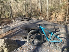
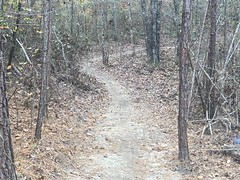
I hit the trail with my bike fully loaded, and a messenger-bag-type pack with food and cooking stuff in it. I'd only ridden with that pack once before, and wasn't quite used to it. Unintuitively, it needs to be pretty tight against you when climbing. Unlike my larger pack, which I usually loosen all the way up when I climb. It's small and light enough that it ends up getting slung around if it's loose, whereas a larger pack has enough inertia that it stays in place and lets your body move underneath it. I re-remembered this climbing that first kick over Mulberry Gap proper, and had to stop about halfway over to get it under control.

I had a good time climbing P3. I only missed 1 switchback. IDK, I love that trail. Some people apparently hate it. It's narrow and steep and rugged, but so is Turkey Mountain that it climbs. The trail has the same character as the mountain itself, and I dig that.

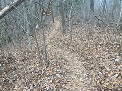
It was super, super leafy, and I had to ease into some corners.

P3 Sidehill

But, it is almost winter, so that's what you get.

P3 Switchbacks

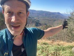
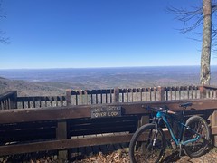
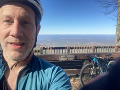
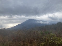
The Cohutta Overlook was up to my left, and as I was there to enjoy the forest (as opposed to being there to crush out miles, build fitness, or rip singletrack) I hung a left and moseyed on up to it.

Cohutta Overlook Northwest 
	Cohutta Overlook Northeast

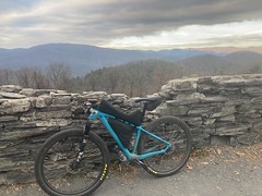
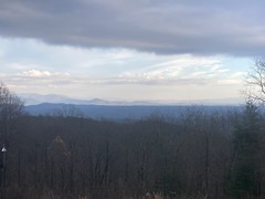
A couple walked up from their car while I was there and took a bunch of photos. The most interesting thing to me was the sky. A front was coming in, and it cast a distinct shadow on the mountains. Beyond the front, the leaves were bright and reflective. Beneath it, everything was a lot darker. I probably sat there for 20 minutes. Long enough to enjoy it, but not long enough to get cold. It was in the mid-60's, I think. I was in my tri-suit, so I was comfortable if I was moving, but I didn't want to sit around too long.

P4 went by quickly. I remember back when nobody rode P4 and the leaf duff would get really built-up. Not so much any more.

At the intersection with Tatum Lead, someone is building a house to the left and there were all kinds of construction materials and equipment scattered around. The gate was tricky to get around. You can normally just jump up onto the backslope, but it's been regraded and now you have to actually open it and close it behind you.

From there, I hung a left and climbed The Most Horrible Climb in the Chattahoochee National Forest.

The Most Horrible Climb in the Chattahooche NF

I took a photo to send to my Dad. We both hate that climb. So does Billy. I've heard several people comment on it, unsolicited. It's not that terrible, in and of itself. It's that you've just climbed P3 and P4 and you're not really expecting to climb any more, and it doesn't look bad, but there's like 5 times more of it that you can't see, and the gravel is usually really loose... I don't know, I mean, I know that describes a lot of climbs. This one is just a perfect storm of all of that.

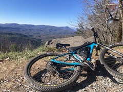
A normal person rides Tatum Lead to P5 and drops down into the valley. I had other plans. It had been a very long time since I'd been all the way out to the end of it, and I'd never ridden the northern leg of the Rock Creek ORV Trail. So, that's what I did. I rode alllll the way out to the very end.

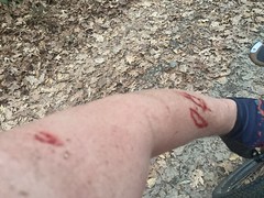
It's mostly downhill, and actually a lot of fun. Near the very end there are a couple of climbs, but they're not bad. They're certainly not as bad as The Most Horrible Climb in the Chattahoochee National Forest. There were a lot of overhanging thorns though, which you'd think wouldn't matter much on a road, but I ended up off to one side more often than not, and they ripped me several new ones.

Thorn Damage

I'd remembered a Private Property sign out there at the end of the trail, but in the 15 to 20 intervening years it has disappeared. There was a trail leading on...

The End of the Tatum Lead Road

...but I was in no position to explore it at the time.

Instead, I turned around, made my way back to Rock Creek and took it down into the valley. Rock Creek was really fun, especially in the dark. I need to check the elevation profile, but it felt as steep as Tibbs, just way cleaner. Like, beautifully clean. There were only a few rocky sections at all, one of which surprised me, as it was covered with leaves, and I couldn't really tell what I was riding into until I was into it, especially in the dark. Fortunately I rode into it at a sane speed.

All right, I've now ridden P5 and both legs of Rock Creek.

Rock Creek ORV Kiosk

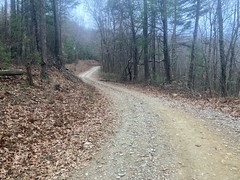
It was, at that point, officially dark, and I'd had my light on since the end of the Tatum Lead. It wasn't late yet, but it was definitely time to start looking for a place to camp. I remembered some spots along the P6 grasstrack that had looked good in the past, and there was at least one creek that crossed it. I could tank up there and then pick a spot.

Or, kill 2 birds with one stone. There was a turnout right next to the creek. Just above it was a flattish spot with a fire ring and some cords where someone had hammocked recently. All right! That'll do.

I set up my gear and got a small fire going.

Camping

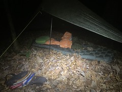
I kept it small - just enough to stay warm with my puffy jacket unzipped. Dinner was tortellini and some weird little beef jerky sausages. Oh yeah, I'd also picked up a dum-dum from Siracusa's on the way out of town. They still have a bowl of them lying around from Halloween. So, I ate that too.

I didn't do much but sit around the fire, keeping it going for the next few hours. It was supposed to be in the mid 40's overnight, but it tends to get colder down in a draw like that, and with the creek it would be a damp cold. I'd recently picked up a puffy jacket, puffy pants, and puffy booties, and I was curious if just wearing those under my SOL bivvy would be adequate in that weather. It turned out yes, more than adequate. It was something else entirely that gave me a problem.

For many years, I used a Thermarest NeoAir, and was always happy with it. But, Big Agnes came out with their AXL last year, and it looked intriguing, so I picked up one of those. It weighs a bit less, and packs a bit smaller, and I've used it several times in warm-weather conditions. I guess it was just a bit too cold for it that night though. At first it was fine. I slept for hours and woke up warm when I had to pee. Then I slept for several more hours and woke up cold. But, just my hip and shoulder, not the rest of me. Just the parts that pushed down into the mat. Maybe it was underinflated. I topped it off and slept a bit more. Nope, a bit later I woke up cold again. It wasn't unmanageable, but it wasn't what I was hoping for. If I'd get up and walk around (eg. to pee) then I was totally warm. It was just lying down that was cold.

I'm not sure, but I may have ended up with a mat that I didn't mean to buy. If you go to the Big Agnes website, they only have one AXL product - the Insulated AXL Air. However, if you google AXL Air, 2 of the top 3 links are REI catalog pages. One is for the "Big Agnes Insulated AXL Air Sleeping Pad" and the other is for the "Big Agnes AXL Air Sleeping Pad". Note the conspicuously absent "Insulated" keyword in the second case. Neither are currently available, but the photo for the second one (not insulated) looks just like mine. Same color and everything. I bought mine from REI. I'll bet that I googled Big Agnes AXL Air, and the non-insulated one was all that was available (from REI), at the time. I bet that I bought that, not realizing that it wasn't the insulated variety that was displayed on the Big Agnes site. I don't have a specific memory of there ever being two of them, but it would appear that there are, or were, or something.

I wonder if I can adequately insulate this mat by putting it inside of a second SOL bivvy, or some other heat-reflective thing. Would that be heavier or more bulky than just carrying the NeoAir? Definitely something to play around with in the backyard.

When I woke up again I was warm and it was light out. Aside from a few cold minutes, I slept well all night. No lying awake, slightly uncomfortable for hours and hours. As camping sleep goes, it was pretty good.

I got the fire going again and cooked some potatoes and hot chocolate.

Hot Chocolate

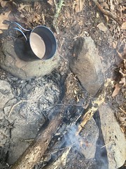
I'd grabbed the wrong variety of potatoes though. I usually grab garlic and butter or something, but this time managed to grab the most completely plain potatoes of all time. No salt. Nothing. They provided adequate calories, but were roundly unsatisfying to taste. The hot chocolate kind-of made up for it though, as did some weird fruit bars that I impulse-bought on the way back to the check-out.

I got packed up reasonably quickly. I've been riding around with my tarp for a year now, but I rarely pull it out. In Pisgah, even, me and John just camped under the stars. So it was a little bit of a challenge to re-pack. It was probably in the low 50's when I got moving, which felt ok, especially since I started climbing right away.

I thought I heard an airplane at first, but soon realized that it was light thunder. Hmm... That's not good. There had been a 29% chance of rain in the forecast. I wasn't completely unprepared for rain, but I wasn't dressed to push through a storm. Soon enough I started feeling mist, which eventually became drops, and before long I had to find a place to post up.

I was still on the grasstrack, so there was plenty of room next to the trail to set up the tarp, but being a decomissioned roadbed, the ground has a hundred years of gravel driven down into it. It's challenging to drive a stake into that, to say the least. On top of that, it was almost impossible to find a rock. It was like the only place in all of North Georgia where there aren't a dozen big ones lying around everywhere. I found one, but it was some weird shaly thing that broke apart after like 5 hits. I ended up breaking one of my stakes too. Woohoo.

I eventually found a better rock, and managed to get everything square. I've only had to pitch the tarp quickly twice. I'm apparently just fine at it whem I'm relaxed, but under pressure, it's frustrating. I guess I need practice.

For the next 3 hours, the rain came in waves.

I evnetually stretched out on the ground, and I think I fell asleep for a bit.

It turned out that I did have one bar, so I was able to look at the weather map. A little band was moving right across me and fizzling out as it moved east. Just lucky, I guess.

When it appeared to have quit, I packed back up and got moving again, only for another wave to come through. That time I just threw the tarp over my head like a poncho and waited it out. Twenty minutes max, that time.

Ok. Are we done?

Let's go.

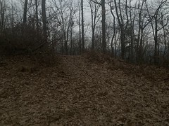
P6 was a blast, even wet. There was a good layer of leaf duff on the trail, like there had been on P3, which really helped.

P6 Shred

In the middle, there's a pretty long, steep climb, that I remembered being super techincal, but it didn't seem bad to me that day, like maybe some recent work had been done on it.

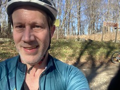
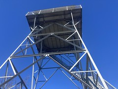
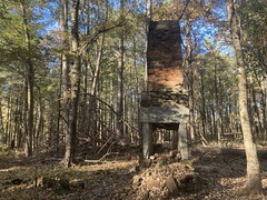
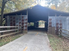
I'd forgotten about the dedication out by the parking lot, and was pleasantly surprised to see it.

P6 Dedication

I could hear people sounds as I approached the lot, and it turned out that there was a guy and his kid, packing up and heading out. They'd stayed at MGap the day and night before, and driven out for a quick out-and-back on P6. I'd seen what looked like evidence that someone else had been through earlier, and wondered if somehow someone had passed me while I was posted up or something. It made sense after talking to them.

Dennis Mill Road had a "Road Closed" sign on it, but I hoped it was something I could navigate on the bike, so I went that way. It turned out that a tree had fallen across the bridge near Dennis Mill proper, damaged the guard rail, and possibly the substructure.
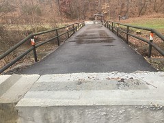
Dennis Mill Bridge

Yikes!

It looked safe enough to walk across, so I did that.

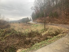
It had warmed up a good bit by then too. It wasn't "warm", but it was comfortable if you were moving.

It was overcast and wet. The last bits of green were still holding on. There was was a weird, gloomy beauty everywhere.

Dennis Mill 
	Dennis Mill Road

I took pavement north to the Stallion store, which is, apparently, no longer called the "Stallion". It's now just the Kwik Shop.

Kwik Shop Nee Stallion

In the direction of Fort Mountain, there was more of that gloomy beauty. I tried to get a shot of it, but these church signs were kind-of in the way.

Church Competition

Later, looking at the photo, they made a more interesting subject than the background. "Go to my church. No, go to my church! No! Go to MY church!"

Heading north, there are better and better views of Fort Mountain.

Holly Creek Church with Fort Mountain 
	Fort Mountain

When I hit CCC Camp Road, I passed several riders coming from the other direction. I recognized 2 of the 3, but couldn't place their names. It's terrible how bad I am with names.

Having recently ridden that same stretch from there back to MGap, unloaded, I was able to compare the experience directly. I was definitely NOT tempo climbing that day. I didn't make terrible time, but I wasn't setting any PRs either. I'd planned on climbing up to the top of Bear Creek, coming down, and maybe hitting some Pinhotis on the way back, but it was super wet, and I'd already lost like 3 or 4 hours waiting out the rain. In theory, I had lunch waiting for me too, though it was like 2PM at that point, and lunch was long over, so I wasn't too sure about that.

I bailed on the Bearhoti, and headed back in, past the old firetruck...

The Old Firetruck

Done!

Done

Aaaand I forgot entirely about lunch until like an hour later after I'd gotten showered and dressed. Oops.

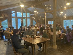
I considered staying for dinner, but it was like 3 hours away.

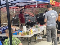
In the end, I visited for a bit, then hit the road. On the way out, I passed this horse-drawn wagon!

Horse Drawn Wagon

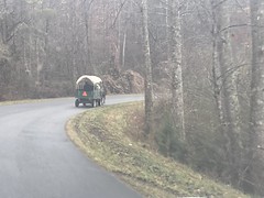
And, it's not the first time I've seen that same wagon. However, the last time I saw it was more than 10 years ago at the bottom of Noontootla, flanked by several additional riders on horseback. This time, it was just the wagon. I'm pretty sure it's the same one, but I'm too lazy to go digging through my old posts and photos, so I'm going to assume that it's the same one. I mean, how many of them could there be these days?

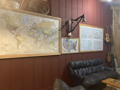
I tried calling Mark B. on the way back to town, but he was heading home from Chicago at the time, and nowhere nearby. I ended up eating at that Wood Fired Pizza place, and checking out one of the local antique stores.

Yeah, I do that now. I'm officially old.

Actually I felt OFFICIALLY old that night, or maybe the next day, driving around Atlanta. I put on 97.1 The River, the local classic rock station, and Jeremy was playing. Jeremy. From Pearl Jam.

Damn.

Blankets Creek

I ride Blankets Creek pretty regularly, but I rarely post about it because there's not usually that much to say. The last time I rode there started out much the same. I'd ridden the Turkey Shuffle the day before, and felt like spinning my legs out, so I drove up, spun a lap around dwelling, screwed around on the jumps for a bit, then headed out.

I got changed, and right as I got back to my truck, across the lot, I saw a bike that I thought I recognized, but couldn't place where. The rider had his head down messing with something on it, so I couldn't tell who it was. Just then, the guy in the car next to me asked me a question, and we got to talking about our respective rides. When we were finished, I heard: "What's up?!!" from that guy I'd seen earlier.

It was Austin!

Austin!

He'd recognized my voice, of all things, while I was talking with that guy.

I knew he'd recently gotten into mountain biking, but as far as I knew, he'd only ridden at Rope Mill so far. "Want to ride?" "Let's go."

We spun a lap around Dwelling and he had no trouble keeping up. In fact, I think he may have been a bit stronger than me on that particular day. We discussed the 100% rule, and hit the flow trails, which he rode with no problem. It was awesome. Much like on rides with his dad, we were talking the whole time. We hit Van Michael after that, and aside from sketching on the Kevorkian rocks, he didn't seem to have any trouble with the rest of the trail.

Heh, the first time I rode Van Micheal, I rode with my Dad. That time was also my Dad's first time riding Van Michael. When a Muse rides Van Michael for the first time, it must be done with another generation of Muse. That doesn't 100% hold true because John and I rode it together his first time, but whatever, it was fun to joke about.

After that, I was beat. Too many miles the day before, and I'd already put in 10 earlier that day, so we headed back to the lot.

He and John were planning on riding together later in the week, and we joked that I got to ride with him before his own Dad did, and that I should lord that over him forever. Of course, I won't, but again, it was fun to joke about.

I wonder if I can get my Dad to come visit, and maybe the three of us could ride Noontootla or something.

Turkey Shuffle

Every year, on the Saturday after Thanksgiving, Mulberry Gap has an event called the Turkey Shuffle. It's kind-of an adventure race, with checkpoints and such, but you only have 5 hours, and the checkpoints don't require a tremedous amount of navigation to get to. It was great fun last year, and I figured it would be fun this year too, so I signed up.

Saturday morning, I grabbed some Waffle House and made my way up to Ellijay. The iconic billboard is still empty for some reason. Man, I hope they don't just tear it down.

Ellijay Sign Still Empty

The square was fully decorated for Christmas, less than 2 full days after Thanksgiving.

Ellijay Square Christmas Decorations

The weather was ok. The weather is always tricky for this event. It tends to be in the high 30's in the morning, but then it tends to warm up to the high 50's or low 60's during the day. And you're climbing for most of the day. But, you end up on the north side of the ridge a lot, and you end up high enough up for that to matter too. One tends to overdress, but year-to-year the conditions are always a little different, so you can't just go by what you did the previous year. When I got there, it was in the high 30's, and a little overcast. I was comfy walking around in street clothes and a puffy jacket, but I had an hour and a half or so before the start, and a lot could change in that time.

I'd already had breakfast, so I just kind of wandered around the barn watching everyone else eat.

MGap Breakfast 
	MGap Lounge Area

I ran into Jeff Leggett at one of the tables, and Curtis Tucker (I think? I'm bad with names) at the stove. The stove felt amazing. It was the first real "it's cold so stand around this heat source" that I'd experienced yet this year.

About an hour out I started getting ready. Instead of the tri kit, I went with the slightly warmer bib-jersey combo, plus a base layer under it. I kept arm and leg warmers and a windbreaker on while walking around, but planned to shed them as soon as I got moving.

Kate gathered us all together for the obligatory pre-ride announcements. Watch for cars, be cool. Don't ride anywhere illegal. Etc. Andrew handed out maps, and we had 5 minutes to come up with a strategy. I may have mentioned this before, but events of this format are always funny to me because they're practical cases of the classic Traveling Salesman Problem from computer science, which is an NP-complete problem. It would take a supercomputer a decent amount of time to come up with an optimal route. There's no way a human can do it in 5 minutes. You can come up with a pretty good route, pretty quickly, but the amount of work and time it would take to come up with a truly optimal route is mind-boggling.

That said, I still put my brain in graph traversal mode and let it crunch. It seemed like a loop up to Potatopatch, over to Grassy Mountain, down Windy Gap, and back, with a quick out-and-back to the Mill Creek Overlook would hit all of the really high value checkpoints. I might be able to scrounge one or two more on the way back, depending on time. Ok, that's the plan.

Go!

There were nearly 75 riders, which is right up against the Forest Service's limit for not needing a permit. I tore off with a group of what seemed to be 10 or 12 toward CCC Camp Road. They ALL dropped me within 5 minutes. This was discouraging at first, but I eventually discovered that the group ahead of me included a bunch of folks on ebikes, as well as some seriously strong riders like Thomas Turner, Scott Hanson, and the entire Randall family.

I'd actually spoken to Lisa prior to the start. I'd seen her at Rope Mill some weeks back, riding with a teenage girl that I thought might have been her daughter. Turned out it was! The last time I'd seen her daughter was at one of the first Blankets Race to Sunset rides. Lisa was up on a podium giving the pre-ride info and her kid was climbing all over the place, grabbing on to mom's skirt for traction, yanking her left and right. Lisa was unfazed. This kind of thing, apparently, happened all day long. Her daughter couldn't have been more than a year and a half old at the time. That was the last time I'd seen her. Now she's shredding Rope Mill and climbind in the Cohuttas!

I'd shed my jacket and arm warmers prior to the start. At Holly Creek Gap, I shed my leg warmers. I'd passed a rider or two by then, and passed a few more on the way up to the overlook.

Checkpoint 1: The Bear Creek Overlook.

Bear Creek Overlook Selfie 
	Bear Creek Overlook

The eagle-eyed among you may notice weird black bags all over my bike. Those are super custom bags from The Spindle - Atlanta. I'm pretty happy with them so far. I had to make a few slight adjustments to them, but all were due to me not being conservative enough with my design. As this is a race, they're empty in this shot - well they contain my jacket and leg warmers. I've been riding around with them loaded for a few weeks though, on local rides. So far, so good.

I caught the Randalls at the overlook and a couple of folks that I didn't know too.

On to Potatopatch...

I forget how long that climb it. It's got a kick at the start, then it eases up, then there's this long grind up a ridge, then some curves as you approach the top. There are always more curves than I remember.

Checkpoint 2: Potatotpatch.

Potatopatch Selfie

(you're supposed to take a selfie at each checkpoint, to prove you were there later)

There were like 5 people at Potatopatch when I got there, most of which bailed back down after getting their points. The two riders that pushed on were both pretty young. I recognized one of them though. I'd parked next to him at the 2019 Southern Cross and then happened to again at the 2019 incarnation of this event. His name was Greg, and the other guy with him was his brother Jayden. They're both very strong and skilled, and I ended up leapfrogging them back and forth for the rest of the ride.

Checkpoint 3: Chestnut Lead Trailhead.

Chestnut Lead Selfie

It was cool up on the ridge, but it wasn't "cold" per-se. I was definitely on the edge of comfortable, but I wasn't motivated to stop and redress.

I'd ridden the Mill Creek Loop a few times this past year, and was kind-of familiar with the location of the overlook. It doesn't seem like a long way from it to the ridge, when you're climbing, but bombing down to it from the ridge seemed to take forever. This sounds completely backwards. Like it ought to seem like a longer to climb-from than descent-to. This struck me as I rode and I actually started to get worried that, inexplicably, I'd made some wrong turn, or somehow ridden past it without recognizing it. I kept seeing riders coming the other way though, so I felt somewhat reassured. But, they could also have taken a wrong turn or passed it...

When I finally got there, I was honestly relieved.

Checkpoint 4: Mill Creek Overlook.

Mill Creek Overlook 
	Mill Creek Overlook Selfie

I had to pee about halfway back up, and the kids caught and passed me. I almost caught them climbing out, and then did as they stopped to check their maps at the intersection. We chatted for a second. It turned out that we all had the same plan. They'd never been to Lake Conasauga though, or to the fire tower, and weren't super sure about how to get to either. In 20+ years of riding up there, I'd never actually been to Lake Conasauga either. There used to be a picnic area directly across from Tibbs, and it was once possible to get water from it, so I'd been there. But that was shut down long ago, and I'd never been to the lake itself, ever. It looked straightforward on the map though, and we ended up riding together down to it.

Checkpoint 5: Conasauga Lake Boat Launch.

Conasauga Lake Boat Launch 
	Conasauga Lake Boat Launch Selfie

Now, I've officially been to Conasauga Lake!

I really should go back. Maybe camp there. It looked pretty nice.

Next, we climbed out and headed up to the fire tower. They pulled ahead of me on the climb, but hung around at the top long enough to catch them. Some hikers were just heading down as I arrived.

Checkpoint 6: Grassy Mountain Fire Tower.

Bike at the Grassy Mountain Fire Tower 
	Grassy Mountain Fire Tower 
	Grassy Mountain Fire Tower Selfie

Greg and Jayden:

Greg and Jayden

I left while they were still eating, and passed the hikers I'd seen earlier. We talked for just a second. They'd climbed the actual fire tower itself. It turns out the trapdoor is unlocked these days. Nice! I've never been all the way up to the deck. Historically, it was always locked.

At Windy Gap, I noticed a "Motorcycles Only Beyond This Point" sign that I'd never noticed before. There was always an "Expert Riders Only Beyond This Point" sign, and I could see it further down. I know what they mean - basically "No ATV's Beyond This Point". It isn't meant to exclude bikes an hikers. Odd that I'd never noticed it before. Maybe it's new. I waited for the kids there. It struck me that if they'd never ridden Windy Gap, and didn't know what they were getting themselves into, then it could be bad. It turned out that they'd both ridden it before, and had a healthy respect for it.

I always forget... The first half mile or so of Windy Gap is actually a steep, chunky climb. It tough, so you'd think I'd remember, but no.

I took the lead, but the kids gave me some room, and didn't appear to have any more trouble than I did riding the trail. Legs AND skills, it would appear. Nice!

When we got into the switchbacks, they had fallen behind a bit, so I waited for a minute or so. Jayden came down first and assured me that Greg is a better downhiller than he is, and had just gotten behind because there were some technical rollers up there. I thought that we were through the switchbacks and were about to start the doubletrack section. So, I left them behind, figuring we'd gotten through all of the really gnarly stuff. Turned out that I'd forgotten how many switchbacks there were, and we were only about halfway through them.

Eyahhh.

The very first bit of doubletrack was super rocky too. I also hadn't remembered that. If I'd remembered it correctly, I'd have ridden it out with the kids, just to be on the safe side. It turned out later, that they'd had no problem with any of the technical stuff. There was, however, a branch hanging way out into the trail. When I passed it, I had to dodge pretty hard to avoid it, and I thought "man, someone's going to hit that", but at the speed I was going, there was no way I was going to walk back up and break it off. One of them hit it. I forgot which one. He was Ok, but ended up sketching pretty bad.

Most of the way down on the doubletrack, I ran into a guy with a dog and an off-road skateboard! His girlfriend was in the lot, sitting in a camping chair, reading a book. She did not, at all, seem even the slightest bit happy about being there. I said hi, but she just scowled in reply.

Checkpoint 7: Windy Gap Lot.

Windy Gap Lot 
	Windy Gap Lot Selfie

From there I bombed the gravel road down to the pavement. It was fairly rutted, and required a bit more than casual effort to negotiate. For one of the Firewater 50s, my truck had been broken, and I'd had to borrow my mom's Thunderbird, and I'd driven it up that road to the lot. No way you could have gotten a Thunderbird up that road on that day.

I made really good time on CCC Camp Road, back towards Mulberry Gap.

Checkpoint 8: Holly Creek Picnic Area.

Holly Creek Picnic Area 
	Holly Creek Picnic Area Selfie

It's a bit of a slog up that road to Mulberry Gap. I'd ridden it several times earlier in the year, but I was always fully loaded down on those rides. With empty bags, it was WAY easier - tempo climbing the whole way. At the turn before Mulberry Gap, I actually started heading up towards Holly Creek Gap before stopping to check the time. I had about 50 minutes left. There were 2 points available at the P2 trailhead. It seemed like I ought to be able to spin the P2 loop in 50 minutes, but I wasn't 100% sure. I mean, I'm sure I can do it when I'm fresh, but I was definitely NOT fresh. There weren't any additional points right along that route either. Like, I couldn't grab 2 more points on Shakerag or anything.

Enough! I had enough points. I headed back to the start.

In the barn, there was a table set up where you could show your photos and get raffle tickets for every point you earned. I turned out that the lady behind the table was the mom of the 2 guys I'd been riding with all day, but I didn't know that until later. It turned out that I'd gotten 23 points. Not too bad!

Right as I finished collecting my raffle tickets, my riding companions showed up and collected their 23 points as well.

I got changed, started feeling a little more human, grabbed some chili, and started feeling a lot more human. Hot food goes such a long way.

There was a table with all kinds of swag on it, and a little glass cup next to each article of swag. You put tickets in the cup and whoever's ticket is selected wins that prize. The more points you got, the more tickets, and thus the greater chance of winning.

While I was puzzling over what to go for, Scott Hanson slid up next to me and said hi. Somehow I hadn't seen him yet all day. I thought maybe I saw him on the way out to the Mill Creek Overlook, but I was flying and my eyes were watering, so I wasn't really sure. Yep, that was him. It's funny. We've known each other for years, exchanged volumes of data, and ridden many of the same events, yet somehow have only been face to face a few times. I talked to him for a while. Turned out he was on a singlespeed (in the Cohuttas!) and managed to get the same checkpoints as me, but got way more points. Man, that guy is strong.

After noodling a bit, I decided that I was really only interested in 2 of the prizes: an entry into the Skyway Epic, and a collection of Chamois Butt'r merch, as my existing tube was running low. So, I attempted to distribute my tickets over those 2 prizes. I did put a few tickets in some other random bowls - I think a few in the Southern Cross and Fool's Gold entry bowls, and I realized that I accidentally put a few in the bowl for some kind of Whiskey that was right next to the Chamois Butt'r bowl. Oops.

It didn't matter though, because I didn't win a thing! Not one thing! I think there were 2 other tickets in the Skyway Epic bowl, plus like 10 of mine, and somehow none of mine got picked. Two different times, they called the last three digits of the ticket, and I thought I won something, but it turned out no. There were red tickets and white tickets. I had red tickets, and the winning tickets in those cases were white.

Ahh, luck. The great equalizer.

After the raffle, there was about an hour until dinner, and despite having eaten lunch just 2 hours prior, I was already getting hungry again. I parked myself in front of the stove, and it was so cozy that I acually dozed off several times.

Curtis came by and hung out with me by the fire. He's a pretty easy guy to talk to, and it was really nice to sit there by the fire with him. We discussed various endurance topics. He's got a really cool jeep camper setup that I envy.

Dinner was brisket, and man was it good. I eventually went back for seconds. Jeff joined me and Curtis and me and Jeff ended up talking long after dinner. He had been a very avid hiker, and he and I had hiked some of the same obscure spots in North Georgia.

Jayden came up to me after dinner with a piece of paper in his hand. "Do you know what this is?" He'd won the entry to the Skyway Epic. He hadn't specifically wanted it, he just had so many tickets that he put on in just for fun. I described the event, though I'd remembered it being longer than it is. It didn't sound like anything he wanted to do, and he'd won other stuff, so he offered me the entry. Awesome! That was the one thing that I really wanted to win! Score!

I ended up meeting their parents too, as they were all leaving. That's when I realized that the mom had been the one reviewing photos and handing out raffle tickets.

It was pretty late when I left and I remember auto-piloting a lot of the trip home. "Oh, Wade Green Road. Ok." That kind of thing. I wasn't sleepy, but definitely tired.

What a day! Great ride. I hadn't felt super strong all day, but when I checked the data on Strava, I had 15 PRs, so I guess not feeling strong doesn't always equal not being fast. I think that's it for Mulberry Gap events this year, but I think they're open on weekends through the whole winter now, so I'll certainly be back up there.

My next event is the CFiTT. Already getting nervous.

Saturday, December 4, 2021

Pumpkinvine

A few weeks back, Billy texted me a link to a grand opening event at a new trail - Pumpkinvine, it was called. This rung a couple of bells. Pumpkinvine is a creek that flows out of the Paulding Forest. There's a gorge along the creek somewhere, that's allegedly pretty awesome, but I've never seen it. Also, unless it's a different Pumpkinvine, I think it flows north to the Etowah in Cartersville. There's an old kiln near it up on that end of it, that I checked out many years ago. Also, it seemed like I'd seen Brett Davidson post something about Pumpkinvine on Strava. He's heavily involved in trail building around the ATL. Same trail?

Turned out yes!

It was a brand new trail, and they were hoping to get folks out there to help wear it in.

There was a pretty good turnout.

Pumpkinvine Lot

It helped that Brett was cooking burgers and hot dogs for everyone.

Cookout

We spun a lap clockwise to start.

Pumpkinvine Singletrack

The trail was fast and fun. Or, I guess, it will be. I guess that I should say that it was built in a manner that should eventually yield a trail that is fast and fun. At the moment, however, it was super soft and bumpy, as might be expected, considering how new it was. About 7/8ths of the way around, we started running into folks coming the other direction. Apparently, while we were out there, they'd reversed the direction. At that point, we felt like we were so close to the end that it didn't make sense to turn around, but that may not have been the right move. There were like 40 people coming from the other way. We eventually made it out, hung out for a bit, then spun another lap in the other direction. Somehow the trail seemed a lot more fun in the other direction. I'm not sure if I was just used to it, or warmed up, or if it had gotten noticeably packed down by then, or if it just flows better in that direction, or what, but I enjoyed it a lot more on the second lap.

We noticed a bunch of old road crossings, and it looked like there was a trail leading along Pumpkinvine Creek itself, that wasn't part of the system. I'd be interested in going back and checking out all of that.

Back at the lot, Brett provided us with burgers, and we talked to the developer about the history of the area. The lot had the remnants of a vault toilet in one corner, and in another there were 4 telepohne poles sticking out of the ground, close together, as if they had once supported a structure of some kind. It turned out that the area had been used, for years, as a camp for at-risk youth. There were semi-permanent campers over by the toilets, and a couple of buildings skirting what's now the lot. There was a fence too, and the whole area was grassy. They used the old roadbeds to access the woods for hunting, fishing, and general adventure. Last year they had an opportunity to move to a better location, and the land became available. A local trail would be great for the local middle school and high school mountain bike teams, so they jumped on the opportunity to develop it.

When I got home to crunch the GPS data, I noticed that the aerial photos on Google Maps still showed the campers and buildings. You could even make out the fence. So, the transformation occurred pretty recently.

The trail was pretty good, if short. It's conveniently located near the beginning of the PaCO loop, and in decent proximity to Mt. Tabor. It ought to be possible to include it in a big loop.

We'll see.

Tuesday, November 30, 2021

Rockdale River Trail

So, I happened upon the Rockdale River Trail while exploring South Rockdale Park, but I didn't have time to ride very much of it. In fact, most of what I rode was just going the wrong way, looking for the park's Expert Trails. The PATH map made it look pretty long, so when I got home, I looked it up to see just how long. It looked like, with spurs and what-not, I might be able to get in 30 miles or more without re-riding parts of Arabia Mountain that I'd already ridden. I was intrigued, and it had been a long time since I'd cranked out miles on a greenway, so the next day I headed back to check it out.

I parked at the same park that I'd parked at the day before, got my stuff together, and got changed.

As I was walking back from the pavilion, 2 girls who had been playing on the playground, ran past me toward the bathrooms. Their mom was sitting at a picnic table right next to the playground and turned around to look at something behind her the exact second that the kids took off full speed away from her. She couldn't have been turned around for more than 3 or 4 seconds, but when she turned back, they were out of sight. She happened to look right first, and during the time it took to do that, the kids (who had run to her left) had both gone into separate bathrooms. From her perspective, she turned around, turned back, and they were gone. She never panicked, but I could hear the growing concern in her voice as she called for them. It, quite reasonably, occurred to her to look for them in the playground equipment, and then in the woods behind it. It did not, again, quite reasonably, occur to her that they might be 100 yards away in the other direction. I happened to have seen where the kids had gone, and told her as soon as I was within earshot. By then, they'd come back out of the bathrooms, and were running around behind them, even further obscured from her. She corralled them pretty quickly once she knew where they were. But, had they gotten into the woods over there, maybe after noticing the Boy Scout shelters, it would have taken a very long time to find them, assuming they even stayed put. I watched a bunch of "impossible" missing persons cases on youtube a few months ago, many involving kids, who disappeared just as quickly. Having raised kids, and spent a lot of time in the woods, many of the cases didn't seem so logic-defying to me. I had ideas about what might have happened, but they were just ideas. Theories. It was wild to watch kids virtually disappear in a matter of seconds, in real time.

She interrogated them a bit on the way back and we joked about it a bit. It turned out they were playing "Maya and the Three" (a netflix cartoon), were acting out some scene from it, and had just forgotte that they weren't supposed to leave the playground.

Kids!

All that happend while I was unloading my bike and getting ready to go. I took a quick photo of the PATH Trails Map.

PATH Trails Map

...just in case. And got to it.

I headed east first, which ended up taking me a bit south as well. The near end of the trail was in that direction. I passed through Lorraine Park...

Lorraine Park Sign

...and after a while entered the property of the Monastery of the Holy Spirit. There were various wide, well groomed side trails, but there were also signs saying to stay on the paved trail, so I stayed on the paved trail, and eventually made it to the Monastery itself.

Monastery of the Holy Spirit Sign

It was, indeed the end of the line. No trail continued on from there.

There was a nice gravel parking lot though, with a bunch of cars in it. I was curious, but I couldn't see the monastery itself very well from the lot, just the tops of a few buildings. There was a gate too, so my curiosity would have to wait.

Back the other way, I passed through the park again. And rolled through the parking lot to get GPS data for it. An older couple was sitting in in the lot, in their truck, engine off, windows down, smoking weed. Since about 2018, it's pretty rare that I go on a ride where I don't run into somebody smoking weed, either while driving, or at least while about to drive. I'm not sure what the exact laws are these days, and I think they vary between city, county, state, and federal, but I'm pretty sure you're not supposed to be high while driving. IDK though, it may not actually be that serious of a crime. Maybe all you get is a ticket unless you can't pass a sobriety test. Maybe not even that. No idea, but openly smoking, behind the wheel, still strikes me as odd, every time.

It didn't take long to get back to my truck, and then not much longer after that to get as far north as I'd yet been.

Just beyond that, there was a weird section that was actually legal to drive on. It looked just like the rest of the trail:

On the Trail

But there were driveways off of it. I guess it was a neighborhood road, but it was narrow like a typical greenway.

Further north, the trail crossed Alexander Lake.

Alexander Lake Dam

Or, I guess, technically it crossed the dam between the two Alexander Lakes.

Alexander Lake

A spur to the left went around one of the lakes, but I figured I'd hit that on the way back, and just kept straight.

A little north of the lakes, I noticed an old chimney just off of the trail.

Old Chimney

There was a bit of a trail leading to it, but I still had to walk a bit.

The trail was surprisingly hilly. I'd kind-of remembered the Arabia Mountain Trail being pretty hilly, but I wasn't sure if I'd remembered it correctly or not. I definitely had. For being a "greenway" type trail, you really had to work.

My plan was to head north to the Arabia Mountain Trail, then turn around and head back, taking two spurs west on my way back, the first being the South River Trail, and the second being I guess just an unnamed spur of the Rockdale River Trail that wound around the Panola Mountain area.

I ended up getting to the Arabia Mountain trail pretty quickly. I was on the mountain bike, loaded with BP gear, as usual, but I was still making really good time. I wasn't really sure how long the spurs were, and I was too lazy to pull out my phone and look, so I wondered if I shouldn't keep going for a while to make sure I got my drive-over's worth. I eventually decided to stick to the original plan, and that turned out to be the right move.

Back at it, heading south!

Back on the Trail

I'd passed an old farm on the way out, and now that I was headed back, figured I should take a few photos.

Lyon Farm 
	Lyon Farm Sign

1821, eh? Exactly 200 years old this year.

Right past the farm, I picked up the South River Trail and took it way out west. There was a pretty good climb in the first little bit of it, and a guy on a fixie managed to almost catch me. He blew up a few minutes later though, and fell back so far that I didn't see him again heading that way. It made me wonder if he'd been chasing me for a while. I only noticed him when he got close enough to hear him. It'd be cool if he'd been pulling me down for like 5 minutes or something. Almost got me!

Out, a little past halfway, on that spur, there's another parking lot, and you can get a decent view of Panola Shoals from the trail.

Panola Shoals

I say "decent" instead of "good" because there's a chain link fence up between the trail and the river, with signs saying that access to the shoals is closed indefinitely due to safety issues. They didn't elaborate beyond that, so it made me wonder if there was an erosion problem, or recent rain, or too many people mobbing the beach, or people getting too crazy sliding down the rocks, or what. Closed or not, the beach was as full of footprints as it could be. There wasn't an inch of it that someone hadn't walked on, recently. There was even a guy down near the water throwing a stick with his dog. It turned out, that if you followed the fence toward the highway, there was eventually an open spot in it (like intentionally open, not just where someone had torn through it) and a sign indicating that you could go in there, but to use caution or something like that.

It struck me as quite a mixed message, but I didn't really read the second sign carefully, so maybe it was less mixed than I'm thinking it was.

The far end of the trail led into the back of MLK High School.

MLK High School

To get to the road from there, you ride right down the bus lane. There's no other way out.

The school was named MLK High School, not Dr. MLK Jr. High School, and as I passed the front there, I wondered if maybe it was intended to honor MLK Senior. I mean, he was also from Georgia, and active in Civil Rights. Maybe?

Seeing the big letters made me want to pronounce them, like M(i)LK, and that reminded me of something from my own high school days. My brother had gotten U2's "The Unforgettable Fire" album, which has a song called MLK. But the name of the song was written in small letters on the back of the cassette insert, and at first glance, he thought it said MILK, which he thought was funny. Why would there be a song called "Milk"? And why was it all capitalized? Then he figured it out, but still called the song M(i)LK afterwards to joke about his original misunderstanding. This led us to generally prouncing MLK when we'd see it, with a very minimized i. Like "Hey, we get M(i)LK day off of school next week!" and "We're turning onto M(i)LK Drive." Which was funny to us and to our buddy Hans who also knew the origin of it, but we'd get weird looks from other friends, and have to explain the whole thing. People thought we didn't know that MLK was an abbreviation, or that we didn't know who MLK was, or that we did but didn't realize that the abbreviation referred to him, or even that we were being intentionally disrespectful... No, we were just kids being silly with pronouncable abbreviations, but we did stop doing it in front of other people pretty quickly.

That was the end of the South River Trail, so I headed back.

It's definitely fall, but fall comes kind of slowly in the Atlanta Metro Area. Slowly at first, then it's REALLY fall for like a week and a half, with all the amazing leaves, then it's like a less cold winter for the rest. It was still trying to slowly be fall that day. A little bit of color. Some leaves on the ground. Nothing spectacular yet though.

Fall Greenway Shred

On the way back, just past the old chimney, there was an old barn.

Old Barn

The trail led directly though it, and it was surprisingly cold inside. "It's that time of year."

The trail itself went up over Panola Mountain, and as such, was a good, steady climb. At the top, there was a spur that led to an overlook, but it was off limits to bikes. I might have walked my bike out to it, but it looked like it was half a mile long, and there were a lot of people. I figured I'd come back and walk it some other day.

At the Panola Mountain Lot, the trail actually kept going. The PATH map didn't show this, but there it was. I had a sense that there might be more trail because on the drive in, I'd seen where it crosssed the road, and not yet seen that in real life. Interesting! There were mile markers too, and it looked like the next trailhead was like 4 miles away. So, at least 8 more miles out and back, and who knows how much further it goes from there. Hmmm!

As it turned out, I did not have time to explore. It was wise, in fact, that I hadn't taken myself up on the urge to ride some of Arabia Mountain. It was getting late, and worse, just starting to get cold.

On the way back, a guy on a road bike passed me, but I passed him back as we climbed Panola Mountain, dropped him, and never saw him again, even crusing down the other side. Ha ha! It's been a while since I dropped anyone on a road bike.

Near that barn, you can take a right and go around the west side of Alexander Lake, so I did that.

Alexander Lake Again

There was a long bit of boardwalk down on that end.

Boardwalk

As I approached the park, the sun was down behind the trees and it was legitimately frosty. It had been in the 70's when I started, and warm in the sun. I want to say that was the first ride where I really noticed it getting cool while I was out. One of the first, at least. Every year it happens, yet every year it seems so foreign.

The last mile or two into the park is a long tempo climb - shallow enough that you're motivated to keep speed, but steep enough that you feel it. At the time, I couldn't remember the last good tempo climb I'd done. There are plenty around, but I hadn't been on the road bike in a while, and the loaded mountain bike doesn't climb as well. I realized that I missed tempo climbs.

And, done!

Rockdale River Trail! 40-odd miles, it turned out. More than I thought it would be.

I have no memory of the drive home, or dinner, so they must have been uneventful.

As greenways go, the trail is pretty awesome. It's surprisingly hilly and twisty, and there are plenty of interesting things to see. It's not just anonymous pavement in the woods like greenways can sometimes be. I'm really interested in finding out where it goes past the Panola Mountain lot. It would be funny if it connected all the way back into Atlanta or something.