Monday, February 27, 2012

Bull Mountain

This weekend was been a marathon. Friday morning we drove (for 5 hours) to Sevierville TN for a gym meet, then played at the indoor waterpark all night, woke up early the next day, did it again then drove back to the ATL just in time for a father-daughter dance. To get all that done, I had had to bail on volunteering for the Southern Cross, for the second year in a row, for the same reason. Maybe next year.

I needn't even mention that I slept in on Sunday, which was unfortunate because my brother wanted to go for a ride at Chicope and though I didn't want to actually ride at Chicopee, perhaps if I'd woken up before he was committed then I could have convinced him to come ride with me. Dangit. I tried calling Tim, but if you get a cyclist's voicemail on the weekend, they are probably already out riding. Dangit again.

Solo then.

I picked up some fuel at the gas station.

 Fuel

That counts as fuel but I think I'm going to need to start eating a little healthier. I would later get an upset stomach from all the sugar.

I had a long day planned and three distinct objectives.

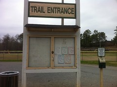
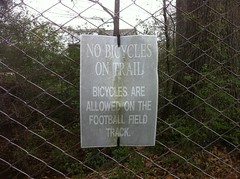
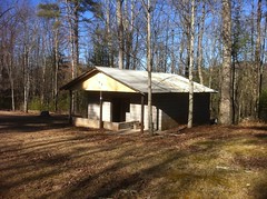
Objective number one was to measure the kiosks at Jake, Bull and FS77A. What? Yes. Measure the kiosks. There are apparently some new signs that need to go up and we need to know how big they can be. I meant to do it weeks ago but things kept coming up: illness, a race, a gym meet... No longer!

Objective number two was to survey the maintenance that's been done on Bull Proper. Some contractors have done some work up there recently, I haven't seen firsthand what work has been done, but I've heard conflicting reports including one alleging that Bull has been castrated and from the photos it appeared to warrant some investigation. Should we rename the trail and sell it as beef? Unknown. But I would know!

Objective number three was a test run of some bikepacking gear. I've got a Huracan coming up and a Pisgah Traverse. For the CFiTT I packed really light because I intended to do it in one day, but the Huracan and Traverse will be multi-day rides. I'll need to bring a bag and a mat, not to mention food. In the past I've loaded up my Gossamer pack but the camelback worked so well on the CFiTT that I wondered if I could just stuff my bag and mat into it. I tried. They fit, but how would they ride? That was the question.

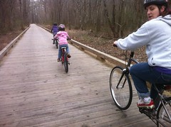
As I passed Nimblewill Church, I discovered why I couldn't get a hold of Tim.

 Tims Truck

Great minds think alike.

And apparently ours do too.

Hiyo!

I'll be here all week.

I parked in a little turnout off of 28-1. And just to put it out there again... If you're riding at Bull/Jake and your route will take you by any of the lots or parking areas other than the Jake Lot, please consider parking at one of those lots rather than the Jake Lot. The horse trailers need to be able to park parallel to one another and then pull forward and around to get out, which can be dicey with a long trailer if there are a bunch of cars all the way around the outer edge.

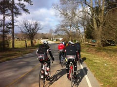
Not 100 yards down the road, The Stronger Cyclist and his buddy Ron had just pulled in themselves. We got to talking for a few minutes but we all had big days ahead of us, in different directions, so we didn't dally about.

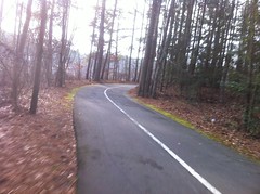
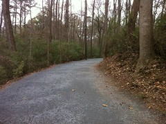
I headed down the road toward the Jake Lot.

It's trying really hard to be spring up there. Apparently the cold snap didn't kill the Daffodils.

 Daffodils

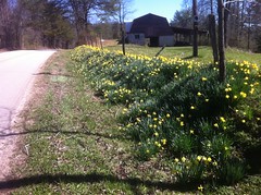
"We do not care about zis, what do you call it? 'Cold?' Bah." That's how daffodils talk.

Checkpoint 1: I measured the kiosk. 71x46-1/2.

All right then.

Onward.

I surveyed the work we'd done recently on the Bull/Jake Connector. It was holding up nicely. It did strike me though, that an unfortunate side effect of trail maintenance is that in its wake, the trail looks messy and unnatural and . I know that a year later it will look all beautiful, but I wonder if there's something that can be done at maintenance-time. Maybe we should just cover it with leaves. Something to think about I guess.

I noticed some spots on the 83 bypass that need some attention. They got bad all of a sudden. I suspect that all the rain we got this winter plus the increased popularity of the system are the culprits. The switchbacks are badly cupped, there's this one little kick near 83 too and a few other spots. Dangit.

Checkpoint 2: The sign at the Bull Lot. 69-1/2x46.

There was a guy snoozing in a Hammock at the bottom end of the lot. I wondered if he was training for the TNGA or something else but he appeared to be asleep so I didn't bother him.

I climbed Bull. About halfway up to the Y I ran into Marc Hirsch and a friend of his who's name I suddenly can't remember.

 Hirsch

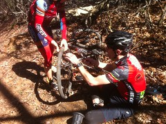
She'd flatted and they were fixing it. They'd volunteered at the Southern Cross the day before. He'd parked next to Matt and Becky that morning. Apparently it wouldn't have been possible for me to go in any direction up there that day without eventually running into somebody that I know. Man it's a small world.

Up past the Y I finally got into the section of trail that the contractor had worked on recently.

Dozens of rolling dips from the original roadbed had been restored and they all looked good. It's apparently rained a bit since the work has been done too and it was clear that the water was successfully diverted. Good to see.

There was also a LOT of this kind of thing...

 Encouragement

...where debris has been placed on the upslope to encourage traffic to stick to the outer edge of the road. If traffic stays to the outside, the buildup on the inside will catch sediment, new soil will form, it'll germinate, it'll blend into the backslope, sweet singletrack will emerge, substantially less work will need to be done to the rolling dips in the future... Win, win, win.

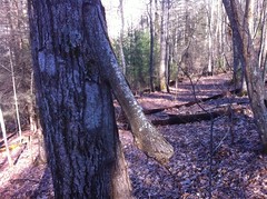
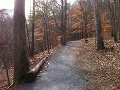
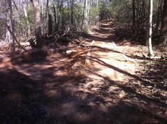
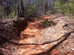
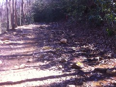
Eventually I got into the sections where the controversial work had been done. I actually rolled right through the first one without noticing it until I'd gotten through it. Bull is a net climb but there are a few short descents. The first one (past the Y at least) is eroded about two feet below grade for about 50 yards and was once very rocky and rutted. It appears that the contractors bulldozed a semi-wavy route through the rocks and now there's a smooth line with rocks to either side. In the photo that I saw a week ago, it wasn't clear why that had been done but riding into it, it became more clear. First, I don't think the contractors had finished their work when the original photos were taken. The photos showed a wide swath cut all the way up the trail but it isn't like that now. There's a distinct line now, with debris on either side and the trail meanders from the left, to the right and back to the left. I would actually like to see it meander a bit more. Maybe we'll go up and tweak it at some point. The trail used to suddenly become steep there but it's fairly gradual now.

This certainly makes the trail less challenging, but from an erosion control standpoint, it is one of the prescribed solutions. When there are precipitous changes in the pitch of the trail, water suddenly accelerates and can do a lot of very localized damage, especially if there are little ledges it can drop off of. Regrading to make the pitch more uniform helps. Meandering the trail helps too because water will tend to go straight downhill, off of the trail, into the rocks and debris on either side. As long as nobody rides through the rocks and debris on a regular basis, they will act as a silt trap, new soil will form, it'll germinate, the 8 foot wide trail will become singletrack, and so on. It DEFINITELY makes the trail less challenging, but riding into it, it was clear why it was done.

I didn't take a photo because I'd already ridden through that section and into the next one before I realized that I'd ridden through it and I was too lazy to go back. I guess that's another point though. The tread on that hill now more closely matches the tread leading up to the hill in both pitch and rugosity. I didn't notice much of a change as I rolled through it except that it was below grade. And that makes sense. One of the goals of a modern trail system is a consistent experience along the trail. It's fine for the trail to gradually become rockier and more difficult or for long sections to have distinctly different feels, but short, sudden, precipitous changes are discouraged. The rock garden that used to be there may not phase an expert mountain biker, but by rights, the trail up to that point could be comfortably ridden by an intermediate rider and rolling downhill around the corner into the rock garden could suddenly put that rider in over their head. In fact, that very thing happened to my dad when he first rode that section ten years or so ago and he crashed. Not bad, but still, he crashed. The change definitely dumbs down the trail, but it makes sense why it was done.

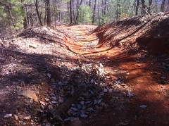
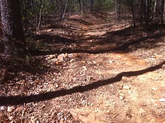
Almost immediately after that first hill, you roll across a flat section and climb this second one. This photo is from the top of that hill, looking back down. It's odd because whenever I take a photo from the top down, it never looks like it. I swear this is from the top, looking down.

 Second Hill From The Top

Again, looking at it firsthand, it was clear why the contractors did what they did. There was a rut there in the past but it's been filled in and, like the previous hill, the entire hill is now a consistent grade, but more importantly, consistent with the pitch of the trail above it. This will help with erosion, which was clearly a problem before, thus the rut. Water won't suddenly accelerate or drop off of ledges any more and eat out a new rut.

Most importantly though, there is a hard left at the bottom of the hill. If a rider comes tear-assing downhill and is suddenly faced with a rutted out section of trail, his or her attention will more likely be focused directly in front of them rather than down the trail and around the corner. An expert mountain biker might be able to easily pick a line through the chunk and still be able to pay sufficient attention to notice oncoming riders but an intermediate level rider might not, or even if they did, might not be able to stop or slow down sufficiently whilst negotiating the gnar, should someone appear around that corner.

Should an oncoming hiker or cyclist appear, they might be able to get out of the way or might already be looking for someone coming down the hill and laugh it off, but Bull is an equestrian trail too and horses are wider, not generally as nimble and can throw their rider.

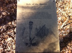
Some of the work could be CYA-related. "For the past 20 years there haven't been issues with people running into each other, so why do anything about it?" one might ask. The trails at Bull/Jake have been getting steadily increased use and with the improvements at Jake, that use has shot way up. Traffic is increasing, encounters are increasing, impact on the trail is increasing. There are sections that don't meet designated standards for erosion control or safety. Somebody could do all kinds of studies to decide whether it's really necessary to change anything, but it's way cheaper to make the trail compliant and if something does happen, the likelyhood of a lawsuit involving the land manager is diminished considerably because the trail was maintained to established standards.

Oh yeah, I forgot to mention. All the way up the hill following that bit of last work, the rolling dips have been restored.

 Turnout Above Second Hill

More erosion control. Combined with the turn at the bottom of the hill, and how short the section is, it's unlikely that that the corridor will rut out again any time soon even though the trail doesn't meander.

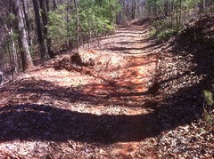
The third hill (from the bottom this time).

 Third Hill

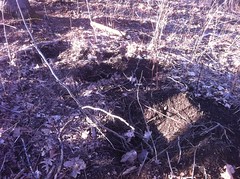
This one has been thoroughly castrated. It used to be deeply rutted, extremely challenging, and you can even see on the really far right how riders had to cling to the side to make it up the hill. In fact, old tire tracks were still visible over there when I rode through. It looks like the tread has been regraded to be consistent with the pitch above it for the same reasons discussed earlier and that the fill is chocked full of rock to armor the soil internally, similar to what was done on the trail leading up off of Jones Creek over at Jake.

This will probably erode a bit over the years, eventually, exposing the rock to some extent. There are a bunch of solutions for sections of trail like this. Ideally, you'd route around it on the outside, but that's expensive, goes outside of the corridor, might require environmental analysis, etc. I'm not really qualified to analyse this work too critically. It doesn't precisely match the solutions I learned in trail school, but it looks "OK". It certainly makes the trail easier, but it's also clear why it was done.

Bridges!

 Bridge

There have classically been 4 or 5 mud holes on Bull that people rode further and further around each year. Bridges have now been built over them. It definitely makes the trail easier because you don't have to sling your bike over to the side and "float". Do these count as castration? I don't know. Mud puddles are fun, but per IMBA standards, trails aren't supposed to have standing water and when they do, widening inevitably occurs. I don't think anyone would argue that widening had occurred around those mud puddles. So, again, it's clear why it was done.
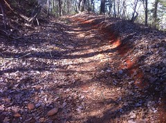
The fourth hill:

 Fourth Hill

Again, this is looking down, from the top, though it may not look like it. The meandering here is really obvious, as is the rock and debris placed to either side to act as a silt trap. Again, there's a hard left at the bottom and a trail designer would want riders to slow down there without skidding and be able to focus their attention ahead. The grade is consistent with the trail above. ...All the same things as before. There's also a new water turnout at the bottom of the hill.

I actually remember this hill very well. It was so chunky that when descending it, I would hug the far right hand side and try to rail that berm way up at the top there as long as I could. To do that, I had to carry a ton of speed and I always rode into the turn below it fast and blind. It was definitely fun, and was probably reasonable to do during the Fool's Gold, but I was always reticent about doing it on a casual ride because someone could be coming the other direction. I always had to brake hard and drop down into the chunk or try to manual back and forth across it, which was a challenge, but it wasn't that much fun, at least not to me. Yeah, it's way easier now, but the work makes sense.

Fifth hill.

 Fifth Hill (From Below)

More of the same. There are now silt traps to either side.

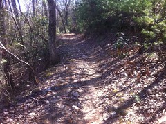
Those particular sections of trail are substantially less rocky and chunky than they were in the past, but the trail as a whole is nearly as rocky as ever. Just uphill from that last hill, for example...

 Rockiness After Fifth Hill

...and more beyond that.

 More Rockiness

Eventually I reached the spring. There was a new turnout above it.

 Turnout Above Spring

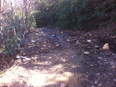
Most of the rock has been moved from the trail itself to the uphill side. Conditions were exactly right to suggest the motivation for this.

 Spring

This photo is looking back up the trail. You can see how to the left, it's dry.

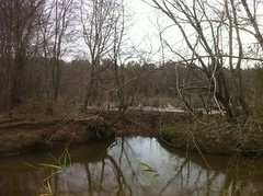
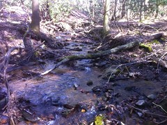
You don't want a spring to flow across and down the trail for any length of time. First off, it erodes the trail and sediments the creek below, in this case, a feeder of Lance Creek, a trout stream. Second, on a horse trail, there's always the possibility of suddenly introducing a good bit of e-coli into the stream if a horse drops a pile anywhere along the length of the outflow. This is one of those things though where I'm not totally sure about how big of an issue that is. It might just be more CYA, but I'm not really qualified to judge one way or another, I just know that it's a concern and work is generally done to mitigate it and that looks like what was done here.

It appears that the contractors corralled the outflow of the spring to the upslope side of the trail and made the upslope side extra rocky, encouraging traffic to take the outside, less rocky line, which is good for reasons discussed above. They did this by moving most of the rock that was on the trail itself to the inside.

Ordinarily water flowing downhill on the upper side of a trail would also be a no-no, but it's super rocky there so it's not likely to erode any significant amount and a feeder creek crosses the trail 50 yards down from the spring. The spring water just joins the feeder right there. Now, instead of riding through the outflow for 50 yards, we cross it at an armored stream crossing. Yes, the trail is dumbed down, but again, the reasons are clear and valid.


Again, as seems to happen regularly these days, I'm afforded an opportunity to study my own duality.

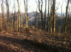
On the one hand, I can totally understand the frustration. "Dammit, trails everywhere are becoming really easy to ride! Where can I find a real challenge these days? Jake is a cakewalk and now and these sections of Bull are too!" I would argue that on the whole, the change in the Bull Proper experience is marginal, it's like 6 spots of maybe 50 yards each over 4 miles, but I don't ride up there every weekend. Somebody who knows the trail really well might be looking forward to individual spots, and now they've been bulldozed out of existence. And this is happening everywhere, not just at Bull and Jake. Is this the end of technical trails?

On the other hand though, I can totally understand why the work is being done and I agree with it, at least in principle. The details, eh, maybe, maybe not. It's hard to say. I'm not really qualified to say whether I like the work or not without seeing how it performs. Woody or Walt or Mike Reiter would be, but I am not them. I can say that those sections of trail are like the worst-case scenarios that they show you in trail class. The solutions we learned were much more extreme and expensive in both money and time; like rock armoring the section from top to bottom, or building up the center, outsloping that, creating an armored drain to one side and an armored turnout at the bottom, or outright rerouting. We did discuss the solutions that were employed as part of a road-trail conversion, but not specifically for a section of trail that is already below grade. I imagine they would still work though, especially for such short runs. Who knows? Time will tell.

Wretched duality! Or triality, quadrality, or whatever you want to call it.

There's really a bigger picture though. By and large, we've been riding trails with unsustainable features all our lives without realizing it or even knowing what that means. In fact, we're used to the ruggedness of the trails and enjoy it. And it seems like the trail has been like that forever, why would it suddenly matter now? Long ago most land managers defined Acceptable Limits of Change for their trails but with a few notable exceptions, were lax about even evaluating whether their trails were compliant, much less doing anything about it. Very recently there has been a push from many different directions to either catch up or close the trails and they're opting to try and catch up. Unfortunately the work that's being done necessarily de-ruggedizes trail because the very things that make sections of trail rugged are the things that make those sections non-compliant.

What we really need are trails that are technical but ALSO sustainable as opposed to trails that are technical because of their unsustainability. Currently, the only reasonable way that I know of to do that is to find naturally technical terrain and run the trail through it a la The Dug Gap Pinhoti. I would argue though, that that's the "right" way to do it. I'd like to see trails that aren't much more than a representation of the surrounding terrain that's negotiable by whatever mode of transport it's designed for. I wouldn't expect the trail to be chunky and technical if the terrain around it isn't. Similarly, I wouldn't expect to find a clean and easy trail through rough and rocky terrain. In the long term, I suspect that the solution will be to have more trails in better locations, and if we want technical trails, build them in naturally technical locations. It will take time but we'll get there eventually if, as a community, we do the right things. I'm certain though, that we won't get there if we don't first make what we already have sustainable and demonstrate that we can manage it.


The contractor's work ended at Lance Creek road and I with that, I accomplished my second objective. Yay!

Objective three was to see how well my overstuffed camelback performed. So far, so good. It kind of "sausaged out" on my back, but it didn't swing from side to side and it sat well. The only problem so far was that I didn't have room to even put my armwarmers (which I had shed by that point) in it. That's how stuffed it was. How would I fit food in there? I could unzip the compression zipper and let it expand but then I know from experience that it swings around if you do that. Hmm, maybe that "so far, so good" actually needed some revision.

The climb up Bare Hare was rocky and fun. The pack was fine, at least from a weight perspective. The descent down the back side was as fun as usual too. Again, no issues with the pack.

Well, almost.

One of my bottles slipped out of the cage.

 Lost My Bottle

I went back to get it, tried to bend the cage to make it a little tighter, and spraaang! it popped. I guess it was about to go and that's why the bottle fell out. Ohhh... no room in my pack. I rearranged some gear and put it in my right pocket but it fell out almost immediately.

Hmmm.

Zip ties to the rescue. I put it in the busted cage and zip-tied it to the frame. Hopefully that would hold. If I ended up needing it, I could pop the zip ties.

At the bottom of Bare Hare I rolled out on 77A, passed a few trucks and eventually made it to CP3, the kiosk at the intersection of 77A and 77.
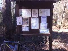
 Kiosk

46x47

It looked pretty full though. I'm not sure how we're going to fit much else on there. That's pretty much the case with all of them actually.

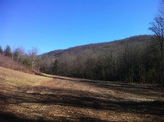
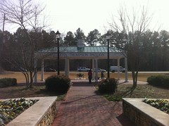
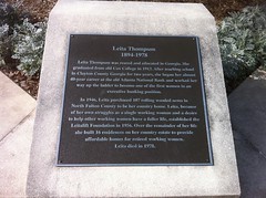
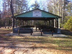
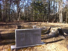
The next leg was a long climb up Winding Stair Gap Road and some out-and-backs on the roads up there. I guess I could say that I had four objectives, though one of them didn't occur to me until I was near the top of Winding Stair. I noticed a few days back that I didn't have any photos on my trails site of the Hickory Flatts Cemetery, despite having been there a dozen times. How did that happen?

Easy to fix though.

The pavillion.

 Hickory Flatts Cemetery Building

The graves.

 Hickory Flatts Cemetery

The "facilities", disgusting as they are.

 Hickory Flatts Cemetery Facilities

Eventually my wanderings brought me back toward the car. Not wanting my freehand nav skills to get rusty, I even did an extended hike-a-bike of what had to be a mile or more though some unfamiliar terrain. This seemed like a great idea at first, and I ended up where I intended to end up, but not before running into this punji stick.

 Shred

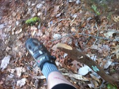
It stuck into my leg as I walked and the force of that eventually broke it off, but the broken off point dug in pretty well. Yaah. The durability of skin never fails to amaze me. That kind of thing has happened a few times and I've always been surprised when it turns out not to have been driven directly into my shin. A few years back, Trey Woodall hit one of those and it did get driven into his shin. He pulled it out and finished his ride. Then he rode the Trans North Georgia a few weeks later. I would like to think that I would be that hard but the opportunity hasn't yet presented itself. Not that I really want it to, but I seem to keep tempting it.

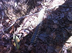
A buddy of mine texted me right before I started the ride and said he was taking his kids squirrel hunting. Later he texted me that they didn't get anything but they still had a good time running around in the woods and shooting. Too bad I couldn't just text him this squirrel that I found here.

 Squirrel

Maybe one day there will be an app for that. Da-da-ding. "Dave has sent you a squirrel."

Ha.

It was getting pretty late. The sun was gone. I had to put my armwarmers back on. You know it's been a good day if you start out wearing warm clothes, then have to take them off, but then you're still out when it gets cold enough to have to put them back on again. I turned on my flashing red tail light. I didn't yet need the headlamp.

As I approached my vehicle, I noticed Stephen's car was still there and I thought I saw someone or something milling around by mine. It turned out that he'd just finished his ride too. Nice. We'd both been out for a little over 7 hours. He was attempting to play a joke on me but I'd ridden up right then. Actually two jokes. They were pretty funny. We talked for a while and it was cool to catch up. He mentioned that he's getting chainsaw certified which will be very helpful. I know of two trees on Bare Hare that he can cut out tomorrow. We had very different rides, but they were apparently equally satisfying and at one point our paths could have crossed. I'm actually surprised that we didn't run into each other.

The experiment with the overstuffed camelback went OK. I don't think it'll be totally functional though. There's no room for anything that I might pick up along the way, like food for example. It's conceivable that I could put my bag in an even smaller stuff sack though. I'll have to try that. The experiment continues.

Oh yeah, I almost forgot. Technically I had five objectives, not four, or three. I'd put a lay-back post on my bike that morning. For a year or more, I've been bothered by how scrunched up I've been between the bars and seat. Lately it's been really bothering my neck and back. After 4 or 5 hours, especially of climbing, it gets pretty bad. I'd always had my seat as far back as possible and eventually that led to breaking a rail at the Fool's Gold last year. I got a lay-back post, originally just so I could put the seat in the same position but with the clamp further back on the rails. I eventually realized though that I needed to be further back from the bars too, so I ended up using the new post and still putting the seat really far back. I tested that out Sunday too. It made a world of difference, but I can imagine that it would be even more comfortable a half inch or more FURTHER back. Maybe I need a longer stem. I'll have to see after a race, that's when I can really tell.

Oh, what a day. The more-likely-to-be-boring part of riding around on gravel was fun, but the more-likely-to-be-fun part of riding on singletrack was work. Mark Twain points out though that work is anything one is obligated to do is and play is anything one is not obligated to do. One will even pay for the opportunity to do something that if one were paid for, one would decline, as being paid turns it into work. I think I see where he's coming from. It's weird because even the trail "work days" don't usually feel like work, yet somehow measuring the signs and examining the trail did.

Weird. So weird. Next time it will be all play.

Wednesday, February 22, 2012

Weekly Beatdown

The Wednesday group rides haven't started up yet, so for now I have to beat myself down.

I went for a semi-exploratory ride today and ended up finding a bunch of long climbs that I didn't know about before and ended up having to climb a bunch that I did know about but didn't realize I'd have to climb them until I was already committed. It's coming back though. I've got a little power again. I can breathe. I can burn again. And I can shed the burn in three or four breaths again. It's awesome.

I spun a loop through Windermere Park and on the way out, I swear I passed a girl that I dated after high school who also moved to the ATL. It couldn't possibly be her though, or at least that's what I told myself. Why would she be there? I couldn't imagine that it was her and she didn't appear to recognize me, though I was wearing odd clothes and a helmet and glasses, so maybe she wouldn't. I kind of kicked myself later for not spinning back and at least finding out.

My explorations took me over by Settles Bridge and I got to see it from the other side this time.

 Settles Bridge From the West

I found some dirt over that way too, a half mile or more off of James Burgess road. I had so much fun down in Paulding County with my brother, I wondered if I could put a loop like that together around here, so last night I googled "dirt roads of forsyth county" and lo, the internet provided me with a list. Apparently the county has to publish the list of roads they're going to treat with Calcium Chloride. Ta-da. I then looked them all up on Google Maps and a few made little loops off of main roads. That's what led me over by Burgess. Burgess itself turned out to be quite a climb too though.

I flatted on some sharp gravel where they were doing some road construction on Old Atlanta. This time I made sure that everything was seated right before I aired it up.

My legs were tired at dinner, but it was a good tired. The best kind of tired. It's all coming back.

Big Creek Greenway

Normally Kathryn and I would just go for a walk on a Tuesday but since the kids were still off of school, we all went for a ride on the Greenway instead.

 Rollin'

Woohoo!

We didn't do too long of a ride and it wouldn't really be worth mentioning except for this cool thing that we saw. About 50% of the greenway in Forsyth County (which is where we rode) is a boardwalk over marshland, and these days the water is about 8 or 10 inches deep in most places. In one spot, it even comes up through the boardwalk a little, and in another spot, you can see, for quite a while, that the marsh level is several feet higher than the creek. What the heck could cause that?

A beaver dam!

 Beaver Dam

I saw it when I was out on my road bike last week but I forgot where it was. It turned out to be right where we turned around.

Awesome.

Tuesday, February 21, 2012

Edmondson Cove

Yesterday was my birthday. Happy birthday to me. My Dad says I'm getting seasoned, but that I shouldn't feel bad about it because I can always say that I'm not yet as seasoned as he is. Ha, ha.

It was also Presidents Day so the girls were off of school, but since they had gym and dance all day I couldn't reasonably do anything with them. Solo! Solo, it is. And therefore I chose something that they would never want to do, ever - climb back and forth over ridiculously steep mountains all day.

I parked at Mauldin Gap. If you've ridden the Winding Stair Loop, you might know where that is. From there, I walked uphill to the top of the knob. There is a "trail" in the vicinity but it sort of comes in from the side and it's not obvious at all except in the summer. In the summer, the hillside is so overgrown with thorns that you can't possibly go any other way, but in the winter it's wide open and clear, and gets a good bit of use by the Rangers, and the shuffled leaves marking the route that they last took up to the top looks as much like a trail as the "real" trail. I don't think I've ever taken the same route up twice.

At the top, the shredded remains of this sleeping mat could be found at every turn.

 Shredded Mat

It looked like the wind had had it's way with them. I'm not sure how the mat got so shredded to begin with though. I looked at it for a while. The cuts were extremely geometric. More than I would expect from somebody hacking at it with a knife, or an animal tearing at it either. It made me wonder if the fabric just deteriorates in that way. It is made of threads running along the X and Y axes. It might just naturally fall apart like that.

Weird.

There are "trails" up on top of Greasy Mountain in the sense that you can tell that people have gone that way before, especially in the summer, but in the winter they are somewhat more difficult to follow. Sometimes the leaves just look slightly out of place. I searched for one that I'd seen up there last time and eventually found it. It led to an old roadbed. When that ended I followed more disturbed leaves down into Edmondson Cove.

At the bottom end of the cove there was once a pond, but beavers and weeds have all but reclaimed it. For a while it was renamed the Edmondson Wetland, but recently, somebody just went and removed the sign altogether.

There was a maze of old logging roads, or something near the creek. I'm not totally sure they were for logging though. It would have been a nice place for a farm and there were a lot of old-looking artifacts lying around - coffee cans, bottles, cinder blocks. The roads might just have meandered around the property. The proliferation of stumps on the hillside implied logging, but the lack thereof in the flats implied otherwise. Who knows. Maybe it was both.

Eventually I made it down to the creek itself, which was much like any other North Georgia Creek. Shallow, clear and cool. Full of rocks. Some of the rocks had moss and some of the moss had lots of other little things growing on up through it. "Ecosystem on a rock" a friend of mine once called it.

 Edmondson Creek

I kind-of wanted to explore the entire cove but some of the old roadbeds were pretty overgrown. Others appeared to get frequent use by hunters and Rangers. Unfortunately, it was easy to tell who used them from the trash. There wasn't much trash, but the little that there was was telling. The tear-off part of an MRE wrapper, spent rounds - blanks from Rangers, real rounds from hunters, shotgun shells, beer cans... Beer and hunting seem to go together like bacon and eggs. Every year after deer season there are new beer cans lying in the middle of nowhere and half burnt ones in the backwoods fire rings.

Eventually I abandoned the maze and headed toward the "pond" and the road. Along my route there was a tree with a weird appendage growing off of it.

 Tree Appendage

Weird.

At the road there was a truck parked with the engine running and a lady sitting in the passenger seat but no driver. I figured maybe her husband was peeing somewhere. I waved. She waved back.

I took the northern side of the Edmondson Pond Loop back into the cove. With the drying up of the pond, nobody seems to use the trail that much any more. It was more overgrown than anything I'd been on all day. The old interpretive signs were still there though.

 Role of the Hunter

This one was interesting. There may have been 350,000 hunters when the sign was put up, but that's been declining by 10% a year since 2000 in Georgia and the revenue from licenses and taxes has been dwindling. The DNR recently gave up the Blue Ridge WMA (of which Edmondson Cove was a part), instituted general user fees for many of their WMA's and kicked around the idea of renaming them Recreation Areas. The management costs, even above and beyond conservation, were traditionally covered by hunters and fishermen, but there just isn't as much money there these days. If you hike or bike or anything in the participating WMA's, you have to buy a pass. I guess that's only fair. It seems odd to me that hunters were subsidizing it in the past. I had no idea. Of course I have no idea what the breakdown is - how much money is spent on what or where it comes from, exactly. That would be interesting to see.

I cut through the woods to a food plot road and as I prepared for the second significant ascent of the day I heard a rustling in the bushes to my right, down on the trail that I'd just come off of. There was an elderly gentleman with a gun, walking the trail, in the opposite direction. It then occurred to me. I think it's small game season. He must have been the driver of that white truck. "Hang out here honey while I go hunting."

I've seen trout fisherman pull up to a bridge, jump out, cast a few times, jump back in and take off. I've even seen bass fishermen do it at park ponds. "Drive-by's". I'd never seen a hunter do it though. I imagine for small game, it's somewhat effective. Jump out, make a loop around a field, or a pond in this case, shoot what jumps up and move on. I'd seen a dozen or more squirrels already that day. I never heard a shot though, so maybe he wasn't so lucky.

As I began my ascent up the south face of Frozen Knob I was afforded a nice view of Greasy Mountain. I had just come down from there. My car was on the other side at the northern end.

 Greasy Mountain

Up on top, it was again clear who spends the most time up there.

Rangers...

 Ammo

...and hogs.

 Hog Rooting

The rooting was indescribable. I say that, yet I will now attempt to describe it. Those holes are about 8 or 10 inches in diameter. If you were to mark out a 20 foot by 20 foot square, there would be at least one set of 2 or 3 holes like that in each square, over the entire top of the mountain. In between you couldn't go more than 3 or 4 inches without seeing a more casual instance. It was like what I'd seen along the road on the way up to Anna Ruby Falls a few weeks back, except over a much larger area. I imagined a herd of pigs, swarming like locusts over the mountain, devouring every buried thing. While I would have loved to have seen that, I would have been terrified to have seen that. On the upside though, the pigs didn't seem to be all that huge. The last time I saw little pits like that they were several feet in diameter with 40 pound rocks casually excavated from them. I could only imagine the beast that did that. This time, there appeared to have been a much larger herd, but of much smaller individuals.

Still though. Wild pigs. Scary.

I headed east and then south to Edmondson Gap. To call what I took down to the gap a trail would again be a very liberal definition of the term. At the CoTrails weekend we had a few weeks back though, we were all asked to define what a trail is and I realized that I tend to define "trail" very liberally. A lot of folks had complex definitions that involved renewal of the mind and spirit and getting exercise and experiencing the outdoors and maintenance requirements and lots of other things. The definition the Trail Dynamics guys has was complex and precise and I remember that it involved the word "facility". My definition was something like "a route where you can tell someone or something has gone before". I don't think my definition will work in a planning or maintenance context, but it certainly works in the woods.

I half expected to see an ammo box on a stick at Edmondson Gap. It looked like a likely place for one, and I'd recently seen one even further out than that. I was disappointed though.

The "trail" back up to Greasy was the steepest yet, and I was on the north face of the ridge so it was cold too. There was even ice on the ground here and there.

My dad called me about halfway up and I sat on a log, facing down into the cove, with a reasonably majestic view for miles around, talking with him for 20 minutes or so about birthdays and computers and auto repair. While that might at first sound like sacrilege, at the time, it seemed like the perfect union of so many of the things that are important in my life.

The trail, vague to begin with, disappeared entirely about halfway up and widened like a delta into the dozens of routes taken recently, only discernible by a footprint here, a trampled thorn bush there, a broken stick smashed down into the ground, an indention on a rotten log, and so on.

Eventually I reached the top and coming out of the shadow, bathed in waves and waves of sun. As I walked, the sun would appear and reappear. When I could see it, I felt 10 degrees warmer.

I headed west to Mauldin Knob. Again, I was afforded another nice view, this time of Sassafras Mountain and the Blue Ridge in general. The AT runs along that ridge.

 Sassafras Mountain

I managed to find the "actual" trail back down off of the knob. It's super steep, the descent made my legs tired, I'd forgotten to bring a snack with me and all I'd eaten that day was a pair of yeast rolls. I could see my car from almost all the way up to the top but it seemed like it took all day to get down to it.

On the drive in, I'd passed a guy on a road bike on Camp Wahsega Road, a guy on a mountain bike climbing FS80, two hikers at Horse Gap, several people out for a drive, and then there was that hunter and his wife down at the pond. It seemed like the woods up there was the place to be, but on the way out it was definitely closing time and I was locking up the joint. It wasn't quite desolate though, there were a few folks at the quarry, making camp, and a lady pedaling two miles an hour on a hybrid back toward Dahlonega. Her partner was up the road a bit, at a church, with his bike turned upside down, lying on the ground, with his feet crossed and propped up on the top tube. He appeared to have been waiting a while, and by the look of it, he'd be waiting a while longer. I couldn't help but smile.

I grabbed a snack at the gas station and headed home. That night we ate with my brother at Pappadeaux which is one of the few places in Atlanta that has good fried seafood. Mmmm. Fried seafood.

It was a good day. It's been a while since I've crawled all over random mountains. I'll have to do it again soon.

Sunday, February 19, 2012

Tribble Mill 6 Hour

Finally! Something worth writing about.

I rode the Tribble Mill 6 Hour today. First race of the season. For me anyway. Technically there were 2 Snake Creek Gap TT's already, but I missed those. To say that I was ill prepared would be an understatement, but it's about the most succinct way of putting it. The first race of the season is usually like that though so I'm not disappointed, or at least not THAT disappointed.

I called Tim last night to see if he wanted to carpool but he was going to do the 9 hour. I'm down to ride for 9 hours, or 12 hours, or 22 hours and 22 minutes, but I don't think I'd enjoy riding the same 8 miles over and over for that long. 6 hours seems to be my limit for that brand of fun.

So no carpool, but I did join him and his cronies at Waffle House in Lawrenceville for some breakfast.

 Waffle House

Eggs, toast and a waffle. It's important to start the day off right.

I went for a little spin-the-legs-out ride yesterday and fully intended to run by the shop for some Clif-Blocks on the way home, but somewhere between Alpharetta and Cumming the thought retreated deep into some inaccessible brain wrinkle and it wasn't until 8:30 that I remembered, long after the shop had closed. I didn't even have time to run by REI. As such, I had to run by the gas station to pick up some Zingers after breakfast. I'd used them once last year. They sufficed. The gas station only had vanilla, but that was probably good. I appear to be absurdly sensitive to the diuretic properties of caffeine these days and the chocolate Zingers might have had enough to be a problem.

On the way to the park, we passed cars and trucks with bikes on the roof, bikes on hitch racks, bikes in the bed... It's been a while. I got that little twinge of excitement like when you're a kid on the way to a water park and you first catch a glimpse of one of the towering waterslides, way off, through the trees.

At the park the bustle was building by the minute. Yeah. I remember this. All right!

 Pit Row

I set up next to Norma and Johnny. They've been running a lot but they hadn't been on the bike any more than I had this winter. All around the pits, that seemed to be the general case. Maybe we'd all ride equally poorly and it would all come out in the wash.

One of the great things about Tribble Mill is the paved trail that runs all through the park, around the lake and next to the road. At other parks you just have to ride up and down the main road to warm up but at Tribble Mill you get scenery, hills, twists and turns. "Road bike singletrack" I often call it. It's great.

 Warm Up Lap

I scared a lady half to death though. She and her friend were walking ahead of me, both talking on the phone. Her friend was in the right lane, she was in the left. I announced myself but she couldn't hear me. I tried to pass on the far, far left, at 3 miles an hour, but right when I did, she walked over even further to the left. I rode off into the gravel, but the noise of it startled her terribly. We laughed about it afterwards but it was pretty bad.

I ran into Matt and Becky at the start. Matt was riding, Becky was just hanging out. They're training for an Ironman and not super focusing on mountain biking right now. Eddie and Nam arrived at the last minute, though somehow also fully prepared, as usual. I'd run into David Sagat in the pits earlier but I didn't recognize him without his bare knuckle boxer 'stache.

"10 seconds!"

Yes. This is really happening.

"Go!"

The route was backwards this year, or at least it went generally backwards from the direction I've ridden in the past. Most importantly, very early on, we were going to ride back and forth across a little ravine, affectionately known as the Taco Stand, presumably because in the other direction you can launch out of it, and if you do it wrong, crash and taco your front wheel. It's in the other direction that the launching can occur. Today we had to climb through it. Early in the race, there's always a traffic jam. A traffic jam at the Taco Stand could be bad news. The holeshot was important. I went for it.

Two riders crashed halfway between the start and the woods. They didn't look hurt. I made it into the woods in good position. The Taco Stand was a non-issue.

The first lap was vaguely familiar. There was a lot of traffic, but we were moving really fast. I was big-ringing everything. I'd forgotten about that strangling feeling of early exertion and about riding in a train at warp speed, counter-steering on singletrack, and about a great many things. Of course, I remembered how to ride, it's "just like riding a bike" and all, but _racing_ was, at the moment, somewhat elusive.

I got passed by some dude with pinwheels sticking out of either end of his bars. Pinwheels. I chased. No way Mr. Pinwheels wasn't going to earn that pass. Eventually I passed him again but near mid lap I let him back by he rode right away. It reminded me of the guy with the aero helmet at the Southern Cross a few years back, and Glen's old Cannondale Skin Suit. If you're running that gear you'd better be able to back it up. They all did. They earned it. Crazy.

Lap 2 was much the same as Lap 1. I'd remembered a lot by then. Relax your upper body when you climb. Lean forward for more power. Way over. Breathe, dammit. Breathe! Pedal circles. Quit trying to manhandle the trail. Had I not been doing those things all winter? As unintuitive as they were, maybe not. Jeez.

Somewhere in there I got caught and passed by Yao Nan (I hope that's how you spell his name) and we sparred for a lap and a half. It was all that I love about racing. Everything. It reminded me of some race at Dauset years ago in the GSC series where me and Eddie Wymberlie (again, I hope that's the right spelling) sparred for the entire race. Yao was smart, or maybe it was all intuition, but it was really good intuition. I think I might even have been one tenth of one percent stronger than he was but it didn't help me out. He'd punch it on the climbs, ease up where it wasn't feasible to pass, punch it again when it opened up, draw me in when it was technical so I'd have to drop back or risk catching a bad line, then punch it when I'd drop back... He'd let me by if I asked, give me enough room to think I'd made some progress, then sneak back up behind me again two minutes later, ride my wheel for a mile and finally need to get back by. I studied his riding when he was in front of me and he had only one weakness that I could see. When it got really rooty and technical, he kind of powered through it rather than bumping gracefully over it. I resolved to pass him again and exploit that weakness as fully as possible, and I was briefly successful, but either he figured out what I was up to or just dug deep and somewhere near the middle of lap three he rode away and I never saw him again. It was awesome.

As fun as it was though, it was also a clear demonstration that I'd brought my D- game. I never bothered to check his number. He was in Sport. I'm in Expert. There was no good reason to waste energy on him. I needed to get by, but I didn't need to drop him. We could have gone back and forth all day and it wouldn't have hurt either of us. We could have coordinated even. Ugh.

My stomach actually felt full at the end of lap one and two. It wasn't just "I'm not hungry", it was "I feel full" and I didn't bother to eat. I shouldn't have had such a big breakfast. I needed simple carbs and sugar, but I was full of protein and complex carbs. In the middle of lap three it hit me like a freight train. Everything started to seem steep and rooty and rough. I kept checking to see if I was in the middle ring. I was. My joints ached. My head was spinning. Incubus's "Anna Molly" was stuck on repeat in my mental iPod. I was crawling. I was getting passed.

Mark D was out there taking photos and he caught one of me, getting caught by a train of poursuivants.

 Getting Caught

Actually that photo may have been from an earlier lap, but it was like that. Grimace. Chase group uncomfortably close. Doom eminent.

In the pits I ate half a Zinger, which seemed like the right amount. I still wasn't hungry though. Lap four was abysmal. I got passed by overweight riders, riders in tee shirts and shorts, riders on flat pedals and a rider in a Lynyrd Skynyrd jersey. Just to be clear, I'm not judging these people, it's just that I'm allegedly an Expert and it was very unlikely that these riders were also Expert riders. It was embarrassing. Disgraceful! I discraced myself, my team, endurance cyclists of the southeast. Humanity itself.

I had a plan though. I couldn't salvage the race, but I might be able to recover some dignity. Maybe.

It took fifty-two hours to get back to the pits and when I got there I barely had control over the creeping insanity but I made it back and I ate a Zinger and a half. Quality calories there.

Lap five was almost exactly like lap 4. I began to doubt the restorative powers of Zingers. Fortunately, I had remembered almost everything that I once knew about how to race, so I was probably a little faster. Eddie lapped me somewhere in there. David Sagat lapped me too. Norma passed me. She always passes me on lap 5. Always. The delicious golden pastries kicked in at about mile 7. It was about 4 miles later than I'd hoped, but hey, that's what I get.

The turnaround was remarkable. It was like lap two again. I had power. The fire in my mind was out. I started passing people for the first time in hours. Too bad it was at the very end of the ride.

Hah. I almost forgot. In the pit before lap 6, I was talking to Johnny, who'd pulled out earlier with a badly bent derailleur hanger. My mental faculties had been returning but they were still somewhat feeble and I apparently dropped my spent water bottle but failed to pick up another one. I noticed it about 5 minutes into the lap. The last time I did that was, ironically, at Tribble Mill, last year. Fortunately it was in the 50's today. Last year it was in the high 90's. I figured I could finish without a bottle, but again, like last year, I'd seen a bottle on the course and I grabbed it. Delicious, lifesaving goodness. That's what I hoped for. The bottle was completely full, and closed, and totally clean. It had probably fallen out before its owner had taken even one pull. Perfect. I drank deeply. It tasted like warm grainy sour orange milk. Oh man it was bad. I almost choked. Later in the lap I got a little thirsty but there was no way I was going to hit that garbage again. I just rode it out.

Done.

 Done

The result. 11th out of 13. Riders in positions 12 and 13 didn't even finish the race. They pulled after 4 laps. I was the slowest rider that finished. Good lord I stunk up the joint. Somebody's got to come in 11th though. It might as well be me. And its OK because it's the first race and I made a thousand mistakes and I'm coming back from illness and some other set of random excuses.

On the way home I got a Cherry Coke and some beef jerky. It was 3.17 but I thought the cashier just said 17. Like 17 dollars. We joked about it. "That would probably be the best coke ever." "Yeah, it would probably cure cancer."

Oh my. What a day. Next time will be better. Next time I'm going to roll right. Next time I'm going to eat right.

Next time.

Saturday, February 11, 2012

Reality Bikes Ride

Man, it got cold all of a sudden! This whole winter has been more like an interpretive dance representing winter than winter itself, then today I actually had to put on warm clothes.

Today Reality Bikes had a big group ride planned and everybody on their various teams and clubs were invited. I was in the club last year but this year Todd's putting together a Grassroots Mountain Bike Team and he asked me to be on it. I guess I'm doing something right. Thanks Todd!

At any rate, we had this ride planned and it was really freakin' cold. I actually had to dig out my full-length fleece tights-bib-thing and winter base layer. I can't remember the last time I used either. We rode out of the lot at the Blue Bicycle, a little bistro up in Dawsonville.

 Reality Ride

It was one of those no-drop rides, which was good because I'm definitely in the kind of shape where I'll be dropped when they start up the weekly beatdowns again. I'm usually like this at the end of winter though. Winter just sucks all of the intensity out of me. I can ride forever but somehow I can't trade a pound of that endurance for an ounce of speed. This winter has been especially difficult. Back in September I had dreams of epic rides, overnighters and hauling around 12 pounds of crap in my camelback all day but between the weather, work, CoTrails, illness and a few oddly timed family events, this winter has been a wash. I've kept my weight down, but I'm not any stronger than at the end of September.

On top of all that, it never helps that at the end of winter, the cherry trees start to bloom, followed by the pear trees. It seems to be redbud, then cherry, then pear, then dogwood. I'm allergic to cherry and pear, and the only thing more miserable than the pollen is the side effects of the various allergy meds. It hit me this past Wednesday, right as I was getting over a cold. Ugh. I'm praying for dogwood. Come on dogwood.

I was planning on just sitting on the back all day, sulking and crying, but I ended up doing ok. Some of the guys around me seemed to be working a little harder than I was even, which was encouraging. Every year I forget how awesome a group ride is too. I've been pulling myself around all winter. In a group you can hide from the wind! Amazing! Who came up with that?

Did I mention that it was cold? Yeah. It was cold. In fact, it snowed on us the entire time. I got hit by a little sleet storm in my neighborhood too. The daffodils are already up this year and they had no idea what to do. No idea! I hope it has some effect on the cherry trees too, but somehow I doubt that it will.

We rolled an easy 40 miles and chatted and kind of felt out our respective fitnesses. The route was surprisingly hilly toward the end and a few guys pushed the pace a little bit over the hills. I've never been up on those exact roads before, but I'm going to make sure to include some of them in my personal stash, they were great.

When we got back, I wanted to eat at the Blue Bicycle but I had to get back home. Maybe I'll go there for dinner tonight.

Tuesday, February 7, 2012

Leita Thompson Memorial Park

Today I drug Kathryn out of the house to another park in Roswell. This time it was the Leita Thompson Memorial Park. I've all but completely kicked my cold, but she's not quite over hers yet. She's been trying to build up some semblance of fitness though and I'm all about supporting that, especially if I can explore new trails while we're at it.

They're all about these little gateways in Roswell.

 Leita Thompson Trail Gateway

Oxbo has one too and it's as equally unlikely that you'd walk through it there as here. It's cute though.

The trail reminded me a lot of the Roswell Area Park - a wide, crushed shale sidehill. But the terrain was a great deal different. It was hilly and woodsy like Big Creek or like Vickery Creek. Kathryn wasn't really digging the hilliness as much as I was but she liked the woodsiness.

 Leita Thompson Trail

There were a lot of beech trees there. We talked about how they don't lose their leaves in winter, but she noticed that while that was true of the short little scrubb ones, on the taller ones, they do lose them on the upper branches. Do they get blown off? Does the sun play a role? Interesting.

There were lots of people out walking their dogs. Some people's dogs were walking them. We went down every little side trail and ended up passing this one guy 3 times. I always wonder what people think when that happens. The first 2 times they're always smiley, but not always on the third.

With the hills, the trail seemed really long. I was doing "The Zero" too. The Zero is where you wake up, don't eat anything and then go exercise for a couple of hours. I do that sometimes. It's not good for you per-se, but I think it's good to be able to recognize it and it's good to know how your body feels and reacts in that situation so it's no big deal when it happens accidentally. I get that low brain sugar feeling, it's hard to concentrate, everything seems bigger, my joints ache a little, my head hurts in a specific spot, if I'm carrying a pack, it feels heavy, but I can still push if I need to, but I know exactly how hard by feel. I'm really familiar with it. I hope that's good.

Most of the way around we ran into a memorial garden named after Leita Thompson herself. There was a pavillion...

 Leita Thompson Pavillion

...and a plaque.

 Leita Thompson Plaque

She sounded interesting. I hope she didn't just do all that charity work for the tax break. Though, I guess, even if she did, it still worked out for somebody, so win-win, right?

Near the end we passed an elderly woman jogging in the other direction who was also an amputee, missing her right hand. When she gets up in the morning, that lady is harder than I am all day. That's what I thought when I saw her.

The last eighth of a mile up to the lot was all uphill and with The Zero, I was feeling it. The cure for The Zero? Dutch Monkey donuts. I actually had a Chocolate Chip Twist. The girls and I could have shared it and it would have been a meal for the three of us. Delicious.

Roswell Area Park

Yesterday was the first day in at least a week that I didn't feel really sick. In fact, I felt energetic. Stuffy, but energetic. I almost went for a road ride, but I didn't want to jinx it so I ended up going for a walk instead.

Roswell has a bunch of parks and every park has a trail system of some sort. I've been working my way through them lately, and yesterday it was the Roswell Area Park's turn.

 Roswell Area Park Trail Map

I'd been there a couple of times before actually, for gym meets. In fact, Iz has a meet there next weekend. I'd always noticed the trails but never had a chance to set foot on them.

When I got there it was surprisingly chilly. This winter has been a joke. I think it was legitimately cold for about one week, but otherwise it's been in the 50's at least. For the past few weeks it's been in the 70's even, but yesterday it was cool and I actually needed my jacket.

The trail was easy to follow. For the most part it looked like this:

 Roswell Area Park Walking Trail

Occasionally it was paved. When I'm on that kind of a trail, I don't think of it as "hiking", but rather as "walking." Actually, just about everyone out there was jogging except me. There were elderly men and women out there jogging. Maybe someday.

Whenever I get to a park trailhead I read the rules and frequently they leave out whether the trail is open to bikes or not. This was the only indication I could get one way or the other:

 No Bikes

It was at the very back of the park, diametrically opposite the trailhead. A kid on a bike who didn't know better, wouldn't know better until he was at the furthest point he could possibly have ridden in either direction. It was almost as if it was there with the intent of maximizing the likelyhood of unauthorized use.

There were a few little neighborhood connectors. One went to a school. One went to an apparently very exclusive neighborhood.

 No Trespassing

Keep moving boy.

The rest of the side trails just led to other parts of the park. One led to this gravel storage area. Hah.

 Gravel Pile

Most of the way around there was a pretty little lake.

 Lake

Along the edge, I got to watch a woodpecker (or birdpecker as Sophie is prone to calling them) looking for a meal.

 Woodpecker

I heard it at first, then I saw it, but I figured it would fly right away. Nope. It couldn't have cared less about me. I watched for like 2 minutes while it hacked at the tree. In my mind, we had a primitive dialog:

Me: "What are you doing man?"

Bird: "I'm doing this." (peck peck)

"Yeah? Are you looking for a grub, or making a nest, or what?"

"I'm doing this. Right here." (peck peck)

"Yeah, what is that?"

(silence... stare...) "I'm doing this." (peck peck peck)

Yeah. That's my bird conversation.

At the very end of the trail I saw what looked like a Ring Tailed Hawk swoop down, land briefly on a branch, then bomb down and grab a mouse or something. It spent quite a while on the ground trying to get a grip on it. I didn't want to scare it away so I went a different direction, hoping when I came back around that I'd see it eating, but when I did, it was gone.

I think I walked around for two hours or so. I'd hoped to clear my head, literally and figuratively. Literally, it pretty much worked. I've apparently got exercise-induced rhinitis, which is great when you're trying to get rid of the last little bit of a cold. Figuratively it didn't work so well. At that trail school a couple of weeks ago, various people made points about how one of the the purposes of a trail is to rejuvinate ones mind and spirit. God I wish that still happened. These days, I notice the construction of the trail. It comes to mind what I'd have to do to fix the little problems. My mind hefts the weight of the work that would be involved. The little side trails jump out at me. Some are user-created. I remember conflict over those and allegations of other conflict. I remember manufactured conflict, ignorant and misguided hate, paranoia, hate-driven rhetoric and a guy that might just go all Mike Vandeman on me one day. I remember being pursued and hunted. I watch my back. It's quite the opposite of mental and spiritual rejuvination. I usually net-enjoy myself, but it's a balancing act. It's not pure. I yearn for that purity. I remember it.

Maybe next time.