Saturday, October 27, 2018

Tyler State Park

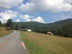
A few posts ago I lamented "What a month" or something similar. Part of what made it such a busy month was visiting my parents in Forney, TX. It was a really quick trip. I drove over on Sunday Sep 30, spent 3 days with them, and drove back the following Thursday.

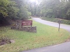
As Tyler is directly between Forney and Atlanta (about 1.5 hours in to the return journey), I figured I'd get a ride in at the park there on the way back. My Dad was able to join me too, and it turned out to be a pretty good ride.

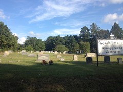
We parked at the Blackjack Lot, which I recognized from the one other time I'd ridden there, literally 20 years ago.

Blackjack Lot

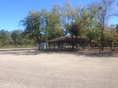
The lot is actually called the Blackjack Campground Lot. The campground being a ring of parking spaces with trailer hook-ups around that little island with the pavilion there. The bathrooms are across the lot from that ring. We parked along the edge near the bathrooms. It was a little weird though. There are no designated parking spots along the edge, but I didn't want to consume a trailer spot. I guess we did the right thing. The lady at the gate said we should park there.

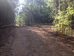
Anyway, the trailhead was back down the road a little, so we rode back to it and hit the loops. The system is basically a set of stacked-loops, creatively named Loop EZ, Loop A, Loop B, Loop C, and Loop D. I remembered that they get progressively more technical and steep as you go, but I didn't remember much in the way of detail.

Dad at Tyler

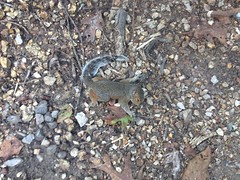
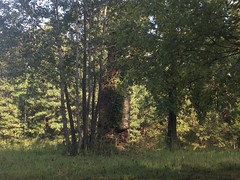
I must have ridden it at a different time of year last time too because this time, there was Beautyberry everywhere.

Beautyberry

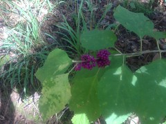
I mean, everywhere. There was like 1000 times more than I'd ever seen in my entire life combined. If it had been there the last time, I'd have remembered.

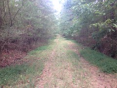
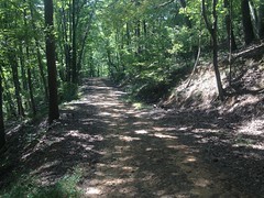
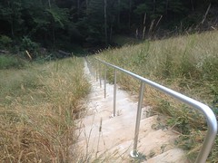
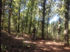
The singletrack was about like this, pretty much everywhere:

Singletrack on A Loop

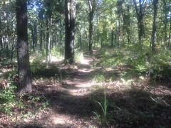
Ribbon-through-the-pines.

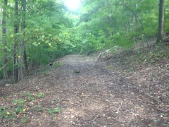
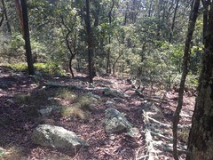
The soil was kind-of sandy and looked like historically, it had been prone to erosion in a few spots. There were former routes here and there, but the current route looked pretty solid. In a lot of places the trail was pine-needly too, and it was really solid in those sections.

It was almost impossible to get lost.

Trail Markers

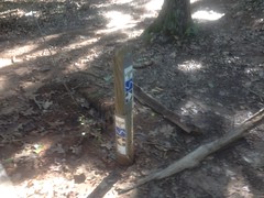
Almost. The intersection between B and C was missing its signage. The posts were there, but the actual markers were missing.

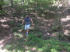
Loops EZ, A, and B were really nice. Loop C was super technical. Like dozens of switchbacks composed entirely of big gnarly pine roots. It reminded me of Clear Springs, except that there were rock gardens all over the place too. If I lived there, I'd probably do multiple laps of EZ, A, and B, and just throw in C and D occasionally.

By the time we got to loop D, we were tired enough of how slow and technical C was that we didn't even ride it. That suited me fine though, as I really needed to get on the road.

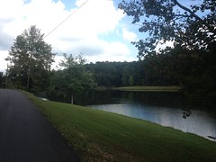
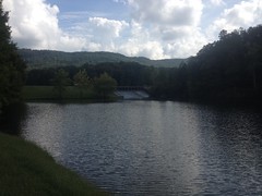
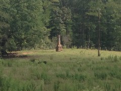
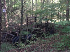
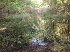
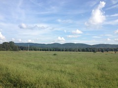
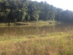
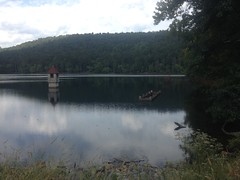
We did take a quick drive through the park on the way out to see if anything else was interesting. There's a lake in the middle of the park, fed by Beauchamps Springs near the gate, but that was about it. There's a road called CCC Overlook (the park was built by the CCC) which I assumed would provide a nice view of the lake, but any overlooking that you might once have been able to do has long been obscured by the recovering forest. It struck me as odd that it's even still called an overlook.

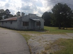
On the way to the highway, I drove past Bodacious BBQ.

Bodacious BBQ Bodacious BBQ Sign

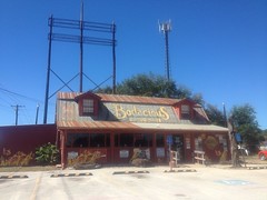
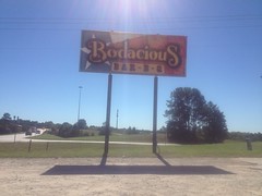
It looked so authentic that as I was turning left onto the interstate I changed my mind, made a full U-turn, and drove back to the restaurant.

They don't serve fries ("This isn't McDonalds") but they do serve you a 2 pound pile of meat and offer multiple sauces, the bottles of which are stored in warm water, so that cold sauce doesn't suck any of the warmth or flavor out of your 2 pounds of meat. Man it was good. So good that I'm looking forward to next time, even though I can't imagine offhand when that will be.

Taylor Ridge

A little less than a month ago I rode all around and over the southern end of Taylor Ridge.

I first rode the Pinhoti up on top, way back when I was scouting the TNGA. Unlike most of the rest of the route though, I didn't come back and explore every little side road and side trail. The Pinhoti up there is great, and I just went with it. There's a state park on the west side though, and old topo maps show a dozen little offshoots heading down from the ridge into the valley to the east. USFS GIS data reveals a couple of FS roads too.

It always seemed like it might be a fun place to explore, and I was happy that I'd finally gotten around to doing it.

I parked in the High Point Lot and headed north on whatever road that is.

Right away, I passed some odd little building. I took it for an abandoned old store at first, but after giving it a second look, I wasn't sure that it was a store, or even abandoned.

Evans Place

Maybe it was a club of some kind, once. Maybe it still is. No idea. The internet doesn't know either.

Up the road a ways I hung a right on Lick Skillet Road, and then onto Sloppy Floyd Lake road. There I discovered The Reynolds Barn, which looked like a rural-themed event venue kind-of place.

Reynolds Barn 1 Reynolds Barn 2 Reynolds Barn 3 Reynolds Barn 4

The internet later confirmed this. Looks like they have weddings and family reunions, and such there.

Slightly further up the road was Sloppy Floyd State Park proper.

Sloppy Floyd Park Sign

I rode around the various access roads and campground roads, just generally checking the place out.

I ran into this poor little guy while doing that.

Poor Little Guy

He wasn't quite dead. Every few seconds he'd lurch a bit. It made me really sad for a while, thinking about him.

There are a bunch of hiking trails in the park, including one that allegedly leads to an old marble mine. A pair of them lead up to and back down from the Pinhoti. I'd seen them before. It seemed like the kind of place me and Billy should go explore.

There are a pair of lakes in the park too. Both look popular for fishing. The upper lake is fed by Marble Springs, directly below it, according to old maps.

Sloppy Floyd - Upper Lake

The road between the lakes runs across the dam that creates the upper lake. The lower lake is hemmed in by its own dam.

Sloppy Floyd - Lower Lake and Upper Dam

There's another lake (Wildlife Lake) below both of them, but I didn't see it that day. I'm not sure its even open to the public.

There's a park office/store at the north end of the dam, but I still had a long day ahead of me, so I didn't go in to check it out.

Sloppy Floyd - Office and Store

Just up the road from the park, I noticed an old chimney on the Hi-Lo Farms property.

Chimney at Hi-Lo Farms

It's way back up off of the road. That's maximum zoom there, but you can see it from the road pretty easily.

Just up the road from that, FS209 led up the mountain to the east. It was marked FS206 in the field, but FS206 proper is closer to Mack White Gap. I thought maybe they'd connect up, but they didn't.

Still, it was a scenic ride. I wish my phone didn't wash the colors out so badly.

FS209 1 FS209 2

Back up the main road a bit, I followed Wayside Church Road until it hit private property, and discovered some old abandoned rigs right on the side of the road there.

Old Rig Old Mad Max-Looking Rig

That second one looks like it might have been used in The Road Warrior.

On the way back, I noticed an old, overgrown well that I didn't see on the way in.

Old Well

I guess that's what it is.

From there, I headed in the general direction of Mack White Gap. Taylor Ridge loomed above me, but the climb up to it wasn't bad at all.

Taylor Ridge

At Mack White Gap, I turned on to FS205 and rode it for as far as it went.

My map showed a dozen old roads leading down to the east, but most of them were completely overgrown. One or two looked passable, but only one or two. I marked them though, and maybe one day I'll come back and check them out on foot. I did find one trail leading east to the Pinhoti. There was a campsite at this end of it, and a really gross pond between the campsite and the road.

Gross Pond

It looks like the construction of the road piled up enough dirt to hem the water in.

It was gross.

205 teed into 201, and I took it down to Silver Hill Road.

There are a bunch of farms down there, and you can see the surrounding ridges pretty well across their fields, from the road.

Ridge Adjacent to Taylor Ridge

To get back to the truck, I had to climb over that ridge, through Tightsqueeze Gap. There's an old, unmarked dirt road at the bottom of the climb that I hoped would lead back up to FS201, but alas, it was gated a half-mile or so back.

Bent-Up Gate

The sign said "No Hunting" but didn't just say "Keep Out" or anything else. I half-considered checking it out, but then also half-considered that I might get shot for doing so, and figured I'd do a little research first.

Silver Hill Road led to Silver Springs Road. There was an old chimney, and a lake on that road.

Chimney on Silver Springs Road Lake on Silver Springs Road

And at its intersection with the main road, I passed the South Carolina Campground Cemetery.

South Carolina Campground Cemetery

It's funny. You start the TNGA at the South Carolina line, and you almost couldn't be further from South Carolina when you pass that cemetery. People have joked about that in the past. I found a pdf detailing the history of the church online. Apparently many of the church's charter members were originally from South Carolina. Thus the name. The church itself burned down some time in the second half of the last century, but the cemetery remains.

And that was it for that Adventure, if you can call it that. Nothing especially crazy happened. It was kind-of heavy on pavement too, but also pretty heavy on points of interest, so I guess that's a good trade.

Berry College

Goodness, what a month. Me and Billy went for a pretty good hike about a month ago, but I haven't had time to even think about it, much less write.

I only vaguely remember the hike. I remember having a good time, but I'm going to have to let the photos jog my memory...

We parked in some odd place and took a nondescript firebreak up the mountain. There was a multi-way intersection at the road, and we explored the various ways that you could go. One just led to a little knob. One was another firebreak, leading up to a powerline cut, and ultimately to the House O' Dreams at the top of the mountain.

From there we bumped along the little singletrack along the ridge for a while, before hanging an abrupt left, off trail...

Off Trail on Lavender Mountain Billy

...to get back down to the road.

The road:

Mountain Goat

That road is called Mounatin Goat, and we somehow got from there down to a road at the bottom of the mountain. I don't remember exactly how. I'm sure it involved exploring some other trail though.

Along that road, we passed the American Chestnut Restoration Project that they're doing up there.

Chestnut Restoration Project Sign

There were like 3 or 4 chestnut trees behind the fence, and they were the largest I'd ever seen.

Gigantic American Chestnut

It was stunning to see them. They didn't even look real. The ones I've seen in the NF are almost unanimously under 10 feet tall, with trunks less than an inch in diameter. Saplings. I saw one, once, on the Arkaqua that was maybe 15 feet tall, and I was amazed to see it. I'd never seen the actual fruit growing on one, ever, and I'd never seen one growing out in the open enough for its leaves to get very dark.

It was like I was seeing a different tree, but really, I was just seeing what they're supposed to look like.

Amazing!

We took some other set of trails, or maybe we just stayed on the road. I don't remember now. But, we ended up at the reservoir.

Berry College Reservoir

It was a little low that day. There wasn't any water flowing into the overflow.

From there, we took the stairs down the front of the dam...

Berry College Dam Stairs

So weird. Stairs.

There was a cute little tree frog hanging out about halfway down.

Tree Frog

So, we said hi to him.

At the bottom, there was barely a trickle coming out of the tunnel. We joked that we could probably walk all the way up it and climb up through the overflow. With my luck though, if I tried that, there would be a sudden storm while we were in there and we'd get washed out.

The trail at the bottom led back to the road, which led past the mill...

Billy at the Mill

...and back to the car.

Somewhere in there we passed a group of students who were clearly headed to the lake for a swim, and clearly ignoring the various signs that forbid such activity. The last time we were up there we some some kids swimming too. I guess people just do that. Signs or no signs.

I don't remember much else. We presumably ate somewhere, but I don't remember where.

On paper it doesn't sound like such a great time, but it was. I guess that's how it goes when it takes so long to get around to writing.