Tuesday, July 11, 2023

Rocky Flats

After ripping Chicopee the day before, I was a little tired this past Sunday. I still wanted to ride, but I felt like exploring something new, rather than hammering or grinding. My initial plan was to ride at Cohutta Springs, which is way up near Sumac Creek, almost in Tennessee. I hit the road a little late, but hey, it's summer time, and the sun doesn't set until about 9, so it really didn't matter.

75 to 411, and 411 up through White, Rydal, Ranger, Chattsworth, Eton, and a bunch of other little towns. I had forgotten just how many of them there are. Back in the early 2000's, we used to drive up that way a lot, to get to Fort Mountain, Sumac Creek, Iron Mountain, and even Windy Gap. But, that was pre-Pinhoti, and pre Mulberry Gap. I wonder how much traffic those trails get these days...

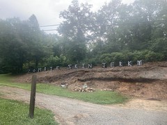
But I digress. As I approached the Cohutta Springs property, I noticed signs saying things like "Private Road, Registered Guests Only" and such. Was this place private? That would be a drag. I hadn't read anything about that in any of the resources online. That would also be just my luck. I ended up calling them, and yeah, it's a private facility. It is possible to get a day pass to ride the trails, but not until fall, because there are kids at camp there all summer.

Well, crap. What else can I ride? I wracked my brain for a minute, remembered that there are various roads off of FS630 (Mill Creek Road), including Rocky Flats. The last time I rode that was with my Dad, in like 2001, and I didn't even own a GPS at the time. Yeah, I could explore Rocky Flats. That might be fun. I needed batteries though. The batteries in my GPS were questionable, and I'd need to mark waypoints. I couldn't just rely on the strava app today.

I'd seen a Dollar General on the way in. In fact, I'd seen one in every town along 411, all the way up. There must have been a dozen of them. But, again, I digress. I headed back to the DG, which was like less than a mile away, purchased some batteries, and headed over to Rocky Flats.

It took me a minute to figure out where to park. I couldn't tell if I was at the bottom end of it, or the top end, and I didn't recognize it from 20+ years ago. After driving around for far too long, I figured out where I was, parked, got dressed, and got going.

Rocky Flats Entrance

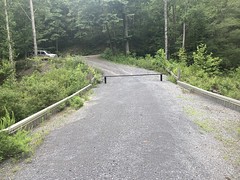
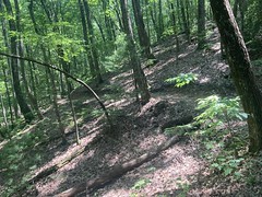
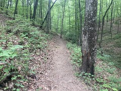
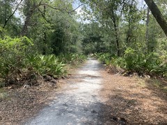
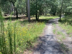
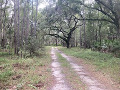
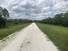
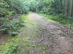
Rocky Flats is, in theory, an OHV trail, but it's super well maintained, and almost entirely on par with an average FS road, if slightly less well-used.

Rocky Flats

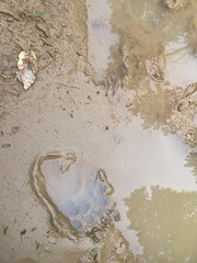
Way out near the end, there are some ruts and puddles, though.

Some Puddles

So, it's like the Dallas trail of forest roads - generally easy, but punctuated with challenges.

Or, at least that's how it would be in a Jeep or something. I was on the bike and it was nothing.

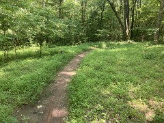
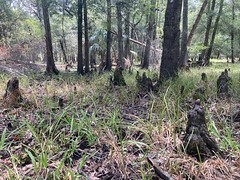
There were a bunch of side trails that, oddly enough, I still remembered seeing years ago. One went to a food plot, and I didn't find anything continuing on from there.

One had the character of a firebreak, but it didn't go super far up the mountain, and it looped back on itself, weirdly. Maybe just a strip cut? I don't know, it was odd.

There were cool claw marks on a piece of deadfall on that one.

Claw Marks

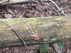
I also got stung twice, on the butt, by a yellow jaket, while exploring that. Man, it hurt. I joked with a friend later that I needed to hire a personal injury lawyer to sue the yellow jackets for pain and suffering.

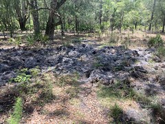
There was another trail that also had the character of a firebreak. It was pretty well choked with deadfall though. On foot, it wasn't a big deal at all, but it wouldn't have been possible to ride it, for very far, at least, in either direction.

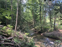
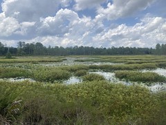
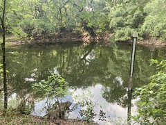
There was one scenic feeder creek, but it was hard to get a good photo of it.

Feeder Creek Along Rocky Flats

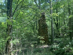
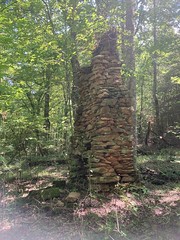
Other side trails included active and abandoned camp sites, a steep climb, and a tricky climb that then paralleled the road and came back down.

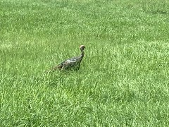
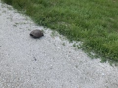
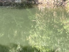
Out at the end, there were both turkey and bear prints in the sand and puddles.

Turkey Prints Bear Prints

It's their woods, really. We're just visiting.

If I remember correctly, Alex Nutt's book said, ot at the end there, to hang a hard right, up over Kelley Humps, and follow the trail back toward FS630. Before it hits the road, it drops down steeply to the creek, crosses it, then ascends steeply up to the road. Something like that.

Oddly enough, the directions for where to park were also something like the reverse of that: hang a right, cross the creek, ascend the other side, and park. I want to say that the mileage was off too, or I misunderstood it. At any rate, when we first drove out there, I mistook the lower end of the trail for the upper end, and drove my Durango, with bikes on the roof, down and across the creek, and began trying to climb the steep-ass jeep trail on the other side. I quickly realized that I did not have the skills to do that, bailed on the attempt, backed down into the creek, and wasn't sure what to do next. Fortunately some guys that knew what they were doing just happened to be driving by, saw us, came down, and talked me through how to get out of the creek and back up to the road. In later years, I developed much better 4wd skills. The descent down to the creek, and back up to the road would have been nothing to future Dave. The steep climb up the other side, however, I never got good enough that I'd have felt confident attempting, and it was fortunate that I'd had the presence of mind to bail on it when I had.

At any rate, way back, when my Dad and I first rode there, the road didn't exactly end where it does now. There were humps, but you could definitely drive a Jeep farther down it, so we kept going, thinking we were still on the right path. Not having a GPS, or even bike computer, we didn't realize where we were, or that we were supposed to have taken that hard right. Eventually, we hit a second set of humps, with a super old, faded, almost unreadable Private Property sign lying on the ground on the other side that looked like it had been there for 50 years. At the time, it struck us as abandoned, and not being necessary to pay attention to. That was actually, kind-of true too. We popped out into some old, abandoned-looking property - there were some old homestead-type buildings to the left, a grassy patch between some overgrown corn fields, and eventually an abandoned-looking, but modern house. We could see the Ellijay-Crandall road ahead of us, and there were some drunk guys on 4-wheelers parked up by the road, who had, it seemed, been riding back in there just like we had. Since those days, the entire farm has been renovated, and the property probably wouldn't be as safe to cross as it was.

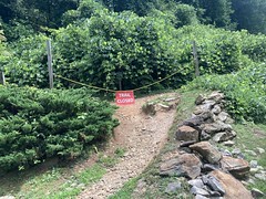
But, again... I digress. The other day, I made it out to the end of the road, and where my Dad and I had continued the last time was now, thoroughly overgrown, and looked impassible. Maybe in winter, on foot, but definitely not by me, that day. I checked the hard right, and it too was impassibly overgrown. There was a side trail, just a little ways back, that looked like it might have bypassed the humps, so I checked it out, but also became overgrown pretty quickly. Again, maybe on foot, in winter, it would be different, but I couldn't have ridden it that day.

Eventually, I turned around and just backtracked out. When I got back near my truck, there was a couple with 2 little kids milling around by the creek. I talked to them for a while. They'd been caving the day before, and needed to wash their clothes. Rather than wreck their washing machine, or clog their bathtub, they'd taken them to the creek to hand wash. They'd throw them in the washing machine when they got home, but this was the first pass.

On the drive out, I couldn't find any trace of the road that I'd taken down to the creek 20 years ago. I'm sure some remnant of it still exists, but I couldn't remember where to look. Maybe if I go back up and look carefully, I'll be able to find it.

So, I more or less salvaged the trip up there, and had a good time exploring the mountains, which I haven't done much of in a really long time. It felt good. Maybe I'll do some more of that in the coming weeks.

Chicopee Woods

I guess Marc had a good time shredding Dauset the other week, because he texed me last week seeing if I wanted to ride at Chicopee. Hell yeah, I did. Not unlike Dauset, I couldn't remember the last time I was up there.

We met up with Chris Hovatter again, along with Aaron, and his girlfriend Kathryn (Katherine?). Apparently Aaron's last name is Chamberlain. I somehow didn't know this. Sorry Aaron.

When Aaron and Kathryn arrived, they had a gravel bike in the trunk. They'd apparently just bought it off of some guy in the parking lot, prior to coming over and parking next to us. I don't know gravel bikes, but it was some kind of Specialized, and looked attractive to me. I've been wanting to get a gravel bike for a while now, for no other reason than to take it out to Mississippi and do some of Jason Shearer's events. Maybe I should score one off of some guy in the Chicopee parking lot too.

Once we got moving, I didn't get any photos beacuse we were pretty much hammering the whole time, and there is no trail out there that's easy to take a photo on, while you're hammering.

Some random thoughts... I remembered the trails much better than I had remembered Dauset. Copperhead Gap was much rootier than I remembered though. We ran into lots of other riders, incuding Chad Hungerford, who was out there ripping everything on a singlespeed. The Granny Climb out was less difficult than I remembered, which I guess is progress. Same with the Red Trail. The tail end of the system was also a lot different. You cross over the dam now, rather than going down into the wetlands and crossing the creek. That may have been how it was last time though, I just don't remember. Aaron and Kathryn took off after about 15 miles but Hovatter hung with us the whole time, which was really cool. It wasn't as hot as it had been the previous weekend, but it was still pretty darn hot. I remember squeezing my gloves out over and over, and my hands were prunes when I finally took them off.

Other than that, it was just crushing pedals, non stop, for hours and hours. Fighter jets, just like last weekend. Woo!

We didn't eat together this time. Everybody had things to get home to. I honestly don't remember what I ate, so it couldn't have been too important!

Lake Acworth

During the days leading up to the 4th of July, my brother, his girl, and I coordinated to get together for some stand-up-paddling. The original plan was to meet up with a bunch of folks on the Chattahoochee, for a little party that typically goes down every year. They usually meet in Roswell, paddle up to this particular rock, hang out for a few hours, grill, and then float back down. I did it with them last year, and it was a blast. This year, though, there had been a bad e-coli warning on the river, and not just the typical it-rained-recently kind of warning. This was an actual sewage leak or something. To deal with it, they released a bunch of water from the dam, so the river was super high, and the current was super strong. The sand bar that we stopped at halfway up was likely to be under water, and the party rock might not even be exposed.

None of this sounded good to any of us, so we decided to paddle around Lake Acworth by ourselves, instead.

I don't remember the exact chain of events, but we ended up leaving late in the day, and driving up to the lake, only to find that the roads were closed to the main parks, somehow related to fireworks. We scrambled to figure out where else we could go, and eventually decided to try our luck on Lake Allatoona, somewhere off of Hwy 20. As luck would have it though, there was an area open, on Lake Acworth, just north of where we wanted to put in. They had one open spot though, so my brother could drive in, but I couldn't. Ha! Just my luck. No matter though, I'd seen a side road a few blocks back, where it looked like people parked sometimes anyway. I just spun back, parked there, threw my cooler over my shoulder, and walked over.

The timing was almost perfect. I ran to the bathroom to get changed, and just as I got back, the boards were fully inflated.

Woo!

It was a little tricky to get into the water. The boat ramp and the dock were jammed with folks launching jet skis and small boats. We ended up putting in directly off of some nearby rocks, but it worked out fine.

Having only ever paddled once, on a river, with no motorized boats on it, the lake seemed like a challenge. The water was generally rougher, and there was a wake coming from some direction, most of the time. It turned out that it wasn't a big deal though. The board was really stable, even in the rough water.

Lake Acworth is really just a spur off of Lake Allatoona, and there's a channel where boats go in and out between the two lakes. We made our way counter-clockwise along the shore, crossed that channel, and paddled over into some really calm water near a couple of campgrounds and cabins. It was a no-wake zone, and even though boats came and went, the water was calm for most of the time that we were back in there.

We found a spot, pulled the boards together, hung out talking and listening to music, drifted around, found another spot, and repeated until we eventually got tired of it.

Kseniya and John Kseniya and John Again Lake Acworth Kseniya and John Yet Again

At a point, we continued further around the lake. We could see a beach on the other side, which looked like the park that we had originally wanted to put in at. There were buoys marking the channel, and John and I wanted to paddle around to a narrow spot, shoot across, and paddle over to the beach. This did not seem like a good idea to Kseniya, and she vetoed the plan. This, honestly might have been the right call, I'm not sure. It didn't seem any more dangerous crossing the lake than crossing that channel we'd crossed earlier, but I really didn't have enough experience to be sure.

Instead, we more-or-less went back the way we came, though we did cross a pretty big chunk of open water, rather than following the shore like we had on the way out. John was looking back at one point, though, didn't notice a wake coming at him, and got knocked off the board. He held on to his paddle though, and, miraculously, grabbed his drink as he was falling, kept it from tipping over, and then managed to get back on the board with no problem.

Good save!

We did more of that paddle around, find a chill spot, and relax thing on the way back. Eventually the sky started getting a little dark though, like weather was thinking about moving in, and that put an end to pretty much everyone's day that was out on the lake, ours included.

Done!

Woohoo! Oh Yeah!

I can't say that I have a passion for SUP, but it is a lot of fun, I guess in the same way that destination hiking is. John always says that it's not exactly a performance sport, but it does require a level of fitness and skill to be fun, and if you have that, then it's fun. That about sums it up. It's also just great to be out on the water. I don't do that much, and it's a whole novel experience. I definitely understand the appeal.

On the way back, we stopped Willys on Barrett Parkway, feasted on burritos and such...

Willy's Feast

...and then got caught in the rain that had chased us off of the lake. Fortuantely the awning was deep enough to keep us dry, and the rain was light and short.

That night I watched fireworks in every direction, just from my house. It's cool that decent mortars are cheap enough for the average family to fire off these days. Of course, where I live, the most popular thing is semi-automatic gunfire. So, in my neighborhood, you get to enjoy both.

Dauset

I texted my brother and Mark Hirsch, and Mark Baldwin a while back. It had been forever since I'd ridden with any of those guys. Did they want to do something the next weekend? Turned out Mark was going to be out of town. John had something going on too. Hirsch was free. I tried to get Austin to join us, and he initially wanted to, but then realized that he miscalculated his girl's day off or something, and couldn't make it. Long story short, me, Hirsch, and Chris Hovatter rode at Dauset the following Sunday.

We had wanted to ride Bull, but it had rained the day before, and even that morning, so it was a last-minute change of plans, but it worked out really well. In fact, since Marc's place was only slightly off route between my place and Dauset, I picked him up, and he didn't have to drive, which he was pretty happy about.

Apparently there was "new" trail at Dauset. Of course, new is relative. I think the last time I rode there was with my Dad. We did a 12-hour race there, more than 10 years ago. So, this new trail was only new to me. It's actually been there a while.

Marc loves Dauset, and really knows his way around. I used to know my way around, but it's been a really long time, and I only vaguely remembered any of it.

We basically rode pretty directly to the newest of the trails - The Creeks, as it's called. Three loops north of the classic system, with a trailhead that's pretty close to downtown Jackson.

Chris led on most of the downhills, and either me or Marc on the climbs. The new trails up there are a lot like the old trails - fast, flowing, and a bit rooty. They add a lot more mileage though.

One thing my brother and I used to love about ripping in-town singletrack is that it's usually fairly twisty, and if you're following someone through fast, twisty trail, it feels like fighter jets dogfighting. Or, at least it has the same feel as POV from the cockpit in a movie that features dogfighting. Neither of us has ever been in an aerial dogfight! We used to call it "fighter jets" though. It had been a long time since I'd had that feeling, but I totally got it, all day long, following either of those guys on those trails.

We passed a few riders coming the other way as we approached The Creeks trailhead, then passed a walking out, only a few hundred yards from the lot.

Hirsch and Hovatter

We stayed there for a bit, and talked to that guy, and some other folks in the lot, while we caught our breath. It was hot though, really hot, and it honestly felt a lot better to keep moving than to stand around, even in the shade, so we didn't stand around for too long.

When we got back to the classic system, Chris split off and rode on his own. Me and Marc wanted to ride over to Indian Springs, but he'd had enough fun for one day already.

The trial to Indian Springs is more "new" trail, in that it wasn't open to bikes when I last rode there, but it's been around for a long time. It definitely wasn't purpose-built singletrack though, like The Creeks trails were. It actually reminded me of some of the trails in Louisiana and Mississippi. You're crusing along on fairly flat trail, then it dives down, crosses a little creek, and climbs steeply back up off of it. It takes a certain amount of strength to be able to keep speed, and if you have it, then the dips become rollers, you can ride the whole trail at tempo, and it's fun. But, if you don't, then you have to sit back and grind out every climb before you can get moving again, which can be a drag. Fortunately, we had it, but it was a lot of effort.

Way out at the end, it tees into a road, and Indian Springs park is to the north a bit. There's a river there too, and tons of kids were playing in the water, despite a large NO SWIMMING sign over by where they were playing.

I didn't need water, per-se, but I'd gone through a little more than 1 bottle, and it would be nice to have some. I could see shops and stuff to the south, so we rode down the sidewalk for a block or two. The first shop looked like a marked, but turned out to be an antiques store. The second was some kind of food place, but between us and it, we noticed the Whimsical Garden, with its water feature.

Whimsical Garden

The water smelled good, and tasted good, so I figured it wasn't chocked full of pesticides. I did drop a couple of iodine tablets into it though, just in case.

The ride back to Dauset was just backwards on the same trail, which required the same level of effort as riding out, and I was flagging a bit when we got there. We ended up spinning a couple of loops around the rest of the park, and eventually ended up at a pavilion with a spigot. Rather than drinking the questionable Whimsical Garden water, I got it straight out of the ground at the pavilion, and I felt a little better about really guzzling it. After that, we rode some other collection of loops, for a total of just under 30 miles for the day.

It had been a while since I'd been on the gas for 30 miles on tight singletrack, but it was really satisfying to do.

We grabbed lunch at Wendy's on the way out, as ones options are limited at that particular exit. It's basically the truck stop or the attached Wendy's. Maybe there's something else, but that's all I ever remember being there.

I dropped Hirsch off at his place, crawled back to mine, and after a shower, I'll admit, crashed out for a nap on my couch for a few hours. Between the heat and the effort, I was wiped out.

It was a great day though! Definitely need to do that kind of thing more often.

Fightingtown Creek

A few weekends ago, I tried to ride at Fightingtown Creek, only to be pushed back by the weather. The next weekend, I was determined to actually ride there. The urge to hit a bunch of different trails in one day had pretty much passed by that point. I just wanted to hit this one.

I had a sense of where it was, but I didn't know for sure. Back when I was exploring the Cashes Valley area, I saw Fightingtown Creek on the map, so I knew it was in that general area. It's funny... In that general area, there are: Fightingtown Creek, Devil's Den, Hell's Hollow, and Dyer Gap. Such intimidating names! I used to know a guy who married a lady with the last name of Payne, who was from halfway between Devil's Den and Hell's Hollow. His family used to joke with him about that.

Siri knew where it was though, and got me there in good time.

It's really out in the middle of nowhere, as all good trails are, way back up a nondescript road, with a bunch of random houses on it. It kind-of looks like a neighborhood. Not exactly somewhere you'd expect a trail system to be. Yet there it is.

Fightingtown Creek Nature Park Sign

The system consisted of 4 trails: Upper and Lower Prince Loops, Laurel Loop, and the Creek Loop.

Fightingtown Creek Map

The Prince Loops are named such because the whole system lies on Prince Mountain. The Creek Loop runs along Fightingtown Creek proper. I'm not sure where the Laurel Loop gets its name from.

There were a number of cars in the lot when I got there, both hikers and mountain bikers. it seemed like a popular place. I got dressed, hit the trail, and had a blast, right away.

The whole system is fast, twisty, bench cut. More of that Sorba trail I've recently described, but modern sorba trail, with more aggressive grades, switchbacks, and rocks. You can fly, but at those speeds, it's pretty technical.

More Typical Fightingtown Creek Trail Typical Fightingtown Creek Trial

I ran into a hiker coming the other direction about halfway around Lower Prince, and we chatted for a second. I wanted to ride everything out there, and since Lower and Upper Prince were stacked, I ended up riding Lower Prince again, and passing the same hiker the second time. At Upper Prince, I realized that I hadn't started Strava, and so I ended up riding yet a third lap around Lower Prince to get the GPS data, after riding upper, once again, passing the same hiker.

After the Princes, I rode the Laurel Loop, which was basically just more of the same, if not slightly more aggressive.

The whole system had that just-built feel to it. It was pretty well worn in, but the backslope was still very notched in, and the outside edge hadn't rounded off yet. It looked like P3 when it was first cut. I'm sure in a few years it'll look like P3 does now.

About halfway around Laurel, I passed an elderly gentleman on an eBike, and then a little while later encountered a guy coming the other way. The trails are directional, so we spent a few minutes figuring out which of us was going the wrong way. I was relieved to find out that it wasn't me, but it just as easily could have been.

There were a couple of humps on Laurel that I was tempted to boost, but was then glad that I was conservative with it because in almost every case, the trail turned abrubptly afterwards, and it could have been ugly if I was still in the air.

The Creek Loop seemed more difficult than the other three. At first I thought maybe I was just getting tired, but after riding it a bit, no I think it was actually more difficult. Rockier and twistier, I think. It looked like some of it might have been road-trail-conversion and other bits just followed an old trail that was good enough. There were a bunch of switchbacks that appeared to have taken the place of an older, fall line trail. Some of it was just in the flats and kind-of soft as a result.

Creekside Trail

Down at the bottom end of the trail, there was an old chimney.

Creekside Homestead Ruins Chimney on Creekside Trail

There were also ruins of this strange creek camp.

Creek Camp Ruins Footings Another Weird Table Weird Table

No idea. I'm curious about the history of the area now, though.

Eventually the trail dropped down and ran along the creek itself for a few hundred yards through a magnolia tunne. The magnolia was blooming at the time, and it was really pretty. There was also this section where trees had fallen, where you could get a good view of the creek.

Fightingtown Creek Proper

The climb back up to the parking lot involved those switchbacks that I mentioned earlier, and it was a bit of work.

When I got there though, I noticed that the lady that I'd seen hiking earlier, and the guy on the eBike were hanging out in some chairs, talking to each other. It turned out that they were a couple, and both in their late 70's. He likes to ride and she likes to hike, so they go do that together. It made me really happy talking to them, and we talked for a while.

As I was changing back into my regular clothes, I noticed some hemlock buds nearby.

Hemlock Buds

I didn't realize they'd still be budding this late into the summer, but it was nice to see. They're pretty tasty, like something between orange juice and Pine Sol. I guess not so much delicious as novel, but still, a treat.

On the way in, I'd passed a church, and on the way out, I noticed its strange, hanging tables.

Macedonia Church of Christ Odd Tables at Macedonia Church

Pretty much every church in North Georgia has an open-air pavilion with tables under it. They're usually concrete though. Occasionally you'll see a wooden table. I'd never seen one that hangs from the roof of the pavilion though. Very interesting.

I don't remember now, but I had some reason to get back home, so I didn't dally about. I think I ate at Shane's in Ellijay, but I really don't remember that either.

So, Fightingtown is a well designed and well built trail system. It's definitely more of an enjoy-the-trail type system, than an enjoy-the-woods type system, but there actually is a good bit of enjoy-the-woods and enjoy-the-weird-stuff-in-the-woods on the Creek Trail, so some of both, really. It'd be great if there was some way to get to it from the Bushy Head Gap area, which is just over Prince Mountain to the west. There are a bunch of nice gravel roads over that way, and it would be cool to be able to combine them all into a longer ride.

Maybe some day.

Monday, July 10, 2023

Woodring Branch

I woke up Sunday with the previous day's Allatoona-Blankets-Rope Mill fiasco still fresh in my head, and I was still a little sad about it. Ok, lets try something completely different.

There are a bunch of trails, scattered around, that wouldn't be good destinations on their own. Like, I wouldn't generally want to drive all the way out there just to ride that one 3 mile trail. I mean, I have done that, but I don't do it regularly, at least not on purpose. What I will do though, is make a loop out of a few of them. If they're near each other, then I'll park at one, ride it, ride to the next, ride it, etc. and eventually loop back to the car. I did this in Cumming once. In Texas, I've ridden one, driven to the next, ridden that one, and so on, but I'm not sure I've ever done it in Georgia.

At any rate, that was my plan. There are 3 trail systems up in North Georgia that I'd never ridden - Woodring Branch (AKA Amadahy), Fightingtown Creek, and Matt Community Park. They're all fairly short, and you can make a driving loop out of the three.

Let's go.

I first heard about Woodring Branch from either Alex Nutt or Jim Parham. One of their books (I can't remember which) mentioned that it was going to be constructed soon, and gave a prospective location of the trailhead, but as it hadn't yet been built, there was no track yet. Those books were written in the late 90's. I picked them up in 2000, and always meant to check out the trail. Fast forward 23 years, and I was finally getting around to it.

Woodring Branch Lot

So, Fisher Creek and Woodring Branch are two creeks form inlets on Carter's Lake. There are a couple of knobs on the point between the inlets. The Woodring Branch trailhead lies just off the main road at the head of the point, and the Amadahy trail circles the point.

Amadahy Trail Map

I'm not sure why the trail is called Amadahy. It's probably Cherokee for something, and I'm probably pretty ignorant for not knowing, but hey, that's how it is.

Amadahy Trail Sign

A couple of hikers left ahead of me, but I caught and passed them pretty quickly. From then on, most of the way around, I was on my own, and man was I lucky. The trail was just staggeringly fast.

Amadahy Trail

If there had been a lot of traffic, it would have been a shame, but all by myself, I could really enjoy it.

I did take a little side trail down to the lake, to get a good look at it.

Carter's Lake

You can see it through the woods as you're flying by, but to get a good look, you really have to drop down to the edge.

If memory serves, it was one of the first "Sorba Trails" in North Georgia. That is, one of the first trails built by the book. The book being the IMBA Guide to Building Sweet Singletrack. Outsloped, 3-foot wide sidehill, with rolling dips, grade reversals, and overall grades under 10%. The trail has been around for over 20 years, but it looks like it was built last year, and it rides like it too. These days, we know that trails like that last and last, but at the time, it was experimental.

The detractors would argue that it's not very technical, and therefore sucks. "Stop dumbing down the trail!" I used to argue that ripping fast XC trail is great, and if you really want technical trail, find rocky terrain and build a trail through it, rather than relying on erosion to constantly expose new rocks, which eventually ruts out the trail and makes it suck. In the early 2000s though, mountain biking hadn't been mainstream long enough for a lot of popular trails to eventually suck, and there weren't many (if any) well-built, technical trails in Georgia. All of that has changed though. Now there are both, and along with them, some amount of vindication for Sorba trail design. Actually, there's a third factor now, too. A modern XC bike has 120mm of travel front and rear, 29 inch wheels, 2.4 inch tires, 720mm bars and a dropper post. And that's just an XC bike, not to mention trail, downcountry, and enduro rigs. What's just rough and technical these days would have been unrideable on a 26 inch hardtail with 1.95 tires and an 80mm fork in the early 2000s. Improving technologoy has arguably dumbed down the bike.

Not that I care about any of that, but it all came to mind while I was riding.

In addition to the Amadahy Trail, there are a couple of unmaintained dirt roads in the area. One, it turns out, follows the ridgeline all the way down to the end of the point, where there's a campground...

Campsites

...complete with multiple outhouses.

Outhouse Double-Outhouse

There were a few folks actually camping, but it looked like most had just anchored their boat and were hanging out for the day. Music, food, and drinks. It looked like everybody was having a really good time, and that made the murderous climb out that I knew I had ahead of me less appealing than it otherwise might have been.

The rest of the roads led to various food plots. There were some overgrown spurs that I didn't bother to explore. Maybe one day, on foot.

I still had 2 more destinations ahead of me, so I got on the road quickly after getting back to the truck.

Not far up the road, I passed the Zombie Skin Jerky Store.

Zombie Skin Jerky Store Zombie Skin Jerky Sign

Ha! Only on North Georgia.

Fightingtown is between Ellijay and Blue Ridge, and as I was driving through Ellijay, I noticed the sky to the north looked as furious as I'd ever seen in my life. I quickly checked the weather radar, and good lord, the storm that was bearing down on me looked outright dangerous to get caught in. The blobs were completely red, covered the entire state, and were heading directly south. Just my luck.

I sped south, basically trying to outrun it, and more or less did so. I got caught in some rain for a few minutes, eventually managed to escape, got home, got all of my gear inside, and then got caught in it again just as I was taking the bike off of the rack. 10 minutes later my power went out and then came the wind and hail, which, as it turned out later, knocked all of the ripe blueberries off of my bushes. It was quite a storm.

So, two days in a row, my ride got cut short because of weather. While both rides were fun, they were unsatisfyingly short. Not the best weekend.

Blankets Creek

So that ride in Florida was fairly long, and while I could still kind-of feel some lingering effects from re-injuring my ribs, I seemed to have finally kicked whatver that upper respiratory infection that I'd caught in Dallas was. I felt like maybe a longer ride in Georgia was in order, with some actual climbing, but nothing too murderous. I eventually settled on Allatoona, and headed up there...

Only to find that it was race day.

Allatoona Race

They have like one race per year, and I happened to try to ride on the day of the race.

Lord.

The next closest place is Blankets Creek, which I'd ridden recently, but hey... If I combined it with Rope Mill, it would be a decently long ride.

So, I spun a lap around Dwelling and Van Michael. I even managed to stay ahead of some folks on eBikes on Van Michael until the very top, where I ran into my buddy Tom and talked with him for a while. I managed to catch them again later though, and only lost them a second time when I climbed 420 and they just kept going. It always feels good to be faster than a guy on an eBike.

After shredding Blankets, I headed over to Rope Mill, only to find all of the trails closed.

Avalanche Trail Closed

There had been pop-up showers all day, and though none hit Blankets, one had clearly hit Rope Mill. It was still pretty damp on the pavement, even.

Great! Just my luck. Just that kind of day, I guess.

Wilderness Park

In late June, I had an annual work thing down in Sarasota, and like last year, instead of flying down, I drove, and I brought my bike with me so I could ride somewhere on the way back to Atlanta. I hoped to ride somewhere in the immediate Sarasota area, but it looked like the local trail was actually a bit south and I didn't want to have an even longer drive home, so I started looking at what was on the way back. There was some trail that looked great, but various comments indicated that it was no good in the summer - always underwater. So, I kept looking, and eventually found the Wilderness Park Trails, AKA Flatwoods.

Looked like I had a plan.

It was a little tricky to find the trailhead. Mile 0 was kind of up on a levee, and there wasn't any parking nearby. The only thing in the area was this turkey.

Turkey

It turned out that the actual trailhead was in a big lot, out on the main road. It was really pretty obvious. Only I would have trouble finding it.

Pay Station at Morris Bridge Lot

I got changed, paid the parking fee, and studied the trail map for a bit.

Wilderness Park Trail Map

It looked like I ought to spin a loop around the Flatwoods Loop, picking up some of the farther-out side loops when I got to them, then try to decipher the various southern loops when I got back, if I still had energy to do it.

The Main Trail was pretty well traveled and fairly easy to follow. The woods was mainly pine and oak, with a million palmettos, and the occasional cactus.

Main Trail Wide Singletrack

There were trail markers at nearly every intersection.

More Signage

The character of the trail changed pretty regularly too. Eg. it popped out on a right of way for a while...

Right of Way

...then went back into some fairly open woods with wildflowers...

Wildflowers and a Bridge

...and there were wetlands replete with cypress knees...

Cypress Knees

...and a little pavement...

A Little Pavement

...which included a crossing of the Hillsborough River.

Hillsborough River

The first option I had was the Eubanks Parkway. Rather than take it immediately though, I followed the main trail up and around, then looped back on it. Oddly, there was also an Int 2 trail at the first intersection, which was not on the map.

Trail Signage

Interstate 2?

Eubanks looked like it got substantially less traffic than the Main Trail, but it was still pretty fun.

I eventually realized that Int 2 meant Interpretive Trail #2. There were all kinds of interpretive signs along it, and some benches. It looked like it got a lot of traffic. Way more than Eubanks. It seemed like it ought to be a loop, but instead, it circled around and eventually teed in to the Main Trail. To get back to the start, I had to get out on the road for a while. That would have been weird if I'd been on foot. I could kind-of see where the loop might have once continued, but it was pretty overgrown when I rode it.

IDK. Weird.

So, the main trail teed into a road, which I had taken left, then looped back on Eubanks and Int 2. I eventually ended up back at the road where those 2 trails split off, and there was a kiosk with a map and a you-are-here there. While studying the map, a roadie rode up and we talked for a bit. He knew which way to go, and was headed that way, so I followed him on the road until I saw the trail.

Along that section of the trail, and really, along the entire rest of the trail, there was a good bit of hog rooting.

Hog Rooting

I eventually started seeing pigs too. At first, just little black foot-long dudes, but eventually gigantic 200+ pounders. One was tan with big black cow spots all over it. That one took off running parallel to the trail and it seemed like every time it would turn, the trail would turn too, and I accidentally chased it for like a quarter mile before it finally crossed the trail and took off to my left.

At the far north end, there were more wetlands.

Flooded Area

The trail up there zigzagged back and forth across this doubletrack...

Doubletrack

...occasionally popping out and running down along it.

It was definitely more of an "enjoy the woods" kind of trail system than an "enjoy the trail" kind of trail system. While the trail was fun to ride, the woods itself was also just so beautiful. At least to me. The live oak, longleaf pine, spanish moss, cypress, and all those palmettos... you just don't see any of that in North Georgia. Well, maybe the occasional live oak, but they're usually pretty stunted. I'm sure if I rode there all the time it wouldn't seem like much, but seeing it so rarely, it made quite an impression.

The Panther Trail teed off to the north, so I took that loop. There were even more beautiful wetlands off of the Panther Trail.

Wetlands off Panther Trail

There was also a road up there that forded some other feeder of the Hillsborough, and some side trails. I think one was called Squiggy. I rode all of that before ending up on a Levee...

Levee

...and taking that back north to eventually loop back to the Panther Trail.

The Main Trail eventually led back around to that same levee, further south, and just ran along it for a while. At that point, I was pretty close to where I started. Mile 0 was up on that levee. There was an almost separate set of trails down there, the Bayshore Trails, and I milled around on them for a while. They basically looped around a couple of lakes, in different directions. One of the trails was super rooty and bumpy, and I somehow ended up riding it twice. Not on purpose.

Bayshore Trail Sign

At at point, I realized that I'd explored most of the official trail, other than the maze on the south side of the main road, so I rode back and forth, and around the bottom end of the levee for a bit, and got a shot of the dam.

Hillsborough River Dam

I also encountered three separate Gopher Tortoises!

Gopher Tortoise Gopher Tortoise Gopher Tortoise

Ok. Time to explore this maze of trails on the south side.

First up: Sinkhole.

I could totally see why it was named Sinkhole. It passed by not only one, but two sinkholes.

First Sinkhole Sinkhole 2

The second of which had a pretty big snapping turtle floating out in the middle of it.

Snapping Turtle

From Sinkhole, I tried to ride Grandpa, but ended up somewhere else, and had to figure out how to get back to where I meant to be. Somewhere in there I crossed paths with this beautiful yellow rat snake.

Yellow Rat Snake

I rode around the end of a tree that had partially blocked the trail, and it was stretched out on the other side. I had to speed-hop to keep from running over it. Fortunately it didn't flee, just contracted, and I was able to get a photo. The only yellow rat snakes I've ever seen have been in Florida. One on the CFiTT, way back, and this one. I don't think they exist in North Georgia, or if they do, they're super rare.

It wasn't long before I gave up trying to decipher the trails on the south side there. While the intersections were well marked, I couldn't always reconcile what I was seeing on the ground with the map. I was also running low on water and food, and honestly, the heat was getting to me. I also had a long drive back still ahead of me, and I didn't want to be crawling in at 2 in the morning, so I packed it in pretty quickly after seeing that snake.

Man! So much wildlife - turkeys, pigs, turtles, and a snake! It would have been a great ride just for all the wildlife.

I was a little sad that I didn't persevere and ride everything, but hey, If I'm back down there next year again, I'll see if I can pick up the rest of the system.