There's a lake kind of north of Dallas called Lake Grapevine. Or is it Grapevine Lake? I forget, but there's also a trail up there that everybody calls Grapevine, which is more correctly called Northshore. I've ridden it a few times, once in the early 2000's with my brother and my Dad, back when my brother lived there, and once more recently with my Dad. Since that last time though, two more trail systems have been built, or at least opened to bikes around the lake: Horseshoe and Knob Hills.
Saturday night, I'd come up with this half baked plan to ride all three of the trails. It looked like there was kind-of a greenway that you could take between them. Kind-of... After fiddling with the gps data for a while though, it looked like it would be like 70 miles of completely unfamliar roads and trails. I figured I should probably scout it first. Maybe do the full loop during my next visit, if it was worth it. Yeah, that seemed wise, and safe. There was a time, recently even, when I would have felt confident that I could do it, but my fitness took a big hit this winter from just being sick all the time. I'd felt good all week, but I wasn't sure if I felt good enough to commit to that. And, my Dad and I have this 100% rule where if you don't feel confident that you can do it safely, you don't do it.
So, Sunday morning I drove up to Horseshoe and scoped it out.
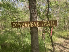
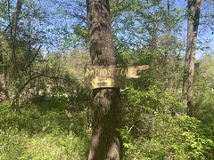
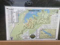
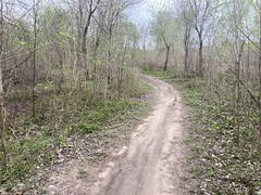
The trail is kind-of weird. It's just one loop, but the map declares it to be a dozen individual trails.
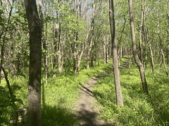
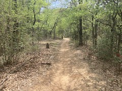
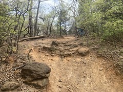
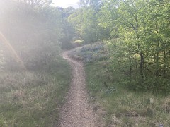
The first few miles were super, super twisty. Like, Cedar-Hill twisty. It was very technical and pretty hard to keep speed. It wasn't as bad as "1" at Squabble Creek, but it was definitely more difficult than fun. But, little by little, either it settled in or I settled into it and it got better and better.
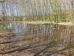
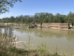
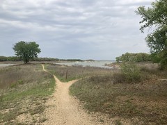
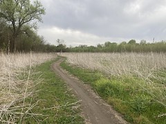
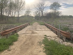
It mostly wound around the area where Jones Branch becomes Lake Grapevine, and there were some pretty amazing little overlooks of either the creek or the lake.
Like so many trails in Dallas, it was mostly easy, but here and there, punctuated by really difficult or technical bits, like this climb.
I cleaned it. [smiles douchily]
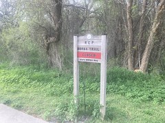
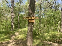
The signage was really good. Every time you hit a new section, there was a sign with a map, and a you-are-here.
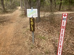
And, that was good because it wasn't impossible to get lost. There were plenty of trails cross-cutting the main trail, and periodically it either crossed a paved trail or ran along it for a second before dropping back into the woods. There was one spot that I don't even know how to describe. Braided all to hell, maybe. "Twisty little passages, all alike." It took me several tries to figure out where I was supposed to go. I couldn't just follow the most well-traveled route because I think everybody struggles equally through that section. Fortunately it was just that one section that was exceptionally difficult. The rest was mainly easy to figure out.
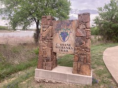
When I got done spinning that lap, I checked out the C. Shane Wilbanks Trail, which was that paved greenway thing that I'd seen on the map the night before.
I almost enjoyed it more than the Horseshoe trail.
A lot of it was just an old paved road...

...but there were purpose-built sections too...
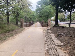
...that took you to the various neighborhoods and parks.
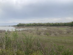
To the left and right there were various "park roads" or in some cases fairly rough trails that led to picnic areas on the lake.
A lot of the picnic areas were in disrepair, but it looked like people still used them for some, possibly nefarious, purpose. Ratty or not, they were undeniably scenic and I kept liking it when I'd pop out of the woods and see the grass and the lake spread out ahead of me.
One thing I didn't like though was thorns.
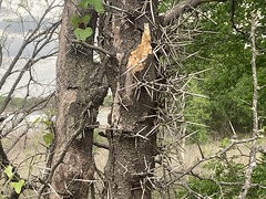
Holy crap, there were so many of these trees. I kept worrying I'd just brush into one accidentally, but they always seemed to be in obvious, easy to see places. Maybe somebody cut them all down along the trail or something.
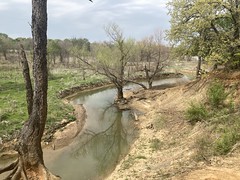
There were various little coves like this all along the trail too.
A lot of them had benches where you could just sit and enjoy them. I didn't make use of the benches, but I did stop and just take it in for a few minutes, more than once.
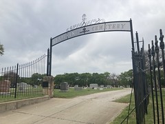
At the very far end of the paved trail there was Grapevine Cemetery.
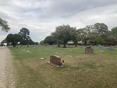
It had a gravel road leading through it, and I was there to explore, so I made a pass through.
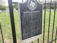
At the main gate...
...there was a historical marker.
I looked around near the gate for that oldest grave, but if it was near the gate, I didn't see it.
One interesting thing though... At one of the graves, a family had driven a couple of cars in, placed a bunch of flowers on the grave, and were having a bit of a party. They had a Dallas Cowboys flag flying and music going, and a picnic. There were kids running around and the adults were all laughing and carrying on. They were having the greatest time. It made me wonder if maybe it was somebody's birthday, perhaps the birthday of the deceased. It had that kind of vibe to it. At the time, it seemed like the sweetest thing in the world to me. A big family, and they all enjoyed each other's company so much.
It took a while to get back to the car, but at least I had the wind at my back for most of it.
I threw my bike on the rack, changed my shoes and headed around the lake to my next stop: Knob Hills.
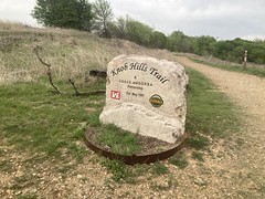
Knob Hills was the real deal. It was fast and fun from the gate. Twisty, but not overly so. Technical, but not a crawl. You could get moving and stay moving. I had the greatest time. I probably should have taken more photos, but I was too busy ripping.
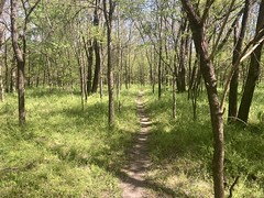
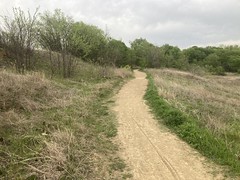
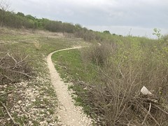
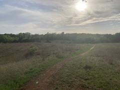
The trail passes through a bunch of different environments. Some of it is out in the open.
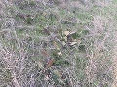
There's tall grass and cactus.
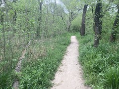
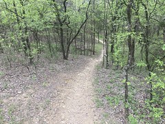
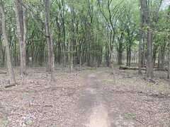
Then there's a lot in the woods too, but it's not all just cedar.
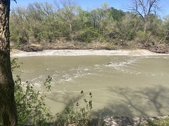
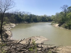
You run along Denton Creek for a while.

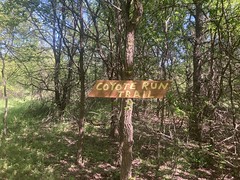
There's good signage.
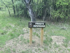
Fred's Revenge turned out to be a chunky downhill. There's a bypass though.
The trail is a bit punctuated, as is to be expected from a Dallas-area trail:
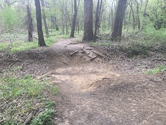
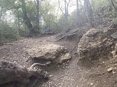
For example, the trail is all la-la-la, then you have to drop into that ravine above from the other side. On the left, it's like dropping in to a 4ft mini ramp. On the right it's super rooty. Choose the form of your destructor!
I dropped in. You can walk it, of course, but you have to know that it's there and you might not expect such a thing. You might just ride into it figuring it'll be fine. Beware.
More of those different enviroments:
There was this one section called "Serenity" that runs along the river for a while. To the left and right, nearly every tree had been chomped on by beavers.
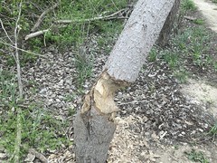
I don't know what the beavers were thinking. The river was like 100 yards across and it was like 12 feet down to it. They're not going to dam it up, no matter how they might try. I didn't immediately see any feeder creeks or wetland of any kind nearby either. There may have been something there that I just didn't notice, but I defintitely didn't notice.
It was funny too... The beavers had dragged logs across the trail here and there. Like maybe every 200 yards or so, for maybe a mile. So, on the trail named Serenity, where you'd think you'd have the easiest-going time, I had to hop log after log after log, at speed. It was fun, but far from serene.
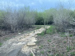
There was this one long section of rock armor that was pretty cool.
I eventually figured out that the system was 6 stacked loops. Each loop had at least one "special" section. Eg. this loop had a section named "Me So Thorny".
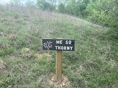
huh huh
It really should have been called Me So Chunky. I didn't see a lot of thorns, but there were lots of very chunky hills.
It seemed like, generally, the trail was more technical, or at least more challenging, the further out you got. It was windier out there, and there were more little drops or technical climbs.
There was one section called "The Gauntlet" that from a distance, just looked like you'd have to walk over these weird boulders.

But, then as you'd get into it, a path through them became clear. Tricky, but clear.
Out at the farthest end of the trail, there was a lot that was back out in the open again. It was pretty rocky out there too.
One bit had a million little yellow flowers along the trail.

They don't look like much in the photo, but they were striking in real life.
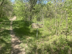
At the very end, the trail hits a dirt road, and there's a sign for the Cross Timbers Trail.

The Knob Hill trail circles back, but the Cross Timbers Trail actually continues on. I debated whether to keep going or not. There were tire tracks leading on, but the trail wasn't obviously marked. After looking around a bit, it looked like the Cross Timbers Trail was a horse trail. It paralleled Knob Hill to the north, and shared a little of the same trail here and there, but was mostly its own trail. I couldn't immediately tell if the trial that continued on was horse-only or not, but I figured I'd look it up online and maybe come back and check it out later. I didn't want to end up riding out, only to find out that I was on a trail I wasn't supposed to be on 2.4 miles later, and have to find some other way back.
It was kind-of more of the same on the way back. Lots of different environments:
My Dad called me for some reason, right as I approached The Goat Killer Climb.
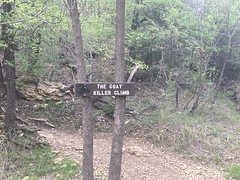
So, I got a chance to stop for a minute to take the call before attempting the climb.
I didn't clean it. However, since it's a GOAT killer climb, and it killed me, that must make me the GOAT. [smiles douchily again]
Back near the entrance there were bluebonnets.
I want to say the last little bit of the trail was semi-confusing. I think you could go left or right, and right turned out to be correct, but left never joined back up. Something like that. I went the correct direction, but only by chance.
And that was it. Horseshoe and Knob Hill. It turns out there are a myriad of other trails around the lake, but most appear to be hike-only or horse-only. Maybe. Info online is scarce. It does look like it would be viable to circumnavigate the lake, connecting all three trails, and they're worth connecting too, especially Northshore and Knob Hills. I think I'd want to start with Horseshoe, then ride the rest.
Something to think about at least. Maybe I'll give it a try next time I'm in town.