Monday, August 8, 2016

Simms and Lavender Mountains

This has been the worst summer on record, for fitness. I was sick for almost 6 weeks at the beginning, then for a few weeks I was more-or-less well, but now that the kids are back in school, they've brought new germs home with them, and we've all been sick again for the past week. I've been less sick than everyone else. No fever, at least, but man, come on!

I'd planned on getting in some good miles during the week and hitting the Drama Queen on Sunday, but I'd barely managed 40, over two days, and one of those was Kathryn and I struggling to put in 10 on the Silver Comet. The Drama Queen was out of the question, but I didn't want to completely waste the weekend. I had an idea for a decently long ride, but one that wouldn't involve an absurd amount of climbing. The tail end of the Pinhoti... I'd never actually ridden it.

Way out by the Alabama line, the Pinhoti follows Hwy 100 for several miles along an old rail corridor. I used a bunch of that for the TNGA, but down near the intersection with Hwy 20 the Pinhoti veers back east for a while. There was no pressing need to send riders back east at that point, so I never even explored that section of the trail. I always meant to though...

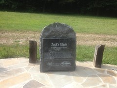
I parked along Hwy 100, at a fairly nondescript location. I guess it's not entirely nondescript though. There is some sign nearby, but I forgot what it said. It's also the spot where the Pinhoti crosses Hwy 100. It didn't really stand out as a good parking spot, but upon closer examination, it was clear that people did, so I parked there too.

The second I was ready to ride, it started raining. It was a gentle rain though, not really a sprinkle even. The kind that probably wouldn't even get into your shoes for several hours. I'd come all that way too, I wasn't about to bail because of a little rain. It was pretty warm out, too. Who knows? The rain might even be refreshing.

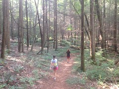
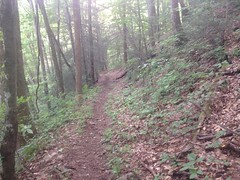
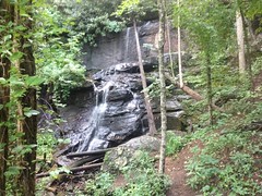
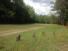
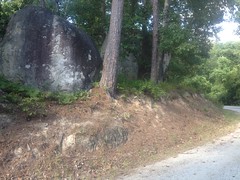
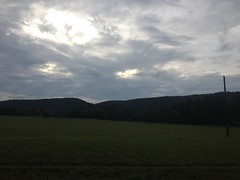
The mountain looming over from the east, was Simms Mountain, and the trail that led along the base of it was, as one might expect, the Simms Mountain Trail.

Simms Mountain Trailhead

It turns out that the Pinhoti co-opts that trail for most of its length.

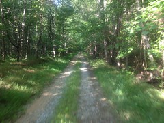
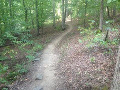
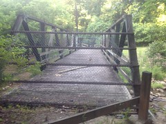
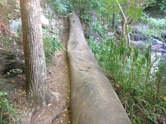
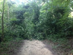
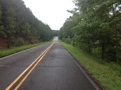
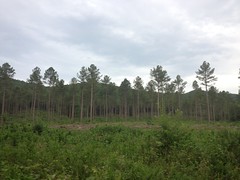
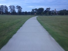
There's not much to see on the Simms Mountain Trail, except for the trail itself, which looks about like this:

Simms Mountain Trail

Or, at least, that's how it looks when you're riding it on a bike.

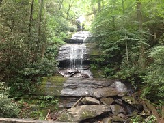
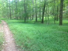
Every so often, thanks to the ever-present kudzu, there is a bit of a view. For example, here's one:
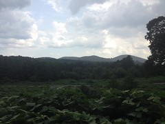
Kudzu and Mountains

Thanks, kudzu.

The trail mostly-follows Friday Road. I could either see it, or kind-of see it most of the time. The trail crossed back and forth over it a few times too.

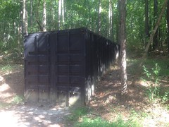
At the final crossing, the sign across the street indicated that the trail continued, and there was a fairly obvious old rail corridor in that direction. But it looked way more like a junkyard than a bike trail. There were TV's and old furniture, but my favorite, by far was the boat:
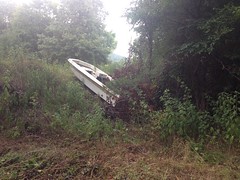
Boat Garbage

Ha!

I love when I find an abandoned boat. The last place you'd expect to find a boat is in the middle of the woods, halfway up a mountain.

The old rail corridor was easy to follow, but it was much more overgrown than the previous section. I started to wonder if anyone ever actually went that way. At about that time, I emerged in someone's front yard, and was accosted by several, quite friendly dogs.

They were like: "Get out of here! But, first, give me love and scratches!" As soon as I turned around, most of the dogs ran back to their yard, but one big pit-bull mix ran along side me for a while, no longer barking, just kind of showing me the way out. He'd get ahead of me, then turn around and wait, and kind-of prance back and forth in anticipation, then he'd do it again. The whole time, he had that happy-dog smile on his face. I felt like finding a stick to throw, but I had a long ride ahead of me and I didn't want to waste too much time.

I rode all over the local roads, trying to determine if the Simms Mountain Trail kept going or not. The old rail bed kept going, but it was closed to thru-traffic and it looked like it would eventually join an active rail.

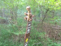
I also expected to see little turkey feet marking which way to go, but I never found any of those. Looking at my map, it wasn't immediately clear whether I should keep heading east, or turn southwest on the main road. I realized that I probably should have studied the route a bit more closely before I got all the way out there, but hey, that's Adventure, right?

I kind-of knew where I was, and I kind-of wanted to figure out how to connect the Pinhoti with the Berry College trails anyway, so I kept heading east, hoping I'd figure out exactly where I was after a few miles.

Almost immediately, I passed a house with two white re-bar swastikas on the gate.

You don't see that every day.

And, a few miles later, I did figure out where I was, and where I wanted to go. To the left was Fouche Gap road, which I figured led up over Lavender Mountain and ought to lead to Sand Springs Road. Yep, it did, and it was a nice little climb. At the top there was a house, and the guy who owned it was getting his mail as I rode by, so we said hi to each other. The descent on the back side was sketchier than I imagined a road-descent could be. Wet mountain bike tires on steep, twisty, wet roads seem to be the worst possible combination. The bike felt really squirmy, and I ended up keeping my speed way down. It's good I didn't see anyone else out there because it would have been pretty embarrassing.

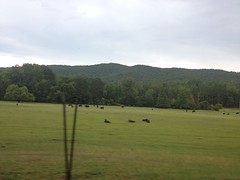
I took Sand Springs Road east.

Sand Springs Road

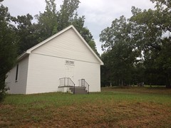
...and there was a lot to see on that road.
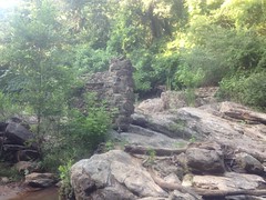
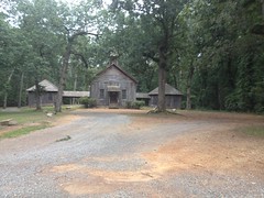
An old church:

Sand Springs Church

Several clear-cuts:

Clear Cut

Cows!

Cows

An old farmhouse and barn:

Old Barn

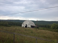
Both on Berry College WMA property, it seemed.

The road seemed interminable too. I could see the mountain to the south, the whole time, and knowing that I'd just be turning around and climbing all the way back along that very ridge made me want to hurry. I'd gotten a late start. I expected to get back after dark, but there's always that instinct to push when you realize it's going to get dark on you.

When I finally rounded the end of the mountain, I took a right on a gravel road that Billy and I had ridden once before, and climbed all the way back up along the ridge. It didn't seem to take nearly as long on dirt, for some reason. When I made it to the college trails I took the House O'Dreams road down into the Mountain Campus, and rode around for a while, trying to figure out how to get over to Possum Trot Road. It's a bit of a maze in there, and if you don't know where to go, it's not easy to figure it out.

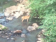
On the upside, I ran into deer after deer, and managed to get a decent photo of one of them.

Berry College Deer

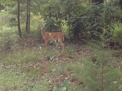
The deer at Berry College have no fear of people. They come out in herds to graze in the fields every evening. I literally saw hundreds of deer during the course of that ride.

I eventually got on the right road. I was headed southeast, and Lavender Mountain was to my right.

Lavender Mountain

It was getting darkish, but it wasn't officially dark. The last time I was up there, I remembered seeing a road leading southish, out near Possum Trot Church. It ought to lead to Technology Parkway, which would take me almost directly back to my car.

I rode out to the church...

Possum Trot Church

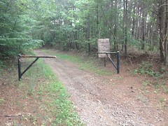
And I found the road, but it was gated and there was a sign saying that you needed a permit to cross the gate. Dangit. I'd once run into a sign like that on CCC Road. I'd called the number on the sign, which rang the campus police, and they told me that it was fine to cross such gates on a bike or on foot, just not in a motor vehicle. But I couldn't exactly remember what the other sign said. I don't remember if it had any language about a permit or not. It didn't seem like it did. I didn't want to break the rules, and I didn't feel like engaging the police, so I ended up backtracking and taking the Viking Trail back toward the main campus.

Viking Trail

It was getting really dusky at that point.

The main campus was as much of a maze as the mountain campus, and though I tried pretty hard to find a way out to the south, I eventually ended up just riding out through the old front gate.

Dark? Almost. Really close. I think it was 8:15 or so. Fortunately it was nothing but roads back to the car. Unfortunately, I took a wrong turn, or more precisely, failed to make the turn, onto Friday Road from Huffacre. In the dark, it wasn't until I saw the smokestacks of Plant Hammond directly ahead of me that I realized what I'd done.

On the upside, I managed to accidentally follow the route of the Pinhoti, all the way back to Hwy 20. So, now I've ridden that whole chunk. On the downside, I had to ride along the shoulder of Hwy 20 for several miles, and the shoulder has a bunch of grooves cut into it to make noise when you drive on them, and there's only like 3 or 4 inches to the right of them that you can ride a bike on.

Tough to manage in the dark.

I made it though, and almost immediately checked my phone to see how late it was. 9:00. Hmm... Not so bad after all. I could still grab some Mexican food in Rome. Woohoo! Seemed like a long 4 hours though. Guess I'm just out of shape....

I got dressed, threw my bike in the car, and headed toward Rome. It was at that point that I realized it was actually 10:00. I had just been close enough to Alabama for my phone to pick up signal from a tower across the border. My phone thought it was in the Central Time Zone. Ha! Well, I felt better about being tired. 5 hours seemed more like it.

Dangit, I had to settle for Zaxby's instead of whatever that Mexican place is called. And, I had to eat in the Lowes parking lot because their dining room was closed. I was fairly well entertained though, as it was quitting time and the employees were carrying on in the parking lot as they walked toward their cars to go home. There were also two cats hanging out in the adjacent lot, lying on top of each other, and then batting at each other, before lying on top of each other again.

Ahh, the life of a feral cat.

I felt a bit like a feral cat myself, actually. I guess that's a good word to describe how it feels when your ride takes you on strange roads and trails, way into the night, when normal people have been sitting at home for hours, watching TV or something.

Feral. One feels feral. Or, at least I do.

Dockery Lake

Yep, getting the backlog knocked out now...

Dockery Lake. That was just two weekends ago, I think.

I remember that it started off bad. Kathryn was pissed at me for driving up Hwy 60 because it's just too twisty and it made her carsick. Then the road leading in to the lake was bumpy and she didn't like that either. Then I wasn't sure which way to go because there were signs indicating that we needed to go left, but a one-way sign pointing to the right. I was indecisive about it and had to back up. When we finally got to the correct parking lot, Kathryn was "ready to be done" with the whole experience. Fortunately car sickness wears off fairly quickly.

There are really two trails out there, the Lakeshore Trail, which leads around Dockery Lake proper, and the Dockery Lake Trail, which leads from Dockery Lake proper up to the AT.

You have to hike a bit of the first to get to the second, so we did. Near the lake dam, there's this little pierish thing...

Dockery Lake Pier

...and apparently people fish there so often that schools of tiny bream followed us back and forth as we walked along the pier. I found some bits of a Cheez-It or something on the dock and you'd have thought the fish were piranha the way they attacked the little bits that I threw in. My god, I've never seen such chaos.

In comparison, the lake itself was super, super calm. A clean, clear mirror for the sky.

Dockery Lake

The tiny fish weren't alone. We noticed several of these 8-inch bullfrog tadpoles lurking about.

Bullfrog Tadpole

I wasn't even sure what they were at first. Biggest tadpoles I've ever seen.

We didn't spend too much time looking at them though. We really needed to get going if we wanted to get in and out before dark.

The trail started off as purpose-cut singletrack, before eventually joining an old roadbed which merged in from the west. I had expected the trail to merge with an old roadbed at the head of Waters Creek, but it did so much earlier than that. It made me curious where the rest of that road goes, but we didn't go bushwhacking off into the wilderness to find out, at the time.

At the head of Waters Creek, there was a bit of a trail leading off to the east, and I suspect if I followed it, I'd eventually find Waters Creek Road, but again, we didn't go looking for it that day.

We did run into a lady with a pair of dogs, washing her hands in a little stream, but other than that, we were alone on the trail for the rest of the day.

Kathryn and Sophie on the Dockery Lake Trail

Man, it was really pretty back in there. The photos really don't do it justice.

My mind wandered though, as it often does, to the previous life that trail must have had.

A lot of trails in North Georgia started as something else. Many had something to do with logging - either a skid or a railbed. But others are just old wagon roads. Outside of the Forest, a lot of those wagon roads were improved and became county roads or highways. Inside of the Forest, they were largely abandoned, but a few became trails, or at least part of them did. Such seemed to be the case with the Dockery Lake Trail.

The grade was too steep and inconsistent to have been a rail. It had once been horribly braided too. In a lot of places the trail followed the fall line, and you could see old versions of itself all over the place.

In other places it was deep below grade, and the slabs of rock that had gotten uncovered as it dug itself down into the hillside had been pulled up and piled up, manually, to either side.

Kathryn and Sophie on the Dockery Lake Trail Again

The placement was wildly inconsistent though. In some places it had been located really well and was still in really good shape.

Dockery Lake Trail

It also led all the way up to Miller Gap and actually, kept going beyond that. Skids invariably stop at whatever point logs can easily be dragged down to them.

I'd seen all of these features before, on East Mountaintown, on the Logan Turnpike, on the Hightower Express, along Cane Creek, and in a few other places that don't immediately come to mind. Logging seemed like an unlikely source for that road. It seemed much more likely that it was just the way people used to go to get over the mountain. There may even have been a community back there, as there is today along the road on the other side of Miller Gap.

I thought about all of this as we walked, but I didn't bore the family with it. Not too much at least.

When we got to the AT, we took a bit of a break in the campsite on the north side.

Dockery Lake Trail Sign Snack at the AT

Sophie had brought a bunch of cheese puffs of some kind with her and I was a little jealous watching her wolf them down. All I'd brought was Clif Blocks.

I explored the area a bit, and that's when I discovered that the old roadbed kept going over the gap. There was a spur leading away to the north too. Someday I'll have to go back and see where they go.

Not that day though, we needed to get home before dark.

The descent went by much more quickly than the climb, but about 3/4ths of the way down Kathryn slipped on a rock, and as she was describing how she had slipped, I slipped on the same rock and fell all the way to the ground. It was like crashing my bike. I think it's only the second time I've ever crashed hiking though. The first was at the very end of the first hike I ever did in Shining Rock. That time, I caught a root, tripped, and fell. This time, I slipped and fell. My injuries were insignificant. I bruised my right hand and bent my left thumbnail back a bit, but that was the extent of it. More than anything, I was just disconcerted. Looking back at the rock, it still didn't look dangerous. I'd probably step on it again. Kathryn had apparently thought the same thing. It didn't look dangerous to her either. That's the kind of thing I worry about: the rock that still doesn't look dangerous, even after you know it is. I missed some subtle thing. I might miss it again.

When we arrived at the lake there was a family there fishing. They'd had no luck though. The schools of little bream were even gone. It was getting late in the day, and the bullfrogs were calling. I'd never heard frog calls as deep as the ones I heard that evening. I heard the pitch that I usually associate with bullfrogs, but then there were more that were so much deeper. The frogs must be enormous. If it hadn't been so dark, or if I'd had a flashlight, I might have tried to track one down.

All that for later though. We needed to get home.

I think we tried to eat at Longhorn and Ruby Tuesdays in Dawsonville, only to find both closed, and resort to the Wendy's-Taco-Bell combo. That sounds right at least. Yes, I remember now, because my Spicy Chicken Sandwich came with everything on it, even though I ordered it plain, and then when they fixed it, I got a non-Spicy Chicken Sandwich, but I was too hungry to send it back again. I've eaten at that Wendy's more times than I can count though, and it's always been good, so I'll forgive them that particular mistake, and barring some catastrophe, I'll certainly eat there again.

DeSoto Falls

More of the backlog...

When was this, the 17th of last month? Not quite a month ago, but close.

The family and I took a little trip to DeSoto Falls:

DeSoto Falls Sign

Actually, it was just me, Kathryn and Sophie. Iz was home sick or something. I forget exactly why she didn't join us.

We did the standard out-and-back to both falls.

First the lower falls...

Lower DeSoto Falls

...where some of the graffiti was apparently left by an English teacher.

English Teacher Graffiti

Danger"ous" Area.

Get it right, students.

Second, the upper falls.

A bit more breathtaking.

Upper DeSoto Falls

The ladies approved, at least.

Sophie and Kathryn at Upper DeSoto Falls

But, sadly, the people leaving graffiti there were a bit less educated, it would seem.

Stay in School

That's DeSot"o" Falls, you guys. With an "o".

An "o".

There's a side trail that leads out to some even more spectacular falls, and then way up the mountain. It goes and goes, and the girls and I tried to follow it one day, only to be forced back by snow before we reached the end of the trail. We tried it again that day, but it was too overgrown for Kathryn's taste, so we turned back even earlier.

Part of the trail leading to the lower falls, and part of the trail leading between the falls really had that I'm-an-old-railbed feel to it. And we found some evidence that it may indeed have been.

Locomotive Nut

That's a cast-iron nut, two inches across. I'd found a similar nut on the old Dover Creek railbed a few weeks prior. I can't confidently say it was from a locomotive, but I know that area was logged by train, and it looks suspiciously like the kind of nut that would have held the equipment that was used in those days together. Given it's location, it seems likely that it had its origins in such activities.

On the way out I found a snapped cable in the campground too but I've seen so many of those I failed to take a photo of it.

The hike was short overall, but we had a pretty good time of it. I don't remember where we ate, but I remember that I wanted to eat at the relatively new Roadkill BBQ that took the place of whatever that old store was at the bottom of the mountain, but Sophie refused to eat anywhere with the word "roadkill" in the name. Fool! It's barbecue, from North Georgia! It's almost guaranteed to be good. I couldn't talk her into it though.

Dangit. Maybe next time.

Cochran Mill (Again)

The backlog again! The backlog is becoming the rule rather than the exception.

Let's see... Over a month ago this time!

Yes, it would seem that I rode Cochran Mill with my brother, and then went back a bit later on my own to explore the trails that we didn't hit together.

The first thing I did was head west on Old Upper Wooten Road. This took me past a big clearing, apparently named Zack's Glade.

Zacks Glade

See...

Zacks Glade Memorial

Zack's Glade.

There was a small network of trails there that I explored before getting back on the old road, but once I did, I discovered a few more interesting things. Like this half-buried cargo container.

Half-Buried Container

Full of tools, I imagine.

And that the road itself doesn't get much use.

Upper Wooten Road

The property to either side is deer lease. I'm not sure that vehicles can access it at all, except via the lease, and then only with permission, and during deer season.

There was a curious sign-in sheet posted at the far end of the road.

Hunting Sign-In Sheet

Write your name on a piece of tape and stick it where you'll be hunting. Good idea. The tape and pen were even provided, and lay on the ground beneath the little kiosk.

In the middle of the road I found this riding crop.

Riding Crop

I guess that's what it is. I'd never actually seen one before.

At the far end of the road, there was a yellow gate and beyond that, the road was open to vehicles. It led to the little community of Rico, and I recognized the area from having ridden through there a dozen times on various Silk Sheets adventures.

On the way back I noticed something kind of funny. I once knew a guy who complained that roads in Georgia made no sense because they weren't laid out in a grid. I tried to explain to him that a lot of the roads were really old, and just made by whoever owned the land way back. They had different goals, and they didn't always have the means to build bridges, build roads in challenging locations, or even clear the land. Geography often dictated the location of the road. This seemed ludicrous to him, but I saw a good example of it on that road.

Rocks Perched on the Backslope

If you're building a road, and you run into gigantic boulders, you go around them. That's how it was done in Georgia, at least.

So, after my little out-and-back I felt like tackling the rest of the trails in the park. They were a bit of a maze, but I eventually figured them out.

The woods itself was beautiful, everywhere I went. All green and ferny.

Cochran Mill Woods

The trails were equally beautiful. Flowing singletrack.

Conchran Mills Singletrack

I figured out how to get to that first waterfall we'd been to on the last trip out there.

Henry Mill Falls

I took some lower-lying trails back though. It turns out that though all the trails in the park are multi-use, some are recommended bike-hike, and some are recommended for horses. So, though they're technically legal to ride, I probably won't be riding those particular trails again.

One of the recommended-horse trails had this little guy decorating one of the carsonite markers.

The Land Before Time

Ha!

On the other side of Cochran Mill Road, I poked around some ruins that I'd caught the vaguest glimpse of during the last ride.

There was this old closed bridge...

Closed Bridge Near Cochran Mill Falls

...and various ruins of a dam, or a bridge, or something...

Ruins Near Cochran Mill Falls More Ruins Near Cochran Mill Falls

...and then the falls that the dam hemmed in...

Cochran Mill Falls

...and the take-off from the dam...

Cochran Mill Take-Off

...and even more ruins!

Even More Ruins Near Cochran Mill Falls

Apparently THAT's Cochran Mill Falls proper, and the ruins belong to Cochran Mill proper. There are numerous other falls and ruins in the area, but those are the ones that the park is named for, and if you say "Cochran Mill Falls" that's what people think you mean.

The pool below the falls looked deep and vast, but compared to the clear waters of the North Georgia mountains, the muddy grey water there looked a lot less inviting.

The map showed 3 loops north of the falls, but it took a while to figure them out. They're just lines on the map, but in real life, the trails that make up the loops have significantly different character. Some are old roads, others are purpose-built singletrack, others seem to have just been worn in over the years.

On one of the trails, I ran into a downed tree that took a bit of effort to get around.

This Tree Wasnt Down an Hour Ago

It hadn't been there the day before. Some hikers coming the other direction said that it hadn't even been down an hour earlier!

I did a little exploring over on the Nature Center side too.

This bridge kind-of divides the park. On one side is the Cochran Mill area, and on the other is the Nature Center area.

Bridge Over Bear Creek

As I rode across the bridge, I noticed a deer milling around below.

Deer in Bear Creek

"Don't mind me, I'm just eating these leaves..."

I found another set of ruins along Bear Creek, that I'd been too tired to even look in the direction of the day before...

Ruins Near Lower Bear Creek Falls

And though I'd seen this dam, I hadn't had an opportunity to check it out very closely.

Lower Bear Creek Dam Lower Bear Creek Dam Again

It looked a lot newer than the other constructions in the area. I wonder what its story is...

And, finally, I ran into a little snake.

Some Kind of Snake

No idea what kind. The water was too muddy and disgusting to be sure. It didn't look poisonous, but other than that... No idea.

So, that was it for that particular ride. I ended up going back a day or two later too, and hitting various little side trails. I think I've explored the entire park now. John had the basic idea down though. The best route out there combines 4 different lollipops, or lassos, whichever you prefer to call them. The terrain is diverse, and there is significant diversity of trail experience. I value that, so I really dig Cochran Mill. It's the closest trail to my brother's house too, so odds are I'll be riding there a good bit.