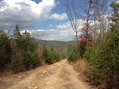
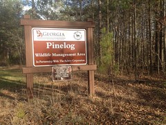
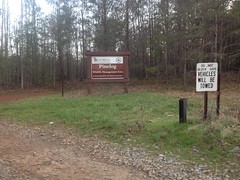
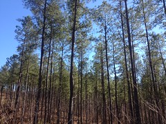
Friday, March 31, 2017

Pine Log WMA (again)

Pine Log!

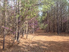
I had such a great time there the last time, I couldn't wait to go back. And, the opportunity afforded itself yesterday at about 3PM. I'd put in a solid day's work, but I had a lot more to do, and I needed a break. It doesn't get dark 'till almost 8 these days, so I figured I had plenty of time to do some exploring. I grabbed my commuter lights off of my road bike though, just in case.

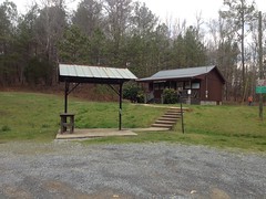
It took a while to get up to Pine Log. It was almost 4:45 when I made it to the lot. Traffic on 75 north between 285 and 575 is apparently terrible, even as early as 3PM, on a Wednesday.

No problem though, I still had plenty of time.

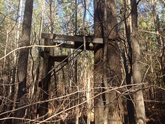
First stop... The Lewis Iron Blast Furnace.

I'd ridden right by it the last time and not seen it. I thought I knew where to look this time though, and voila, when I looked there, I found it.

Lewis Iron Blast Furnace

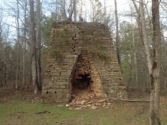
I'd seen photos, but I really had no sense of scale, so here's my bike next to it.

This thing is huge.

Lewis Iron Blast Furnace (With Bike For Scale)

Really, freakin', huge.

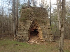
Ore was dumped in the top of the furnace. Air was blasted in through the "tuyere" arch on the right side by a set of bellows, powered by a waterwheel. Molten iron flowed out of the casting arch on the front side. Slag also flowed out of the casting arch, presumably to the right of the molten iron.

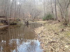
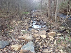
There were extensive piles of slag along the creek to the southeast of the furnace, now overgrown with brush and trees. There were also hills behind the furnace which may have been stockpiles of ore. I need to go back and study them a bit more.

To the right of the furnace there would have been all kinds of machinery, but mainly a bellows, driven by a waterwheel.

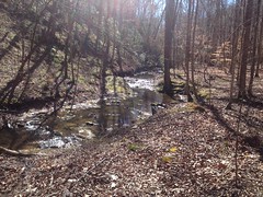
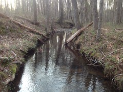
The waterwheel would have been driven by water taken off of the creek by a raceway. A vague hint of the old raceway is still visible in the creek behind the furnace.

Mill Race Ruins on Stamp Creek

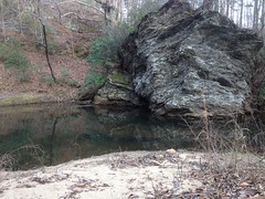
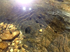
It's not clear whether the wheel was over, under or breastshot, but in any case, the water would have poured over or under the wheel, dumped into this rock-armored output basin...

Waterwheel Output

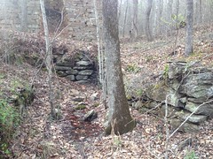
...and been directed back into the creek.

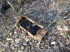
There were a few big chunks of either slag or ore lying on the ground, to the left of the furnace.

Slag or Ore

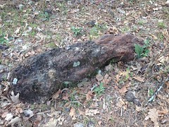
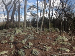
Given their size, and location, I'd guess ore. Also, there's a bunch of rock that looks similar to that in the Sugar Hill Mine area to the north. But honestly, I don't know enough to tell one from the other.

About 50 yards away from the furnace, to the southwest, there was what I guess is a basement wall.

Basement Wall Near Lewis Furnace

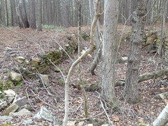
I actually saw it as I rode in, and recognized it from B & E Roberts' photos, but I couldn't remember what he thought it was. Struck me as a foundation/basement for a building. No idea though. Could have been a coal bunker or something too. Did they use coal back then?

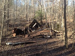
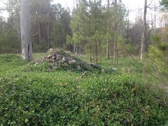
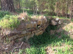
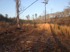
To the south of the furnace, right along the main road, there are more ruins, completely overgrown with some creeping vine. They bear a striking resemblance to the main furnace ruins though. There's this random pile of rock, which used to be something.

Old Furnace Ruins (Maybe)

And this wall is part of another box, directed at the creek, in similar proximity to that rock pile as the waterwheel output above is to the furnace:

Old Waterwheel Output (Maybe)

There's another old rock wall to the west too, which could conceivably have been a footing for whatever structure gave access to the top of the furnace.

Rock Wall Corner

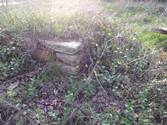
It made me wonder if an older furnace had stood there at some point. Perhaps it was canibalized to build the Lewis Furnace. No telling though. It could have been anything, really.

So, that was a lot of fun, and though it required a lot of words to describe it, I only spent about 10 or 15 minutes checking it out. I had lots more on my agenda.

Namely, there was another furnace nearby, along Guthrie Creek, and the ruins of a sawmill somewhere in the area as well. I needed to see them too.

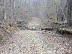
Fat chance of that though. I followed the road leading west from the furnace until it hit private property. There were a couple of little spurs to the left and right, but they didn't really go anywhere, except to more of the same private property. Man, it would be really disappointing if the other furnace and the mill weren't in the WMA. But I was sure they were. Hmm... Well, turns out I wasn't on the road I thought I was on. The trail that leads to the mill and to the other furnace was south of me. I was on a semi-parallel road to the north.

I've got a pretty well trained eye for side trails though, and I didn't see anything where the trail to the mill was supposed to be. I guess I'll have to try again, now that I know the area better.

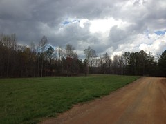
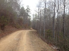
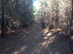
There was plenty more to see though, so I headed back to the lot and hung a right on Stamp Creek Road, toward the town of White.

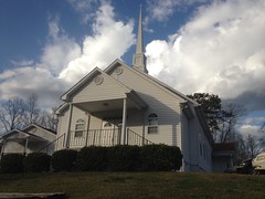
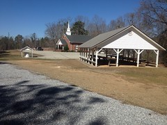
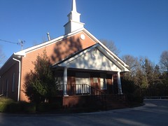
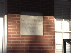
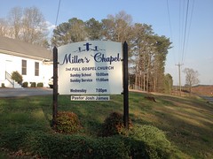
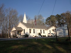
Miller's Chapel was nearby. I'd seen it last weekend when I was riding back in the dark. But, being dark, it wasn't a good opportunity for photos. There was plenty of light yesterday though.

Millers Chapel Sign Millers Chapel Millers Chapel Cemetery (Facing West) Millers Chapel Cemetery (Facing East)

There are a couple of rollers, but it's mostly downhill to White. Downhill, from Wolfpen Gap, actually. In fact, according to old maps, at least, the entire area between the gap and White was once called Wolfpen. North Georgians really don't seem too creative when it comes to naming things. The various Peachtree Roads in Atlanta come to mind, of course, but I can think, offhand, of at least 3 other Wolfpen Gaps, and a Wolfpen Ridge, in North Georgia. And I'll bet there are more that I can't think of right now, and probably at least one more that I don't know of at all.

Ha!

Anyway, I came tearing down the road into White, hung a right onto 411, and hung another immediate right onto Oak Street. There was no street sign indicating that it was Oak Street. On the other side of the highway, it's Richards Street or something. But pretty soon I spotted some piece of power or phone equipment with "Oak Street" written on it, and before long I hit the WMA boundary.

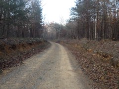
It's gravel, immediately when you enter the WMA, but for a while it looks like it was once blacktop. I didn't notice the old-blacktop/true-gravel border though.

One thing I did notice was a fence made of old railroad ties along the north side of the road.

Repurposed Tie From the Iron Belt

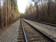
Oak Street used to be part of the Iron Belt Railroad which ferried iron (ore, I guess) from mines in the nearby mountains to Chattsworth in the late 1800's and early 1900's. I imagine those ties were once part of that railroad. Though, I thought about it later... Wouldn't it be funny if they weren't. Like the guy just bought them from some local landscape company. Oh, the irony that would be.

It made me smile thinking about it.

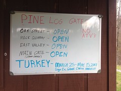
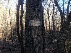
There was allegedly a "Dove Field Road" somewhere up Oak Street a bit, and since it was turkey season, and the roads were all open to vehicular traffic, some helpful soul had put up a "Dove Field" sign at the intersection with the road. Woohoo! No guesswork.

As I was riding in, a hunter was hiking out, and I spoke to him for a few seconds, just to confirm that he was finishing up rather than just getting started. I didn't want to be riding on top of him. He was finishing up though, and hadn't seen anyone else on the road all day.

Further down the road, you know what I saw? Turkey prints. Lots, and lots of turkey prints. Oh, man. They were everywhere, and they were fresh. It reminded me of that time in Florida where I took a photo of a bear on one of the roads in the Ocala, and then right over the top of the hill a bunch of guys were heading out bear hunting.

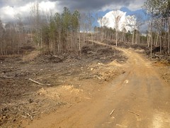
Dove Field Road ended at a clearcut.

Rough Bushwhack

I'd hoped it would lead all the way out to Stamp Creek Road, but it didn't. I could see the road though, and hear traffic on it. I figured it was close enough to shoulder the bike and whack through to.

Ha!

Thorns.

Everything had thorns.

My knees were bleeding for the next hour.

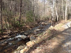
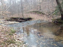
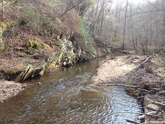
It was a little tricky crossing Wolfpen Branch, as it was trenched pretty deep, and there were no obvious fords.

Wolfpen Branch

But, I was back on the pavement directly, and back on Oak Street again a few minutes later.

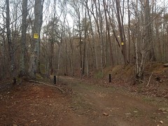
As Oak Street is an old railbed, it has a very consistent grade, thanks to the numerous deep cuts and fills along its length.

Oak Street

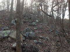
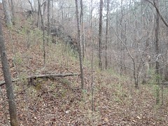
There were a bunch of recent clear-cuts uphill from the trail and some of them exposed the borrow pits for the fills. In some spots though, it looked like they'd shaved off a lot more of the mountain than would have been necessary for the next fill, and I wondered if I was actually looking at an old mine cut.

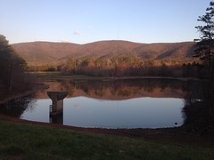
The land behind one of the fills had become a little pond.

Pond Off of Oak Street

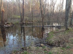
I wonder if it dries up in the summer.

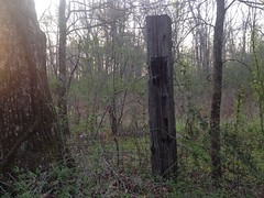
Past the pond this weird hole in the ground caught my eye.

Weird Hole in the Ground

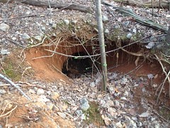
It's hard to tell in the photo, but it's about 3 or 4 feet tall. I thought it might be some animal's den, but I didn't know of an animal that would be found in that area that's the right size to have a den like that. On closer insepection, it looked a bit like the mine shafts on Sawnee Mountain. Further uphill it looked like bits of it had collapsed too. I don't know enough about iron mining to say whether it might be involved in that or not. Whatever it is, it's interesting.

"End of the road, boys. It's had its twists and turns, now it deposits you here."

End of the Line

Dangit, I'd hoped I could keep going past the WMA boundary and end up somewhere off of 411 or East Valley Road.

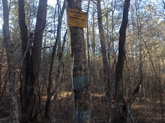
On further examination, I wasn't sure that I couldn't. I mean, those "Posted" signs look pretty definitive, but the gate had no crossbar. The road beyond was just as worn as the road behind. I.e. it didn't look like a long-standing border. And most curiously, there were posted signs on trees down the road, facing the road, that you would see if you were on the road, past the gate. I wondered if the signs were meant to indicate that the land to either side of the road was private, but the road itself was ok to travel on, as long as you stayed on the road. There certainly are plenty of cases of that. That's why I like "Private Drive" signs. No ambiguity. If I ever have a private drive, I'll put up one of those signs.

I didn't like it, but I erred on the side of caution and turned back.

I did check out a few side trails on the way back. There's a maze of ATV trails west of the road, and one that looks more official and less ATV. Almost all of the trails led directly to someone's house. I wondered if they'd been used to access the WMA before the neighborhood was built, and then as each house popped up, a new trail popped up from the next lot over. It seemed semi-plausible, but the trails all looked equally well used. Like maybe every family in the neighborhood had an ATV and each of them made their own trail. No telling. It's also possible that the trails don't actually go all the way to each person's house. There may be a rail that ties them all together, just inside the WMA or something. Each time I could see the trail going straight toward a house, I turned around. People were out cutting their grass and hanging out in their backyards, jabbering. I didn't want to bother them, walking up on their backyard. Who knows though, maybe that happens a lot and they're used to it.

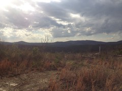
Anyway, I gave up on the maze quickly and headed back down Oak Street in a direct abort. It must have been slightly uphill on the way in because I was spun out quickly heading out. It was getting late and pretty, so I tried to take a photo of the ride out, but it was too dark, and shaky.

When I got to town I flicked on my commuter lights and rode back to the trailhead in the dark. I felt a lot stronger than I had last weekend, maybe because I was more well recovered from the flu. Or maybe just because I'd done a lot less climbing than the last time. Either way, I felt pretty good and pushed pretty hard back to the car.

On the way home I stopped at a gas station on Hwy 20 near I-75 and saw 2 interesting things. The first was a guy purchasing 2, and only 2 items: beer, and detox pills. The second was the impressive selection of Confederate Flag themed stickers and other memorabilia, juxtaposed with the older Indian couple who appeared to own and operate the store. I imagined them looking through catalogs, deciding to stock those items. I wondered what their thought process must have been. It made me smile and thinking about it kept me entertained for longer than it probably should have.

Whoo! Another good day at Pine Log. Still plenty more to do and see there too, so I will, no-doubt, be back again soon.

Tuesday, March 28, 2017

Pine Log WMA

Last Saturday night I finally felt like I was legitimately over the flu. Not 100%, but well enough to get in some real exercise - something that I wouldn't just describe as "light hiking". Where to go, though? What to do? Always the big questions. Well, I was updating some of the Blanket's Creek/Rope Mill data on my trails site and when I zoomed out I noticed a trailhead icon to the northwest that I didn't immediately recognize. What's up that way?... Oh, that's right, Pine Log.

I'd last been there years ago with Eddie, Nam, and Travis and I basically just followed them around with no idea where I was going until I got home and sifted through the GPS data. I'm not sure why I never went back, but I guess there was always something more important to do.

At any rate, noticing how close Pine Log was to Blanket's Creek made me wonder if there was a short bit of road between them. That led to a lot of research, a lot of new dotted lines on my map, and the urge to get out and explore the WMA for real.

So, Sunday afternoon I drove up and did just that.

On the way up, I drove some of the roads that I'd considered using to get over from Blankets. Ha! It's like 16.5 miles from Blanket's to Pine Log. Not exactly the short bit of road I'd hoped for.

The Pine Log lot was busy. There were several cars. There were lots of people walking back and forth to Stamp Creek with various trout rigs. It looked like the same destination had come to everyone's mind.

I geared up and spun over to the game check station for a minute...

Pine Log Game Check Station

...and noticed that there was a turkey hunt going on. All the roads were open to vehicles.

Turkey Hunt Info

Ha! That only happens a few times a year, and I picked one of the days.

That's cool though. I had no plans to ride anything but roads today, so it ought to work out just fine.

Oh, I almost forgot... Right before I left the lot, a guy came walking up to me and asked me what kind of riding there was back in there. Turned out his name was Rob, he lived in Cartersville, rode Blankets and Rope Mill often, but had never even considered riding in the WMA, despite being right next door. I felt bad because I didn't have a ton of info for him, but after we finished talking about riding, I complimented him on his Corrosion of Conformity tee shirt, and we talked about the various times we saw them for probably the same amount of time that we'd spent talking about riding.

But, I digress...

I headed up the aptly named Main Road, passing meadow after meadow...

Meadow on Main Road

...and ultimately running up along Stamp Creek for a while...

Stamp Creek

...before bending around to the left and climbing a rather steep and unmaintained section of road up to a little knob. It looked like a trail continued, probably all the way up to Hanging Mountain, but I left it alone for the time being and, instead, bombed back down through all the ruts...

Main Road

...(which somehow look like nothing at all in the photo), passed more people fishing where the road crosses Stamp Creek, and hung a left on Grassy Hollow Road.

Shortly, to my left, I noticed a well-maintained looking road and thought it might lead up to what I call "Shut-In Ridge" - the ridge on which Shut-In Creek originates. All right! I'd been looking for that road, and I felt good that I'd reached it so quickly.

But the feeling was short lived. I wasn't where I thought I was. I was looking for the WMA boundary, and before long I'd ridden much farther than it seemed like I ought to have to to hit it. Yeah, I was just off on some little spur.

The spur appeared to have been clear-cut recently.

Recent Clear Cut

Near the top I could see 360 degrees, and confirm my location.

Dangit.

Well, better luck next time...

Actually, while I was up there, a moss-covered boulder field caught my eye and I climbed all over it.

Boulder Field

I did slip a bit though, in my bike shoes. I used to ditch the bike and go hiking all over the place, all the time, but it had clearly been a while.

Ok, back on track...

As I climbed, I noticed patch after patch of butterflies. Little black ones just sitting on the road, in groups of 10 or 12. They'd flutter up when I passed, then settle back down. I must have passed 100 little bunches of them. I'd never seen black ones like that before. It's not uncommon to see packs of light blue or purple ones up in the National Forest, usually crowded around a recent campfire or sometimes just sitting on the road, but never black.

Neat.

When I was in the vicinity of Grassy Hollow proper, I heard a vehicle approaching. The road was steep, and the driver was spinning the tires almost constantly. It sounded like he was bouncing his truck up the hill wildly, and I expected to be overtaken any second. This did not happen though. He just sat back there screeching away for like 5 minutes before he finally got past me.

The driver was a young guy, probably in his early 20's. His passenger was probably his brother, of similar age. Their 8 or 9 year old sister was riding in the bed of the truck, tumbling around as he struggled to keep the truck going kind-of straight. At first I thought maybe he was playing around, but I soon realized he just had bald tires, 2-wheel drive, and a standard differential. It was all he could do to keep it on the road, moving forward. I guess I should give him credit for commitment. If I'd had that much trouble, I'd have turned around a lot earlier.

I did find the connector to Shut-In Ridge, but the mood to explore it had passed and I pushed on.

About 2/3rds of the way around there was a nice view of the whole Stamp Creek valley.

View From Grassy Hollow Road

I think that's Little Pine Log Mountain in the distance. I'd be over that way later.

When I reached Rock Quarry Road, I hung a left. According to the map, it ought to run out to the WMA border, and there should be one spur leading south too. Ha! The main road forks and the correct way to go is not the obvious way. And, there are like 6 spurs leading south. They all put me at a power line cut, and a bunch of them kept going. I didn't have time to check them all out though, and the one I did follow to the end later turned out to be the wrong one.

Goodness.

I took Rock Quarry Road out to the paved road I'd driven in on. There was a WMA sign there.

Pine Log Rock Quarry Road Entrance

Hmm... Aubrey Corporation. Apparently that's the landowner. I looked them up later. They don't appear to have a website. They do, however, appear to be into everything from real estate to farm transportation. A quick look at a map of the area shows an Aubrey Road and two different Aubrey Lakes. They appear to be a pretty big fish in the Cartersville pond. Thanks for sharing your space, guys.

As I headed back towards the lot, I passed the Stamp Creek Church.

Stamp Creek Church Cemetery Stamp Creek Church Sign Stamp Creek Church

The lot was full, and an older gentleman and his wife were arriving late as I stopped to take those photos. When he opened the door, I could hear the choir singing some lively tune that I didn't recognize: "something, something, something, when I doo-ooo..." It made me happy. Made me want to go inside and sing with them. Sadly, I was a bit under-dressed, and quite a bit over-dirty.

Instead, I headed back to the lot and back up the Main Road, where I eventually hung a left and proceeded up Pine Log Gap Road.

Pine Log Gap Road

It was actually getting somewhat late, so I kind of pushed it a bit. I felt "well" in the sense that I no longer felt like I had the flu. But I also felt like I'd been lying on the couch for two weeks. Oof. Maybe not so well, after all.

It was really rocky up near the gap itself.

Rocks Near Pine Log Gap

And on the way up, I could also see a rock wall running up along one of the spurs to the right of the road. I suspect it's the border of an older road, where the rock was cleared to one side when they built it. I'll have to go check that out someday.

The road bombed down off the north side of the gap, hung a quick right, and flattened out. At that point, the character of the mountain changed dramatically. Dozens of little spurs ran, haphazardly, up and down the backslope, and they were all terribly eroded. There were cliffs and ledges... "Oh! I bet this was a mine! And this kind of feels like I'm on a railbed here..." I was so excited that I actually said that out loud.

A little further down the road some massive excavations confirmed the mine theory. A couple of deep cuts for the road seemed to confirm that I was, indeed, on a railbed too.

A long meadow drew out to my right. It appeared to have a creek running through it. It was mostly grass, but I thought I saw some flowers were starting to bloom. I bet it'll be spectacular next weekend.

At a point, the old rail appeared to keep going straight, through a gate, while the road dropped down to the right and crossed a creek. The creek was deeper than I expected and I ended up dunking my feet and eventually stepping off. Dangit, I'd almost managed to stay dry all day.

To my right, things looked post-apocalyptic. It took me a few seconds to sort it out. The creek tumbled down through a great rift in the hillside. At the base of the rift were the exposed ruins of a stacked stone wall. Some creation of mankind, buried by disaster, now exposed again by erosion. What was I looking at? Like I said, it took me a few seconds. All I could come up with, and it seemed unlikely, was that I was looking at the ruins of a dam, and that the meadow behind it was once a lake, that has since filled itself in. When the creek overtopped the dam, it began creating The Great Rift, which has been growing ever since.

It was pretty amazing. I know, academically, that this can happen, but I'd never seen it in action before. That is, of course, if I was right about it.

On the way out, I passed Neel Lake.

Neel Lake

Or Floodwater Retarding Lake No. 25.

Floodwater Retarding Dam No. 25 Dedication

Whichever is more fun to call it.

The north entrance was just down the road.

Pine Log North Entrance

As I approached it, 3 girls wearing shirts from some UGA sorority came tear-assing toward me in a golf cart, smiling and laughing, and having a heck of a time with the gravel. I'm pretty sure I saw both passenger-side wheels come off of the ground at the same time, but the driver saved it. It looked like they either really knew what they were doing, or REALLY didn't know what they were doing. I hope it worked out, cause I remember an episode of Jackass where it didn't, and it kind of reminded me of that.

So, at that point I had a dilemma. There's another chunk of road in the WMA called, of all things, Oak Street. I hoped to find a legal way of accessing it from that end of the world, but that would require some exploring, and it was getting pretty late. I could still see the sun, but it was low enough to blind me as I rode west. I worried that it would blind drivers coming up behind me too, so I flicked on my red blinky light, just in case it might give me that extra little bit of protection.

Nobody hit me, so I guess it worked.

Oak Street starts in the town of White and runs all the way down the west side of Little Pine Log Mountain. On topo maps, it looks like it bends around the north side of the mountain and tees in to the road I was on. But, the road had a dozen spurs and I wasn't sure which one would eventually lead me to Oak Street. Also, the bending-around was all outside of the WMA. For all I knew it was entirely on private property. Hard to say though, it might be on county land. The map made it look like there were a few access points at the back of various neighborhoods. I was optimistic, but I proceeded with caution.

The first neighborhood was called East Heritage. No luck. On one side it was posted, and on the other I'd have had to have ridden about 15 feet down some guy's driveway to get to the trail. It looked like he used the trail though, as there were 2 ATV's parked directly on it.

I bailed on the next 3 neighborhoods. The sun was down. I was getting tired, and it was like 6 miles back to the car no matter how I did it.

So, I punted, took 411 to White and Stamp Creek Road back to the car. It was officially dark as I rode into White. My blinky light was invaluable on Stamp Creek Road. It was pitch-freakin'-black. On the upside, both roads had excellent shoulders.

When I got home, I did some research. Yes, the north end of the WMA was once the Sugar Hill Iron Mine and apparently, there's a bunch of really cool stuff to see there. There appears to be some disagreement about exactly when it was in operation though. The mine was apparently worked by convict laborers who were housed on site. I can only imagine the hell that must have been. If nobody called it "Sugar Hell" at the time, they really missed an opportunity. Also, all of Oak Street, the streets at the back of that neighborhood I piddled around in, and part of Pine Log Gap Road were once part of The Iron Belt Railroad which basically ran from Cartersville up to the Sugar Hill mine, with a few stops at some other mines to the south. A topo map from 1906 shows the mine, the railroad, and everything. It also appears, in fact, that the meadow that I saw was once a lake, as was another meadow above it. Ha! Amazing.

At the south end of the WMA, there are apparently various stone furnaces and the ruins of a sawmill on Stamp Creek. The furnaces were operated pre-Civil War by Jacob and Moses Stroub as the Etowah Bloomery and the sawmill was operated post-Civil War by R. H. Jones, who made carriages, furniture, and caskets. John W. Lewis apparently owned the property at some point too, for some purpose. I guess I should have sorted all of this info out before repeating it... Don't take my word for any of this.

One funny thing... I recently added historical topo maps to my trails site, covering most of North Georgia. I should have seen everything that was on that 1906 map before setting foot on site. But! I didn't. Why not??? Well, I got all of my maps from the awesome ArcGIS USGS Historical Topo Map Explorer, and it appears to be missing that particular map! The University of Alabama Map Collection has it though, and a lot more. I may have to raid their data at some point. Though, I'm not sure that I should, on principal. You know, because it's Alabama.

Geaux Tigers.

Friday, March 24, 2017

Friendship Church Area (again)

I'd felt good last Sunday and Monday, but then Tuesday and Wednesday I felt pretty terrible again, like maybe I'd gotten a secondary infection. Thursday I had energy, and it seemed like some fresh air would do me some good, just as it had the previous Sunday.

To that end, I reprised Sunday's festivities with further exploration of the Friendship Church area of the Paulding Forest.

This time I parked up the road from the church, at the other end of the loop, and hiked some "trails" on that side.

I say "trails" because most of them were much more like unmaintained roads than proper trails.

The Trails Today

But fresh air is fresh air, and I was happy just to be well enough to be outdoors at all.

I have no idea what the actual road I was on is called, but I call it the "Friendship Baptist Church Area Road" on my maps. Somewhere out there, a ways down that road, Inland Rome has an inholding. It's surrounded by the Paulding forest, but I guess that little square of land belongs to Inland.

Inland

The borders were fairly well marked, with orange paint, but there were no keep out or no-trespassing signs, and the road went right through their land, uninterrupted. Temple-Inland has a reputation for being friendly to outdoor types. They sponsored a mountain bike team for a while. I also remember while scouting the area north of Rome for the TNGA, I kept running into Inland tree farms, but I met a guy on an ATV who alleged that he ridden the trails through the tree farms for 15+ years, encountered Inland staff plenty of times, and "nobody cared". I ultimately decided not to run the route through the tree farms, but it seemed like I probably could have gotten permission to, if I'd tried.

As such, I figured it was cool to pass through, just not to hunt there. Turned out it was a fairly small chunk of land too. Couldn't have been 1/4 of a mile long even.

On a little side trail, I found a DNR trail cam securely fastened to a tree.

DNR Trail Cam 1

I bet they've got a photo of me taking a photo of them now.

I had a time budget, and I really wanted to get down to the Cochran Branch and Raccoon Creek area, so I didn't get to explore every trail in that direction, but I got the general gist of it.

It's barely spring, but some grass is starting to grow, and some trees are trying to leaf, especially down along the creeks.

Creek Crossing

The trees are super confused though. Usually redbud blooms first, then pear, then cherry, then dogwood. I'm always praying for dogwood because I'm allergic to cherry (or something else that blooms at the same time), but this year cherry bloomed in early February, then stopped. Then pear bloomed like a week later, and now redbud, cherry (again), and dogwood are all blooming at the same time. I saw all 3 driving in, and the woods was full of redbud and dogwood.

Ha!

I figured I'd take an off-trail shortcut down to Cochran Branch, but I ended up on an old abandoned road that went right where I was planning on going. What luck!

The shortcut probably saved me 15 minutes, and before I knew it, I was at the furthest extent of the old road that I'd yet explored, right where it crosses Cochran Branch.

Cochran Branch Ford

This time, I crossed the creek and followed the road around and up over the hill on the other side.

There was a ton of river cane growing on the south side of the hill.

River Cane

Some of it was 20+ feet tall and as big around as bamboo. I've seen thickets of it before, but none as dense and tall as that one.

The road dropped down to Raccoon Creek...

Raccoon Creek

...and eventually forded it.

Raccoon Creek Ford

On the other side, I found a little side trail leading to a deep pool with a nice little beach.

Pool on Raccoon Creek

The pool looked deep enough to dive into, or at least to cannonball into. I saw some little trout in the pool too. I may be back this summer for a bit of both.

The old road led up and along the ridge of another little mountain, and eventually deposited me at the active rail that crosses that part of forest.

Southern Rail

I say "the active rail" because the Silver Comet Trail crosses the forest too, and though it was once an active rail, it is now, of course, a bike trail.

There were lots of little side trails that I didn't have time to explore, so I guess I'll have to make a trip back some time to check them out. I followed what seemed to be "straight ahead" at each little intersection, but apparently, one of the little side trails, way out toward the end was "the right way" to go, and the way that seemed like the main route was actually a side trail, or at least it diverged from the dotted line on modern topo maps. It was funny too, because I was studying the map rather carefully and the route I took seemed to match up pretty well.

Hmm... Gonna have to work on that, I guess.

On the way back, I noticed another trail cam, which I'd apparently walked right by without seeing on the way out.

DNR Trail Cam 2

I didn't notice at the time, but when I compared photos, I noticed that both cameras have the same number on them: 7102. It makes sense to number the cameras with a unique identifier. "Bill, go check cameras 7102, 7103, and 7104." "Saw lots of hog activity on camera 7102 last week." "Who's this goofball in the black tights. We caught him on cameras 7102, 7103 and 7104 last week." And so on... But why would 2 cameras have the same number? Seems like it defeats the purpose. I guess the number is not intended to be a unique ID for the camera. But, if it's not, what does it mean?

Weird.

About halfway back, I saw a turkey running down the road. I'd seen tracks all day, but no actual turkey until then. I'd seen a chipmunk earlier too. Yay, wildlife!

I'd left a note for Sophie before I left, telling her I'd be back for 7:30, and I'd been checking the time on my GPS all day. At about 6:30, I was about 5 minutes from the car, and I was thinking to myself something like: "All right Dave, you made really good time today, and left yourself an hour to get home, even though you only need like 45 minutes. Great job!" But right as I was thinking that, I got this wave of panic like something wasn't right. Maybe the angle of the sun didn't sit right in my subconscious, or something, but whatever had occurred in the back of my mind, it eventually made its way forward as doubt about the time of day. I checked the GPS again. 6:30. I checked my phone though, too, just to be sure. 7:30. Christ. My GPS predates the 2006 changes and it hasn't "sprung forward" yet. Dangit!

So, rather than being super on top of things, I was an hour late.

Nice job loser.

I called Sophie though, and it was OK. There was plenty of chicken in the fridge and she was happy to heat it up herself. So, no crisis, but man, I hate when that kind of thing happens.

Wednesday, March 22, 2017

Friendship Baptist Church Loop

This past Sunday I'd been fever-free for more than a day, and though I was still a little rough, I'd slept well all the night before, and hadn't succumbed to any coughing fits yet that day. I felt cooped up, and needed some fresh air. My first thought was to spin my legs out on the Silver Comet, but I tend to overdo that when I'm getting well. If anything, I should do some light hiking. I didn't feel like driving up to the real mountains, so I ended up settling on a loop that I'd seen in the Paulding Forest.

The Paudling Forest is pretty much right next door. Just one county to the left, and less than an hour away, with weekend traffic, at least. It's legal to ride a bike on the ungated roads, and I'd already ridden everything I could ride last summer, but the vast majority of the roads and trails in the forest are gated, and they've been languishing out there, as-yet unexplored, by me at least.

One spot, in particular, got my attention as I glanced over the map. The Friendship Baptist Church Loop. I guess it caught my eye because "Friendship Baptist" is also the name of the church at the foot of Noontootla that I'd been parking at so much recently.

Totally different church.

Friendship Baptist Church Lot Friendship Baptist Church Friendship Baptist Church Dedication

This one is a bit newer, though only a bit, and sports a much larger cemetery. They're both popular trailheads though.

I parked at the one in Paulding at about 3:45. Yeah, I was getting a late start, but I had plenty of time, now that the time has changed.

There's a forest road loop leading south from the church that eventually bends around and tees back into the main road. I figured I'd follow the loop and check out the various side trails as I had the opportunity to.

The road itself was pretty well unmaintained.

Friendship Church Loop

It looked like no one had driven on it for many, many storms. The soil was loose and weathered. There were lots of prints too - deer, turkey, small animals like maybe raccoons, and even a few shoe prints. I remember thinking that it was no big loss that I couldn't ride my bike on it. It would have been a bit of a wrestling match.

The trees all around were exclusively pine.

Exclusively Pine

There were lots of little strip cuts too. The road I was on mainly followed a ridgeline, and it looked like the top of the ridge had been clear-cut, replanted with pine, and was now basically used as a tree farm. Looking hard through the trees, it looked like maybe there was a more diverse forest downhill a bit.

One of the spurs looked like it would lead down to a creek, so I followed it, and yes, just a little bit downhill from the ridge, the forest was much more diverse, and it looked like if it had ever been logged, it had been done a very long time ago.

The stream down there was idyllic, and a really nice little bed of round gravel struck me as the closest thing to a beach that I was likely to run into, so I spread out my jacket, threw down my camelback and relaxed there, lying on the ground, next to the water for a half hour or more.

Cochrans Branch

The temperature was perfect. The breeze was perfect. The sound of the water was perfect. It was all perfect.

I remember thinking that I wished I'd been able to lie there for the past 5 days instead of lying on the couch.

At length though, I didn't feel like lying down any more and I got up to take a look around. The water was teeming with little cone snails.

Cone Snails

I followed the old road downstream for a while, where it eventually crossed. I didn't cross though. I figured I'd save that for next time.

There was an old road sign there though, chucked to one side, near the crossing.

40

I wonder what it means. I wonder if I'll find more of them elsewhere in the forest.

On another spur, I found some old tree stand.

Tree Stand

And a chunk of old road gated behind a cable-gate that has become a trail, rather than a road.

Trail Through Piney Woods

At its furthest extreme, down by Raccoon Creek, I found the WMA boundary.

Posted WMA Boundary

I was kind of bummed though, because it's so close to the creek, but the creek is actually outside of the WMA.

Back on the main road, there was one spot where it dove down off of the ridge, crossed a creek and then climbed back up to the ridge.

There were what looked like the ruins of an old hunting camp crumpled up along the creek.

Hunting Camp Ruins

I assume that's what they were. I saw all the constituent parts of a camp - corrugated metal roofing, wooden walls, several mattresses, chairs, a bit of glass... It looked like maybe it had been demolished and then bulldozed into a pile. It clearly hadn't just fallen down. Or, at least, it didn't look like it had.

There were other bits of weird stuff lying about too.

Like this.

The Heck

What in the world is that? Whatever it was, it was clearly under pretty high pressure. That's 1/4-inch cast iron that something blew apart, right there.

That was all of the interesting stuff that I saw out there though. The rest of the hike back was somewhat less interesting than I'd hoped for.

But that was fine. It was just what I'd hoped for, really. Not too tough. Not so intriguing as to lure me deeper in.

I felt great the next day, and OK on Tuesday, but today was rough. No fever, just a lot of coughing, and no energy. It would appear that I'm not well yet. Not quite yet.