I don't usually write about a ride at Allatoona. It's a great trail system, but I ride there so much. Soooo much. There's just never that much to tell. There is a bit from my ride yesterday though.
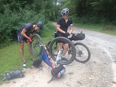
First, my Dad was in town, so we rode there together. I hadn't ridden with my Dad in a long time. He'd been riding a lot, but all of that he'd done in Dallas (TX), and there isn't too much climbing in Dallas. He wanted to ride, but I didn't want to punish him, so Allatoona seemed like a good choice.
It turned out to be, I think. He had no trouble with it, just ripped it all day.
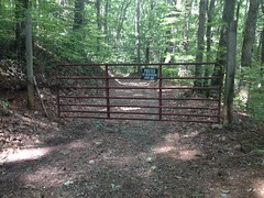
We couldn't ride Mumbo Jumbo though, that whole side was closed, and will be for the next two week while some water line work is being done, or something.
We could ride a new trail though, one that was built recently to the north, across that bridge that they build last year. It's not a bridge to nowhere any more.
I also showed my Dad where I crashed and cracked up my ribs. It looks so trivial to ride, even now. I know what I did wrong, but I just feel even that much dumber about it when I look at the trail.
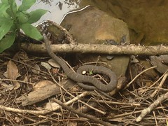
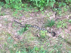
We saw a cool snake on Turtleback. I think it was a Black King Snake. Black Kings, Eastern Kings, and Pine Snakes all look kind of similar though. Some people say Pine Snakes are really just Eastern Kings. It struck me as a Black, but I'm not 100% sure. It didn't have the little triangly markings of an Eastern King. Anyway, when it saw us it got nervous and started shaking its tail like a rattlesnake. This actually made a bit of noise, rustling the grass and leaves it was lying on. I had no idea any snake shook its tail except for rattlesnakes. I wonder if maybe all snakes did way back, only a few still do, and rattlesnakes eventually developed the rattle. My Dad had recently read that some king snakes rattle their tails. It would seem so.
I had plenty of opportunity to take a photo, but sadly, it hadn't even occurred to me to bring my camera. I rarely do out there.
It's funny, this was only a week ago, but I remember it less clearly than the last 3.
When Billy and I most recently explored the upper Blood Mountain Wilderness, I was surprised when we didn't run into an old road leading south along upper Dick's Creek. The USGS map showed one. Long ago, I'd seen what I thought was the bottom of it. We did see an old overgrown thing that might have been it, but it didn't look like a good candidate. I figured I'd attack it from the bottom, and see what was what.
I parked at the switchback and got to it.
It appeared that FS34 itself used to continue directly up along Dick's Creek at some point. There was a weird fill there too. Rather than sidehilling into a little draw, whoever built the road filled the heck out of it. It wasn't rock-armored like the rest of the old railbed fills I'd seen in the area, but it did remind me of some of the fills I'd seen up on Pigeon Mountain for the light gauge ore rail they'd built up there way back. The only reason I puzzled about it at all is because I have this book that alleges that the Morse Brothers ran a rail up along Dick's Creek. One spur followed Blood Mountain Creek. Another followed Dick's Creek proper, presumably along the current corridor of FS34. Both of those had secondary spurs. I think I found the one leading along Blood Mountain Creek last time. It's not clear from the map in the book exactly how far up Dick's Creek proper the main line ran. That fill seemed to indicate that it went farther up than the switchback.
It was actually tricky getting on the old road/rail at all. There was a tangle of trails up there. One was the old road/rail, another led down to an old campsite. Another led along the little ridge in the area. There were several connecting it with the old road/rail. It was a mess. To make matters worse, there was apparently a trestle/bridge there at some point. It was long gone there was dense overgrowth to either side of where it must have been. Nobody seemed to go that way any more, and I wasn't looking forward to pushing through miles of completely abandoned railbed.
Fortunately I noticed where people do go now, and quickly found the trail I was looking for.
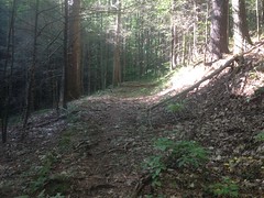
Looked like an old rail that had been converted to a road. The grade was really consistent, but it was wider than necessary for a railbed, and here and there it had rolling dips cut into it.
The hike up was pleasant. No brush to speak of. It was a popular route, as unpopular routes go.
There was one very odd feature though. Paralleling the length of the old road, there was an older-looking, narrower bench cut, directly above it. This little cut went into and out of every little draw, where fills had been built for road.
It reminded me of a similar thing that's visible along Hwy 52 coming down off of Fort Mtn toward Chattsworth. My best guess was that it was the original trail that had been built, or maybe just worn in, and for some reason, rather than build the rail/road directly on top of it, they cut in to the left of it. I'm not sure why they would have. There's a similar thing on the Dockery Lake trail, but it's only about 100 feet long. This one was like a half mile long or more.
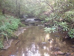
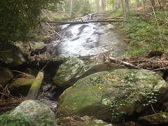
There were several little feeder streams too.
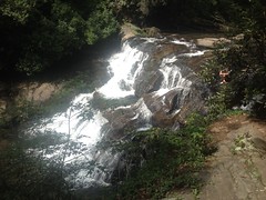
And when I followed the trail to its furthest extent, I ran into this waterfall-ish thing.
That would have been the end of the line for the rail. Unless there were some amazing set of trestle-switchbacks, there was no getting over that falls. There could be a skid up above it. There might have been a slide. I'll have to go look for that some day. At the time, I didn't feel like scrambling up over the falls.
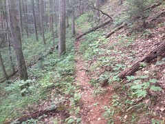
I'd seen a spur to the left earlier. Two, actually, and upper spur looked like the way people go these days.
That trail was a little weird too. The lower spur looked like it had been constructed with equipment. The upper spur looked like it had just been worn in over the years.
I couldn't imagine why at first, but I eventually saw that there was a big gap in the lower spur. It had either been washed out, or spanned by a trestle/bridge that had been washed out. The upper spur eventually joined the lower above the break.
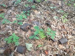
Way up, someone had dumped a bunch of old cans off to the side.
That's just what I could get a photo of. There were a lot more. Trash or artifact?
You decide.
I guess at some point, fairly recently, it was possible to get a vehicle up there. Though, it seemed more likely that whoever had driven out, had done so from the other side. I was in the general vicinity of Miller Gap. There are properties to the north even today. Maybe it was somebody's granddad.
The trail eventually got cleaner and cleaner, and I even started to hear voices. I wasn't going crazy. The AT was above me, and the old road had been converted to a camping spur. There were three older gentlemen settling in for the evening, and they were a little surprised to see me coming from that direction. There was a small maze of trails up there too, and it wasn't immediately obvious which was the AT. I actually had to ask a second group where it was.
Oh! Also, I got to talking with the first three guys and found out that they were super confused by the bear lines, so I showed them how to use them.
I took the AT north, expecting to have to hike to Jarrard Gap before dropping back in. I found another little spur leading down a few hundred yards up though, and it just put me back on the same trail I'd taken up.
Good enough.
The hike back was uneventful. No people, no wildlife, no trouble of any kind.
I still don't know why the map says that the trail along Dick's Creek tees into the trail coming down from Burnett Field Mountain, but those old quads have errors like that sometimes. This quad alone has several such errors. I guess I'll just have to do more some exploring to figure it out.
Actually, lets back up a bit from that even. Paulding Forest is basically right next door. I'd ridden the Silver Comet across it several times, and I'd ridden the PACO Mixed Loop with my brother, but otherwise I'd never given it that much thought. A few months ago this occurred to me, and I couldn't really justify why not. I pulled up some maps, studied them, and realized how much land is actually out there. It seemed ripe for exploration, but I knew that Dawson Forest had some odd rules. Specifically, in Dawson Forest, bikes and horses are only allowed on trails, and not on gravel roads. Vehicles are, but not bikes or horses. I knew that the Georgia Forestry Commission managed both lands, so the same rules might apply to both Forests. I didn't want to assume, so I emailed Tony Pope at the GFC. He was pretty sure that bikes were allowed on ungated roads (because they were county-maintained), but not on gated roads, but he recommended that I check with the DNR and let him know if they thought otherwise. So, I did that and the DNR rep said she believed bikes were allowed on any road, gated or not. So, I emailed Tony again, and he sorted it out with the DNR. I felt bad about creating all of that work for him, but he seemed grateful that I had uncovered the misunderstanding. Unfortunately for me, the correct understanding was Tony's. No bikes on gated roads.
Dangit!
But! There were still plenty of ungated roads. They crisscrossed the map left and right, and I wasted no time exploring and mapping them in my truck. After a couple of days of that, I had a loop worked out. Really, it wasn't much more than the PACO Mixed Loop with some extensions, but the extensions looked really promising.
That was months ago though. As quickly as I had put the route together, I sure took my time getting out there on the bike. Other things to do. Other places to be.
Finally, a few weeks back, I checked out the route.
I parked at the Rambo Trailhead on the Silver Comet, and headed west. It had been a while since I'd been out that way, and I'd forgotten about the high trestle out there.
It took longer than I remembered to get to the turn-off. I worried that I didn't have an accurate idea of the scale of the map, and thus the length of the route. The start was near Dallas, but the route would eventually take me way up by Cartersville. I'd done a road-ride like that once, and it was long. Almost 100 miles. This route was shorter than that, but I wasn't sure how much shorter. I'd done that other ride on the road bike too. This time I was on the mountain bike. Yeah, I wondered if I hadn't bitten off more than I could chew.
I did find the turn off though, at McPherson Church Road. That led to Johnny Monk Road.
From there, I rode north to High Shoals, Raccoon Creek, and Thomas Road.
Driving in the truck, I'd declared some of those roads to be gravel, but on the bike I realized that they had once been paved with asphalt, and had just deteriorated into a terribly rough state over the years. They were awash with top-off, but there was still a layer of asphalt deep underneath.
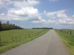
I'd gotten a reasonably early start and it had been reasonably cool, for a Georgia summer at least. High 80's. As the morning wore on though, it was getting warmer and warmer, and there were long stretches along Braswell Mountain Road and Hwy 61 with a lot of sun exposure. I was burning through my water ahead of schedule. I had identified a number of opportunities for resupply along the route though, and I was sure I'd hit one of them before I ran out. So, I didn't worry, and just pressed on.
On Lucas Road...
...I was passed by a couple in a BMW. Further on I found them stopped on the side of the road, consulting their GPS. It seemed they'd been told to go that way, but weren't too happy about the dirt and gravel. I passed them back and never saw them again.
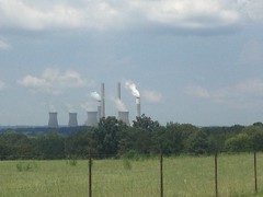
Lucas road crosses back and forth across a right-of-way, buzzing with high-tension wires leading directly to Plant Bowen. I could see it in the distance, and it grew each time I crossed the right-of-way again, but it seemed tiny and it just underscored how long the ride might actually be.
Further down the road, I came around a curve and I saw a woman standing on the opposite side, dressed in street clothes, with a phone in her hand, seemingly taking a selfie. I was confused at first. I saw no vehicle in her vicinity. There wasn't anything interesting in the background.
????
Well, my assumption about the selfie was actually wrong. These days, I apparently assume selfie when I see someone holding up a phone. She was actually filming something else. There was a vehicle, just up the road. A Jeep, in fact, driven by her girlfriends, excitedly, at high speed, toward a mud puddle on her side of the road. The puddle was deep, but it wasn't very wide, and only the passenger-side wheels actually ended up in the puddle. This, of course, yanked the jeep toward the edge of the road, directly at the lady with the phone. She managed to step out of the way, but it was pretty close.
I'm pretty sure the video was pretty amazing. I can only imagine how the expressions of the lady driving must have changed during the course of the stunt.
Woohoo! I shouted, and carried on.
Before long I was back on pavement.
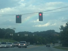
And eventually on Hwy 113.
Plant Bowen loomed in the distance, but that was as close as I got to it.
My water was running pretty low, so I stopped at the Dollar General along the highway there, grabbed a couple of 20oz Gatorades, and got back on the route.
The last time I was up that way, I'd ridden straight up Hwy 113, which wasn't that much fun. Since then I'd explored the side roads to the east, and figured out a way to connect them together and avoid the highway as much as possible.
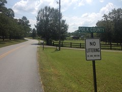
Unfortunately there's no dirt on those roads, but there was a county-line sprint:
(which, of course, I took)
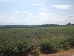
Field after field of cotton:
A Pizza Farm:
...and plenty of shade.
There was a bit of a kick leading into the community of Braswell, but aside from that, the roads rolled gently.
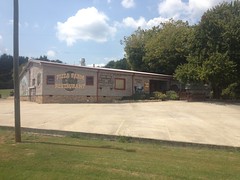
I'd burned through my first bottle already, and started into the second one. I hoped that the convenience store was open, but I was out of luck.
Yeah, it was a quiet afternoon in those parts. A police car sat outside of the local city-hall/police-station/catch-all-government-building. A lady was milling around the lot outside of her apartment building across the street. Nobody drove by.
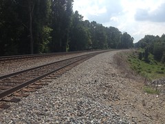
I took Skyline Drive past whatever the abandoned building down it is. The road quickly became dirt and gravel, crossed a neighborhood street and continued on to the railroad tracks that crossed the forest.
The same road picked up on the other side. They had clearly been connected in the past.
From there I took Brushy Mountain Road and Yorkville Pass into Yorkville proper. That's where I did most of my climbing, but it wasn't really all that much. The toughest part was the burning sun, and my dwindling supply of Gatorade.
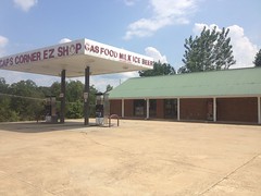
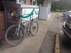
The Yorkville Market was nearby though.
And I'd barely run out when I arrived there.
My ride was mostly done, but I still had a few miles left on Goldmine Road and a mile or two back to the start along the Silver Comet. Two more Gatorades later, I was back on the bike.
I passed the old Jefferson Island store...
...and I crossed Hwy 278. I was surprised how good I still felt. I hadn't felt "strong" at any point, but I hadn't bonked, or cramped, or developed any particular pains. There had been a few times when my 30 tooth 1x11 was a little undergeared, but only a few, and only on the road.
Willow Springs led to McPherson Church, and that led back to the Comet. I pondered the idea of hitting the side trail, but I'd had a decently long day, and I didn't want to push my luck.
I still don't know how many miles it was, but it took about 5 and a half hours to ride. Except for the heat, it wasn't too tough. The mountain bike might have been unnecessary too. I suspect that I could have ridden it all on the road bike. Skyline road was the only sketchy part.
There are plenty more dirt roads to the south. I think that I can put together an even longer route. I might wait until it's a little cooler outside to ride it though.
This also happened a while back, like 3 weeks back...
It's been 4 years since I had anything to do with the TNGA. Four years is a long time. It's funny, for all of the scouting, group rides, thru-rides, and general organization, I only coordinated the actual event for 3 years. Derek has actually been handling it for longer than I did. When I turned it over, I was worried that it didn't have a critical mass, or that no one would be up to the challenge of stepping in and picking it up. I'm glad to see that I had no reason to be worried about either. In fact, in the intervening years, everything I had trouble with seemed to have been worked out.
It was quite a thing to see.
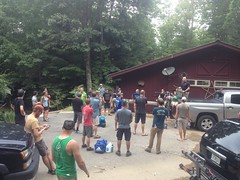
I drove up to Mulberry Gap Friday morning. Most of the riders had reservations there. The reservation got them a ride to the start, and a pick-up from the finish, or from wherever they called it quits. They had been arriving all morning, packing up, and getting ready.
I didn't have any of that to do though. I was just wanted to meet some people and watch the spectacle.
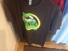
One part of the spectacle that I never expected: merchandise!
Ha! There's a shirt, that you can buy, that says TNGA on it.
The enterprising mind might think "whoooaaah, hold on, isn't there some kind of trademark infringement opportunity here?$$$$" But if a mind can just smile, mine did. This thing is for the community. It always has been. For the riders, the clubs, the shops, the stores, the lodging, the transportation, the organizers, the forest service... For everyone that makes it happen. It's not for me, or at least no more than for anyone else playing the roles I played. I don't feel like I have any more right to it than anyone else. I may love it a bit more than some though, especially after a few days on the trail :)
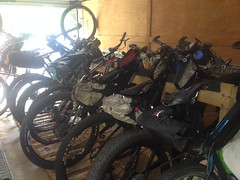
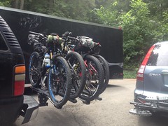
Another part of the spectacle was transport.
Andrew pulls a huge, enclosed trailer full of bikes and there are a couple of church vans involved too. Sadly, Rick Moon and his Cadillac limo seemed to be out of the picture. I guess that's progress though.
The thing that struck me the most was how relaxed everyone was. The way we used to do it, everyone would arrive on Friday, at all hours of the day and night. They'd eat at MGap and hit the hay for a few hours. At 3am I'd wake everyone up, we'd caravan to the start and get right to it.
Then somebody at MGap coordinated with a campground in SC to provide lodging the night before and a dining hall the morning of. They'd eat at MGap, hit the road mid-afternoon, stay in the cabins overnight, have an early breakfast, and take a short trip to the start.
In the intervening years, the time-to-leave MGap got pushed forward, and there's now a stop at a restaurant in Clayton halfway through the drive to SC.
The result is everyone arriving much earlier, even the night before, and getting everything loaded up at their leisure. There's no forcing yourself awake. No rushing around. No one is tired. It's as laid back as I could ever imagine.
In fact, most people were ready before noon, and just hung around talking for hours.
It was during all this that I met Derek Kozlowski for the first time, formally at least. When I handed this thing off, I basically asked Eddie O to see what he could do with it. I half-assumed he'd take it over himself, but what I didn't know it at the time was that he was getting out of the event business. He was actually planning on handing off the Fools Gold and Southern Cross that year; and those were events that people paid to ride. Koz found Eddie, or Eddie found Koz. I don't know the exact details, but it worked out really well. I talked to Derek a few times on the phone, but I hadn't actually shaken his hand until I saw him sitting on that tailgate, that morning.
We had a lot to talk about. Oh, man, so many stories. That's pretty much what everyone did, right up until it was time to go. Shake hands, hang out, and tell stories.
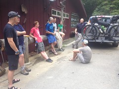
The pre-ride meeting was just more of that.
In the early years, we'd see many of the same riders each year. Probably half of the field had done it the year before, and a quarter the year before that. These days, it's the same distribution, but a whole new group of veterans have rotated in. I don't think anyone rode this year rode 4 years ago. Maybe a few, but very few. No one was around for the formative years. People wanted to hear about it. "During the first year, how long did you think it would take people to finish the route?" We didn't know. I guessed two-weeks or less, but I wasn't really sure it could be done at all. When I announced the event, no one had actually ever finished the route. Shey, Rob, and Jimbo, some of the hardest guys alive, at the time, had tried twice. I'd failed fewer than 100 miles in. It eventually took me, Johnny, and Norma 5 days and change. That seemed like a good average. Since then, I think only 2 people have taken longer than that to finish. Dozens, maybe over 100 have finished way faster. I'm still amazed how quickly people finish.
Everyone took off a little after 1 and I headed back home. I had a ton of work to do, but I'd be back up the next morning.
I set my alarm for 3AM and woke up spontaneously at 4. The heck? My phone was sitting on the Apple-reboot screen. It was warm to the touch. I was worried it was completely dead, but it wasn't. The cable had gone bad, sometime that night. Not only had the phone not been charging, somehow it had been discharging. If I positioned the cable just right, it would charge in the car, but it couldn't be positioned right with the wall charger.
I really hoped I'd have enough time to get to the start. It looked like we'd barely make it, like make it, or miss it by 1 minute. It didn't help that I needed gas. It also didn't help that I pulled into a gas station 5 minutes after they were supposed to be open, to find the attendant driving up a minute later yelling: "Them pumps ain't on!" It surely didn't help that the next available gas station was behind me, and their pump wouldn't work with debit, and my card apparently has the wrong zip code associated with it, so I can't use it as credit. And, beyond all of that, it didn't help that Sophie told me that she had to use the bathroom two minutes after we pulled away from that gas station!
It was as if God wanted us to be late.
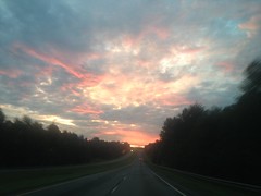
On the positive side, driving up 985 in the morning is consistently beautiful.
And, as luck would have it, we managed to get there with about 10 minutes to spare.
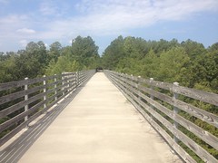
Sophie walked across the bridge into South Carolina to take some photos and videos of the people getting ready. I never got any of those from her though. Hmm... Maybe I should. I stayed on the Georgia side, perched on the guard rail to watch the start.
I used to just start everyone from the lot on the SC side. Koz lines them up on the actual border. Ha! I love it. I love all the little refinements like that.
And they're off!
Sophie got video too.
It was noticeably better than mine.
We hung around for a few minutes after the riders left. Joe Polk was hanging around too. I hadn't seen him in a few years either, and we caught up a bit.
Next stop though, Sarah's Creek. Me and Sophie drove up there and waited for the riders to start coming through. There was another guy up there too, with a cowbell. He was planning on watching all of the riders come through, then setting up camp and kicking back for a couple of days.
At that point the riders were starting to get spread out, so you'd see little groups come through every few minutes.
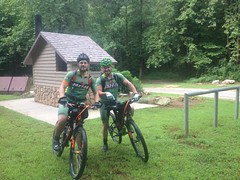
Glen and Justin were giving it a go this year.
Glen and I go way back. I rode for him for years, back in the BOR days. 24 HOA 2004/2006!
Justin is more of my brother's buddy, but I rode with him at Cochran Mill earlier this summer.
One rider had to stop and tighten his spokes.
...of all things!
I chatted up the camping guy too, told him the history of the event. He'd heard about it in Scott's book, and become enthused. He had literally hundreds of questions and seemed tickled that I had reasonably authoritative answers for them.
The gnats were merciless in the field there though, so we eventually headed out.
I don't remember if we got lunch on the road or later. I'm thinking pretty hard right now and it's not coming to me, so it must not have been that great.
What was great was relaxing on the couch back at Mulberry Gap. There was almost no one else around. I think there was one group up from Florida, and one random Georgia guy, and they were all out riding. Other than that, it was just Koz, his wife Libby, me and Sophie, the staff, and their small herd of dogs and cats. I crashed on one of the couches in the barn. Several dogs took it as permission to crash on the adjacent couches. One of the cats decided to climb all over me. At one point, it was just standing there with all four feet on my body, for like a minute. Sophie thought this was hilarious.
She and Libby ran around the property while I tried to get some rest. Sophie's been a regular up there since she was like 8 years old. She knows where everything is, and she knows what everything was, and how it's changed over the years. So, she was eager to show someone else around.
At the Koi Pond, she found a Banded Water Snake, so she came and got me so I could see it too.
Apparently that one in particular is a regular at the pond. He's recognizable by his damaged tail.
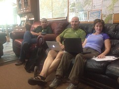
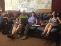
When I got back, Ginny, Koz and Libby were all up and about. We basically did this:
and this:
For the next 3 hours or so. By that, I mean, sat on the couch, checked the trackers from time to time, and swapped. For example: Ginny's apparently going to Japan soon, and she had to change all kinds of flight details to be able to get on the same flight as her daughter. I think it's her daughter. They originally had the two of them flying out of two different airports and it was a monumental effort to fix it.
Several hours later, Sophie and I decided to head back over to Helen to see if we could get some video of riders coming off of the Hickory Nut.
There was a Rainbow in the sky over Blue Ridge.
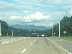
And we got a decent view of Brasstown Bald from Blairsville.
And we saw the race leader just as he pulled onto the pavement from the Hickory Nut. I managed to beat him down the road and get a video of him turning onto the highway.
We tried to find a good spot on the trail, but it's really, really overgrown to either side these days. There's a thin ribbon of singletrack through pretty dense brush. We walked a good quarter mile or more up the trail and it never got better. Several riders passed us, and we couldn't see or hear them coming long enough to set up, and they were gone in a flash. We ended up going back down to the intersection with the Smith Creek trail, and it worked out way better from there.
It started raining on us a few minutes later, and drizzled off and on for the next hour or more. It had been doing that all day, actually. It would be dry and sunny, then rain intensely for 2 minutes, stop for 5, drizzle for 2, stop for 10, drizzle again, and then completely dry up for an hour before starting the cycle over again.
It was getting dark too. Riders were starting to put their lights on. I imagine some riders had to face their worst nightmare: getting stuck on the Hickory Nut, in the dark, in the rain.
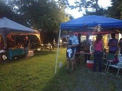
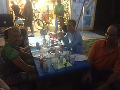
When it got sufficiently dark, we headed over to Woody's. There was a bit of a party going on when we got there.
His shop is right on the route, and a lot of riders get there late on the first day.
Many camp overnight, but many more rest up, resupply, take care of any mechanicals, and push on.
I ran into John Hightower again. He'd been at the start, and he rode out ahead of the riders. I saw him again at Sarah's Creek about a third of the way through his ride. He has some loop he likes to do up there. At Woody's he was dressed in street clothes. He was standing on his truck, trying to get cellular data working, when Woody's wife told us there was WiFi up by the house. No kidding, there was. So, we stood there in the pitch dark looking at Trackleaders on his phone until he'd figured out where the guy he was looking for was.
"Woody's wife" told me her name, but I'm super bad with names, and dangit, I've already forgotten it. I noticed a map of the Yonah Preserve Trails posted nearby though, and I had no idea what they were, so I asked her and she was very pleased to give me all of the details.
Eventually, I realized the property was the old YMCA property off Asbestos Road. Clark and Suzy had told me all about the trails way back. It looked like they had become a reality, or were steadily becoming a reality. It's funny, Helen is a mountain biking destination, but most people go there to ride gravel roads. The only singletrack in the National Forest is the Hickory Nut, which relatively few riders brave. Unicoi Park has a 5 mile loop, but it's a really strenuous ride. YPT looks like it's going to be what's becoming standard for a bike park: a stacked loop configuration with beginner, intermediate, and advanced loops. Nice. I'm looking forward to getting out there some day.
The night was wearing on, and it didn't look like Glen or Justin would arrive any time in the next 3 hours. We needed to get some dinner, and we eventually needed to get some sleep, so we headed out around 9 or so. The Nacoochee Tavern was still open, so we availed them of their hospitality. I had a cuban sandwich. Sophie ordered some kind of panini but only ate part of one bite. Turned out she'd had some pizza at Woody's and didn't realize she wasn't still hungry until she tried to eat her sandwich. Ha! Kids.
Actually, she had it the next day for lunch, so it worked out OK.
Quite a few people pulled out in Helen. It's a good spot to pull out, and these days someone associated with MGap gets a hotel room there, collects up the fallen riders, and gives them a ride back to MGap together. Another subtle but important improvement.
We watched the trackers for the next few days. I'm always impressed how strong and fast the riders are. Even the riders that bail early on their first attempt tend to get further than I did on my first attempt.
When did this happen? 1 month ago? "I remember it as though it were a meal ago..."
Billy called me up one Thursday evening, said he'd be in town that weekend, and wondered if I wanted to do some hiking with him. Of course I did! When he indicated that he had no particular destination in mind, I indicated the opposite, and though he didn't know it at the time, he might have preferred to have chosen himself. Billy is no fan of the slithery type, and as it turned out, where we were headed, they lay in wait, in abundance.
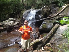
The family and I had recently Adventured the Chestatee WMA, in the general lower Blood Mountain Creek vicinity. On that day, we'd gone for a swim at Dick's Creek Falls, before exploring the general lower Blood Mountain Creek area.
I figured Billy might dig the falls, so we parked nearby and took a quick side trip down to it.
Of course, being appropriately dressed for it, I jumped off of the cliff of death and swam around in the pool for a while.
Billy wasn't interested in such shenanigans, and so we moved on quickly.
When the family and I had last been up that way, we declined the trail along Blood Mountain Creek itself because Kathryn isn't a big fan of treacherous scrambles. The girls and I however, had explored the trail years prior, and the waterfalls there were pretty amazing. I figured Billy would enjoy them, so we walked up the road a ways, and began the real hike there, near the confluence with Dick's Creek.
The "trail" that leads up along Blood Mountain Creek can barely be called that. "Scramble" is the word I prefer. I think the girls were 6 and 8 when we hiked it, and at the time I had good confidence in their ability to manage it, but looking at it again that day, I wasn't sure exactly how I had. It wasn't a problem for grown men, but it didn't exactly shout "bring your kids".
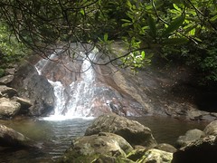
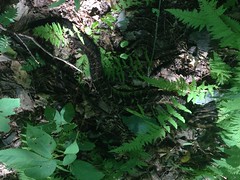
We managed it though, and the falls were just as I remembered them.
There are actually 4 cascades. The fourth is tough to get a photo of without spending more time than I wanted to. It was still early, but we had a long way to go, and I didn't want to dally about.
Above the last cascade, the trail kind of peters out. If you know what you're looking for, you can see where people usually go, where they get down to the creek, and where they usually cross. If you don't, you might just turn around, which is what it looked like most people did.
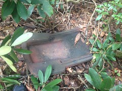
We found this weird cast-iron something-or-other up there.
There are meadows upstream, presumably once part of a farm or settlement of some kind. And logging was rampant in the area in the early 1900's. I imagined it was somehow associated with farming or logging, but I couldn't identify it, and its location was enigmatic. It was across the creek and up a hill from the nearest old road, so it wasn't likely dumped. It seemed too high up off of the creek to have been washed downstream. Part of an old still? Seemed unlikely. No idea.
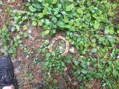
We bushwhacked a bit to the nearest road and proceeded north. Along that road we found a far less enigmatic artifact.
And confirmed my suspicion that the roads and trails my family and I had hiked the last time get a bit of horse traffic.
The northern-most meadow framed Blood Mountain nicely.
I had failed to get a photo of it the previous time, so I made sure to that time.
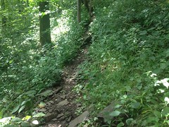
USGS Quads showed two trails in the vicinity, one of which led, allegedly, directly up along Blood Mountain Creek. The other led up some other creek that I don't remember the name of. We followed the first. It followed an old roadbed, and it was open and clear.
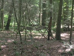
Across the creek to the right I spied the frame of an old shelter.
I've seen quite a few of those in the past few years.
I'd forgotten to fill my camelback at home, and it was getting a little low, so when the trail got close to the creek I took the opportunity to fill it up there.
Little did I know that the trail would get much, much closer later.
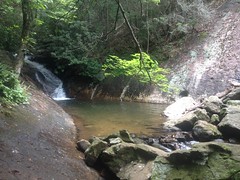
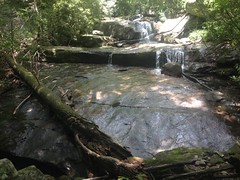
Before long it stopped at the foot of a small waterfall.
Samuel Thomas Yoder falls, I presumed.
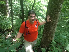
I tried to capture the scale by getting Billy to stand in front of it, but it didn't really work. The falls looks bigger than this in real life.
The old road stopped dead at the base of the falls. We scrambled up over it though, and, unexpectedly, found another old road directly above it. It started as abruptly as the other one had stopped. They were even aimed at each other. If they were connected at some point, then the bridge involved must have been quite a sight. I guess it's possible that the road was really an old railbed and a trestle climbed the falls. It didn't strike me as a rail though. Really, none of the roads in the area did.
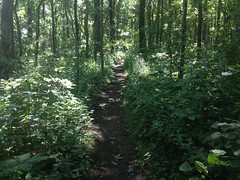
We followed the newly discovered road up and up. We were clearly not the only ones who had ever gone that way, but it was definitely the road less traveled. Eventually, it joined another old road, which led off in both directions, and appeared equally well traveled in both. I wondered if we'd missed a spur lower down. We certainly hadn't been climbing long enough to reach the end of the trail, as shown on the map. When in doubt, keep climbing.
We did.
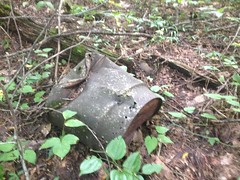
There was an old iron drum up there somewhere.
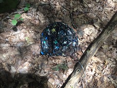
And, of course, a balloon.
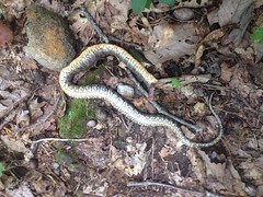
And we ran across a dead snake with no head at all.
I couldn't immediately identify it. Northern water snake? Banded water snake? Midland brown? It didn't strike me as any of these, and I'm still not sure.
But I was sure of this one!
Timber rattler!
Billy is terrified of snakes. He didn't mind the dead one, but he really didn't like this one. I had stepped directly over it without seeing it. It made me wonder how often that happens. We had been discussing snakes on the way up. Rattlers are dangerous, but they've always been rather docile in my experience, the one exception being the one I ran into on Tibbs, which was super pissed after John and Marc Hirsch nearly ran it over. This one was no exception, and I pointed it out to Billy.
He was having none of it though. The old roadbed was probably 12 feet wide, and the snake was all the way to the inside, but rather than just giving it about 9 feet of room, Billy walked down the slope under the trail and probably didn't come within 30 feet of it.
"There might be ANOTHER snake down there Billy!"
"Yeah, well, I know THAT one isn't down here!"
Ha! Good point, I guess.
According to the map, the old road should eventually tee into another old road, way up Blood Mountain, but lower down than the Freeman trail.
At a point, it was clear that the map was wrong. The trail kept going and going, and then it just ended abruptly. From a later look at the Lidar data of the area, it looks like it may have made a hard left across the stream, but there may have been a bridge involved at one point. Standing there, it wasn't clear. It looked like the very end.
We stopped there, sat down on some logs, and had a bite to eat. Bugs annoyed us persistently, but none of them bit. They just buzzed around incessantly. Actually, I did find a tick crawling on my ankle, but it wasn't biting me yet.
It was possible that the road we'd expected to tee into was still further uphill, or it was possible that it just didn't exist. I wasn't sure, but I was sure that the Freeman Trail was uphill, and we'd hit it eventually if we kept climbing.
And that, we did, not 100 more yards uphill.
The Freeman Trail led to the AT.
Which led to Jarrard Gap.
Jarrard Gap road was the road that we were supposed to have intersected earlier. I was really curious why we hadn't, so we followed it as far as we could.
Turned out that wasn't very far though. It becomes a private drive after a half mile or so.
That's a fairly unusual sight: an inholding, completely surrounded by Wilderness.
When we'd been at Jarrard Gap earlier, I'd done a little scouting run down a trail leading east. Later scrutiny of the same Lidar data that I mentioned before revealed that this trail would eventually become the old road shown on the map. Someone had apparently gotten it confused with Jarrard Gap Road way back.
Well, with that mystery solved, we had to decide how to get home. We'd seen a spur to the right a little ways back, which seemed to correspond to a line on the map. If it did, indeed, then it would eventually drop us onto FS34.
And that's exactly what it did.
There was supposed to be another spur leading off of it down around Dicks Creek, but the only spur we saw down there was older than the trail we were on, and much more overgrown, so we stayed on the most well-traveled path.
At FS34, we met a man and his wife hanging out on the tailgate of their truck, just enjoying being in the woods. The man was packing heat, so I was a little apprehensive about approaching them, but they were parked in the direction we wanted to go, and I really wanted to go that way. They were quite friendly, actually. I guess the heat wasn't meant for me. They had all kinds of questions for us. They'd seen where we'd come from and wanted to know what was up that way, specifically if you could get to the AT without too much trouble. There are actually 4 different directions you can go from that point. I'd been down two of them already, so I gave him the rundown. They had only explored a bit of one of the roads we'd been on earlier. They'd found the same trail along Blood Mountain Creek but hadn't followed it for any real distance.
We chatted them up for a while, but eventually had to keep moving. The trail we were interested in was another old road. When it ended, a rough trail continued, but even that petered out eventually and we found ourselves whacking down to Blood Mountain Creek, and then back up to the road we found that horseshoe on earlier. From there we headed south through several meadows, including the one that Kathryn and the kids and I had seen the bear in earlier this year.
There were no bear that day, but there was another Timber Rattler.
And Billy wasn't any happier about that one than he had been about the last.
I guess 3 snakes (one dead) doesn't really count as the "abundance" I mentioned earlier, but Billy isn't interested in running into any number of snakes greater than 0, so I'm sure in his mind, "abundance" seemed like the right word to use.
I saw 2 coyotes too, but they bolted before I could get a photo. Their coloration was amazing though. Some of their fur was almost blue.
We eventually took the old road down Crow Mountain, back to FS34, and that back to the car.
Actually, I went for another swim below the falls before we went. It was in the mid 90's and the water felt really good after the long day. The only trouble was that my body felt extra heavy after relaxing in the pool for so long, and the short trip back to the car from the falls felt a lot longer than it was.
In total, I think we walked about 15 miles, on every type of trail imaginable, and even some cross-country. We saw every kind of think I usually set out to see: woods, waterfalls, wildlife, and artifacts. I jumped off of a cliff, and swam in a river. It had been a long, fulfilling day, and wee were both pretty exhausted on the drive home. We may have grabbed some Zaxby's in Dawsonville, but I have no specific memory of it.
Yeahhh, Blood Mountain Wilderness! Great fun. And, there's still a good bit of it that I hadn't seen yet, so I was sure to be back soon.