Sunday, September 27, 2009

Bowmans Island

I spent all the day with the kids today. Early church service, lunch at Little Azio's, bike riding in the parking lot at a local bank, and some exploring in the Bowman's Island area.

On the east bank, there are some trails in the far northwest corner that we haven't been on yet. To get there by trail you have to go in a big U. It's like going from New York to Chicago through Atlanta. I've been wanting to do some bushwhacking out there. Today was a good opportunity.

We parked at the Island Ford Road trailhead, took the trail a few hundred yards and started heading downhill. Right away I saw a familiar sight. An old collapsed chimney. I think. Maybe.

 Ruins

Not much bushwhacking actually. The woods was pretty much wide open. Not much underbrush to speak of. My plan was to descend along a creek, explore the trails and follow the ridgeline back. Before long we were on the creek, finding cool stuff.

Bone.

 Bone

I'm not sure what these are. They were set down inside pits, which appeared to be dug to house them. That or they used to sit on flat ground and the hillside has eroded down and filled in around them. They looked kind of like drums, but they were made of flimsy material. I always think moonshine when I see something weird like this, but who knows.

 Drums

For a while there was plenty of flat to either side of the creek. We made good time there, but eventually it pinched and we had to tiptoe on exposed rocks. The girls were having a good time.

 Girls at the Creek

Sophie kept finding these little red bugs everywhere. I didn't see any until she finally pointed them out.

 Red Bugs

When we reached the trails we were looking for, we took a little break and pressed on. The topo map shows a trail leading down from Pass Road, bending north and leading up a ridgeline back toward Pannell Road. We'd been up the trail to Pass Road. It ends at private property. We took the trail toward Pannell Road. It became overgrown almost immediately, but a little trail led toward the river, past this oddity:

 Tombstone

A tombstone? Maybe, but it was all alone, and unmarked. The trail led to an old roadbed, which led down to the river and T'ed into a riverside trail. We explored up and down it for a while and spent some time down at the river itself.

 Girls Descending to River

 Chattahoochee

 Girls at the River

 Girls Ascending

The trail led south to Old Pass Road and north to the Laurel Ridge Trail. The recent rains had ravaged one of the little feeder creeks we crossed, leaving this cool little pool.

 Pool

At Laurel Ridge, we met a lady with a short, fat Black Lab. The girls are usually a little nervous around dogs they don't know, but not this one. It was walking slow and panting hard doing it. No threat. Very sweet though. We scratched it's head for a while.

On the way back we found this cool tree. 2 trees had grown together and eventually split back apart.

 Split Tree

Mission accomplished, time go head back home. We picked up the ridge south of the creek. Again, the woods was wide open. Very little brush. There was this enormous rock pile though.

 Huge Rock Pile

And somebody was getting artistic out there.

 Square

And then we made it into the dumping ground.

 El Camino

Iz named it Betty. Betty the El Camino. The presence of an actual car made me look hard for signs of an old road. I kind-of found one. Turns out it led right where we wanted to go. We lost and found it over and over all the way back to the main trail.

Some highlights...

Rock piles.

 Rock Piles 1

 Rock Piles 2

 Rock Piles 3

Some kind of fruit tree and the fruit it bears. Not sure what these are. They smelled like tiny little apples and had the same consitancy, but I didn't taste them.

 Fruit Tree

 Fruit

There was a whole house full of crap dumped out there along the road.

 Fridge and Washer

 Stove

There was also a dryer, a couple of toolboxes and ten thousand glass jars. Ugh.

Back on the main trail (Old Island Ford Road) we found some weird fruits about the size and color of a black cherry, but growing on a vine, individually, not in a bunch. They looked like grapes on the inside and smelled like them too. No idea. Maybe some kind of weird grape.

Right by the car I found this persimmon tree.

 Persimmon

Finally, one I can identify, but all of the fruits were either underripe or rotten. Oh well, there's a persimmon tree by my house and one behind the dumpster at my office. I'm not hurting for persimmons.

When we left the house, the girls didn't want to go, but we had a great time. No dead legs, no rain, no injuries. Just fun. I felt like a kid, playing in the woods. I hope we have more days like today.

Saturday, September 26, 2009

Tooni Mountain (Again)

The weatherman said it would rain all week, but it did not. It was sunny every day, except today. Today it stormed non-stop.

I had so much fun running around on Tooni Mountain last week, why not go for a repeat?

The drive in was rainy and foggy...

 Misty Mountains

...but Laurel Creek and the Toccoa weren't so high today.

Last week I found a couple of old roadbeds, with a million spurs left and right. Some were overgrown, but some were clearly travelled on a regular basis. Today I planned on exploring as many of them as I could.

Right off the bat I made some discoveries. Somebody rolled up a couple of old fences and dumped them, some time ago. One was partially unrolled across the trail and I got all tripped up in it. The fence was both square mesh and barbed wire. I was lucky I didn't get cut.

 Fence Pile

I found this old stovepipe too. At least I think it's a stovepipe. Maybe from a still?

 Stovepipe

I walked on ten billion trails. All old roadbeds, in various stages of being reclaimed. Some were clean, some were so overgrown all I could do was parallel them in the open woods.

It rained all day, sometimes torrentially. Last week my jacket performed poorly. I was far more comfortable just getting wet. This week I'd run by Dick's sporting goods on the way out of town and grabbed a couple of ponchos. One was a lightweight emergency poncho, the other was a Dry Ducks poncho. I tried on the Dry Ducks at the trailhead. While lightweight, it was ungainly. I can imagine using it on a wide open trail, but not on the kind of stuff I push through. The emergency poncho was much less restrictive, so I used it all day. I imagine it could keep you dry if you huddle near the ground and don't move, but not while hiking. Rain trickled in steadily and I was soaked almost immediately. I kept it on though. I'd put it on over my pack, hoping it would at least keep that dry. It did keep it from getting completely waterlogged, but I wouldn't call it dry. I'm going to try a trash compactor bag inside my pack next time. I think if it's warm outside, I'm just going to let myself get soaked. If it's cold, my jacket and pants are fine because I don't get soaked with sweat. But, I still don't have a good plan for when it's like 50 degrees outside.

But I digress...

The woods were dark and wet, but scenic.

 Wet Woods

At one very confusing intersection of trails I found this cable, half buried under deadfall. I've seen several of these, thrown to the side of old roads. Maybe back when the trails were passable roads, people had homes or hunting camps there and strung these up across the trail like a gate. Or maybe they're somehow associated with logging. Who knows.

 Cable

I saw very little wildlife today. There was this turtle though...

 Turtle

...and I saw a little tan mouse, who ran up a rhododendron branch and "hid" just above me. I tried super hard to take a photo of him, but I use my iPhone to take pics, and even though I keep it in an Otter Box, a tiny bit of water does get in sometimes, preventing the touch screen from working reliably. When I finally got it working, the mouse was gone.

This was on one of the last trails of the day, which was the most difficult rhodo-whack ever. I couldn't even parallel the trail, the entire hillside was covered. The trail ended in the most peculiar way. Usually old bench-cuts end with a little pile of dirt where the bulldozer just stopped and backed up. Sometimes, if the hillside flattens, they disappear into the flatness. Sometimes they turn directly up or downhill and disappear into the fall line, if it's shallow. This one turned downhill along a very steep, rocky fall line and proceeded for about 10 feet. Track-marks were clearly visible, but disappeared abruptly. I studied the area for quite a while. There was literally zero evidence of the trail beyond that point and the terrain was not the kind I've ever seen a trail disappear into. I suspect the bulldozer driver decided it was too steep and rocky and backed on up. But I half-imagined the dozer turning downhill, losing traction and tumbling into oblivion. Who knows. Unique though.

Nearby, I heard the sound of rushing water. At first I thought it was rain, but it wasn't rain.

 Cascade

Not exactly a waterfall, but close. I imagine if it had rained less today, it wouldn't have been worth a second look.

On the way back to my car I saw a dozen white tailed deer. They're everywhere right now, but in a couple of weeks they better watch out.

Monday, September 21, 2009

Tooni Mountain

It has rained literally every day of the past week, for most of the day. Sometimes hard, sometimes just a dribble, but it's been steady.

Sun equals biking. Rain equals hiking.

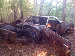
I'm still rocking the Grand Marquis. With all this rain, I needed a trailhead on pavement. Tooni Mountain has one. Let's try that.

I didn't feel like driving 2 hours up through Dahlonega and over Woody's, so I took Doublehead Gap Road, which does have an unpaved section, but it's short and well maintained. I figured I'd risk it.

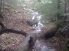
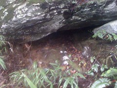
Laurel creek was high.

 Flood

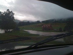
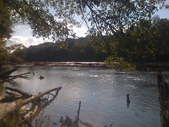
Fortunately not up to the main road though. The Toccoa was high too. It hadn't occured to me that there could be flooding. The rain hadn't been torrential, just steady. But I guess it fills up the river either way.

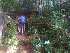
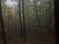
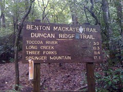
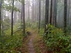
On the trail. The Benton MacKaye/Duncan Ridge Trail to be exact.

 Tooni Mountain Trailhead

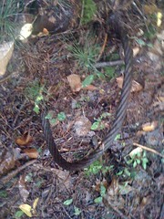
or crail as it were...

 Crail 1

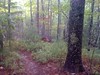
The initial climb was pretty steep, then it eased off and I wound around back and forth across the ridge.

 BMK Tooni 1

 BMK Tooni 2

 BMK Tooni 3

 BMK Tooni 4

The rain was light when I started, but it picked up before long. When it's cold, my jacket is great. When it's warm, I can be soaked with either rain or sweat, my choice. At first I chose sweat, but eventually I took it off and let the rain come down. I was wearing a brand new Craft Pro Cool sleeveless base layer, which turned out to be totally comfortable in the rain, unlike the button-up shirts I usually wear. Awesome.

I'd seen several side trails, none too interesting, but toward the southern end of the mountain, I had to get around a fallen tree and found a very well-worn trail leading east along an old roadbed. The Benton MacKaye went west, but for a minute I wasn't sure which way to go. I'll have to come back for that one, today I wanted to see the Toccoa River and the suspension bridge. Side trails will have to wait.

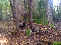
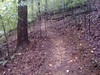
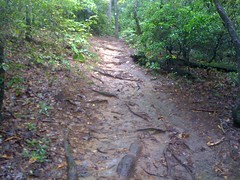
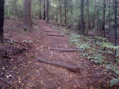
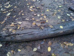
More crail action. Reminds me of the Ivestor Gap trail when my bro and I hiked the Art Loeb.

 Crail 2

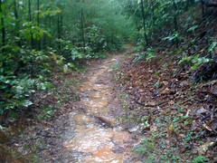
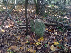
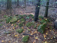
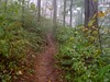
It has been argued, with vigour, to my face, that a hiking trail can be placed anywhere, as foot travel is incapable of causing wear, only bikes and horses wear trails. I guess those folks don't get out much. For example...

 Rooty

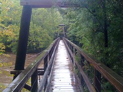
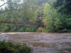
Ahh, the Toccoa Suspension Bridge!

 Toccoa Suspension Bridge 1

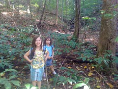
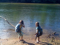
Last time I was here was with the girls. Probably last year, but it seems like so long ago.

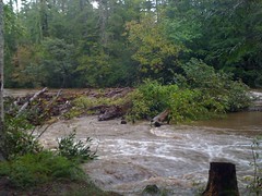
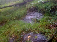
On that day, we walked out on the rocks and played in the water. Not today. The rain had all but stopped, but the river was absolutely raging.

 Raging Toccoa 1

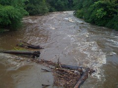
Even the little feeder creek that you cross on the south side to get to the camp sites was raging.

 Small Falls

The bridge from the south side.

 Toccoa Suspension Bridge 2

Crossing the bridge, I wondered how it was built. More specifically, how the materials were transported to the site. On the north side, the Benton MacKaye didn't follow an old roadbed. They could have carried in the cables and wood by hand I guess, but the towers were single timbers. No way they could have been brought in on the trails. Maybe they were cut from trees on the banks. The huge concrete pylons though, did they carry in all that concrete? Maybe there were old roads leading in that I didn't know about. That was now my mission. If they were there, I would discover them.

On the south side, an old roadbed led south and the Benton MacKaye eased off to the right. Ah, ha. The road must lead out to FS333 and they must have brought everything in by truck on that road. I figured I'd take the BMK out to 333 and loop back on that road. Looking at my map, I had a good idea where it would tee in.

The BMK led up a fairly steep hill, turned staircase.

 BMK Near Bridge

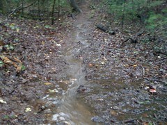
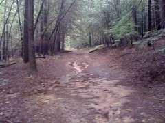
Here's another good example of why rolling dips are better than water bars. The left side of this one is completely back-filled. It would need frequent maintenance to keep it clear, unlike a dip.

 Overtopped Water Bar

If I'd been here an hour earlier I could have taken a photo of water pouring over it. Every single bar on the entire hill was either back-filled or water was running around one end or the other.

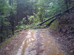
I took a left on 333. It's funny how hard gravel feels when you've been walking on dirt for a while. There was a tree down.

 Tree Down on 330

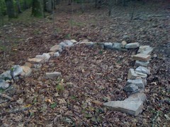
I took the first left. The map shows it leading all the way down to the river, but pretty far upstream of the bridge. I figured a side-road must split off of it somewhere. As it turned out, I was right. There was a gated road, but there was also a large flat camping area next to it. You could drive an 18-wheeler around the gate if you wanted to. The road was pretty rough though.

 South Bridge Access Road

The old road led right down to the river. Mystery solved. Or at least part of it. How'd they get the stuff down to the north side? Did they cross the river, or was there another road over there.

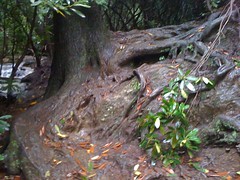
Next to one of the support pylons, there was this big rock ledge and a hemlock tree twisted it's big gnarly roots all over it. Without something for scale, it looks less impressive here than in person though.

 Gnarly Roots

Crossing back over the brige, I noticed a plaque.

 Bridge Plaque

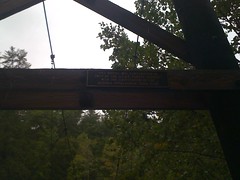
Built in '77. Also interesting.

The first time I saw the bridge, me and the girls parked at the end of FS816 and walked out on what looked like "Old 816" before it joined the BMK. But it joined at an odd intersection, with a trail leading east. I hiked back to that intersection and took that trail. It was, in fact, an old road, and led directly to a large camp site on the river. An impressive log jam had built up just offshore, and right when I got there, a bunch of logs came slamming into it from upstream. It sounded unreal. Like a house collapsing or something. Some of the logs kept going, but some got added to the jam.

 Log Jam

The campside was a bit upstream from the bridge, but another roadbed led directly over to the northern base. Ok, now the mystery was totally solved. It must have been an impressive sight when they brought in the timbers for those towers. Maybe there are photos of that. Seems like the kind of thing that might be documented somewhere. Hmmm.

Moving on...

I hiked back north on the BMK, took a couple of side trails, ended up back on FS816.

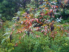
There was some sumac growing on the side of the road. Usually a treat, but too late in the season now.

 Sumac

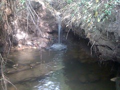
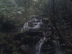
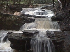
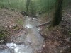
I took a spur of 816 east, hoping it would lead back up to the BMK. It turned out to be part of a network of old logging skidways. I poked around on them for a while. At the end of one the sound of rushing water got my attention.

I imagine it's usually just a trickle, but today, it was a full on, with cascades and pools every 20 feet.

 Tooni Cascade 1

 Tooni Cascade 2

 Tooni Pools

 Tooni Cascade 3

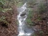
I followed it upstream for a while. Later realizing that following it downstream may have led to a falls, but at that point I was already committed. The drips from a wide ridge of rock appeared at first to be the source...

 Drips

but once I got above the ridge, there was more. A spring?

 Water Tunnel

...no, further uphill, the stream went underground and just emerged there. I kept climbing and ran into a trail before finding the source. The trail led to the BMK, and to a bunch of other trails. Part of another logging network, or maybe part of the same one I was on earlier. These trails were much cleaner than the others though.

Maybe even used by some ridge runners way back...

 Jug Handle

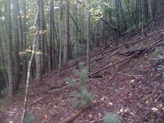
It seems that when a road is abandoned, light reaches the ground and thick brush grows up quickly. Later a dense tangle of saplings crowd out the brush. At that point, unless a trail has been kept through it, the road is all but impassible. The saplings grow up though, crowding each other out. Some grow tall, others fall and eventually decay. At that point, very little light reached the ground. The brush is gone, the small trees are gone, and the old road is once again passable, as a trail. This section of the old road appears to be in between the last 2 stages. There were small trees down all over it; brittle, virtually explosive.

 Downed Trees

I followed the network of trails north, hoping to tee back into the BMK. But no luck. Eventually the trail I was on led off into a flat area and got swallowed up by the duff.

The woods was wide open though. I could see a long way in any direction and there was very little ground cover.

 Open Woods

I needed to go west to get to FS816. It was starting to get too dark for comfort. With all of this open woods, west would be the one direction that was kind of blocked, so I went northwest. The car was actually pretty well due north anyway. Eventually I ran into some more old trails, followed them out to 816 and took 816 back to the car.

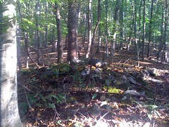
Tooni Mountain was pretty cool, despite not finding anything worthy of becoming a point-of-interest on my map. I'll definitely come back. Maybe next time the weather will be better.