So, I happened upon the Rockdale River Trail while exploring South Rockdale Park, but I didn't have time to ride very much of it. In fact, most of what I rode was just going the wrong way, looking for the park's Expert Trails. The PATH map made it look pretty long, so when I got home, I looked it up to see just how long. It looked like, with spurs and what-not, I might be able to get in 30 miles or more without re-riding parts of Arabia Mountain that I'd already ridden. I was intrigued, and it had been a long time since I'd cranked out miles on a greenway, so the next day I headed back to check it out.
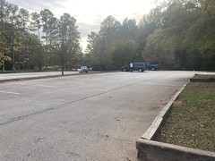
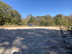
I parked at the same park that I'd parked at the day before, got my stuff together, and got changed.
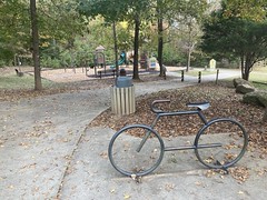
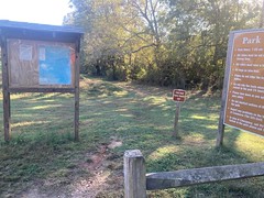
As I was walking back from the pavilion, 2 girls who had been playing on the playground, ran past me toward the bathrooms. Their mom was sitting at a picnic table right next to the playground and turned around to look at something behind her the exact second that the kids took off full speed away from her. She couldn't have been turned around for more than 3 or 4 seconds, but when she turned back, they were out of sight. She happened to look right first, and during the time it took to do that, the kids (who had run to her left) had both gone into separate bathrooms. From her perspective, she turned around, turned back, and they were gone. She never panicked, but I could hear the growing concern in her voice as she called for them. It, quite reasonably, occurred to her to look for them in the playground equipment, and then in the woods behind it. It did not, again, quite reasonably, occur to her that they might be 100 yards away in the other direction. I happened to have seen where the kids had gone, and told her as soon as I was within earshot. By then, they'd come back out of the bathrooms, and were running around behind them, even further obscured from her. She corralled them pretty quickly once she knew where they were. But, had they gotten into the woods over there, maybe after noticing the Boy Scout shelters, it would have taken a very long time to find them, assuming they even stayed put. I watched a bunch of "impossible" missing persons cases on youtube a few months ago, many involving kids, who disappeared just as quickly. Having raised kids, and spent a lot of time in the woods, many of the cases didn't seem so logic-defying to me. I had ideas about what might have happened, but they were just ideas. Theories. It was wild to watch kids virtually disappear in a matter of seconds, in real time.
She interrogated them a bit on the way back and we joked about it a bit. It turned out they were playing "Maya and the Three" (a netflix cartoon), were acting out some scene from it, and had just forgotte that they weren't supposed to leave the playground.
Kids!
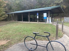
All that happend while I was unloading my bike and getting ready to go. I took a quick photo of the PATH Trails Map.
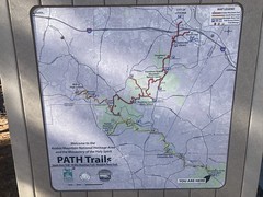
...just in case. And got to it.
I headed east first, which ended up taking me a bit south as well. The near end of the trail was in that direction. I passed through Lorraine Park...

...and after a while entered the property of the Monastery of the Holy Spirit. There were various wide, well groomed side trails, but there were also signs saying to stay on the paved trail, so I stayed on the paved trail, and eventually made it to the Monastery itself.

It was, indeed the end of the line. No trail continued on from there.
There was a nice gravel parking lot though, with a bunch of cars in it. I was curious, but I couldn't see the monastery itself very well from the lot, just the tops of a few buildings. There was a gate too, so my curiosity would have to wait.
Back the other way, I passed through the park again. And rolled through the parking lot to get GPS data for it. An older couple was sitting in in the lot, in their truck, engine off, windows down, smoking weed. Since about 2018, it's pretty rare that I go on a ride where I don't run into somebody smoking weed, either while driving, or at least while about to drive. I'm not sure what the exact laws are these days, and I think they vary between city, county, state, and federal, but I'm pretty sure you're not supposed to be high while driving. IDK though, it may not actually be that serious of a crime. Maybe all you get is a ticket unless you can't pass a sobriety test. Maybe not even that. No idea, but openly smoking, behind the wheel, still strikes me as odd, every time.
It didn't take long to get back to my truck, and then not much longer after that to get as far north as I'd yet been.
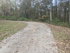
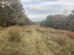
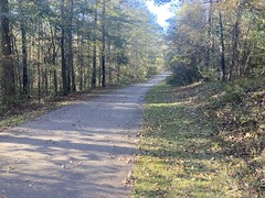
Just beyond that, there was a weird section that was actually legal to drive on. It looked just like the rest of the trail:

But there were driveways off of it. I guess it was a neighborhood road, but it was narrow like a typical greenway.
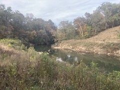
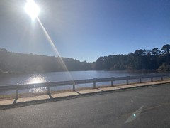
Further north, the trail crossed Alexander Lake.
Or, I guess, technically it crossed the dam between the two Alexander Lakes.
A spur to the left went around one of the lakes, but I figured I'd hit that on the way back, and just kept straight.
A little north of the lakes, I noticed an old chimney just off of the trail.
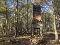
There was a bit of a trail leading to it, but I still had to walk a bit.
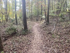
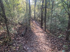
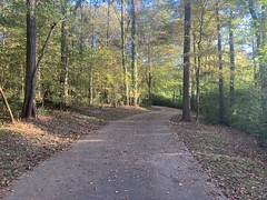
The trail was surprisingly hilly. I'd kind-of remembered the Arabia Mountain Trail being pretty hilly, but I wasn't sure if I'd remembered it correctly or not. I definitely had. For being a "greenway" type trail, you really had to work.
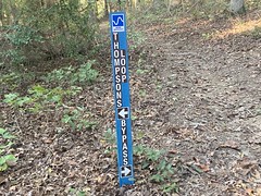
My plan was to head north to the Arabia Mountain Trail, then turn around and head back, taking two spurs west on my way back, the first being the South River Trail, and the second being I guess just an unnamed spur of the Rockdale River Trail that wound around the Panola Mountain area.
I ended up getting to the Arabia Mountain trail pretty quickly. I was on the mountain bike, loaded with BP gear, as usual, but I was still making really good time. I wasn't really sure how long the spurs were, and I was too lazy to pull out my phone and look, so I wondered if I shouldn't keep going for a while to make sure I got my drive-over's worth. I eventually decided to stick to the original plan, and that turned out to be the right move.
Back at it, heading south!
I'd passed an old farm on the way out, and now that I was headed back, figured I should take a few photos.


1821, eh? Exactly 200 years old this year.
Right past the farm, I picked up the South River Trail and took it way out west. There was a pretty good climb in the first little bit of it, and a guy on a fixie managed to almost catch me. He blew up a few minutes later though, and fell back so far that I didn't see him again heading that way. It made me wonder if he'd been chasing me for a while. I only noticed him when he got close enough to hear him. It'd be cool if he'd been pulling me down for like 5 minutes or something. Almost got me!
Out, a little past halfway, on that spur, there's another parking lot, and you can get a decent view of Panola Shoals from the trail.
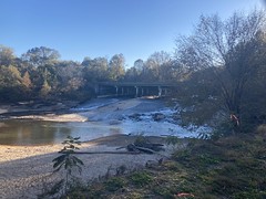
I say "decent" instead of "good" because there's a chain link fence up between the trail and the river, with signs saying that access to the shoals is closed indefinitely due to safety issues. They didn't elaborate beyond that, so it made me wonder if there was an erosion problem, or recent rain, or too many people mobbing the beach, or people getting too crazy sliding down the rocks, or what. Closed or not, the beach was as full of footprints as it could be. There wasn't an inch of it that someone hadn't walked on, recently. There was even a guy down near the water throwing a stick with his dog. It turned out, that if you followed the fence toward the highway, there was eventually an open spot in it (like intentionally open, not just where someone had torn through it) and a sign indicating that you could go in there, but to use caution or something like that.
It struck me as quite a mixed message, but I didn't really read the second sign carefully, so maybe it was less mixed than I'm thinking it was.
The far end of the trail led into the back of MLK High School.

To get to the road from there, you ride right down the bus lane. There's no other way out.
The school was named MLK High School, not Dr. MLK Jr. High School, and as I passed the front there, I wondered if maybe it was intended to honor MLK Senior. I mean, he was also from Georgia, and active in Civil Rights. Maybe?
Seeing the big letters made me want to pronounce them, like M(i)LK, and that reminded me of something from my own high school days. My brother had gotten U2's "The Unforgettable Fire" album, which has a song called MLK. But the name of the song was written in small letters on the back of the cassette insert, and at first glance, he thought it said MILK, which he thought was funny. Why would there be a song called "Milk"? And why was it all capitalized? Then he figured it out, but still called the song M(i)LK afterwards to joke about his original misunderstanding. This led us to generally prouncing MLK when we'd see it, with a very minimized i. Like "Hey, we get M(i)LK day off of school next week!" and "We're turning onto M(i)LK Drive." Which was funny to us and to our buddy Hans who also knew the origin of it, but we'd get weird looks from other friends, and have to explain the whole thing. People thought we didn't know that MLK was an abbreviation, or that we didn't know who MLK was, or that we did but didn't realize that the abbreviation referred to him, or even that we were being intentionally disrespectful... No, we were just kids being silly with pronouncable abbreviations, but we did stop doing it in front of other people pretty quickly.
That was the end of the South River Trail, so I headed back.
It's definitely fall, but fall comes kind of slowly in the Atlanta Metro Area. Slowly at first, then it's REALLY fall for like a week and a half, with all the amazing leaves, then it's like a less cold winter for the rest. It was still trying to slowly be fall that day. A little bit of color. Some leaves on the ground. Nothing spectacular yet though.
On the way back, just past the old chimney, there was an old barn.
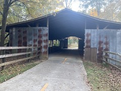
The trail led directly though it, and it was surprisingly cold inside. "It's that time of year."
The trail itself went up over Panola Mountain, and as such, was a good, steady climb. At the top, there was a spur that led to an overlook, but it was off limits to bikes. I might have walked my bike out to it, but it looked like it was half a mile long, and there were a lot of people. I figured I'd come back and walk it some other day.
At the Panola Mountain Lot, the trail actually kept going. The PATH map didn't show this, but there it was. I had a sense that there might be more trail because on the drive in, I'd seen where it crosssed the road, and not yet seen that in real life. Interesting! There were mile markers too, and it looked like the next trailhead was like 4 miles away. So, at least 8 more miles out and back, and who knows how much further it goes from there. Hmmm!
As it turned out, I did not have time to explore. It was wise, in fact, that I hadn't taken myself up on the urge to ride some of Arabia Mountain. It was getting late, and worse, just starting to get cold.
On the way back, a guy on a road bike passed me, but I passed him back as we climbed Panola Mountain, dropped him, and never saw him again, even crusing down the other side. Ha ha! It's been a while since I dropped anyone on a road bike.
Near that barn, you can take a right and go around the west side of Alexander Lake, so I did that.

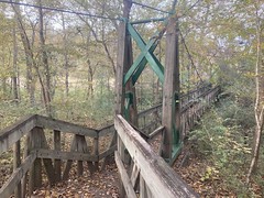
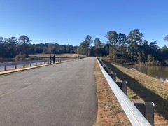
There was a long bit of boardwalk down on that end.

As I approached the park, the sun was down behind the trees and it was legitimately frosty. It had been in the 70's when I started, and warm in the sun. I want to say that was the first ride where I really noticed it getting cool while I was out. One of the first, at least. Every year it happens, yet every year it seems so foreign.
The last mile or two into the park is a long tempo climb - shallow enough that you're motivated to keep speed, but steep enough that you feel it. At the time, I couldn't remember the last good tempo climb I'd done. There are plenty around, but I hadn't been on the road bike in a while, and the loaded mountain bike doesn't climb as well. I realized that I missed tempo climbs.
And, done!
Rockdale River Trail! 40-odd miles, it turned out. More than I thought it would be.
I have no memory of the drive home, or dinner, so they must have been uneventful.
As greenways go, the trail is pretty awesome. It's surprisingly hilly and twisty, and there are plenty of interesting things to see. It's not just anonymous pavement in the woods like greenways can sometimes be. I'm really interested in finding out where it goes past the Panola Mountain lot. It would be funny if it connected all the way back into Atlanta or something.