Monday, February 27, 2017

Bear Creek/Pinhoti

Ok, FINALLY I got in some miles on the bike.

I managed to get in two mid-week rides on the road bike, after replacing the big ring. It was worn out so I got another one a week or so back, but good luck finding a 9-speed chainring anywhere. The 10/11-speed that I could find just wouldn't work. I ended up pulling the old chainring off of the hulk of my brother's old Cannondale. It was worn, but not nearly as worn as the one I replaced.

After getting in those mid-week miles, I felt OK on Saturday so Sunday I figured I'd rede at Bear Creek with the frere and Mark Baldwin.

Whoo!! No good. I woke up with a sore throat and it never improved all day. I'm not sure if I was sick or if it's just pear/cherry allergies, but damn, it was no good.

I felt absolutely terribly climbing Bear Creek. The guys had to wait for me a few times.

The only time I had time or energy to take a photo was at the Bear Creek Overlook.

Bear Creek Overlook

Tearing back down Bear Creek was great except that I dropped my chain twice. Damnit, the clutch was off, apparently. Did I bump it? Did it flop into the off-position on it's own? I'm still not used to having to check that.

I felt a bit better on P1 but I had to stop to pee and I fell off a bit even before stopping. It looked like someone had done some work on the switchbacks out there fairly recently. They felt really nice.

I had trouble shredding though. The frere would just roll away from me. Too much hiking and too many road miles I guess.

Ugh.

P2 wasn't much better. I fell off and never caught. The guys had to wait for me at the entrance to the singletrack. I did manage to hang on all the way down P2 except that we caught a guy who'd gone in ahead of us and it took a while to get by him.

Oddly, enough, I was feeling pretty good at that point, and I was able to push as hard as I wanted over Painter Gap on Shakerag Road. It seemed like my cardio was just starting to get going, right as the rest of me was getting tired.

Awful.

We grabbed some lunch at Pizza King, which I'd only been to once before, like 15 years ago. Kaylee and Wren met us and it was really fun to watch Mark and Wren together. I've known him for so long, but I'd never really seen him be a dad. Ha! Good stuff. Made me smile.

Goodness, what a day. I hope it was just a bad day. Whether it was or not, I know what I need to do: 120 on the road during the week, or the off-road equivalent. 30-50 off road on the weekend. Family-type hike/ride on the other day of the weekend. Get to it Dave. It's tough to fit that into my work schedule though. I guess, in general, these days, it's tough to make financial, family, and fitness ends all meet.

Alec Branch Cove

A little over a week ago I finally got my bike out of the shop but it rained and rained and by Saturday morning it was still wet and cold, and though I've ridden in those conditions before, I really didn't feel like doing it that day. There was still a short little chunk of the Randa-to-Stock-Hill route that I hadn't yet explored too, so I ended up doing that (again) instead of riding.

I parked off of FS58E and began the semi-tedious march up it.

All the ruts in the road were filled with water, frog eggs, and, this week, with tadpoles.

Tadpoles

In antiquity, a road dove down from Watkins Branch Gap, along Watkins Branch itself, sidehilled over to the gap between Alec Mountain and Big John Dick Mountain, then dove down along one of the branches, or maybe along some little spur, down into the cove cut by Alec Branch, eventually becoming modern day Angel Drive. Modern FS58E starts at FS58, sidehills up along the south face of Alec Mountain, tees into that old road, follows it for a while, then eventually wanders off to the north on its own. I didn't know exactly where it began wandering off though, and the last time I was up there, I saw several old roads leading down into the cove. I had no idea which was the right one to take, and the old map I had that showed the route wasn't super accurate.

It might be a bit of a challenge.

To make matters worse, I'd forgotten to print out a map of the area before I left home that morning. I didn't realized this though, until I was about an hour away from the house. If I'd gone back and printed a map, there wouldn't be enough time left in the day to get back up into the woods. I reasoned that I knew the area well enough to do what I wanted to do though, and though the map would be helpful, I didn't really need it. I guess I'd see if I was right or not.

I made it up to the gap in good time, and soon discovered the day's mylar ballon, lying in the middle of the road.

Mylar Balloon

There was no shortage of old roads leading down into the cove. I quickly discovered at least 7, many of which appeared to predate FSS8E, as they came up from below the road and appeared to continue up the mountain above it, but the intersection had been obliterated when FS58E was built.

Any one of those old roads could be the one I was looking for. There was just no telling. I eventually made it out to a campsite that I knew was relatively close to the modern end of the road. The last time I was there (like 10+ years earlier) it looked like maybe a trail led down the spur past the campsite. I was on my bike at the time though, and the trail didn't look too bike-friendly. I knew for sure that the trail I was looking for either led down that spur, or was one of the old roads south of it, so I eventually decided to follow the spur down to Alec Branch, follow that as far downstream as I could, and then try to figure out which of the old roads leading back up the branch looked like the right one.

There was, in fact, an old road leading down the spur. I knew right away it wasn't the one I was looking for though. I didn't have the right character. Given the pitch of the slope, the old roadbed ought to have been cut deep below grade by teams of horses struggling to pull laden wagons uphill. There ought to be piles of small boulders to either side, removed from the road as they were exposed and eventually became too difficult to climb over. No, this particular trail looked like nothing of the sort. In fact, I wasn't sure it was a old "road" at all. It was basically just a series of humps and dips with less woods between them than to either side. It may well have once been a firebreak.

I found the disarticulated skeleton of what I guess is a coyote or maybe just a dog somewhere in there.

Skull

And I was sure that I was going the right way, or at least going the way that someone else used to, because the length of whatever I was following was marked with old orange ribbons.

Ribbon

The ribbons looked pretty old though and whoever once followed them didn't seem to do so much any more, except maybe on foot. There was a bit more undisturbed deadfall than you'd typically see on a horse trail, ATV, or bike trail.

Toward the bottom end, it started looking more and more like a road than a firebreak. It was a bit below grade, and there was a worn-out and abandoned former-route off to the left. So weird.

The orange ribbons appeared to end there too, at first, but looking carefully I could see one about 100 yards ahead of me, directly through the woods. If there had been a trail from where I stood to that ribbon, I couldn't discern it. But, I was down in the flats at that point, and trails come and go quickly in places like that.

I appeared to have teed into some other trail which led north and south. To the north, it led up along what I assumed to be Alec Branch proper. I followed it south and it crossed some little feeder creek before depositing me in the middle of one of the most enigmatic places I'd ever been in the national forest.

There were random piles of dirt everywhere. Different shapes and sizes. Some partially buried trees. Others had trees growing out of them. Many were partially eroded. Others were covered in grass. There were cables and barrels buried all over. Some partially exposed.

Cable and Barrel

A road appeared to generally lead north-south through all of it. The trail I'd come in on appeared to predate the piles, but also appeared to have been "recovered" after them.

The piles appeared to extend up the adjacent hillside as well. They weren't just down there to either side of the road. Were they mine tailings? If so, I couldn't find the hole they could have come out of. Maybe they were excavated further downstream and dumped there because it was "back in the woods". But why would they have dumped them up the hillside too? The cables and barrels suggested logging, but I'd never seen that much dirt piled up in association with a logging effort.

I puzzled over it for a while, and really wanted to explore the area to try to make some sense of it, but I had other objectives and I didn't want to get stuck out in the dark, so I followed the old road downstream.

I could tell right away that it too wasn't the road I was looking for. It felt very modern - a neat sidehill. No, the road I was looking for must be off to the north, somewhere down in those flats closer to the creek. Pondering that, I wondered if I'd be able to find it at all.

As I pushed downstream, up the hill to my left, I noticed a bunch of rock piles.

Alec Branch Rock Piles

Clearly man-made. Some of the piles lined up with other piles, but some of them didn't line up with anything. If they were the footings for a structure, it was a very large structure. And I couldn't imagine what someone would have built right there, at that particular spot.

No idea.

Further on I discovered the NF's most well marked property boundary.

Well Marked Boundary Even More Well Marked Boundary

Ha! They used the lid of the paint can as part of a the painted pile surrounding one of the boundary markers.

Paint Can Lid

I'd once discovered an old red paint can up on East Mountaintown, with no lid. Now I've found a lid with no can.

As well-marked as the boundary was intended to be, since it was kind-of a corner, it was still a little difficult to figure out which side I was supposed to be on. After figuring that out, I felt kind of silly that it hadn't been obvious, but I'm telling you, go down there and look, and you'll see what I mean. I'll bet it will be equally confusing to you.

I pushed downstream from there and the road I was on got a lot clearer. There was also a former-route below it with all the character I'd expect from a 150+ year old main-road. Hmm... I might have found what I was looking for. It diverged from the road I was on though, which got even clearer and more well-travelled the further down it I went.

That is, until a point, where it abruptly became a solid wall of saplings. A bit of singletrack led around them to the left, but something caught my eye to the right, and I didn't follow the trail.

Through the woods, I could clearly make out this old rock wall.

Old Angel Drive Rock Wall

It turned out to be the southern border of the old road I'd been looking for.

As I mentioned before, it's not uncommon to find rocks semi-piled up on either side of an old road, dug out of the same as they became to difficult to get over. In this case, this had been done to such an extent that it had formed a wall. There was a bit of a wall on the other side, too, but it was much more pronounced on the south side.

I could see an open field and a structure of some kind to the north. I could see a line of red-blazed trees following just to the north of the old road too.

I followed the old road west until It became rhododendron hell. Underfoot it was nothing but little boulders and a small amount of dirt clinging to them. It was easy to see why the wall had formed. There were plenty of rocks to build it.

It looked like if I pushed through the hell, I'd end up in the same field I could see to the north, so I didn't bother. After getting home and crunching the data though, I'm not so sure. There may yet be some amount of NF property down there that I haven't seen. Dangit! I may have to go back up and explore that last little piece someday.

I was pretty confident that I'd found the old road I was looking for though. It was in the right place, it had the right character.

Old Angel Drive

I followed it east and it just looked more and more correct the further I went.

More Old Angel Drive

At a point, the old road had gotten so deep that it was below the level of the adjacent creek, which then diverted itself into the road for a ways and there were several sections of plastic pipe down in there.

Crail

At first glance it looked like maybe someone had made some effort to channel the water with the pipe, rather than let it continue to eat into the old road. But looking at it more, I couldn't imagine what they'd tried to do. The pipe just lay scattered about, some bits partially buried. That's some modern-looking pipe too. I wondered if it had really just washed down from above. Like it had been used as a culvert up by all those dirt piles and eventually got rejected, or dug up and abandoned, and then ended up there.

Eh, who knows?

I ended up back in the middle of all those dirt piles soon after, and looked around a bit more while I was there.

I found another old cable too.

Another Cable

From there, the trail improved somewhat. There were rolling dips and multiple reroutes.

What appeared to be the oldest route led by this big rocky outcropping.

Old Angel Drive Rocky Landmark

I imagined it might have been a landmark way back. A "getting close to the top now" kind of thing.

In fact, it was pretty close to the top, or at least close to modern FS58E, where the road flattens out a great deal. The actual intersection with FS58E was difficult to discern. It had been partially destroyed by the construction of 58E, and there was a culvert dumping directly onto the old road, which had partially buried it. And, if that didn't make it difficult enough to discern, a reroute cut directly across the old road just below the output of the culvert, making it seem like maybe I needed to turn left.

Whoo!

When I got home and compared the route I had taken to the route shown on the old map, they didn't match up exactly. It seemed like the route on the map went more directly up to the gap between Alec and Big John Dick Mountains. I didn't see anything going that way, but I easily could have missed it. Or the map might not be so accurate. Hard to tell. I can't definitively confirm that the route I took was the route on the map, but it sure seemed to be the oldest route out there. There were plenty of re-routes, but they all looked more modern than the route I'd taken. There were a few spurs too, but they looked a lot less well-travelled.

I may have to get back up there at some point and try descending down from the gap.

At the time though, I was pretty satisfied. On the march out, I heard what must have been several waterfalls along Watkins Branch, though I couldn't see them through the woods and there was no discernible trail to any of them. From the road, though, the woods looked remarkably clear though, down towards the creek, and I had plenty of daylight left, so when I got back down to FS58, I just followed the creek upstream as far as the open woods would allow me to go.

Watkins Branch

The magnolia eventually closed in though, and I ended up following a pig trail up some hillside until it teed into another old road. In one direction it just sidehilled off into nowhere, maybe eventually teeing into FS58. In the other direction it eventually led back to and crossed 58E. It appeared to predate FS58E, but it was really pretty hard to tell.

Unfortunately I never happened upon any of the waterfalls I'd heard.

Now it was getting dark, and I made tracks back to the car.

Like I said, at the time, I felt rather satisfied, but when I got home and crunched the data I was far less so. I may not have really found the road I was trying to find. Some of the spurs I did find look like they line up with other trails I found years ago, so now I want to go see if they do. There appears to be more NF land down in the Alec Branch flats that I could conceivably explore. And there are uncharted waterfalls on Watkins Branch.

Isn't that how it is though? Seeking answers, you generate three times as many new questions.

Monday, February 13, 2017

Watkins Branch and Mill Creek Valley

Goodness, I want to ride my mountain bike. I did manage to get it into the shop this past Thursday, so I guess that's a good first step. I also picked up a new big ring for the road bike, but I'm not sure it'll actually work. It advertises itself as a 10/11 speed, and I'm (still) running 9 speed.

How embarrassing.

Maybe some day...

This past Friday I was thinking ahead to the weekend, which would almost certainly be dominated by fixing vehicles and building Billy's fence, so if I wanted to get in any Adventure it would have to be done on Friday. I'd gotten much of what I'd wanted to get done all week, work-wise too, except for a bunch of work for my guys in Brazil, but one day wasn't going to fix that... Yeah, it seemed like a good idea to get in what I could on Friday.

I knew just what I wanted to do too. Last time I'd managed to follow the old route from Hickory Flats to upper Mill Creek, but for the life of me, I could not find the road up to Watkins Branch Gap. This time I'd hit it from the other side though and maybe my luck would be better.

To that end, I drove up to Noontootla and paused for a moment at the cemetery across from the Friendship Baptist Church.

Stock Hill Johnson Family Cemetery

From the road, I thought I noticed a now-familiar granite marker...

Stock Hill School Marker

Yep. Indeed.

Apparently there was a school at that location too!

The Fannin County Heritage Foundation really likes to mark where there used to be schools, it seems.

I parked just up the road from FS58E..

FS58E Sign and Gate

(which I've only ever seen open once in 17 years)

... and right away, checked out what appeared to be a former route of FS58 itself. The old route was marked with the triple-blue-blazes that I've seen all over the place.

3 Blue Blazes 1

Still can't divine their exact meaning though.

It looked like the Rangers had a party back there recently and there were all kinds of little bits left over: strips of tape, glow sticks, and a crumpled up index card with notes on it.

Ranger Notes

"Humbug!"

"Humbug damnit or we will fire!"

"Harvest!"

I imagined something like that might have gone down during that particular exercise.

From there I hiked up 58E...

FS58E

...which had a dozen or more little side trails off of it. Almost all to the left. Their main purpose appeared to be logging, as the hillside above the road was covered in old stumps and general dirty-jungle while the woods below looked like much older growth.

58E joins an older road at a campsite and bends back around to the left. I took a right though, and followed the old, closed road in that direction. At Watkins Branch, it split and followed both sides of the creek. The far side looked like a more modern route so I followed the older route on the near side.

There were more of those blue blazes back in there.

3 Blue Blazes 2 3 Blue Blazes 3

Some were on relatively young looking trees. Either those trees are older than they look or the blazes are a lot newer. The mystery deepens.

The road/trail there is garbage. It alternates between overgrown:

Overgrown Watkins Branch

And less overgrown:

Less Overgrown Watkins Branch

But there are long sections of each and I can't imagine how awful they would be during the summer.

There are lots of side trails back in there too, but none appear to go very far and few appear to sidehill. I wondered if homes had lined the road at some point. There was one spot where it looked like maybe an old crumbling rock wall had been built up against the road. Old enough maps allege a house back there somewhere in the vicinity of that wall, but I didn't find any definitive sign of it.

During one less overgrown section, I was glancing off to the right and noticed this, a ways off.

Watkins Branch Homestead Ruins

I'd guess it was an old chimney, but it had an "I was just built" kind of a feel about it. The rocks looked clean. No moss covered them. There was no sign of old mortar. The interior wasn't partially filled with dirt. I didn't see any of the rest of the chimney scattered about. I wondered, for a second, if someone wasn't playing an elaborate joke on me. Like they knew I'd be up that way soon and built that little structure to fool me.

Ha! Wouldn't that be funny.

It seemed really unlikely, but I laughed about it to myself, a bit.

The old road let up to the gap above Watkins Branch, just as I expected, and on the other side it bombed down along the middle prong of Mill Creek, as I'd seen before. The other side was a lot more overgrown though, and briefly became rhododendron hell, or I guess, more precisely, magnolia hell.

In the midst of this hell, I heard noises ahead of me that sounded much like the noises I was making, and as unlikely as it seemed, I fully expected to encounter another human shortly. In fact, I could see another black shape pushing through the overgrowth ahead of me, a ways off, to the left. It didn't look or act like a bear, so I wasn't too worried about that, but it wasn't clearly human either so I worked my way up onto the backslope to get a better view. I still couldn't tell what it was though, until I'd worked my way out of all the magnolia and down to a clear spot on the trail.

Heh. Pigs.

"I see you pigs!"

One of them took off grunting when it heard me. The other just stared at me.

That's why I don't like pigs. They're huge, and they're not necessarily scared of you.

I took the opportunity to get my out my phone and start recording though. I can't remember what else I said, but I said more stuff to the pig and then, suddenly, it was scared of me and took off after the first one.

I never saw either of them again, but I saw a lot of rooting further down. Way more than 2 pigs could have done on their own.

The old road followed the creek more closely as it dropped down into the valley. There were several really trenched out chunks:

Trenched Out Old Road

And several spots where the creek had gotten diverted down the old road so they had to reroute the road.

The surrounding woods was idyllic though.

Glade

I wish I had a sure fire way of looking at a map and telling whether the forest will be idyllic glade or rhodo-hell. Both are found down in or near flats and bottoms, but the rhodo-hell seems to be the predominant feature, 10-to-1 or more over idyllic glade.

The old road led right by another chimney ruin.

This one had fallen more like I expect them to fall though.

Upper Mill Creek Homestead Ruins

Like Jenga.

I couldn't tell that the road kept going, so I backtracked and took a spur I'd seen earlier which led directly to the ruin I'd discovered last time, and to the mine (or whatever it is) nearby.

Mill Creek Mine

Ha! This time, my photo is in-focus.

So, I'd basically figured out how to get from Watkins Branch Gap to the old Mill Creek Road, but there was still, allegedly, some way to connect all of that up with the road leading over from Hickory Flats, but that road was still nowhere to be found.

I spent the next half hour scouring the flats for some indication of it, but all I found was this old lantern.

Old Lantern

At great length, I pushed directly up the south prong of Mill Creek, through more super-dense magnolia and rhododendron, until I was able to get up on the hill that the road should have been on, and then just followed the hillside upstream until I did, eventually, hit the old road.

There it was, plain as day, and not especially overgrown even.

I followed it uphill until I found where it teed in to the road along the ridge. On the way up there was a really badly trenched and braided section.

More Trenched Out Old Road

So much of that. It's really clear why that particular route had fallen out of favor.

Up near the ridge, it was terribly overgrown and it was no wonder that I hadn't seen in last time.

But! Success!

I'd discovered the road, definitively.

In the other direction, it led down to the creek, crossed it, and led right by those ruins I'd found earlier. It was a lot more obvious from that side.

I found the day's mylar balloon too.

Mylar Balloon

I'd started to think that I was going to go a whole day without one.

Ok! Enough of the Mill Creek Valley for one day. I pushed back up to Watkins Branch Gap. Actually, on the way up I did explore two little side trails. One petered out and the other appeared to be a more modern reroute of the original road. It was also abandoned though, and even more overgrown than the road it appeared to replace. Funny how that happens.

On the Watkins Branch side, I found where the road that led up the other side of the creek teed into the one I'd taken up and took it back down. It also appeared to be a more modern reroute, but was also much more overgrown than the original route.

There is only 1 chunk of the entire route that I haven't looked into yet. The bit that leads down from FS58E to Angel Dr. I was right there too, I really wanted to just go knock it out, but I was also a bit pressed for time. I wanted to get back in time to eat dinner with the family so I put it off and marched out instead.

Actually, there was a water puddle full of clusters of frog eggs, so I did check that out for a minute.

Frog Eggs

But then I marched out.

I called Iz as soon as I had service and told her to tell Kathryn that I was going to be back for 6:30. Then, as I approached town, at about 6:15, I called them again and they were in line at the McDonalds drive-thru and had already ordered.

Seriously!?

I had apparently woken Iz up when I called her, and she had no memory of the conversation. She swore she hadn't talked to me. I had to get her to look at her phone's call log to prove it to her.

Teenagers.

Fine, if you guys are going to eat without me, I'm getting Mexican food which you guys don't like. Ha!

So, there's 1 little segment left of the Randa-to-Stock-Hill Route. Just 1 little segment and I'm done. Maybe I can knock it out this upcoming weekend. Of course, if my bike's out of the shop, then I'll probably want to ride that. Hmm...

Decisions, decisions.

Tuesday, February 7, 2017

Jake Mountain Work Party

Last Saturday was work party day at Bull/Jake and despite being in the low 20's we had a really good turnout and got a lot done.

It's funny though, the bridge on the Etowah will be out for the next 6 months, so I drove in a very different way than usual, and got to see a bit of North Georgia that I almost never see. Instead of going up 400 to 136, I took 575 to 53, to 183, to 136. I drove through Tate and what I guess is the general Burnt Mountain area. I'd only ever been through Tate once before. There was (is?) a marble quarry there, and the whole city is gilded in marble, including the bathroom walls at the gas station I stopped at. The woods in those mountains appears to be full of old homestead ruins too. And there are a lot of old buildings in and around Tate. It was very interesting.

But, back to the work party...

Last time, we'd started work on the Bull-Jake Connector, basically just cleaning out and restoring nicks and turnouts. We only managed about 1 mile's worth of work though. This time, Debbie wanted to get completely done with that trail. But, since it had been 2 wet months since the last work party, and it's the most used trail in the entire system, we really needed to re-clear the drains we'd worked on last time.

We had our work cut out for us, for sure.

However, we also had an incredibly productive crew, one of the most productive I've ever worked with. And, the drains we'd already worked on mainly just needed the leaves (and the little bit of sediment they had collected) to be cleared, which didn't actually take that much time.

As usual, I'd brought the soccer ball, and within an hour, we'd cleared and soccer-ball-tested everything up to the point we'd finished last time.

We'd also debermed most of the rest of the trail 4 or 5 years ago, and where the grade was shallow, we had relatively little work to do.

You know your trail is in good shape when it has a deposition problem, rather than erosion. Basically, most of what had happened since the deberming was leaves fell on the trail, sediment ran off of the backslope and got trapped by the leaves, then hardened up a bit. Toward the middle of the trail, traffic crushes it down or pushes it out of the way, but toward the outside edge, it builds up. I always thought of cupped trails as having formed by crushing into the center of the existing trail, but it appears that the outside edge can actually get built up as well. We saw a lot of that.

It's super-easy to clear though, and we made quick work of it.

There are a few sections that are too steep to be sustainable and just need to be rerouted at some point. They're short sections, and they're not terrible, but there's no easy way to fix them, other than to reroute them. One of them looks like an easy reroute too, so maybe we can pursue that soon.

In those sections, we put in a lot of work to restore the existing turnouts, and really, spent most of our time on that.

It felt to me like we'd only done like half of the trail, but Debbie insisted that we were close to the road. I was like: "No way! Can't be. We're only like halfway there!" But then we came around a corner and I could see the road through the woods!

Man, I was pleasantly surprised! I couldn't believe it. I was so glad to be wrong. I think that's the largest number of soccer-ball-approved miles I've ever seen a crew get done in one day.

Cindy usually shows up near the end of the day with lunch, so Debbie called her, thinking she might be on her way in. She was! And she and was able to pick us all up in her truck at FS28-1. We didn't even have to walk back!

I did have to hold the pot of taco soup in my lap, but it was a small price to pay.

Speaking of taco soup... The lunch spread was a banquet. We had taco soup (both vegetable and meat varieties), various kinds of chips, canteloupe, honeydew, watermelon, jalapeno cornbread, homemade oatmeal raisin cookies, and various other things that I know I'm forgetting. I consumed mass quantities of everything and experienced a great deal of that peak-relaxation that can only be achieved by wearing out your whole body and then filling your stomach.

Yes, it was a great day. Sadly, there won't be another one until April because of the Southern Cross and some other trails day. That's cool though, those things are important too. Barring anything unforseen, I'll be there in April.

Hickory Flats and the Mill Creek Valley

Last Friday I took the day off. I'd been working extra, extra hard for weeks and my fitness and sanity were both suffering. The last few months had been really tough, I'd been pulling hard, but things were just starting to improve. We might have turned the corner, it seemed like I might be able to sit up for a second. A day off seemed appropriate.

Unfortunately, despite the cycling analogies, no cycling was involved in that particular day off. The brakes on my mountain bike need some tending-to and the big ring on my road bike is just worn completely out. I guess I can find the cash to fix them, but the time is more difficult to find. It ends up just being easier and more immediately satisfying to go for a hike, especially when it's been raining, which it had been.

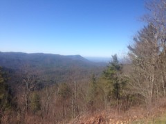
So, that was again the case this past Friday, but I didn't feel like I was settling for a hike because I had a very specific destination in mind, In fact, I was kind of excited about it.

I'd been trying to follow the old (circa 1882 and maybe before) route from modern-day Nimblewill (near Bull Mountain) to Stock Hill (at the bottom of Noontootla Creek Road/FS58) and so far, I'd explored everything from Nimblewill Church to the Hickory Flats Cemetery. There was still a long section from Hickory Flats to Stock Hill though, that I'd barely ever been on. I'd seen maybe a quarter mile of it, 8 or 9 years ago.

So I headed up to Hickory Flats to try to knock out as much of that section as I could.

I kind-of went up the dumb way though. I wanted to approach from the Noontootla side, but I auto-piloted up 400 because that's just how I usually go to get up there. This error added like 30 minutes to my trip, but it wasn't all bad, as it also added a stop at the Dutch Monkey, where I ran into Chris from Reality Bikes, whom I hadn't seen in like 5 years!

Eventually, I made it to Noontootla, but I stopped near the Friendship Church to get a photo of a historical marker nearby.

Pine Top #1

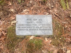
I guess there was a school there, at the bottom of Noontootla. It doesn't specifically say, just mentions a teaching job. Also, I'm guessing that the Fannin County Heritage Foundation put it there, but it doesn't say that either. I'd actually seen the marker before, but I couldn't remember if I had a photo of it. I definitely didn't have a GPS marker for the location, so I got that too.

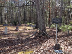
Speaking of markers... As I drove up to the cemetery, I noticed yet another marker, kind-of across the street from it.

Hickory Flats School

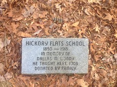
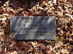
Apparently there was a school there too!

I had, in the past, assumed that the community of Hickory Flats was confined to the actual flats down along Long Creek, and that the cemetery was located on the hill overlooking the community. Historical topo maps suggest the same, and do not show a school anywhere in the vicinity. It would seem that the maps are incomplete though. I wonder if the Fannin County Heritage Foundation has better maps...

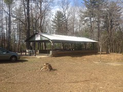
As I pondered this, I parked at the cemetery.

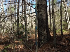
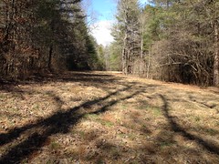
There is an actual cemetery there, but the area is more like a campground. There's a pavillion with tables and chairs, and I've never seen fewer than a dozen gallons of water put out for whoever needs it.

Hickory Flats Cemetery Pavillion

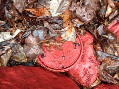
There's also a bath house, with luxurious facilities.

The Red Carpet to the Throne

I love the red carpet that leads to the throne.

There's always paper. It is funny though, there's a curtain that you can draw, but if you do, then the draft slowly pushes the bottom of it toward you until its wraps up around your calves and knees. Good luck trying to hold it away from you, it'll just slowly wrap around your hand too.

There's also a "shower", with a drain, where you can hang a bag of water and bathe. It's typically stocked with soap and shampoo.

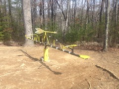
Outside there's a weird merry-go-round/see-saw thing that I swear was there a long time ago, then was gone for a while, and is now back.

Hickory Flats Cemetery Merry Go Round

There's a fire ring to the left of the pavillion, and the cemetery itself is behind it.

The whole place is kind of the last maintained remnant of the Hickory Flats community. We can thank the New Bethel Baptist Church for that. I believe they own the property and maintain it.

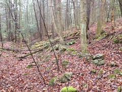
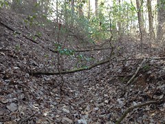
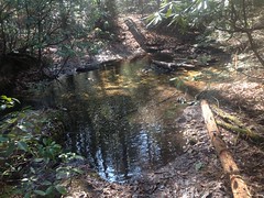
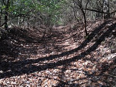
In antiquity, there was a road leading down the hill behind the cemetery to Long Creek where it allegedly teed into another road leading up and down the creek, and that's where the community of Hickory Flats proper was. I'd been down that road once before, but only once, like 10 years ago.

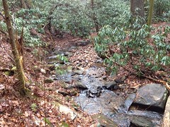
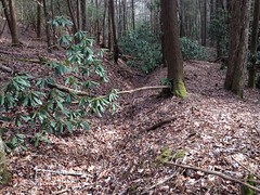
I took it again that day, and really noticed how braided it was. There were at least 2 former routes off to the right. Maybe more even. They all coalesced at the creek though.

Long Creek Crossing

Whoo! The water was cold. It was in the high 30's outside.

My phone didn't like that too much either. The battery works really badly if it gets cold. It was at 100% in the car, but it was at 49% not 10 minutes later. I ended up taking it out of the case and tucking it between my running tights and my left hip so my body heat would keep it reasonably warm. This actually worked, and hours later it hadn't dropped below 47%.

Just past Long Creek, the old road leads to a food plot.

Hickory Flats Food Plot

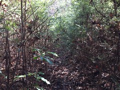
But, legend had it that there's an old road leading up the adjacent ridge. In fact, there was! But it was pretty overgrown and it took quite a bit of meandering just to go the first 100 yards. Fortunately though, after the first 100 yards, it cleared up nicely.

Old Hickory Flats Connector

It looked like I'd been on a "former route" and the most current route came in from the right at that point.

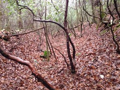
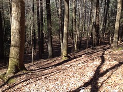
For the next mile or so, the trail was reasonably clear. You'd probably struggle to get a horse or a bike down it, but on foot, it was no problem.

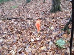
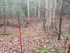
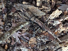
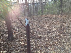
Eventually, it seemed like I was getting close to FS251B. I think I crossed a Kelly Hump or something. And, looking for the road, I almost missed this stake in the ground, off to my right.

Former Orienteering Marker (Maybe)

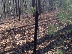
I figured it was one of the orienteering markers for the Rangers at Camp Merrill. Maybe one day they'd quit using it and taken down the actual marker, but left the stake in case they wanted to use it again.

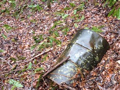
But something else caught my eye as I walked over to get a photo of the stake. Just over the hill...

Helicopter Crash Memorial 1 Helicopter Crash Memorial 2 Helicopter Crash Memorial 3

Wow!

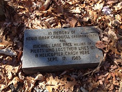
I ran into a bigfoot legend about this crash ages ago. The story was so full of inaccuracies though, that I assumed it was completely made up. I hadn't seen the AJC article about it at the time. I never thought I'd randomly discover the crash site.

I was surprised, intrigued, and sad all at the same time.

Adventure!

The biggest irony, is that I'd actually been on that particular section of the old road before and not seen any of it. Like 10 years or more ago, I rode my bike out that way, parked it, and went walking down the old road until it got too overgrown. I used to do a lot of that. Apparently I had lower standards for "too overgrown" way back though, because these days I wouldn't call it that.

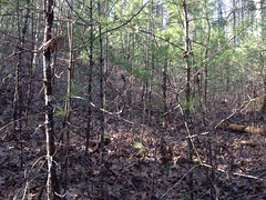
The old road kept going on the north side of FS251B and I kept following it. That side was substantially more overgrown. I was glad it was winter. Before long it started looking a lot more like a creekbed than a road.

Nasty Crail

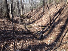
Hard to believe _that_ was the main drag at one point.

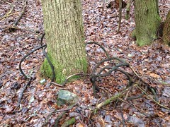
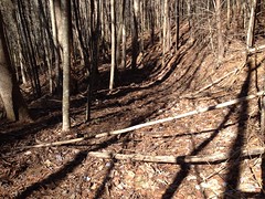
There was a reasonably large poplar down in there too.

Reasonably Large Poplar

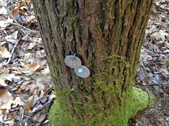
The astute observer may notice a weird black X floating in the air in front of the tree.

I have no idea what the purpose of this weirdness was, but black cordage was tangled all over the tree and nearby saplings, and it seemed to have been put there, intentionally, as it was knotted around all kinds of stuff nearby.

Booby Traps

Maybe that's where the Rangers had been trained to make a last, desperate stand against a Predator, or maybe against bigfoot.

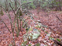
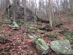
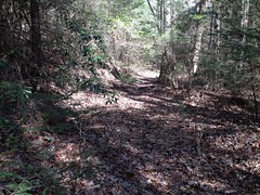
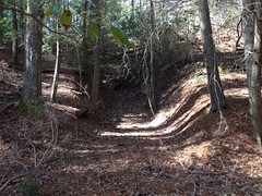
The old road descended the left side of the draw, and continued along a ridge to the north. It was a bit of a geographcal oddity, actually; a draw that funnels down to a ridge. I can't think of anywhere I'd ever seen that before. The creek was rather dry that day, but appeared to flow downhill to that point, and then alternately drop off to one side or the other depending on the century. It looked like it currently dropped off to the east. From the west, a newer looking road joined in, and for a while, the trail ahead was clean and clear. You could have driven a truck down it.

It looked like a modern logging road had been built down to that ridge from FS251B and then bulldozed over top of the old road. I actually expected to run into something like that though, because in the old black and white USGS DOQ images (aerial photos) of the area, that were taken in the 80's (I think), and which were once available online, you can see where the ridge had been logged and started to regrow, but still looked different than the surrounding woods. The ridge to the east appeared to have experienced the same fate. In those old photos you could even make out much of the logging road. When I'd seen those photos, I figured it was just another random logging road. I had no idea about its historical significance.

Oddly, there wasn't much logging along the road at first. No stumps, fairly old-looking growth. No "dirty jungle". But that changed eventually. The border of the clear-cut was pronounced, and the road beyond was the longest stretch of overgrowth that I'd ever pushed through. This photo sums up the experience:

Push Through This

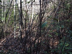
Yeah, push through that.

It wasn't like rhododendron hell though. I didn't have to climb over and under and around. I mostly just had to put my forearms up a few inches in front of my face and walk forward. My forearms bent the little branches out of the way as I walked. I swear though, 1 in 5 was short enough to spring back and whip me in the face, which I reasoned was better than just pushing them out of the way with my face, and also better than taking hours to duck under and in between every branch.

Toward the end, conditions improved rather suddenly.

Trail Improves Somewhat

It looked like maybe a controlled burn had eaten up a lot of the undergrowth. Hog rooting was fairly prevalent as well. Between the two, the trail was much easier to get down.

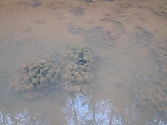
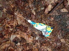
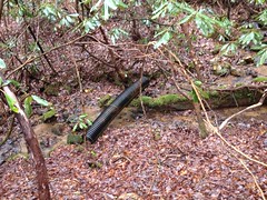
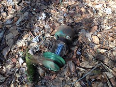
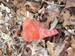
In the first few hundred feet, I found the day's balloon.

Mylar Balloon

It was black and gold. I could make out any writing, but maybe it had flown in from New Orleans.

Go Saints.

I was looking forward to enjoying the rest of the trail, but I was out of luck. Suddenly, and definitively, it came to an end.

This was discouraging. I'd hoped that the modern road would follow the route of the old one all the way down to Mill Creek, but instead, it must have diverged from the old route at some not-so-obvious point.

Goodness...

I spent the next 30 minutes trying to figure out where. This was made difficult by several factors: 1) The various knobs of the adjacent John Dick Mountains look really similar from that angle. 2) The trail was super overgrown. 3) I had marked the route of the old road on my map by eyeballing the map from 1914 and doing my best to match up features between the two. The route that I had marked was by no means definitive. 4) I wasn't super confident in the accuracy of the 1914 map. I'd discovered a few errors in it already.

After about 30 minutes, I was very confident about where I was on the map, but I couldn't find any old road descending the ridge where it should be. Either the map was wrong, or I had transcribed it wrong, or the new road had obliterated the intersection so well that I couldn't find it, or it was just so freaking overgrown that there was just no way.

Eventually I backed up, dropped down about 50 yards and sidehilled until I crossed something that looked like a trail. I took it uphill to see where it hit the logging road, and then downhill into the valley. Unfortunately it disappeared into the backslope almost immediately. It probably wasn't the right trail. Or, if it was then it's seen better days.

Screw it! Off-trail! I'll find it again down in the flats.

Almost immediately I stepped into a good bit of old growth, and I made really good time through it.

Old Growth

There was a reasonably large pine down in there.

Reasonably Large Pine

And as middle-of-nowhere as it seemed, someone had been back in there treating hemlocks.

Hemlock Treatment Tags

I did find an old road, but I wasn't sure if it was the one I was looking for. I followed it east to see if it joined up with a trail I'd found years earlier, but I eventually gave up when it became rhododendron hell.

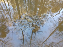
I did find a waterfall though.

Mill Creek Falls

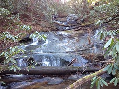
Too bad I didn't have anyone to stand in front of it for scale.

Being "Mill Creek", I half-expected to find some evidence of a dam and/or mill nearby, but no luck there.

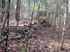
To the west, well upstream, I did find some ruins. Not a mill though.

Mill Creek Ruins

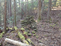
The map from 1914 alleged a structure near where I found that chimney, so I wasn't too surprised to find it. Later though, when I compared the location to the old map, what I found was a bit north of where it was alleged to be. So, either the map is wrong, or there might be another ruin back in there somewhere.

Also, is it just me, or do those old chimneys seem way too durable? This one had been hit by two different trees, but was still mostly upright. I'd think they'd be like Jenga. Touch them wrong and the whole thing comes down. But, no, the building they're attached to can collapse and rot into nothing, but the chimney will stand there like nothing happened. Maybe a little moss will grow on it.

I guess it's a testament to that good old-timey mortar.

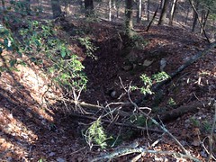
The road continued behind the ruin and passed in front of whatever the heck this is:

It's hard to tell in the photo, and it doesn't help that it's out of focus, but after walking up in there and looking around, it really looked like a collapsed mine shaft. I've seen a bunch of old rail tunnels on Pigeon Mountain, some of which have collapsed, and a few mine shafts on Sawnee Mountain, which haven't collapsed. It just struck me as similar to those. Plus, the giant piles of dirt nearby looked like way more than could have come directly out of the hole that remained. And, there was an even older road that led up to a spot near the top of the hole.

I guess it could also have been an archaeological excavation of some kind. Either way, really interesting.

The old road kept going, but it had the wrong bearing. An adjacent dry branch had the right bearing but no sign of an old road. Maybe the "road" was just the floor of the draw. I'd seen that twice before. The Logan Turnpike trail is kind of like that.

Blah!

I committed to the roadless draw.

Through this crap.

And there was no road. No nothing. Dangit!

Screw it, bushwhack up to the ridge, take that up to the trail that I knew was above me.

But then the ridge was just as difficult to push through!

When it finally cleared, I walked right by this:

Which is hard to make out in the photo. It's a big hole in the ground. Really big. A pit mine, maybe? It lay on the same ridge as the thing I'd found earlier. It struck me that they both may have been shafts leading into the same mine. I had no idea how likely that was though.

There was a campsite nearby though, and a bit of a trail leading from it up the ridge, so I guess it's a minor point of interest to someone, or maybe it was just a coincidence. Who knows?

I picked up Old No-Name Ridge Road up the ridge, and took that to Watkins Branch Gap where I could clearly see the road that I had been looking for dive down into the valley below. It existed, but I'd have to follow it down from there, if I wanted to see where it goes.

I wanted to, but it was getting late. Not late in the absolute sense, but I was like 6 miles from the car and it would take a few hours to get back to it, like 2 or 3 hours. #planningahead.

I bumped up to the Benton MacKaye and headed back south.

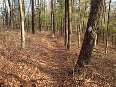
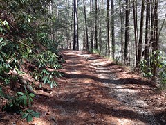
Oh, man, quick progress on an actual trail! It was a joy I had hardly experienced all day.

I ran into another blank stake, I think at the gap uphill of whatever creek Noontootla Falls is on.

There was no memorial nearby, but there was a bit of a hole in the ground, and then another downhill to the southwest, and another beyond that. Maybe it was a really old firebreak. Maybe it was nothing at all, just where trees had fallen down and the fact that they lined up was coincidental.

If the stake was a former orienteering marker then it was the furthest one I'd ever seen from Camp Merrill.

No telling.

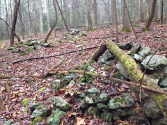
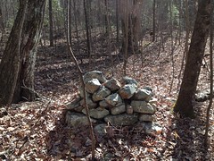
There were at least a half dozen rock piles up there on the next knob.
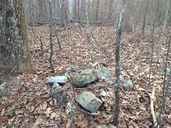
Indian graves?

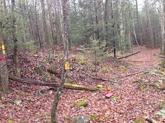
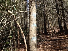
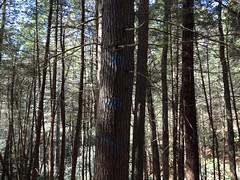
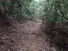
As I crested the knob south of the rock piles, I noticed a new-looking double-blaze and some trail leading off to the right. It turned out to be a set of switchbacks that I hadn't hiked before. I don't know how new they were, but they were new to me. They looked pretty good too, with that IMBA flow.

They crossed the spurs that trail off of the end of the No Name Ridge Road. I don't know if that was intentional, but it couldn't have been better executed if it was. They managed to cross the ONLY other trails in the area.

At the next gap... Oh, the irony.

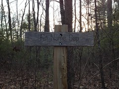
It reminded me of a photo I once saw of a road sign that said: "This sign has no purpose."

This gap has no name.

There are lots of unnamed gaps, but I guess the distinction here is that the name of this gap IS "No-Name Gap", which is perfect, as it lies along No-Name Ridge.

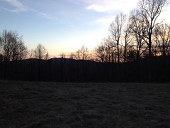
The sun was getting low when I hit the food plot, but I felt good about the progress I was making so I spent a few minutes taking in the general serenity.

From there, the BMT dropped down to Long Creek, and took on a very different character.

There were 2 dudes down there setting up a tarp shelter with a blazing fire so warm that I could feel it from across the little creek between us. More folks were camping down by Long Creek Falls too.

It was darkish when I turned onto the AT, and officially dark when I got to the road by the cemetery.

It was also officially cold - mid 20's. I was wearing running tights, barefoot shoes, a base layer and a wind shell. I had warm gear in my pack, but I hadn't gotten cold enough to change into any of it. It was only after changing back into my street clothes that I wished I'd changed into them instead.

Brrrrr.

My phone was feeling it too. I'd had it on my hip all day, but I'd put it in my car while changing in the bath house and it had gotten cold. I had signal, and the battery had been at 47%, so I figured I'd give Kathryn a call, but as soon as I unlocked it, it went to 20% and gave me the low-battery warning. As soon as I acknowledged that, it gave me the 10% warning. When I acknowledged that, it showed 3% and turned itself off a second later.

Ha!

When the car got warm, I warmed the phone back up, and when I turned it back on, it was back to 47%.

Keep your batteries warm, kids.

As had been the case on the previous hike, I had forgotten that I'd left myself a doughnut in the car, and was elated upon remembering. I was a bit too aggressive in eating it though, and had to stop twice on the road out, to put the doughnut down and drive more precisely, lest I put the car in the wrong rut.

I grabbed some dinner in Ellijay. Shanes Rib Shack, again, and it really hit the spot.

This time, I did have that good, whole-body tired going, but unfortunately I got a little sleepy on the way home and had to stop in Jasper just to walk around a bit and wake up.

So, I'm not sure if this particular hike counts as the ultimate in weekend Adventure, but on paper, it looks pretty good. 8+ hour day? Check. Significant diversity of trail experience? Check. Discovery of historically significant points of interest? Check. Discovery of a waterfall that's not on the map? Getting a little bit lost? Off-trail navigation? Discovery of new trail? Hiking out in the dark? Whole-body tired? Check, check, check, check, check, check!

I don't know, it's a pretty good candidate.

On the drive home though, I passed not just one, but two horrific accidents, neither of which looked survivable, and it took a few hours to get over how bad I felt after seeing them.

So, maybe not such a good candidate after all.

What a way to end the day.