For the past few weeks I've been getting dropped left and right from the Reality ride. But thanks to steady deployment of the secret weapon (riding my bike to work), I hung on easily yesterday.
Things were going well for a while, but the group became confused at the top of Elmo Road. One of the organizers had asked us to stop and buy gatorade from the store there to show support for the community, and the bike shop was going to reimburse us, or something. I didn't totally understand. Apparently nobody did. Half of the group stopped and the other half was like "Why are you stopping?" I half regretted stopping, but it felt like the right thing to do.
Afterward, our group pushed it for the rest of the ride. I pulled some guys into the final sprint. But leaning through the last curve, I could see something was wrong. Chaos. Mass carnage. Riders were down. Bent derailleurs everywhere, but by a miracle, no injuries. I might have been in that sprint group, but thanks to the ripple effect of disconnected coincidence, the wrecking ball swung well ahead of me. I guess the store was the right decision. Karma, karma, karma.
If I don't get blown up this weekend, I'll try again next Wednesday. This weekend will be busy though; 6 hours of Yargo on Saturday and Oak Mountain on Sunday. Pray for my legs.
Thursday, April 30, 2009
Sunday, April 26, 2009
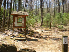
Freeman and Jarrard Gap Trails
show on map
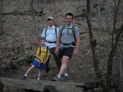
My brother John called me last night. "Want to ride tomorrow?" Yeah, I did, but we couldn't think of where we wanted to go, and actually, I was a little biked-out from last week's commuting. I had an idea though. My bro and his son met me near my house and we headed up to Blood Mountain.
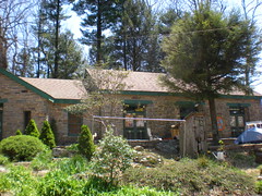
After a quick stop at Mountain Crossings..
We parked at Byron Reece and climbed the Freeman Trail.
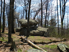
A few months back my bro and I did a couple of days on the AT and saw some pretty cool rock formations. We passed close to there again today.
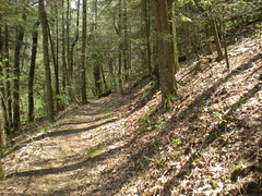
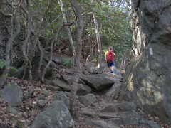
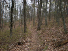
The Freeman Trail is rocky. Not like the AT on Blood Mountain, but still.
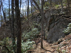
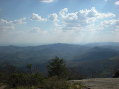
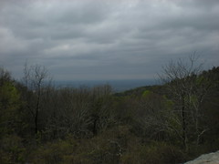
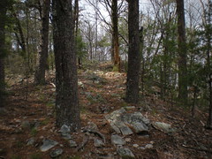
Nice views.
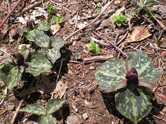
At Bird Gap we stopped for a while. These weird things were growing everywhere. I used to know the name of them but I can't remember now.
From there we headed west to Jarrard Gap, down Jarrard Gap Road and back up Jarrard Gap Trail. A few weeks back I tried to hike Jarrard Gap Trail with my kids, but ended up on the Road instead. This time we did it right.
The Jarrard Gap Trail is pretty steep.
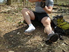
We backtracked over Gaddis Mountain and Turkey Stamp back to Bird Gap and took another break. The frere changed socks.
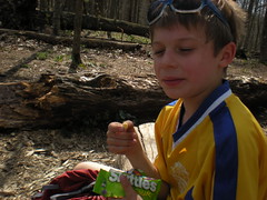
Austin tore into some Sour Skittles.
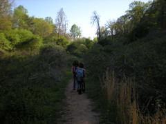
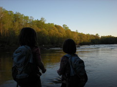
At the intersection with the Slaughter Creek Trail we drank from the cool, refreshing waters of a natural spring and some folks took our picture. I'm in the middle, not smiling much for some reason.
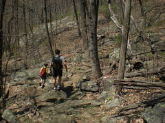
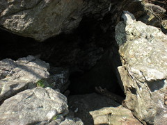
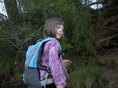
Around this point, I was getting pretty impressed with Austin's stamina. He was easily keeping pace with me and John. We climbed up over Blood Mountain. Austin showed me some caves that he'd found the last time he was up there.
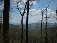
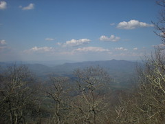
The views were pretty nice. I banged my head hard into a tree climbing up onto a big rock. Woohoo!
I think the tallest peak there is Brasstown Bald.
I needed to get back to the car for 6 so I could get back home for 8. We had about an hour to get down, so we didn't hang around for long. Descending Blood Mountain is no easy thing. It's super steep and rocky and just slams your knees all the way down. Austin made it look easy.
We made it down quick. John and Austin were dreaming of some particular type of ice cream that they'd seen at Mountain Crossings the last time they came up here a few months back. We stopped by but apparently they ran out or something. What a drag.
We did get lucky at Moe's, or at least I did. I asked for a Joey with just rice and extra meat and the chick gave me like a pound of steak. Score.
I made it back for 8 but it turned out that the thing I needed to do was really on Sunday. Heh.
My brother John called me last night. "Want to ride tomorrow?" Yeah, I did, but we couldn't think of where we wanted to go, and actually, I was a little biked-out from last week's commuting. I had an idea though. My bro and his son met me near my house and we headed up to Blood Mountain.
After a quick stop at Mountain Crossings..
We parked at Byron Reece and climbed the Freeman Trail.
A few months back my bro and I did a couple of days on the AT and saw some pretty cool rock formations. We passed close to there again today.
The Freeman Trail is rocky. Not like the AT on Blood Mountain, but still.
Nice views.
At Bird Gap we stopped for a while. These weird things were growing everywhere. I used to know the name of them but I can't remember now.
From there we headed west to Jarrard Gap, down Jarrard Gap Road and back up Jarrard Gap Trail. A few weeks back I tried to hike Jarrard Gap Trail with my kids, but ended up on the Road instead. This time we did it right.
The Jarrard Gap Trail is pretty steep.
We backtracked over Gaddis Mountain and Turkey Stamp back to Bird Gap and took another break. The frere changed socks.
Austin tore into some Sour Skittles.
At the intersection with the Slaughter Creek Trail we drank from the cool, refreshing waters of a natural spring and some folks took our picture. I'm in the middle, not smiling much for some reason.
Around this point, I was getting pretty impressed with Austin's stamina. He was easily keeping pace with me and John. We climbed up over Blood Mountain. Austin showed me some caves that he'd found the last time he was up there.
The views were pretty nice. I banged my head hard into a tree climbing up onto a big rock. Woohoo!
I think the tallest peak there is Brasstown Bald.
I needed to get back to the car for 6 so I could get back home for 8. We had about an hour to get down, so we didn't hang around for long. Descending Blood Mountain is no easy thing. It's super steep and rocky and just slams your knees all the way down. Austin made it look easy.
We made it down quick. John and Austin were dreaming of some particular type of ice cream that they'd seen at Mountain Crossings the last time they came up here a few months back. We stopped by but apparently they ran out or something. What a drag.
We did get lucky at Moe's, or at least I did. I asked for a Joey with just rice and extra meat and the chick gave me like a pound of steak. Score.
I made it back for 8 but it turned out that the thing I needed to do was really on Sunday. Heh.
Saturday, April 25, 2009
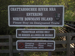
North Bowman's Island (Again)
show on map
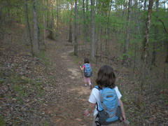
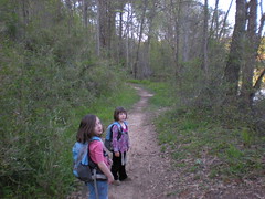
The kids and I traipsed all over the northern end of the Bowman's Island trails last week. This week we hit the southern trails.
I've been commuting to work (by bike - 12 miles each way) for the past couple of days. Not too hard a ride, and last year I did that for months, but I'm just starting up this year and today I was a little weary. In fact I think the girls were a little stronger than me today.
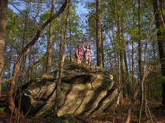
We found a cool rock.
The kids were outpacing me though :)
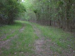
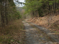
The trail T's into a gravel "road".
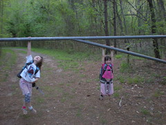
Heading toward the river, you go under the worlds tallest gate. Seriously, you could drive a small car right under it. For the kids it was a jungle gym.
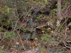
The road became a trail, leading right along the river, and eventually to a small creek.
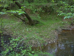
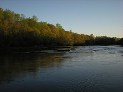
We crossed the creek and milled around on the other side for a while. One of my favorite things about getting outside after work is I'm usually at some scenic spot right at the magic hour.
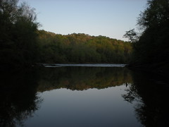
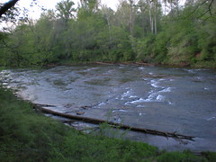
Some folks set up a whole patio set along the trail just south of the shoals. It looked like there was an equestrian ford there too. One day I'll have to wade over and check out Bowman's Island itself.
We had to push it to get back before dark. On the way back we saw at least a dozen white tailed deer. It was too dark to get a shot of them though.
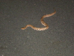
This guy was hanging around the top of my driveway though. He held still long enough for me to figure out my camera, kind-of.
The kids and I traipsed all over the northern end of the Bowman's Island trails last week. This week we hit the southern trails.
I've been commuting to work (by bike - 12 miles each way) for the past couple of days. Not too hard a ride, and last year I did that for months, but I'm just starting up this year and today I was a little weary. In fact I think the girls were a little stronger than me today.
We found a cool rock.
The kids were outpacing me though :)
The trail T's into a gravel "road".
Heading toward the river, you go under the worlds tallest gate. Seriously, you could drive a small car right under it. For the kids it was a jungle gym.
The road became a trail, leading right along the river, and eventually to a small creek.
We crossed the creek and milled around on the other side for a while. One of my favorite things about getting outside after work is I'm usually at some scenic spot right at the magic hour.
Some folks set up a whole patio set along the trail just south of the shoals. It looked like there was an equestrian ford there too. One day I'll have to wade over and check out Bowman's Island itself.
We had to push it to get back before dark. On the way back we saw at least a dozen white tailed deer. It was too dark to get a shot of them though.
This guy was hanging around the top of my driveway though. He held still long enough for me to figure out my camera, kind-of.
Saturday, April 18, 2009
Rose 45
show on map
The Dogwood Festival's in town. I got back just before 5 and rolled out the door directly. No dirt today, but I had just enough time for a road ride.
I dig the Reality Bikes loop but I get enough of that. The 50 mile option is just an add-on to the same loop. But, I'd seen
Rose
45
64
painted on the road a few times. Maybe the 45 would be cool.
Indeed it was. Straight to the 50 mile extension and eventually off into new territory. The route was very well marked. I was enjoying myself, but 2 things kept nagging me. First, I was just heading west, and west and west again. Second, the more I thought about it, the less the timing worked out. I figured that I left at 5, even at just 15 miles an hour, I could get back in just over 3 hours, no problem. But really, I left a little after 5 and it's a couple of miles from my house to the start of the loop. And really, where does the loop start from? The bike shop? Spot Road? The first marker? Hmm. It could get dark on me. But, I'd been pushing pretty hard, so maybe I'd be OK.
I saw a beaver on the side of the road, nowhere even close to water. I thought it was a groundhog at first. Weird.
West, west, west. Cars had their headlights on. Streetlights were coming on. I had a pretty good idea where I was. If the route took a hard left and went straight back to Cumming, I could still get home in time, but I couldn't think of a road that did that, other than one of the major highways.
Eventually, I tee'd into East Cherokee Drive and there was no marker. Did I miss one? Was the route just not fully marked? Had it been paved over? Was the route not a loop? Who knows. I figured I'd head south until I hit Hwy 20 then figure it out from there. I went southish for a while, then eastish on Union Hill Road. Maybe it was the same Union Hill Road that went through Alpharetta by my office. I've got a buddy who lives off of Union Hill Road, maybe I could get to his place before dark.
Just as the light was getting questionable, a Citgo appeared on the horizon. Choirs of angels erupted in song. The guy managing the place was really cool. I called my wife and a rescue ensued. Somehow I'd actually crossed Hwy 20 without realizing it. How'd that happen, I drive that road all the time? Who knows.
It's good to learn from one's mistakes. I've got a whole semester's worth of learning to do from this one.
* Don't go exploring new routes at 5PM.
* Check your arithmetic.
* Bring a map or cue sheet.
* Bring a phone!
* Learn your wife's cell phone number.
Kathryn figured I was lost, but also maybe that I was injured. If I was knocked out, I had no ID. Off road, they'd eventually find my car and ID me. On the road, no way.
* Bring ID.
There's probably more too. I'll be scratching my head over this one for a while.
The sad thing is that I know these things. Off road I'm well prepared. Somehow it just didn't translate over to my road-brain. Maybe it will next time.
Friday, April 17, 2009
North Bowman's Island
show on map
I recently discovered that just about the entire Chattahoochee River corridor from Buford Dam to Atlanta is a series of parks, full of trails. The kids and I checked out the North Bowman's Island area after work today. They complained at first but before long they were having a blast.
No bikes :( Maybe not, but the trails have plenty of tire tracks on them.
The first bit of the trail goes through an area devastated by kudzu, turned briar patch. We'll be back for blackberries later in the year.
Fall-line trails on sandy soil. Lots of hoof prints, foot prints and tire tracks too. But apparently the traffic is light enough, the trails are in good shape.
Some bench-cut.

We found a cool overhanging rock.
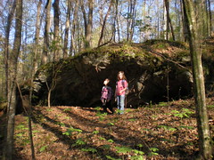
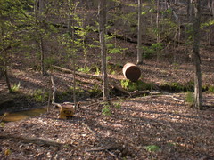
With some "artifacts" nearby.
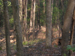
We ran into some deer too. There's one way back in the center of this photo, but it's hard to see.
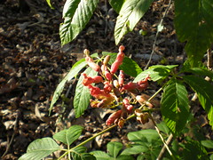
On the southern end of the southern loop of the Northern Trail, almost every tree is one of these. Cool flowers, what are they?
Heading back.
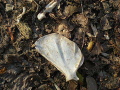
We found the scattered bones of some small animal. Sharp teeth. A cat? An opossum?
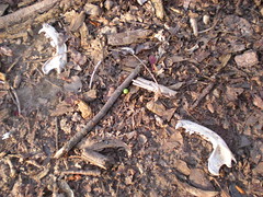
A shoulder blade.
When we got back to the truck the sun was about to go down. The magic hour. We walked down a trail and scaled a near vertical rooty staircase to the river.
Sophie had a hard time getting down but an easy time climbing back up.
Woohoo! A good day. Time to go.
I recently discovered that just about the entire Chattahoochee River corridor from Buford Dam to Atlanta is a series of parks, full of trails. The kids and I checked out the North Bowman's Island area after work today. They complained at first but before long they were having a blast.
No bikes :( Maybe not, but the trails have plenty of tire tracks on them.
The first bit of the trail goes through an area devastated by kudzu, turned briar patch. We'll be back for blackberries later in the year.
Fall-line trails on sandy soil. Lots of hoof prints, foot prints and tire tracks too. But apparently the traffic is light enough, the trails are in good shape.
Some bench-cut.
We found a cool overhanging rock.
With some "artifacts" nearby.
We ran into some deer too. There's one way back in the center of this photo, but it's hard to see.
On the southern end of the southern loop of the Northern Trail, almost every tree is one of these. Cool flowers, what are they?
Heading back.
We found the scattered bones of some small animal. Sharp teeth. A cat? An opossum?
A shoulder blade.
When we got back to the truck the sun was about to go down. The magic hour. We walked down a trail and scaled a near vertical rooty staircase to the river.
Sophie had a hard time getting down but an easy time climbing back up.
Woohoo! A good day. Time to go.
Saturday, April 11, 2009
Snake Creek Gap
show on map
My dad's been ripping up Rowlett Creek for the past few years, but when he lived in Atlanta, we rode just about everything; quick spins at Blankets, night rides, cross-country races, 12 and 24 hour races, epic 8 hour mountain deathmarches, you name it. This weekend he's in town. We missed riding yesterday, but the weather was good today, and there were a few trails that we never got around to.
Snake Creek Gap.
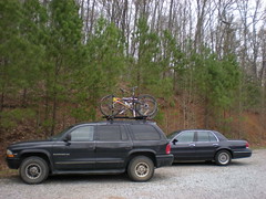
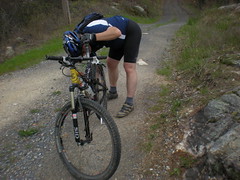
We met there and shuttled to Dug Gap. Like 2 minutes into the ride, he had to stop and adjust the limit on his rear derailleur. Riding in Dallas, he's literally never used the granny gear since he bought this cassette :)
Dalton's down there somewhere.
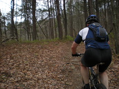
After the first strangling climb, we got into the rocks. My dad's got skills and he figured them out quickly. Of course, he sketched when I tried to take a picture.
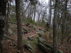
"Trail".
I've only made the climb up to the northern end of Barn Mountain once. Not today.
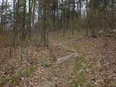
The Padre grinding out that climb.
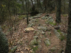
Chunky.
Smoother.
Smoother still.
On the forest road, I saw what I thought was fresh horse sign and later smelled a strong animal scent, but never ran into anything. Weird.
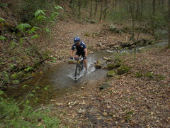
With the recent rains, Swamp Creek was higher than usual. There was a good trickle going near the first crossing.
Ha ha, I didn't get my feet wet.
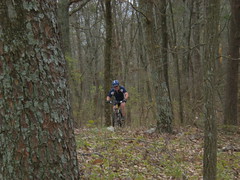
Grinding up Mill Mountain.
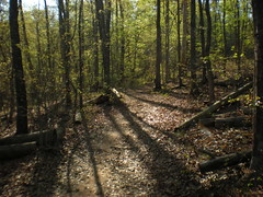
On the Mill Mountain ridge, there were 2 tough climbs, a bunch of rollers and the long descent to Snake Creek Gap. Except for 2 climbs, we were really moving. No time for pictures. Woohoo!
My dad's been ripping up Rowlett Creek for the past few years, but when he lived in Atlanta, we rode just about everything; quick spins at Blankets, night rides, cross-country races, 12 and 24 hour races, epic 8 hour mountain deathmarches, you name it. This weekend he's in town. We missed riding yesterday, but the weather was good today, and there were a few trails that we never got around to.
Snake Creek Gap.
We met there and shuttled to Dug Gap. Like 2 minutes into the ride, he had to stop and adjust the limit on his rear derailleur. Riding in Dallas, he's literally never used the granny gear since he bought this cassette :)
Dalton's down there somewhere.
After the first strangling climb, we got into the rocks. My dad's got skills and he figured them out quickly. Of course, he sketched when I tried to take a picture.
"Trail".
I've only made the climb up to the northern end of Barn Mountain once. Not today.
The Padre grinding out that climb.
Chunky.
Smoother.
Smoother still.
On the forest road, I saw what I thought was fresh horse sign and later smelled a strong animal scent, but never ran into anything. Weird.
With the recent rains, Swamp Creek was higher than usual. There was a good trickle going near the first crossing.
Ha ha, I didn't get my feet wet.
Grinding up Mill Mountain.
On the Mill Mountain ridge, there were 2 tough climbs, a bunch of rollers and the long descent to Snake Creek Gap. Except for 2 climbs, we were really moving. No time for pictures. Woohoo!
Subscribe to:
Posts (Atom)


