Until recently, I haven't spent much time in the Chestatee WMA. I'd been to Dick's Creek Falls before, and up the road a bit, but there's not much back up in there in the way of developed recreation opportunities. You can visit the falls, camp along the road, and fish in the creek, but there aren't any system trails and the road is just a short out-and-back. At first glance, it doesn't seem like there's that much to do.
If you take a closer look though, you might find a few things. I'd been taking that closer look for a while, and at the end of every day, I wished I'd had more time or more stamina. It kept me coming back. Such was the case a few weeks ago.
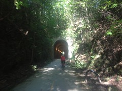
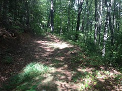
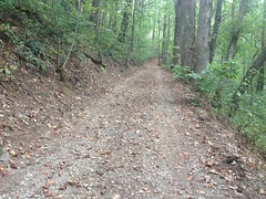
I parked at the end of the main road (FS34) and proceeded up what I call Old Burnett Field Mountain Road. Who knows what its real name is. If someone does, please tell me.
It was just starting to try to be fall up there. No color in the leaves yet, but everything was starting to thin out.
The ground was covered in acorns.
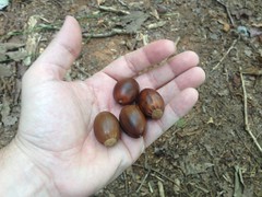
Big, Chestnut Oak acorns. In fact, they rained down left and right. I was worried I'd get hit in the head, but I was lucky enough not to. We used to have Chestnut Oak in our yard in Cumming. The acorns are no joke. They're so heavy that they'll dent your car. My insurance had to cover "hail damage" on a rental once, because I left it parked in the driveway at the beginning of fall.
I'd walked down the road I was on a few weeks earlier, but I hadn't yet climbed it. I was hoping to investigate some side trails on this trip, but I kept noticing other interesting things too...
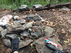
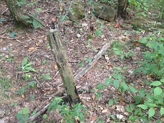
This is a makeshift water bar.
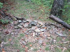
There are dozens of these out there. The trail was once a road, with rolling dips every so often. People pile up sticks at the peaks of the old dips and anchor them with rocks. Sometimes there are rocks lining the lower side of the dip too. It's not clear how this is intended to help though. Without being dredged from time to time, the dip itself will get backfilled. Water bars themselves have to be dredged from time to time too. There didn't appear to be any of that going on. And, all of these constructions were at the peak of existing dips. The existing dip might channel away water, but the rock wouldn't do anything until the dip was completely backfilled, which could take decades. The rockiness might encourage horses to step over them though, and not wear down the peak of the dip. Now that I think about it, that might be the specific intent. Hmmm...
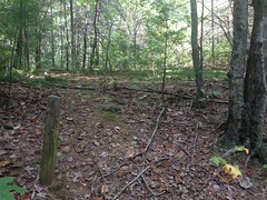
There were 2 old clearings up there too, the first of which was barely discernible as a clearing, but had been marked by a post at some point.
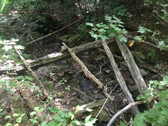
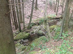
A littie further up, the ruins of an old bridge still spanned a creek.
Right after the old bridge, I met a man coming the other way.
We were both equally surprised to see each other. He was up from Sweetwater Florida, exploring the mountains, as he does a few times a year. We talked about where we'd each been and where we were going. He had surprisingly good knowledge of the area. Though, thinking about it, even though I'm local, he probably gets more exploring done than I do because he's able to camp there for a week at a time and spend all day trekking around.
He'd basically done the same hike that I'd done last time I was up there, but upon finding the waterfall on Dick's Creek, he scrambled up it and bushwhacked to the old road that we ran into each other on.
He had concluded, as I had, that whoever marked the trails on the USGS quad must have been trying to recall them from some vague memory of the area.
We spoke for a while, but we both had things to do, so we eventually parted ways and got back to our respective exploring.
I hit the side trails I'd wanted to check out. One was just a short dead end. There could have been a house down there at some point, or not. Who knows?
The second had some old shot-up orange buckets lying in the middle of the trail.
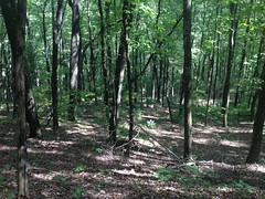
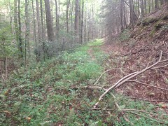
Further up the old road itself became suddenly very overgrown, but the surrounding woods was surprisingly open and easy to walk around in, but it was a maze of game trails, old segments of road, braided creekbeds, and what appeared to be hand-cut channels.
I found 2 chimney ruins.
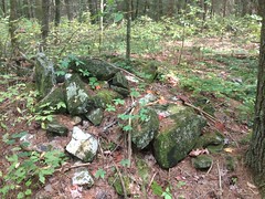
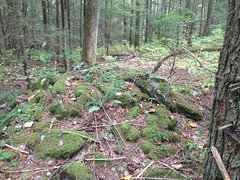
Though they don't look like much in the photos.
And there was a wooden plank lying in a stream nearby.
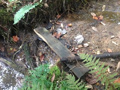
Somebody used to do something up there. Goodness only know what though, or when.
The whole area lay a bit downhill of an inholding, and I was a little apprehensive about walking around too far from the old road that I'd taken in. With my luck, the bottom end of the property wouldn't be fenced or marked, and I'd wander on to it. I mean, why fence it, who'd come in from that side? Me. I would. I've done my share of that, and I wasn't looking to do it again.
So, I made note of what I'd seen and planned to come back later with a more accurate map and more time on my hands.
I took Jarrard Gap Road up to Jarrard Gap proper.
There I kicked back at an AT campsite for a while and ate some lunch.
I think lunch involved Skittles, but I don't remember what else.
I'd seen a trail leading east-southeast from there last time, so I took that trail.
It should be named The Begger Lice Trail, because that seemed to be the only thing that grew along it.
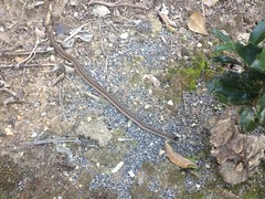
Oh, there was also this really angry timber rattler.
It's funny. I can't count the number of rattlesnakes I've encountered on the trail. Except for this one, and one on Tibbs, they have been universally ambivalent to my presence. This one was decidedly NOT ambivalent.
I should email the link to Billy. Heh.
At great length I ended up at Blood Mountain Creek.
Near there, the trail teed into a trail that Billy and I had explored the last time. We'd walked right by the intersection though, and not seen it, despite looking for it. That day, I couldn't see how we could have missed it, or why we thought the trail kept going uphill. The trail does keep going uphill, but for the life of me, I couldn't discern it. In fact, I assumed that I wasn't on the same trail that Billy and I had been on the last time, but rather on a trail that paralleled it, or something, until I started recognizing features.
This old post, for example:
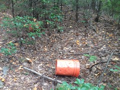
And further down there was an old drum.
Weird.
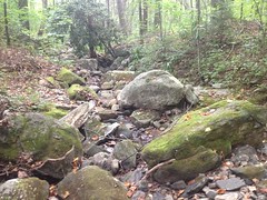
Much further down, I followed a route I hadn't been on before. It's hard to describe it, but it was The Right Way to go, and the last time, we'd taken The Wrong Way.
The Right Way offered nice views of the creek.
..and I ran into the requisite mylar ballon.
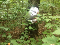
Though, this one was still partially inflated, and hung a few feet above the ground. I'd never seen that before.
There was a bit of a chasm across the old road too.
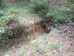
I guess an old culvert caved in and got washed away. That or someone dug it out on purpose.
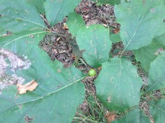
Further down there was this gall, made by a gall wasp.
And then the road got more and more overgrown.
Eventually I ended up at a pile of downed trees that no one had ever made any effort to clear a path through.
This made no sense to me. Further up, the trail was well traveled. The tangle of trees was near the bottom, seemingly close to FS34. I walked back and forth a bit, before finally discovering a little connector that led down to The Wrong Way that Billy and I had taken last time. Ok, ok, it did make sense, I just didn't see it. It's really funny how well hidden trails can be sometimes. Trails that get a lot of use even. Never fails to amaze me.
After that, I stumbled back to the car and headed out. I recognized the guy that I'd seen in the woods earlier, camping a bit down the road, so I stopped and talked with him a bit more. He was thinking about moving to Georgia, and we talked about various places that might be nice to move to.
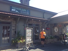
I ate dinner at The Roadkill Cafe on Hwy 129. I'd wanted to eat there the last time I was up with my family, but Sophie refused to eat anywhere with the name Roadkill in the name. Her loss though. It was delicious.