Wednesday, November 21, 2018

Carville Loop

Yesterday morning we did a bunch of family stuff, but I had a few hours to jump on the bike and get in a few miles before sunset. It looked like there was some gravel in the vicinity, so I figured I'd try to get in some miles on that.

I'd ridden my road bike on the River Road dozens of times, but never ridden up on the levee itself. Turns out it's legal to ride up there, and though there's an effort to pave it and turn it into a Silver Comet type trail, that effort has only been partially successful so far, and there are still long stretches of gravel.

I parked at the Mount Bethel Baptist Church in Carville...

Mount Bethel Baptist Church

...and took MLK drive north.

Carville

There's a big bend in the Mississippi near Carville, the River Road becomes private for most of the way around it, and the MLK drive cross-cuts it. I took it north, picked up the River Road again, and took that north to St. Gabriel.

Somewhere in there a guy passed me and tried to spin his tires as soon as he got past, but only spun one of them, and only for a second.

Poor guy - F250, lift, ambiguously threatening decals on the back glass... Ohhh.... open differential.

How embarrassing.

Near the old Barthel Store and Commissary...

J.A. Barthel Store J.A. Barthel Commissary

I jumped up on the Levee, and found that it was paved.

Levee Trail

A few years ago it was paved near downtown Baton Rouge. I'm not sure if it's paved all the way from Baton Rouge to St. Gabriel or not, but that definitely bears investigation...

The paved section ended pretty quickly though, and the levee was covered with limestone gravel beyond.

Limestone Gravel on Levee

The St. Gabriel Church was striking from that vantage.

St. Gabriel Church

I could see the river a lot of the time, but only little bits at a time. It was tough to find a spot to take a photo, but there were a few.

Mississippi River 1 Mississippi River 2

Eventually the limestone ended, and the levee took on a more natural surface.

Natural Surface on Levee

I stayed on the levee where Hwy 75 diverges from the river, and the road below eventually hit private property. A fence crossed the road, led up, and crossed the road I was on. There was no gate though, just a cattle guard, and no signage of any kind. There were Posted signs down below though, and it made me wonder if it was legal to ride there. As luck would have it, there was a lady standing right there, at the fence, taking in the sunset, right as I rode up. She confirmed that it was ok to ride up there, and she looked pretty official.

The sun was a little below the horizon about that time, but it was still pretty light out.

The road below had become dirt and gravel, and it was super, super torn up from cane trucks running up and down it. One such truck had apparently gotten a little wide trying to merge onto the road, and ended up in a ditch. The poor driver was moping around the field behind it, waiting on a tow or a pick-up. Pretty soon, I saw a guy in a truck headed toward me on the levee. I imagine he was there to pick up the driver. There's no way he could have gotten his truck down the road below.

The levee trail became paved again almost right as it was time to drop down to my truck, but I didn't pursue it further south. I had plenty more miles in my legs, but we still had dinner and a movie ahead of us.

The sun was officially down then, but it was still light enough to enjoy the sky.

And, what a sky it was.

Louisiana Sky

Louisiana sky. That should be a thing: "A Louisiana Sky."

We had Jambalaya for dinner and watched The Crimes of Grindelwald after. Complicated movie. I don't know how they expect people to follow it.

Bonnet Carré Spillway

I'm presently in Louisiana for the Thanksgiving holidays, and though we've got enough family stuff planned to occupy us all week, I was able to get free for a few hours yesterday morning. I usually bring my road bike to Louisiana, but this time I did a little research and discovered that there are like 5 trails within a few hours of Baton Rouge that I'd never ridden before. The closest was the Bonnet Carré Spillway Trail.

Seemed like a good idea.

I got directions from the BRAMBA website, and they were good enough to get me there without incident. It helped that my parents lived in LaPlace when I was in college too, so I knew the area reasonably well.

I parked at the singletrack trailhead and got right on the trail.

Spillway Trail Kiosk

The kiosk called the trail the NOMAMBO BIKE TRAIL (all caps), and it took me a minute to figure out what that meant. "AMBO" was naggingly familiar. I quickly rememberd that the SORBA chapter local to Roswell is called RAMBO. For Roswell Area Mountain Bike Organization. So, maybe the AMBO part meant that. What would NOM be though. New Orleans is often referred to as NOLA (for New Orleans, LA), but I've never heard of it being called NOM. That nagged at me a bit, but at some point, New Orleans Metro came to mind. So, maybe it meant New Orleans Metro Area Mountain Bike Organization. Yep, the internet confirmed that when I got home.

Ha! I discovered your secret code.

The trail was flowy, twisty, and fun. The soil was made of very fine, dark gray silt. It was wet in a few places and the mud was black. I got it all over my bike, and it was refreshingly different from the coarse, sandy North Georgia clay I've become so accustomed to.

There were bridges in various places. Some in good shape.

Bridge on Spillway Trail

Others looked too dangerous to try, and others still were completely overgrown.

The trail roughly parallels one of the canals, and in a lot of spots, it gets very close to it.

Spillway Trail Singletrack

It looks like the trail was originally a good bit shorter than it currently is. But, here and there, they rerouted it back on itself, over and over.

It was super twisty and fun.

There were signs here and there on the trees too. They looked like the road signs in downtown New Orleans. The first one I noticed had some strange word on it that I don't remember. The second said "Seinfeld." The third was the best though:

5 Minutes Alone

"Take bites of broken glass!"

My buddy Nick from high school was such a Seinfeld and Pantera fan that I wondered, just for a second, if he'd moved to New Orleans, and taken up mountain biking, without me finding out.

If you look up the Spillway Trail on the internet, it shows a photo of a guy railing a berm during some race they must have had there.

This is that berm.

Berm on Spillway Trail

I railed it too, but only because I saw it coming. That whole section is wild. It seemed like you'd have to be pretty familiar with it to be able to rail the whole thing. The berms seemed far away from each other. I guess they wouldn't if you were moving fast enough, but I'd have to ride it a few times to feel confident riding into it faster than I did.

There were some weird shelter ruins somewhere out there.

Weird Shelter Thing on Spillway Trail

A blind?

A stand for some piece of equipment?

No idea.

When I got back to the lot, I figured I'd explore the local roads. Some of them had to be dirt, right?

There were a few cool things in the immediate vicinity.

Some really scraggly, mossy oaks right there in the lot...

Mossy, Scraggly Oaks

The canal I'd been paralleling earlier...

Lower Canal

A Doppler Radar tower...

Doppler Radar

One of the many pumping stations in the area...

Pump Station

The spillway sits between the Mississippi River and Lake Ponchartrain. When the river gets too high for comfort, they open the floodgates and release water into the lake. There are "guide levees" on either side, running from the river to the lake, and at first glance, the "lower guide levee" looked legal to ride.

I rode south for a while, and eventually through an open gate, and only discovered that the road was closed when I looked back for an unrelated reason and happened to notice the sign posted on the gate itself, which was swung open so far that you could only see it from the opposite direction.

Road Closed

Come on! That's like a trap or something.

There's a causeway running across the spillway that splits it into northern and southern sections. The lot I was parked in was on the east end of the causeway. There were various other roads in the area, but none led into the northern section. I did find an ATV lot, and several ATV/motorcycle trails, but I couldn't tell if they were open to mountain bikes, and they looked pretty muddy too. A couple had just unloaded a 3-wheeler when I drove up. I hadn't seen a 3-wheeler since the '80's. I didn't even know any still existed.

On the south side of the causeway, the lower guide levee was open, all the way to the river.

Lower Guide Levee Road

Two different railroads cross the spillway.

Northern Railroad

The I-10 causeway sits just offshore in Lake Ponchartrain, and there's a third railroad just onshore. So, 3 railroads, and 2 causeways. I could see a network of roads down on the actual spillway too. One of them had dumptrucks tear-assing back and forth the entire time I was riding.

To the east, the Norco refinery was cranking out whatever they crank out. Gasoline, I imagine. You can see the refinery from the causeway, driving into or out of New Orleans. It's especially visible at night. Looks like a robot city. I'd driven past it on Airline Hwy years back, but never thought I'd be as close to it as I was yesterday.

There were a bunch of pressure vessels up against the fence line.

Norco Pressure Vessels

Futher down there were these 2 giant heat exchangers. One of them looked kind of busted up, but it was still working. Those things are so freaking primitive. Wood, cascading water, and a couple of gigantic cans. They always seem out of place to me. Like a box fan aimed at the back of a server rack.

I finally got to the river, and got a look at the floodgates.

Spillway From Lower Guide Levee

Wild! It holds back the river. The whole river. The Mississippi! That just seems impossible. Audacious. Amazing.

I should have taken the River Road to the upper guide levee, but instead, I backtracked to the lot I was parked in, and took Airline Hwy itself to the west side.

There was another boat ramp there, and it looked like there were a pair of trails leading north from it. I wondered if they led all the way to the lake or not, but there weren't any signs saying who was allowed on the trail. The bike trail specifically says "no horses", and the ATV trail specifically says "no off-road vehicles", so if you assume you can ride unless otherwise specified... No. Probably not a good idea. I should do a little research first.

I did check out the upper guide levee road though. It was similarly blocked toward the lake, but went all the way to the river to the south, just like the lower levee road had.

I followed various roads that spurred off of it, into the interior of the spillway too.

One led along whatever that northern railroad is.

Road Along Northern Rail

The road had 2 super muddy spots on it, and I crashed after digging in to the bottom of a rut that turned out to be softer than I thought it would be. "Glad nobody saw that!", I thought to myself. Then, I noticed a truck way up the road. When I got to it I had to cross another wet spot, got bogged down, and had to step off. "Looks like fun!" said the guy in the truck. "Did you see me eat it back up the road?" "Yeah..." And we both laughed about it. "You know where you are?" "Yep." That was only kind of true. I knew how to get back to the main road, but I didn't know where I was in relation to much else. There was a gate there, and no side trail, so all I could do was turn around.

Water was blasting across the road there too.

Outflow

It looks like there's always some amount of water being released from the Mississippi.

I ended up following the guy back out, and though he had a lot of trouble with that same bunch of ruts that I crashed in, he eventually made it through them.

Closer to the river, I followed another road into the interior, as far as I could.

There was more outflow crossing that road...

More Outflow

...which actually looked passable. I mean, I've crossed rougher looking currents in various North Georgia rivers. But there were signs specifically instructing me not to...

Do Not Cross

...so I took the conservative route.

At the river, on that end, there was a road leading up over the Levee, directly into the river. You could literally drive into it if you wanted.

A couple of oil tankers were anchored there...

Tankers Anchored in the Mississippi

The closest being the Savannah Pearl.

Savannah Pearl

There was a trail leading through the woods, down along the river, but it became overgrown after a short while. I imagine it gets flooded pretty regularly too.

And that was about it for my spillway adventure. I headed back on the road, and crossed the Airline Causeway again.

I needed to get back to Baton Rouge in time to meet some relatives for dinner, but I was also starving, and it was a bit past lunch time. Canes to the rescue.

Canes For Lunch

The 3-chicken strip combo was the exact right amount of food to tide me over 'till dinner.

Ca c'est bon, yeah!

Monday, November 19, 2018

The John Dick Mountains

It rained last week, all week. The week before, it also rained, all week. Last weekend, however, for some reason, it did not. How fortunate for me!

Like the previous weekend though, I could either ride forest roads, or go for a walk, and the latter struck me as more likely to be fun, so that's what I did. I honestly don't remember what made me want to explore the specific area that I did, but I do remember thinking that it was a great idea, and that I didn't want to go anywhere else.

The place in question is John Dick Mountain. Or, rather, the pair of mountains - Big John Dick Mountain, and Little John Dick Mountain.

If they don't sound familiar, that makes sense. They aren't very well known these days, but that wasn't always true.

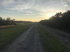
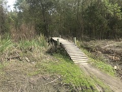
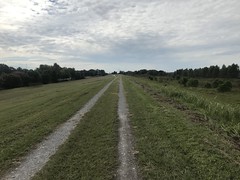
I drove in on an unusual route - up 400, over to FS28-1, up 77, over Winding Stair Gap, down FS58, and out on FS58E to the campsite at whatever that creek is up there. I really should have taken 575, Hwy 52, and Big Creek Road out, but for some reason that didn't occur to me until I was already committed to the other route.

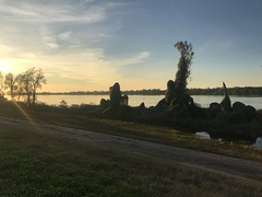
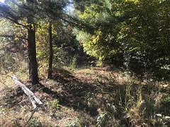
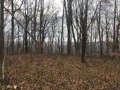
I haven't been up to the Blue Ridge for a while, and I almost missed fall. Not quite though. Not quite. There were still some colors on display as I climbed FS77.

FS77

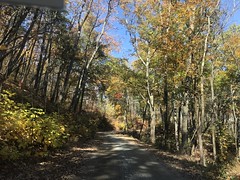
It wasn't amazingly gorgeous, but I was glad that I got to see something.

As I mentioned earlier, I drove up FS58E and parked at that campsite. FS58E isn't usually open, but it is this time of year, for deer and bear season. What luck!

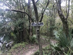
Just up the road from that campsite, there's a trail leading up little John Dick Mountain. 15 years ago, I hiked a good ways up that trail, but gave up when it became indistinct. Why try it again? Several reasons... First: Since then, I found a series of historical topo maps show a network of trails leading every which way up there. The trail I'd followed was one of them, and the maps showed it leading all the way up to the top of Little John Dick Mountain. Second: I recently got a copy of "Sound Wormy", Andrew Gennett's memoir, and he mentions regularly riding his horse Ribbon to the top of John Dick Mountain to survey his Fannin County logging lands, so I had decent reason to believe that those trails did exist during the time frame that the old maps were printed. And, third: I'm a lot better at following old, forgotten trails than I was 15 years ago.

Right away, I noticed that the trail had, at some point, been maintained as a road or a firebreak. There were several turn-outs that I hadn't noticed before. I found an old road crossing it too, that I'd seen on Google's lidar layer. Stuff I hadn't noticed 15 years ago.

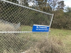
One thing I did notice 15 years ago though, was that the trail followed the WMA boundary. Or, I guess, more precisely, that the boundary followed the trail, as the trail predated the WMA.

WMA Boundary Sign

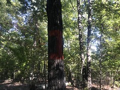
I found plenty of markers this time too.

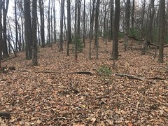
At a point, the trail leveled off, and became less and less distinct, as an obscure trail along a level bit of ridgeline is wont to do. I did see a couple of overgrown sidehills here and there, suggesting a logging network.

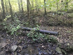
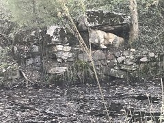
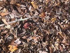
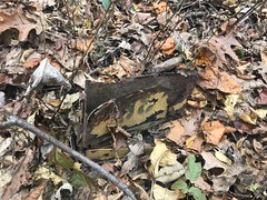
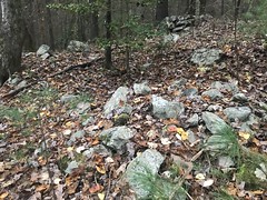
And if there was any doubt that the area had been logged, this old cable set that doubt to rest.

Logging Cable

It looked like the area had been logged ages ago, completely recovered, and been logged again at a lower elevation. I wonder if the forest service has records of who logged what, and when.

I also found a bunch of reflective ribbons marking the route.

Reflective Ribbon

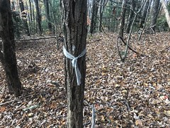
The Rangers use those. Between those and the WMA signs, it was pretty easy to tell which way to go. Of course, it's also just generally easy to climb to the top of a mountain - you just go uphill until you get to the top.

Even without the WMA signs, or the ribbons, there was a generally discernible corridor leading up the ridge, and the ground in it was generally more solid than the ground to the left or right, but it was clear that if there was a time that people went that way regularly, it was definitely a long time ago.

I made it to the top of Little John Dick Mountain in good time. There was no discernible trail or corridor leading up to it though. Along the ridge itself, the brush was parted. A game trail maybe. Some old maps show the Benton MacKaye running across that ridge though. I don't know if it ever really did, or if the old maps just generalized its route. I've seen trails get rerouted, and I've seen maps just be wrong. Who knows?

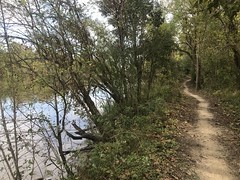
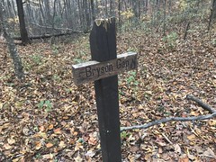
I mentioned earlier that the John Dick Mountains weren't always as obscure as they are today. These days, if you're riding the Noontootla Loop, they loom distinctively on the ridgeline to the left, as you head back toward home on Doublehead Gap Road. The Benton MacKaye trail also skirts them. People camp sometimes at Bryson Gap between them, and there's a spring downhill to the east. But, that's about it.

In antiquity, at least according to Andrew Gennett, Cherokee Chief John Dick had a house and a farm on top of the mountain. Specifically, a peach orchard. John Dick lived there, and Gennett alleges to have eaten "indian peaches" from the trees that were planted 100 years prior to his arrival. Around Gennett's time, the whole Blue Ridge WMA was as populated as the rest of North Georgia. As far as I can tell, there were two main settlements - Hickory Flats and Argo. Hickory Flats was basically the whole area between Long Creek and FS42, from Noontootla Creek to No-Name Ridge, and Argo was everything north of Hightower Gap, in the Rock Creek watershed. There were 50-odd settlements in the Argo area, and probably fewer in Hickory Flats, but still, quite a few. To the south, the Blue Ridge loomed over these settlements. The John Dick Mountains would have towered above them to the north. I imagine they would have been iconic to the locals, at the time, in the way that Sawnee Mountain is to Forsyth County locals today.

John Dick Mountain is actually made up of three knobs. Gennett's memoir doesn't mention which of them the farm or house was located on, but I planned on hitting all three of them, if I could.

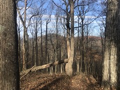
Big John Dick was visible ahead of me, a little east of north.

Big John Dick Mountain

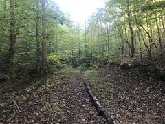
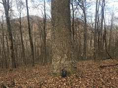
I followed the trail for as long as it was discernible. It became indiscernible in the vicinity of this biggish oak.

Big Oak

From there on, I was bushwhacking until I hit Bryson Gap.

Bryson Gap

The old road to the north there had been blocked, since I was last up that way. And, intentionally so, it appeared.Old Road Closed

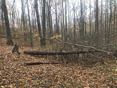
There was a reasonably discernible old road leading directly up Big John Dick from the gap, with multiple side trails. It resembled a logging network. This didn't surprise me, considering the extensive network I'd found in the Alec Branch valley to the north west. Old maps show the BMT taking that route over the knob too, so it may have once followed the old road. It didn't go all the way up though, or at least I couldn't discern where it did, if it ever had.

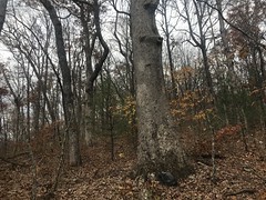
Near the top, there was another pair of largish oaks.

Pair of Largeish Oaks

And at the very top, an old campfire ring.

Old Campfire Ring

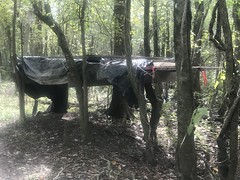
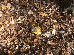
There was modern trash up there too, so I guess I wasn't the only one adventurous enough to make it to the top recently.

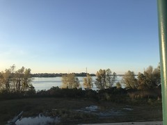
It had been sunny earlier, but clouds had been rolling in all day. To the north though, there was a break in the cover and a bright ribbon of sun on the farms and fields in that direction.

Ribbon of Daylight in the Distance

I tried hard to get a photo of it, but I could capture anything that matched how striking it was in real life.

A vague trail led north toward Sapling Gap. I'll have to check that out someday. I headed east though, following another vague trail heading in that direction.

At the gap, there was an old orienteering marker.

Old Orienteering Marker Stake Old Orienteering Ammo Box

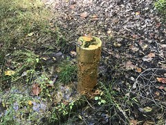
The Rangers placed those all over the forest, eons ago. There are multiple generations of them. The most modern are highly reflective, yellow diamond road-sign-looking things, and they look like they were produced in a factory somewhere. Older ones were bigger, made out of 3/4-ply and painted yellow. Their shape is hard to explain. From above, they would look like a plus-sign. From the front or side, they were square. Older still are just squares, diamonds, or circles of plywood, usually painted yellow, but I've also seen red ones. And, I think the oldest ones are yellow ammo boxes. This one has definitely seen better days. Over the years, I saw many of the plywood markers either been removed outright, or replaced with more modern signs. I had a map once with the locations of all the ones that I had found, but then they started moving/removing them, and I quit keeping track. I'm not sure they really know where some of them are though. Like this one. Seems like it's due for removal or replacement.

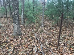
The knob to the east was easy to explore. The woods was wide open up there.

Open Woods on Big John Dick Mountain

I didn't see a discernible trail, but you wouldn't really need one either.

Oh, yeah. It was cold up there too.

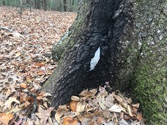
Some water was seeping out of this tree here, and freezing as it seeped.

Frozen Seep

Wanting to get out before dark, I'd been keeping an eye on the time, and I'd been pushing it a bit. It was definitely time to get back.

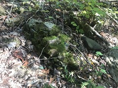
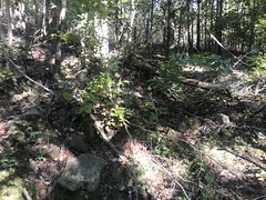
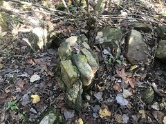
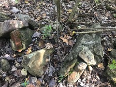
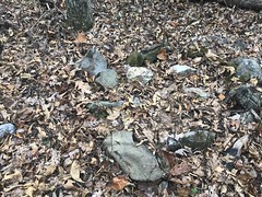
As often happens though, I found a nice-looking side trail on the way back, which led to others, and others, and I ended up going back a very different way than I'd come in. I ended up on the BMT for a while, then ended up sidehilling off-trail for a while, believing I'd recognize the ridge that I came in on. Well, I didn't, and eventually ended up on a parallel spur, heading the right direction, just about 1/4 mile to the north of where I wanted to be. Somehow I also managed to just barely miss hitting FS58E, and didn't discover exactly where I was until I hit a crossing trail, near a bunch of indian graves.

Indian Graves

Those, I recognized, distinctly. And, my goodness, I was off track. I'd descended some several hundred feet below the road my car was parked on and would have to climb back up. Fortunately I finally knew where I was. Unfortunately, I knew exactly how tough of a climb out it would be. Doubly unfortunate was how much deadfall had accumulated on one of the trails since I'd last hiked it. I'd originally marked it as an "adventure" trail on my map, but it has definitely degraded to "reclaimed."

I did make it out though, and even made it out roughly on time. I took the correct route home, grabbed some Shane's in Ellijay, and made it home in good time to watch New Orleans beat Cincinnati.

Woohoo! Adventure and another win. What a day.

Friday, November 16, 2018

Berry College

A few weekends back it had been raining for days and everything was still wet. If I wanted to get in anything fun outdoors, it would have to be either forest roads or hiking. Hiking seemed like more fun at the time, and there's this big horse trail network at Berry College that I still hadn't seen much of.

It was the first thing that came to mind, I was feeling impulsive, so that's what I went and did.

I parked at the Old Mill and headed west on the road toward the spot that me and Billy had noticed was part of the trail last time we were up there. On the way I ran like 10 other hikers, and about half of them had cute little dogs with them. There's a funny 5-way intersection near the trail and while I stood there studying my map, a lady walked by (with a dog, of course) and confirmed that she'd come from the lake. Cool, I was apparently right on track.

I picked up the trail near a creek, but I had a hard time following it. There were various side trails that looked like they got a lot more use than the main trail, and I kept going for a while, missing a turn, and ending up on some side trail that would eventually peter out.

It pretty much looked like this:

Trail, I Guess

Pretty much everywhere.

The "right way" was blazed by some weird orange blazes that looked like an I with a small o superimposed on top of it.

Weird Blaze

But the were intermittent enough, that I'd walk a while, not see one, start to worry that I was off track again, and then finally run into one again.

After a while, the trail turned into a more predictable sidehill that pretty much just paralleled the road below, and I stopped getting lost. There were a dozen or more of what looked like old overgrown connectors heading down towards the road, and the woods below the trail looked a lot more raggedy than the woods above it. It made me wonder if the trail had been a firebreak at some point, or maybe the upper border of a clearcut.

After a while, I ran into some "organized rocks" which turned out to be the ruins of some old structure. There were several piles of old clumps of brick or rock, mortared together, just sitting there, above the trail.

Ruins 1 Ruins 2 Ruins 3 Ruins 4

I couldn't tell what it was for sure, but the bricks struck me as old footings, and the rocks as part of an old chimney.

A ways further up this pipe came up out of the ground, right in the middle of the trail, with water steadily bubbling out of it.

Bubbling Pipe

For horses? I wondered. I'd never seen anything like it before though.

From there on, the trail was really nice and looked like it got a lot more traffic.

Nice Trai

It looked like people generally bypassed the section I'd been on earlier, favoring the road below.

The trail led up along a creek with little shoals at semi-regular intervals.

Small Shoal

There was a big chunk of pipe up there too.

Old Pipe

I'd noticed culverts earlier made out of similar-looking pipe, but it wasn't clear whether that one had been used in a culvert or not. Above the Old Mill, pipes used to take water off of the creek to feed the mill. They used to be buried, but some of them eventually got exposed. It occurred to me that this creek might have had a similar pipeline at some point, and that pipe might have once been a section of it. Somebody out there knows. Maybe.

As I approached Redmond Gap I started getting a little concerned about the time. There's a gate that they close at 6PM and if you're not out, you get locked in. There was a game at 8 that I didn't want to miss, and besides, who wants to get locked in anywhere?

I ended up taking the road back down though, and jogging most of it, so I made good time. I did get distracted by a ringneck just lying there in the road.

Ringneck on Mountain Goat

...but only for a minute or so. It was about 5:40 when I got to the car. Plenty of time to get out.

Or so I thought.

Just as I was about to start changing, a semi-distressed guy got my attention, hoping I had some jumper cables. I did. He needed them. We tried to get his car to start for the next 10 minutes, but it wasn't the battery. I even got my Dad on the phone to help figure it out. It looked like the fob might be going bad. You could open the doors with it, but the car didn't like something about it. If you'd power everything off, lock and unlock the doors, then try again, it would do its self test, but then the security light would just blink and blink. Attempts to start didn't do much. I could hear a relay switch, but that was it. Apparently if a Ford gets in that state, the security code has to be cleared somehow, and it's apparently a dealer secret how.

Luckily, they lived nearby, or at least one of their parents did. They were also able to call the campus police and delay locking the gate so they could get picked up. Good luck to them. I hope it worked out.

On the way in, I'd noticed a weird building near the Old High School Road Lot, that I hadn't seen before. So, on the way out, I parked in the lot and walked over to check it out.

There were two buildings, actually. The first was a little gazebo-looking thing.

Gazebo

It lay on the edge of a pond that looked like it might not be full year-round. There were hundreds of little saplings growing up through the water.

There were actually two ponds, the big one with all the trees in it, and another little one, maybe 20 yards across, slightly uphill, with a dam between them. A trail led from the gazebo, across the dam, towards the other building, which was mostly submerged in the pond.

Flooded Building Outside

The inside was visible through a door in the roof.

Flooded Building Inside

So weird. I'd have taken it for a boat house, but the water was way too high for it to be usable. The water level did seem to usually be a lot lower. Maybe that's what it was.

There were also clumps of bricks nearby.

Bricks Near Flooded Building

So I imagine there had once been another structure of some kind in the vicinity.

The back wall of the pond also looked like it had been constructed.

Rock Wall at Back of Pond

I wonder if there are any old photos of the area. Somebody used to do something there.

The trip home was uneventful. I even made it home in time for the game. The only problem occurred last weekend. I'd apparently forgotten to download the GPS data when I got home. Last weekend I cleared it, went for another hike, and only realized that I'd lost the data when I got back home, pulled down the new data, saved it, and realized that the previous week's data wasn't in the folder. Dangit! In 15 years or more, I'd never done that. I guess I was finally due.