Sunday, July 29, 2018

Dirty Sheets

I got a bunch of work done on my bike last week and needed to give it a good shake down. I'd just been talking to Glen about the 75 mile Dirty Sheets route that I'd come up with, but never actually ridden, so that sounded like a good idea Saturday morning. I felt like doing it bikepacking style too, so I downloaded maps into my bulk-monster GPS, mounted it on my stem and otherwise prepared for Adventure.

One of the things I'd had done the previous week was swapping the fork. When John upgraded everything he owned to 29 (like 6 years ago) he had two spare 26' Fox forks. Both had been used, rebuilt, and Push'ed. He had no use for them, so he gave them to me. I'd been riding one of them for like 6 years, and it finally gave out last week. It can probably be rebuilt, but in the mean time, I got Glen to throw the other one on. He did, but it still needed to be adjusted. So, I put some air in it, and started fiddling with the compression damping and rebound. Turns out if you turn the rebound knob all the way one way, and one of the damping knobs all the way some other way, they will get locked together. The damping knob gets stuck and while the compression knob will turn, it doesn't do anything. According to John, the solution is to take the cap off of the damping knob and turn the shaft with a pair of pliers, which can give you more grip on it. I figured I'd run by Glen's shop and do it there. If I broke it, I'd leave it with him to fix, and his shop was on the way to the trail.

Turns out, yes, that fixes it, and after hanging out a bit, I was finally on my way. It was 2 hours later than I'd wanted to get started, but I still had plenty of time.

When I got to the parking spot, I changed my pants, got ready to change my shoes, and realized I had my road shoes in the back of the truck. My mountain bike shoes were on the floor in the garage.

Dangit.

Almost exactly 1 hour later I was back in the parking spot, with the correct shoes on, ready to roll out. I still had enough time, maybe, if I didn't mind finishing up in the dark.

The first few miles alternate between pavement and gravel, and run right along the Chattahoochee River, though you can barely see it with all of the brush on the side of the road.

The Hooch

Then you pop out in Campbellton at a bend in the river and Charlie's Store is right across the highway. From there it's more pavement and gravel until you get to Cochran Mill Park.

My chain started skipping somewhere in there, and I kept having to adjust my shifter. Considering that the cable had JUST been replaced, that seemed really strange. I figured maybe it was settling in, but it was so persistent that I finally stopped and examined the cassette. It was super loose, as if the lock ring hadn't been tightened at all. This also seemed really unlikely, considering that Glen has been doing good work for 20+ years, and on my bike, in particular, for at least 15. I suspected that the ring was stripped, but I had no good way to be sure. Fortunately everything was kind-of captured in there, and did actually work, mostly, especially when I was in bigger gears. I was mainly the bottom 3 that were sketchy.

I felt like I had decidedly crossed the border from managing Adversity to "forcing a ride" though, and almost turned back before turning on to the singletrack at Cochran Mill.

I'd been sniffling all morning, and when I started climbing the singletrack, I had zero energy. It wasn't because I was well into the ride either. This was classic for fighting some low-grade illness. I could sit back and grind it out, but I couldn't carry anything, and it was pretty miserable.

A mile from Henry Mill Falls I felt my back tire pinch, and though it didn't go flat immediately, I could feel it getting soft.

I made it to the falls though, and crossed the creek there.

Henry Mill Falls

There was a guy relaxing in the woods on the other side who I didn't see until I was climbing up off of the rock. He was very surprised to see me cross the creek.

A minute later my back tire was too flat to keep riding.

When I pulled the wheel out to fix it, the cassette exploded into all of its various pieces.

Exploded Cassette

I put it back together, got the lock ring finger-tight, swapped tubes, and aired it up. Unfortunately, I didn't get the full 20 oz of CO2 into it, and the tire was still a little soft after fixing it. It wasn't going to get any worse, but that was the last straw for me. Too many problems and not enough value in continuing to push through them. When I got back to the lot, I checked to see if anyone had a floor pump. There were 2 other sets of mountain bikers in the lot, but nobody had one.

On the way back to the truck, the lock ring worked its way loose again, only this time it was 10 times worse. In any of the bottom 3 gears, I couldn't pedal 3 times without the chain skipping. After a few miles, that'll drive you crazy.

When I got home and tried to figure out what the problem was, it became even more mysterious. Neither the lock ring, nor the hub were stripped. If I tightened it down, it would get tight, but if I tightened it too much, it would pop completely loose, without stripping any threads. I can't imagine how that's possible. I half expected the hub to have a crack in, but if there was such a crack, I couldn't find it. I eventually ended up putting on a lock ring from an older cassette, with a wider flange, that would presumably create more friction and hold better, and tightened it until it was "good and tight" but not as tight as I had tried to get the other one.

We'll see... I intended to shake all of that down today, but I got up feeling sick again, and didn't want to force another ride. I'm feeling better this evening, so maybe I can get in some miles tomorrow afternoon.

Fingers crossed.

Noontootla

My parents were in town a few weeks back and my Dad and I managed to get a ride in at Noontootla Saturday afternoon. He mentioned the day before that he'd been "fantasizing" about riding there for a while, and though he knew it would be super tough, considering he's been living in Texas for 10 years now, it was on his mind. So, it seemed like the right place to go.

We got there mid-afternoon and actually parked up the road a bit, off whatever FS road that is across from Peter Knob Road. The idea being that we could get in a couple of warm-up climbs before hitting the main 8 miler.

On the way over to the first turn we passed a little ringneck snake on the road and I stopped to show my dad. It was super docile, and barely complained when I picked it up. He'd never seen one before and was surprised, given its size, that I noticed it at all as we rode through. I put in in the grass, hoping it wouldn't slither back out onto the road and get run over.

We hung our left and started climbing. It's hard to say if the warm-up helped or not. Noontootla is a tough climb no matter how far into your ride you are when to get to it.

Me and Dad Climbing Noontootla

We'd had some rain the day before, so the creek was high and raging, and the campsites were wet, but the road was only slightly damp. It seemed like we'd made the right choice from that perspective too. The in-town trails might be open, but they'd be a mess to ride.

We made it to the top in good time, hung a left, ripped across 42 to Hightower Gap...

Ripping FS42

...and then bombed down to the fish hatchery. There were relatively few people camping and fishing. There's a weird looking pipe along the creek somewhere in there, that if you don't know what it's for, might be terribly confusing. It's about 8 inches in diameter, 4 feet off of the ground, and leads from the road to the creek, but slants down, but ends in mid air about 2 feet above the surface of the water. I've seen dozens of them and I puzzled over them for probably 6 months before it dawned on me what they're for. Then, not a week later, I saw one in action. My dad had no idea. They're for stocking the creek. At the hatchery, the fill these trucks with water and trout, and then drive them along the creek until they get to one of those pipes. The pipe is at just the right height to catch trout (and water) as it pours out of the truck. From there, they go sliding down into the creek. And voila! More trout in the creek!

I love stuff like that. Incomprehensible structures who's purpose and mode of operation become so obvious later that you wonder how it is that it wasn't obvious to begin with.

The Shady Grove rollers were a little tough on the padre.

Dad Climbing on FS69 Shady Grove

As were the kicks on 333.

I saw a coyote dart across the road about 100 yards up near the BMT, but my Dad was just a little too far back to see it.

We made it out to Doublehead Gap Road, and got to within a mile of the car when my Dad's legs had finally had it and started cramping.

Noooo!

He usually keeps mustard packets with him and chugs them if he starts twinging, but he noticed that he didn't have any with him shortly before we started riding, and there was no good opportunity to get any. I wish I knew how it is that mustard fixes cramps. It must be some kind of allergic reaction, or something like that, because there can't be any actual chemical that does it directly - it happens way too fast. I guess the internet might know. Maybe I should look it up...

I rode back to the truck and picked him up. As luck would have it, it began to pour down rain when I was about 2 blocks away.

Insult to injury!

Fortunately the back hatch of my truck is good shelter in the rain and we didn't get too wet.

Climbing, cramps, and rain aside, it was still a good day.

I tried hard to eat at Zaxby's on the way home, but the line was moving unimaginably slowly. So, we eventually bailed and went to Wendy's, where my bike made it under the pole, but still hit the awning.

Seriously!?

Someone needs to recalibrate that pole.

Mt. Tabor Park, Silver Comet Side Trail, and Sara Babb Park

Two weeks into this past month, I was still on my multi-park kick, but felt like hitting some Paulding County trails this time.

First up - Mt. Tabor. My dad and I had ridden there in 2010 (I think), but the park was alleged to still exist, and appeared to even have a few more miles of trail than it had when I'd last been there.

The facilities were a little disappointing though. The men's room was straight-up locked. I have a pretty good idea why though. Reference my 2010 post on A. L. Burrus park some for insight into that, if you like. But it sucked for me because I needed to change, and I didn't want to change in my truck. So, I borrowed the ladies room, and none of the ladies present seemed to mind. One of them even smirked and nodded in a manner that I interpreted to mean something to the effect of: "Go ahead. The men's is locked. I think we both know why."

Ha!

The trail was almost exactly how I remembered it.

Mt. Tabor Singletrack 1 Mt. Tabor Singletrack 3

Diverse and fun. The back hill was very different though. Ten years ago it had been logged, and was subsequently choked with sumac. Nothing but sumac. This past ride, it had become a stand of pine. No trace of sumac remained. The pine was fairly mature too. You could see all the way down the hill through it.

I guess a lot can change in 10 years.

Speaking of things changing too, I rode the various older trails in the park, including the little paved trail that runs down by the lake, and noticed this dedication.

Old Becky Echols Park Dedication

Apparently the park was once called Becky Echols Park. At least the section over by the lake was. The whole place feels very divided. Ball fields and a civic center to the left, lake and trails to the right. I imagine it was originally Becky Echols Park, and got renamed when it was expanded. I'd like to pick some local's brain about that someday.

Riding away from the park, I passed Mt. Tabor Church proper, from which the road, and park get their names.

Mt. Tabor Church

I was on the road for a while after that. The route was a little circuitous, and took me through some commercial areas, and neighborhoods.

Between Trails

I eventually ended up at the Seaboard Road Lot...

Seaboard Road Lot Caboose

...and picked up the Silver Comet Side Trail soon after.

Silver Comet Side Trail Kiosk

It turned out to be quite a slog. I was somewhat prepared for this, as it had been a slog 10 years ago too. The trail basically parallels the Silver Comet Trail. Considering that the Silver Comet is an old railbed, which was cut directly through every hill and filled every draw in its path, and any trail paralleling it would have to actually climb and descend said mentioned, it ought to be a pretty tough trail. It was, for those reasons, but also, we've had a lot of rain recently. The low-lying areas were soft and overgrown, and the climbs/descents were scoured and chunky.

There were plenty of clean sections, but they didn't look like they'd gotten a lot of traffic recently.

Silver Comet Side Trail 1

And, if invariably, if I ever did get cruising, I'd hit a ratty old bridge or something.

Ratty Old Bridge Bridge

There were a couple of really nice bench-cut sidehills.

Silver Comet Side Trail 2

But, only a couple, and one was so choked with kudzu that I had to stop and cut it out of my rear derailleur.

East of the Rambo lot I could see the marker for where I was supposed to go, but after a hundred feet or less, I couldn't discern anything vaguely resembling the trail. I had to hike out, look through the woods for it, and then just walk back in to get back on it when it reappeared.

I'm certain I missed at least one section.

At the very end, it drops you down to some neighborhood, and there's no obvious continuation of the trail. I gave up eventually, took roads back to the Silver Comet, and then took it out to where I was ultimately headed.

I think I took Mt. Olivett Road back into Dallas.

Dallas

There was a lake out there somewhere.

Lake Near Dallas

From there I took main roads over to Sara Babb Park, which I'd never ridden before.

Sara Babb Park Sign

Forever ago, I had received GPS data for the trail system there, but when I looked at a modern map of the trail, it looked nothing at all like the GPS data that I had. I'd heard that the trail was supposed to be a "gateway trail" like the one at North Cooper Lake Park and Haw Creek Park. Wide, non-technical, and not too long. Fun for locals and beginners. Something to get them into the sport.

What I found bore no resemblance to that description.

The entrance to the trail itself was as confusing is it gets. There were 2 parallel trails leading off into the woods, and no signs at all. I figured they'd join each other, but they didn't, they just paralleled each other for a while, before eventually diverging. "Ahh, ok, it must be a loop." I thought. But then another trail cross-cut both of them. It was signed "Connector Trail" which made even less sense.

On top of that, these warning signs were EVERYWHERE.

Warning Sign

Were they intended to just warn me, or was I already on a trail I wasn't supposed to be on?

I finally found some red and blue markers indicating that I was on a valid trail, and tried to follow them.

My goodness. The trail was a relentless crawl. I barely had enough gear to climb it. It looked well traveled, but it was incredibly steep. Fortunately, at a point, there weren't any options, and I could easily tell where it was that I was supposed to go. But, then I ran into this:

WTF

What the heck does that mean? The red and blue markers say "go this way" but the private property sign says "don't go this way." How am I supposed to interpret that? It it private, but you can still ride there? Is it no longer private, but the sign is still up?

No idea.

I was getting tired. I didn't feel like sorting out the maze, and I definitely didn't feel like trespassing, so I backtracked and headed out. When I got home and compared the GPS data to an actual trail map, it looked like I had gone the correct direction, and that if I'd continued, it would at least have followed the trail on the map. I'll have to go back there and sort out the system on foot or something. Maybe, after emailing the Sorba guys for some insight into it first.

Back on the road, it was a relatively short trip back to Mt. Tabor. I passed a guy on a road bike climbing up to the park.

"Hey, how's it going?"

"Not as good as it is for you! Man, I hate this hill."

"Ha! Yeah, it's tough."

I was out of energy at the top, but fortunately, the park was at the top, and I could just coast back to the car.

Whew! What a day. Palding County! Tons of fun.

Ironically, I have to go back out that way right now, to pick up some chairs for a play that Kathryn's working on. I'd better get to it!

Charleston, Central, and Haw Creek Parks

Earlier this month I got on multi-park kick. That is to say that it seemed like a good idea to ride the trail system at one park, take roads over to another park, ride there, take roads over to another park, ride there, etc. This is sort of what you do on rides like the CFiTT or the Huracan, and I guess I felt like I was missing that vibe or something. Whatever the reason, that's what I felt like doing, and Cumming seemed like the place to do it because I hadn't ridden up there in years.

First up, Charleston Park.

Charleston Park Sign

I'd never ridden there at all. Ever. When I lived up there, the park was little more than an elaborate boat ramp.

Charleston Park Boat Ramp

I remember there being some chicken-egg controversy about building the trails. The only good place for them was on the other side of a creek, which required a bridge, but the county didn't want to build the bridge, because nothing currently existed on the other side of the creek to bridge to. Apparently they resolved the issue though, because the bridge, and trails, now exist.

Bridge to Nowhere

The system is a double-stacked loop - Inner Loop and Outer Loop.

There were at least 3 other riders out there while I was riding, and a half dozen people hiking too. It seemed like a popular place.

I wasn't a big fan of the Inner Loop. I'd have to ride there a lot to get a good feel for it. It seemed very difficult to carry speed. I felt like I was riding the brakes, hanging a u-turn and grunting up the next climb, over and over. I'm sure if I rode there a lot, I'd get the flow, but for a casual ride, it was a little frustrating.

The Outer Loop couldn't be more opposite. It was fast and flowy, with long lines of sight.

Charleston Park Singletrack

It was a pleasure to ride. If I lived there, I'd probably ride out, do multiple laps of the outer loop and ride back in.

There are also 2 picnic areas back there, one of which has a nice view of the lake, and boat ramp.

Charleston Park Trail Lower Picnic Area Charleson Park Trail Lower Picnic Area Lake View Charleston Park Upper Picnic Area

The only problem I had out there was that someone had dragged a downed sapling across the trail to the lower picnic area and I managed to catch some part of my bike on it and drag it along with me until crashing into another sapling and getting tangled up in both. It beat me up, and pissed me off, but I wasn't injured per-se.

The only other thing that sucked was that virtually every switchback was cross-cut. If I'm GPS'ing a trail (which I was that day), I like to map those, but I gave up after having to stop every 100 yards to map another one. The sheer number of them was unbelievable.

Next up, Central Park.

Actually, next up was the ride over to Central Park.

On the Road

Since switching to 1x11, I hadn't ridden much on the road, except between Blankets and Rope Mill. It wasn't terrible, but it wasn't great. I did find myself spun out, wishing for bigger gears, but not often. It felt inefficient at times, but I never felt like I was crawling.

I hadn't ridden at Central Park in probably 8 years. I used to take my kids to the playground there when they were little, but I didn't even ride there a lot when I lived there.

When I got there, I was surprised to see that the kiosk was missing, and even more surprised to see that the trail itself was missing.

Central Park

If you know exactly where it used to be, then you can kind-of make out the dent in the backslope. If not, you'd never know it was ever there.

The only solid indicator of its former existence is this little chunk of asphalt that once helped you get over the curb.

Central Park Trail Artifact

Behind it, no evidence remained.

It looked like the trail had mostly been abandoned, or otherwise absorbed into the disc golf course. I don't know when this happened, or what prompted the decision, but I do remember that the trail was mostly out-in-the-open with no canopy to protect it. I can imagine that would have eventually caused some erosion problems. Who knows, though? I didn't ride there enough to observe any such decline.

So, that was a little anti-climactic, but I still had Haw Creek ahead of me, and I'd heard that some work had been done out there recently.

It's a bit of a hike to get to Haw Creek though. I think it's about 5 miles away from Central Park, directly through the semi-recently renovated downtown.

Downtown Cumming

That's a 5-story courthouse and, across the street, to the right, a 3 story jail. Equivalent in size to the same in Cobb County, which has 3 times the population. They're either experiencing a massive crime wave, or expecting one in the near future. Either way, yikes!

I passed Alan's Flooring on the way over too. If you own a rental property in Cumming that needs new carpet, I highly recommend Alan's Flooring.

After an eternity on surface streets, I finally made it to Haw Creek, and ripped several laps. I recognized a couple of reroutes, and some intermediate options that hadn't been there way back.

There was also a pump track.

Haw Creek Pumptrack

Which I just couldn't get the flow of. It seemed like it required 2 manuals that I kept coming up short on. It could have just been that I was a little tired though. I have no idea how many miles I'd put in at that point.

There was a group of at least 20 riders hanging around a pavilion near the lot when I rode through the first time. I never saw them on the trail though. So, either we just managed to miss each other, or they were finishing up as I was heading out.

The ride back to Charleston Park was difficult. Rather than backtrack through Cumming, I took Samples and Buford Dam Roads, which are both very hilly, and murder if you hit them at the end of your ride. On top of that, my tires felt like they were velcro'ed to the blacktop.

Ugh.

I made it back though, and grabbed some Mexican food at whatever that place is off of exit 15 on the way home.

Mole Chicken Enchiladas.

Enchiladas

Delicioso!

Thursday, July 5, 2018

Bull and Jake Mountain (Again)

Last Saturday, I rode the Bull/Jake system again. It had rained torrentially, multiple times, since the last time I was up there, the Rainbow Family Gathering was kicking off the following Sunday, and the trail work party on the 7th was going to be cancelled. I wanted to take another look at how my rolling dip had fared, determine, if I could, where the Family traffic would most likely be concentrated, and see how so much rain had affected the trails.

Those were my pseudo scientific objectives. Of course, I also wanted to ride awesome trails, get in some good climbing, and gawk at the beginnings of the spectacle, if there was anything to be seen yet.

I wasn't disappointed, on any of those fronts.

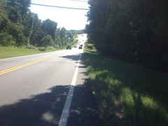
The spectacle started early. Three miles out from the Jake lot, there were about 20 police cars parked up and down Hwy 52 and about the same number of officers in the road, conducting a very expeditious license check. I'd read about the law enforcement presence that was planned for the event. They weren't kidding.

When I got to the Jake lot, I immediately ate like 30 blackberries.

Blackberries

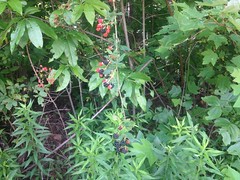
They were everywhere, all along the edge. I had to stop myself from eating more when it felt like I was spending too much time doing it.

When I was done gorging myself, I got dressed, and a Foxworthian thought, that I'd actually had once before, hit me. If standing in the middle of a parking lot, applying a liberal dose of minty balm to your chamois and to yourself doesn't seem weird to you, or to the guy sitting in his car next to you, you might be an endurance cyclist.

And, speaking of guys in cars sitting next to me...

There were 4 other vehicles lot when I got there, two of which were pulling horse trailers. The riders had just gotten back, and were just starting to get packed up when I arrived. I went over and said hi to them, and to their horses too. The horses were Traveller, Fire, and another one with a regular name that I somehow can't remember now. They were hot, tired, and hungry. Traveller was in no mood to be stroked and pat but the other two were very friendly. The ladies who'd been riding them were very friendly too. They were also out there to ride awesome trails and gawk at the beginnings of the spectacle. One of them was wearing a tie-dye'd shirt, and had gotten compliments on it from Family members, or "non-members" as they might prefer.

The occupant of the third vehicle was Dave Greenwell! Yeah! We used to race 6-hours together, a lot. I'd last seen him about 4 years ago at Blanket's Creek. He'd had some health problems for a couple of years, and was just finally getting back into the swing. He'd just gotten done with the Winding Stair Loop and warned me about some super chunk gravel at the top of FS77, as well as some felled trees above FS28A that I later learned were intended to keep trailers and RV's from attempting to climb it. Man! It was cool to see him, and I was really glad to see that he was able to ride again.

The ladies pulling the horse trailers left before I got on the trail, and Dave left shortly after talking to me.

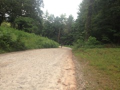
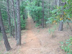
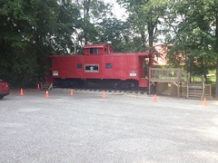
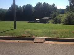
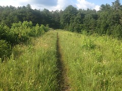
I didn't see the occupant of the 4th vehicle, but this was the state of the lot when I got on the trail:

Jake Lot

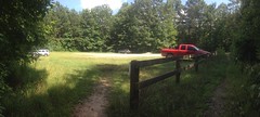
A lot less busy than it was feared to be. I wondered if that would continue to be the case all week.

I'd replaced my other pedal the day before, and my bike was in really good working order. I felt pretty good too, so I was going for a decent ride - Bull -> Jones Creek -> 28C -> 28A -> No-Tell -> Connector to 28-B -> Moss Branch -> Jake.

Go!

The Jake-Bull Connector and 83 Bypass both looked scoured. The steeper sections were in rough shape, but fortunately on the Connector those sections are very short. There's a long run on the 83 Bypass, basically from the road to the switchbacks that needs some attention. We need to re-gravel the little kicks up from the road on both too.

The Bull lot appeared to be where everyone was parking their buses and trailers.

Hippie Bus

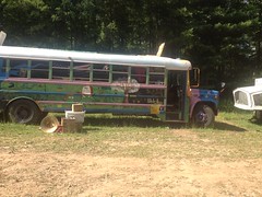
Tool's "The Pot" was emanating from this awesome hippie bus, right as I rode by, and got stuck in my head for the rest of the day.

"Liar, Lawyer, Mirror for you, what's the difference?"

(jam)

The lower (newer) section of Bull looked a lot less scoured, but could really use some love and attention; like the kind that we put in on the new Booger Holler trails after they were first built.

Further up there were a couple of crossed trees down, immediately after a quick descent, and I was a little worried about whether I could stop in time to keep from hitting them.

Trees Down On Bull

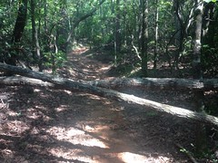
Turned out yes, with PLENTY of trail to spare, but they are scary at first glance. They could use some tending-to.

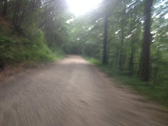
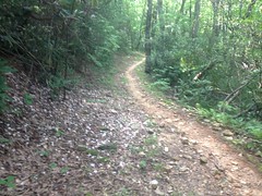
Above the Y, the tread was scoured, rough, and pebbly. It was tough to keep any speed.

Further up, that one really bad, chute-like spot had gotten a little worse. I'd been able to ride it last time. This time it was full of 6-inch diameter rocks. And, leading up to it were hundreds of similar rocks, strewn about the trail, and wide to either side, like there'd been a slide. It was bizarre, I'd never seen anything like it. Had the water exposed them all from within the chute, or had they all poured down from further up and some gotten caught in the chute? I really wanted to know.

Further up, the trail is a lot less steep, and it looked and felt pretty much like it always does.

Bull Singletrack

Beautiful.

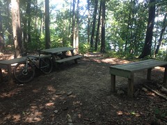
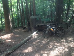
Of course, no trip to Bull Mountain is complete without a photo of your bike leaning against the truck.

My Bike at the Bull Mountain Truck

Bear Hare also felt rough and scoured but I could see that the erosion control structures were mostly still working.

There was another notable tree down on Lance Creek Road near the gate.

Tree Down on Lance Creek Road

Like the ones on Bull, it would be tough to get a horse around it.

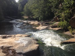
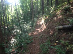
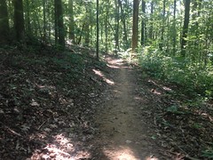
The Booger Holler trails were fast, fun, and clean. The rain didn't appear to have affected them at all.

Ditto for Jones Creek.

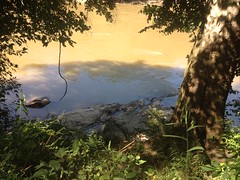
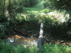
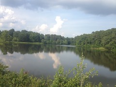
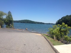
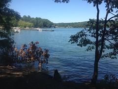
The lake was surprisingly low.

Jones Creek Pond

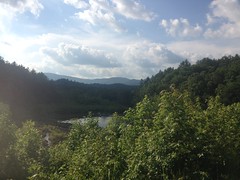
The grass was not surprisingly high.

Singletrack Across the Dam

I passed some Family Gatherers heading north, before I got to the lake. I presumed that they'd parked in the Bull lot and were heading over to 28-A to camp. They were friendly folks, though our interaction didn't involve much more than pleasantries.

There is one bad spot on Jones, in some switchbacks, leading up from the dam. It's just super-sandy there, and a runoff channel has formed along the inside (upslope) edge of the trail, kind of like what you do intentionally to drain a road. People actually ride to the outside (downslope) though, and that part of the trail is totally fine. It's not ideal, but we might do well to just rock-armor the channel, if we can find any rock in the area.

The rest of the trail was great, and the decent to 77A was as fun as always, though someone had laid their tent and bag out in the middle of the trail, close to the road, presumably to dry.

77A was a beehive. It appeared to be a designated parking area and cars were parked along the east side, in both directions, as far as I could see. Everyone appeared to be heading north from there to 28A.

I took 28C and Lower Turner Creek to 28-1 and took that north to 28A.

The "Shitter" sign had been taken down, and no one was parked or camping along 28-1 any more, except in the Beaver Pond campsite, where another awesome blue hippie bus was parked.

It's a bit of a downhill to 28A, and I was must have looked like I was moving pretty fast as I approached it. There were various people milling around, directing everybody to park on 28B and walk west on 28A. The most vocal guy was shirtless, tattooed, dirty, and wild eyed, and he barked something unintelligible at me as I began braking.

"What?"

"You're gonna get a speeding ticket!" ...and erupted into intense, awkward laughter.

"Ha! Yeah, maybe!" struck me as the most disarming response.

It was the only awkward exchanged I'd had yet, and the only vaguely threatening looking guy I'd seen. It seemed unfortunate that THAT guy was probably the first guy that a lot of people would encounter or talk to as they drove by, as he reinforced various negative stereotypes generally associated with people who don't float the mainstream.

It looked like the bulk of the Gathering was going to happen along 28A. About every hundred feet or so, I passed a small group of campers, walking west. Some looked like they really knew what they were doing. Others looked like they'd just picked up 100% of their gear at Walmart in Dawsonville.

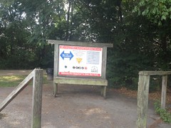
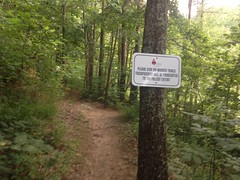
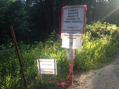
There were dozens of signs hung on trees to either side. Many gave helpful camping tips, but others read a bit like rules. For example... Don't use money, barter only. Protect the land...

Protect The Land

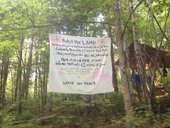
...as well as trees, plants, local fauna, etc.

There was also a rule about photography. No photography without permission. At first I wondered if they interpreted that to apply to wide shots too, or just to individuals, but then it made me think a little deeper...

The Gathering is controversial because the USFS wants any group of more than 75 forest users to obtain a permit for whatever activity they're going to be engaged in. Everybody I know that's organized a bike race in the NF has had to do this. I did it for the TNGA, even when we had fewer than 75 people riding.

As I understand it, the Family has classically dodged the permit in 2 ways. First, they argue that they are not an organization, there are no leaders, there's no hierarchy, there's no one with any more authority than anyone else. There's no individual qualified to sign any permit. Second, the first amendment grants any US citizen the right to peaceably gather. Any law or rule that contradicts that is unconstitutional, unenforceable, and just plain wrong. I don't know if its ever gone to court, but they've been successful with that argument for 50 years.

The USFS's take basically amounts to "OK, OK... Technically yes, but come on guys, we're tasked with protecting the land. We can't just trust you. Forest user groups are going to kick US in the balls if YOU screw around. Come on... Play ball... Eh? ...Eh?" Or, less figuratively: If you would please comply with this rule, even though it contradicts a higher level rule, and we really don't have a legal basis for enforcing it, it would demonstrate respect to the people who have vested interests in the continued success of this land.

Change the last word in that sentence from "land" to "event", and I think it accurately describes the spirit behind the no-photography rule. The higher level rule that it contradicts being that people in a public place don't have a reasonable expectation of privacy and can therefore be photographed without their explicit permission.

That idea struck me, as I debated whether to take a photo of their Protect The Land sign. I wondered if anyone had thought about it before. I figure a reasonable middle ground was to kind-of follow their example, and kind-of flaunt their rule, but not for individuals, which is what I suspected they probably meant by it anyway.

As I took the photo, a legion of law enforcement officers crested the little hill ahead of me, marching east. There must have been 30 of them, 3 abreast. It was a diverse group - county and state police, and DNR and USFS officers. Someone was shouting some unintelligible thing when they first appeared. I couldn't tell if it was one of them, or somebody shouting at them. I felt like I couldn't have looked less like an event-goer, on my bike, in my completely black and white kit, and short hair. I was pretty dirty though, and I was out there in it. I wondered how I looked to them. I nodded to the first guy, and said what I've said to every officer directing traffic at a bike race, that I've ever passed: "Thanks for being here."

The guy next to him kind-of smiled, but the guy I said it to just looked away.

I hoped he didn't think I was being sarcastic. I wasn't. I've been to enough outdoor concerts to appreciate the security, and probably more importantly, trained first responders.

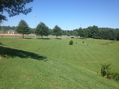
Up the road a bit, just before No-Tell, there's a big food plot on the south side of the road. It looked like it would end up being the epicenter of the festivities.

Rainbow Family Gathering

You could hear the low drone of voices from a few hundred yards away, and it was surreal hearing that out there. Some dude was singing too. Some droning, repetitive lyric, at the top of his lungs. I might have heard a guitar too. I'm not sure. It had the vibe of a music festival, while people are arriving, before the first act. I imagined a stage down in the southeast corner of the field, and that Hendrix would be entertaining that crowd in a few hours.

That's the closest experience I've had that I could relate to what I saw. There was no stage though. There would be no screaming guitars. It wasn't a big rock show, nor was it the solitude of camping.

It was intriguing, but not intriguing enough to stop and mingle. 100% of my interactions ended up being: "Hey, I'll be on your right (or left)", "Thanks", and "Hey, how's it going." Sometimes with "brother" thrown in, if it struck me to say. The Rainbow Family call each other brother and sister, but I'm not sure if it's right to say if you're not a (non-)member, so I had mixed feelings about saying it. I regularly call other cyclists "brother" when I pass them on the trail though, especially during a race, so it was kind of instinctive to do.

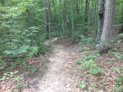
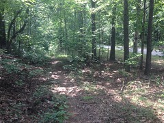
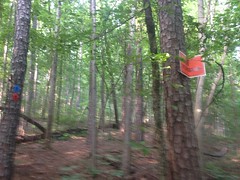
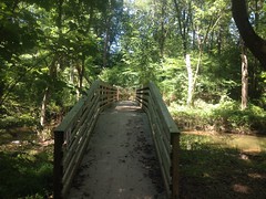
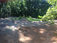
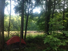
There were tents and tarps in the woods surrounding the field, and along No-Tell, right up to where the new singletrack diverges from the original route. It pretty much looked like this, all over the place:

Rainbow Family Camping

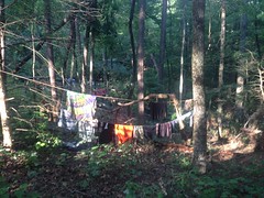
They'd cleared leaves from under their tarps, and trampled vegitation to the extent that you might expect from someone camping somewhere, but I couldn't discern any impact to the No-Tell trail itself. The road, of course, had looked like it always does, except for footprints in the low spots.

There was one funny thing... A guy with no shirt, leather pants, boots, a cape, and a Gandalf hat was lying on his back, directly in the middle of the No-Tell trail, with his eyes closed, apparently sleeping. People were walking around him, and I figured I'd dismount and do the same, but right as I stopped, another guy walking toward us half-shouted: "Guy on a bike!" and it woke the sleeping guy up.

"Good morning!" he announced, instinctively. It reminded me of Everett's "My hair..." in O Brother, Where Art Thou when he wakes up in the barn, surrounded by police, and it made me smile and chuckle a little.

That was about it for the Rainbow Family. I rode No-Tell, and the Black Branch Connector to 28B. Both seemed unaffected by the rain. The No-Tell roadbed was maybe a little rough. Maybe. There was a tree down somewhere in there, and stepping over it, I caught the my right calf on a "hatrack" (the short, spikey remnant of a dead branch that got knocked off before the tree fell) and lacerated it pretty good.

Dangit! I'm smarter than that. I even specifically taught my kids how to avoid doing exactly that. They both immediately knew what had happened when I showed it to them the next day, and chastised me a bit for making the mistake. Those things can be deadly if you manage to impale yourself near your upper, inner thigh.

Fortunately it wasn't too deep, but man did it bleed.

On 28B there were cars lined up along the south side of the road, forever, in both directions. Near the intersection with 28-1 a very gender fluid individual was sitting at a table, I guess directing traffic. I was greeted with the friendly demeanor I'd generally come to expect from the folks out there, as opposed to how I had been by the guy out on the main road. He did shout something to me as I rolled away though...

"What?"

"Did you know that your leg is bleeding?"

"Oh! Yeah, it's fine. I caught it on a hatrack."

"Oh, ok, just wanted to make sure you knew about it!"

"Thanks! Sometimes I don't!"

And we laughed. Something like that anyway. I wondered if he knew what a hatrack is. I wondered if he even heard the word correctly. Does anyone else call them hatracks? I learned it from Woody Keen in a trail maintenance class. No idea if it's a common term.

A little farther down the road, I passed 28A going the other way, and the loud guy was giving someone directions. On the left hand side of the road though, I spotted a guy standing over a full-on bikepacking rig. I stopped and suggested that he looked like he was training for the Trans North Georgia. Actually, it turned out he was riding the Cohutta Cat Loop, had gotten a little off route, and wanted to take 28A back to the route, but wasn't sure if he'd be attacked and robbed if he tried. He'd passed a different checkpoint earlier, and the police warned him about camping in the area. Apparently one event goer's car had been broken into and he'd gotten his gear stolen, presumably by another event goer! Plus, he'd been watching that one belligerent hippie for a few minutes and worried that he might be representative of the rest of them. Ha! That's exactly what I'd thought might happen earlier.

We talked for like 10 minutes about all kinds of stuff. As we talked, I noticed and picked off 3 different ticks that had been crawling up my legs. If watching someone do that mid-conversation doesn't strike you as odd, you might be an endurance cyclist. I think his name was Caleb Young. Cool guy. I hope his Cohutta Cat went well, and I hope I'll run into him again on some epic ride some day and get to ask him about it.

At Moss Branch there were parking signs on one side...

Parking Signs

...and an open-top on the other side.

Open Top at Moss Branch

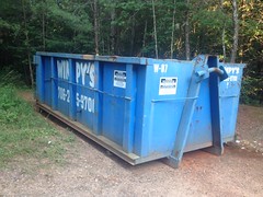
I had to ride around it to get onto the trail. I wondered if the Family put that there, or the USFS. Either way, it seemed like a good idea. I might have located it south of the Y though, so people would see it coming down 77 or 28-1.

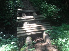
The geotextile at Moss Branch is getting exposed. It's not an environmental problem, but it could be a problem for horses.

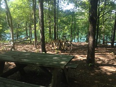
The Moss Branch and Jake trails were in fine shape. The rolling dip looked identical to how it had a few weeks earlier.

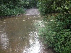
Soaking myself in Jones Creek was a welcome experience.

Jones Creek

It was hot outside. I think it was 96 when I started, and it didn't feel like it had gotten any cooler later in the day.

I noticed that chair that I found was on the opposite side of the creek. Someone must have taken it over there for some reason.

A busted old bike shoe was lying next to it too.

Washed Up Shoe

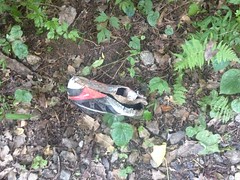
I think that's a Garneau Montana. I had a pair like that for a while. If it's not, it looks a lot like one. No idea how it got there, or how it got in that shape. Maybe an animal had been gnawing on it. I find shoes in the woods pretty regularly, actually, and they're one of the more mysterious things that I find. I mean, how did you lose a shoe? It seems like that's the one thing that couldn't possibly go unnoticed. The best theories I have are: 1) For some reason, someone had two pairs of shoes, and lost one of the spare pair, somehow. And 2) Someone suffered such an injury to their foot that taking the shoe off was required to treat it, they were better off not putting the shoe back on, and limped out on one shoe, leaving the other one behind.

I had no reasonable means to pack out the shoe. Maybe I can pick it up during the next work party.

I felt really strong climbing out and pushed it all the way back to the car.

4 hours, 30 minutes. I was tired at the end, but it wasn't terrible. Sadly though, I think my best Fools Gold time was pretty close to that, and it included additional loops of Winding Stair and Montgomery Creek.

On the way out, I passed through another roadblock, this time on Nimblewill Creek Road. It appeared that they'd just moved the same cars and officers from the one earlier.

"You headed in to the Gathering?"

"Noooo... I've been riding my bike. I'm headed out."

"Sounds good. Take care." (returns license)

Something like that. Super quick. I wondered if they'd actually arrested or even cited anyone all day. I could imagine someone pulling up smelling like Indonesia, answering with: "Dave's not here man..." and the whole thing going south from there. But I wondered if anything like that had actually happened. Except for belligerent guy, and the guy who was literally asleep, everyone I ran into had been unstereotypically lucid.

The festivities have been underway for a few days now. I've been too busy to wonder how it's going, but I'm a little curious now that I'm thinking about it. Best case, everybody has a good time, law enforcement has nothing non-medical to respond to, area residents barely notice anything except for a few more cars on the road, the Gold Creek Gas Station makes a killing, local restaurants make a little extra as everyone leaves town, all trash is picked up, leaves get spread back out, the underbrush recovers in a matter of weeks, and impact on the trails is indiscernible. I'm not planning on going back unless Debbie and/or Stan decide to actually have the work party, so I'll have to wait until everybody's gone to find out. Actually, if they do decide to have the work party, I wonder how many volunteers we could recruit... Maybe this is a golden opportunity.

Who knows?

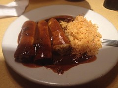
I ate at Big D's Barbecue on the way home.

Big Ds Barbecue

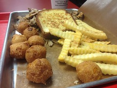
I'd missed them by minutes last time, but this time I made it with minutes to spare.

They give you so much food. I still have a few hush puppies in the fridge.

Jones Creek had washed most of the blood off of my leg.

Hatrack Damage

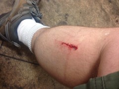
Kathryn didn't want me in bed until it was dried up though. "Eww... It's all weepy. Don't get in bed with that, or it'll get blood on everything!" If a wound like that doesn't freak you out, and you're mainly concerned about whether or not it'll mess up the bed, your husband might be an endurance cyclist.