Friday, December 30, 2011

Habersham Bank

The Swing, and how to get back into it? That is the million dollar question these days.

Sometimes just pure immersion helps. I hoped it would today.

I didn't feel like going to the bike shop but my road bike was in dire need of repair. I'd popped a derailleur cable weeks ago and my bars are in such hideous need of new tape that it's embarrassing, even to me. I also talked to Todd about getting a new gruppo and through it all I could feel the ancient memories working their way back up to the surface.

I got Sophie a new bike about a week before Christmas too, but with the weather and everything else going on, we haven't had time to dial it in. We made time today though, at our favorite learn-to-ride spot: Habersham Bank. Both kids learned to ride there. Iz learned to ride her geared bike there and now Sophie has too.

 Sophie's New Bike

She was a little nervous about the brakes. She's been riding a coaster brake for years now. Iz didn't have any trouble adjusting though, and as it turned out, neither did Sophie.

Also, Iz got a skateboard like 2 Christmases ago and she wanted to try to learn to ride it again today.

 Sk8

Actually, she got 2 boards, one small and one adult sized. She played around with the little one and I tried to ride the big one. It's so weird. I've got photos and videos of myself sliding gigantic handrails, clearing huge gaps and doing 3 foot backside ollies on the 7-foot half-pipe at the Skatepark of Houston but stepping onto that board today... It was inconceivably foreign.

I remember, way back, other people's boards always felt foreign and if I'd take a week off then it would take a week to get back straight again. I never imagined taking 20 years off though. It's not like riding a bike. It doesn't just come right back. I could feel how to do stuff in my head but making my body do it seemed impossible. I spun a few laps around the bank though and before long I felt confident enough to do a couple of skip-ollies. Before long I was doing frontside 80's but then I crashed on a backside and figured I'd better quit while I was ahead.

Fortunately, crashing instincts do come right back.

Sophie likes her new bike and she's noticeably faster on it. They'll be off until Thursday, so hopefully we can get in a good ride before then.

It's all starting to come back to me now.

Sunday, December 25, 2011

Vickery Creek

Topsy Turvy.

That's how my life has been lately. Twisted around by work and weather and eventualities, I barely feel like myself. On the one hand, it's kind-of nice to get a break from the routine, but on the other hand, I really like some parts of the routine and I don't really want a break from them. For example, I've been stuck in the house and I haven't seen the sun or set foot on dirt in weeks.

Weeks!

Last Saturday I tried to end that run though, with a little trip to Roswell. It's not really "the woods" but there are trails there, and thus I must hike.

I parked at the Old Mill Park. The kids and I had stopped by a few months back on the way back from riding the Riverside Trail but we just looked around a little. You drive down to the lot from Hwy 9 and it seems like a good way down, but then there's an even more precipitous drop from the lot down to the river.

There are some ruins of an old cotton mill down there and a covered bridge down there that takes you across the river.

 Covered Bridge

Down by the river itself there's a network of pipes running up and down and back and forth.

 Pipe

I'm really curious about the pipes, actually. Where do they go? What are they for, exactly? They don't look big enough to be drainage or sewer lines. I guess they could be part of the water supply, but they're way down in the creek, lower than I'd expect supply lines to be.

There were a dozen or more people walking around down by the river, not all together, but in a couple of little groups. It looked like a popular place. Aside from the pipes, there were other interesting sights down there too.

There was this crazy cave-rock.

 Cave Rock

And it rained torrentially for days last week so the creek was raging over the little shoal under the bridge.

 Shoal on Vickery Creek

The creek, by the way, is Big Creek - the same Big Creek that the girls and I ride along so often, just further downstream. On the west side, where I parked, the land is owned by the city. Across the creek, the land is part of the Chattahoochee NRA, in the Vickery Creek Unit. In antiquity, Big Creek was known as Vickery Creek, named after a Cherokee woman who owned a farm somewhere upstream.

I didn't find a trail map online (though I must admit that I didn't try all that hard) so I was really just kind of winging it. I had a topo map, and it looked like basically there was just one big hill in the area, hemmed in by Big Creek, the Chattahoochee and some neighborhoods.

The trails along the river looked kind of unofficial, so I headed back to the bridge and up some stairs. I figured if there were stairs, then there were probably real trails at the top. And yea, there were.

Most of it was doubletrackish.

 Vickery Creek Doubletrack

But the park wasn't entirely without singletrack.

 Vickery Creek Singletrack

Along the river there appeared to be dozens of scramble paths too where people climbed down over the rocks to get to the water. Those are very common, up and down the entire Chattahoochee. Further upstream they have become cavernous but with all the rock in the area down there, they weren't so bad.

I headed up to the northwest corner of the park and followed a trail back along the river. It was wide and clear, and then ended abruptly at a bridge of sorts.

 Pipe Bridge

Hmm. It appeared to be the right way to go.

 This Way

When I was a kid in Texas, we used to cross pipes like that all the time. There was one in particular that I had to cross to get to the school behind my neighborhood if I wanted to skate there, otherwise I had to go like a mile around the other way. The pipes in Texas were generally suspended 10 or 15 feet above a dry canal but still, it was similar enough to trigger a flood of good memories.

Across the creek the trail led along the creek but there was a dense tangle of Autumn Olive blocking the view. Here and there little side trails led down to the water, but not for any immediately obvious reason. The water looked deep and slow there though and after a while I started to wonder if you could swim there.

The further south I went, the more I could hear the roar of the dam, and as I approached it, I got the answer to my question.

 Danger

Apparently so. I know what I'm doing this summer.

The river raged over the dam with furious effort and a deafening howl. If the dam had cracked and burst and gone tumbling downstream, it wouldn't have surprised me in the least.

 Old Mill Dam

The main torrent was impressive, but I was more interested in the raceway outlet.

 Old Mill Dam Raceway Outlet

Water would pour through that outlet, run along a long flume...

 Raceway

and drive a wheel at the end which ran all this crazy machinery.

 Old Mill Machinery

Apparently the flume was first made of wood but eventually they replaced it with that metal pipe.

There are interpretive signs all over with old photos but man I really want to see one of those old mills in action. There's got to be one somewhere in North Georgia still running. Standing there, looking at all of it, it was amazing. The things that people put together back then... There was no gasoline, no electricity, barely even steam. A water-driven mill was the height of technology, built by hand out of rough timber, brick, mortar and cast-iron. The scale was amazing too. It was enormous. There was a dam and multiple buildings packed full of pipes and wheels... It consumed acres, and that's just the part of the mill that generated the power, never mind the rest of it. Today you could get the same work out of a little engine sitting on a concrete pad with a natural gas line hooked up to it. I'm sure in another hundred years the enormity of even that will seem preposterous though.

As impressive as it might have been, it's all falling apart now.

 Old Mill Ruins

I don't know though, that might make it even more interesting.

I crossed the covered bridge again and explored along the east side of the river some more.

There was a rope swing...

 Rope Swing

...and an old shirt tangled up in the tree revealed a recent high-water mark.

A rough trail followed the creek for a long time and eventually petered out in some thorns. Leave it to me to find thorns. I will find them. That is one thing you can count on.

I ended up backtracking a lot on that side, looping back to pick up trails I'd seen earlier.

The whole system is situated at a big bend in the river and along the north side of the property there was another pipe that you could cross to get to the parking lot for the aptly named Oxbo Trail.

 Oxbo Trailhead

The Oxbo Trail is a wide gravel trail running along the north bank of Big Creek. The Historic Roswell Trail tees into it near there too. I wonder if either or both are open to bikes? If so, they looked like good places to ride with the girls.

I headed back across the pipe, backtracked some more and found a nice piece of singletrack that paralleled the river, higher up the bank. Later I would discover that it was not part of the official system trails. Until you just know the system, it's difficult to tell where you're supposed to go out there.

Eventually the trail went under another pedestrian bridge, upstream of which was another dam, the purpose of which wasn't entirely clear.

 Dam Upstream of Oxbo

The lower dam was there to run the mill, but this one was modern and didn't appear to have any machinery attached to it. At some point, I will have to inquire further into the matter.

Just south of the bridge, somebody appeared to have abandoned their guinea pig.

 Rodent Cage

Maybe it bit them. Beware the feral guinea pig of Vickery Creek. It can't be tamed. It kills for sport.

Witness it's fury:

 Dead Bird

I'd say 9 times out of 10 when I see a dead bird, all I really see is a patch of feathers. Whatever killed it apparently de-feathered and ate it right there. But now and then I see one just lying there, dead and uneaten, except partially, by ants. Did it die of natural causes? Did it taste bad? Was the killer scared off? How?!

The entire trail system runs around and over a single hill and eventually I made my way up to the top of it. The topo map showed a square clearing up there, but there was no discernible clearing any more.

There was, however, this interesting little pen.

 Pen

Or at least the ruins of one. I'm not insufficiently well-versed on farm structures to identify what kind of pen it was. Corrals are typically round. Poultry is generally completely free-range or kept completely indoors. On the opposite side, there was a small chute that didn't look big enough for cows or horses. Pigs? Maybe?

As interesting as all these little points of were, my body was falling apart on me. My right leg, in particular, felt like it had been transplanted from somebody who had never walked a mile in their life. The front of my hip was sore. I have actually wondered if I have a bone spur there that the tendon just grinds across. That's what it feels like. If I stretch, it's manageable but sometimes it really hurts. My knee felt like I'd landed wrong on a 12 stair ollie. My calf was sore. MY calf was sore. How does that happen?

It was Christmas Eve too and I didn't want to be out in the woods by myself ALL day. I'd only explored about half of the system, but it was time to pack it in.

There's still a bunch more to see out there, including the ruins of another entire mill. Maybe I can coerce the girls into joining me next time.

Monday, December 12, 2011

Five Points

A month or two ago I read about this new trail system "Five Points" on the Sorba Forum. It was supposed to be up near Chattanooga somewhere. From the photos it looked like the kind of place I'd really dig but I then I half-forgot about it with everything else that was going on.

When I was at Mulberry Gap for Andrew's birthday, Richie brought it back up though. Legend says that it was designed and/or built by the same guy that did Racoon Mountain and that it's part of an effort to build a chain of connected trail systems from Chattanooga down to the Pinhoti, or at least to Taylor's Ridge. That little bit of background information was apparently what I needed to hear and it drove the trail firmly into The List.

Yesterday I got the chance to cross it off.

I did a little research online and it turned out that 5 Points is on the Cloudland Canyon property. So I printed out a map and headed off to Cloudland Canyon.

 Cloudland Canyon Park Sign

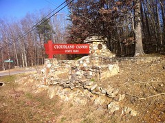
If I'd done 1% more research then I'd have realized that the trail system is up the road a bit from what you'd think of as the park proper. It's technically on their property, but not on the part that the public generally goes to.

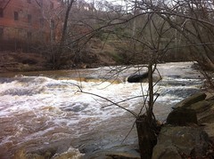
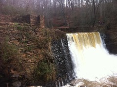
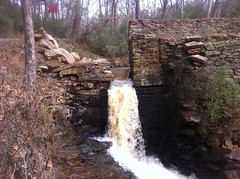
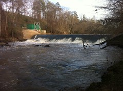
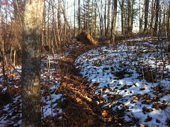
Before I realized my error I drove around the main park area for a while. They've got miles of hiking trails and a waterfall and beautiful views and I'm definitely going back there sometime.

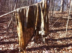
And! There are two inholdings on the park property. One of them just is a classic North Georgia used-to-be-farm property. The other has a trailer up near the road and a house set a little back on the property and it looks like both exploded all over the yard.

Between the natural scenic beauty and those two properties, the park is a perfect microcosm of North Georgia.

After figuring out what I'd done wrong, I got back on the road and went the right way. I'd sort of noticed on the way in, but after seeing the shredded house in the park, I really started noticing... The entire neighborhood is a collection of once-farm properties with dilapidated houses, trailers or shops next door and industrial debris and old trucks scattered about, randomly. It looked like a long time ago the town had been just prosperous enough to get established before drying up completely. Now, several generations later, people still live on their great-grandparents' land but for half of them, there just isn't enough money to hold it all together. That's how it struck me at the time. Later I would get a little more insight, but I'm getting ahead of myself.

On Hwy 157 I saw some little squirrel looking thing bound across the road. It was red though, like the squirrels in Dallas and Tennessee. As I got closer though I realized that it was big, bigger than a squirrel, and it had black markings on it too. It was some kind of weasel. At first I thought it was an escaped pet ferret but no, it was something else. The Weird Red Weasel of North Georgia.

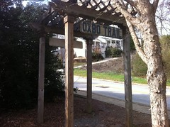
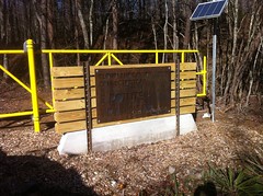
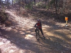
Eventually I made it to where I had originally intended to be. The 5 Points Trailhead.

 5 Points Trailhead Sign

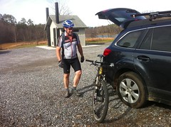
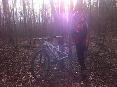
There, I met Travis, with whom I have shared so many adventures.

 Travis

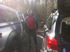
There were 6 or 8 other dudes in the parking lot too. I noticed two odd things about them. One, they all had shaggy beards. Like, I-just-finished-hiking-the-AT beards. Maybe they were holdovers from "Movember". Maybe they all just got finished hiking the AT. I wonder. The second odd thing was that they were all riding 26'ers. After Jessie and Karlos and the majority of the Florida mountain biking community making fun of my 26'er, I now notice the size of everybody's wheels. The bell can't be un-rung. It's like the CruisingGays.com guys and the custody swaps. Once you find out, it just jumps out at you everywhere.

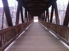
The 5 Points Lot is great. There's a composting privy and an actual changing room, though the slats in the changing room don't quite overlap enough and you can see into the one next door as you walk into the other one. Fortunately I am only slightly more modest than Flea so this was not a problem for me.

The only problem I had was the temperature. It was like 37 degrees. Brisk. I prayed that there would be no sudden gust of wind before I was fully dressed and thankfully, my prayers were answered.

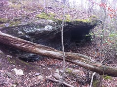
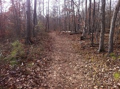
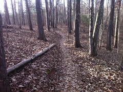
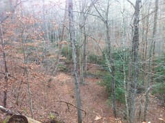
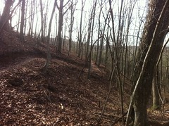
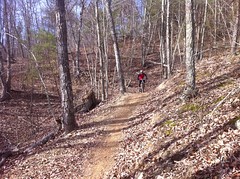
When we were done screwing around with bikes and gear, me and Travis hit the trails. The first one reminded me of Santos. It rolled up, down, over and around these weird little bluffs which couldn't possibly have been actual bluffs because they appeared to be mainly composed of little bits of sandstone and shale. I couldn't imagine a natural process that could have formed them, or any of the dozens of little half-frozen ponds between them either. I mentioned that to Travis and we discussed it a bit. Mining? Maybe. Whatever it was, it was done a long time ago.

The name of the trail should have given us a clue. If I'd paid attention to it, then it might have. The trail was called "Tailings Run". As in mine-tailings. As in the piles of dirt left over from a mining operation. I had guessed that they might have been left over from a mining operation, but even later when I read the name at the next intersection, I didn't put it together. It finally hit me on the way home later, like a Thunderbold of Duh. I was thinking about something else, then Bam! "Tailings."

On the drive in, Travis had gone up north in search of breakfast and noticed that the trail crossed the road up there. The map didn't show it crossing, so we checked it out. Yep, it crosses the road. On the other side, it's "Long Branch".

 Long Branch Trail

Later I would read on the Internet that Long Branch leads north for about 5.6 miles. It looks like that plan to connect up with Chattanooga is coming together after all.

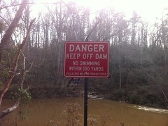
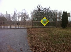
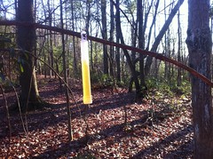
On either side of the road there were these crazy signs.

 Oncoming Traffic Does Not Yield

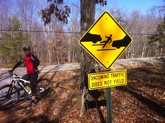
I love the dramatic depiction. It reminded me of a sign that Norma had seen up north warning you not to approach elk with a similarly dramatic depiction of an elk attacking a guy. It's just not what you expect to see on such a familiar yellow road sign.

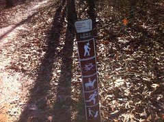
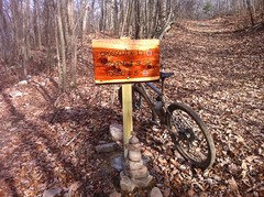
Most of the trails out there loop out and back from a central point - 5 Points.

 5 Points

Though I'm not sure that's the right name for it because I counted 8 trails leading out of there, 7 of which followed old roadbeds, so it's not like it was 5 points historically and 3 more were added recently. Maybe 7 Points just didn't sound as good. Maybe it got the name when before two of the roads were built. These are the kinds of things that I just need to know. Somebody knows. Tell me.

We'd ridden Tailings Run, taken the CCT out and back and climbed part of the Fugget Lift when we noticed Slickenside, which was marked in black on the map. The black trails kind of blended into the lines for the old roadbeds and it always surprised me to find one. Slickenside was chocked full of berms and small tabletops but it looked like maybe it was designed to be ridden in the other direction so we did an out-and-back. The other direction was anticlimactic though. You really had to work for almost every jump and it was a little disappointing.

We rode the rest of the Fugget Lift, took Windy Shot back to 5 Points and headed out on Kettle Bottom. I kept expecting it to drop down into the Valley but for some reason we kept switching back up the hill. Any minute now... It turned out we were not on Kettle Bottom. I had a map and the signage out there is very obvious and highly descriptive...

 Signage

...so you'd think we'd have a hard time getting lost, yet we still managed it.

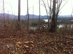
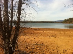
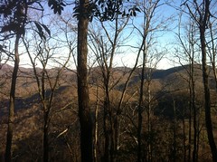
Fortunately everything loops back on itself so we were on Kettle Bottom soon enough and hit the first long run-out of the day. It wasn't crazy-steep but it was long and fast and fun with good views, a lot like the Pinhoti in the Cohttas.

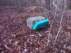
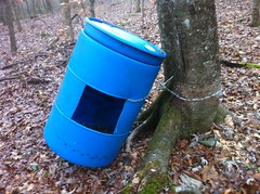
At the north end there was an impressive Tire Pile.

 The Great Tire Pile

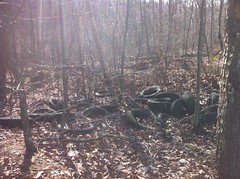
More tires had been dumped up closer to 5 Points too, and there was also a Great Bottle Pile.

 The Great Bottle Pile

Some of the bottles were really old and interesting. I have this duality about trash. By rights, trash should be cleaned up, but if there isn't much of it and it's old enough to be unfamiliar, and it somehow escapes the clean-up process then maybe a piece of trash can become an artifact and maybe it makes a more culturally and historically valuable statement left in place. Even if that statement is negative, like "People used to dump trash up here", it is still historically accurate. Me and Travis discussed this a bit while we rode back up to bomb down Hanging Wall and Foot Wall.

Iz called me on the climb. It still amazes me where I get mobile phone coverage. She'd lost her thumb drive. I didn't know where it was but if she'd just keep things a little more organized...

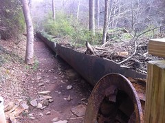
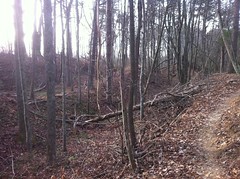
Hanging wall and Foot Wall were fun. A lot of the trail sits on an old, narrow roadbed.

 Old Roadbed

But a good bit is purpose-cut singletrack too.

 Singletrack

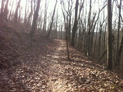
It looked like they used the old roads whenever they could but when they were below grade, or when they just ended, they cut new trail. There was substantial variety in the scenery and the character of the trail. It wasn't just the same 100 yards, ten thousand times. I love that.

I don't remember exactly what trails we rode next. Somehow we worked our way down to the southern end and discovered the old, buried Torino.

 Turino

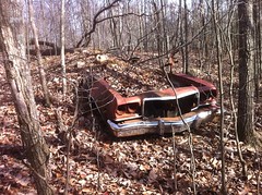
Somebody went through a lot of trouble to ditch that hulk. The apparently hauled it out on the old road that is now Backend, pushed it over the side and then piled dirt and rock all over it so it couldn't be seen from the road. The trail runs right by it though, so it's easy to see from the other side. I bet if you unbury it, there are bodies in the back seat.

Again, with the trash. I hope they leave that one in place.

We rode all over the south side trails.

 Travis Climbing

There are two called North Hogsback and South Hogsback that were even gnarlier than Tailings but ran over the same kind of terrain.

 Coal Mine Piles

There's just NO way that's natural.

Still not realizing what it was, we debated it further. Travis suggested that they might be the remnants of civil-war era earthworks. There were battles galore fought throughout that area and you can't preserve them all as historic sites. I could totally imagine that and for a while, it was our operative theory.

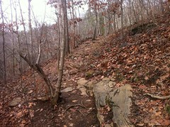
We made it to the Ascalon Road Trailhead where I used the facilities, then we headed back up for two more loops back to 5 Points and back. The only really technical part of the whole system is on the Caprock trail where you have to crawl over lots of exposed rock a la the Pinhoti on Dug Gap Mountain. There's even a loop where if you screw it up, you can loop back until you get it right. I never got it right. There was this tricky ledge I couldn't get over, and in the other direction I managed to get my bike to rebound out from under me once. Woohoo!

Travis's tire had been leaking down and he had to juice it, once up by the old Turino...

 Tire Repair

...and again down lower right before we headed back to the lot at the end of the day.

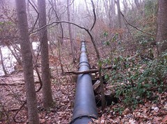
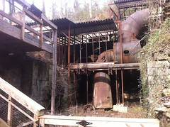
While he was attending to it the second time, I waited about 50 yards down the trail at the next intersection and ran into a group of hikers that we'd seen earlier. It was a couple, their kids and one of their mothers. Three generations of family out hiking together. I love it. I talked to them a bit and it turned out they lived nearby, had for generations, had walked all over the mountain for years and knew the history really well. Post-civil war it had been a coal mine and all that weird terrain was, in fact, mine tailings. The coal was mainly shipped to Chickamauga by rail but the older lady's father used to buy coal from the mine and resell it locally. She'd gone there with him to pick it up several times. The ground was always warm, the coal was always scattered in thin piles everywhere and it steamed constantly. To her, it seemed like the entrance to the pit of hell. The coal was originally dug out by hand but later they brought in steam shovels and it was eventually abandoned in the late 1800's.

What are the odds that I'd run into the one family out there hiking, right when I'd be stopped otherwise, and that they would be that closely tied to the history of the mountain, which we just happened to be curious about after noticing the weird terrain that probably nobody else would think twice about. What are the odds!?

Incalculable.

It had been a long day, and a slightly cold day too. It probably never got higher than 40 degrees and I'd been wiggling my toes for hours. Somehow though, it didn't seem nearly as bad as it did on the road a few days earlier and it was over ten degrees colder.

Back at the lot we asked some locals about good places to eat. They suggested two allegedly great Mexican joints but Travis wanted a burger. He was attempting to consult the internet when a guy came over and suggested the Pigeon Mountain Country Store. His directions weren't that accurate but oddly enough, I knew where it was. I'd ridden by it twice this past summer trying to beat the sunset back to my car.

They were always closed when I'd ridden by and I told myself "Someday I'll be up here early enough to eat there" and lo, the prophesy was fulfilled.

 Pigeon Mountain Country Store

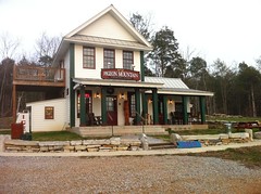
They make burgers from locally-raised grass-fed beef and serve them on an onion roll and man it hit the spot. Man! I'm eating there next time I'm up that way and you should too.

In the parking lot on the way out, I observed a custody swap. Can't un-ring that bell. I see them everywhere.

Satisfied! That's how I felt on the drive home. It was all smiles and satisfaction. I had a two and a half hour drive back but I definitely got my money's worth. New trails, great trails! A long ride, good food, and it was great to ride with Travis again. I almost can't wait for next weekend. Maybe I can do it all over again.

Saturday, December 10, 2011

Dawsonville

Oh man. I've been working 16 hours a day for a week now, writing a SQL parser and translator. If you understood that sentence, you just earned several nerd points. Computer programming is the opposite of exercise so in an attempt to balance it out, I tried to get out on the road for a few hours early in the week. It didn't work out.

Yesterday though, I finally managed to get out for real. It was about 1PM when I left and about 55 degrees. The only clean jersey I had was sleeveless, so with the armwarmers I was looking all NBA.

I set the timer on my phone for 2 hours and headed north. Not 5 minutes north of town my front derailleur cable broke.

 Broken Cable

I debated turning around but that would be the second time in a week. I didn't NEED a big ring.

A little while later my chain was getting really creaky. I guess that's what I get for riding in the rain for so long that last time. I considered stopping at a store to see if they had some kind of oil behind the counter when I noticed a bottle on the side of the road.

 Oil

Thanks litterbug. Sort-of. I guess.

The bottle felt empty so I turned it upside down and let it all run down into the cap. It wasn't as empty as I thought though and when I unscrewed the cap it poured out all over my glove. That's OK though, I didn't NEED gloves either.

My chain was the quietest I've ever heard it. Good old 10w30. Maybe I'll use that from now on.

After a long run up Hwy 9 I reached Dawsonville...

 Dawsonville Square

...and hung a left. I'd been up that way before but I didn't have much time and I didn't get much further. This time I made it out to 186, all the way up Keith Evans Road and even a bit up Bailey-Waters. Local mountain bikers might recognize those roads, as they are in the general vicinity of Bull Mountain. In fact, I'd hoped to make it to Nimblewill Church but my alarm went off just north of the Kangaroo place.

 Kangaroo Place

Darnit. I was still a few miles south of Nimblewill. It's a net climb on the way out so the return trip is generally faster but it gets dark right at rush hour these days and I didn't want to push it.

On the return it got substantially colder. When I got home my face was pale, my eyes were bloodshot, my big toes were purple and wouldn't reprofuse and I had a splitting headache. How am I going to stand it when it's even in the 30's? Much less the teens?

How!?

Tuesday, December 6, 2011

Cumming

This morning I could barely even remember that last road ride I'd done and I tried hard to get one in today but it was like God didn't want me on the bike or something.

It took me a while to find my riding clothes. Apparently I'd left them in the trunk last weekend. If I'd done that in the summer, I'd have asphyxiated sometime last week upon opened the car door but being fall, they just hung out back there, unnoticed.

So it was tough to get out of the house but once I did, everything went well for a while. I rode around my house, ran by the Dutch Monkey for whatever meal you want to count that as and eventually rode over by Reality Bikes to pick up a pair of road tubes. I'd only had one left and it looked like it was for my wife's Townie and probably wouldn't fit under my tire.

Franklin told me how just last weekend he was riding at Chicopee with a buddy and he'd flatted, the spare had a hole in it and then the secondary spare blew too so they just walked out. Something like that. "Terrible luck." I thought.

Then I wasn't back on the road for more than 5 seconds before flatting too. Ha! I changed it, ran back to the shop for another tube and CO2, realized the tire was sliced, bought a new tire too, aired it up and "Bang!" blew that tube too. I'd gotten it pinched under the bead. I'd even checked my work, three times. Don't trust me to fix your bike.

Chris had been walking by and joked "Don't blow that one up." Yeah. I ended up buying a tire, four tubes and a CO2 today.

Also, it rained the whole time. Did I mention that?

Hey, I still got to ride for a couple of hours and it was fun and I needed a new rear tire anyway, so I can't really count today's experience as negative. I just hope the next one is a little less interesting.

Saturday, December 3, 2011

Jackrabbit

Jackrabbit is awesome. Riding with my dad is awesome. Today I did both. Woohoo!

 Dad at Jackrabbit

The last time we tried to ride there his rear hub self-destructed and we only got in about 10 miles. This time things went a little better.

There were a bunch of cars in the lot and people coming on and off the trail. This boded well. It had been below freezing at my Dad's place and we were worried it would be a little cold but when we got there it was up around 60 degrees.

We had a blast, all day...

 Singletrack

...and zero mechanicals. The only problem we had of any kind was that my dad hadn't ridden in about 6 weeks and the climb up to High Point put him in the hurt locker. In Dallas there's a distinct riding season. Starting in early fall it rains every couple of days, never dries up, the soil becomes thick black clay and nobody can ride in it. I keep telling him to get out on the road...

He did make it up though.

 Dad at High Point

The rest of the ride was fast and fun. The leaves are all gone and we got good views of Lake Chatuge too. Of course, we took a little stroll around Saba Beach.

 Saba Beach

We spun two laps but left out High Point the second time. I think we ran into a dozen or more bikers, a pair of hikers and two hunters. One group of bikers we kept seeing over and over. They had two dogs with them. One ran behind them but the other was a puppy and a guy was carrying it in a backpack. It seemed odd but the dog looked really happy, like a dog looks with its head out the window. Ha!

On the way home we grabbed some Jordano's Pizza in Helen. Bacon and Pepperoni. Yeah. It was cold outside so we ate in their dining room. I didn't even know they had a dining room. Outside it's all picnic tables and a concrete floors. Inside it's all fancy with real decor and a wood-burning fireplace. Who'd have guessed?

Oh, man, Jackrabbit is great. Too bad it's so far away. If it were down the street from my house and I'd ride there every week.

Thursday, December 1, 2011

Gooch Creek Cove

I've been wanting to go explore some new trails ever since I got back from Louisiana so this afternoon I tried to convince my wife to go for a walk around Vickery Creek. She wasn't going for it though and the more I thought about it, the more I wanted to get up in the mountains rather than go running around Alpharetta.

A few clicks and a print later and I was on my way up to Gooch Creek Cove. If you have any idea where that is, you're pretty well versed in obscure North Georgia geography. I'd found some trails in the area years and years ago and I'd once met the guy who owns the little horse farm at the foot of the cove when we were both out for a ride on the road that runs through it. From our conversation, I was pretty sure there were more trails, or at least cool terrain up in there and today seemed like a good day to go check it out.

As soon as I entered the National Forest, I got an interesting surprise.

 FS80 Regrading and Regravelling

It was The Great Regravelling of FS80. I actually got passed by two gravel trucks and the grader was parked at Cooper Gap. I've ridden and driven that road for 10 years now and probably put in more miles there than anywhere else and I struggled to remember the last time it'd had any work done. In fact, I still can't remember. I want to say they did a little work a few years back but it hasn't been gravelled in at least 8 or 9.

I drove up over the gap, hung a left on a fairly obscure FS road, parked at Frank Creek and headed off into the unknown.

Actually, part of it wasn't all that unknown. I'd been through there a month or two back during a little excursion up on Frozen Knob and years ago I'd been up along Frank Creek and something up that way had piqued my interest. The first time I was up there it was summer. The old roadbed dead-ended and I just turned around. The next time, it was winter (no leaves) and way up at the end of the road, I saw another old roadbed up the hill. It wasn't clear if it intersected Frank Creek or not and I couldn't explore it then but I filed it away in the backlog.

Today, I still didn't figure out if it intersected Frank Creek or not, but I found where it goes: Low Gap. It was so overgrown though that I couldn't imagine anyone ever goes that way. Apparently I was wrong though.

 Army Poncho

Right up at the top, there was a US Military issue poncho lying in the middle of the trail. It had been there a while and it was covered in leaves and so full of water that it was suction-cupped to the ground. I was going to pack it out but I figured I'd hang it and let it drain first. After two minutes it was still draining and the water that was left on it would have completely soaked my gear. I left it hanging. The Rangers must go that way, hopefully they'll pick it up next time.

Up on the ridge I found a familiar "trail", headed west and then finally off into the truly unknown.

It had snowed up there earlier this week, the first snow of the year, and on the north-facing slopes there was still a good bit lying around.

 Snow

The slight angle of the trail against the backslope allowed it to dry out in some places but mostly I had to walk in the snow. The crunch was satisfying but I could have done without the little bits that ended up down the back of my shoes. It's funny, whenever the seasons change, I find myself re-learning everything over again. Oh yeah, snow gets down the back of your shoes. Gotta do the kick-step.

I'd been running sort-of southeast along an unnamed ridge for a while. It was relatively flat, so I was, in fact, actually running for most of it. Off to the south I could see Greasy Mountain and for a while I'd heard a helicopter loitering in the area. I figured it was a Blackhawk from Merrill but when I finally got a glimpse of it, it turned out to be a Life Flight chopper. It was just hovering around the north end of the ridge near Mauldin Gap and it stayed there for a long time. I tried to get a photo but there was just too much brush in the way.

I assumed someone was hurt. A hiker on the AT? A car accident? Did a mountain biker crash heading down toward Hightower Gap? It looked like the pilot was looking for a place to land. I've always wondered if you could get a chopper in at Hightower. I guess not. There's a clearing up on Hawk Mountain but he didn't go for it. I watched for a while, thinking maybe they'd pull someone up in a basket or something but they never did. Eventually they headed north along FS69 out of view. I could still hear them for a long time though. I wonder what happened.

I mentioned earlier that I forget everything about a season until it's suddenly upon me. One thing I hadn't forgotten though is how nice it is to have somewhat unobstructed views.

 Fairly Unobstructed View

I'd actually been looking forward to that for a while. In the summer, it would have just been leaves. I like leaves, but I'd been getting pretty tired of them.

Speaking of leaves though... My god. Most of the ridge had been pretty flat but eventually I had to drop down off of a steep little knob and it was like the Old Butt Knob in Shining Rock all over again, except this time there weren't so many rocks to leap between. I can imagine that in the summer it's not so bad, but in the fall... The leaves. THE LEAVES! It was sketchy and treacherous and I slipped more times than I would like to admit to but fortunately it was short, or at least it was short in retrospect. At the time it seemed like it was taking forever.

Toward the end of the ridge the trail became less and less distinct and after exploring around up there for a while I ended up taking a little side trail down to the road.

There were indications that I wasn't the only one who runs around up there.

Mainly glow sticks.

 Glow Stick

And more glow sticks.

 Glow Sticks

I still haven't seen one actually glowing though, even at night. Do you have to shake them?

At the road I was faced with a quandary. I was parked to the left but it was still very much "day" outside and I though I'd scratched a good bit of the exploratory itch, I didn't want to waste the day and it looked like there was another trail ahead of me. However, should I choose to continue exploring, somewhere down in the cove ahead of me there was private property. I'd met the owner years ago but the chance that he'd remember or recognize me was infinitesimal. The danger is that people don't always mark their borders, especially the ones facing into the woods. I mean really, who's going to be coming from that direction, right? Yeah. I've had fun with that before. The law says that until you're notified that you're trespassing and refuse to leave, you're not trespassing. Notification can take many forms but it has to be clear and authoritative. That's the law and all but sometimes people come up with their own take on the law, especially after a couple of beers. I've had fun with that recently too.

You can't be afraid of the wind though, right? Something like that. And the USFS does mark their borders, with bearing trees and big red stripes, or at least they usually do.

Onward.

I walked for a while and even though I was confident that I was still in the NF, I was diligent, looking for signs, ribbons, fences, etc. Instead, this is what I found...

 Bear Bait

I know what that is. It was empty, but I know what it is. I'd seen a pair of them up off Rock Creek Road near Stanley Gap once. I've seen photos on the the USFS website. I watched a video of an archer kill a Cinnamon Boar feeding out of one on a hunting show once too. I was definitely still in the NF and as such, the owner might be more than a little upset with me for stumbling onto it. I scanned around for tree stands, simultaneously realizing the futility. I was wearing orange and I'd made plenty of noise in my approach. If there was a sufficiently unscrupulous hunter up there, I'd have long been dead.

I was on an old roadbed and it led along Gooch Creek itself for a while.

 Gooch Creek

At the eastern end of the road there was a nice little fence, clearly marking that end of the property.

 Fence

Or so I thought. On the way back, I noticed this NF Boundary sign on a bearing tree that somebody had lazily just painted a blaze on rather than painting all the way around.

 NF Boundary

Wee.

So who knows, I might have wandered onto private property for a little while there. Darn those sketchy borders. At least I know now.

At that point it was actually starting to get somewhat darker and more importantly, somewhat colder. I'd had enough for the day.

It was an easy march back. It was officially dark almost as soon as I got on the road and the moon was only a crescent but I could see and it would have been virtually impossible to get lost.

One thing that did suck though was the pain radiating out of every joint in my legs. Again, I forget. I get less mid-week exercise during the fall and winter and my legs get stiff. I have to make an effort to stretch or my joints ache when I finally do get out. What else am I forgetting?