Monday, January 16, 2017

PR Gap Creek and Winding Stair Knob Ridge

This weekend is a long weekend. We have the standard Saturday and Sunday, plus MLK Day on Monday. The kids are off of school Monday, Kathryn has work, and I'll be Mr. Mom all day. So, I didn't feel too bad about running off into the woods for a second day in a row on Sunday.

PR Gap Creek Cove!

An obscure location to be sure. PR Gap is unlabeled on any map, as is the creek, and the cove. For all I know it has a different name, but that's what I call it.

The significance of that cove, in particular, to me at least, is just that even modern-ish topo maps allege that there's a road running up along the creek, but the one time I tried to find it 10+ years ago, I had no luck. As fate would have it though, I'd noticed the road (or what's left of it) just the day before when I was looking for the Old Winding Stair Gap Road. Now that I knew it was there, and where to look, I felt compelled to explore its reaches and learn what I could of its secrets.

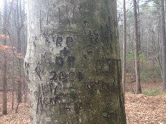
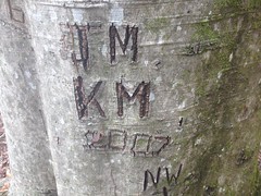
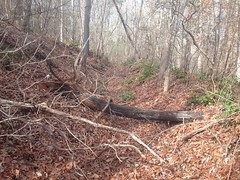
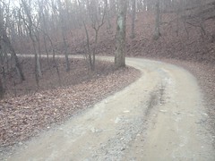
After passing a couple of riders on horseback, a mountain biker and a guy on a dual sport bike, I parked at the graffiti beech again and headed up the old road. At first it appeared to be super well traveled, but then, with you could see that fewer and fewer people pushed past each fallen tree, and eventually it deteriorated to teetering on border of what I'd call overgrown. I'd bet that if I'd been there in the summer, it would have been miserable.

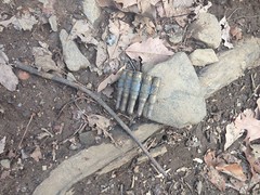
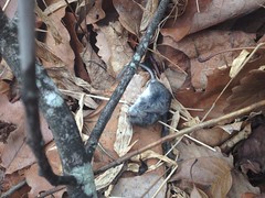
It wasn't hard to follow the trail though, and eventually I made my first discovery.

Cable

Cables like that usually indicate logging. But they can also just be tied between trees to block the road, like a gate. This one was strung directly across the road, and tangled on both sides with what remained of two fallen trees. So, I'd guess the latter, except that it seemed to be much longer than it needed to be to act as a gate.

Classic. No answers, just more questions.

My second discovery was all of the balloons in the world.
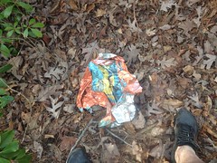
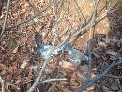
Balloon 1 Ballon 2 Balloon 3 Balloon 4

No fewer than 4.

I am fairly confident that it beats any previously established record for balloons found along a single trail.

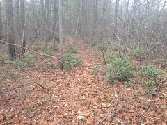
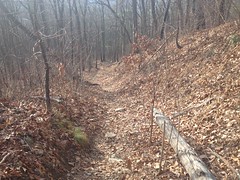
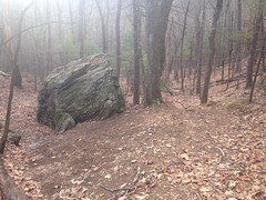
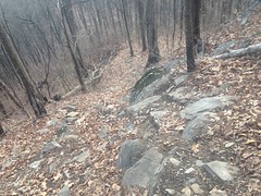
The trail led up along the creek like the map said it would. There were lots of little side trails leading up adjacent draws. The roads got really steep too, but they weren't rutted at all. Like they were built, used, abandoned, and never used again. Classic logging network. The forest struck me as being secondary growth too. Messy, dirty forest. At least in the vicinity of the roads. Classic.

The final, incredibly steep kick led up to within 100 feet or so of the Old Winding Stair Gap Road along the ridge to the west. The road there just blended gently into the backslope too. It didn't end abruptly like so many others do. In the past it may have continued on, and just gotten filled in gently over the years.

I picked up the Old Winding Stair Gap Road, took it to the PR Gap Trail, took that down to the creek, and then took the FS877 Food Plot Road over to the food plot on the next ridge.

Along the way, I found not one, but two of these little fleece caps lying on the trail.

Fleece Cap

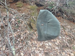
No doubt standard issue to the Ranger Candidates. Somebody's head's gonna be cold tonight. Two somebodies in fact.

10+ years ago I'd seen a trail leading north up the ridge from the food plot, but hadn't had the opportunity to check it out at the time, so it has lain dormant as a couple of green dots on my map ever since.

The trail was rather braided, but otherwise easy to follow. Classic Ranger trail. It reminded me of the trail on Conner Mountain.

Winding Stair Knob Ridge Trail

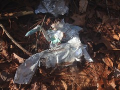
I found a spot that looked like where they often make camp.

An elaborate assemblage of glow sticks nearby seemed to confirm my suspicion.

Elaborate Glow Sticks

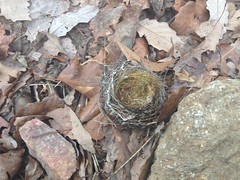
I also found some chipmunk's acorn cache somewhere along the trail.

Acorn Cache

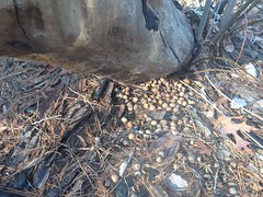
Quite a stash he had going there.

The ridge led in the direction of Winding Stair Knob, or at least what I call Winding Stair Knob. The knob directly east of Winding Stair Gap, with the clear-cut on top of it. I was on a secondary ridge though, I had to bump up on to the primary ridge. The trail was tough to follow there, but it existed, and once I was on the main ridge, it was just as clear as before.

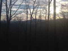
Oooh, it was getting late too. The sun was thinking hard about going behind Springer Mountain. I needed to get to the top before that happened.

View from Winding Stair Knob Ridge

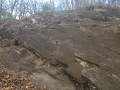
There was a second campground on the primary ridge, just below the kick up to the knob itself. The kick looked treacherous.

View Ahead on the Winding Stair Knob Ridge Trail

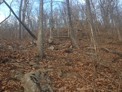
If that doesn't look treacherous, then it's either because the photo doesn't do it justice, or because you have some actual climbing skills. It's super steep and super rocky, and super leafy, and the leaves hold moisture into the half inch of dirt on top of the rock. So the leaves slip on the dirt and the dirt slips on the rock, and the rock is wet and slippery too. And the wet dirt gets ground into your shoes, and makes them slippery...

Looking back down the trail made continuing on seem much more inviting than backtracking.

View Back Down the Winding Stair Knob Ridge Trail

When I got to this wall, I could not figure out how to get over it.

The Wall I Wouldnt Climb

It looked like the trail went directly to it, and I was expected to climb it. Perhaps if I had some actual climbing skills to speak of I could have. But I did not. I also didn't have much confidence that if I managed to scramble up it, that I wouldn't be presented with an even more difficult section above.

Looking back now at the photo I'd taken from further away, it looks like if I'd gotten over it, then I could have walked up the rest of the hill easily, but I couldn't tell that when I was right up against it.

I tried sidehilling around it to both sides, which was also really sketchy. I tested each step before I took it. There wasn't much to grab on to if I'd slipped. I imagined picking up speed and tumbling end-over-end like a skier before eventually hitting a tree at 40+ miles per hour. Twice I thought I saw a way up, only to get a foot or two into it and decide that I wasn't confident I could do it.

Eventually I found a section between some rocks that was choked with little saplings and briars. Had the slope been shallower, I'd have done all I could to avoid a section like that, but given the circumstances, it looked ideal. Lots to hold on to. Lots to grab on to if I slipped. Worst case, the brush itself might just catch me if I slipped. I reasoned that the soil must be reasonably deep there too because that kind of brush needs a few inches to grow.

I made it up, never slipped, and once I got into it, it wasn't even all that sketchy. I did get torn to pieces by the briars, but in retrospect, it still seemed like the best case scenario.

One day I should learn how to climb.

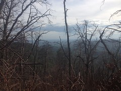
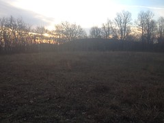
Oh yeah... Time pressure. I was definitely feeling it. The sun was setting and I didn't have all day to decide what to do. It worked out though. I even had time to stand around in the meadow taking in the view and enjoying my continued survival.

Winding Stair Knob Meadow

There was a maze of trails up there, many leading to and from another makeshift campground. Others led over to the rocks that I'd managed to make my way over. I'll have to get back up there someday and decipher them.

There was an adventure-race-looking checkpoint nearby too.

Adventure Race Checkpoint

All of the orienteering markers that I'd ever seen the Rangers use were large signs or ammo boxes on posts, painted yellow or red, with alphanumeric markings on them. I guess an orienteering Ranger would locate it and write down the number rather than punching their ticket. This one had a punch.

There were a couple of vehicles parked at Winding Stair Gap. The two guys milling around one of them looked military, but the vehicles didn't. They were preoccupied with whatever they were talking about and I doubt they even saw me walk by.

There was nothing left to do but hike down the road, pick up the PR Gap Trail, take it back to FS877, take that to FS77A, and take that back to the car. No doubt most of that would be done in the dark.

Winding Stair Gap Road

The sun hadn't officially set though. I could still see part of it over the ridge. I truck passed me and its occupants got out to watch the sun descend behind the ridge. I had almost made it to their location when they got in and left. I'd half hoped they'd offer me a ride, but you know, gotta run what you brung.

It was dusky when I got onto PR Gap, and dark by the time I got to the creek. It wasn't super dark yet though, I could only see 1 star. Actually, I presumed that it was Venus, and not technically a star.

It was dark enough though, that I had to be careful where I stepped when I crossed the creek. It'd been a while since I'd hiked in the dark and I more than once I was surprised that the trail ahead was lower than I'd expected it to be.

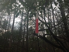
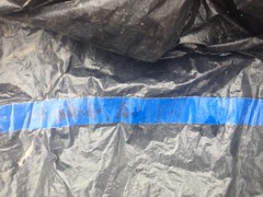
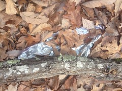
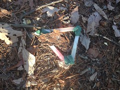
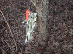
One positive thing about the dark was that anything vaguely reflective caught my eye. Geometrically shaped, reflective things REALLY caught my eye. For instance:

Silver Dollar Road Sign

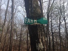
Somebody put up this road sign about halfway down the trail.

???

Considering that there was another one further up, it made me wonder if there were more of them elsewhere in the area that I just hadn't noticed yet.

I hung a left on 877, hung another left on 77A, got passed by 2 jeeps who's occupants were friendly, but no doubt wondered what the heck I was up to. Hopefully I looked sufficiently pro and non-threatening.

Walking back along the road, looking up at the sky through the skeletons of the trees, I enjoyed the strangeness of it. It's not so often that I get to do that these days. I tried to do that thing where I imagine that it's already the future and the present is a memory that I'm looking back on fondly. Being able to do that is the secret to enjoying the moment, but it's been a long time since I've been able to do it reliably, and it was a little frustrating at the time. Of course, as I sit here, I remember it as fondly as I wanted to in the moment. Funny how that works.

I grabbed dinner at El Jinete in Dawsonville. Their new menu confused me. Chile Colorado is now called Pork Chile, which I guess is a more accurate description as everyone else's Chile Colorado is made with beef. Whatever it's called, it's as delicious as ever and I was glad that I decided to eat there rather than Zaxby's.

There's still a great deal more to explore back in there, and a great more elsewhere too. But, as much as I love it, I really hope that I can get my bike fixed before next weekend, and jump in on a group ride instead.

If I can't though, at least I have a solid plan B.

Old Winding Stair Gap Road

A few weeks ago I discovered that in 2014 the USGS published GeoPDF's of their entire Historical Topo Map Collection and that the folks at ESRI had put together a really friendly interface for downloading them.

I became intrigued at the idea of integrating that data into my trails site and after some fruitless searching for a tile server, eventually just downloaded the GeoPDF's for most of North Georgia, cobbled together some scripts to crunch them, and built my own tiles.

Voilá!

My trails site now has Historical Topo layers, with maps that were current as of 1888, 1892, 1914, 1936, 1946, and 1972. Surveying practices 1936 were rather less advanced, so the terrain doesn't line up so well with more modern maps, but if you open 2 windows, with the old map on the left and the new map on the right, you can A-B them and match things up reasonably well.

As soon as I had that working, I scoured the maps, hoping to answer some of the questions that I had developed over the years... Ha! Yes! Hightower Gap was once called Etowah Gap. Yes! The Chestatee WMA around Dicks Creek and Blood Mountain Creek was once heavily populated. Yes! Various trails predated logging. They were just the way people went to get over the mountains to access other communities.

I also made several new discoveries. The community surrounding present-day Lake Winfield Scott was once named Quebec. Nimblewill was once named Randa. The ruins near Winding Stair Gap were once a ranger station. But, most interestingly, to me at least, was that from at least as far back as 1888 until some time between 1914 and 1936, the main drag from the church near Bull Mountain (Nimblewill Church) to the church at the bottom of Noontootla (Fellowship Primitive Church) followed a most interesting and unexpected route.

I felt like I'd explored the Blue Ridge WMA more thoroughly than any other section of the Chattahoochee National Forest, but a glance at those maps made me realize just how little I'd truly discovered.

The section of the old road from Nimblewill Church to Winding Stair Gap originally ran up along a ridge behind the church until it teed into to the present-day Bull Mountain trail, then followed that up to Bull Mountain proper, followed the Whoop-de-do's down to Booger Holler, hung a left, crossed Lance Creek, hung a right, then led up some unnamed ridge to the present-day PR Gap Trail to PR Gap proper, then hung a left and followed present-day FS77 up the ridge up to Winding Stair Gap.

I had long wondered about the origin of some of those roads and trails. Conventional wisdom would declare them old logging roads, and they may well have been used for that at some point, but, in fact, they predated all logging activity. Way back, they were just the roads that connected communities.

I had never seen two sections of that route before. The one leading up to Bull Mountain, and the one leading up the ridge behind Booger Holler. After much debate over which to check out, I eventually settled on the one behind Booger Holler, and set out to explore it this past Saturday.

On the way in, I passed a group ride, just finishing up. 20+ mountain bikers climbing back up to the church on 28-1. For a minute, I wished I was among them. I need to work on my brakes though, or more precisely, I need to get Glen to work on them, and I was way too busy, and way too broke for any of that last week. I spewed encouraging words out the window as I passed each rider though, and I got a few smiles in return, but only a few. It looked like it had been a long ride.

Pulling around in behind Booger Holler, I parked on FS77A, in a spot next to a heavily graffiti'ed beech tree.

Beech Graffiti

Ahh, juvenality at its finest. The word "penis" appears, by itself, no fewer than 3 times.

Heh. I also noticed the initials of my brother John and his wife, though I don't think they were the ones who carved them.

JM and KM

I located the trail right away. It certainly helps to know where it ought to be. It also helped that it was winter. I had attempted to locate and explore all of the various trails back there 10+ years ago, in the spring, and found a dozen or so, but never even noticed this one.

This was the general character of the trail, for quite a while.

Lower Old Winding Stair Gap Road

Deep below grade. A bowl, the primary purpose of which, these days, is to collect deadfall and brush. It was slog to walk in, and it was substantially easier to walk through the woods to one side of the trail, rather than down it. It didn't appear that anyone else had done this recently though, or did it with any regularity.

Well, I say that. At a point, a distinct side-trail appeared...

Old Winding Stair Gap Road Side Trail

...and it was very easy to follow. It seemed like a horse trail. Hard to say why. It was very hard-packed. The canopy around it was high. But, most notably, little sticks and branches were intact. People tend to step on them, and break them, or kick them out of the way. Cyclists run them over and break them. I guess horses tend to step over them. I guess that's why it intuitively seemed like a horse trail. I didn't see any proof though. No prints. No "sign". The trail reminded me of a similar trail that leads up along a similar old road from the Kellum Valley area, over Carr Gap. I know that trail was created by riders on horseback, as evidenced by prints. This trail had the same feel.

The trail eventually teed in to what I had always called the PR Gap trail.

At the intersection, I was surprised to see this old road sign, nailed to a tree nearby.

Farm Road Sign

The tree is eating the sign, but marvelously managed to work itself in between the metal and the paint.

Wow!

I've seen trees absorbing signs before, but never with such precision.

"I consume the metal and reject the paint."

I'd actually seen that sign before, long ago, the one time I climbed the trail, but I'd forgotten all about it, and apparently that was back before I started taking photos of everything.

The kick up to PR Gap proper was as steep as I remembered, but surprisingly devoid of leaves. There was a time when I referred to the PR Gap Trail as "The Deep Leaves Trail" and anyone who'd hiked or ridden it knew exactly what I meant.

Upper Old Winding Stair Gap Road

Being winter, I could see way off into the Piedmont, but photos never seem to capture the experience. I guess your mind filters out the trees in the foreground.

View From Near PR Gap

Ahh, PR Gap proper.

PR Gap

Why PR Gap? P stands for a creative term for urination, and R stands for "rock". Apparently, at some point, there was a large rock exposed at the gap, and it appeared to have been urinated on by a great many animals. It was scaly, and stunk and there were often puddles on it. So goes the legend, at least. I can't remember whether it was Steve Houghton that told me that, or Larry Thomas. Maybe one told me and the other confirmed it, or something. Anyway, that's what it stands for.

In retrospect, I'm not sure why I climbed up to the Gap. I had no intention of continuing up the ridge. It was fortuitous though. I noticed that there's an overgrown turn there at the intersection. You can clearly see that the PR Gap Trail used to hang a left and continue up along the route of modern FS77. It's difficult to see in the summer, but it was super clear at that time.

Ok, so I confirmed that chunk of the Old Winding Stair Gap Road existed. My primary mission was accomplished. My map had several dotted green lines on it though, representing unexplored side-trails in the area. I figured I'd head back down and check those out.

On the way down, I noticed lots of little bits of evidence, indicating who used the trail. A diverse crowd, it seemed. There were hoof prints, a bike tire track, boot prints, rock piles leading up to logs, ammo...

Blanks

...glow sticks...

Glow Stick

...a glove. I even found a pair of what looked like shooting glasses on the ground and hung them on a limb nearby.

Yes, a diverse crowd indeed.

The trail is rather scenic. It feels like a miniature version of Mountaintown, with fewer creek crossings. There's also this really big rock that you can go either way around.

Rock on PR Gap Trail

Just past the rock I found a teeny tiny little nest on the ground. It couldn't have been 3 inches across.

Teeny Tiny Nest

For a hummingbird?

I followed a side trail waaaay up along the creek there. I call it a side trail. Actually, I think it may have been the original route. The current route hangs a hard right (if you're climbing) and gets narrow and steep at that point, and the "side-trail" keeps going straight and remains wide and shallow, like the trail below.

It led way up along the creek before finally terminating, distinctly. There were several little spots along the trail that had obviously been leveled artificially, and various spurs that jutted off of the main trail and terminated at the creek. The whole thing was enigmatic though. What was its purpose? Logging, of course, comes to mind, but it didn't feel like a logging network, and if it was logged, it was a very long time ago. The forest looked really mature. There were no stumps. The road was wide like a modern FS road, not narrow like the roads of the Gannett era. My best guess was an "all of the above" kind of guess. Someone lived back there. They let someone log the upper reaches of it, then sold it to the FS, who widened the road and created some campsites, but then eventually abandoned it. The campsite theory also fits with the various 55 gallon drums that litter the lower reaches of the trail. I don't understand the little juts over to the creek though? They're not ideal for camping by any stretch. I'd seen that kind of thing before though, along what I knew to be a logging spur. In comparison with the Upper Chattahoochee though, it really doesn't look like it was ever logged, or cleared for farming, for that matter.

No idea.

Somewhere back in there I found this poor little mouse lying on the ground, getting eaten by ants.

Dead Mouse

Poor little guy.

And there was also this trash bag, labelled, as far as I could tell, "Niblet Auction".

Nibblet Auction

It probably doesn't say that, but I've been wracking my brain to guess what it does say. I remember once finding an old Chrysler New Yorker in the woods, and the "New Yorker" logo had little bits broken off of it, and a bit of flashing on the r's too, making it look like "Lew Nonken". I never figured it out. My mom determined the make of the car by comparing photos of the fenders and grill. Only then did I realize what the logo said. No such clues with this one.

Somewhere around that point, my phone died, suddenly, with 20% battery life left. Hmm... Might be time for a new phone.

So, no more photos. But, it wasn't that big of a deal. I didn't do much else other than hike down and back to the car. I did check out a few side trails, but they didn't go anywhere. They honestly looked like logging skids. The ridge above them looked rough, but the lower slopes looked like they'd never been touched. I wonder if that's something that was done at some point - cut a road up along a creek, then harvest the ridge to either side, but leave a buffer between the clear cut and the creek.

Actually, that may have been done unrelated to logging. If I owned land in an area with a creek and an an adjacent ridge, with no significant flats, I might build my house down by the creek, but cut a road up to the ridge, clear it, and plant or graze up there. It would be the most level land and get the most consistent sunlight. I guess that would explain the various ridge-line food plots that still dot the forest. Some of them, at least.

Eh.. Whatever. I puzzled about it on the way back to the car and puzzle about it still. I wonder if there are even more detailed historical maps of some of the areas I've explored.

It was officially dark on the way out of the woods. I grabbed some red curry at the Thai Cuisine in Dawsonville. I'd seen it for years, but never stopped in. I enjoyed it, but it was a bit onion-heavy.

I'll have to remember that for next time.