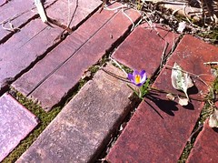
On the way out of the house, we saw the first flower of the year:
The weather was great; 65 degrees, sunny and a nice, light breeze. Maybe spring isn't so far off.
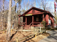
We rolled through the Dutch Monkey for some "breakfast" and from there, to Red Top Mountain.
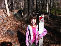
The Trillium Trek is coming up and the girls could use some nav practice.
We ran through the visitors center to check out the snakes and then got caught up in a long, drawn out debacle at the bathroom. The locks on the bathroom doors are the worst design of all time. It's trivial to close the door behind you, leaving it locked. We didn't do that, but the folks ahead of us did. The ladies room was locked and the only reason the men's room wasn't was because the last guy failed to close the door behind him. To make matters worse, they have no key at the visitors center and had to call maintenance.
Twenty minutes later, we finally hit the woods. A dad and his son were out doing the same thing as us. The kid couldn't have been more than five, and it brought back memories of taking my kids out when they were little like that. Good memories.
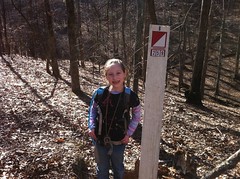
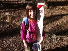
Iz got us to the Start.
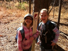
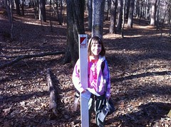
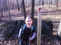
Sophie got us to CP1.

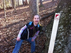
Iz got us to CP2.
But we'd done those the last time. Today we were going after some alternate checkpoints that we'd skipped before. They're spread out a bit more, and supposedly a little more challenging to find. We planned on upping the challenge even more too, by following terrain and landmarks more and relying on the compass less. I wasn't sure how well that would work out, but it was worth a try.
Sophie led us along the trail, to the road, where we stopped for a while to consult the map and decipher an impressively confusing intersection. A gentleman camping nearby came over to offer us some help, figuring we were lost and trying to find our way back to the visitor's center. We explained what we were up to, but I couldn't tell if he really understood or not. It is a bit of a fringe sport, I guess.
We figured out which way to go, but we had to make a quick detour to check out some tire spikes.
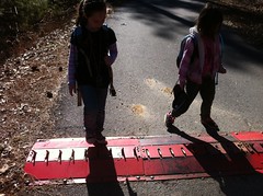
The kids were pretty fascinated by them. They'd only seen them before in a parking lot in New Orleans, but not close-up. They pushed them down with their feet over and over and never seemed to get tired of it. If I hadn't suggested that we get moving, they might still be there.
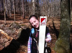
Checkpoint A wasn't too hard to find.
We had to push through some brush and find the "real" top of the hill. It was sort of a double-knob. While approaching the second knob, a white-tailed deer sprang out from behind the rocks and took off across the little valley. Eventually, it decided we weren't a threat, circled around and walked back by, within about 30 feet of us.
We were also greeted by a little black dog belonging to some hikers on a nearby trail. Sophie thought it was a rabbit at first.
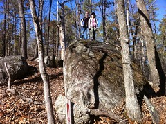
There were a bunch of exposed boulders up on top of the hill, and the kids climbed up on one of them.
CPB was a good bit harder to find than A. A new trail had been built since the publication of the map and a trail shown on the map had been all but reclaimed by nature, so the landmarks were tough to follow. It was also supposed to be down along a creek, right around here...
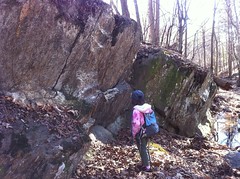
...but after a pretty rigorous search, we eventually found it 2/3rds of the way up a neighboring hill to the east.
We'd spread out and canvassed the draw almost out to the lake, then turned around and combed the eastern hillside before Iz finally spotted it. It was just kind of balanced up behind a stump. I bet the creek floods a bit when it rains. Maybe it had worked its way out of the ground and somebody relocated it.
CPC was directly over the hill from B, but we opted to sidehill around instead of walking straight up over it.
This took us all the way down the draw, out to the shores of Allatoona.

Somewhere around there we saw a little herd of deer. There were families and kids and dogs all playing down by the lake. The lake itself was down and there were two, currently suicidal, rope-swings hanging nearby, waiting for the water to come back up.
Sophie got us to CPC.
The plan to get to CPD involved several turns. Iz took us uphill to a road which ran through a nearly empty campground. With a picnic table right there, we all agreed that it was snack time.
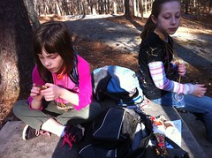
I'd brought a Whatchamacalit bar, and Sophie unintentionally recited that commercial from the 80's almost verbatim... "What do you call it?" "Whatchamacalit." "What do you call it?" And so on. It was great.
CPD was right where it should be...
...but the "cleared area" shown on the map was overgrown with young pine and there was a new trail in the area too. It's neat to see how things change, and it was enlightening to the kids; you can't trust every detail on a map.
From there, Sophie led us down the draw to CP3.
And Iz took us up to CP4.
CP4 was tricky because it was a little bit below a gap on the opposite side of the hill. Iz's plan was to head uphill to the top of one of the knobs, head down into the gap and then down from there into the draw. I urged her to use the compass, but she declined and we ended up at a gap, not knowing which of the three knobs on that ridge we were between. Oh no! We'd triangulated earlier at CPB to figure out exactly where we were though, and this time, Iz did it mostly by herself. It turned out we were in the gap we wanted to be in. I actually knew that, but it was cool to see Iz go from feeling totally lost to feeling like it was nearly impossible to get lost.
Sophie got us back to CP1 and the Start. I failed to take photos of those.
Sophie kind of had a hard time today. She's usually really good at brain-teasers and combining problem solving strategies and all that, but she struggled to even tell whether we needed to turn left or right at an intersection, even after reorienting the map. She kept getting distracted all day too, and she couldn't remember the names of things. It was like she wore out her brain yesterday or something. Poor little girl.
Traffic was horrendous on the way home, but we made up for that by killing down some Rick Tanner's chicken.
So that was two fulfilling days in a row. It doesn't make up for a disappointing winter, but it's a good start. Let's keep it going.


Man, looks like we missed a grand time - hope our raincheck is in the mail.
ReplyDeleteI see it's time to update that map. Glad you enjoyed the course. Hope you and the girls can join us for more adventures. We meets about twice a month.
ReplyDeletewww.GAorienteering.org