It seems that I'm starting to develop a backlog. Too much work to do much journaling these days. Lets see if I can knock this one out quickly though...
Billy and I got together last weekend for a bit of mountain biking up at Berry College. I'd long heard there were trails up there, somebody send me some data for some of them years back, but I'd never actually been there. Neither had Billy, it turned out, so we gave it a try.
On the way into town, we ended up behind someone getting a vehicular escort for about a mile.
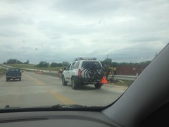
I'd heard of European tour riders getting a chase car to follow them sometimes, and I know people do it during the RAAM, but I'd never seen it in person. Not sure who it was, or what they were up to. The RAAM's not going on right now. No idea.
We also passed south of Plant Bowen.
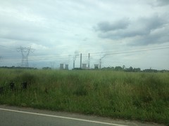
If memory serves, Plant Bowen produces more electricity from coal than any other North American plant. It has some record like that. I'd seen it from farther away before, on a ride with my brother, but up close it looked even more massive.
When we arrived at the college, I had to pee super bad, so we stopped at the welcome center, availed ourselves of their facilities, and picked up a much better map than the one I'd printed off of the web. Fifteen minutes later, we were on the trail.
"The trail" being the paved, multi-use Viking Trail, named after the Berry College mascot. Berry College has two campuses, the Main Campus, and the Mountain Campus. There's not much between them but woods and fields.
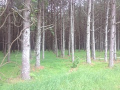
The Viking Trail crosses said woods and fields and leads from one campus to the other.
It has two interesting features.
The first is this tiny little side-trail that runs along the entire length.
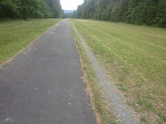
Though tiny, it's gravelled, so it does appear to be there on purpose. Later on we saw someone running along it, rather than on the pavement. My guess is that it formed over the years, there's no good way to keep people off the grass, so they eventually gravelled it to keep it from getting braided.
The other interesting feature is a model of the solar system. Near the trailhead, there's a big yellow sun painted on the trail, with the word "SUN" written across it. Then further out there's this little spec with Mercury labelled above it. Then Venus, Earth, Mars, etc. Each to scale, in diameter, and distance from the sun. I never saw Pluto. Not sure if they left it out because of its dwarf-planet status, or whether it's just so far out that they ran out of trail.
Anyway, we rode out and back on the Viking Trail, just to have done it. I really wanted to ride some dirt, and there were allegedly multiple dirt roads that paralleled the Viking Trail and led to trails up on Lavender mountain. So, we spun back and tried to find O'Bryan Gap Road.
The map showed it crossing fields and roads, right through the main campus, but it did no such thing. There was an old log cabin next to a raised bit of land in the middle of one field, and what vaguely looked like a continuation of that same raised bit of land across the road to the east. Maybe, in the olden days, those little raised bits were part of the road, but further east and to the west of the first bit, construction of the campus seemed to have bulldozed it out of existence. The bits that remained also appeared to have been part of a disk golf course, so we gave up on O'Bryan Gap and looked for Old High School Road instead.
It was easy to find and led right where it was supposed to. For being an old road, it was really nice. Gated at both ends, it clearly gets very little vehicular traffic, and so it's basically just become doubletrack. The woods to either side are interesting too. There's a swamp back in there and the tree canopy is pretty dense, more-or-less shrouding the entire trail, at least in the summer. Out at the very end it turned back into pavement and there was a sign for the Frost Chapel to the left. It looked familiar, but I couldn't put my finger on why at the moment.
We didn't go checking out the Chapel though, we were looking for the Hurtin' Gator trail, which turned out to be back the other way just a bit.
It turned out to be more of the same closed-road doubletrack that we'd already ridden on. At first it just ran along the foot of the mountain, but then it hooked left and climbed straight up it. We brainstormed about the name of the trail. My theory was that someone from the University of Florida had come up to visit, gotten into a ride with some locals, and suffered immensely from all the climbing. If you're used to riding in Georgia though, it's not that bad.
Up on top we followed the map to The House o' Dreams. No idea what the objective of The House o' Dreams is, or who put it there, but it's basically a really nice house, up on top of the ridge, with a view to in the north-ish direction.
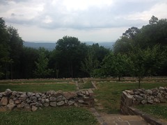
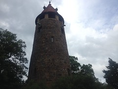
At the west end of the property there was this massive tower.
And there was also a "Bike Trail" sign leading south.
When I first started playing guitar, I got into Iron Maiden. At the time, the average Iron Maiden song was within my ability to play, except that in each song there was this short little bit that was ridiculously difficult. Listening to the song, the whole thing sounded equally difficult, so it was always unexpected to run into that difficult bit. That's how it was up on Lavender Mountain.
So far, the "trails" had basically just been either closed dirt roads or manicured gravel roads. They required a little climbing effort, but from a technical perspective, they were a non-issue. The "Bike Trail" though, was like the Pinhoti on Dug Gap Mountain. I rolled into it thinking it'd be more manicured smoothness, but I quickly found myself in the wrong gear, pinging off rocks, brushing trees and grabbing brakes... for all of 100 yards... and then BAM! I was back on manicured doubletrack. The heck!?
There was another equally short but chunky section a bit further on, but then it went right back to easy old roads again too. The whole rest of the day we didn't encounter another shred of technical trail, just those short, very technical bits up on top. Ha! I love it.
We took the Snow Loop down off of the west end of the mountain. It rained on us briefly, but it was short lived.
Then we took Old Redmond Gap Road back south toward campus, ...
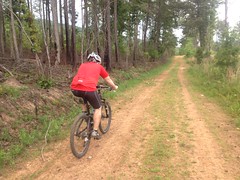
...hung a left at the Possum Trot Church, ...
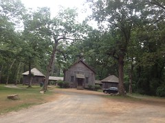
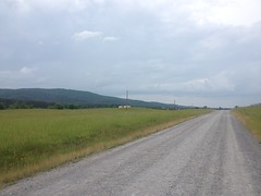
...got a good view of the mountain from the road, ...
...rode past dozens and dozens of horses, ...
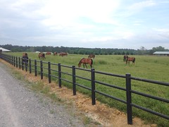
...and apparently got so wrapped up in taking in the scenery that we missed our turn.
All of a sudden we were approaching the Mountain Campus again, but we were supposed to have taken a right back there somewhere.
Adventure!
We backtracked and found our turn off, right were it should have been.
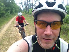
That old road was even less like a road than the other one. It looked like everyone rode on the left side too. The right side disappeared entirely in a few places.
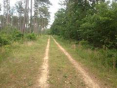
That trail was long and straight, and you could see forever down it. It reminded me a lot of crossing the Ocala in Florida, only the roads in the Ocala are wider and more open.
Oh yeah... We also passed a guy running the other direction, and I do mean running. Not jogging. Running. His pace actually made me feel lazy.
Back near campus we picked up the Viking Trail and took it back in. There were dozens of deer milling around in the fields. Billy counted 24, but then there were even more lying down further on. We passed a mother and fawn and I tried to get a photo of them, but they were a little too far away and the grass was too tall. Turned out that it didn't matter though, across the road, there was another mother and fawn in an open field with mowed grass, unconcerned about being photographed.
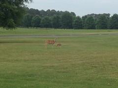
So many deer! I'd bet that if you went to school there, after the first week, you'd get bored of seeing them.
We'd gotten in some good miles, but I still wanted to resolve the mystery of O'Bryan Gap Road. Up by Hurtin' Gator, we'd seen the top end of it, so it must exist, but where does the bottom end come out? We headed up toward it again, but about halfway out, Billy'd had enough. I figured we'd just head back but he urged me to continue and meet him on the same trail after I'd figured out the other road. After some quick debate about the subject, I gave him the rest of my Clif Blocks and took off.
It was just as well though, Billy hates snakes, and I ran into this massive Grey Rat Snake out there.
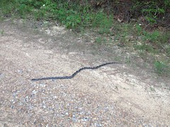
Harmless of course, but try telling that to someone that doesn't like snakes.
Turns out O'Bryan Gap Road becomes a paved road and tees in to some other loop just about where the map says it should. I'm not sure how we'd missed it earlier.
I spun back out, met Billy and we headed back in.
In the lot, we tried fixing his windshield wipers. It was time, and he'd bought new ones, but one of them was missing parts. Two different parts, it turned out, and the instruction booklet. Come on! We passed an Advance Auto Parts on the drive back though, which is where he'd bought his, and we were able to get the guy to swap them out. Or, actually... They were sold out of the exact size that he needed, but the mounting clips are universal, so the guy just opened a package and gave us the mounting clips out of it. No doubt someone had done the same thing to the ones that Billy'd bought earlier, and that's why the clips were missing from his. Ha! I wonder now if someone else will buy the one that the guy pulled the parts out of and then have to do the same thing we did, and if the whole process will then repeat forever. I wonder.
So, Berry College... I give it an A for diversity of trail, and an A for scenery. We rode over 40 miles, so it also gets an A for distance too. I'd give it a C for fun though, there's not much in the way of singletrack (at least that we saw) except for that really short bit of very technical singletrack. But, it's easy enough that if they can handle the climbing, I could take my kids riding there, and there are some loops that they could do with almost no climbing involved.
Hmmm.... Definitely something to think about.


No comments:
Post a Comment